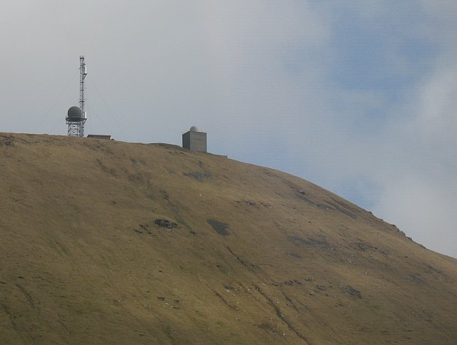
Loch na Cille

Lake, Pool, Pond, Freshwater Marsh in Inverness-shire

Scotland

Loch na Cille
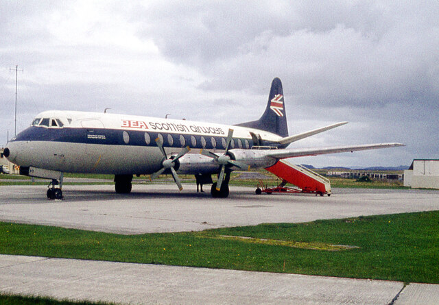
BEA Vickers Viscount at Benbecula Airfield
BEA Vickers Viscount at Benbecula Airfield Credit: Alan Reid

The requested URL returned error: 429 Too Many Requests

If you have any feedback on the listing, please let us know in the comments section below.

Loch na Cille Images

Images are sourced within 2km of 57.470224/-7.3681969 or Grid Reference NF7854. Thanks to Geograph Open Source API. All images are credited.
BEA Vickers Viscount at Benbecula Airfield
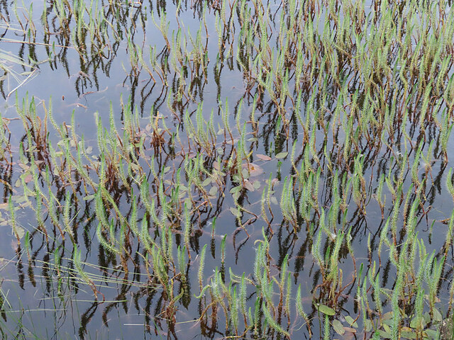
Marestail (Hippuris vulgaris) A plant that always grows in water, for once conveniently close enough to the land to be photographed.
Marestail (Hippuris vulgaris)
A plant that always grows in water, for once conveniently close enough to the land to be photographed.
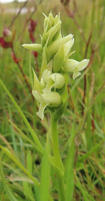
Irish Lady's-tresses (Spiranthes romanzoffiana) A member of the orchid family, with a very western distribution.
Irish Lady's-tresses (Spiranthes romanzoffiana)
A member of the orchid family, with a very western distribution.
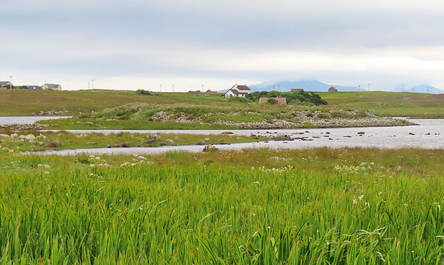
Dùn Buidhe The 'yellow fort' is on a peninsula, almost an islet, in Loch Dùn Mhurchaidh.
Dùn Buidhe
The 'yellow fort' is on a peninsula, almost an islet, in Loch Dùn Mhurchaidh.
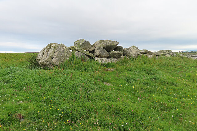
Boulder Dyke On a peninsula in Loch Dùn Mhurchaidh.
Boulder Dyke
On a peninsula in Loch Dùn Mhurchaidh.
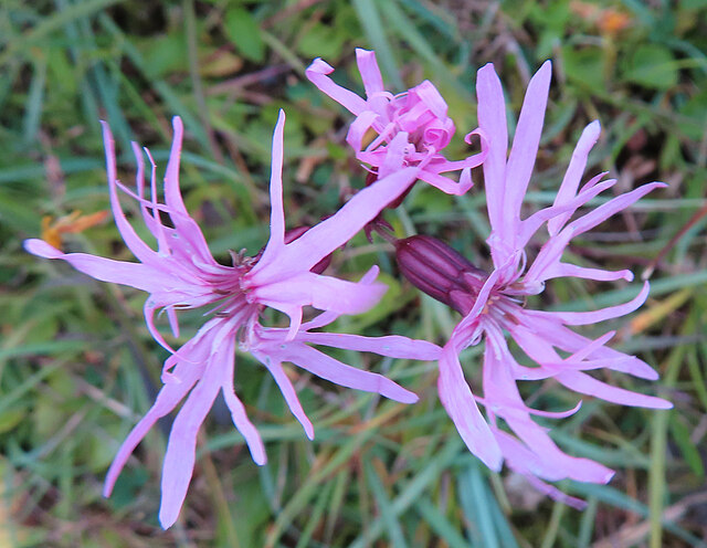
Ragged Robin (Silene flos-cuculi) Previously known as Lychnis flos-cuculi.
Ragged Robin (Silene flos-cuculi)
Previously known as Lychnis flos-cuculi.
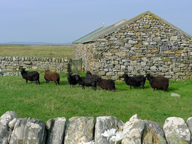
Hebridean Sheep at Airdbheag, Benbecula Dry stone walling events have been held at Airdbheag and there is evidence in the walls and stone buildings of the skills of dry-stone wallers.
Hebridean Sheep at Airdbheag, Benbecula
Dry stone walling events have been held at Airdbheag and there is evidence in the walls and stone buildings of the skills of dry-stone wallers.
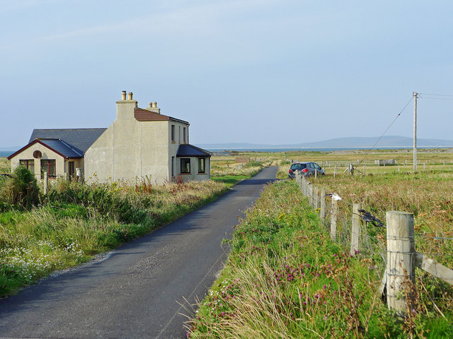
The road through Aird
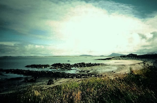
Shore at Clachan Garbh, Benbecula
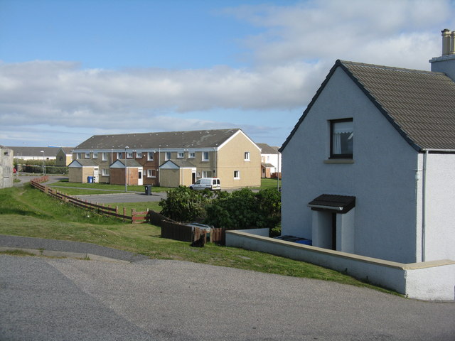
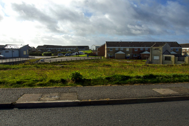
Houses at Baile a' Mhanaich/Balivanich On the western edge of the village.
Houses at Baile a' Mhanaich/Balivanich
On the western edge of the village.
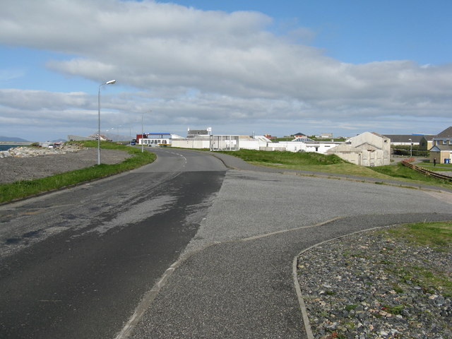
The B892 at Baile a' Mhanaich/Balivanich Looking east towards the main part of the village and airfield.
The B892 at Baile a' Mhanaich/Balivanich
Looking east towards the main part of the village and airfield.
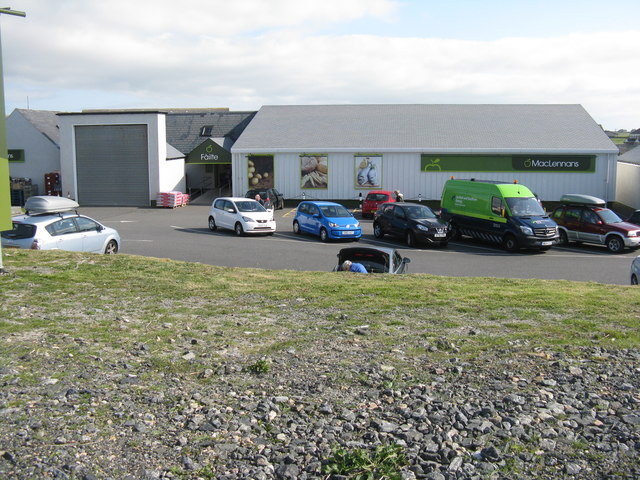
MacLennans at Baile a' Mhanaich/Balivanich A well-stocked store in Benbecula.
MacLennans at Baile a' Mhanaich/Balivanich
A well-stocked store in Benbecula.
Baile a' Mhanaich
Baile a' Mhanaich
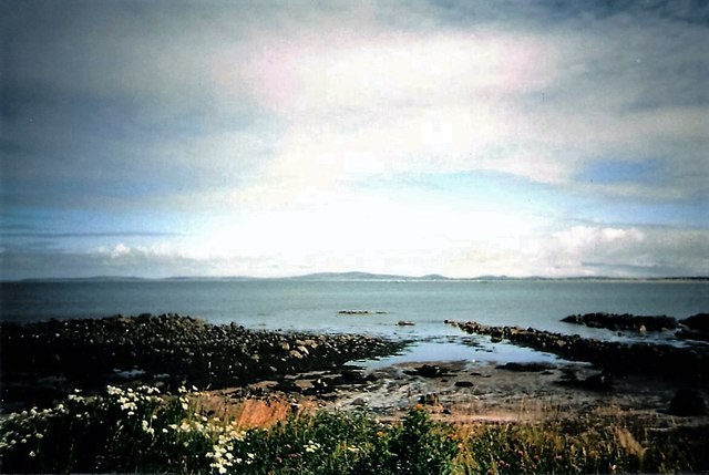
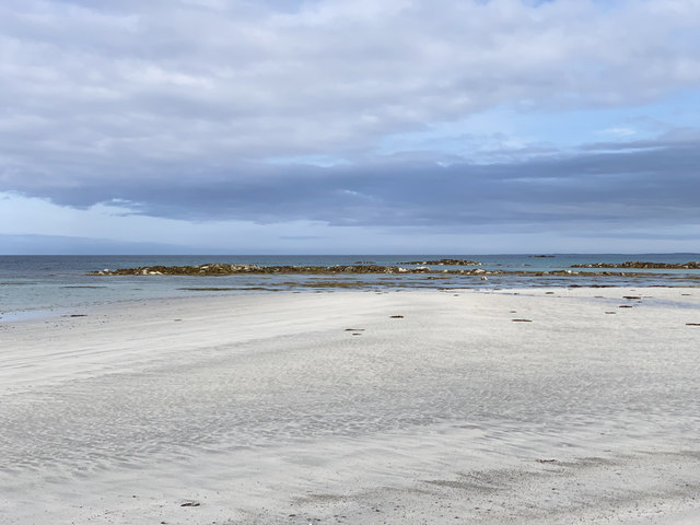
Beach at Baile a' Mhanaich Looking to the rocks of An Ceòthan.
Beach at Baile a' Mhanaich
Looking to the rocks of An Ceòthan.
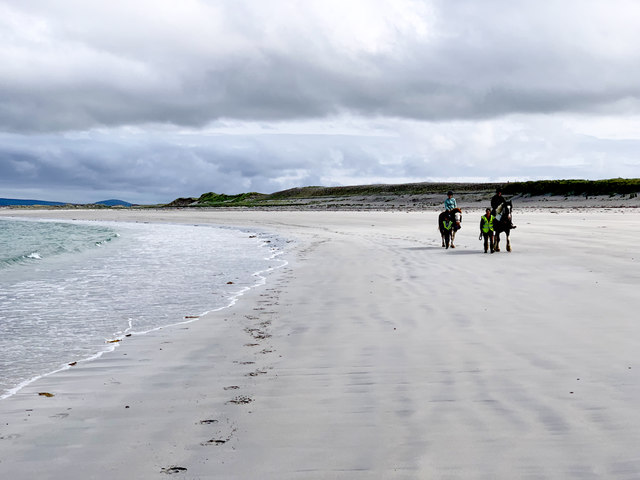
Beach at Baile a' Mhanaich Right beside Benbecula Airport. The runways are on top of the visible sand dunes on the right.
Beach at Baile a' Mhanaich
Right beside Benbecula Airport. The runways are on top of the visible sand dunes on the right.
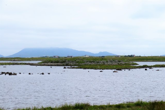
Dun Buidhe The dun is situated on the further island, and although there's a lot of stones around it, one would be hard pressed to identify anything of a built nature.
Dun Buidhe
The dun is situated on the further island, and although there's a lot of stones around it, one would be hard pressed to identify anything of a built nature.
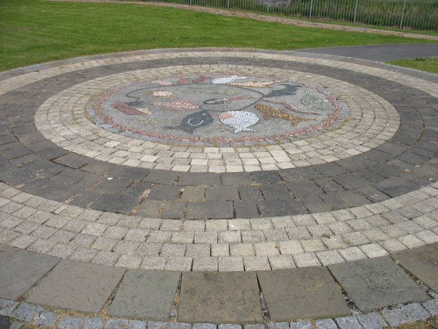
Artwork in Baile a' Mhanaich (Balavanich) An attractive mosaic in a small park near the school in Baile a' Mhanaich.
This is not, however, one of the 'Roadends' sculptures (as I first thought it might be). That is in the grounds of the adjacent school. I now think that I did see the sculpture from a distance without realising that that was 'it'. In these enlightened times, lone males entering school grounds are regarded with extreme suspicion: if they have a camera then that is almost a confession of guilt. What nonsense! But it is, perhaps, a pity that those who located these 'Roadends' sculptures did not have regard to this issue.
There are many anglicised versions of the name Baile a' Mhanaich, including Balivanich, Ballivanich, and Bailivanish (the former name of the RAF airfield here). My 'Balavanich' comes from the 'Roadends' plaque in <a href="https://www.geograph.org.uk/gridref/NF8963">NF8963</a>, which I assumed to be reasonably authoritative. I have been told that 'Balavanich' is a good indication to an English speaker of the pronunciation of Baile a' Mhanaich, and so I have used that version here.
Artwork in Baile a' Mhanaich (Balavanich)
An attractive mosaic in a small park near the school in Baile a' Mhanaich. This is not, however, one of the 'Roadends' sculptures (as I first thought it might be). That is in the grounds of the adjacent school. I now think that I did see the sculpture from a distance without realising that that was 'it'. In these enlightened times, lone males entering school grounds are regarded with extreme suspicion: if they have a camera then that is almost a confession of guilt. What nonsense! But it is, perhaps, a pity that those who located these 'Roadends' sculptures did not have regard to this issue. There are many anglicised versions of the name Baile a' Mhanaich, including Balivanich, Ballivanich, and Bailivanish (the former name of the RAF airfield here). My 'Balavanich' comes from the 'Roadends' plaque in NF8963, which I assumed to be reasonably authoritative. I have been told that 'Balavanich' is a good indication to an English speaker of the pronunciation of Baile a' Mhanaich, and so I have used that version here.
Show me another place!

Loch na Cille is located at Grid Ref: NF7854 (Lat: 57.470224, Lng: -7.3681969)

Unitary Authority: Na h-Eileanan an Iar

Police Authority: Highlands and Islands

What 3 Words

///instilled.adding.juggled. Near Balivanich, Na h-Eileanan Siar

Related Wikis

Deep Sea Range

The Deep Sea Range is an RAF missile range in the Outer Hebrides. It has also been known as the Hebrides Guided Weapon Range and the South Uist Missile...

Balivanich

Balivanich (Scottish Gaelic: Baile a' Mhanaich [palə ˈvanɪç]) is a village on the island of Benbecula in the Outer Hebrides off the west coast of Scotland...

Uist and Barra Hospital

Ospadal Uibhist agus Bharraigh (Uist and Barra Hospital) is a community hospital in Benbecula which provides services on the islands of North Uist, South...

Benbecula Airport

Benbecula Airport (Scottish Gaelic: Port-adhair Bheinn na Faoghla) (IATA: BEB, ICAO: EGPL) is located on the island of Benbecula in the Outer Hebrides...

Nearby Amenities

Located within 500m of 57.470224,-7.3681969
Barrier: bollard
Bicycle: yes
Foot: yes
Lat/Long: 57.4737998/-7.3712834
Barrier: bollard
Bicycle: yes
Foot: yes
Lat/Long: 57.4738323/-7.3712758
Barrier: bollard
Bicycle: yes
Foot: yes
Lat/Long: 57.4738442/-7.3712469
Barrier: bollard
Bicycle: yes
Foot: yes
Lat/Long: 57.4738668/-7.3712332
Barrier: bollard
Bicycle: yes
Foot: yes
Lat/Long: 57.473896/-7.3712234
Barrier: bollard
Bicycle: yes
Foot: yes
Lat/Long: 57.4739217/-7.3712064
Barrier: bollard
Bicycle: yes
Foot: yes
Lat/Long: 57.4739422/-7.3711951
Barrier: bollard
Bicycle: yes
Foot: yes
Lat/Long: 57.4739657/-7.3711829
Barrier: bollard
Bicycle: yes
Foot: yes
Lat/Long: 57.4739796/-7.3705505
Barrier: bollard
Bicycle: yes
Foot: yes
Lat/Long: 57.4739909/-7.3711667
Barrier: bollard
Bicycle: yes
Foot: yes
Lat/Long: 57.4739953/-7.3706064
Barrier: bollard
Bicycle: yes
Foot: yes
Lat/Long: 57.4740153/-7.371153
Barrier: bollard
Bicycle: yes
Foot: yes
Lat/Long: 57.4740219/-7.3707051
Barrier: bollard
Bicycle: yes
Foot: yes
Lat/Long: 57.4740323/-7.3711425
Barrier: bollard
Bicycle: yes
Foot: yes
Lat/Long: 57.4740327/-7.37074
Barrier: bollard
Bicycle: yes
Foot: yes
Lat/Long: 57.4740493/-7.3707958
Barrier: bollard
Bicycle: yes
Foot: yes
Lat/Long: 57.4740541/-7.3711319
Barrier: bollard
Bicycle: yes
Foot: yes
Lat/Long: 57.4740576/-7.370842
Barrier: bollard
Bicycle: yes
Foot: yes
Lat/Long: 57.4740706/-7.3708825
Barrier: bollard
Bicycle: yes
Foot: yes
Lat/Long: 57.4740737/-7.3711182
Barrier: bollard
Bicycle: yes
Foot: yes
Lat/Long: 57.4740793/-7.3709198
Barrier: bollard
Bicycle: yes
Foot: yes
Lat/Long: 57.474088/-7.3709562
Barrier: bollard
Bicycle: yes
Foot: yes
Lat/Long: 57.4740946/-7.3711076
Barrier: bollard
Bicycle: yes
Foot: yes
Lat/Long: 57.4740989/-7.3710007
Barrier: bollard
Bicycle: yes
Foot: yes
Lat/Long: 57.4741094/-7.3710396
Barrier: bollard
Bicycle: yes
Foot: yes
Lat/Long: 57.4741133/-7.3710833
Man Made: tower
Lat/Long: 57.4730723/-7.3740191
Cafe
Island Kitchen Cafe
Addr City: Beinn na Faoghla
Addr City En: Benbecula
Addr Country: GB
Addr Postcode: HS7 5LW
Addr Suburb: Baile a 'Mhanaich
Addr Suburb En: Balivanich
Contact Facebook: https://www.facebook.com/Islandkitchenbenbeculaairport/
Lat/Long: 57.4738972/-7.3717933
Entrance: main
Lat/Long: 57.473857/-7.3717317
Leisure: picnic_table
Lat/Long: 57.4738852/-7.371432
Bench
Lat/Long: 57.4727129/-7.364842
Social Facility
Tagsa Uibhist
Facebook: https://www.facebook.com/tagsauibhist
Office: charity
Social Facility: outreach
Website: http://www.tagsa-uibhist.com/
Lat/Long: 57.472999/-7.364724
Telephone
Lat/Long: 57.4739161/-7.3719284
Post Box
Lat/Long: 57.4738978/-7.3720677
Car Rental
Car Hire Hebrides
Website: https://www.carhire-hebrides.co.uk/
Lat/Long: 57.473908/-7.3718718
Toilets
Lat/Long: 57.473922/-7.3719817
Third Sector Hebrides
Office: charity
Lat/Long: 57.4739956/-7.3689864
Am Paipear
Office: newspaper
Lat/Long: 57.4739487/-7.3689267
Neil Campbell
Craft: electrician
Website: https://www.nc-ec.co.uk/
Lat/Long: 57.4738333/-7.3686209
Power: pole
Lat/Long: 57.4731777/-7.3709254
Power: pole
Lat/Long: 57.4726917/-7.3706002
Power: pole
Lat/Long: 57.4720093/-7.3701436
Power: pole
Lat/Long: 57.4717578/-7.3699859
Power: pole
Lat/Long: 57.4709953/-7.3702455
Power: pole
Lat/Long: 57.4704573/-7.3703841
Power: pole
Lat/Long: 57.4695941/-7.3706889
Power: pole
Lat/Long: 57.4687524/-7.3696028
Power: pole
Lat/Long: 57.4682805/-7.3690038
Power: pole
Lat/Long: 57.4677127/-7.3682863
Power: pole
Lat/Long: 57.4673638/-7.3678128
Power: pole
Lat/Long: 57.4669005/-7.3672047
Power: pole
Lat/Long: 57.4663327/-7.3664698
Power: pole
Lat/Long: 57.4677905/-7.366916
Power: pole
Lat/Long: 57.4683284/-7.3657603
Power: pole
Lat/Long: 57.4688365/-7.3647229
Power: pole
Lat/Long: 57.4693536/-7.3637037
Power: pole
Lat/Long: 57.4697363/-7.3629233
Power: pole
Lat/Long: 57.4702168/-7.3619178
Power: pole
Lat/Long: 57.4707569/-7.3609373
Power: pole
Lat/Long: 57.4705118/-7.3714468
Power: pole
Lat/Long: 57.4705537/-7.3724636
Power: pole
Lat/Long: 57.4705944/-7.3734919
Power: pole
Lat/Long: 57.4706369/-7.3746507
Power: pole
Lat/Long: 57.4706835/-7.3756212
Power: pole
Lat/Long: 57.4712628/-7.3754471
Power: pole
Lat/Long: 57.471631/-7.3753341
Power: pole
Lat/Long: 57.4723329/-7.3751825
Power: pole
Lat/Long: 57.471319/-7.3733648
Power: pole
Lat/Long: 57.4722216/-7.3731596
Power: pole
Lat/Long: 57.4725532/-7.3731131
Power: pole
Lat/Long: 57.4732331/-7.3728081
Power: pole
Lat/Long: 57.4702585/-7.3598642
Power: pole
Lat/Long: 57.4685627/-7.3629035
Man Made: mast
Tower Construction: mast
Tower Type: lighting
Lat/Long: 57.4741754/-7.3720489
The data included in this document is from www.openstreetmap.org. The data is made available under ODbL.

Have you been to Loch na Cille?

Leave your review of Loch na Cille below (or comments, questions and feedback).