Langdon Cliffs

Cliff, Slope in Kent Dover

England

Langdon Cliffs

Temporary traffic lights It appears that a trench has been dug, along the edge of the pavement, to accommodate new cabling for when permanent traffic lights are reinstalled, as in this view of the <a href="https://www.geograph.org.uk/photo/4564794">TR3141 : Fire-damaged United Reformed Church, High Street</a>. .

Beyond these works is the former United Reformed Church, which had planning permission granted in October 2019 to convert it into 16 self-contained apartments but, since then, there has been concern as to where residents living there would park their cars, as the surrounding streets have no more spaces for additional cars. Work appears to have stalled on the conversion/
Temporary traffic lights Credit: John Baker

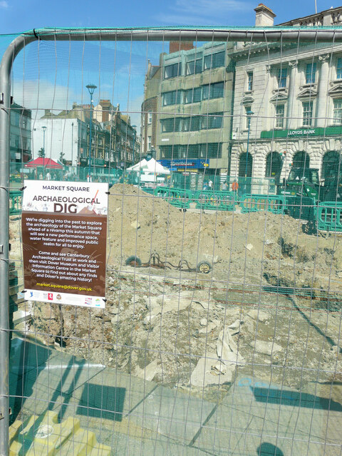
Langdon Cliffs, located in Kent, England, is a prominent chalk cliff formation that stretches along the southeastern coast of the country. Rising to a height of approximately 100 meters (328 feet), it offers breathtaking panoramic views of the English Channel and the neighboring French coastline. The cliffs are part of the larger White Cliffs of Dover, a natural landmark famous for its stunning beauty and historical significance.

The cliffs are composed mainly of soft white chalk, a sedimentary rock formed from the remains of marine creatures millions of years ago. Over time, erosion and weathering processes have sculpted the cliffs into their current dramatic shape, featuring steep slopes and sheer cliff faces. The exposed chalk provides a striking contrast against the deep blue sea below, creating a picturesque and awe-inspiring sight.

Langdon Cliffs is a popular destination for nature enthusiasts, hikers, and birdwatchers due to its diverse wildlife and habitat. The area is home to various rare and endangered plant species, including the Adonis blue butterfly and the oxtongue broomrape. Bird colonies, such as razorbills, fulmars, and peregrine falcons, can also be found nesting in the cliffs, making it a haven for bird lovers.

In addition to its natural beauty, Langdon Cliffs holds historical significance. During World War II, the cliffs served as a crucial defensive position and lookout point for the British military. Remnants of military infrastructure, including tunnels and observation posts, can still be seen along the cliffs, offering visitors a glimpse into the area's wartime past.

Overall, Langdon Cliffs offers a unique blend of natural splendor, biodiversity, and historical importance, making it a must-visit location for anyone exploring the Kent coastline.

If you have any feedback on the listing, please let us know in the comments section below.

Langdon Cliffs Images

Images are sourced within 2km of 51.130139/1.336104 or Grid Reference TR3342. Thanks to Geograph Open Source API. All images are credited.

Temporary traffic lights It appears that a trench has been dug, along the edge of the pavement, to accommodate new cabling for when permanent traffic lights are reinstalled, as in this view of the <a href="https://www.geograph.org.uk/photo/4564794">TR3141 : Fire-damaged United Reformed Church, High Street</a>. .

Beyond these works is the former United Reformed Church, which had planning permission granted in October 2019 to convert it into 16 self-contained apartments but, since then, there has been concern as to where residents living there would park their cars, as the surrounding streets have no more spaces for additional cars. Work appears to have stalled on the conversion/
Temporary traffic lights
It appears that a trench has been dug, along the edge of the pavement, to accommodate new cabling for when permanent traffic lights are reinstalled, as in this view of the TR3141 : Fire-damaged United Reformed Church, High Street. . Beyond these works is the former United Reformed Church, which had planning permission granted in October 2019 to convert it into 16 self-contained apartments but, since then, there has been concern as to where residents living there would park their cars, as the surrounding streets have no more spaces for additional cars. Work appears to have stalled on the conversion/
Video screen, King Street The screen is a recent addition to this location. It has replaced the advertisement board in this view of <a href="https://www.geograph.org.uk/photo/3272700">TR3141 : King Street, Dover</a>,
Video screen, King Street
The screen is a recent addition to this location. It has replaced the advertisement board in this view of TR3141 : King Street, Dover,
Pontoons in a marina Visibility was limited due to coastal fog.
Pontoons in a marina
Visibility was limited due to coastal fog.
Cannon Street The blue arrow sign was pointing to a safety device for pedestrians, while a length of gas pipe was being installed under the road’s surface.
Cannon Street
The blue arrow sign was pointing to a safety device for pedestrians, while a length of gas pipe was being installed under the road’s surface.
Returning from Düsseldorf, at Dover – 1978 Reading Transport no.120, a Scania Metropolitan, makes its way off the ferry from Ostend following an official visit to Reading's twin town in Germany. Ferry bridge no.4 no longer exists as a result of developments of the port layout.

This is one of a series of views featuring buses in the 60s, 70s, and 80s. <a title="https://www.geograph.org.uk/search.php?i=137652761" href="https://www.geograph.org.uk/search.php?i=137652761">Link</a>
Returning from Düsseldorf, at Dover – 1978
Reading Transport no.120, a Scania Metropolitan, makes its way off the ferry from Ostend following an official visit to Reading's twin town in Germany. Ferry bridge no.4 no longer exists as a result of developments of the port layout. This is one of a series of views featuring buses in the 60s, 70s, and 80s. Link
National Westminster Bank, Market Square There are plans to remove these telephone kiosks and to replace them with a single kiosk.
National Westminster Bank, Market Square
There are plans to remove these telephone kiosks and to replace them with a single kiosk.
Craighton House, Castle Street Planning permission has been granted by Dover District Council under application number DOV/21/00689 for the “re-siting of BT public telephone kiosks” 

It appears that they will be erected, on the pavement, outside the British Heart Foundation outlet.
Craighton House, Castle Street
Planning permission has been granted by Dover District Council under application number DOV/21/00689 for the “re-siting of BT public telephone kiosks” It appears that they will be erected, on the pavement, outside the British Heart Foundation outlet.
Dover Town Hall Extensive work is being undertaken to this historic building and planning permission has been granted for listed building consent by Dover District Council under application numbers DOV/20/00536 and DOV/20/00537. 

The scaffolding on <a href="https://www.geograph.org.uk/photo/6846130">TR3141 : Dover Town Hall</a>, below the flagpole, has been dismantled but now further scaffolding has been erected on the building below the clock.
Dover Town Hall
Extensive work is being undertaken to this historic building and planning permission has been granted for listed building consent by Dover District Council under application numbers DOV/20/00536 and DOV/20/00537. The scaffolding on TR3141 : Dover Town Hall, below the flagpole, has been dismantled but now further scaffolding has been erected on the building below the clock.
Dover Bowling Club Pavilion, Maison Dieu Gardens This view shows <a href="https://www.geograph.org.uk/photo/6803177">TR3141 : Dover Bowling Club Pavilion, Maison Dieu Gardens</a> before the installation of replacement double doors. The former doors were painted blue; now they are white.
Dover Bowling Club Pavilion, Maison Dieu Gardens
This view shows TR3141 : Dover Bowling Club Pavilion, Maison Dieu Gardens before the installation of replacement double doors. The former doors were painted blue; now they are white.
Market Square Archaeological Dig The noticeboard read: We’re digging into the past to explore the archaeology of the Market Square ahead of a revamp this autumn that will see a new performance space, water feature and improved public realm for all to enjoy. 

Come and see Canterbury Archaeological Trust at work and then visit Dover Museum and Visitor Centre in the Market Square to find out about any finds and Dover’s amazing history. 

market.square@dover.gov.uk
Market Square Archaeological Dig
The noticeboard read: We’re digging into the past to explore the archaeology of the Market Square ahead of a revamp this autumn that will see a new performance space, water feature and improved public realm for all to enjoy. Come and see Canterbury Archaeological Trust at work and then visit Dover Museum and Visitor Centre in the Market Square to find out about any finds and Dover’s amazing history. market.square@dover.gov.uk
Waterloo Mansions, Waterloo Crescent This was <a href="https://www.geograph.org.uk/photo/6161729">TR3141 : Waterloo Mansions, Waterloo Crescent</a> during the building’s refurbishment.
Waterloo Mansions, Waterloo Crescent
This was TR3141 : Waterloo Mansions, Waterloo Crescent during the building’s refurbishment.
Waterloo Mansions, Waterloo Crescent This was <a href="https://www.geograph.org.uk/photo/6137921">TR3141 : Waterloo Mansions, Waterloo Crescent</a> during the building’s refurbishment; viewed from Cambridge Road.
Waterloo Mansions, Waterloo Crescent
This was TR3141 : Waterloo Mansions, Waterloo Crescent during the building’s refurbishment; viewed from Cambridge Road.
64-120, Harold Street These were the flats in <a href="https://www.geograph.org.uk/photo/6351349">TR3141 : Harold Street</a> during their construction.
64-120, Harold Street
These were the flats in TR3141 : Harold Street during their construction.
1-24, Bomford House, Harold Street This was <a href="https://www.geograph.org.uk/photo/6353435">TR3142 : Bomford House</a> during the flats’ construction.
1-24, Bomford House, Harold Street
This was TR3142 : Bomford House during the flats’ construction.
Dover PRIDE event The participants gathered on Roman Lawn at the far end of Market Street.
Dover PRIDE event
The participants gathered on Roman Lawn at the far end of Market Street.
Super Pizza, 2, Cannon Street The outlet used to be a <a href="https://www.geograph.org.uk/photo/6617632">TR3141 : Betfred Shop, 2, Cannon Street</a>.
Super Pizza, 2, Cannon Street
The outlet used to be a TR3141 : Betfred Shop, 2, Cannon Street.
Park Place These two recharging points for electric vehicles have recently been installed on the pavement outside Dover police station.
Park Place
These two recharging points for electric vehicles have recently been installed on the pavement outside Dover police station.
Holland & Barrett, Unit 6c, St James Street This was the location of <a href="https://www.geograph.org.uk/photo/6888893">TR3141 : Holland & Barrett, 35, Biggin Street</a>, before the shop moved to St James Retail Park.
Holland & Barrett, Unit 6c, St James Street
This was the location of TR3141 : Holland & Barrett, 35, Biggin Street, before the shop moved to St James Retail Park.
Show me another place!

Langdon Cliffs is located at Grid Ref: TR3342 (Lat: 51.130139, Lng: 1.336104)

Administrative County: Kent

District: Dover

Police Authority: Kent

What 3 Words

///iterative.saying.unguarded. Near Dover, Kent

Related Wikis

HMS Codrington

HMS Codrington was one of nine A-class destroyers built for the Royal Navy during the 1920s. She was the flotilla leader for the class. During the Second...

Swingate, Kent

Swingate is a village near Dover in Kent, England. The population of the village is included in the civil parish of Sutton. == See also == Swingate transmitting...

Langdon Bay Wreck

The remains of a Middle Bronze Age vessel were identified in Langdon Bay, Kent, England in 1974. The site was designated under the Protection of Wrecks...

Swingate transmitting station

The Swingate transmitting station is a facility for FM-transmission in the village of Swingate, near Dover, Kent (grid reference TR334429). For many years...

St Mary sub Castro, Dover

St Mary sub Castro (i. e. "St Mary below the Castle"), or St Mary de Castro, or St Mary in Castro ("St Mary in the Castle"), is a church in the grounds...

Dubris

Dubris, also known as Portus Dubris and Dubrae, was a port in Roman Britain on the site of present-day Dover, Kent, England. As the closest point to continental...

Dover Castle

Dover Castle is a medieval castle in Dover, Kent, England and is Grade I listed. It was founded in the 11th century and has been described as the "Key...

RAF Swingate Down

Royal Air Force Swingate Down or more simply RAF Swingate Down is a former Royal Air Force Chain Home Low radar station operational during the Second World...

Nearby Amenities

Located within 500m of 51.130139,1.336104
Millennium Milepost Langdon Cliffs
Bicycle: yes
Description: 1) Dover 1.5 2) Inverness 1194, Deal 8
Image: https://www.cyclestreets.net/location/185600/cyclestreets185600.jpg
Information: guidepost
Ncn Milepost: mccoll
Sustrans Ref: MP 833
Tourism: information
Lat/Long: 51.1325519/1.3378075
Ferry Terminal
Dover 3
Ferry: yes
Public Transport: station
Seamark Name: 4
Seamark Type: berth
Lat/Long: 51.1268047/1.3380595
Barrier: kissing_gate
Bicycle: permissive
Foot: permissive
Horse: no
Motor Vehicle: no
Lat/Long: 51.1319037/1.3358619
Barrier: kissing_gate
Bicycle: permissive
Foot: permissive
Horse: no
Motor Vehicle: no
Lat/Long: 51.1325747/1.3378264
Barrier: kissing_gate
Bicycle: permissive
Foot: permissive
Horse: no
Motor Vehicle: no
Lat/Long: 51.1333659/1.3384088
Tourism: viewpoint
Lat/Long: 51.1304946/1.3369207
Police
Lat/Long: 51.1292192/1.3337861
Cafe
Costa
Brand: Costa
Brand Wikidata: Q608845
Brand Wikipedia: en:Costa Coffee
Cuisine: coffee_shop
Takeaway: yes
Wheelchair: yes
Lat/Long: 51.1276973/1.3390289
WHSmith
Brand: WHSmith
Brand Wikidata: Q1548712
Brand Wikipedia: en:WHSmith
Shop: newsagent
Lat/Long: 51.1279196/1.3386802
Toilets
Wheelchair: yes
Lat/Long: 51.1275964/1.3387607
Crossing
Crossing: uncontrolled
Crossing Island: no
Crossing Markings: zebra
Crossing Signals: no
Lat/Long: 51.1267943/1.3339805
Crossing
Check Date Crossing: 2023-07-02
Crossing: uncontrolled
Crossing Markings: yes
Crossing Signals: no
Crossing Ref: zebra
Tactile Paving: no
Lat/Long: 51.1267233/1.3340395
Crossing
Crossing: uncontrolled
Crossing Markings: zebra
Crossing Signals: no
Crossing Ref: zebra
Lat/Long: 51.1280637/1.3384751
Crossing
Crossing: marked
Crossing Island: no
Crossing Markings: zebra
Crossing Signals: no
Tactile Paving: no
Lat/Long: 51.1281196/1.3384721
Crossing
Crossing: uncontrolled
Crossing Ref: zebra
Lat/Long: 51.1280845/1.3390048
Crossing
Crossing: uncontrolled
Crossing Markings: yes
Crossing Signals: no
Crossing Ref: zebra
Lat/Long: 51.1283158/1.3391828
Crossing
Crossing: marked
Crossing Island: no
Crossing Markings: zebra
Crossing Signals: no
Tactile Paving: no
Lat/Long: 51.1281395/1.3388281
Barrier: toll_booth
Lat/Long: 51.1293657/1.3414603
Crossing
Lat/Long: 51.12935/1.3389687
Barrier: toll_booth
Lat/Long: 51.1293534/1.3413872
Barrier: toll_booth
Lat/Long: 51.129326/1.34124
Barrier: toll_booth
Lat/Long: 51.1293375/1.3413095
Barrier: toll_booth
Lat/Long: 51.1293787/1.3415457
Crossing
Crossing: uncontrolled
Crossing Markings: yes
Lat/Long: 51.1299314/1.3416705
Crossing
Crossing: uncontrolled
Crossing Markings: yes
Lat/Long: 51.129641/1.3406244
Crossing
Crossing: uncontrolled
Crossing Markings: yes
Lat/Long: 51.1296897/1.3406012
Crossing
Crossing: uncontrolled
Crossing Markings: yes
Lat/Long: 51.1295585/1.3406644
Crossing
Crossing: uncontrolled
Crossing Markings: yes
Lat/Long: 51.1296029/1.3406437
Crossing
Crossing: uncontrolled
Crossing Ref: zebra
Lat/Long: 51.127422/1.3393205
Crossing
Crossing: uncontrolled
Crossing Ref: zebra
Lat/Long: 51.1279743/1.3392625
Crossing
Lat/Long: 51.1289758/1.3374165
Turning Circle
Lat/Long: 51.1273321/1.3390581
Barrier: toll_booth
Lat/Long: 51.1292582/1.3408513
Barrier: toll_booth
Lat/Long: 51.1293139/1.3411579
Barrier: toll_booth
Lat/Long: 51.1293037/1.3410874
Barrier: toll_booth
Lat/Long: 51.1292529/1.3408259
Barrier: toll_booth
Lat/Long: 51.1292894/1.3410053
Barrier: toll_booth
Lat/Long: 51.1292758/1.3409321
Barrier: toll_booth
Lat/Long: 51.1292287/1.3407105
Crossing
Crossing: uncontrolled
Crossing Markings: yes
Crossing Signals: no
Crossing Ref: zebra
Lat/Long: 51.1274409/1.337688
Crossing
Crossing: uncontrolled
Crossing Island: no
Crossing Markings: yes
Crossing Signals: no
Lat/Long: 51.1273867/1.3327844
Crossing
Lat/Long: 51.1271666/1.3356754
Crossing
Crossing: unmarked
Crossing Markings: no
Source: P147-0320
Lat/Long: 51.1301375/1.3410993
Crossing
Lat/Long: 51.1266768/1.335826
Ferry Terminal
Dover 6
Bus: yes
Ferry: yes
Public Transport: stop_position
Seamark Name: 6
Seamark Type: berth
Toilets Wheelchair: yes
Wheelchair: yes
Lat/Long: 51.1258777/1.3357696
Crossing
Crossing: uncontrolled
Crossing Markings: yes
Lat/Long: 51.1303849/1.3391106
Crossing
Lat/Long: 51.1269708/1.33503
Crossing
Lat/Long: 51.129277/1.3385747
Barrier: lift_gate
Lat/Long: 51.1288839/1.339718
Barrier: lift_gate
Lat/Long: 51.1288983/1.3397978
Barrier: lift_gate
Lat/Long: 51.1289118/1.339873
Barrier: lift_gate
Lat/Long: 51.1289246/1.3399442
Barrier: lift_gate
Lat/Long: 51.128939/1.340024
Barrier: lift_gate
Lat/Long: 51.1289519/1.3400961
Barrier: lift_gate
Lat/Long: 51.1289659/1.340174
Barrier: lift_gate
Lat/Long: 51.1289804/1.3402545
Barrier: lift_gate
Lat/Long: 51.1289937/1.3403284
Barrier: lift_gate
Lat/Long: 51.1290064/1.3403988
Barrier: lift_gate
Lat/Long: 51.1290197/1.3404729
Barrier: lift_gate
Lat/Long: 51.1290341/1.3405531
Barrier: lift_gate
Lat/Long: 51.1290478/1.3406291
Barrier: lift_gate
Lat/Long: 51.1290615/1.340705
Barrier: fence
Board Type: notice
Description: No access to the port or city centre
Information: board
Tourism: information
Lat/Long: 51.1290333/1.3323235
Barrier: kissing_gate
Bicycle: no
Foot: permissive
Horse: no
Motor Vehicle: no
Lat/Long: 51.129703/1.3336226
Crossing
Crossing: unmarked
Crossing Markings: no
Source: P147-0320
Lat/Long: 51.130202/1.3410685
Crossing
Crossing: uncontrolled
Crossing Island: no
Crossing Markings: zebra
Crossing Signals: no
Crossing Ref: zebra
Lat/Long: 51.1279045/1.3363262
Crossing
Crossing: uncontrolled
Crossing Markings: yes
Crossing Signals: no
Crossing Ref: zebra
Lat/Long: 51.1277003/1.3382319
Crossing
Lat/Long: 51.1265541/1.3353199
Crossing
Lat/Long: 51.1298915/1.3381719
Barrier: border_control
Lat/Long: 51.1293259/1.3359941
Barrier: border_control
Lat/Long: 51.1291157/1.334731
Barrier: border_control
Lat/Long: 51.1291794/1.3346915
Barrier: border_control
Lat/Long: 51.129058/1.3347721
Crossing
Crossing: uncontrolled
Crossing Markings: yes
Lat/Long: 51.130256/1.339796
Barrier: border_control
Lat/Long: 51.129276/1.3346304
Crossing
Crossing: uncontrolled
Crossing Markings: yes
Crossing Signals: no
Lat/Long: 51.1300716/1.339898
Crossing
Crossing: uncontrolled
Crossing Markings: yes
Lat/Long: 51.130374/1.3397364
Crossing
Crossing: uncontrolled
Crossing Markings: zebra
Crossing Signals: no
Lat/Long: 51.1281435/1.3376356
Crossing
Crossing: uncontrolled
Crossing Markings: zebra
Crossing Signals: no
Lat/Long: 51.1281559/1.3376801
Crossing
Crossing: uncontrolled
Crossing Markings: zebra
Crossing Signals: no
Lat/Long: 51.1280249/1.3372099
Crossing
Crossing: uncontrolled
Crossing Markings: zebra
Crossing Signals: no
Lat/Long: 51.1281648/1.337712
Crossing
Crossing: uncontrolled
Crossing Markings: zebra
Crossing Signals: no
Lat/Long: 51.1280386/1.3372591
Crossing
Crossing: uncontrolled
Crossing Markings: zebra
Crossing Signals: no
Lat/Long: 51.1280761/1.3373934
Crossing
Crossing: uncontrolled
Crossing Markings: zebra
Crossing Signals: no
Lat/Long: 51.1280636/1.3373487
Crossing
Crossing: uncontrolled
Crossing Markings: zebra
Crossing Signals: no
Lat/Long: 51.1281156/1.3375354
Crossing
Crossing: uncontrolled
Crossing Markings: zebra
Crossing Signals: no
Lat/Long: 51.1280121/1.3371636
Crossing
Crossing: uncontrolled
Crossing Markings: zebra
Crossing Signals: no
Lat/Long: 51.1280495/1.3372981
Crossing
Crossing: uncontrolled
Crossing Markings: zebra
Crossing Signals: no
Lat/Long: 51.1281268/1.3375754
Crossing
Crossing: uncontrolled
Crossing Markings: zebra
Crossing Signals: no
Lat/Long: 51.1280933/1.3374554
Crossing
Crossing: uncontrolled
Crossing Markings: zebra
Crossing Signals: no
Lat/Long: 51.1281022/1.3374871
Barrier: lift_gate
Lat/Long: 51.129624/1.3407728
Barrier: lift_gate
Lat/Long: 51.1296658/1.3407654
Barrier: lift_gate
Bus: yes
Lat/Long: 51.1297207/1.3407313
Crossing
Crossing: uncontrolled
Crossing Markings: zebra
Crossing Signals: no
Lat/Long: 51.1278233/1.3364859
Crossing
Crossing: uncontrolled
Crossing Markings: zebra
Crossing Signals: no
Lat/Long: 51.1278352/1.3365288
Crossing
Crossing: uncontrolled
Crossing Markings: zebra
Crossing Signals: no
Lat/Long: 51.1278462/1.3365683
Crossing
Crossing: uncontrolled
Crossing Markings: zebra
Crossing Signals: no
Lat/Long: 51.1278596/1.3366162
Crossing
Crossing: uncontrolled
Crossing Markings: zebra
Crossing Signals: no
Lat/Long: 51.1278725/1.3366625
Crossing
Crossing: uncontrolled
Crossing Markings: zebra
Crossing Signals: no
Lat/Long: 51.1278888/1.336721
Crossing
Crossing: uncontrolled
Crossing Markings: zebra
Crossing Signals: no
Lat/Long: 51.1279012/1.3367656
Crossing
Crossing: uncontrolled
Crossing Markings: zebra
Crossing Signals: no
Lat/Long: 51.1279137/1.3368107
Crossing
Crossing: uncontrolled
Crossing Markings: zebra
Crossing Signals: no
Lat/Long: 51.1279262/1.3368553
Crossing
Crossing: uncontrolled
Crossing Markings: zebra
Crossing Signals: no
Lat/Long: 51.1279387/1.3369005
Crossing
Crossing: uncontrolled
Crossing Markings: zebra
Crossing Signals: no
Lat/Long: 51.1279512/1.3369452
Crossing
Crossing: uncontrolled
Crossing Markings: zebra
Crossing Signals: no
Lat/Long: 51.127964/1.336991
Crossing
Crossing: uncontrolled
Crossing Markings: zebra
Crossing Signals: no
Lat/Long: 51.1279757/1.3370332
Crossing
Crossing: uncontrolled
Crossing Markings: zebra
Crossing Signals: no
Lat/Long: 51.1279884/1.3370788
Crossing
Crossing: uncontrolled
Crossing Markings: zebra
Crossing Signals: no
Lat/Long: 51.128001/1.3371239
Barrier: border_control
Lat/Long: 51.1292321/1.3346627
Toilets
Access: yes
Fee: no
Opening Hours: Please check the National Trust website for current opening times
Operator: National Trust
Operator Type: charitable
Operator Wikidata: Q333515
Lat/Long: 51.1316099/1.3373195
Crossing
Crossing: uncontrolled
Crossing Island: no
Crossing Markings: zebra
Crossing Signals: no
Tactile Paving: no
Lat/Long: 51.1267327/1.3338075
Crossing
Crossing: uncontrolled
Crossing Island: no
Crossing Markings: zebra
Crossing Signals: no
Tactile Paving: no
Lat/Long: 51.1267478/1.3338498
Crossing
Crossing: uncontrolled
Crossing Island: no
Crossing Markings: zebra
Crossing Signals: no
Tactile Paving: no
Lat/Long: 51.1267618/1.333889
Crossing
Crossing: uncontrolled
Crossing Island: no
Crossing Markings: zebra
Crossing Signals: no
Tactile Paving: no
Lat/Long: 51.1267794/1.333938
Crossing
Crossing: uncontrolled
Crossing Island: no
Crossing Markings: zebra
Crossing Signals: no
Lat/Long: 51.1267919/1.3336467
Crossing
Crossing: uncontrolled
Crossing Island: no
Crossing Markings: zebra
Crossing Signals: no
Tactile Paving: no
Lat/Long: 51.1268093/1.3340229
Crossing
Crossing: uncontrolled
Crossing Island: no
Crossing Markings: zebra
Crossing Signals: no
Tactile Paving: no
Lat/Long: 51.1268243/1.3340658
Crossing
Crossing: uncontrolled
Crossing Island: no
Crossing Markings: zebra
Crossing Signals: no
Tactile Paving: no
Lat/Long: 51.1268417/1.3341154
Crossing
Crossing: uncontrolled
Crossing Island: no
Crossing Markings: zebra
Crossing Signals: no
Tactile Paving: no
Lat/Long: 51.1268553/1.3341545
Crossing
Crossing: uncontrolled
Crossing Island: no
Crossing Markings: zebra
Crossing Signals: no
Tactile Paving: no
Lat/Long: 51.1268703/1.3341975
Crossing
Crossing: uncontrolled
Crossing Island: no
Crossing Markings: zebra
Crossing Signals: no
Tactile Paving: no
Lat/Long: 51.1268855/1.3342409
Crossing
Crossing: uncontrolled
Crossing Island: no
Crossing Markings: zebra
Crossing Signals: no
Tactile Paving: no
Lat/Long: 51.1269007/1.3342842
Crossing
Crossing: uncontrolled
Crossing Island: no
Crossing Markings: zebra
Crossing Signals: no
Tactile Paving: no
Lat/Long: 51.1269168/1.3343306
Crossing
Crossing: uncontrolled
Crossing Island: no
Crossing Markings: zebra
Crossing Signals: no
Tactile Paving: no
Lat/Long: 51.1269313/1.3343729
Crossing
Crossing: uncontrolled
Crossing Island: no
Crossing Markings: zebra
Crossing Signals: no
Tactile Paving: no
Lat/Long: 51.1269462/1.3344161
Crossing
Crossing: uncontrolled
Crossing Island: no
Crossing Markings: zebra
Crossing Signals: no
Tactile Paving: no
Lat/Long: 51.1269615/1.3344606
Crossing
Crossing: uncontrolled
Crossing Island: no
Crossing Markings: zebra
Crossing Signals: no
Tactile Paving: no
Lat/Long: 51.1269755/1.3345011
Crossing
Crossing: uncontrolled
Crossing Island: no
Crossing Markings: zebra
Crossing Signals: no
Tactile Paving: no
Lat/Long: 51.1269928/1.3345514
Crossing
Crossing: uncontrolled
Crossing Island: no
Crossing Markings: zebra
Crossing Signals: no
Tactile Paving: no
Lat/Long: 51.1270072/1.3345934
Crossing
Crossing: uncontrolled
Crossing Island: no
Crossing Markings: zebra
Crossing Signals: no
Tactile Paving: no
Lat/Long: 51.1270195/1.3346386
Crossing
Crossing: uncontrolled
Crossing Island: no
Crossing Markings: zebra
Crossing Signals: no
Tactile Paving: no
Lat/Long: 51.1270321/1.3346847
Crossing
Crossing: uncontrolled
Crossing Island: no
Crossing Markings: zebra
Crossing Signals: no
Tactile Paving: no
Lat/Long: 51.1270445/1.3347302
Crossing
Crossing: uncontrolled
Crossing Island: no
Crossing Markings: zebra
Crossing Signals: no
Tactile Paving: no
Lat/Long: 51.1270578/1.3347791
Crossing
Crossing: uncontrolled
Crossing Island: no
Crossing Markings: zebra
Crossing Signals: no
Tactile Paving: no
Lat/Long: 51.12707/1.3348238
Crossing
Crossing: uncontrolled
Crossing Island: no
Crossing Markings: zebra
Crossing Signals: no
Tactile Paving: no
Lat/Long: 51.1270817/1.3348668
Crossing
Crossing: uncontrolled
Crossing Island: no
Crossing Markings: zebra
Crossing Signals: no
Tactile Paving: no
Lat/Long: 51.1270941/1.3349124
Crossing
Crossing: uncontrolled
Crossing Island: no
Crossing Markings: zebra
Crossing Signals: no
Tactile Paving: no
Lat/Long: 51.1271068/1.3349589
Crossing
Crossing: uncontrolled
Crossing Island: no
Crossing Markings: zebra
Crossing Signals: no
Tactile Paving: no
Lat/Long: 51.1271222/1.3350155
Crossing
Crossing: uncontrolled
Crossing Island: no
Crossing Markings: zebra
Crossing Signals: no
Tactile Paving: no
Lat/Long: 51.1271322/1.3350523
Crossing
Crossing: uncontrolled
Crossing Island: no
Crossing Markings: zebra
Crossing Signals: no
Tactile Paving: no
Lat/Long: 51.127145/1.3350993
Crossing
Crossing: uncontrolled
Crossing Island: no
Crossing Markings: zebra
Crossing Signals: no
Tactile Paving: no
Lat/Long: 51.1271561/1.3351398
Crossing
Crossing: uncontrolled
Crossing Island: no
Crossing Markings: zebra
Crossing Signals: no
Tactile Paving: no
Lat/Long: 51.1271685/1.3351853
Crossing
Crossing: uncontrolled
Crossing Island: no
Crossing Markings: zebra
Crossing Signals: no
Tactile Paving: no
Lat/Long: 51.1271818/1.3352342
Crossing
Crossing: uncontrolled
Crossing Island: no
Crossing Markings: zebra
Crossing Signals: no
Tactile Paving: no
Lat/Long: 51.127194/1.335279
Crossing
Crossing: uncontrolled
Crossing Island: no
Crossing Markings: zebra
Crossing Signals: no
Tactile Paving: no
Lat/Long: 51.1272061/1.3353233
Crossing
Crossing: uncontrolled
Crossing Island: no
Crossing Markings: zebra
Crossing Signals: no
Tactile Paving: no
Lat/Long: 51.127219/1.335371
Crossing
Crossing: uncontrolled
Crossing Island: no
Crossing Markings: zebra
Crossing Signals: no
Tactile Paving: no
Lat/Long: 51.1272316/1.3354172
Crossing
Crossing: uncontrolled
Crossing Island: no
Crossing Markings: zebra
Crossing Signals: no
Tactile Paving: no
Lat/Long: 51.1272437/1.3354614
Crossing
Crossing: uncontrolled
Crossing Island: no
Crossing Markings: zebra
Crossing Signals: no
Tactile Paving: no
Lat/Long: 51.1272556/1.3355052
Crossing
Crossing: uncontrolled
Crossing Island: no
Crossing Markings: zebra
Crossing Signals: no
Tactile Paving: no
Lat/Long: 51.1272696/1.3355566
Crossing
Crossing: uncontrolled
Crossing Island: no
Crossing Markings: zebra
Crossing Signals: no
Tactile Paving: no
Lat/Long: 51.1272819/1.3356015
Crossing
Crossing: uncontrolled
Crossing Island: no
Crossing Markings: zebra
Crossing Signals: no
Tactile Paving: no
Lat/Long: 51.127294/1.3356462
Crossing
Crossing: uncontrolled
Crossing Island: no
Crossing Markings: zebra
Crossing Signals: no
Tactile Paving: no
Lat/Long: 51.1273069/1.3356935
Crossing
Crossing: uncontrolled
Crossing Island: no
Crossing Markings: zebra
Crossing Signals: no
Tactile Paving: no
Lat/Long: 51.1273198/1.3357407
Crossing
Crossing: uncontrolled
Crossing Island: no
Crossing Markings: zebra
Crossing Signals: no
Tactile Paving: no
Lat/Long: 51.1273321/1.3357859
Crossing
Crossing: uncontrolled
Crossing Island: no
Crossing Markings: zebra
Crossing Signals: no
Tactile Paving: no
Lat/Long: 51.1273438/1.3358288
Crossing
Crossing: uncontrolled
Crossing Island: no
Crossing Markings: zebra
Crossing Signals: no
Tactile Paving: no
Lat/Long: 51.1273563/1.3358749
Crossing
Lat/Long: 51.1289428/1.3371797
Noexit: yes
Lat/Long: 51.1297691/1.3389793
Crossing
Crossing: uncontrolled
Crossing Island: no
Crossing Markings: yes
Crossing Signals: no
Lat/Long: 51.1274669/1.3327414
Crossing
Lat/Long: 51.1289156/1.3372323
Crossing
Crossing: uncontrolled
Crossing Markings: zebra
Crossing Signals: no
Tactile Paving: no
Lat/Long: 51.1263353/1.3328938
Crossing
Crossing: uncontrolled
Crossing Markings: zebra
Crossing Signals: no
Tactile Paving: no
Lat/Long: 51.1262647/1.3326822
Crossing
Crossing: uncontrolled
Crossing Markings: zebra
Crossing Signals: no
Tactile Paving: no
Lat/Long: 51.1265447/1.3333545
Crossing
Crossing: uncontrolled
Crossing Markings: zebra
Crossing Signals: no
Tactile Paving: no
Lat/Long: 51.1264102/1.3331189
Crossing
Crossing: uncontrolled
Crossing Markings: zebra
Crossing Signals: no
Tactile Paving: no
Lat/Long: 51.126382/1.3330293
Crossing
Crossing: uncontrolled
Crossing Markings: zebra
Crossing Signals: no
Tactile Paving: no
Lat/Long: 51.1264585/1.3332569
Crossing
Crossing: uncontrolled
Crossing Markings: zebra
Crossing Signals: no
Tactile Paving: no
Lat/Long: 51.1263068/1.3328083
Crossing
Crossing: uncontrolled
Crossing Markings: zebra
Crossing Signals: no
Tactile Paving: no
Lat/Long: 51.1262934/1.3327685
Crossing
Crossing: uncontrolled
Crossing Markings: zebra
Crossing Signals: no
Tactile Paving: no
Lat/Long: 51.1264838/1.3332918
Crossing
Crossing: uncontrolled
Crossing Markings: zebra
Crossing Signals: no
Tactile Paving: no
Lat/Long: 51.1263205/1.3328495
Crossing
Crossing: uncontrolled
Crossing Markings: zebra
Crossing Signals: no
Tactile Paving: no
Lat/Long: 51.126395/1.3330705
Crossing
Crossing: uncontrolled
Crossing Markings: zebra
Crossing Signals: no
Tactile Paving: no
Lat/Long: 51.1265086/1.3333253
Crossing
Crossing: uncontrolled
Crossing Markings: zebra
Crossing Signals: no
Tactile Paving: no
Lat/Long: 51.1262518/1.3326438
Crossing
Crossing: uncontrolled
Crossing Markings: zebra
Crossing Signals: no
Tactile Paving: no
Lat/Long: 51.1264267/1.3331662
Crossing
Crossing: uncontrolled
Crossing Markings: zebra
Crossing Signals: no
Tactile Paving: no
Lat/Long: 51.126371/1.332994
Crossing
Crossing: uncontrolled
Crossing Markings: zebra
Crossing Signals: no
Tactile Paving: no
Lat/Long: 51.1262364/1.3325975
Crossing
Crossing: uncontrolled
Crossing Markings: zebra
Crossing Signals: no
Tactile Paving: no
Lat/Long: 51.1265823/1.3333752
Crossing
Crossing: uncontrolled
Crossing Markings: zebra
Crossing Signals: no
Tactile Paving: no
Lat/Long: 51.1262789/1.332725
Crossing
Crossing: uncontrolled
Crossing Markings: zebra
Crossing Signals: no
Tactile Paving: no
Lat/Long: 51.1263557/1.3329533
Crossing
Crossing: uncontrolled
Crossing Markings: zebra
Crossing Signals: no
Tactile Paving: no
Lat/Long: 51.1264379/1.3332102
Barrier: lift_gate
Lat/Long: 51.1292261/1.3416202
Barrier: lift_gate
Lat/Long: 51.1292792/1.3419156
Barrier: lift_gate
Lat/Long: 51.1292654/1.3418389
Barrier: lift_gate
Lat/Long: 51.1291015/1.3409275
Barrier: lift_gate
Lat/Long: 51.1292392/1.341693
Barrier: lift_gate
Lat/Long: 51.1292524/1.3417664
Barrier: lift_gate
Lat/Long: 51.1291159/1.3410074
Barrier: lift_gate
Lat/Long: 51.1291291/1.3410818
Barrier: lift_gate
Lat/Long: 51.1291835/1.3413837
Barrier: lift_gate
Lat/Long: 51.1292109/1.3415356
Barrier: lift_gate
Lat/Long: 51.1291975/1.3414613
Barrier: lift_gate
Lat/Long: 51.1290758/1.3407847
Barrier: lift_gate
Lat/Long: 51.1291438/1.3411625
Barrier: lift_gate
Lat/Long: 51.1291705/1.3413114
Barrier: lift_gate
Lat/Long: 51.1291562/1.3412314
Barrier: lift_gate
Lat/Long: 51.1290909/1.3408686
Ferry Terminal
DFDS Seaways
Ferry: yes
Public Transport: station
Lat/Long: 51.1285964/1.3423155
Ferry Terminal
P&O Ferries
Ferry: yes
Public Transport: station
Lat/Long: 51.1285955/1.3424627
Ferry Terminal
Irish Ferries
Ferry: yes
Public Transport: station
Lat/Long: 51.1285985/1.3423893
Crossing
Crossing: marked
Crossing Island: no
Crossing Markings: zebra
Crossing Signals: no
Tactile Paving: no
Lat/Long: 51.1281171/1.3383652
Crossing
Crossing: marked
Crossing Island: no
Crossing Markings: zebra
Crossing Signals: no
Tactile Paving: no
Lat/Long: 51.1281185/1.3384233
Crossing
Crossing: marked
Crossing Island: no
Crossing Markings: zebra
Crossing Signals: no
Tactile Paving: no
Lat/Long: 51.1281224/1.3385227
Crossing
Crossing: marked
Crossing Island: no
Crossing Markings: zebra
Crossing Signals: no
Tactile Paving: no
Lat/Long: 51.1281253/1.3385735
Crossing
Crossing: marked
Crossing Island: no
Crossing Markings: zebra
Crossing Signals: no
Tactile Paving: no
Lat/Long: 51.1281285/1.3386305
Crossing
Crossing: marked
Crossing Island: no
Crossing Markings: zebra
Crossing Signals: no
Tactile Paving: no
Lat/Long: 51.1281313/1.3386811
Crossing
Crossing: marked
Crossing Island: no
Crossing Markings: zebra
Crossing Signals: no
Tactile Paving: no
Lat/Long: 51.128134/1.3387291
Crossing
Crossing: marked
Crossing Island: no
Crossing Markings: zebra
Crossing Signals: no
Tactile Paving: no
Lat/Long: 51.128137/1.3387831
Crossing
Crossing: marked
Crossing Island: no
Crossing Markings: zebra
Crossing Signals: no
Tactile Paving: no
Lat/Long: 51.128142/1.3388843
Crossing
Crossing: marked
Crossing Island: no
Crossing Markings: zebra
Crossing Signals: no
Tactile Paving: no
Lat/Long: 51.1281441/1.3389331
Crossing
Crossing: marked
Crossing Island: no
Crossing Markings: zebra
Crossing Signals: no
Lat/Long: 51.1281465/1.3389886
Crossing
Crossing: marked
Crossing Island: no
Crossing Markings: zebra
Crossing Signals: no
Lat/Long: 51.1281481/1.3390416
Crossing
Crossing: marked
Crossing Island: no
Crossing Markings: zebra
Crossing Signals: no
Tactile Paving: no
Lat/Long: 51.1281496/1.3390928
Crossing
Crossing: marked
Crossing Island: no
Crossing Markings: zebra
Crossing Signals: no
Tactile Paving: no
Lat/Long: 51.1281512/1.3391464
Crossing
Crossing: marked
Crossing Markings: zebra
Lat/Long: 51.1282812/1.3380846
Crossing
Crossing: marked
Crossing Markings: zebra
Lat/Long: 51.1282893/1.3381211
Crossing
Crossing: marked
Crossing Markings: zebra
Lat/Long: 51.1282992/1.3381662
Fast Food
Burger King
Addr City: Dover
Addr Housename: Terminal 3
Addr Place: Eastern Docks
Addr Postcode: CT16 1JA
Brand: Burger King
Brand Wikidata: Q177054
Brand Wikipedia: en:Burger King
Cuisine: burger
Fhrs Id: 452096
Source Addr: FHRS Open Data
Takeaway: yes
Website: https://locations.burgerking.co.uk/dover/dover-port-3
Lat/Long: 51.1275663/1.3390403
Seamark Mooring Category: dolphin
Seamark Type: mooring
Lat/Long: 51.1258495/1.3339456
Seamark Mooring Category: dolphin
Seamark Type: mooring
Lat/Long: 51.1260825/1.3341704
Seamark Mooring Category: dolphin
Seamark Type: mooring
Lat/Long: 51.125989/1.3338968
Seamark Mooring Category: dolphin
Seamark Type: mooring
Lat/Long: 51.1259368/1.333874
Seamark Crane Category: travelling
Seamark Type: crane
Lat/Long: 51.12689/1.3404005
Crossing
Lat/Long: 51.1289001/1.3374347
Bench
Backrest: no
Lat/Long: 51.131606/1.3413844
Bench
Backrest: yes
Material: wood
Lat/Long: 51.130332/1.33537
Crossing
Crossing: uncontrolled
Crossing Island: no
Crossing Markings: yes
Crossing Signals: no
Lat/Long: 51.1272326/1.332905
Dover Eastern Docks Ferry Terminal
Entrance: main
Naptan AtcoCode: 2400DVE0
Naptan CommonName: Dover Eastern Docks Ferry Terminal
Naptan Indicator: main entrance
Naptan Landmark: Dover Eastern Docks Ferry Terminal
Naptan RevisionNumber: 1
Naptan ShortCommonName: Dover Eastern Docks
Naptan Status: act
Naptan Street: Dock Exit Road
Source: naptan_import
Source Date: 2009-07-22
Lat/Long: 51.1277375/1.3317983
Crossing
Lat/Long: 51.1295863/1.3380969
Crossing
Lat/Long: 51.1300175/1.3385076
Crossing
Lat/Long: 51.1300882/1.3385206
Crossing
Lat/Long: 51.1301683/1.3384471
Crossing
Lat/Long: 51.1301887/1.3388528
Crossing
Lat/Long: 51.1302097/1.3387208
Crossing
Crossing: uncontrolled
Crossing Markings: yes
Crossing Signals: no
Lat/Long: 51.1304192/1.339361
Crossing
Lat/Long: 51.1296521/1.3375071
Noexit: yes
Lat/Long: 51.1297897/1.3377459
Noexit: yes
Lat/Long: 51.1290584/1.3367435
Crossing
Lat/Long: 51.1295075/1.337179
Noexit: yes
Lat/Long: 51.129724/1.3371281
Give Way
Lat/Long: 51.129848/1.3383373
Crossing
Lat/Long: 51.1283243/1.3357162
Crossing
Lat/Long: 51.1276246/1.3320819
Crossing
Lat/Long: 51.1276616/1.3320524
Crossing
Lat/Long: 51.1277197/1.3320061
Crossing
Crossing: unmarked
Crossing Markings: no
Tactile Paving: no
Lat/Long: 51.1296651/1.3356037
Crossing
Crossing: unmarked
Crossing Markings: no
Tactile Paving: no
Lat/Long: 51.1295892/1.3356482
Crossing
Crossing: unmarked
Crossing Markings: no
Tactile Paving: no
Lat/Long: 51.129524/1.3357055
Crossing
Crossing: uncontrolled
Crossing Markings: yes
Lat/Long: 51.1293946/1.3357694
Crossing
Crossing: uncontrolled
Crossing Markings: yes
Lat/Long: 51.1294692/1.3357431
Crossing
Crossing: uncontrolled
Crossing Markings: yes
Lat/Long: 51.1292881/1.3358399
Crossing
Lat/Long: 51.1283046/1.3338575
Crossing
Lat/Long: 51.1281059/1.3339346
Crossing
Lat/Long: 51.1285389/1.3342089
Crossing
Lat/Long: 51.1286116/1.3342106
Crossing
Crossing: marked
Crossing Markings: zebra
Lat/Long: 51.1283853/1.3338082
Crossing
Lat/Long: 51.1284435/1.3356244
Crossing
Lat/Long: 51.1282454/1.3399345
Crossing
Lat/Long: 51.1282105/1.3399379
Crossing
Lat/Long: 51.1281614/1.3407778
Crossing
Lat/Long: 51.1278446/1.3417284
Crossing
Lat/Long: 51.1279294/1.3372059
Crossing
Lat/Long: 51.127226/1.3357335
Crossing
Lat/Long: 51.1281306/1.3389971
Crossing
Lat/Long: 51.1282718/1.3398653
Crossing
Lat/Long: 51.1270417/1.3311857
Crossing
Lat/Long: 51.129655/1.3371618
Noexit: yes
Lat/Long: 51.1297703/1.3375224
Crossing
Lat/Long: 51.129355/1.3367861
Bench
Backrest: no
Direction: S
Material: wood
Seats: 2
Lat/Long: 51.1313598/1.3415342
Bench
Backrest: no
Direction: S
Material: wood
Seats: 2
Lat/Long: 51.1313224/1.3410868
Bench
Backrest: yes
Direction: S
Material: wood
Seats: 3
Lat/Long: 51.1313106/1.3407872
Boot Wash
Lat/Long: 51.1316422/1.337365
National Trust White Cliffs of Dover
Operator: National Trust
Tourism: attraction
Lat/Long: 51.1315733/1.3374504
Leisure: picnic_table
Lat/Long: 51.132304/1.3369635
Bench
Backrest: no
Direction: S
Material: wood
Seats: 3
Lat/Long: 51.1323338/1.3374719
Leisure: picnic_table
Lat/Long: 51.1323326/1.3376059
Waste Basket
Lat/Long: 51.1315143/1.3377104
Waste Basket
Lat/Long: 51.1314944/1.3372033
Bench
Backrest: no
Direction: S
Lat/Long: 51.1312133/1.3399833
Ferry Terminal
Dover
Cargo: passengers
Ferry: yes
Operator: P&O Ferries
Public Transport: station
Lat/Long: 51.127418/1.3306872
Barrier: kissing_gate
Bicycle: no
Foot: permissive
Horse: no
Motor Vehicle: no
Lat/Long: 51.1304861/1.3335796
Barrier: kissing_gate
Bicycle: no
Foot: permissive
Horse: no
Motor Vehicle: no
Lat/Long: 51.1298593/1.3325997
Barrier: kissing_gate
Bicycle: no
Foot: permissive
Horse: no
Motor Vehicle: no
Lat/Long: 51.1293226/1.3317382
Man Made: mast
Tower Type: lighting
Lat/Long: 51.1277059/1.3339305
Man Made: mast
Tower Type: lighting
Lat/Long: 51.128019/1.3359643
Man Made: mast
Tower Type: lighting
Lat/Long: 51.1269384/1.3361094
Man Made: mast
Tower Type: lighting
Lat/Long: 51.1265697/1.3345911
Ferry Terminal
Dover 2
Ferry: yes
Public Transport: station
Seamark Name: 3
Seamark Type: berth
Lat/Long: 51.126928/1.3386762
Ferry Terminal
Dover 5
Ferry: yes
Public Transport: station
Seamark Name: 5
Seamark Type: berth
Lat/Long: 51.1260319/1.3362693
Man Made: mast
Tower Type: lighting
Lat/Long: 51.1277148/1.3406051
Man Made: mast
Tower Type: lighting
Lat/Long: 51.128285/1.3421296
Man Made: mast
Tower Type: lighting
Lat/Long: 51.1298991/1.3399755
Man Made: mast
Tower Type: lighting
Lat/Long: 51.1300696/1.3410236
Man Made: mast
Tower Type: lighting
Lat/Long: 51.129053/1.3367733
Barrier: border_control
Lat/Long: 51.1291459/1.3351128
Barrier: border_control
Lat/Long: 51.1292045/1.3350737
Barrier: border_control
Lat/Long: 51.1292633/1.3350352
Barrier: border_control
Lat/Long: 51.1293211/1.3349966
Barrier: border_control
Lat/Long: 51.1293616/1.3349651
Man Made: mast
Tower Type: lighting
Lat/Long: 51.1287505/1.3345179
Power: substation
Lat/Long: 51.1265728/1.3346881
Toilets
Fee: no
Lat/Long: 51.1287294/1.3375452
The data included in this document is from www.openstreetmap.org. The data is made available under ODbL.

Have you been to Langdon Cliffs?

Leave your review of Langdon Cliffs below (or comments, questions and feedback).