Trinkies
Cliff, Slope in Shetland
Scotland
Trinkies

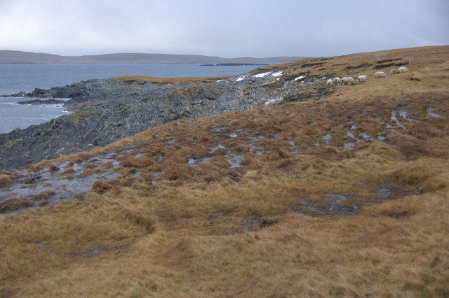
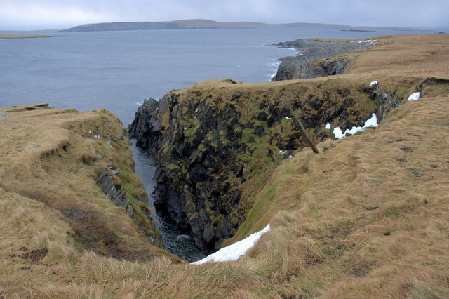
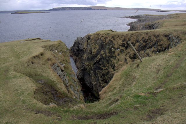
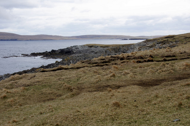
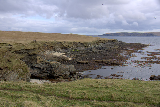
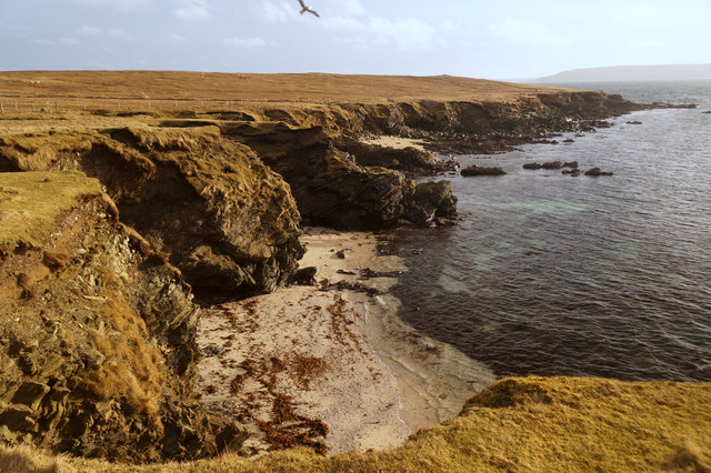
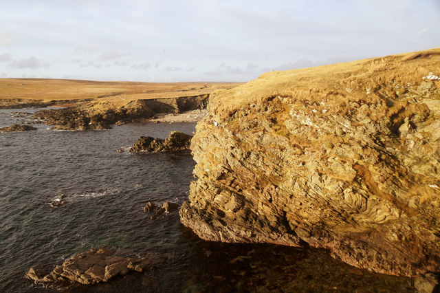
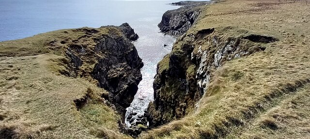
Trinkies is a rugged coastal feature located in Shetland, a remote archipelago in Scotland. Specifically, Trinkies refers to a series of cliffs and slopes that are situated along the coastline. The name "Trinkies" is derived from the Old Norse term "trong," meaning steep or precipitous, which accurately describes the nature of this geographical formation.
The cliffs at Trinkies are renowned for their dramatic beauty and imposing heights, attracting visitors and nature enthusiasts from around the world. Rising up to 100 meters (330 feet) above the crashing waves of the North Sea, these cliffs offer breathtaking panoramic views of the surrounding landscape.
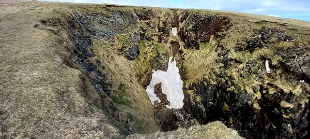
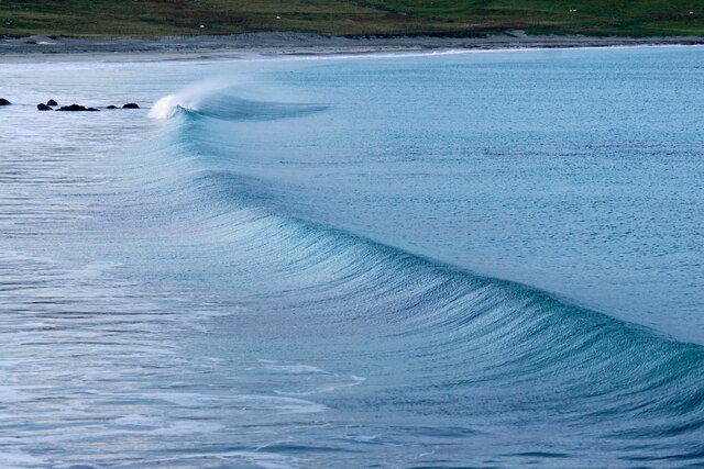
The geological composition of Trinkies is predominantly composed of sandstone and shale, giving the cliffs a distinctive layered appearance. Erosion processes, driven by the relentless force of the sea, have sculpted the rocks into fascinating shapes and formations over millions of years. Visitors to Trinkies can witness the raw power of nature as waves relentlessly pound against the cliffs, gradually shaping and reshaping the coastline.
The slopes at Trinkies are equally remarkable. These gradients, although less steep than the cliffs, provide an excellent habitat for various plant species, including hardy grasses, wildflowers, and shrubs. Additionally, the slopes are home to a diverse range of bird species, such as puffins, guillemots, and fulmars, which nest in the crevices and ledges of the cliffs.
Trinkies is not only a site of natural beauty but also an important ecological treasure. Efforts are made to preserve and protect this unique coastal landscape for future generations to enjoy.
If you have any feedback on the listing, please let us know in the comments section below.
Trinkies Images
Images are sourced within 2km of 60.693342/-0.84733632 or Grid Reference HP6301. Thanks to Geograph Open Source API. All images are credited.


Trinkies is located at Grid Ref: HP6301 (Lat: 60.693342, Lng: -0.84733632)
Unitary Authority: Shetland Islands
Police Authority: Highlands and Islands
What 3 Words
///shame.model.besotted. Near Uyeasound, Shetland Islands
Nearby Locations
Related Wikis

Muness Castle
Muness Castle is located on Unst, which is one of the Shetland Islands of Scotland. The castle is 3 kilometres (1.9 mi) east of the village of Uyeasound...

Mailand, Shetland
Mailand is a hamlet in the Shetland Islands. It is on the island of Unst, the northernmost of the inhabited British Isles, near its southern coast. �...

Clivocast
Clivocast is a settlement on the island of Unst in the Shetland Islands, Scotland at 60.67°N 00.90°W / 60.67; -00.90 or grid reference HP6000 and is situated...

Haaf Gruney
Haaf Gruney is a small island in the north east of the Shetland Islands. == Geography and geology == The island is between Unst and Fetlar which are to...

Uyeasound
Uyeasound is a village on the Isle of Unst, the northernmost island of the Shetland Islands, Scotland. It takes its name from the neighbouring strait of...
Uyea, Unst
Uyea (Scots: Uyea) is an uninhabited island, lying south of Unst in Shetland, Scotland. == History == The island was inhabited as early as the Bronze Age...

Huney
Huney is an uninhabited island due east of the island of Unst in the Shetland Islands, Scotland. The island is located approximately 1 kilometre south...

Unst Airport
Unst Airport also called Baltasound Airport is an unlicensed airfield near Baltasound, on the island of Unst, Shetland Islands, Scotland. The airfield...
Nearby Amenities
Located within 500m of 60.693342,-0.84733632Have you been to Trinkies?
Leave your review of Trinkies below (or comments, questions and feedback).