Sheenaberg

Cliff, Slope in Shetland

Scotland

Sheenaberg

Haaf Gruney from Unst The island of Haaf Gruney ('green island in the deep sea') from Ramnageo on Unst.
Haaf Gruney from Unst Credit: Mike Pennington

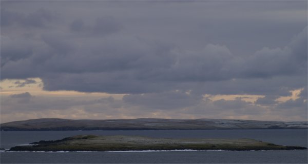
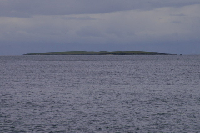
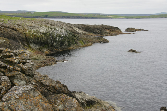
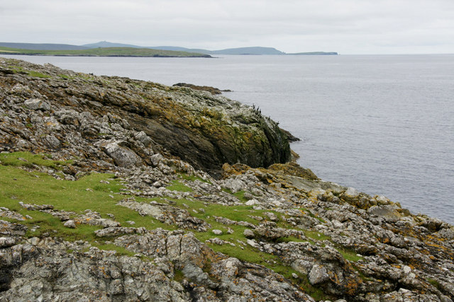
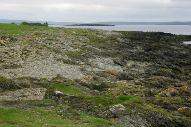
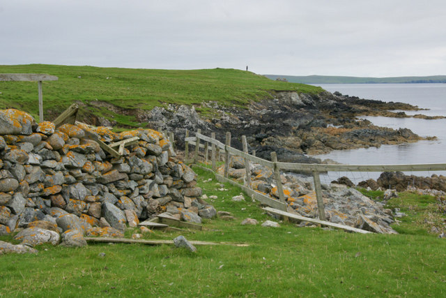
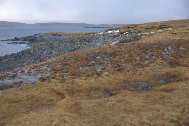
Sheenaberg is a picturesque cliff located in the Shetland Islands, an archipelago in Scotland. Nestled on the western coast of the main island, it offers breathtaking views and is a popular destination for nature enthusiasts and hikers.

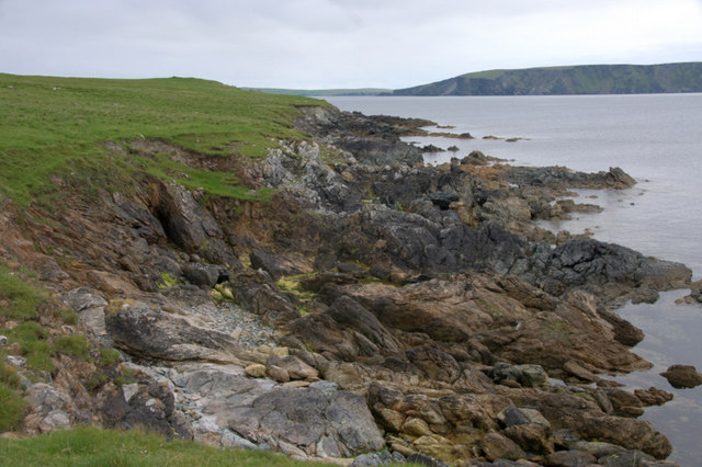
Rising majestically from the North Atlantic Ocean, Sheenaberg stands tall at approximately 200 feet (60 meters) high. Its rugged and dramatic cliffs are composed of layers of ancient rock formations, showcasing the island's geological history. The cliff face boasts unique features, such as natural caves and crevices, which add to its allure.

The slope leading up to Sheenaberg is a sight to behold, covered in lush green vegetation and wildflowers during the summer months. The diverse flora and fauna of the area make it a haven for wildlife, including nesting seabirds like puffins, fulmars, and guillemots. Visitors can often spot these fascinating creatures perched on the cliff ledges or soaring in the skies above.

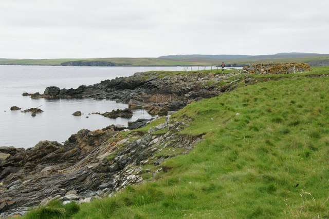
The cliff is accessible via a well-maintained footpath, providing a challenging but rewarding hike for outdoor enthusiasts. As one ascends the slope, the panoramic views of the surrounding coastline, the sparkling ocean, and neighboring islands become increasingly awe-inspiring. At the top, visitors are rewarded with a breathtaking vista that stretches as far as the eye can see, making it an ideal spot for photography or simply taking in the natural beauty.

Sheenaberg is not only a stunning natural landmark but also a testament to the rich history and beauty of the Shetland Islands. Its rugged cliffs and captivating views make it an unforgettable destination for anyone seeking to immerse themselves in the wonders of nature.

If you have any feedback on the listing, please let us know in the comments section below.

Sheenaberg Images

Images are sourced within 2km of 60.679648/-0.84822879 or Grid Reference HP6300. Thanks to Geograph Open Source API. All images are credited.

Haaf Gruney from Unst The island of Haaf Gruney ('green island in the deep sea') from Ramnageo on Unst.
Haaf Gruney from Unst
The island of Haaf Gruney ('green island in the deep sea') from Ramnageo on Unst.
Ruined crofthouse on the Ness of Ramnageo
Ness of Ramnageo A ruined planticrub (shelter for growing crops) on the Ness; Fetlar is in the distance.
Ness of Ramnageo
A ruined planticrub (shelter for growing crops) on the Ness; Fetlar is in the distance.
Beaches on the west of the Ness of Ramnageo The ruined croft at Littlegarth can just be seen in the distance.
Beaches on the west of the Ness of Ramnageo
The ruined croft at Littlegarth can just be seen in the distance.
Coastline below Littlegarth Uyea isle is in the distance.
Coastline below Littlegarth
Uyea isle is in the distance.
Cliffs at Littlegarth Fulmars are beginning to return to ledges left empty for most of the winter.
Cliffs at Littlegarth
Fulmars are beginning to return to ledges left empty for most of the winter.
Wick of Fauld Looking across the wick from Littlegarth towards Ramnageo.
Wick of Fauld
Looking across the wick from Littlegarth towards Ramnageo.
Beach on Ness of Ramnageo Looking towards Fetlar.
Beach on Ness of Ramnageo
Looking towards Fetlar.
Wick of Fauld from Ramnageo Looking towards Littlegarth.
Wick of Fauld from Ramnageo
Looking towards Littlegarth.
Haaf Gruney from the west Taken from the Fetlar ferry.
Haaf Gruney from the west
Taken from the Fetlar ferry.
Vailan, Haaf Gruney The landing place for the island.
Vailan, Haaf Gruney
The landing place for the island.
West coast of Haaf Gruney Looking south.
West coast of Haaf Gruney
Looking south.
East coast of Haaf Gruney Looking north towards Unst.
East coast of Haaf Gruney
Looking north towards Unst.
Landward Taing, Haaf Gruney Closest to Unst.
Landward Taing, Haaf Gruney
Closest to Unst.
North coast of Haaf Gruney This beach is used as a nursery beach by Grey Seals in autumn. The ruined house at the far end of the beach was a shelter used by chromate miners working at the quarry, but there were no permanent homes on the island.
North coast of Haaf Gruney
This beach is used as a nursery beach by Grey Seals in autumn. The ruined house at the far end of the beach was a shelter used by chromate miners working at the quarry, but there were no permanent homes on the island.
Vailan, Haaf Gruney Small stone shelter above the landing place.
Vailan, Haaf Gruney
Small stone shelter above the landing place.
Ness of Ramnageo Looking out towards Wedder Holm, with Fetlar in the distance.
Ness of Ramnageo
Looking out towards Wedder Holm, with Fetlar in the distance.
Scranklings, Ness of Ramnageo This unusual piece of coastline along the east side of the Ness of Ramnageo has the strangely appropriate-sounding name of Scranklings, according to the 1:10,000 map.
Scranklings, Ness of Ramnageo
This unusual piece of coastline along the east side of the Ness of Ramnageo has the strangely appropriate-sounding name of Scranklings, according to the 1:10,000 map.
Show me another place!

Sheenaberg is located at Grid Ref: HP6300 (Lat: 60.679648, Lng: -0.84822879)

Unitary Authority: Shetland Islands

Police Authority: Highlands and Islands

What 3 Words

///creatures.duos.countries. Near Uyeasound, Shetland Islands

Related Wikis

Muness Castle

Muness Castle is located on Unst, which is one of the Shetland Islands of Scotland. The castle is 3 kilometres (1.9 mi) east of the village of Uyeasound...

Haaf Gruney

Haaf Gruney is a small island in the north east of the Shetland Islands. == Geography and geology == The island is between Unst and Fetlar which are to...

Mailand, Shetland

Mailand is a hamlet in the Shetland Islands. It is on the island of Unst, the northernmost of the inhabited British Isles, near its southern coast. �...

Clivocast

Clivocast is a settlement on the island of Unst in the Shetland Islands, Scotland at 60.67°N 00.90°W / 60.67; -00.90 or grid reference HP6000 and is situated...

Nearby Amenities

Located within 500m of 60.679648,-0.84822879
Ramnageo
Is In: Scotland, GB
Place: hamlet
Lat/Long: 60.6795167/-0.8551921
Power: pole
Lat/Long: 60.6795042/-0.8570285
The data included in this document is from www.openstreetmap.org. The data is made available under ODbL.

Have you been to Sheenaberg?

Leave your review of Sheenaberg below (or comments, questions and feedback).