Bay Hevda

Cliff, Slope in Shetland

Scotland

Bay Hevda

North Head, Tingon, from Leascole, Eshaness
North Head, Tingon, from Leascole, Eshaness Credit: Mike Pennington

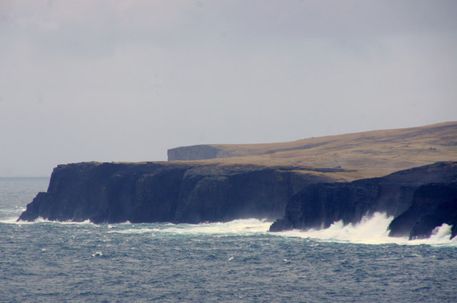
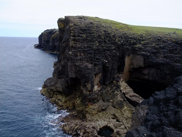
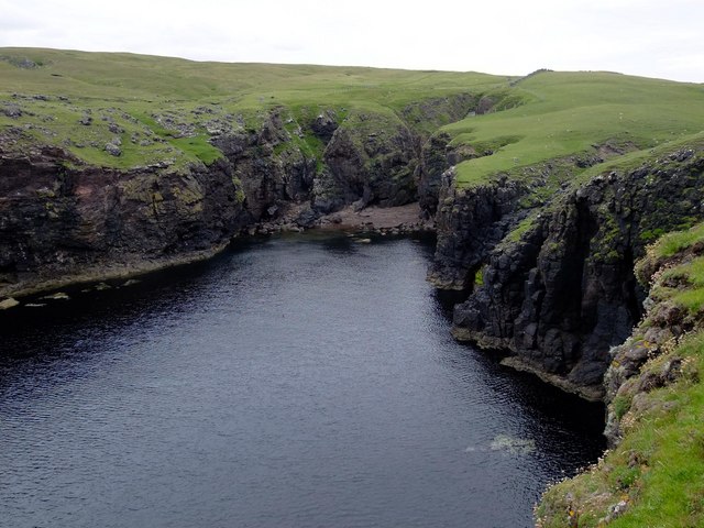
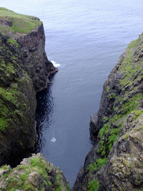
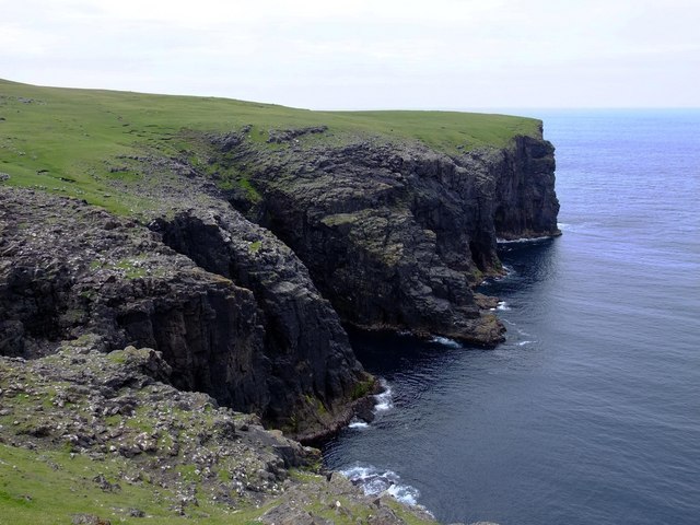
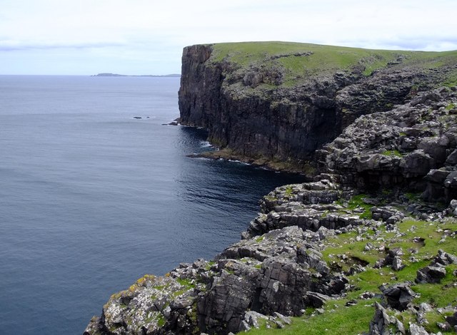
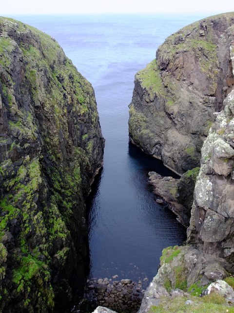
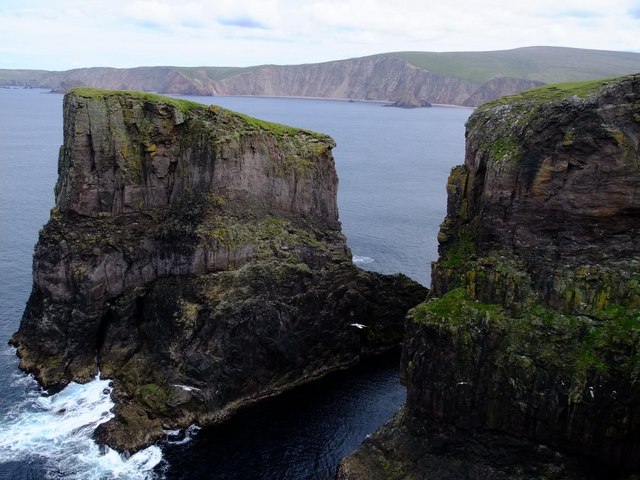
Bay Hevda is a picturesque coastal area located in the Shetland Islands, an archipelago in Scotland. Nestled on the eastern coast of the mainland, this bay boasts stunning cliffs and slopes that offer breathtaking views of the surrounding landscape.

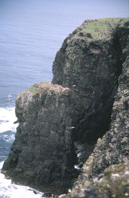
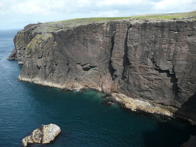
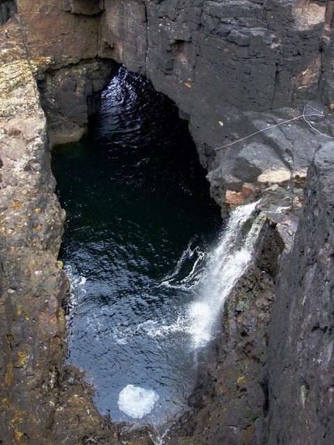
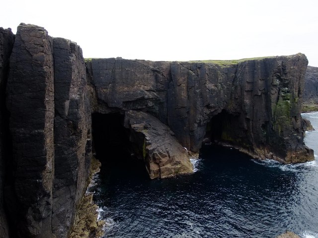
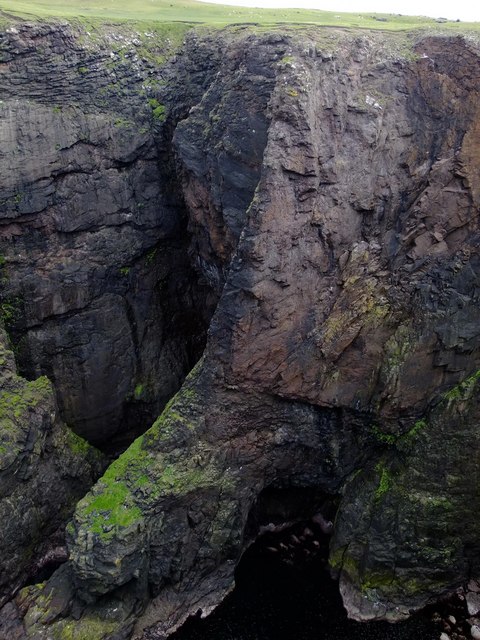
The cliffs of Bay Hevda rise majestically from the North Sea, reaching impressive heights that can reach up to 300 feet in some areas. Composed of rugged rock formations, these cliffs showcase a variety of colors, ranging from earthy browns to vibrant reds and oranges. They are a result of millions of years of geological processes, with layers of sediment and volcanic activity contributing to their unique appearance.

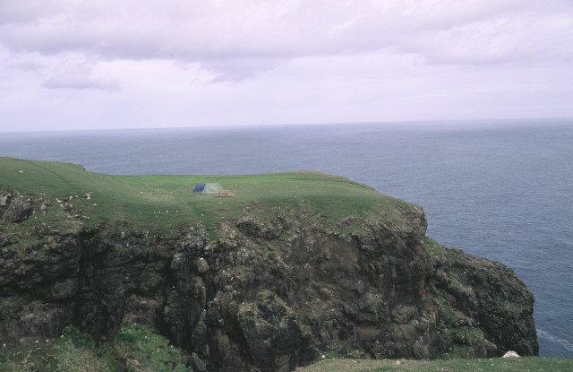
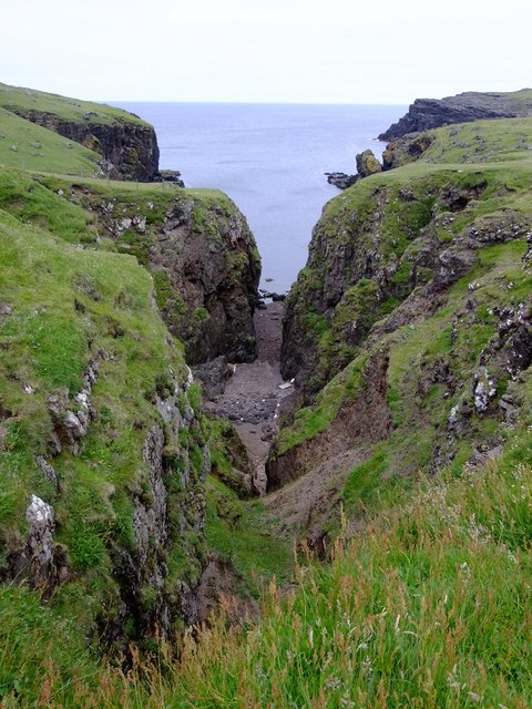
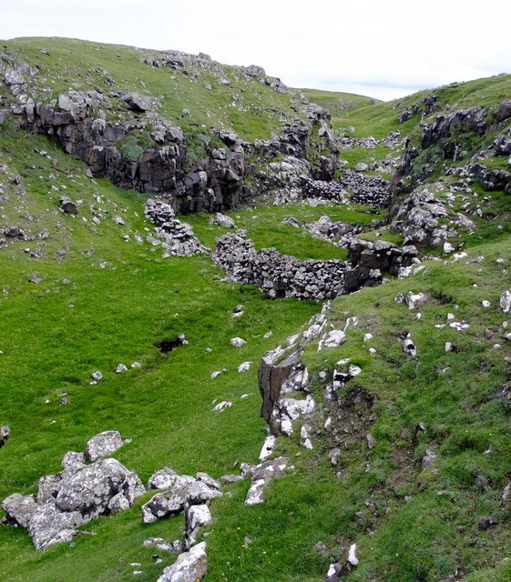
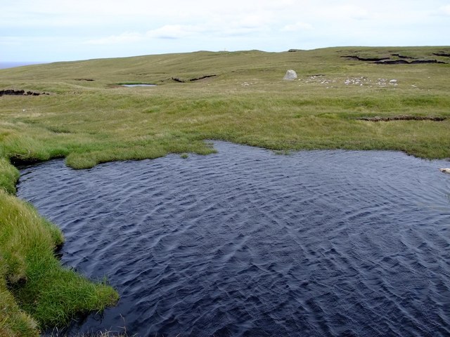
The slopes of Bay Hevda provide a striking contrast to the vertical cliffs. They are characterized by gentle inclinations covered in a lush carpet of green vegetation, including grasses, wildflowers, and hardy shrubs. These slopes are a testament to the fertile soil that has developed over time, allowing for the growth of an array of plant life.

Visitors to Bay Hevda are treated to a mesmerizing panorama of the sea stretching out before them, with the cliffs and slopes framing the view. The rugged beauty of this coastal area attracts nature enthusiasts, hikers, and photographers alike. It also serves as a vital habitat for various bird species, including puffins, guillemots, and fulmars, which nest along the cliffs and find refuge in the surrounding waters.

Whether one is seeking a tranquil stroll along the cliffs, an adventurous hike, or simply a place to admire the sheer grandeur of nature, Bay Hevda in Shetland is an idyllic location that offers a truly unforgettable experience.

If you have any feedback on the listing, please let us know in the comments section below.

Bay Hevda Images

Images are sourced within 2km of 60.548345/-1.5538001 or Grid Reference HU2485. Thanks to Geograph Open Source API. All images are credited.

North Head, Tingon, from Leascole, Eshaness
The Faither Sea Cliffs in this area are mostly loose and somewhat dangerous, but in places the sea keeps the base 30m or so relatively clean.  The pocketed rock provides perfect nesting locations for Fulmars.
The Faither
Sea Cliffs in this area are mostly loose and somewhat dangerous, but in places the sea keeps the base 30m or so relatively clean. The pocketed rock provides perfect nesting locations for Fulmars.
Headland across Galti Geo This land shows signs of recent usage as pasture but is now mostly occupied by a large variety of birdlife.  Many gulls and fulmars can be seen here nesting on the cliffs
Headland across Galti Geo
This land shows signs of recent usage as pasture but is now mostly occupied by a large variety of birdlife. Many gulls and fulmars can be seen here nesting on the cliffs
Seacliffs south of North Head
Headland at Warie Gill The huge black hole on the right of the picture is one end of a natural arch.  The Burn of Tingon falls in a 10 m waterfall into the sea at the end of this arch.
Headland at Warie Gill
The huge black hole on the right of the picture is one end of a natural arch. The Burn of Tingon falls in a 10 m waterfall into the sea at the end of this arch.
Burn of Tingon at Warie Gill The Burn of Tingon descends in a 10m waterfall into Warie Gill (a geo) which is at one end of a natural arch.  There is a climbing rope in the picture, and the quality of the sea cliffs here yields some stunning and probably unclimbed routes.
Burn of Tingon at Warie Gill
The Burn of Tingon descends in a 10m waterfall into Warie Gill (a geo) which is at one end of a natural arch. There is a climbing rope in the picture, and the quality of the sea cliffs here yields some stunning and probably unclimbed routes.
Sea caves at North Head These caves are at the base of 50 m sheer cliffs.  Cormorants and fulmars are plentiful here.
Sea caves at North Head
These caves are at the base of 50 m sheer cliffs. Cormorants and fulmars are plentiful here.
Geo of Ockran, North Head
Looking SE down the Geo of Ockran
Gorsendi Geo The cliffs are between 50 and 70 metres high.  The southern slopes had many hundreds of Greylag Geese, grazing on the rich grassland.
Gorsendi Geo
The cliffs are between 50 and 70 metres high. The southern slopes had many hundreds of Greylag Geese, grazing on the rich grassland.
Bay Hevda from Clew Head
Sheep folds, Clew Head These sheep folds use the sides of a narrow ravine to form the edges of the enclosures.  There are similar examples in HU3072, above South Sound in Mangaster.
Sheep folds, Clew Head
These sheep folds use the sides of a narrow ravine to form the edges of the enclosures. There are similar examples in HU3072, above South Sound in Mangaster.
Clew Head from Bay Hevda
Ler Geo These tremendous cliffs at the head of the Geo are about 80 m high.
Ler Geo
These tremendous cliffs at the head of the Geo are about 80 m high.
Ler Geo
Ler Geo
Trig Point  107 m, above The Faither Oddly, this peninsula north of Hamnavoe has no name on any maps, large or small scale.  Local names only cover small areas of terrain (e.g. Villains of Hamnavoe, The Faither, etc.), and locals in Hillswick don't know any names either.  Can anyone out there offer any help or suggestions?
Trig Point 107 m, above The Faither
Oddly, this peninsula north of Hamnavoe has no name on any maps, large or small scale. Local names only cover small areas of terrain (e.g. Villains of Hamnavoe, The Faither, etc.), and locals in Hillswick don't know any names either. Can anyone out there offer any help or suggestions?
Galti Stack
Galti Stack
Lergeo Water
Lergeo Water
Show me another place!

Bay Hevda is located at Grid Ref: HU2485 (Lat: 60.548345, Lng: -1.5538001)

Unitary Authority: Shetland Islands

Police Authority: Highlands and Islands

What 3 Words

///sounding.brambles.with. Near Brae, Shetland Islands

Nearby Locations

Bay Hevda

Related Wikis

Tingon

Tingon is a peninsula in the north-west of Northmavine, Shetland. It is delineated on the east by Ronas Voe, and on the west by Hamnavoe. It is designated...

Johnnie Notions

John Williamson (c. 1730 – c. 1803), more commonly known by the nickname Johnnie Notions (pronounced [ˌdʒoni ˈnoʃəns], JOH-nee-NOH-shəns) was a self-taught...

Lang Ayre

The Lang Ayre is a beach on the west side of Ronas Hill, Northmavine, Shetland. At 1 kilometre (0.6 mi) in length it is the archipelago's longest. It is...

Ronas Voe

Ronas Voe (pronounced [ˈrø̞nis ˌvo̞:] Shetland Dialect: Rønies Voe) is a voe in Northmavine, Shetland. It divides the land between Ronas Hill, Shetland...

Braehoulland

Braehoulland is a hamlet on Mainland, in Shetland, Scotland. Braehoulland is situated within the parish of Northmaven. Eshaness Community Centre is located...

Ronas Hill

Ronas Hill (or Rönies Hill) is a hill in Shetland, Scotland. It is classed as a Marilyn, and is the highest point in the Shetland Islands at an elevation...

Heylor

Heylor is a settlement situated on the south side of Ronas Voe in Northmavine, Shetland, Scotland. It lies directly opposite Ronas Hill, Shetland's tallest...

Esha Ness

Esha Ness, also spelled Eshaness, is a peninsula on the west coast of Northmavine, on the island of Mainland, Shetland, Scotland. Esha Ness Lighthouse...

Have you been to Bay Hevda?

Leave your review of Bay Hevda below (or comments, questions and feedback).