Lover's Leap

Cliff, Slope in Argyllshire

Scotland

Lover's Leap

Autumn woodland above Ardentinny On a forestry logging road bound for Knap, further north on Loch Long-side.

This photograph was taken during the Coronavirus (COVID-19) pandemic of 2020/21.
Autumn woodland above Ardentinny Credit: James T M Towill

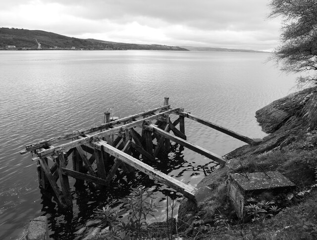
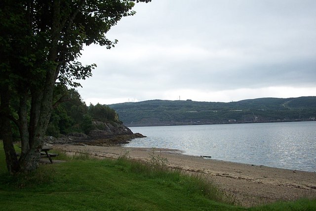
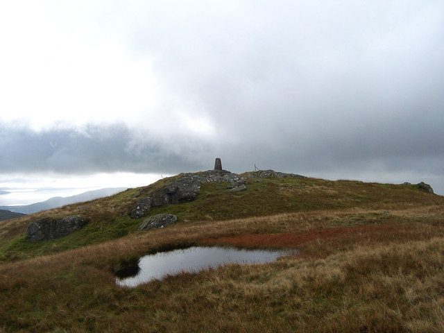
Lover's Leap is a prominent cliff and slope located in Argyllshire, Scotland. It is situated on the west coast of the country, overlooking the picturesque village of Arrochar and the expansive Loch Long. The name "Lover's Leap" is steeped in local folklore and adds an air of romanticism to the area.

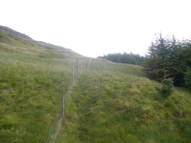
The cliff itself stands at an impressive height, offering breathtaking views of the surrounding landscape. It is composed of rugged rock formations and lush greenery, making it a popular destination for nature enthusiasts and hikers. The slope leading up to the cliff is covered in heather and wildflowers, adding to the natural beauty of the area.

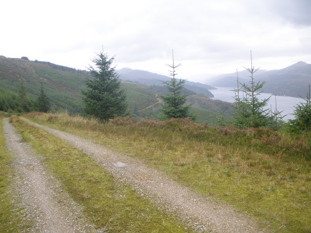
One of the main attractions of Lover's Leap is the panoramic vista it provides. From the top of the cliff, visitors can gaze out at the serene Loch Long, with its calm waters reflecting the surrounding mountains. On clear days, the view extends beyond the loch to the majestic peaks of the Arrochar Alps, including the iconic Cobbler mountain.

Lover's Leap also holds historical significance, as it is believed to have been a meeting place for lovers in ancient times. Legend has it that couples would jump off the cliff together, symbolizing their eternal love and commitment to each other. While there is no concrete evidence to support this tale, it adds an element of mystery and allure to the site.

Overall, Lover's Leap in Argyllshire is a must-visit destination for those seeking natural beauty, stunning views, and a touch of romance.

If you have any feedback on the listing, please let us know in the comments section below.

Lover's Leap Images

Images are sourced within 2km of 56.055927/-4.90994 or Grid Reference NS1888. Thanks to Geograph Open Source API. All images are credited.

Autumn woodland above Ardentinny On a forestry logging road bound for Knap, further north on Loch Long-side.

This photograph was taken during the Coronavirus (COVID-19) pandemic of 2020/21.
Autumn woodland above Ardentinny
On a forestry logging road bound for Knap, further north on Loch Long-side. This photograph was taken during the Coronavirus (COVID-19) pandemic of 2020/21.
Disused jetty at former WWII anti-submarine boom winch station This jetty is depicted on the 1:25k map, but not at other scales.  Very little information seems to exist about the site other than it apparently having been a winch station for an anti-submarine boom during WWII.  Some of the fittings appear to be perhaps a little more recent than this era; I did wonder if there was any connection with the  Loch Long Torpedo Range much further up the loch, the existence of which preservered well beyond the Second World War.

This photograph was taken during the Coronavirus (COVID-19) pandemic of 2020/21.
Disused jetty at former WWII anti-submarine boom winch station
This jetty is depicted on the 1:25k map, but not at other scales. Very little information seems to exist about the site other than it apparently having been a winch station for an anti-submarine boom during WWII. Some of the fittings appear to be perhaps a little more recent than this era; I did wonder if there was any connection with the Loch Long Torpedo Range much further up the loch, the existence of which preservered well beyond the Second World War. This photograph was taken during the Coronavirus (COVID-19) pandemic of 2020/21.
Disused winch station building by Loch Long A view of the seaward side of a (largely wooden) building at the winch station site. The shutters would have been lifted to enable passage of cables to the winches within the building.  Very little information seems to exist about the site other than it apparently having been a winch station for an anti-submarine boom during WWII. Some of the fittings appear to be perhaps a little more recent than this era; I did wonder if there was any connection with the Loch Long Toredo Raange much further up the loch, the existence of which preservered well beyond the Second World War.

This photograph was taken during the Coronavirus (COVID-19) pandemic of 2020/21.
Disused winch station building by Loch Long
A view of the seaward side of a (largely wooden) building at the winch station site. The shutters would have been lifted to enable passage of cables to the winches within the building. Very little information seems to exist about the site other than it apparently having been a winch station for an anti-submarine boom during WWII. Some of the fittings appear to be perhaps a little more recent than this era; I did wonder if there was any connection with the Loch Long Toredo Raange much further up the loch, the existence of which preservered well beyond the Second World War. This photograph was taken during the Coronavirus (COVID-19) pandemic of 2020/21.
Ground anchor above former winch station What appears to be a ground anchor of some description can be found in the woodland above the former winch station.

This photograph was taken during the Coronavirus (COVID-19) pandemic of 2020/21.
Ground anchor above former winch station
What appears to be a ground anchor of some description can be found in the woodland above the former winch station. This photograph was taken during the Coronavirus (COVID-19) pandemic of 2020/21.
Possible cable guide above former winch station Located a short distance from what appeared to be a ground anchor, this structure may well have been some kind of cable guide or stay.

This photograph was taken during the Coronavirus (COVID-19) pandemic of 2020/21.
Possible cable guide above former winch station
Located a short distance from what appeared to be a ground anchor, this structure may well have been some kind of cable guide or stay. This photograph was taken during the Coronavirus (COVID-19) pandemic of 2020/21.
Exterior of former winch station building This predominantly wooden building is adjacent to a concrete building (behind photographer).  The winches and associated mechanisms are within this wooden building; the concrete structure houses what may have been a generator room and toilet.

This photograph was taken during the Coronavirus (COVID-19) pandemic of 2020/21.
Exterior of former winch station building
This predominantly wooden building is adjacent to a concrete building (behind photographer). The winches and associated mechanisms are within this wooden building; the concrete structure houses what may have been a generator room and toilet. This photograph was taken during the Coronavirus (COVID-19) pandemic of 2020/21.
Winches and associated mechanisms A view within the former winch station building reveals a wealth of machinery remaining.  Unfortunately, the floor of this building is ankle-deep in water.

This photograph was taken during the Coronavirus (COVID-19) pandemic of 2020/21.
Winches and associated mechanisms
A view within the former winch station building reveals a wealth of machinery remaining. Unfortunately, the floor of this building is ankle-deep in water. This photograph was taken during the Coronavirus (COVID-19) pandemic of 2020/21.
View from the former WWII anti-submarine boom winch station A view across the disused jetty and Loch Long towards RNAD Coulport on the eastern shore.

This photograph was taken during the Coronavirus (COVID-19) pandemic of 2020/21.
View from the former WWII anti-submarine boom winch station
A view across the disused jetty and Loch Long towards RNAD Coulport on the eastern shore. This photograph was taken during the Coronavirus (COVID-19) pandemic of 2020/21.
A track behind Finart Bay A pleasant walk from Ardentinny village to reach the carpark at Finart Bay.
A track behind Finart Bay
A pleasant walk from Ardentinny village to reach the carpark at Finart Bay.
Forest track towards Carrick Castle
Coille Mheadhanaich Rich woodland covering the northern slopes of Glen Finart.
Coille Mheadhanaich
Rich woodland covering the northern slopes of Glen Finart.
Forest road at Loch Long A big deep puddle in the road, just north of Port Dornaige.

See also <a href="https://www.geograph.org.uk/photo/6403179">NS2090 : Object by the forest road at Loch Long</a>.
Forest road at Loch Long
A big deep puddle in the road, just north of Port Dornaige. See also NS2090 : Object by the forest road at Loch Long.
Object by the forest road at Loch Long It is the lower section of an anti-shock trekking pole.
Object by the forest road at Loch Long
It is the lower section of an anti-shock trekking pole.
Am Binnein Summit The cliffs on the north side of Am Binnein's summit as seen from the col linking the peak to Cruach a'Chaise
Am Binnein Summit
The cliffs on the north side of Am Binnein's summit as seen from the col linking the peak to Cruach a'Chaise
South-West Slopes of Cruach a'Chaise Rocky outcrops litter the south-west slopes of Cruach a'Chaise
South-West Slopes of Cruach a'Chaise
Rocky outcrops litter the south-west slopes of Cruach a'Chaise
Forestry road comes to an end Glen Finart
Fenceline at the edge of the forest below Cruach a' Chaise
Forest road above Loch Long
Show me another place!

Lover's Leap is located at Grid Ref: NS1888 (Lat: 56.055927, Lng: -4.90994)

Unitary Authority: Argyll and Bute

Police Authority: Argyll and West Dunbartonshire

What 3 Words

///crouch.landlords.texts. Near Garelochhead, Argyll & Bute

Related Wikis

Glen Finart

Glen Finart (Scottish Gaelic: Gleann Fhionnaird) is a glacially formed glen on the Cowal peninsula, Argyll and Bute, Scotland. The glen is within the...

Ardentinny

Ardentinny (Scottish Gaelic: Àird an t-Sionnaich or Àird an Teine) is a small village on the western shore of Loch Long, 14 miles (23 km) north of Dunoon...

RNAD Coulport

Royal Naval Armaments Depot Coulport, shortened to RNAD Coulport, on Loch Long in Argyll, Scotland, is the storage and loading facility for the nuclear...

Coulport (village)

Coulport (Scottish Gaelic: An Cùl Phort - literally the Back Port or Ferry) is a village on the east side of Loch Long, Argyll and Bute, Scotland. It is...

Loch Long

Loch Long is a body of water in the council area of Argyll and Bute, Scotland. The Sea Loch extends from the Firth of Clyde at its southwestern end. It...

Beinn Ruadh

Beinn Ruadh (664 m) is a mountain of Argyll and Bute in Scotland. Part of the Grampian Mountains, it lies between Loch Eck and Loch Long in Argyll Forest...

Ardpeaton

Ardpeaton is a settlement in Argyll and Bute, Scotland, on the shore of Loch Long, with a population under 1000. == References ==

Coylet

Coylet is a hamlet on Loch Eck, Cowal peninsula, Argyll and Bute, in West Scotland.The hamlet is within the Argyll Forest Park, which is itself within...

Nearby Amenities

Located within 500m of 56.055927,-4.90994
Created By: almien_coastlines
Lat/Long: 56.055658/-4.905844
Parking
Lat/Long: 56.0559855/-4.9059972
Tourism: picnic_site
Lat/Long: 56.0552289/-4.907466
Toilets
Lat/Long: 56.0559855/-4.9064264
Stronvochlan
Place: isolated_dwelling
Lat/Long: 56.0570192/-4.9129434
Lover's Leap
Place: locality
Lat/Long: 56.0566923/-4.9083639
Power: pole
Lat/Long: 56.0554237/-4.9106183
Power: pole
Lat/Long: 56.0553875/-4.9106077
The data included in this document is from www.openstreetmap.org. The data is made available under ODbL.

Have you been to Lover's Leap?

Leave your review of Lover's Leap below (or comments, questions and feedback).