Creag nam Fiadh

Cliff, Slope in Cromartyshire

Scotland

Creag nam Fiadh

Ruins on hillside beside coastal path
Ruins on hillside beside coastal path Credit: Chris Wimbush

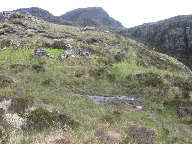
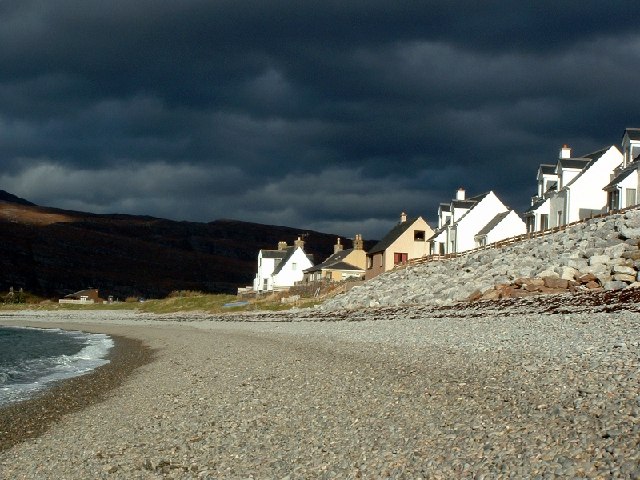
Creag nam Fiadh, located in Cromartyshire, is a prominent cliff and slope formation that holds significant geological and ecological importance. Rising majestically along the coastline, it is a natural landmark that captures the attention of visitors and locals alike.

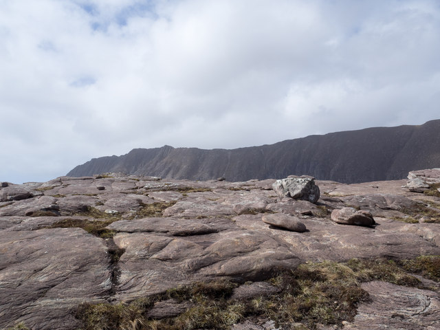
The cliff, which stands at an impressive height of approximately 100 meters, is composed of various layers of sedimentary rock, including sandstone and limestone. These rocks offer a glimpse into the region's geological history, with some dating back millions of years. The layers of rock also showcase the effects of erosion and weathering, with distinctive shapes and patterns etched into the cliff face.

The slope leading up to the cliff is covered in a diverse array of vegetation, from hardy grasses and mosses to shrubs and small trees. This rich plant life provides a habitat for numerous species of birds, insects, and small mammals, making Creag nam Fiadh an important ecological site.

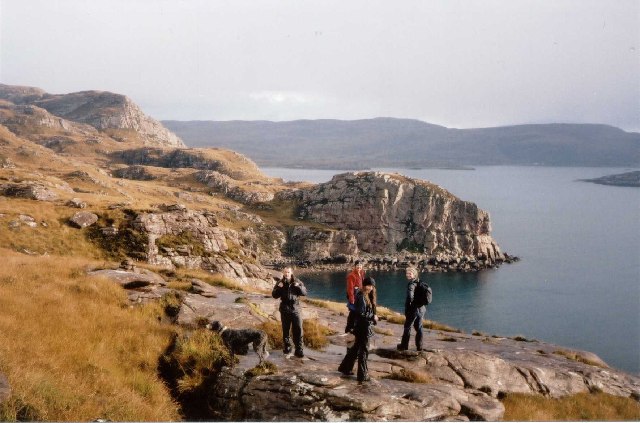
Visitors to Creag nam Fiadh can enjoy breathtaking panoramic views of the surrounding landscape, with the sparkling waters of the Cromarty Firth stretching out before them. The cliff also offers an opportunity for adventurous climbers to test their skills, although caution is advised due to the steepness and potential rockfall hazards.

Preservation efforts have been undertaken to safeguard Creag nam Fiadh's natural beauty and ecological significance. Local authorities have implemented measures to prevent erosion and protect the delicate ecosystem that thrives around the cliff and slope.

In conclusion, Creag nam Fiadh is a remarkable natural formation in Cromartyshire, commanding attention with its towering cliff and verdant slope. This geological wonder and its diverse ecosystem make it a must-visit destination for nature enthusiasts and those seeking awe-inspiring views of the Scottish coastline.

If you have any feedback on the listing, please let us know in the comments section below.

Creag nam Fiadh Images

Images are sourced within 2km of 57.957487/-5.1977362 or Grid Reference NC1000. Thanks to Geograph Open Source API. All images are credited.

Ruins on hillside beside coastal path
Old Schoolhouse on Isle Martin The Isle Martin Trust is intending to renovate this so that it can be used. There is a newer schoolhouse nearer the main houses, now used as a small museum.
Old Schoolhouse on Isle Martin
The Isle Martin Trust is intending to renovate this so that it can be used. There is a newer schoolhouse nearer the main houses, now used as a small museum.
Coastal path waymark approaching Blàr Mòr
Coast path waymark near Creag Dearg
View from Dùn Canna View from Dùn Canna
View from Dùn Canna
View from Dùn Canna
Camas Mòr At low tide, From the iron age fort, Dùn Canna.
Camas Mòr
At low tide, From the iron age fort, Dùn Canna.
New tree planting by the River Canaird
Contrasting banks of the River Canaird The flood plain appears to be free draining whereas the moors above are not.
Contrasting banks of the River Canaird
The flood plain appears to be free draining whereas the moors above are not.
Perched boulder on Beannan Beaga Beannan Beaga, especially along its broad summit ridge has large areas of sandstone slabs with many perched boulders. The distant mountain slopes are of Ben More Coigach.
Perched boulder on Beannan Beaga
Beannan Beaga, especially along its broad summit ridge has large areas of sandstone slabs with many perched boulders. The distant mountain slopes are of Ben More Coigach.
Perched boulders at summit area of Beannan Beaga The location is close to Beannan Beaga's summit which is just to the left, out of the image. Ben Mòre Coigach rises above.
Perched boulders at summit area of Beannan Beaga
The location is close to Beannan Beaga's summit which is just to the left, out of the image. Ben Mòre Coigach rises above.
Ship at a fish farm in  Loch Kanaird
Ship at a fish farm in Loch Kanaird
Coigach Coastline Taken on the coast below the imposing slopes of Ben More Coigach, the peninsula of Rubha Meallain Bhuidh can be seen on the horizon, as can a small part of Isle Martin on the middle right edge of the photo
Coigach Coastline
Taken on the coast below the imposing slopes of Ben More Coigach, the peninsula of Rubha Meallain Bhuidh can be seen on the horizon, as can a small part of Isle Martin on the middle right edge of the photo
Creag nam Fiadh The steep slopes of Creag nam Fiadh on the northern bank of Loch Kanaid.
Creag nam Fiadh
The steep slopes of Creag nam Fiadh on the northern bank of Loch Kanaid.
Fish Trap, Camas Beag As seen at low tide from Dun Canna, an ancient fort. The V shaped walls trap fish on a receding tide.
Fish Trap, Camas Beag
As seen at low tide from Dun Canna, an ancient fort. The V shaped walls trap fish on a receding tide.
Isle Martin, Northern Coastline The northern coast of Isle Martin is comprised entirely of sea cliffs.
Isle Martin, Northern Coastline
The northern coast of Isle Martin is comprised entirely of sea cliffs.
Low Tide at Dun Canna With isle Martin to the right and the mainland to the left.
Low Tide at Dun Canna
With isle Martin to the right and the mainland to the left.
Allt Stac a' Bhuilg Mor The burn drains a large area of the Beannan Beaga and also the Loch Stac a' Bhuilg Mor.
Allt Stac a' Bhuilg Mor
The burn drains a large area of the Beannan Beaga and also the Loch Stac a' Bhuilg Mor.
Allt Stac a' Bhuilg Mor The final few hundred metres of the burn form an impressive gorge before it meets the sea.
Allt Stac a' Bhuilg Mor
The final few hundred metres of the burn form an impressive gorge before it meets the sea.
Show me another place!

Creag nam Fiadh is located at Grid Ref: NC1000 (Lat: 57.957487, Lng: -5.1977362)

Unitary Authority: Highland

Police Authority: Highlands and Islands

What 3 Words

///absent.confining.tower. Near Ullapool, Highland

Related Wikis

Isle Martin

Isle Martin (Scottish Gaelic: Eilean Mhàrtainn) is an uninhabited island in Loch Broom, on the west coast of Scotland. It is the closest of the Summer...

Ardmair

Ardmair (Scottish Gaelic: Àird Mhèar) is a village in Wester Ross, in the North West Highlands of Scotland. Formerly a fishing village, Ardmair is located...

Ben Mor Coigach

Ben Mor Coigach (Scottish Gaelic: Beinn Mhòr na Còigich) is the highest point along a ridge rising steeply from Loch Broom, in the far northwest of Scotland...

Rhue, Scotland

Rhue (An Rubha in Gaelic) is a small settlement north of Ullapool in Ross and Cromarty, and is in the Scottish council area of Highland, Scotland. ��2...

Nearby Amenities

Located within 500m of 57.957487,-5.1977362
Source: PGS
Lat/Long: 57.9566794/-5.206047
Source: PGS
Lat/Long: 57.9569909/-5.2054577
Source: PGS
Lat/Long: 57.9570771/-5.2049132
Source: PGS
Lat/Long: 57.957161/-5.2041952
Source: PGS
Lat/Long: 57.957322/-5.203268
Source: PGS
Lat/Long: 57.9571994/-5.2006279
Source: PGS
Lat/Long: 57.9572395/-5.1998017
Source: PGS
Lat/Long: 57.9572155/-5.1990403
Source: PGS
Lat/Long: 57.9573334/-5.19755
Source: PGS
Lat/Long: 57.9574651/-5.1926349
Source: PGS
Lat/Long: 57.9574624/-5.192236
Source: PGS
Lat/Long: 57.9566398/-5.193152
Source: PGS
Lat/Long: 57.9562135/-5.1941055
Source: PGS
Lat/Long: 57.9560199/-5.1940884
Source: PGS
Lat/Long: 57.956029/-5.1937909
Source: PGS
Lat/Long: 57.9560147/-5.1924072
Source: PGS
Lat/Long: 57.9558332/-5.1919496
Source: PGS
Lat/Long: 57.9555167/-5.19174
The data included in this document is from www.openstreetmap.org. The data is made available under ODbL.

Have you been to Creag nam Fiadh?

Leave your review of Creag nam Fiadh below (or comments, questions and feedback).