A' Chrois

Cliff, Slope in Argyllshire

Scotland

A' Chrois

Inch Kenneth from Gribun Field gate and track leading from the B8035 at Gribun, Mull, down to the Loch opposite Inch Kenneth island
Inch Kenneth from Gribun Credit: Peter Evans

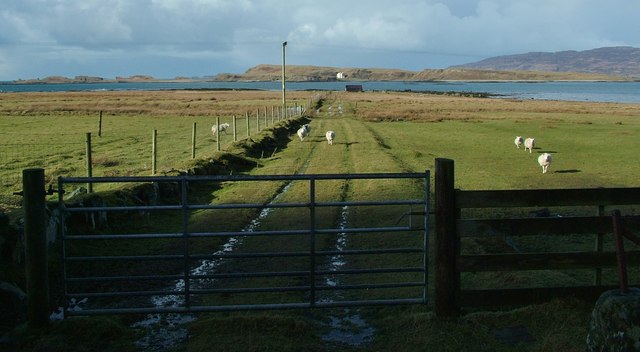
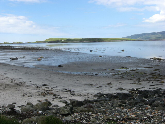
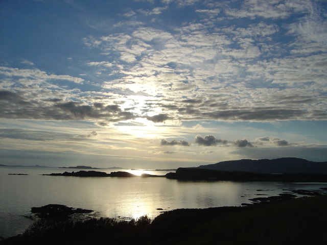
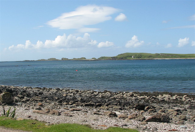
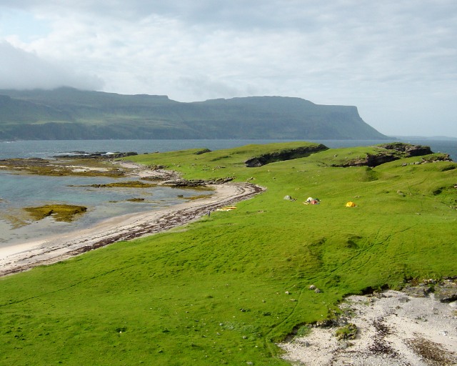
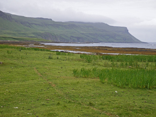
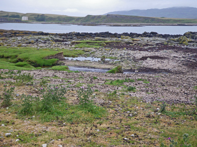
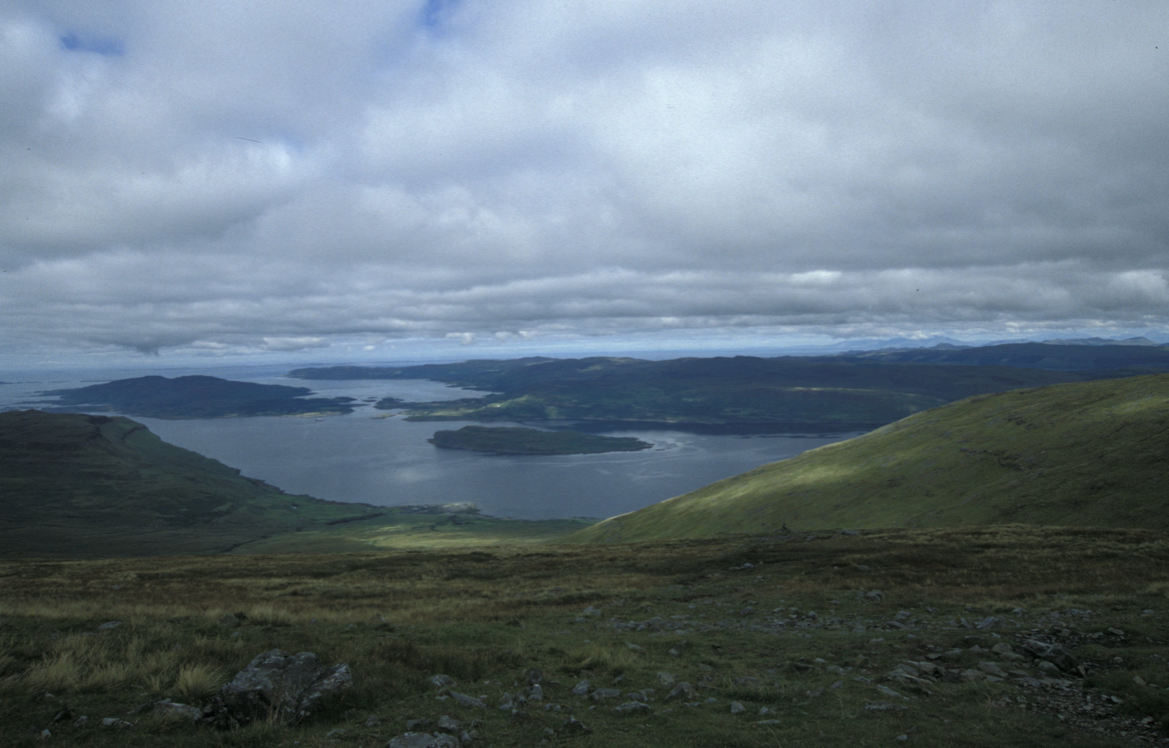
A' Chrois is a stunning cliff located in Argyllshire, a historic county in western Scotland. Situated on the western coast of Scotland, this natural wonder offers breathtaking views and is a popular destination for nature enthusiasts and hikers.

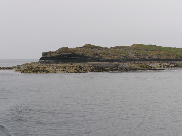
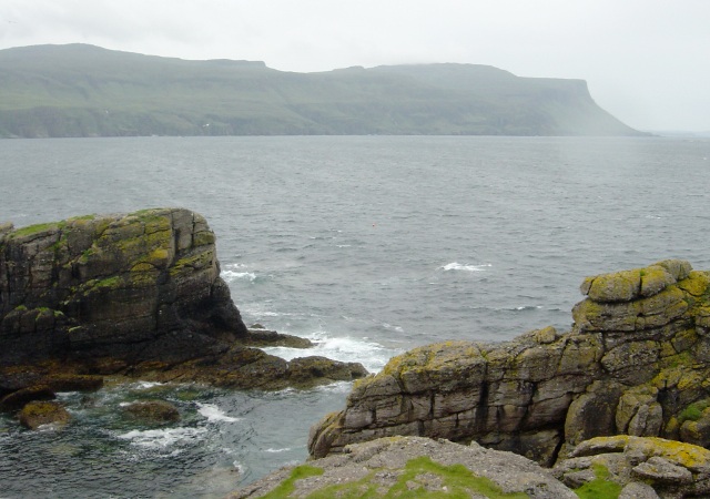
Rising to an impressive height, A' Chrois is a prominent feature of the rugged coastline. Its sloping edges and steep cliffs create a dramatic and picturesque landscape. The cliff is made up of layers of sedimentary rock, showcasing the geological history of the region. The combination of colors in the rock formations, ranging from reds to grays, adds to the visual appeal of A' Chrois.

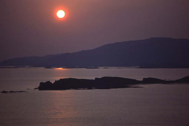
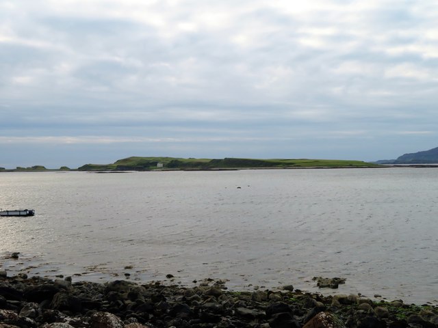
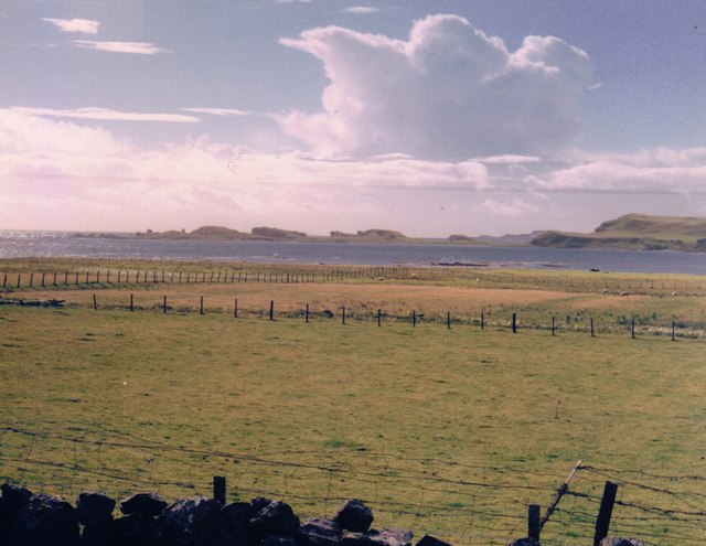
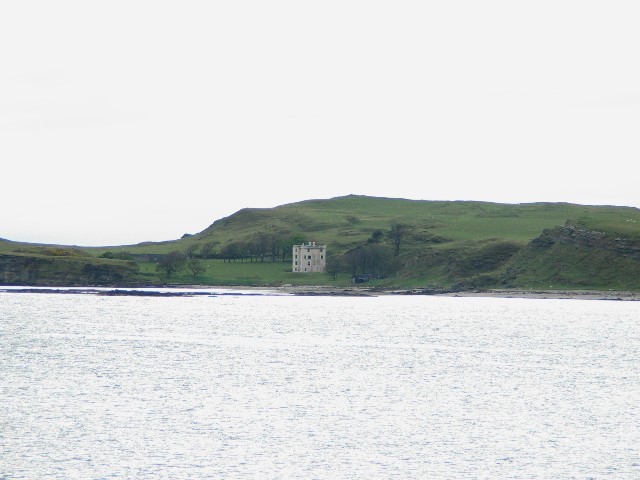
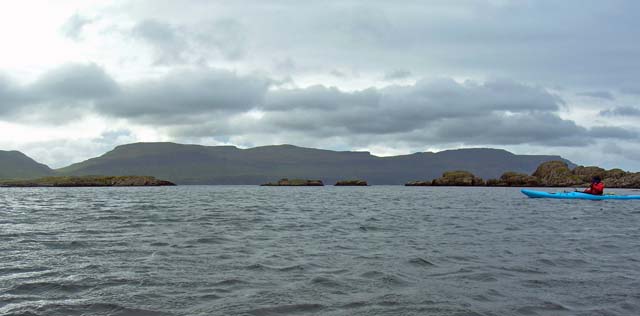
The cliff overlooks the Atlantic Ocean, providing visitors with sweeping vistas of the open sea and the surrounding countryside. On clear days, it is possible to see neighboring islands and even catch a glimpse of passing marine life, such as dolphins or seals.

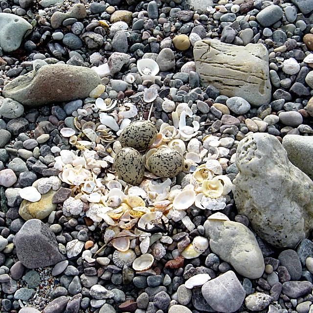
A' Chrois is also a haven for birdwatchers, as it serves as a nesting site for various seabirds. Species such as puffins, gannets, and razorbills can be spotted nesting on the cliff faces, adding to the diverse wildlife found in the area.

For those seeking adventure, A' Chrois offers excellent opportunities for rock climbing and abseiling. Experienced climbers can challenge themselves on the rugged surfaces, while beginners can take advantage of local guides and instructors to learn the ropes.

Overall, A' Chrois in Argyllshire is a remarkable natural feature that combines stunning scenery, rich geological formations, and abundant wildlife. It is a must-visit destination for anyone looking to experience the beauty of Scotland's western coastline.

If you have any feedback on the listing, please let us know in the comments section below.

A' Chrois Images

Images are sourced within 2km of 56.442285/-6.1652181 or Grid Reference NM4335. Thanks to Geograph Open Source API. All images are credited.

Inch Kenneth from Gribun Field gate and track leading from the B8035 at Gribun, Mull, down to the Loch opposite Inch Kenneth island
Inch Kenneth from Gribun
Field gate and track leading from the B8035 at Gribun, Mull, down to the Loch opposite Inch Kenneth island
Setting sun over Inch Kenneth and Ulva Looking across the mouth of Loch na Keal to Ulva. The southern part of Inch Kenneth is nearest the camera.
Setting sun over Inch Kenneth and Ulva
Looking across the mouth of Loch na Keal to Ulva. The southern part of Inch Kenneth is nearest the camera.
Loch na Keal Loch na Keal by Clachandhu with Inch Kenneth behind.
Loch na Keal
Loch na Keal by Clachandhu with Inch Kenneth behind.
Coastal pastures at Gribun, 1988 We stopped here as we drove south along the coastal road because I'd spotted an otter lolloping across the fields.  It was the first otter I'd ever seen, but in the next few days we saw a good few more - along the shores of Loch na Keal, by smaller tidal inlets, and by inland lochans.   At Gribun there were also peregrines on the cliffs (behind the camera) - in days before they became a common sight in built-up areas.

In geomorphological terms (or so I was told at the time) the strip of land between the road and the sea is a raised beach - a relic of a higher sea level.  The low-lying but rocky off-shore island is Inch Kenneth.  The tilting mesa-like slabs of rock are highly characteristic of the islands around here.
Coastal pastures at Gribun, 1988
We stopped here as we drove south along the coastal road because I'd spotted an otter lolloping across the fields. It was the first otter I'd ever seen, but in the next few days we saw a good few more - along the shores of Loch na Keal, by smaller tidal inlets, and by inland lochans. At Gribun there were also peregrines on the cliffs (behind the camera) - in days before they became a common sight in built-up areas. In geomorphological terms (or so I was told at the time) the strip of land between the road and the sea is a raised beach - a relic of a higher sea level. The low-lying but rocky off-shore island is Inch Kenneth. The tilting mesa-like slabs of rock are highly characteristic of the islands around here.
Beach at Clachandhu Looking across to Inch Kenneth.
Beach at Clachandhu
Looking across to Inch Kenneth.
Geasgill Mor Small Island, South of Ulva
Geasgill Mor
Small Island, South of Ulva
Inch Kenneth Building on Inch Kenneth taken from B8035 on Mull
Inch Kenneth
Building on Inch Kenneth taken from B8035 on Mull
Inch Kenneth Chapel
Inch Kenneth Chapel
Sunset over Inch Kenneth The photograph looks out from near Staffa Cottage, over the southern tip of Inch Kenneth towards the Isle of Staffa in the far distance.
Sunset over Inch Kenneth
The photograph looks out from near Staffa Cottage, over the southern tip of Inch Kenneth towards the Isle of Staffa in the far distance.
Inch Kenneth The large building used to host the Piping Competitions!
Inch Kenneth
The large building used to host the Piping Competitions!
Celtic Cross on Inch Kenneth A particularly fine cross adorns the slope below the priory on Inch Kenneth, contrasting well with the leaden skies on this wet and windy day.
Celtic Cross on Inch Kenneth
A particularly fine cross adorns the slope below the priory on Inch Kenneth, contrasting well with the leaden skies on this wet and windy day.
Viking Longship and celtic knotwork on gravestone There are a number of interesting gravestones on Inch Kenneth, of which this one appears to be the oldest with its weathered slate depiction of a Viking Longship
Viking Longship and celtic knotwork on gravestone
There are a number of interesting gravestones on Inch Kenneth, of which this one appears to be the oldest with its weathered slate depiction of a Viking Longship
Camping on Inch Kenneth The last night out of a week's sea kayak tour in windy conditions, the gentle grassy slopes of Inch Kenneth provide a nice site, but rather exposed. Beyond is the wilderness coast of Mull, which we had reluctantly left behind, as any increase in swell could have trapped us on an isolated beach campsite there.
Camping on Inch Kenneth
The last night out of a week's sea kayak tour in windy conditions, the gentle grassy slopes of Inch Kenneth provide a nice site, but rather exposed. Beyond is the wilderness coast of Mull, which we had reluctantly left behind, as any increase in swell could have trapped us on an isolated beach campsite there.
Rocky inlet on Inch Kenneth Looking at the sea state south of Inch Kenneth across to the wilderness coast of Mull, the waves crashing into this little zawn were perhaps less than we had expected, given the windy evening and night we had just experienced camping on the island on the last night of our sea kayak tour. Lochan na Keal was to prove rough enough, however, surfing back to our final take-out.
Rocky inlet on Inch Kenneth
Looking at the sea state south of Inch Kenneth across to the wilderness coast of Mull, the waves crashing into this little zawn were perhaps less than we had expected, given the windy evening and night we had just experienced camping on the island on the last night of our sea kayak tour. Lochan na Keal was to prove rough enough, however, surfing back to our final take-out.
Oystercatcher nest on Inch Kenneth Like every other nest I've ever found on a beach, this one suddenly snapped into view with a second to spare before I trod on it. Although the eggs are camouflaged, this bird had chosen to make the nest more visible with a scattering of broken shells, mostly limpets, and if not for that I would not have seen the nest in time, so maybe there is some survival value in not having perfect camouflage !
Oystercatcher nest on Inch Kenneth
Like every other nest I've ever found on a beach, this one suddenly snapped into view with a second to spare before I trod on it. Although the eggs are camouflaged, this bird had chosen to make the nest more visible with a scattering of broken shells, mostly limpets, and if not for that I would not have seen the nest in time, so maybe there is some survival value in not having perfect camouflage !
Geasgill Beag Kayaking past the small set of skerries off the coast of Ulva at the entrance to Loch na Keal.
Geasgill Beag
Kayaking past the small set of skerries off the coast of Ulva at the entrance to Loch na Keal.
Grassy iris backshore and rocky foreshore The headland in the distance is slightly outside the gridsquare.
Grassy iris backshore and rocky foreshore
The headland in the distance is slightly outside the gridsquare.
Level backshore at Rubha Baile na h-Airde The water in the background is the sea loch.
Level backshore at Rubha Baile na h-Airde
The water in the background is the sea loch.
Show me another place!

A' Chrois is located at Grid Ref: NM4335 (Lat: 56.442285, Lng: -6.1652181)

Unitary Authority: Argyll and Bute

Police Authority: Argyll and West Dunbartonshire

What 3 Words

///shipwreck.nibbled.heats. Near Salen, Argyll & Bute

Related Wikis

Inch Kenneth

Inch Kenneth (Scottish Gaelic: Innis Choinnich) is a small grassy island off the west coast of the Isle of Mull, in Scotland. It is at the entrance of...

St Kenneth's Chapel

St. Kenneth's Chapel is a ruined chapel on Inch Kenneth Island, Parish of Kilfinichen and Kilvickeon, Isle of Mull, Argyll and Bute, Scotland. It dates...

Samalan Island

Samalan Island is a small island, just off the Isle of Mull at the mouth of Loch na Keal in the Inner Hebrides, Scotland. To its south west is the island...

Ulva Ferry

Ulva Ferry (Scottish Gaelic: Caolas Ulbha) is a hamlet on the Hebridean island of Mull, on its west coast. Ulva Ferry is on the shore of Ulva Sound (Caolas...

Ulva

Ulva (; Scottish Gaelic: Ulbha) is a small island in the Inner Hebrides of Scotland, off the west coast of Mull. It is separated from Mull by a narrow...

Eorsa

Eorsa is an uninhabited island in the Inner Hebrides of Scotland. == Geography == Eorsa lies in Loch na Keal on the west coast of the Isle of Mull, to...

Loch na Keal

Loch na Keal (Scottish Gaelic: Loch na Caol), meaning Loch of the Kyle, or Narrows, also Loch of the Cliffs, is the principal sea loch on the western,...

Little Colonsay

Little Colonsay (Scottish Gaelic: Colbhasa Beag) is an uninhabited island west of the island of the Isle of Mull in Scotland. The geology of the island...

Nearby Amenities

Located within 500m of 56.442285,-6.1652181
Source: PGS
Lat/Long: 56.4453034/-6.1597592
Source: PGS
Lat/Long: 56.445035/-6.1588191
Source: PGS
Lat/Long: 56.4450348/-6.1589459
Source: PGS
Lat/Long: 56.4450478/-6.1590605
The data included in this document is from www.openstreetmap.org. The data is made available under ODbL.

Have you been to A' Chrois?

Leave your review of A' Chrois below (or comments, questions and feedback).