Port an Ròin

Sea, Estuary, Creek in Argyllshire

Scotland

Port an Ròin

Old milepost One of the remaining mileposts on the B8035 road from Salen southwards to join the A849 for the 38 miles from Salen to Fionnphort and the Iona Ferry jetty.   These posts on Mull made by Smith, Patterson of Blaydon are the only ones known to have been cast at that foundry that have a date, 1897.   This post is on the west side of the road north of Balnahard.
Old milepost Credit: John Hicks

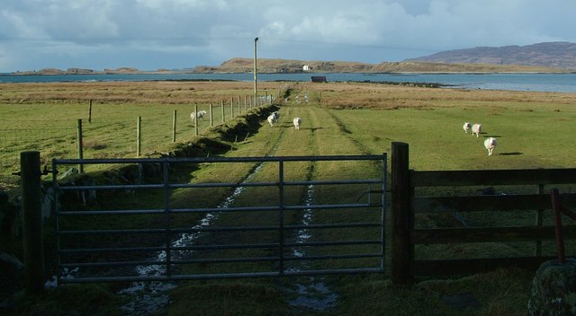
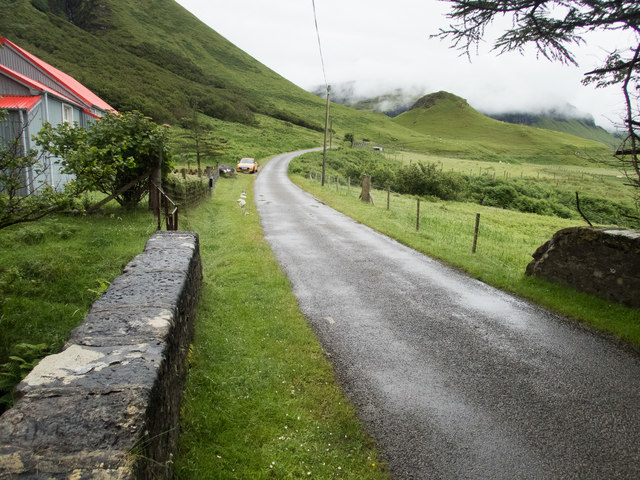
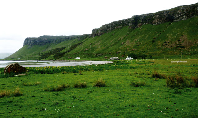
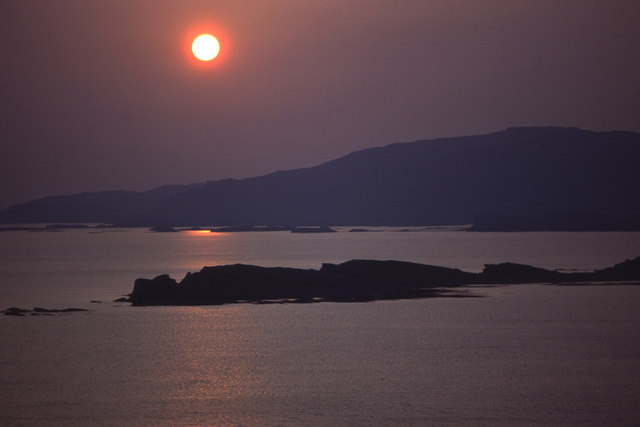
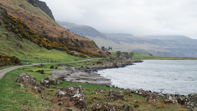
Port an Ròin, located in Argyllshire, Scotland, is a picturesque coastal settlement nestled on the shores of the North Atlantic Ocean. Situated at the mouth of a meandering estuary, this charming village is renowned for its stunning natural beauty and rich maritime heritage.

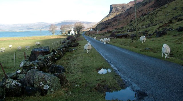
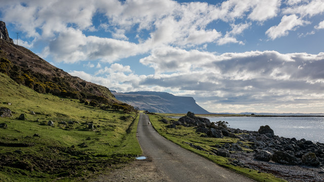
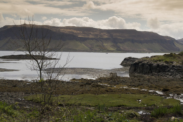
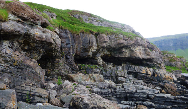
The sea plays a significant role in shaping the character of Port an Ròin. Its crystal-clear waters offer an ideal habitat for a diverse range of marine life, making it a popular destination for fishing enthusiasts and wildlife enthusiasts alike. The village's rugged coastline is dotted with rocky outcrops and sandy coves, providing ample opportunities for beachcombing, coastal walks, and water-based activities such as kayaking and sailing.

The estuary, formed by the convergence of several small rivers, is a hub of ecological significance. Its tidal cycle creates a constantly changing landscape, with mudflats and salt marshes providing a haven for wading birds and other waterfowl. Visitors can witness the mesmerizing sight of flocks of migratory birds using the estuary as a stopover during their long journeys.

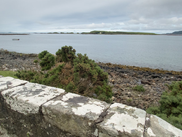
A small creek winds its way through the village, adding to its enchanting charm. Local fishermen often moor their colorful boats along the creek, which serves as a focal point for the community. The creek also offers a sheltered spot for leisurely boat trips, allowing visitors to explore the waterways and catch a glimpse of the abundant wildlife that thrives in this idyllic setting.

Overall, Port an Ròin provides a tranquil retreat for those seeking a serene coastal experience. Its blend of rugged coastline, diverse marine life, and vibrant maritime culture make it a hidden gem in the heart of Argyllshire.

If you have any feedback on the listing, please let us know in the comments section below.

Port an Ròin Images

Images are sourced within 2km of 56.438075/-6.1609744 or Grid Reference NM4335. Thanks to Geograph Open Source API. All images are credited.

Old milepost One of the remaining mileposts on the B8035 road from Salen southwards to join the A849 for the 38 miles from Salen to Fionnphort and the Iona Ferry jetty.   These posts on Mull made by Smith, Patterson of Blaydon are the only ones known to have been cast at that foundry that have a date, 1897.   This post is on the west side of the road north of Balnahard.
Old milepost
One of the remaining mileposts on the B8035 road from Salen southwards to join the A849 for the 38 miles from Salen to Fionnphort and the Iona Ferry jetty. These posts on Mull made by Smith, Patterson of Blaydon are the only ones known to have been cast at that foundry that have a date, 1897. This post is on the west side of the road north of Balnahard.
Inch Kenneth from Gribun Field gate and track leading from the B8035 at Gribun, Mull, down to the Loch opposite Inch Kenneth island
Inch Kenneth from Gribun
Field gate and track leading from the B8035 at Gribun, Mull, down to the Loch opposite Inch Kenneth island
Gribun sheep Very inquisitive and/or hungry sheep along the B8035 at Gribun, Mull - February 2016
Gribun sheep
Very inquisitive and/or hungry sheep along the B8035 at Gribun, Mull - February 2016
Gribun cattle Cattle around a ring-feeder on ground below the B8035 at Gribun, Mull. Inch Kenneth island is across the water and Little Colonsay further off to the left.
Gribun cattle
Cattle around a ring-feeder on ground below the B8035 at Gribun, Mull. Inch Kenneth island is across the water and Little Colonsay further off to the left.
Road near Clachandhu
Cliffs on Mull The road passes directly below these cliffs. It is very narrow with passing places so you hope not to meet something large coming the other way.
Cliffs on Mull
The road passes directly below these cliffs. It is very narrow with passing places so you hope not to meet something large coming the other way.
On the bridge over the Alltan na Caillich This is looking SE to the fantastic scenery (partly obscured by mist) that overlooks the A8035 and the coast of this part of Mull. The red-roofed house features in <a href="https://www.geograph.org.uk/photo/2944007">NM4534 : Corrugated House by the B8035</a> and  <a href="https://www.geograph.org.uk/photo/3377713">NM4534 : Corrugated iron house at Balnahard</a>. There is a rivet benchmark <a href="https://www.geograph.org.uk/photo/5461779">NM4534 : A well indicated benchmark</a> on the right hand edge of the stone with the large patch of whitish lichen on its left hand edge.
On the bridge over the Alltan na Caillich
This is looking SE to the fantastic scenery (partly obscured by mist) that overlooks the A8035 and the coast of this part of Mull. The red-roofed house features in NM4534 : Corrugated House by the B8035 and NM4534 : Corrugated iron house at Balnahard. There is a rivet benchmark NM4534 : A well indicated benchmark on the right hand edge of the stone with the large patch of whitish lichen on its left hand edge.
A well indicated benchmark The arrow of this rivet benchmark is really obvious, unlike many. The OS description is: RIVET E PARA BR OVER ALLTAN NA CAILLICH 1.3M N END. The bridge is shown in <a href="https://www.geograph.org.uk/photo/5461774">NM4534 : On the bridge over the Alltan na Caillich</a>.
A well indicated benchmark
The arrow of this rivet benchmark is really obvious, unlike many. The OS description is: RIVET E PARA BR OVER ALLTAN NA CAILLICH 1.3M N END. The bridge is shown in NM4534 : On the bridge over the Alltan na Caillich.
View to Inch Kenneth Beyond the parapet of this bridge over an unnamed stream is a narrow strip of coast and a view to Inch Kenneth two squares to the west. There is a rivet benchmark <a href="https://www.geograph.org.uk/photo/5461820">NM4535 : Benchmark on bridge parapet</a> on the central stone of the parapet.
View to Inch Kenneth
Beyond the parapet of this bridge over an unnamed stream is a narrow strip of coast and a view to Inch Kenneth two squares to the west. There is a rivet benchmark NM4535 : Benchmark on bridge parapet on the central stone of the parapet.
Benchmark on bridge parapet The OS description is: RIVET NW PARA BR 1.6M N END. The bridge is shown in <a href="https://www.geograph.org.uk/photo/5461816">NM4535 : View to Inch Kenneth</a>.
Benchmark on bridge parapet
The OS description is: RIVET NW PARA BR 1.6M N END. The bridge is shown in NM4535 : View to Inch Kenneth.
Clachandhu from Rubha Baile na h-Airde This is the point where the "Wilderness coast" of Mull becomes a little more subdued and is accessible to road building - the B8035 cuts across the Ardmeanach peninsula from Loch Scridain, and here drops down to a wide enough coastal plain on the shore of Loch na Keal. The flat area is at its most extensive just at this point, where a reef extends out into Loch na Keal towards Inch Kenneth and has provided enough shelter from the sea for a wide grassy area to form and provide some grazing, hence the habitation.
Clachandhu from Rubha Baile na h-Airde
This is the point where the "Wilderness coast" of Mull becomes a little more subdued and is accessible to road building - the B8035 cuts across the Ardmeanach peninsula from Loch Scridain, and here drops down to a wide enough coastal plain on the shore of Loch na Keal. The flat area is at its most extensive just at this point, where a reef extends out into Loch na Keal towards Inch Kenneth and has provided enough shelter from the sea for a wide grassy area to form and provide some grazing, hence the habitation.
Balnahard from Rubha Baile na h-Airde Having avoided the "Wilderness coast" by cutting across the Ardmeanach peninsula from Loch Scridain, the road rejoins the coast just north of Balnahard, where an area of low lying grassland provides enough grazing to support a tiny community. The screes, and cliffs behind rising to 200m face west, across a short and shallow stretch of Loch na Keal towards Inch Kenneth. The connecting reef is responsible for the shelter which has helped form the raised beach, now grassy but with a lot of flag iris which, being too tough to graze, thrives whilst other vegetation is kept down by the sheep.
Balnahard from Rubha Baile na h-Airde
Having avoided the "Wilderness coast" by cutting across the Ardmeanach peninsula from Loch Scridain, the road rejoins the coast just north of Balnahard, where an area of low lying grassland provides enough grazing to support a tiny community. The screes, and cliffs behind rising to 200m face west, across a short and shallow stretch of Loch na Keal towards Inch Kenneth. The connecting reef is responsible for the shelter which has helped form the raised beach, now grassy but with a lot of flag iris which, being too tough to graze, thrives whilst other vegetation is kept down by the sheep.
Buried landscape on the Gribun coast In Scotland where one is so used to seeing younger rocks thrust over older ones by the dramatic (if long drawn out) collision of continents, it's good to find a classic unconformity where the younger rocks (in this case Triassic conglomerates) were laid down over the top of an existing, ancient landscape. The lower rocks (grey, layered, fine-grained) are Psammites of the Moine Series - ancient impure sandstones metamorphosed by heat and pressure, then raised to the surface and eroded. They formed shoreline rocks as the sea covered them and deposited sand and pebbles which, with deeper burial, became the conglomerate rock you see above the eroded caves and below the grass. The uneven boundary between the two rock types shows the shape of the rocky shore before its burial. More recently again, in Tertiary times, as Europe and North America started to separate, the whole lot was buried deeper by lava flows.  Erosion works constantly, and here they all are again exposed to view as the sea cuts away the land, leaving scattered boulders not only of the conglomerate and the psammite, but also of the basalt from the cliffs seen in the distance.
Buried landscape on the Gribun coast
In Scotland where one is so used to seeing younger rocks thrust over older ones by the dramatic (if long drawn out) collision of continents, it's good to find a classic unconformity where the younger rocks (in this case Triassic conglomerates) were laid down over the top of an existing, ancient landscape. The lower rocks (grey, layered, fine-grained) are Psammites of the Moine Series - ancient impure sandstones metamorphosed by heat and pressure, then raised to the surface and eroded. They formed shoreline rocks as the sea covered them and deposited sand and pebbles which, with deeper burial, became the conglomerate rock you see above the eroded caves and below the grass. The uneven boundary between the two rock types shows the shape of the rocky shore before its burial. More recently again, in Tertiary times, as Europe and North America started to separate, the whole lot was buried deeper by lava flows. Erosion works constantly, and here they all are again exposed to view as the sea cuts away the land, leaving scattered boulders not only of the conglomerate and the psammite, but also of the basalt from the cliffs seen in the distance.
Setting sun over Inch Kenneth and Ulva Looking across the mouth of Loch na Keal to Ulva. The southern part of Inch Kenneth is nearest the camera.
Setting sun over Inch Kenneth and Ulva
Looking across the mouth of Loch na Keal to Ulva. The southern part of Inch Kenneth is nearest the camera.
Shore of Loch na Keal alongside B8035 The B8035 below steep ground. Inch Kenneth is just offshore, out of view.
Shore of Loch na Keal alongside B8035
The B8035 below steep ground. Inch Kenneth is just offshore, out of view.
B8035 heading south As the B8035 heads south at an area known as Gribun it's confined below some very steep ground and Loch Na Keal; here some of the steepness can be seen including the striking cleft of Alltan na Sròine.
B8035 heading south
As the B8035 heads south at an area known as Gribun it's confined below some very steep ground and Loch Na Keal; here some of the steepness can be seen including the striking cleft of Alltan na Sròine.
Rough Grazing Rough pasture with Loch Keal behind.The cattle look as though they need the supplements from the feeder on this thistly field.
Rough Grazing
Rough pasture with Loch Keal behind.The cattle look as though they need the supplements from the feeder on this thistly field.
Red Roof by the Roadside A small cottage by roadside woodland at Balnahard.
Red Roof by the Roadside
A small cottage by roadside woodland at Balnahard.
Show me another place!

Port an Ròin is located at Grid Ref: NM4335 (Lat: 56.438075, Lng: -6.1609744)

Unitary Authority: Argyll and Bute

Police Authority: Argyll and West Dunbartonshire

What 3 Words

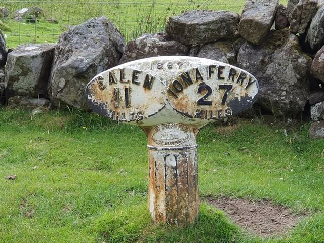
///stance.hill.ballooned. Near Salen, Argyll & Bute

Related Wikis

St Kenneth's Chapel

St. Kenneth's Chapel is a ruined chapel on Inch Kenneth Island, Parish of Kilfinichen and Kilvickeon, Isle of Mull, Argyll and Bute, Scotland. It dates...

Inch Kenneth

Inch Kenneth (Scottish Gaelic: Innis Choinnich) is a small grassy island off the west coast of the Isle of Mull, in Scotland. It is at the entrance of...

Samalan Island

Samalan Island is a small island, just off the Isle of Mull at the mouth of Loch na Keal in the Inner Hebrides, Scotland. To its south west is the island...

Ulva Ferry

Ulva Ferry (Scottish Gaelic: Caolas Ulbha) is a hamlet on the Hebridean island of Mull, on its west coast. Ulva Ferry is on the shore of Ulva Sound (Caolas...

Nearby Amenities

Located within 500m of 56.438075,-6.1609744
The data included in this document is from www.openstreetmap.org. The data is made available under ODbL.

Have you been to Port an Ròin?

Leave your review of Port an Ròin below (or comments, questions and feedback).