Tregiffian Veor Cliff

Cliff, Slope in Cornwall

England

Tregiffian Veor Cliff

Looking down to Sennen Cove from the coast path on the dunes
Looking down to Sennen Cove from the coast path on the dunes Credit: Rod Allday

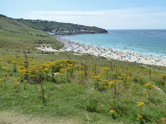
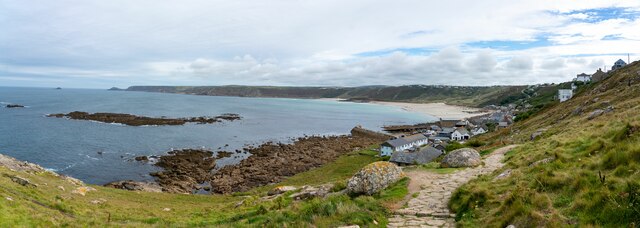
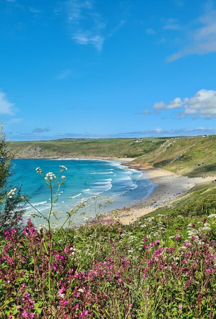
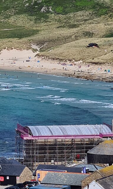
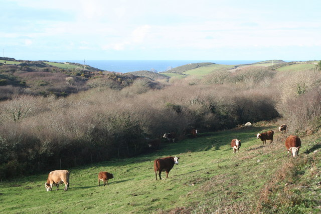
Tregiffian Veor Cliff, located in Cornwall, England, is a picturesque and rugged cliff that attracts numerous visitors throughout the year. Situated near the village of Porthcurno, this cliff offers breathtaking views of the surrounding landscape and the stunning blue waters of the Atlantic Ocean.

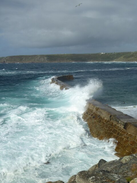
Standing at an impressive height of approximately 80 meters (262 feet), Tregiffian Veor Cliff showcases dramatic rock formations that have been shaped by the relentless forces of nature over centuries. The cliff face is composed of granite, adding to its unique and rugged appearance.

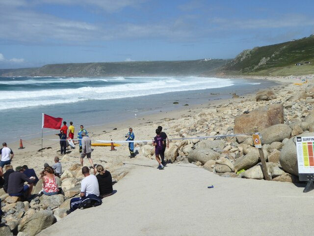
Visitors to Tregiffian Veor Cliff can take advantage of the various walking paths and trails that provide access to different viewpoints along the cliff's edge. These paths offer opportunities to observe the diverse wildlife in the area, including seabirds such as gannets, razorbills, and fulmars.

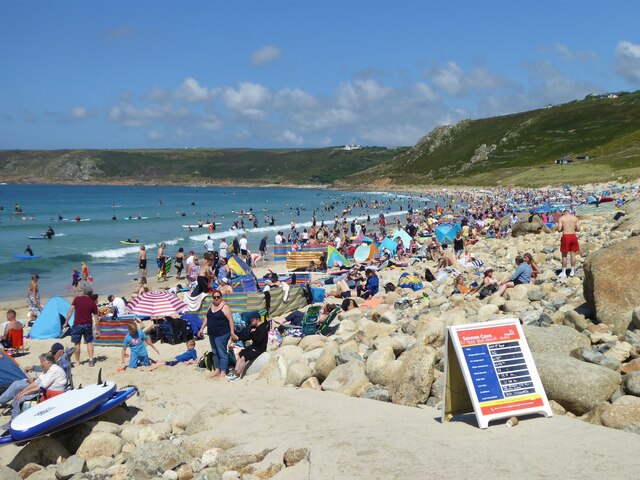
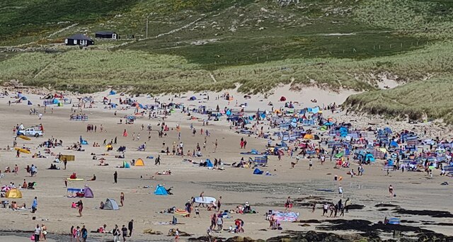
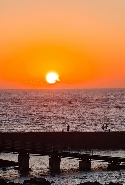
The cliff's location near the popular Porthcurno beach makes it an ideal spot for nature enthusiasts and hikers to explore and admire the natural beauty of the area. The cliff also provides a vantage point to witness stunning sunsets, adding to its allure.

However, it is important to exercise caution when visiting Tregiffian Veor Cliff, as the terrain can be steep and unstable in some areas. Sturdy footwear and adherence to safety guidelines are necessary to ensure a safe and enjoyable visit.

Overall, Tregiffian Veor Cliff is a captivating natural landmark that offers visitors a glimpse into the raw beauty of Cornwall's coastline and has become a must-see destination for nature lovers and outdoor enthusiasts alike.

If you have any feedback on the listing, please let us know in the comments section below.

Tregiffian Veor Cliff Images

Images are sourced within 2km of 50.09133/-5.6870404 or Grid Reference SW3627. Thanks to Geograph Open Source API. All images are credited.

Looking down to Sennen Cove from the coast path on the dunes
The crowded beach at Sennen at high tide in August The beach at Sennen is vast but at high tide space is at a premium!
The crowded beach at Sennen at high tide in August
The beach at Sennen is vast but at high tide space is at a premium!
Empty beach on a sunny day in August! Compare with <a href="https://www.geograph.org.uk/photo/6929331">SW3526 : The crowded beach at Sennen at high tide in August</a>. The beach has been closed by the lifeguards and coastguards after a suspicious object was found.  It proved to be a WWII Mills bomb which was later disposed of by the Navy bomb disposal team from Plymouth
Empty beach on a sunny day in August!
Compare with SW3526 : The crowded beach at Sennen at high tide in August. The beach has been closed by the lifeguards and coastguards after a suspicious object was found. It proved to be a WWII Mills bomb which was later disposed of by the Navy bomb disposal team from Plymouth
Waves breaking over the breakwater at Sennen Cove at high tide
Big breakers on Whitesand Bay
Sennen beach on a sunny August day
Teasel seed head
Teasel seed head
Sunset over the harbour at Sennen Cove
Figures on the breakwater at sunset
Sennen August sunset
Small boats, Sennen Cove Not a day for fishing in a small boat. These are tied up, well away from the water.
Small boats, Sennen Cove
Not a day for fishing in a small boat. These are tied up, well away from the water.
Sennen Cove viewed from the South West Coastal Path
Public toilets at Sennen Cove
Storm damage to Sennen Cove Lifeboat Station During Storm Eunice on 18 February 2022 the zinc covering of the roof was completely peeled off by extremely high winds.  The crumpled remains of the roof covering can be seen in front of the building.
Storm damage to Sennen Cove Lifeboat Station
During Storm Eunice on 18 February 2022 the zinc covering of the roof was completely peeled off by extremely high winds. The crumpled remains of the roof covering can be seen in front of the building.
Zinc roof covering from Sennen Lifeboat Station The roof covering was completely torn off by Storm Eunice on 18 February 2022.
Zinc roof covering from Sennen Lifeboat Station
The roof covering was completely torn off by Storm Eunice on 18 February 2022.
Watching the waves on the beach at Sennen
Red Campion and Cow Parsley flowers in Maria's Lane Looking down to Sennen beach.
Red Campion and Cow Parsley flowers in Maria's Lane
Looking down to Sennen beach.
New roof on the lifeboat station Sennen lifeboat house lost its zinc roof covering in Storm Eunice on 18 February 2022 <a href="https://www.geograph.org.uk/photo/7113570">SW3526 : Storm damage to Sennen Cove Lifeboat Station</a>.  The repair work is now almost complete.
New roof on the lifeboat station
Sennen lifeboat house lost its zinc roof covering in Storm Eunice on 18 February 2022 SW3526 : Storm damage to Sennen Cove Lifeboat Station. The repair work is now almost complete.
Show me another place!

Tregiffian Veor Cliff is located at Grid Ref: SW3627 (Lat: 50.09133, Lng: -5.6870404)

Unitary Authority: Cornwall

Police Authority: Devon and Cornwall

What 3 Words

///scrubbing.translated.migrate. Near Sennen, Cornwall

Related Wikis

Escalls

Escalls is a hamlet in the civil parish of Sennen on the Penwith peninsula in west Cornwall, England, UK. == Toponyny == Escalls previously written as...

Trevillet

Trevillet or Trevillett is a hamlet in Cornwall, England, United Kingdom. It is located within the civil parish of Tintagel, to the east of Bossiney village...

Carn Towan

Carn Towan (Cornish: Karn Tewyn) is a coastal hamlet northeast of Sennen Cove in west Cornwall, England, UK. Carn Towan is in the civil parish of Sennen...

Nanquidno

Nanquidno is a hamlet near St Just in Penwith in west Cornwall, England. It is about half a mile southwest of Kelynack. == References ==

Related Videos

1886km walk across Great Britain - Lands End to John o'Groats - LEJOG 2021

This summer I walked the length of Great Britain, starting from Lands End. It took me 48 days - including 2 rest days - to reach the ...

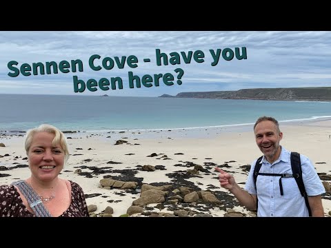
SENNEN COVE | Exploring the seaside holiday town of Sennen Cove Cornwall

Sennen Cove is a seaside holiday and surfing village located near Penzance and Land's End in Cornwall, England. It is known for ...

Sennen Cove, Cornwall - Royal Landings with devious intentions! A short walk along the SWCP

In this week's video we visit Sennen Cove near Land's End, and explore this stunning stretch of the Cornish coastpath around the ...

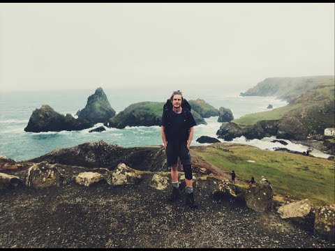
Hiking the South West Coastal Path

In 2020 during the summer of the pandemic, me and my partner decided to trek part of the South West Coastal path from Land's ...

Nearby Amenities

Located within 500m of 50.09133,-5.6870404
Source: PGS
Lat/Long: 50.0943097/-5.6918679
Source: PGS
Lat/Long: 50.0941776/-5.6915158
Source: PGS
Lat/Long: 50.0936836/-5.6906477
Source: PGS
Lat/Long: 50.0935936/-5.6903784
Source: PGS
Lat/Long: 50.0921967/-5.6889673
Source: PGS
Lat/Long: 50.0917137/-5.6888876
Source: PGS
Lat/Long: 50.0900202/-5.6885523
Source: PGS
Lat/Long: 50.0891839/-5.6887266
Source: PGS
Lat/Long: 50.0883733/-5.6889975
Source: PGS
Lat/Long: 50.0877188/-5.6897127
Source: PGS
Lat/Long: 50.0877779/-5.6899738
Source: PGS
Lat/Long: 50.0874267/-5.6901603
199
Ele: 69.099976
Sym: Scenic Area
Tourism: viewpoint
Lat/Long: 50.089586/-5.6858774
Source: PGS
Lat/Long: 50.0875934/-5.689834
Location Transition: yes
Power: pole
Lat/Long: 50.0905967/-5.6801999
Generator Method: photovoltaic
Generator Output Electricity: yes
Generator Source: solar
Generator Type: solar_photovoltaic_panel
Location: roof
Power: generator
Lat/Long: 50.0929958/-5.6814021
Source: PGS
Lat/Long: 50.0926469/-5.6903063
Source: PGS
Lat/Long: 50.0912368/-5.6894964
Source: PGS
Lat/Long: 50.0909615/-5.6895125
Ford: yes
Lat/Long: 50.0882508/-5.6884698
WW2 Pillbox (remains of)
Building: bunker
Bunker Type: pillbox
Military: bunker
Lat/Long: 50.0936079/-5.6898324
Access: no
Barrier: stile
Foot: yes
Material: stone
Stile: stepover
Lat/Long: 50.0891653/-5.6842181
Power: pole
Transformer: distribution
Lat/Long: 50.0881685/-5.684195
Power: pole
Lat/Long: 50.0884447/-5.6833059
Power: pole
Lat/Long: 50.0887528/-5.682355
Power: pole
Lat/Long: 50.0917342/-5.6825388
Power: pole
Transformer: distribution
Lat/Long: 50.0910562/-5.6822759
Power: pole
Lat/Long: 50.0900426/-5.6818897
Power: pole
Lat/Long: 50.0890273/-5.681482
Power: pole
Lat/Long: 50.0951739/-5.6841508
Power: pole
Lat/Long: 50.0928578/-5.6820211
Power: pole
Lat/Long: 50.0929215/-5.6828123
Power: pole
Lat/Long: 50.0928544/-5.6834534
Power: pole
Lat/Long: 50.0927615/-5.6841105
Power: pole
Lat/Long: 50.0926789/-5.6848186
Power: pole
Lat/Long: 50.0943824/-5.683566
Power: pole
Lat/Long: 50.0935427/-5.6832361
Power: pole
Transformer: distribution
Lat/Long: 50.0928613/-5.6829464
Barrier: stile
Lat/Long: 50.0933225/-5.681082
The data included in this document is from www.openstreetmap.org. The data is made available under ODbL.

Have you been to Tregiffian Veor Cliff?

Leave your review of Tregiffian Veor Cliff below (or comments, questions and feedback).