Escalls Cliff

Cliff, Slope in Cornwall

England

Escalls Cliff

Looking down to Sennen Cove from the coast path on the dunes
Looking down to Sennen Cove from the coast path on the dunes Credit: Rod Allday

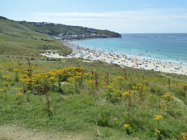
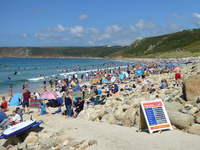
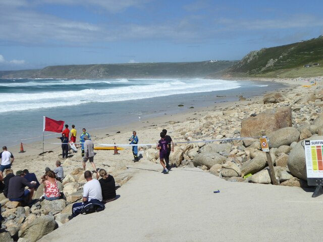
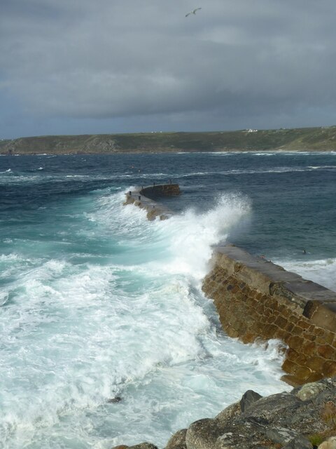
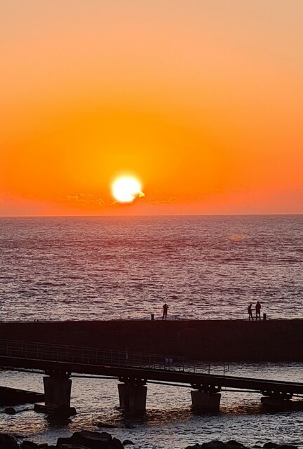
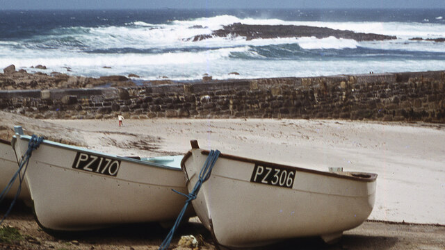
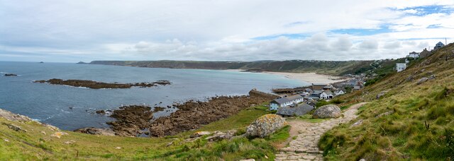
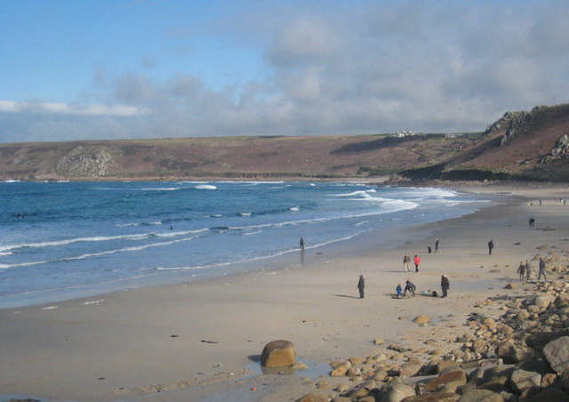
Escalls Cliff is a prominent cliff located on the southwestern coast of Cornwall, England. It is situated near the small village of Escalls, between the popular towns of St. Ives and Lands End. This spectacular cliff stands at an impressive height of approximately 100 meters, offering breathtaking views of the surrounding landscape and the vast Atlantic Ocean.

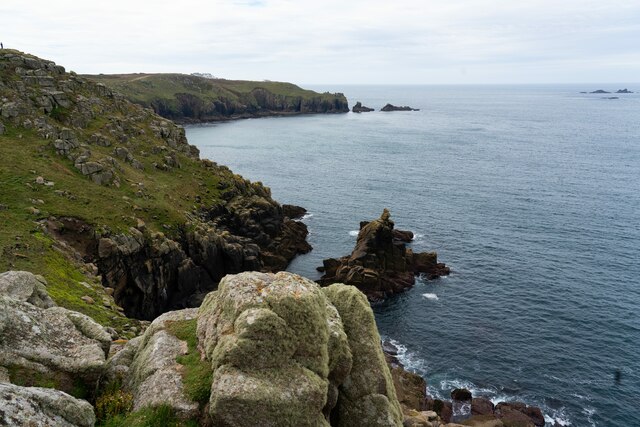
The cliff is characterized by its rugged and dramatic appearance, with sheer cliffs descending sharply into the sea below. The rock formations that make up Escalls Cliff are predominantly composed of granite, which adds to its natural beauty and allure. The cliff face features various colors and textures, ranging from gray and black to hues of orange and pink, due to the presence of different minerals.

Escalls Cliff is a haven for wildlife enthusiasts, as it provides a habitat for a diverse range of bird species, including puffins, gannets, and peregrine falcons. The surrounding waters are also home to a variety of marine life, such as seals and dolphins, which can often be spotted from the cliff's edge.

Visitors to Escalls Cliff can enjoy stunning coastal walks along the cliff top, taking in the mesmerizing views and immersing themselves in the tranquility of the natural surroundings. The cliff is easily accessible by foot, with well-maintained footpaths leading from nearby parking areas.

Overall, Escalls Cliff is a captivating natural landmark in Cornwall, offering visitors a chance to experience the awe-inspiring beauty of the Cornish coastline and its diverse wildlife.

If you have any feedback on the listing, please let us know in the comments section below.

Escalls Cliff Images

Images are sourced within 2km of 50.087168/-5.68893 or Grid Reference SW3627. Thanks to Geograph Open Source API. All images are credited.

Looking down to Sennen Cove from the coast path on the dunes
The crowded beach at Sennen at high tide in August The beach at Sennen is vast but at high tide space is at a premium!
The crowded beach at Sennen at high tide in August
The beach at Sennen is vast but at high tide space is at a premium!
Empty beach on a sunny day in August! Compare with <a href="https://www.geograph.org.uk/photo/6929331">SW3526 : The crowded beach at Sennen at high tide in August</a>. The beach has been closed by the lifeguards and coastguards after a suspicious object was found.  It proved to be a WWII Mills bomb which was later disposed of by the Navy bomb disposal team from Plymouth
Empty beach on a sunny day in August!
Compare with SW3526 : The crowded beach at Sennen at high tide in August. The beach has been closed by the lifeguards and coastguards after a suspicious object was found. It proved to be a WWII Mills bomb which was later disposed of by the Navy bomb disposal team from Plymouth
Waves breaking over the breakwater at Sennen Cove at high tide
Big breakers on Whitesand Bay
Sennen beach on a sunny August day
Teasel seed head
Teasel seed head
Sunset over the harbour at Sennen Cove
Figures on the breakwater at sunset
Sennen August sunset
The First and Last Inn, Sennan
Sennen Church - corner of tower Cut benchmark on this corner

<span class="nowrap"><a title="https://www.bench-marks.org.uk/bm51379" rel="nofollow ugc noopener" href="https://www.bench-marks.org.uk/bm51379">Link</a><img style="margin-left:2px;" alt="External link" title="External link - shift click to open in new window" src="https://s1.geograph.org.uk/img/external.png" width="10" height="10"/></span>
Sennen Church - corner of tower
Cut benchmark on this corner LinkExternal link
Small boats, Sennen Cove Not a day for fishing in a small boat. These are tied up, well away from the water.
Small boats, Sennen Cove
Not a day for fishing in a small boat. These are tied up, well away from the water.
Sennen Cove viewed from the South West Coastal Path
Irish Lady rock off Sennen Cove
Public toilets at Sennen Cove
Storm damage to Sennen Cove Lifeboat Station During Storm Eunice on 18 February 2022 the zinc covering of the roof was completely peeled off by extremely high winds.  The crumpled remains of the roof covering can be seen in front of the building.
Storm damage to Sennen Cove Lifeboat Station
During Storm Eunice on 18 February 2022 the zinc covering of the roof was completely peeled off by extremely high winds. The crumpled remains of the roof covering can be seen in front of the building.
Zinc roof covering from Sennen Lifeboat Station The roof covering was completely torn off by Storm Eunice on 18 February 2022.
Zinc roof covering from Sennen Lifeboat Station
The roof covering was completely torn off by Storm Eunice on 18 February 2022.
Show me another place!

Escalls Cliff is located at Grid Ref: SW3627 (Lat: 50.087168, Lng: -5.68893)

Unitary Authority: Cornwall

Police Authority: Devon and Cornwall

What 3 Words

///flaking.cascade.masts. Near Sennen, Cornwall

Related Wikis

Escalls

Escalls is a hamlet in the civil parish of Sennen on the Penwith peninsula in west Cornwall, England, UK. == Toponyny == Escalls previously written as...

Trevillet

Trevillet or Trevillett is a hamlet in Cornwall, England, United Kingdom. It is located within the civil parish of Tintagel, to the east of Bossiney village...

Carn Towan

Carn Towan (Cornish: Karn Tewyn) is a coastal hamlet northeast of Sennen Cove in west Cornwall, England, UK. Carn Towan is in the civil parish of Sennen...
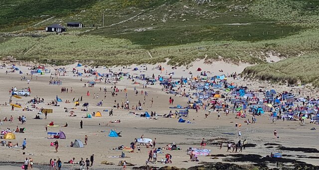
Whitesand Bay

Whitesand Bay (Cornish: Porth Senan, meaning cove at Sennen) is a wide sandy bay near Land's End in west Cornwall, England, United Kingdom. It stretches...

Nearby Amenities

Located within 500m of 50.087168,-5.68893
Source: PGS
Lat/Long: 50.0900202/-5.6885523
Source: PGS
Lat/Long: 50.0891839/-5.6887266
Source: PGS
Lat/Long: 50.0883733/-5.6889975
Source: PGS
Lat/Long: 50.0877188/-5.6897127
Source: PGS
Lat/Long: 50.0877779/-5.6899738
Source: PGS
Lat/Long: 50.0874267/-5.6901603
Source: PGS
Lat/Long: 50.0874836/-5.6909448
Source: PGS
Lat/Long: 50.0856768/-5.6913077
Source: PGS
Lat/Long: 50.0855332/-5.691577
Source: PGS
Lat/Long: 50.0853847/-5.6916756
Source: PGS
Lat/Long: 50.085205/-5.6915832
Source: PGS
Lat/Long: 50.0848298/-5.6916718
Source: PGS
Lat/Long: 50.0844701/-5.6917763
Source: PGS
Lat/Long: 50.0838781/-5.6920981
Source: PGS
Lat/Long: 50.0833617/-5.692361
Escalls Cliff
Alt Name: The Favourite Place
Is In: Cornwall, England, UK
Is In Country: England
Is In Country Code: GB
Is In County: Cornwall
Loc Name: The Point
Place: locality
Lat/Long: 50.0867988/-5.6889449
199
Ele: 69.099976
Sym: Scenic Area
Tourism: viewpoint
Lat/Long: 50.089586/-5.6858774
Tourism: viewpoint
Lat/Long: 50.0866094/-5.6888361
Source: PGS
Lat/Long: 50.0875934/-5.689834
Source: PGS
Lat/Long: 50.0870458/-5.690642
Generator Method: photovoltaic
Generator Output Electricity: yes
Generator Source: solar
Generator Type: solar_photovoltaic_panel
Location: roof
Power: generator
Lat/Long: 50.0841167/-5.6839193
Source: PGS
Lat/Long: 50.0912368/-5.6894964
Source: PGS
Lat/Long: 50.0909615/-5.6895125
Ford: yes
Lat/Long: 50.0882508/-5.6884698
Access: no
Barrier: stile
Foot: yes
Material: stone
Stile: stepover
Lat/Long: 50.0891653/-5.6842181
Power: pole
Transformer: distribution
Lat/Long: 50.0881685/-5.684195
Power: pole
Lat/Long: 50.0884447/-5.6833059
Power: pole
Transformer: distribution
Lat/Long: 50.0831741/-5.6878307
The data included in this document is from www.openstreetmap.org. The data is made available under ODbL.

Have you been to Escalls Cliff?

Leave your review of Escalls Cliff below (or comments, questions and feedback).