Aoineadh Bhurg

Cliff, Slope in Argyllshire

Scotland

Aoineadh Bhurg

View over Burg, North-West Mull The view over Burg in North-West Mull towards distant Ben More.
View over Burg, North-West Mull Credit: Peter Evans

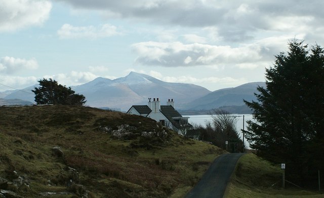
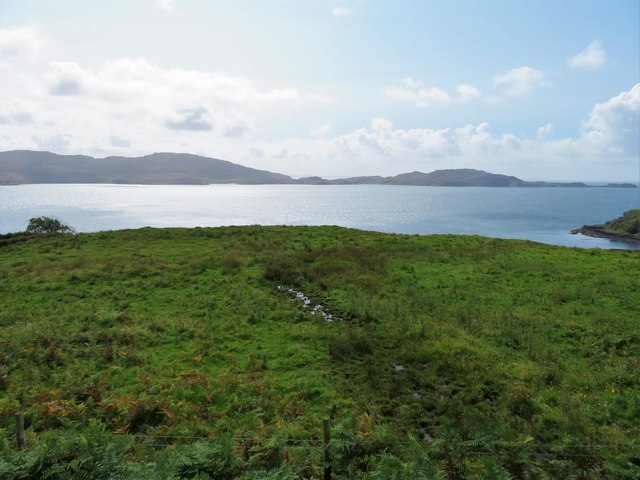
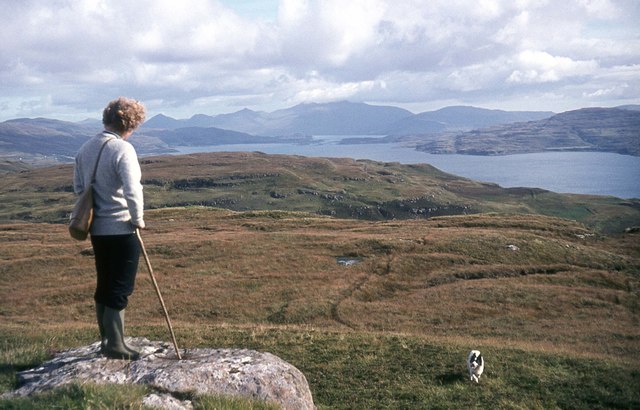
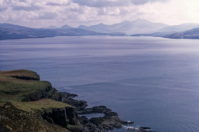
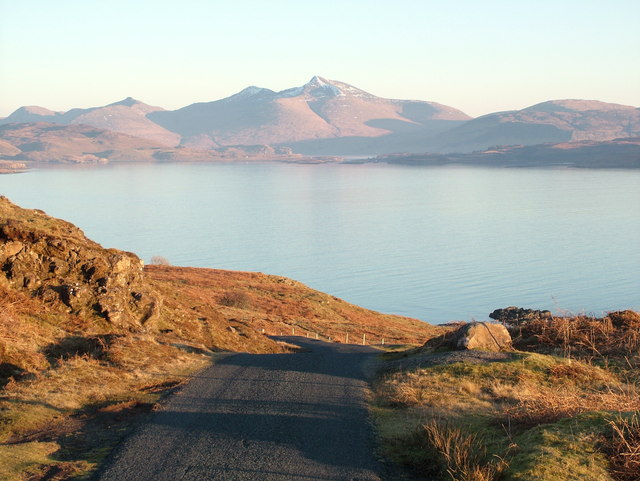
Aoineadh Bhurg, also known as Argyllshire Cliff or Slope, is a prominent geographical feature located in Argyllshire, Scotland. Situated in the western part of the county, this cliff offers breathtaking views of the surrounding landscape and the Atlantic Ocean.

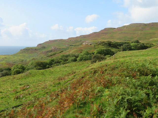
Rising to an impressive height of approximately 200 meters (656 feet), Aoineadh Bhurg stands tall and majestic, providing a stunning backdrop to the local area. Its sheer vertical face showcases layers of ancient rock formations, offering a glimpse into the geological history of the region. The cliff's rugged and weathered appearance adds to its allure, capturing the imagination of visitors and locals alike.

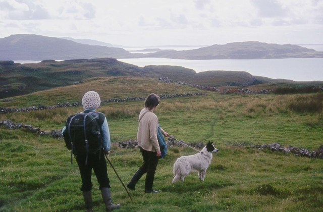
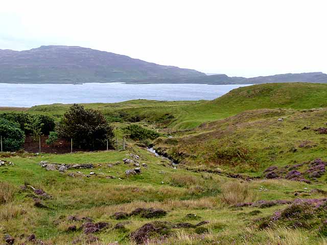
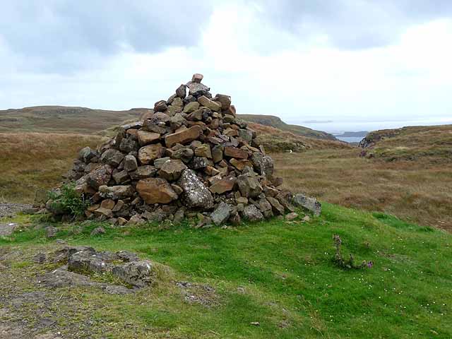
Aoineadh Bhurg is a popular destination for outdoor enthusiasts, hikers, and nature lovers. Several walking trails and paths meander along its base, allowing visitors to explore its beauty up close. The cliff's proximity to the coast also makes it an ideal spot for birdwatching, as various seabirds can be spotted nesting on its ledges.

The surrounding area is rich in biodiversity, with native flora and fauna thriving in the diverse habitats created by Aoineadh Bhurg. The cliff's unique microclimate, created by its height and exposure to the elements, supports a variety of plant species, including heather, mosses, and lichens.

In conclusion, Aoineadh Bhurg is a remarkable cliff in Argyllshire, Scotland, offering stunning views, diverse wildlife, and a glimpse into the region's geological past. Its natural beauty and accessibility make it a must-visit destination for those seeking to immerse themselves in the captivating landscapes of western Scotland.

If you have any feedback on the listing, please let us know in the comments section below.

Aoineadh Bhurg Images

Images are sourced within 2km of 56.525921/-6.2867015 or Grid Reference NM3645. Thanks to Geograph Open Source API. All images are credited.

View over Burg, North-West Mull The view over Burg in North-West Mull towards distant Ben More.
View over Burg, North-West Mull
The view over Burg in North-West Mull towards distant Ben More.
Burg Headland Looking over the grassland above Port Burg across Loch Tuath to Ulva and Gometra.
Burg Headland
Looking over the grassland above Port Burg across Loch Tuath to Ulva and Gometra.
Allt Bhurg Woodland Trees following the path of the Allt Bhurg.
Allt Bhurg Woodland
Trees following the path of the Allt Bhurg.
Rough Grazing Rough pasture before moorland with Cnoc Cuairteach behind.
Rough Grazing
Rough pasture before moorland with Cnoc Cuairteach behind.
Roadside Cairn A cairn beside the B8073 with Loch Tuath in the far distance.
Roadside Cairn
A cairn beside the B8073 with Loch Tuath in the far distance.
Crackaig A deserted settlement comprising about 15 unroofed buildings and other enclosures. Crackaig, along with the nearby deserted settlement of Glac Gugairidh, is a scheduled monument (SM10577).

A dwelling house at the eastern end of the settlement has ship graffiti carved on the outside wall. Local tradition has it that this was carved by one of the last inhabitants and represents the ship that was to take the people away across the Atlantic to their new home in America. A single-roomed structure 175m to the SSE of the main cluster of buildings at Crackaig is said to be the schoolhouse.
<span class="nowrap"><a title="https://ancientmonuments.uk/123755-crackaig-and-glac-gugairidh-depopulated-settlements-mull-oban-south-and-the-isles-ward" rel="nofollow ugc noopener" href="https://ancientmonuments.uk/123755-crackaig-and-glac-gugairidh-depopulated-settlements-mull-oban-south-and-the-isles-ward">Link</a><img style="margin-left:2px;" alt="External link" title="External link - shift click to open in new window" src="https://s1.geograph.org.uk/img/external.png" width="10" height="10"/></span>

According to a local blog about the old ash tree at Crackaig: "Crackaig and Glac Gugairigh were abandoned, not because of the Highland clearances but following a typhoid epidemic in the late 19th century when the disease almost wiped out the populations of both villages. It is rumoured that the last remaining resident refused to leave his home and hanged himself from the only tree in the area."
<span class="nowrap"><a title="https://www.mullnativewoodlandsgroup.co.uk/2018/05/the-old-ash-tree-of-crackaig/" rel="nofollow ugc noopener" href="https://www.mullnativewoodlandsgroup.co.uk/2018/05/the-old-ash-tree-of-crackaig/">Link</a><img style="margin-left:2px;" alt="External link" title="External link - shift click to open in new window" src="https://s1.geograph.org.uk/img/external.png" width="10" height="10"/></span>
Crackaig
A deserted settlement comprising about 15 unroofed buildings and other enclosures. Crackaig, along with the nearby deserted settlement of Glac Gugairidh, is a scheduled monument (SM10577). A dwelling house at the eastern end of the settlement has ship graffiti carved on the outside wall. Local tradition has it that this was carved by one of the last inhabitants and represents the ship that was to take the people away across the Atlantic to their new home in America. A single-roomed structure 175m to the SSE of the main cluster of buildings at Crackaig is said to be the schoolhouse. LinkExternal link According to a local blog about the old ash tree at Crackaig: "Crackaig and Glac Gugairigh were abandoned, not because of the Highland clearances but following a typhoid epidemic in the late 19th century when the disease almost wiped out the populations of both villages. It is rumoured that the last remaining resident refused to leave his home and hanged himself from the only tree in the area." LinkExternal link
Looking down on Crackaig
Walking the dog at Reudle Looking over to Ulva Island.
Walking the dog at Reudle
Looking over to Ulva Island.
View towards Ben More from Cnoc an t-Sluaigh
Dun Aisgain, Isle of Mull A dun beside Loch Tuath.  Ben More and A' Chioch dominate the skyline.
Dun Aisgain, Isle of Mull
A dun beside Loch Tuath. Ben More and A' Chioch dominate the skyline.
Coastline of Loch Tuath near Dun Aisgain The circular pool in the rocks at the sea edge is prominent in the aerial imagery provided by OS Maps.
Coastline of Loch Tuath near Dun Aisgain
The circular pool in the rocks at the sea edge is prominent in the aerial imagery provided by OS Maps.
Dun Aisgain, Mull Looking down Loch Tuath to Ulva and Ben More. Image by Tom Richardson.

The photographer, Tom Richardson, originally submitted this image flipped (ie the transparency was scanned back to front).  This is a corrected image. I have also revised the view direction so it is now clear Ben More is in the angle of view.

Tom Richardson's profile page on Geograph is <a title="https://www.geograph.org.uk/profile/26074" href="https://www.geograph.org.uk/profile/26074">Link</a>
Dun Aisgain, Mull
Looking down Loch Tuath to Ulva and Ben More. Image by Tom Richardson. The photographer, Tom Richardson, originally submitted this image flipped (ie the transparency was scanned back to front). This is a corrected image. I have also revised the view direction so it is now clear Ben More is in the angle of view. Tom Richardson's profile page on Geograph is Link
Crackaig seen from the sea Trap landscape, Treshnish.
Crackaig seen from the sea
Trap landscape, Treshnish.
Allt Burg Looking down the valley of the Allt Burg towards Loch Tuath. On the far side lie the islands of Ulva (to the left) and Gometra. It is just possible to make out the entrance to the narrow channel between the two.
Allt Burg
Looking down the valley of the Allt Burg towards Loch Tuath. On the far side lie the islands of Ulva (to the left) and Gometra. It is just possible to make out the entrance to the narrow channel between the two.
Cairn by the B8073 This cairn marks the highest point of the B8073 road as it crosses the neck of the peninsula separating Calgary Bay and Loch Tuath. Out to sea can be seen Eilean Dioghlum <a href="https://www.geograph.org.uk/gridref/NM3442">NM3442</a> with Staffa <a href="https://www.geograph.org.uk/gridref/NM3235">NM3235</a> beyond.
Cairn by the B8073
This cairn marks the highest point of the B8073 road as it crosses the neck of the peninsula separating Calgary Bay and Loch Tuath. Out to sea can be seen Eilean Dioghlum NM3442 with Staffa NM3235 beyond.
Loch Tuath and Ben More. The road from Calgary Bay to Kilninian overlooking Loch Tuath, the Sound of Ulva and Ben More in the distance.
Loch Tuath and Ben More.
The road from Calgary Bay to Kilninian overlooking Loch Tuath, the Sound of Ulva and Ben More in the distance.
Approaching Glac Gugairidh Sheep on the path at the approach to the ruined settlement of Glac Gugairidh.
Approaching Glac Gugairidh
Sheep on the path at the approach to the ruined settlement of Glac Gugairidh.
Ruins at Glac Gugairidh Abandoned [or possibly cleared] in the 19th century, this settlement consisted of thatched croft cottages with evidence of runrig agriculture around. The Gaelic name means 'the hollow of the dark grazings'.
Ruins at Glac Gugairidh
Abandoned [or possibly cleared] in the 19th century, this settlement consisted of thatched croft cottages with evidence of runrig agriculture around. The Gaelic name means 'the hollow of the dark grazings'.
Show me another place!

Aoineadh Bhurg is located at Grid Ref: NM3645 (Lat: 56.525921, Lng: -6.2867015)

Unitary Authority: Argyll and Bute

Police Authority: Argyll and West Dunbartonshire

What 3 Words

///worked.visual.venturing. Near Calgary, Argyll & Bute

Related Wikis

Gometra

Gometra (Scottish Gaelic: Gòmastra) is an island in the Inner Hebrides of Scotland, lying west of Mull. It lies immediately west of Ulva, to which it is...

Torloisk House

Torloisk House (sometimes referred to as Torluck House in 19th century references) on the Isle of Mull, Argyll in Scotland was the family seat held by...

Achleck

Achleck is a small settlement in the north-west of the Isle of Mull in Argyll and Bute, Scotland. == References ==
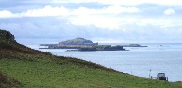
Cairn na Burgh Beag

Cairn na Burgh Beag is one of the Treshnish Isles in the Inner Hebrides, Scotland. Cairn na Burgh Beag is the smaller of the two "Carnburgs" (as they...

Have you been to Aoineadh Bhurg?

Leave your review of Aoineadh Bhurg below (or comments, questions and feedback).