Gazick

Cliff, Slope in Cornwall

England

Gazick

The stream from Cot Valley discharging onto the beach at Porth Nanven
The stream from Cot Valley discharging onto the beach at Porth Nanven Credit: Rod Allday

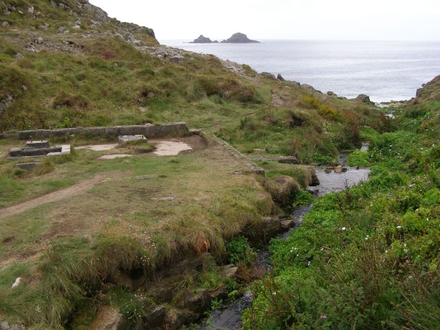
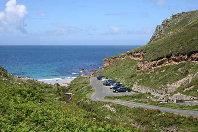
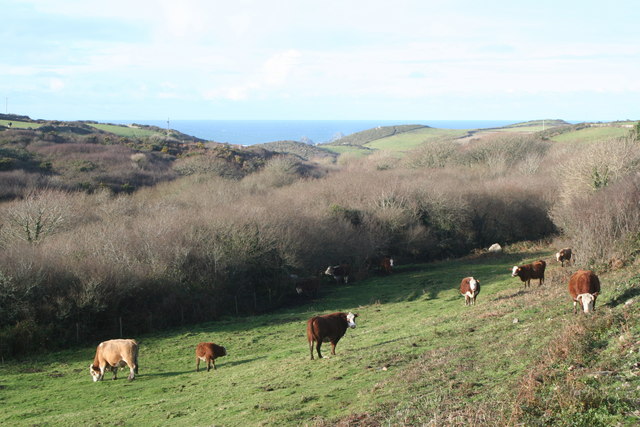
Gazick is a small coastal village located in Cornwall, England. Situated on a cliff, it offers breathtaking views of the Atlantic Ocean and is known for its rugged, natural beauty. The village is characterized by its steep slope, which adds to its charm and uniqueness.

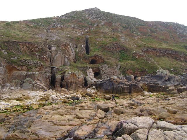
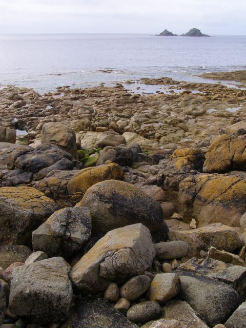
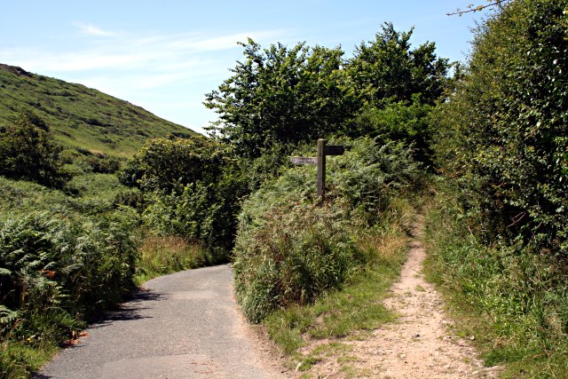
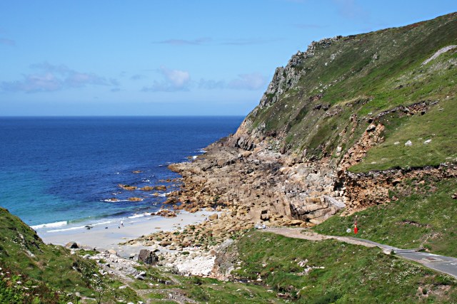
The cliff in Gazick is made up of sedimentary rocks, including sandstone and shale, which have been shaped by years of erosion from the crashing waves below. The cliff face is jagged and features various nooks and crannies, providing habitats for an array of bird species and other wildlife.

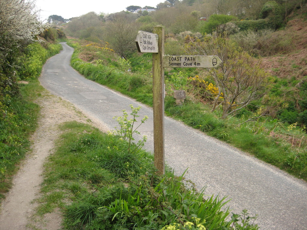
The slope in Gazick is known for its challenging terrain and attracts outdoor enthusiasts, particularly hikers and climbers. The steep gradient offers an exhilarating experience for those seeking adventure and a chance to test their physical abilities. It is important for visitors to exercise caution and be well-prepared when venturing onto the slope, as it can be slippery and unstable, especially during wet weather.

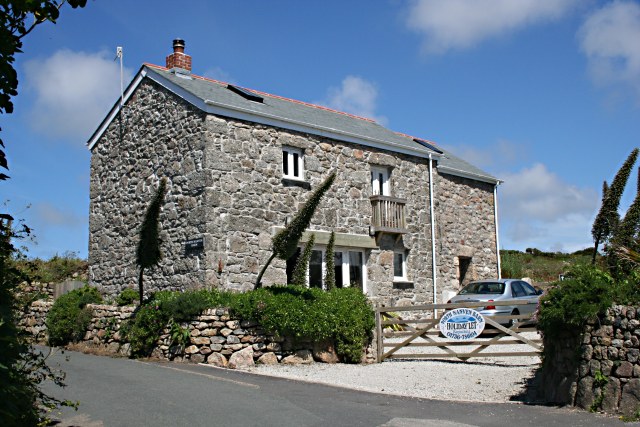
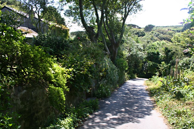
The village itself is small and has a close-knit community. It is home to a handful of houses, a local pub, and a small cafe that serves visitors and locals alike. The residents of Gazick are known for their warm hospitality and love for their village, which is evident in the well-maintained gardens and charming cottages that dot the area.

Overall, Gazick, Cornwall, with its cliff and slope, offers a unique and picturesque landscape, making it a must-visit destination for nature lovers and adventure seekers alike.

If you have any feedback on the listing, please let us know in the comments section below.
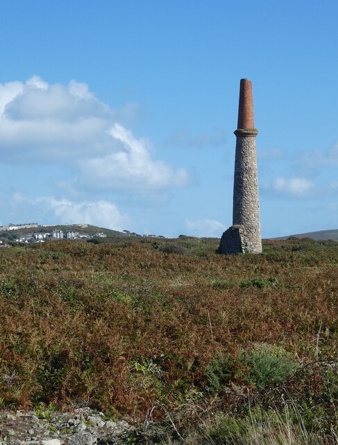
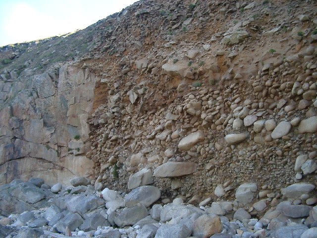
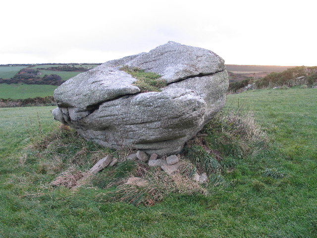
Gazick Images

Images are sourced within 2km of 50.104104/-5.6964153 or Grid Reference SW3529. Thanks to Geograph Open Source API. All images are credited.

The stream from Cot Valley discharging onto the beach at Porth Nanven
Eroded rocks on the beach at Porth Nanven Worn away by the stream in the Cot Valley, which discharges onto the beach here.
Eroded rocks on the beach at Porth Nanven
Worn away by the stream in the Cot Valley, which discharges onto the beach here.
Emergency call point at Porth Nanven
Chimney of former mine at Ballowall Situated a few dozen metres southeast of <a href="https://www.geograph.org.uk/photo/6982138">SW3531 : Ballowall Barrow</a> this chimney is all that is left of a former mine. It is one of many mining remnants in the area, which collectively form the Cornwall and West Devon Mining Landscape UNESCO World Heritage site - see
UNESCO: <span class="nowrap"><a title="https://whc.unesco.org/en/list/1215" rel="nofollow ugc noopener" href="https://whc.unesco.org/en/list/1215">Link</a><img style="margin-left:2px;" alt="External link" title="External link - shift click to open in new window" src="https://s1.geograph.org.uk/img/external.png" width="10" height="10"/></span>
English Heritage: <span class="nowrap"><a title="https://historicengland.org.uk/listing/the-list/list-entry/1000105?section=official-list-entry" rel="nofollow ugc noopener" href="https://historicengland.org.uk/listing/the-list/list-entry/1000105?section=official-list-entry">Link</a><img style="margin-left:2px;" alt="External link" title="External link - shift click to open in new window" src="https://s1.geograph.org.uk/img/external.png" width="10" height="10"/></span>
Chimney of former mine at Ballowall
Situated a few dozen metres southeast of SW3531 : Ballowall Barrow this chimney is all that is left of a former mine. It is one of many mining remnants in the area, which collectively form the Cornwall and West Devon Mining Landscape UNESCO World Heritage site - see UNESCO: LinkExternal link English Heritage: LinkExternal link
Climate history revealed! Bottom: current beach - rounded rocks
Middle: raised beach (rounded pebbles but above current sea level) from warm period 120000 years ago (Mediterranean Climate in south Britain)
Top: head deposits (angular - broken by ice action) from 100000-20000 years ago when area was tundra and ice covered much of Britain.
Climate history revealed!
Bottom: current beach - rounded rocks Middle: raised beach (rounded pebbles but above current sea level) from warm period 120000 years ago (Mediterranean Climate in south Britain) Top: head deposits (angular - broken by ice action) from 100000-20000 years ago when area was tundra and ice covered much of Britain.
Tom Thumb rock St. Just-in-Penwith
Beach and cliffs at Nanven Looking inland towards the cliff at low tide, with the rocky beach exposed. The dark vertical gashes in the cliff are the remains of mine workings which followed the seams of minerals. The cliff around the lower entrance is supported by a wall. Look closely and you can just make out a figure making their way across the rocks - they had been snorkelling and were returning to their kit.
Beach and cliffs at Nanven
Looking inland towards the cliff at low tide, with the rocky beach exposed. The dark vertical gashes in the cliff are the remains of mine workings which followed the seams of minerals. The cliff around the lower entrance is supported by a wall. Look closely and you can just make out a figure making their way across the rocks - they had been snorkelling and were returning to their kit.
Rocky beach at Nanven Looking out to sea at low tide from the rocky beach at Nanven, with boulders that have been weathered into smooth shapes by the action of the sea. On the horizon: The Brisons.
Rocky beach at Nanven
Looking out to sea at low tide from the rocky beach at Nanven, with boulders that have been weathered into smooth shapes by the action of the sea. On the horizon: The Brisons.
Geologically interesting beach at Porth Nanven At the end of the Cot Valley is this National Trust owned beach, shown here in the traditional Cornish drizzle at low tide. The geology of the brown cliff on the left is explained in more detail in this geograph: <a href="https://www.geograph.org.uk/photo/71736">SW3530 : Climate history revealed!</a>! A cagouled human figure is supplied in the foreground for scale (crouched down looking into a rockpool). According to the National Trust interpretation board (at the head of the slipway, to the right of the brown cliff) it is an offence to remove stones from this beach.
Geologically interesting beach at Porth Nanven
At the end of the Cot Valley is this National Trust owned beach, shown here in the traditional Cornish drizzle at low tide. The geology of the brown cliff on the left is explained in more detail in this geograph: SW3530 : Climate history revealed!! A cagouled human figure is supplied in the foreground for scale (crouched down looking into a rockpool). According to the National Trust interpretation board (at the head of the slipway, to the right of the brown cliff) it is an offence to remove stones from this beach.
Ruined mine workings in the Cot Valley The stream in this photo runs along the Cot Valley and joins the sea below at Porth Nanven. On the left (and behind the photographer) are the remains of mine workings that accompanied the various shafts in the surrounding cliffs and hills. The rocky islands out to sea are The Brisons, with a profile perhaps unkindly likened to General de Gaulle lying on his back.
Ruined mine workings in the Cot Valley
The stream in this photo runs along the Cot Valley and joins the sea below at Porth Nanven. On the left (and behind the photographer) are the remains of mine workings that accompanied the various shafts in the surrounding cliffs and hills. The rocky islands out to sea are The Brisons, with a profile perhaps unkindly likened to General de Gaulle lying on his back.
Disused Mine Shaft on Carn Gloose Overlooking Porth Naven.
Disused Mine Shaft on Carn Gloose
Overlooking Porth Naven.
Row of Disused Mine Shafts On the top of the valley slope at Porth Nanven.
Row of Disused Mine Shafts
On the top of the valley slope at Porth Nanven.
The Coast Path in the Cot Valley The path descends from Carn Gloose then takes the valley road down towards Porth Nanven.
The Coast Path in the Cot Valley
The path descends from Carn Gloose then takes the valley road down towards Porth Nanven.
Converted Barn at Bosorne This is now a holiday home.
Converted Barn at Bosorne
This is now a holiday home.
The Road into Cot Valley
Car Park at Porth Nanven There are no houses or tourist facilities here, just this parking area with space for a few cars.
Car Park at Porth Nanven
There are no houses or tourist facilities here, just this parking area with space for a few cars.
Porth Nanven Porth Nanven is at the mouth of the Cot Valley is a tiny bay to the south of the granite cliffs of Carn Gloose.  It is noted for the round granite boulders scattered on the beach which are the remnants of old raised beach deposits.  It is a site of special scientific interest.
Porth Nanven
Porth Nanven is at the mouth of the Cot Valley is a tiny bay to the south of the granite cliffs of Carn Gloose. It is noted for the round granite boulders scattered on the beach which are the remnants of old raised beach deposits. It is a site of special scientific interest.
Mine Shaft at Carn Leskys The cliffs to the south of Porth Nanven are riddled with old mine workings and shafts, many of which are not as well marked as this. It is not a good idea to stray from the footpath around here.
Mine Shaft at Carn Leskys
The cliffs to the south of Porth Nanven are riddled with old mine workings and shafts, many of which are not as well marked as this. It is not a good idea to stray from the footpath around here.
Show me another place!

Gazick is located at Grid Ref: SW3529 (Lat: 50.104104, Lng: -5.6964153)

Unitary Authority: Cornwall

Police Authority: Devon and Cornwall

What 3 Words

///advising.examiner.lecturing. Near St Just, Cornwall

Related Wikis

Nanquidno

Nanquidno is a hamlet near St Just in Penwith in west Cornwall, England. It is about half a mile southwest of Kelynack. == References ==

Porth Nanven

Porth Nanven (grid reference SW355307; most well known as Cot Valley and occasionally known as Penanwell) is a beach in the far west of Cornwall, England...

Cot Valley

Cot Valley is located half-a-mile south of St Just in west Cornwall, United Kingdom. It has a very mild microclimate.The stream which runs down the valley...

Kelynack

Kelynack (from Cornish: Kelynek is a settlement in west Cornwall, England, UK. == Geography == Kelynack is on the Penwith peninsula approximately four...

Nearby Amenities

Located within 500m of 50.104104,-5.6964153
Source: PGS
Lat/Long: 50.1054232/-5.6982355
Source: PGS
Lat/Long: 50.1011611/-5.6973389
Barrier: kissing_gate
Lat/Long: 50.1066874/-5.696784
Adit
Historic: ruins
Note: The tunnel has collapsed and its course can be seen in the hillside
Lat/Long: 50.1053627/-5.6953845
Waterwheel pits
Historic: ruins
Note: Remains of pits where water wheels were once used, probably in conjunction with the mine workings
Lat/Long: 50.1055696/-5.6952709
Generator Method: photovoltaic
Generator Output Electricity: yes
Generator Source: solar
Generator Type: solar_photovoltaic_panel
Location: roof
Power: generator
Lat/Long: 50.1058016/-5.6931743
Power: pole
Transformer: distribution
Lat/Long: 50.1065875/-5.6932247
Power: pole
Lat/Long: 50.1068025/-5.691677
Power: pole
Transformer: distribution
Lat/Long: 50.1041584/-5.691787
Power: pole
Lat/Long: 50.1033671/-5.691382
Power: pole
Lat/Long: 50.1028957/-5.6903708
Power: pole
Lat/Long: 50.1037645/-5.6894749
Power: pole
Lat/Long: 50.1028355/-5.6903011
The data included in this document is from www.openstreetmap.org. The data is made available under ODbL.

Have you been to Gazick?

Leave your review of Gazick below (or comments, questions and feedback).