Mayon Cliff

Cliff, Slope in Cornwall

England

Mayon Cliff

Looking down to Sennen Cove from the coast path on the dunes
Looking down to Sennen Cove from the coast path on the dunes Credit: Rod Allday

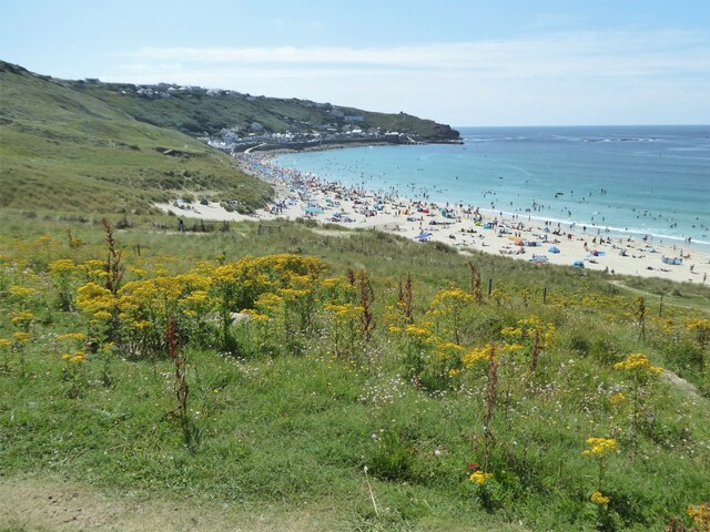
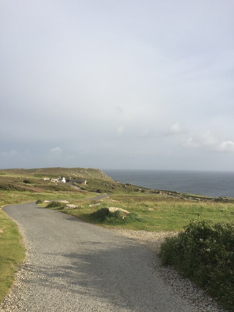
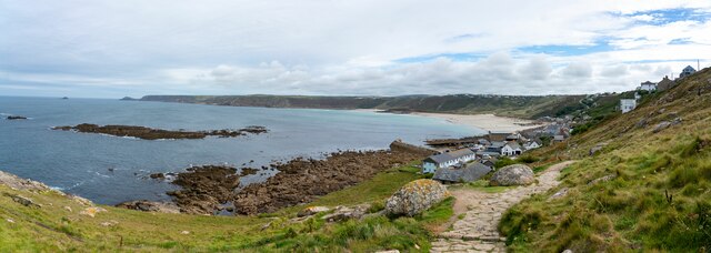
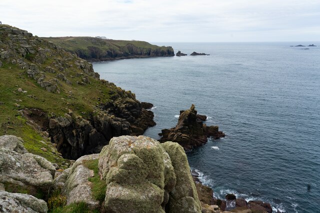
Mayon Cliff is a prominent geological feature located in Cornwall, England. This impressive cliff, also known as Mayon Hill, is situated on the eastern side of the county, near the town of Bude. Standing at approximately 100 meters in height, it offers breathtaking views of the surrounding landscape and the vast Atlantic Ocean.

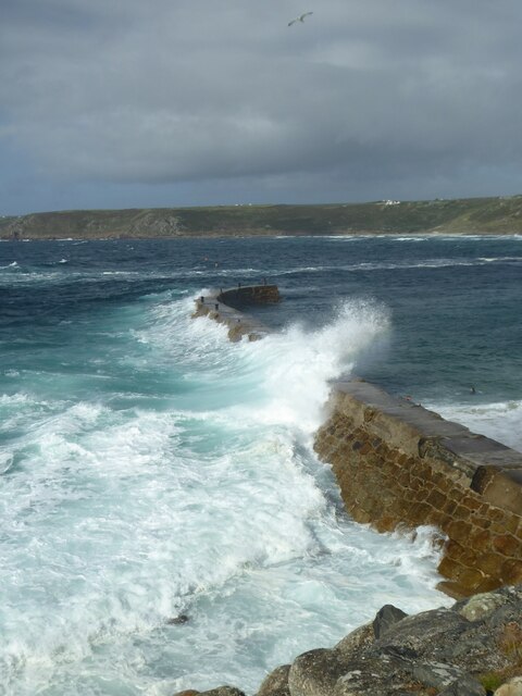
The cliff is formed by a combination of sedimentary rock layers, primarily composed of sandstone and shale. These layers have been shaped by millions of years of coastal erosion, resulting in the striking vertical face that we see today. The exposed rock formations provide a glimpse into Cornwall's geological history, showcasing the different layers of sediment that have built up over time.

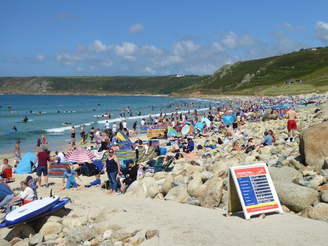
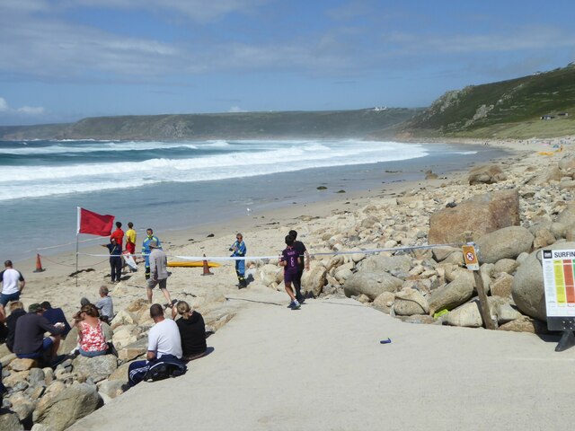
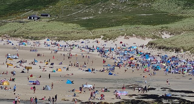
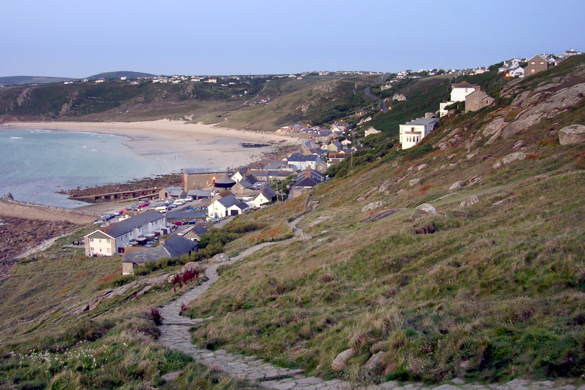
Mayon Cliff is popular among hikers and nature enthusiasts, who are drawn to its natural beauty and the opportunity to explore the stunning coastal scenery. There are various walking paths and trails that allow visitors to venture along the cliff edge, offering panoramic views of the rugged coastline and the crashing waves below. Birdwatchers also frequent the area, as it provides a habitat for various species of seabirds, including gulls, cormorants, and fulmars.

Due to its steep incline and exposed location, caution is advised when visiting Mayon Cliff. Visitors are encouraged to stay on designated paths and avoid getting too close to the edge for safety reasons. The cliff is easily accessible by car or on foot, with parking facilities available nearby. Mayon Cliff is truly a remarkable natural wonder, showcasing the raw beauty and power of Cornwall's coastal landscape.

If you have any feedback on the listing, please let us know in the comments section below.

Mayon Cliff Images

Images are sourced within 2km of 50.073725/-5.7081394 or Grid Reference SW3425. Thanks to Geograph Open Source API. All images are credited.

Looking down to Sennen Cove from the coast path on the dunes
The crowded beach at Sennen at high tide in August The beach at Sennen is vast but at high tide space is at a premium!
The crowded beach at Sennen at high tide in August
The beach at Sennen is vast but at high tide space is at a premium!
Empty beach on a sunny day in August! Compare with <a href="https://www.geograph.org.uk/photo/6929331">SW3526 : The crowded beach at Sennen at high tide in August</a>. The beach has been closed by the lifeguards and coastguards after a suspicious object was found.  It proved to be a WWII Mills bomb which was later disposed of by the Navy bomb disposal team from Plymouth
Empty beach on a sunny day in August!
Compare with SW3526 : The crowded beach at Sennen at high tide in August. The beach has been closed by the lifeguards and coastguards after a suspicious object was found. It proved to be a WWII Mills bomb which was later disposed of by the Navy bomb disposal team from Plymouth
Waves breaking over the breakwater at Sennen Cove at high tide
Big breakers on Whitesand Bay
Sennen beach on a sunny August day
Teasel seed head
Teasel seed head
Sunset over the harbour at Sennen Cove
Figures on the breakwater at sunset
Sennen August sunset
Land's End Signpost
Land's End Signpost
View towards Greeb Farm
The First and Last Inn, Sennan
Sennen Church - corner of tower Cut benchmark on this corner

<span class="nowrap"><a title="https://www.bench-marks.org.uk/bm51379" rel="nofollow ugc noopener" href="https://www.bench-marks.org.uk/bm51379">Link</a><img style="margin-left:2px;" alt="External link" title="External link - shift click to open in new window" src="https://s1.geograph.org.uk/img/external.png" width="10" height="10"/></span>
Sennen Church - corner of tower
Cut benchmark on this corner LinkExternal link
Small boats, Sennen Cove Not a day for fishing in a small boat. These are tied up, well away from the water.
Small boats, Sennen Cove
Not a day for fishing in a small boat. These are tied up, well away from the water.
Sennen Cove viewed from the South West Coastal Path
Irish Lady rock off Sennen Cove
Public toilets at Sennen Cove
Show me another place!

Mayon Cliff is located at Grid Ref: SW3425 (Lat: 50.073725, Lng: -5.7081394)

Unitary Authority: Cornwall

Police Authority: Devon and Cornwall

What 3 Words

///elevates.should.sling. Near Sennen, Cornwall

Related Wikis

MV RMS Mulheim

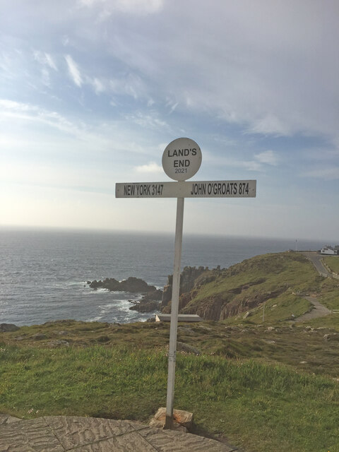
The RMS Mülheim was a German cargo ship that was built in Romania and launched in May 1999. It was wrecked on 22 March 2003 at Land's End, United Kingdom...

Maen Castle

Maen Castle is an Iron Age promontory fort or 'cliff castle' close to Land's End in Cornwall. It is one of only two fortified sites in Cornwall where...

Sennen Cove

Sennen Cove (Cornish: Porthsenen) (grid reference SW352261) is a small coastal village in the parish of Sennen in Cornwall, England, United Kingdom. According...

Sennen Cove Lifeboat Station

Sennen Cove Lifeboat Station is the base for Royal National Lifeboat Institution (RNLI) search and rescue operations for the sea around Land's End, Cornwall...

Nearby Amenities

Located within 500m of 50.073725,-5.7081394
Source: PGS
Lat/Long: 50.077763/-5.7079572
Source: PGS
Lat/Long: 50.0775411/-5.7088773
Source: PGS
Lat/Long: 50.0774635/-5.7088235
Source: PGS
Lat/Long: 50.0771604/-5.708932
Source: PGS
Lat/Long: 50.0766537/-5.709527
Source: PGS
Lat/Long: 50.0764893/-5.7093674
Source: PGS
Lat/Long: 50.0760528/-5.7088898
Source: PGS
Lat/Long: 50.0756163/-5.7092783
Mayon Cliff
Is In: Cornwall, England, UK
Is In Country: England
Is In Country Code: GB
Is In County: Cornwall
Operator: The National Trust
Place: locality
Lat/Long: 50.0748517/-5.7088551
Millennium Milepost Sennen
Description: 1) Lands End 0.75 2) Penzance 12.5, John O'Groats 1446
Image: https://www.cyclestreets.net/location/194727/cyclestreets194727.jpg
Information: guidepost
Ncn Milepost: mccoll
Sustrans Ref: MP 345
Tourism: information
Lat/Long: 50.0746524/-5.7035941
Maen Castle
Designation: Iron Age promontory fort
Historic: archaeological_site
Source: http://en.wikipedia.org/wiki/Maen_Castle
Wikidata: Q15072505
Wikipedia: en:Maen Castle
Lat/Long: 50.0727155/-5.7080356
Bench
Backrest: no
Check Date: 2022-07-03
Lat/Long: 50.0766462/-5.7084867
Post Box
Check Date: 2022-07-03
Check Date Collection Times: 2022-07-03
Collection Times: Mo-Fr 09:30; Sa 09:30
Operator: Royal Mail
Post Box Type: lamp
Ref: TR19 141
Royal Cypher: EIIR
Royal Cypher Wikidata: Q33102113
Source: survey
Lat/Long: 50.0757588/-5.7023744
Tourism: viewpoint
Lat/Long: 50.076537/-5.708415
RMS Mulheim (wreck)
Historic: wreck
Place: locality
Seamark Type: wreck
Seamark Wreck Category: hull_showing
Wikidata: Q2124425
Wikipedia: en:MV RMS Mulheim
Lat/Long: 50.0733991/-5.7085596
Direction: S
Generator Method: photovoltaic
Generator Output Electricity: small_installation
Generator Source: solar
Generator Type: solar_photovoltaic_panel
Location: roof
Power: generator
Source: bing
Lat/Long: 50.0762565/-5.7025078
Direction: S
Generator Method: photovoltaic
Generator Output Electricity: small_installation
Generator Source: solar
Generator Type: solar_photovoltaic_panel
Location: roof
Power: generator
Source: bing
Lat/Long: 50.0762083/-5.702835
WW2 Nissen Huts Accommodation for RAF Sennen (site of)
Building: bunker
Military: bunker
Lat/Long: 50.0776994/-5.7049388
Fire Hydrant
Emergency: fire_hydrant
Survey Date: 2022-07-03
Lat/Long: 50.0756424/-5.7028948
Bench
Survey Date: 2022-07-03
Lat/Long: 50.0766179/-5.708479
Fire Hydrant
Emergency: fire_hydrant
Fire Hydrant Type: underground
Survey Date: 2022-07-03
Lat/Long: 50.0763024/-5.704792
Waste Basket
Survey Date: 2022-07-03
Lat/Long: 50.0755478/-5.7030714
Location Transition: yes
Power: pole
Lat/Long: 50.0744594/-5.7022986
The data included in this document is from www.openstreetmap.org. The data is made available under ODbL.

Have you been to Mayon Cliff?

Leave your review of Mayon Cliff below (or comments, questions and feedback).