Gob Fhlath

Cliff, Slope in Ross-shire

Scotland

Gob Fhlath

Cappadale Sands
Cappadale Sands Credit: Sandy Gerrard

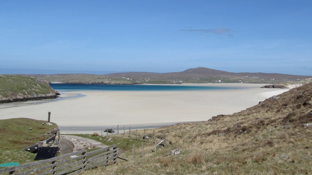
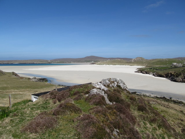
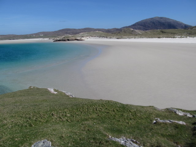
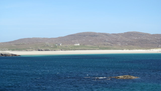
Gob Fhlath, also known as the Ross-shire Cliff or Slope, is a prominent geological feature located in the county of Ross-shire, Scotland. This natural wonder can be found near the village of Gairloch, situated along the western coast of the region.

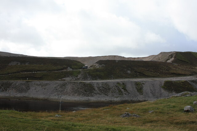
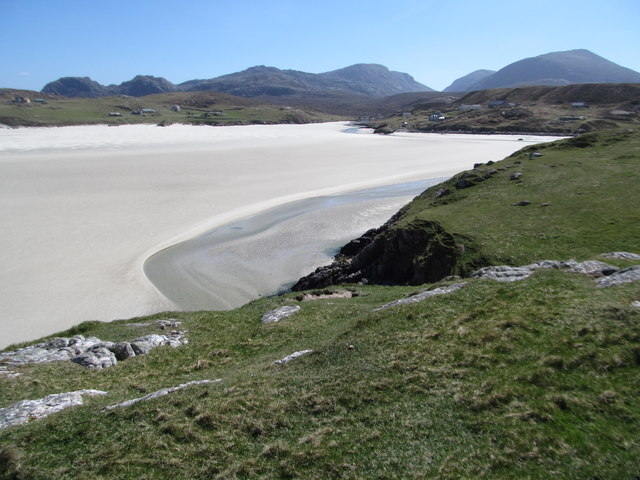
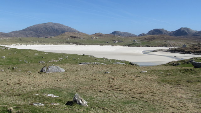
Gob Fhlath stretches for approximately 1.6 kilometers (1 mile) and is characterized by its steep and imposing cliffs, which rise to heights of around 120 meters (394 feet) above sea level. The cliff face is composed of a variety of rock types, including ancient Lewisian gneiss and Torridonian sandstone, dating back millions of years.

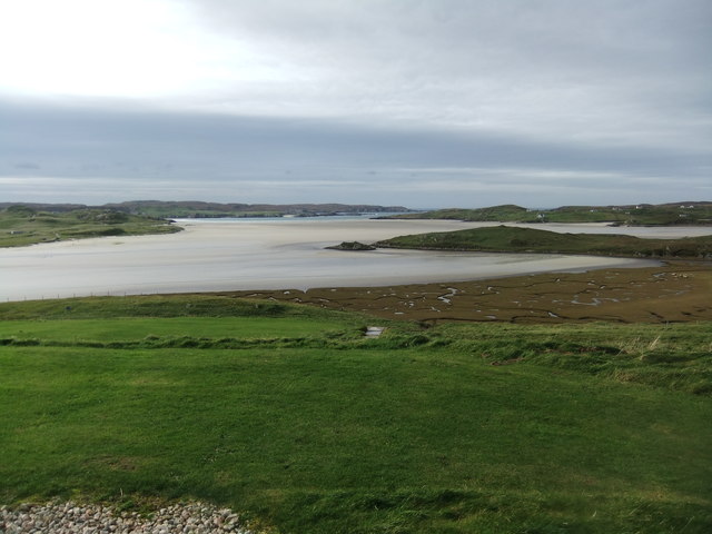
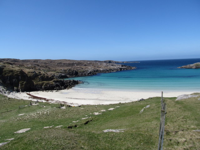
The Gob Fhlath cliff offers breathtaking panoramic views of the surrounding landscape, including the picturesque Loch Gairloch and the rugged mountains of Wester Ross. Its impressive height and dramatic rock formations make it a popular destination for hikers, climbers, and nature enthusiasts.

The area surrounding Gob Fhlath is rich in biodiversity, with a diverse range of plant and animal species inhabiting the slopes and the nearby loch. Visitors to the site may encounter various bird species, including seabirds like gannets, kittiwakes, and puffins. Additionally, marine mammals such as seals and dolphins can sometimes be spotted swimming or basking in the waters below.

Due to its natural beauty and geological significance, Gob Fhlath is recognized as a Site of Special Scientific Interest (SSSI) and is protected under conservation laws. It serves as a reminder of the ancient geological processes that shaped the Scottish Highlands and continues to captivate visitors with its awe-inspiring beauty.

If you have any feedback on the listing, please let us know in the comments section below.
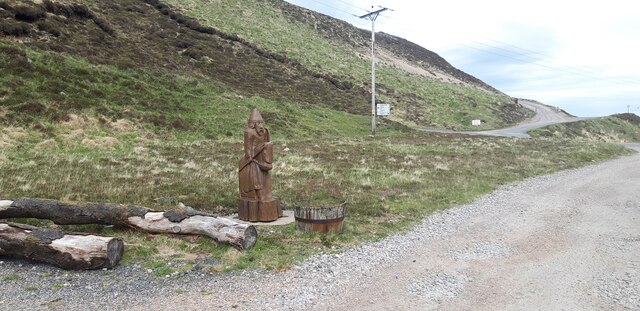
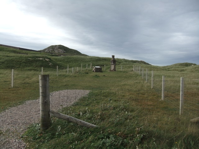
Gob Fhlath Images

Images are sourced within 2km of 58.17974/-7.0495449 or Grid Reference NB0332. Thanks to Geograph Open Source API. All images are credited.

Cappadale Sands
Cappadale Sands
Beach and headland at Carnais
Beach at Carnais
Beach at Carnais
Wooden sculpture of a Lewis Knight Chess Piece at the Abhainn Dearg Distillery car park
Tom A small tidal island near Carnais.
Tom
A small tidal island near Carnais.
The Gravel Pits at Carnais, on the Red River, Uig, Lewis The Abhainn Dearg Distillery lies to the left of the picture. The Red River - Ahbainn Dearg flows to the sea at the foot of the scree slope, but is shown on the OS Sheet as Abhainn Caslabhat.
The Gravel Pits at Carnais, on the Red River, Uig, Lewis
The Abhainn Dearg Distillery lies to the left of the picture. The Red River - Ahbainn Dearg flows to the sea at the foot of the scree slope, but is shown on the OS Sheet as Abhainn Caslabhat.
The road to Ardroil With Suaineabhal catching the sun in the distance.
The road to Ardroil
With Suaineabhal catching the sun in the distance.
Abhainn Dearg Road Bridge The buildings in view are the Abhainn Dearg, a relatively new distillery which is aiming to revive the tradition of whisky distilling on the islands.
Abhainn Dearg Road Bridge
The buildings in view are the Abhainn Dearg, a relatively new distillery which is aiming to revive the tradition of whisky distilling on the islands.
Heavy Haul Plant associated with nearby sand and gravel pit.
Heavy Haul
Plant associated with nearby sand and gravel pit.
Chessman statue
Chessman statue
Uig Bay
Uig Bay
Uig Sands, looking N from Carnish They say Uig Sands are the best beach in Scotland, and I've never seen a beach as good.  Very large area of sand, turquoise/azure sea becoming dark blue, transparent sea water, shoreline not built up.  The beach was very crowded: there was a single person visible on the sand.
Uig Sands, looking N from Carnish
They say Uig Sands are the best beach in Scotland, and I've never seen a beach as good. Very large area of sand, turquoise/azure sea becoming dark blue, transparent sea water, shoreline not built up. The beach was very crowded: there was a single person visible on the sand.
Uig Sands, looking northward from the Carnish area Isle of Lewis.
Uig Sands, looking northward from the Carnish area
Isle of Lewis.
Small beach near Carnish, Isle of Lewis ... showing the colour and transparency of the Atlantic.
Small beach near Carnish, Isle of Lewis
... showing the colour and transparency of the Atlantic.
Uig Sands, southern part, looking SE from near Carnish
Uig Sands, looking E from near Carnish The Southern part of Uig Sands is in the foreground, with the larger Northern part in the distance at the left of the photo.
Uig Sands, looking E from near Carnish
The Southern part of Uig Sands is in the foreground, with the larger Northern part in the distance at the left of the photo.
Uig Sands, Northern part, seen from Carnish area This photo does not do justice to the huge size of the northern part of Uig Sands.
Uig Sands, Northern part, seen from Carnish area
This photo does not do justice to the huge size of the northern part of Uig Sands.
Uig Sands, southern end, from near Carnish
Show me another place!

Gob Fhlath is located at Grid Ref: NB0332 (Lat: 58.17974, Lng: -7.0495449)

Unitary Authority: Na h-Eileanan an Iar

Police Authority: Highlands and Islands

What 3 Words

///teaches.bathtubs.steadier. Near Carloway, Na h-Eileanan Siar

Related Wikis

Abhainn Dearg distillery

Abhainn Dearg distillery ( AV-in JAIRG) or Red River distillery is a Scotch whisky distillery in Uig, on the west coast of the Isle of Lewis in the Outer...

Ardroil

Ardroil (Scottish Gaelic: Eadar Dhà Fhadhail) is a village on the Isle of Lewis in the Outer Hebrides, Scotland. Ardroil is within the parish of Uig....

Uig, Lewis

Uig (Scottish Gaelic: Ùig [uːkʲ]), also known as Sgìr' Ùig, is a civil parish and community in the west of the Isle of Lewis in the Outer Hebrides, Scotland...

Timsgarry

Timsgarry (Scottish Gaelic: Tuimisgearraidh) is a village on the Isle of Lewis, in the Outer Hebrides, Scotland. Timsgarry is home to the Baile na Cille...

Nearby Amenities

Located within 500m of 58.17974,-7.0495449
Carnais
Name En: Carnish
Name Gd: Carnais
Place: village
Lat/Long: 58.1771654/-7.0509616
Barrier: cattle_grid
Lat/Long: 58.1760179/-7.0490064
Power: pole
Lat/Long: 58.1756167/-7.0485548
Power: pole
Lat/Long: 58.1760027/-7.0490181
Power: pole
Lat/Long: 58.1763956/-7.0495645
Power: pole
Lat/Long: 58.1769306/-7.05027
Power: pole
Lat/Long: 58.1772002/-7.0513058
Power: pole
Lat/Long: 58.17739/-7.0521323
Power: pole
Lat/Long: 58.1776056/-7.0530396
Man Made: utility_pole
Lat/Long: 58.1777024/-7.0532123
Man Made: utility_pole
Lat/Long: 58.1779831/-7.05334
Man Made: utility_pole
Lat/Long: 58.1783357/-7.0535607
Man Made: utility_pole
Lat/Long: 58.1788389/-7.0534222
Man Made: utility_pole
Lat/Long: 58.1790741/-7.0540955
Man Made: utility_pole
Lat/Long: 58.1794368/-7.0548441
Power: pole
Lat/Long: 58.1794767/-7.0548797
Power: pole
Lat/Long: 58.1790891/-7.0541456
Power: pole
Lat/Long: 58.1788478/-7.0534358
Power: pole
Lat/Long: 58.177978/-7.0533608
Power: pole
Lat/Long: 58.1777057/-7.0532263
Power: pole
Lat/Long: 58.1767585/-7.0476052
Power: pole
Lat/Long: 58.1764336/-7.0482055
Passing Place
Lat/Long: 58.1768763/-7.0503045
Passing Place
Lat/Long: 58.1757367/-7.0490085
The data included in this document is from www.openstreetmap.org. The data is made available under ODbL.

Have you been to Gob Fhlath?

Leave your review of Gob Fhlath below (or comments, questions and feedback).