Abbey Head

Landscape Feature in Yorkshire Richmondshire

England

Abbey Head

Footpath through wood below Brough Scar
Footpath through wood below Brough Scar Credit: Roger Templeman

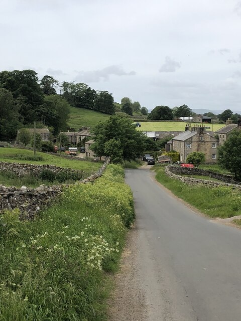
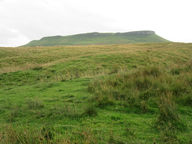
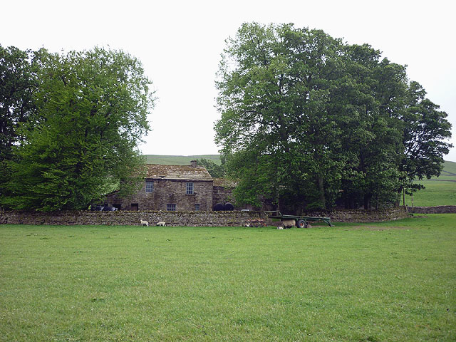
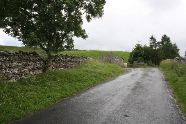
Abbey Head is a prominent landscape feature located in the county of Yorkshire, England. Situated on the eastern edge of the North York Moors National Park, Abbey Head boasts breathtaking views and is a popular destination for nature enthusiasts and hikers alike.

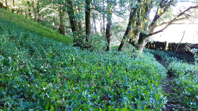
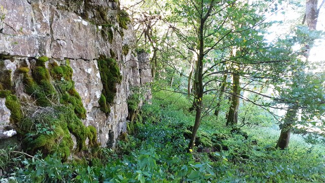
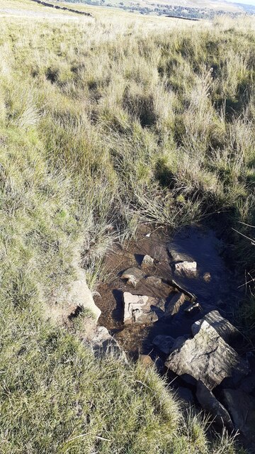
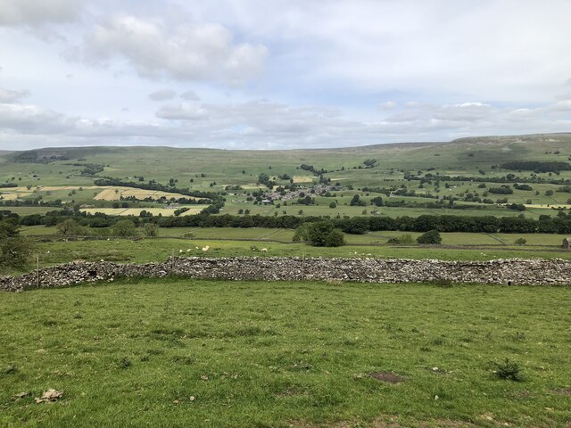
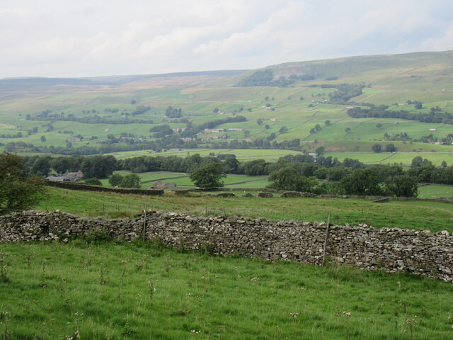
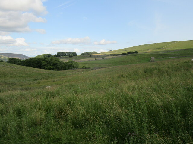
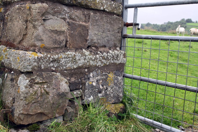
The landscape is characterized by its rolling hills, lush green pastures, and dense woodlands, providing a diverse range of habitats for various flora and fauna. The area is particularly renowned for its rich biodiversity, with numerous rare and protected species calling Abbey Head their home.

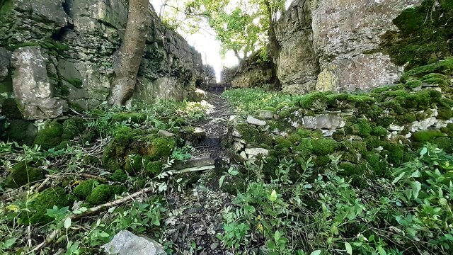
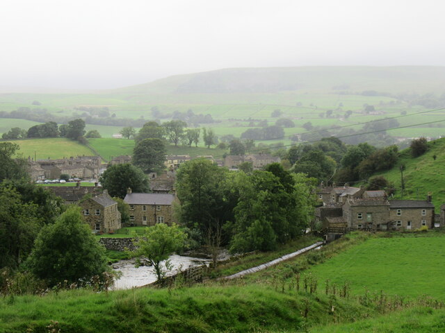
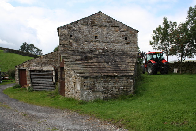
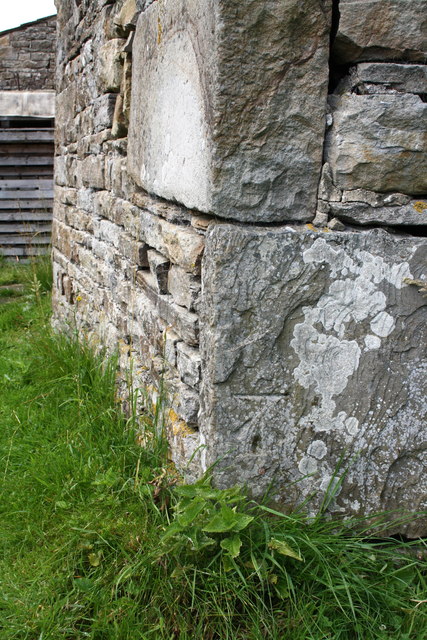
One of the most striking features of Abbey Head is the presence of several ancient ruins, including the remnants of an abbey that once stood on the site. These ruins serve as a reminder of the area's historical significance and attract history buffs from far and wide.

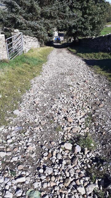
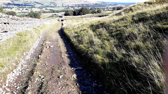
The landscape also offers an array of walking trails, allowing visitors to explore the area's natural beauty and discover hidden gems along the way. From leisurely strolls to more challenging hikes, Abbey Head caters to all levels of fitness and provides an opportunity to immerse oneself in the tranquility and serenity of the countryside.

Furthermore, Abbey Head is blessed with an abundance of wildlife. Visitors may spot red deer roaming freely, while birdwatchers can observe a wide variety of avian species, including kestrels, buzzards, and owls. The area's diverse ecosystem ensures that every visit to Abbey Head is a unique and memorable experience.

In conclusion, Abbey Head in Yorkshire offers a captivating landscape with its rolling hills, ancient ruins, and diverse wildlife. Whether one seeks a peaceful retreat or an adventure in nature, Abbey Head provides a picturesque setting that is bound to leave a lasting impression.

If you have any feedback on the listing, please let us know in the comments section below.

Abbey Head Images

Images are sourced within 2km of 54.312247/-2.0902057 or Grid Reference SD9490. Thanks to Geograph Open Source API. All images are credited.

Footpath through wood below Brough Scar
Footpath passing through gap in Brough Scar
Bridleway approaching Cubeck from SW
Looking west along Brough Scar
A stream on Worton Pasture
Bridleway from Worton Pasture towards Cubeck
Wensleydale View of Wensleydale from lower slopes of Addlebrough. The treeline in the middle distance is Worton Scar, and the small town of Askrigg can be seen in the centre of the image.
Wensleydale
View of Wensleydale from lower slopes of Addlebrough. The treeline in the middle distance is Worton Scar, and the small town of Askrigg can be seen in the centre of the image.
The north side of Addlebrough Looking up at the north side of Addlebrough.
The north side of Addlebrough
Looking up at the north side of Addlebrough.
Near Cubeck Looking across Wensleydale near Cubeck.
Near Cubeck
Looking across Wensleydale near Cubeck.
Near Bainbridge Looking east from Cam High Road.
Near Bainbridge
Looking east from Cam High Road.
Bainbridge Looking north to Bainbridge.
Bainbridge
Looking north to Bainbridge.
Scar Top The house does not seem to be occupied - slates are sliding off the roof.
Scar Top
The house does not seem to be occupied - slates are sliding off the roof.
Barn on Cam High Road near Bainbridge There is an OS benchmark <a href="https://www.geograph.org.uk/photo/2708746">SD9389 : Benchmark on barn on Cam High Road</a> on the barn.
Barn on Cam High Road near Bainbridge
There is an OS benchmark SD9389 : Benchmark on barn on Cam High Road on the barn.
Benchmark on barn on Cam High Road Ordnance Survey cut mark described on the Bench Mark Database at <span class="nowrap"><a title="http://www.bench-marks.org.uk/bm39074" rel="nofollow ugc noopener" href="http://www.bench-marks.org.uk/bm39074">Link</a><img style="margin-left:2px;" alt="External link" title="External link - shift click to open in new window" src="https://s1.geograph.org.uk/img/external.png" width="10" height="10"/></span>
Benchmark on barn on Cam High Road
Ordnance Survey cut mark described on the Bench Mark Database at LinkExternal link
Benchmark on stone of Carpley Green Road Ordnance Survey pivot benchmark described on the Bench Mark Database at <span class="nowrap"><a title="http://www.bench-marks.org.uk/bm39075" rel="nofollow ugc noopener" href="http://www.bench-marks.org.uk/bm39075">Link</a><img style="margin-left:2px;" alt="External link" title="External link - shift click to open in new window" src="https://s1.geograph.org.uk/img/external.png" width="10" height="10"/></span>
Benchmark on stone of Carpley Green Road
Ordnance Survey pivot benchmark described on the Bench Mark Database at LinkExternal link
Carpley Green Road south from Bainbridge There is an OS benchmark <a href="https://www.geograph.org.uk/photo/2719675">SD9389 : Benchmark on stone of Carpley Green Road</a> on the wall on the left side of the road
Carpley Green Road south from Bainbridge
There is an OS benchmark SD9389 : Benchmark on stone of Carpley Green Road on the wall on the left side of the road
Benchmark on gateway on Carpley Green Road Ordnance Survey cut mark benchmark described on the Bench Mark Database at <span class="nowrap"><a title="http://www.bench-marks.org.uk/bm39076" rel="nofollow ugc noopener" href="http://www.bench-marks.org.uk/bm39076">Link</a><img style="margin-left:2px;" alt="External link" title="External link - shift click to open in new window" src="https://s1.geograph.org.uk/img/external.png" width="10" height="10"/></span>
Benchmark on gateway on Carpley Green Road
Ordnance Survey cut mark benchmark described on the Bench Mark Database at LinkExternal link
Show me another place!

Abbey Head is located at Grid Ref: SD9490 (Lat: 54.312247, Lng: -2.0902057)

Division: North Riding

Administrative County: North Yorkshire

District: Richmondshire

Police Authority: North Yorkshire

What 3 Words

///guessing.turns.beaten. Near Leyburn, North Yorkshire

Nearby Locations

Abbey Head

Related Wikis

Askrigg railway station

Askrigg railway station is a disused railway station in North Yorkshire, England and served the village of Askrigg. It was part of the Wensleydale Railway...

St Oswald's Church, Askrigg

St Oswald's Church is a Grade I listed parish church in the Church of England in Askrigg, North Yorkshire. == History == The church dates largely from...

Cringley House

Cringley House (also known as Skeldale House) is an historic building in the English village of Askrigg, North Yorkshire. Standing on the south side of...

Askrigg

Askrigg is a small village and civil parish in Wensleydale in the Yorkshire Dales National Park. It was formerly a part of the Richmondshire district of...

River Bain, North Yorkshire

The River Bain is a river in North Yorkshire, England. As a tributary of the River Ure, it is one of the shortest, named rivers in England. The river...
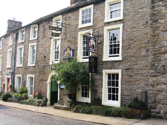
Kings Arms Hotel

The Kings Arms Hotel is a public house and inn in the English village of Askrigg, North Yorkshire. A Grade II listed building, standing on the northern...

Fors Abbey

Fors Abbey was an abbey in Low Abbotside, Askrigg, North Yorkshire, England.It was built in 1145 for the Savigniac order and converted to the Cistercian...

Virosidum

Virosidum was a Roman fort and settlement situated near to the modern town of Bainbridge, North Yorkshire, England. The site is a Scheduled monument....

Nearby Amenities

Located within 500m of 54.312247,-2.0902057
Barrier: stile
Material: stone
Source: survey;gps
Stile: squeezer
Lat/Long: 54.3164524/-2.0898438
Askrigg
Historic Railway: station
Railway: site
Wikidata: Q4807246
Lat/Long: 54.3129381/-2.088224
Source: OS_OpenData_Streetview
Waterway: weir
Lat/Long: 54.3161096/-2.0885929
Barrier: cattle_grid
Lat/Long: 54.3129638/-2.0876852
Barrier: stile
Material: stone
Source: survey;gps
Stile: squeezer
Lat/Long: 54.3164571/-2.089399
Barrier: stile
Material: stone
Source: survey;gps
Stile: squeezer
Lat/Long: 54.3150388/-2.0953601
Barrier: stile
Material: stone
Source: survey;gps
Stile: squeezer
Lat/Long: 54.3152269/-2.0937564
Barrier: stile
Material: stone
Source: survey;gps
Stile: squeezer
Lat/Long: 54.3155236/-2.0924345
Barrier: stile
Material: stone
Source: survey;gps
Stile: squeezer
Lat/Long: 54.3158873/-2.0903966
Askrigg Camping
Addr City: Hawes
Addr Housename: Lowlands Farm
Addr Postcode: DL8 3HZ
Addr Street: Station Road
Addr Suburb: Askrigg
Phone: +447811851584
Tourism: camp_site
Website: https://askrigg-camping.com/
Lat/Long: 54.3135949/-2.0836159
Power: pole
Transformer: distribution
Lat/Long: 54.3126993/-2.0890412
Power: pole
Lat/Long: 54.3118309/-2.0832717
Power: pole
Lat/Long: 54.3119529/-2.0845699
Power: pole
Lat/Long: 54.3122581/-2.0859996
Power: pole
Lat/Long: 54.3125742/-2.0875056
Power: pole
Lat/Long: 54.3126649/-2.0890412
Power: pole
Lat/Long: 54.3127556/-2.0905808
Power: pole
Lat/Long: 54.3128167/-2.0919943
Power: pole
Lat/Long: 54.3128808/-2.0930296
Power: pole
Lat/Long: 54.3128996/-2.0933542
Power: pole
Lat/Long: 54.3129825/-2.0947731
Power: pole
Lat/Long: 54.3130858/-2.096377
Power: pole
Lat/Long: 54.3131421/-2.0975974
Power: pole
Transformer: distribution
Lat/Long: 54.3125718/-2.086709
Power: pole
Transformer: distribution
Lat/Long: 54.3121618/-2.0867372
Power: pole
Transformer: distribution
Lat/Long: 54.313049/-2.0856509
Power: pole
Transformer: distribution
Lat/Long: 54.3130326/-2.0879924
Power: pole
Transformer: distribution
Lat/Long: 54.3129176/-2.0866647
Material: wood
Power: pole
Lat/Long: 54.313556/-2.0832798
Material: wood
Power: pole
Lat/Long: 54.3134738/-2.0838746
Material: wood
Power: pole
Lat/Long: 54.3132782/-2.0849193
Power: pole
Lat/Long: 54.3128855/-2.0861752
Power: pole
Lat/Long: 54.3138149/-2.0933327
Low Mill Outdoor Centre
Addr Housename: low mill outdoor centre
Addr Street: Station Road
Building: dormitory
Building Levels: 2
Building Material: stone
Roof Shape: gabled
Smoking: outside
Lat/Long: 54.3134328/-2.0850874
The data included in this document is from www.openstreetmap.org. The data is made available under ODbL.

Have you been to Abbey Head?

Leave your review of Abbey Head below (or comments, questions and feedback).