Swineham Point

Coastal Feature, Headland, Point in Dorset

England

Swineham Point

Pasture Field on the Arne Peninsula The bracken round this field of dairy cows had already died back to a golden brown.
Pasture Field on the Arne Peninsula Credit: Nigel Mykura

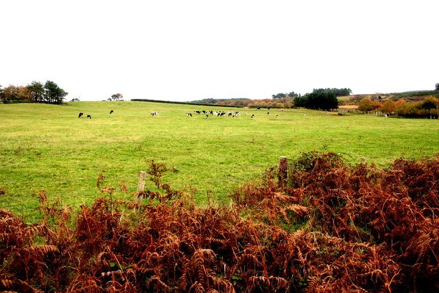
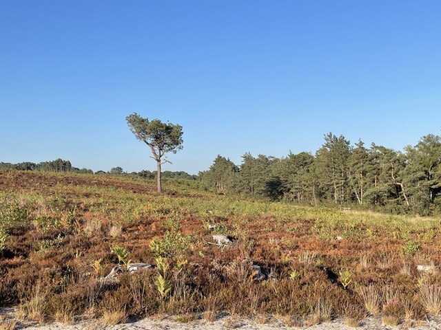
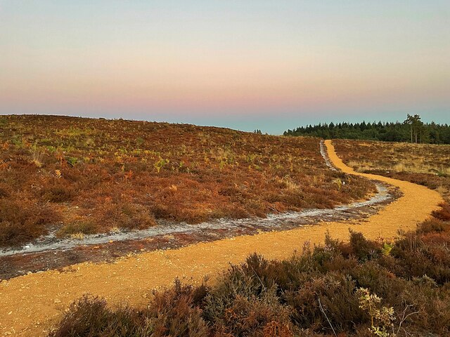
Swineham Point is a prominent headland located on the southern coast of Dorset, England. Situated near the village of Wareham, this coastal feature stretches out into the English Channel, offering stunning views of the surrounding area. It is a popular destination for tourists and locals alike, known for its natural beauty and diverse wildlife.

The headland is characterized by its rugged cliffs, which rise steeply from the sea and are composed of sedimentary rocks such as limestone and sandstone. These cliffs provide a dramatic backdrop to the coastal scenery and are home to a variety of seabirds, including gulls and cormorants.

Swineham Point also boasts a sandy beach, which is accessible from the nearby village of Studland. The beach is a popular spot for sunbathing, picnicking, and swimming during the summer months. It is also a favored location for water sports enthusiasts, offering opportunities for surfing, kayaking, and paddleboarding.

The headland is surrounded by a diverse and ecologically important habitat, including salt marshes and mudflats. These areas provide a haven for numerous species of birds, including waders and migratory birds. Swineham Point is particularly renowned for its populations of wading birds, such as curlews and redshanks, which can be observed feeding in the mudflats during low tide.

In addition to its natural beauty, Swineham Point has historical significance. The headland is situated near the site of the Iron Age settlement of Poole Harbour, which was an important trading hub in ancient times. Visitors can explore the remains of this settlement and learn about its rich history at the nearby museum.

Overall, Swineham Point offers a unique blend of natural beauty, recreational opportunities, and historical significance, making it a must-visit destination for nature lovers and history enthusiasts alike.

If you have any feedback on the listing, please let us know in the comments section below.

Swineham Point Images

Images are sourced within 2km of 50.69029/-2.0805561 or Grid Reference SY9487. Thanks to Geograph Open Source API. All images are credited.

Pasture Field on the Arne Peninsula The bracken round this field of dairy cows had already died back to a golden brown.
Pasture Field on the Arne Peninsula
The bracken round this field of dairy cows had already died back to a golden brown.
Bank Gate Cottages On Arne Road on the Arne peninsula
Bank Gate Cottages
On Arne Road on the Arne peninsula
Minor road junction on the Arne Peninsula  Where Soldiers Road meets Arne Road
Minor road junction on the Arne Peninsula
Where Soldiers Road meets Arne Road
Rustic seating  Beside a car park providing access to the Purbeck Heaths Nature Reserve
Rustic seating
Beside a car park providing access to the Purbeck Heaths Nature Reserve
Hyde’s Heath Part of the RSPB’s Arne Nature Reserve
Hyde’s Heath
Part of the RSPB’s Arne Nature Reserve
Solitary tree on Hyde’s Heath On RSPB’s Arne Nature Reserve
Solitary tree on Hyde’s Heath
On RSPB’s Arne Nature Reserve
Sunset over Wareham Channel Seen from Hydes Heath on the RSPB National Nature Reserve
Sunset over Wareham Channel
Seen from Hydes Heath on the RSPB National Nature Reserve
Conifer trees in Salterns Copse Heathland on the Arne peninsula
Conifer trees in Salterns Copse
Heathland on the Arne peninsula
Sunset over Wareham Channel
A solitary swan at sunset On the Wareham Channel
A solitary swan at sunset
On the Wareham Channel
Sunset over the Wareham Channel Viewed from the RSPB's Hyde's Heath Nature Reserve
Sunset over the Wareham Channel
Viewed from the RSPB's Hyde's Heath Nature Reserve
Moonrise over Saltern's Copse A not quite Supermoon (that was the next day) seen from RSPB's Hyde's Heath Nature Reserve
Moonrise over Saltern's Copse
A not quite Supermoon (that was the next day) seen from RSPB's Hyde's Heath Nature Reserve
Path on Hyde's Heath On RSPB's Arne nature reserve
Path on Hyde's Heath
On RSPB's Arne nature reserve
River Frome Boats moored on the river near Wareham.
River Frome
Boats moored on the river near Wareham.
River Frome Boats moored on the River Frome.
River Frome
Boats moored on the River Frome.
South Bridge Wareham
River Frome Looking East from Wareham
River Frome
Looking East from Wareham
Slepe Heath A sunset across Slepe Heath
Slepe Heath
A sunset across Slepe Heath
Show me another place!

Swineham Point is located at Grid Ref: SY9487 (Lat: 50.69029, Lng: -2.0805561)

Unitary Authority: Dorset

Police Authority: Dorset

What 3 Words

///early.vase.vague. Near Wareham, Dorset

Related Wikis

River Piddle

The River Piddle or Trent or North River is a small rural Dorset river which rises in the Dorset Downs and flows into Poole Harbour near Wareham. ��2...

Gigger's Island

Gigger's Island is an island in Poole Harbour in the English county of Dorset. The island is situated near to the Frome and Piddle rivers, near to the...

Mid Dorset and North Poole (UK Parliament constituency)

Mid Dorset and North Poole is a constituency represented in the House of Commons of the UK Parliament since 2015 by Michael Tomlinson, a Conservative....

Ridge, Dorset

Ridge is a village in the English county of Dorset. It is situated on the south bank of the River Frome, about half a mile due south east of the town of...

Nearby Amenities

Located within 500m of 50.69029,-2.0805561
Source: PGS
Lat/Long: 50.6916582/-2.0740625
Source: PGS
Lat/Long: 50.6916868/-2.0743166
Source: PGS
Lat/Long: 50.6919092/-2.0743066
Source: PGS
Lat/Long: 50.6864961/-2.0813451
Source: PGS
Lat/Long: 50.6866404/-2.0815941
Source: PGS
Lat/Long: 50.6868334/-2.0817798
Source: PGS
Lat/Long: 50.6870111/-2.0819666
Source: PGS
Lat/Long: 50.6873242/-2.0817473
Source: PGS
Lat/Long: 50.6876984/-2.0812485
Source: PGS
Lat/Long: 50.68766/-2.0807017
Source: PGS
Lat/Long: 50.6878332/-2.0807456
Source: PGS
Lat/Long: 50.688581/-2.081449
Source: PGS
Lat/Long: 50.6907856/-2.0836052
Source: PGS
Lat/Long: 50.6908086/-2.0830607
Source: PGS
Lat/Long: 50.6898907/-2.0821065
Source: PGS
Lat/Long: 50.6897607/-2.0819891
Source: PGS
Lat/Long: 50.689642/-2.0818391
Source: PGS
Lat/Long: 50.6895844/-2.0817534
Source: PGS
Lat/Long: 50.6893934/-2.0815227
Source: PGS
Lat/Long: 50.6891566/-2.081243
Source: PGS
Lat/Long: 50.6890059/-2.0810104
Source: PGS
Lat/Long: 50.6887415/-2.080845
Source: PGS
Lat/Long: 50.6885391/-2.0805634
Source: PGS
Lat/Long: 50.6883377/-2.0802501
Source: PGS
Lat/Long: 50.6882077/-2.0793319
Source: PGS
Lat/Long: 50.6909084/-2.0784392
Source: PGS
Lat/Long: 50.6923757/-2.0789025
Source: PGS
Lat/Long: 50.693885/-2.0789842
Source: PGS
Lat/Long: 50.6943597/-2.0793086
Source: PGS
Lat/Long: 50.6938199/-2.0806548
Source: PGS
Lat/Long: 50.6936853/-2.0810652
Source: PGS
Lat/Long: 50.6931994/-2.0821432
Source: PGS
Lat/Long: 50.6870763/-2.0774673
Source: PGS
Lat/Long: 50.6869769/-2.0790242
Source: PGS
Lat/Long: 50.6872178/-2.0799505
Source: PGS
Lat/Long: 50.6872932/-2.0804188
Source: PGS
Lat/Long: 50.6870632/-2.081587
Swineham Farm Tidal Flap Valve
Lat/Long: 50.6905961/-2.0853169
Seamark Buoy Lateral Colour: green
Seamark Type: buoy_lateral
Lat/Long: 50.6939482/-2.0767007
Seamark Buoy Lateral Colour: red
Seamark Type: buoy_lateral
Lat/Long: 50.693567/-2.0763299
The data included in this document is from www.openstreetmap.org. The data is made available under ODbL.

Have you been to Swineham Point?

Leave your review of Swineham Point below (or comments, questions and feedback).