Centre Hill

Landscape Feature in Lancashire

England

Centre Hill

Rochdale Canal at Gauxholme View from Rochdale to Leeds railway
Rochdale Canal at Gauxholme Credit: Raymond Knapman

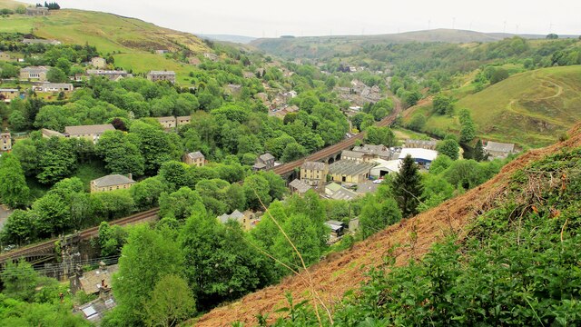
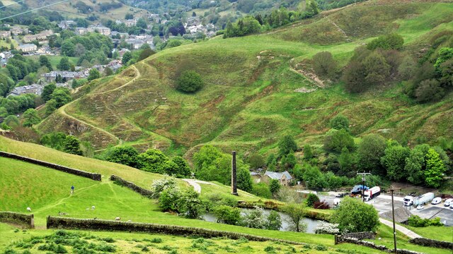
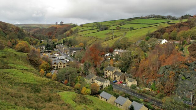
Centre Hill is a prominent landscape feature located in the county of Lancashire, England. Situated in the northern part of the county, it is part of the larger Pennine Range, which stretches across the northern regions of England.

At an elevation of approximately 650 meters (2,130 feet), Centre Hill offers breathtaking panoramic views of the surrounding countryside. Its distinctive peak, known as Centre Hill Summit, provides a vantage point from which visitors can admire the vast expanse of rolling hills, lush green valleys, and picturesque villages that dot the landscape.

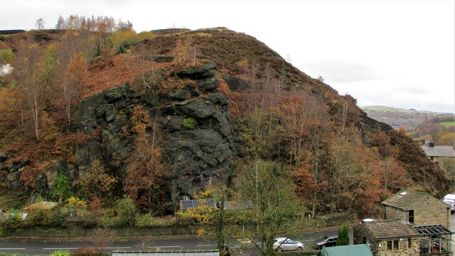
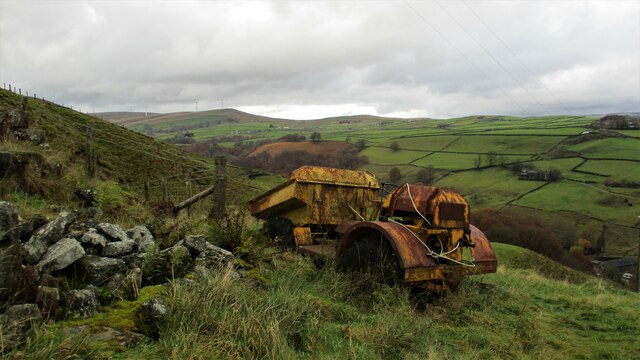
The hill itself is predominantly covered in grass and heather, with scattered patches of woodland adding to its natural beauty. The area is home to a rich variety of flora and fauna, making it an important site for biodiversity conservation. The hillside is often dotted with grazing sheep, adding to the rural charm of the area.

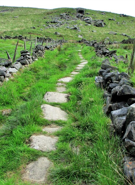
Centre Hill is a popular destination for outdoor enthusiasts and nature lovers. It offers a range of activities, including hiking, mountain biking, and birdwatching. The hill is crisscrossed by a network of well-maintained footpaths and trails, allowing visitors to explore the area at their own pace.

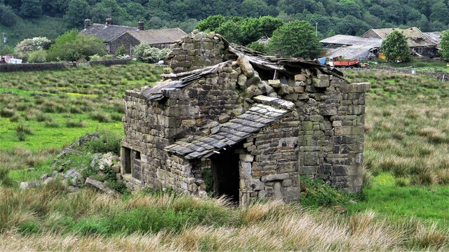
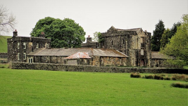
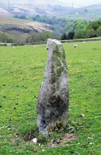
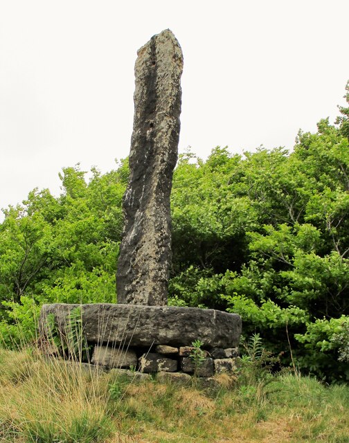
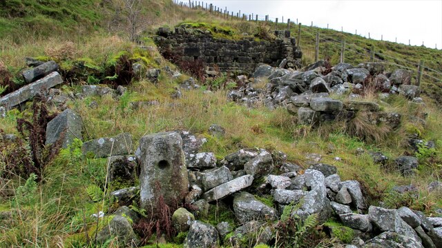
In addition to its natural features, Centre Hill is also of historical significance. It is believed to have been a site of human activity dating back thousands of years, with archaeological remains suggesting the presence of ancient settlements in the area.

Overall, Centre Hill in Lancashire is a captivating landscape feature that combines stunning natural beauty with a rich cultural and historical heritage.

If you have any feedback on the listing, please let us know in the comments section below.
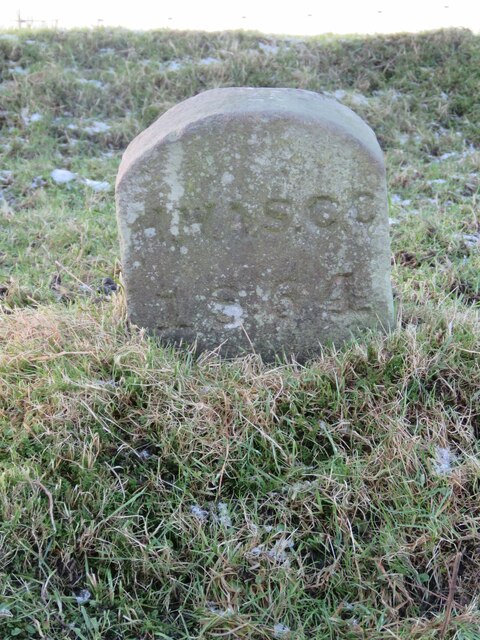
Centre Hill Images

Images are sourced within 2km of 53.710046/-2.1147397 or Grid Reference SD9223. Thanks to Geograph Open Source API. All images are credited.

Rochdale Canal at Gauxholme View from Rochdale to Leeds railway
Rochdale Canal at Gauxholme
View from Rochdale to Leeds railway
Burnley Road, Todmorden View from Rochdale to Leeds railway
Burnley Road, Todmorden
View from Rochdale to Leeds railway
Old Boundary Marker near Flailcroft, Todmorden Chapelry Boundary Marker beside a footpath north of Flailcroft. Todmorden parish. Inscribed H W A S C C / 1864 for Harley Wood All Saints Consolidated Chapelry. See  <span class="nowrap"><a title="https://www.thegazette.co.uk/London/issue/22908/page/5170" rel="nofollow ugc noopener" href="https://www.thegazette.co.uk/London/issue/22908/page/5170">Link</a><img style="margin-left:2px;" alt="External link" title="External link - shift click to open in new window" src="https://s1.geograph.org.uk/img/external.png" width="10" height="10"/></span>.

Milestone Society National ID: YW_TOD10pb
Old Boundary Marker near Flailcroft, Todmorden
Chapelry Boundary Marker beside a footpath north of Flailcroft. Todmorden parish. Inscribed H W A S C C / 1864 for Harley Wood All Saints Consolidated Chapelry. See LinkExternal link. Milestone Society National ID: YW_TOD10pb
Lower Knowl A work in progress
Lower Knowl
A work in progress
Swineshead Farm View from Lower Knowl
Swineshead Farm
View from Lower Knowl
Lower Knowl A farmhouse hopefully work in progress
Lower Knowl
A farmhouse hopefully work in progress
Causey Stones up Moor Lane Track south of Top O Th Rough towards Rake End
Causey Stones up Moor Lane
Track south of Top O Th Rough towards Rake End
Derelict Top O Th Rough Viewed from Moor Lane
Derelict Top O Th Rough
Viewed from Moor Lane
Dobroyd Clough after storms At the bottom of the Clough, Network Rail have done much work to stop this sort of debris blocking the culvert under the railway
Dobroyd Clough after storms
At the bottom of the Clough, Network Rail have done much work to stop this sort of debris blocking the culvert under the railway
Gauxholme Railway Viaduct View South over Shade & Gauxholme from Dobroyd Road
Gauxholme Railway Viaduct
View South over Shade & Gauxholme from Dobroyd Road
Model Farm to Dobroyd Castle The farm from Stones Road showing its apparent Scottish style with a central tower or keep.
Model Farm to Dobroyd Castle
The farm from Stones Road showing its apparent Scottish style with a central tower or keep.
Standing Stone No.2 at Stones A listed stone possibly prehistoric off Stones Lane. There are reportedly another 3 in the area but only No.1. is also listed. Midgelden Brook is in the valley beyond
Standing Stone No.2 at Stones
A listed stone possibly prehistoric off Stones Lane. There are reportedly another 3 in the area but only No.1. is also listed. Midgelden Brook is in the valley beyond
Centre Hill Monument A possible prehistoric stone mounted on a mill stone at Stones
Centre Hill Monument
A possible prehistoric stone mounted on a mill stone at Stones
Friths Mill Chimney View from Stones over the isolated chimney with Naze Road snaking up the other side of the valley
Friths Mill Chimney
View from Stones over the isolated chimney with Naze Road snaking up the other side of the valley
Crag at Gauxholme View from Naze Road across the valley to the crag against Bacup Road
Crag at Gauxholme
View from Naze Road across the valley to the crag against Bacup Road
Friths Mill Chimney View from Naze Road to the isolated chimney. Bacup Road runs up the valley
Friths Mill Chimney
View from Naze Road to the isolated chimney. Bacup Road runs up the valley
Naze Farm Remains Remains on North side of Naze Road
Naze Farm Remains
Remains on North side of Naze Road
Abandoned Dumper at Naze Farm The dumper's demise must be at a later date than the farm's demise. The valley of Dulesgate Water is beyond the dumper
Abandoned Dumper at Naze Farm
The dumper's demise must be at a later date than the farm's demise. The valley of Dulesgate Water is beyond the dumper
Show me another place!

Centre Hill is located at Grid Ref: SD9223 (Lat: 53.710046, Lng: -2.1147397)

Unitary Authority: Calderdale

Police Authority: West Yorkshire

What 3 Words

///pacemaker.grew.clerk. Near Todmorden, West Yorkshire

Nearby Locations

No Man's Wood Centre Hill

Related Wikis

Related Videos

Summer Hiking: Gaddings Dam🧗🏻📍🚞

Hi guys!!! Glad to see you again. Enjoy this vlog and drop your comment below.

VISIT TODMORDEN - Wish You Were Here? #todmorden #tourism

Visit Todmorden today. Free parking somewhere, a Lidl and an Aldi. Wish you were here. Music by @UkeofCarl.

CENTRE VALE PARK WALKING

Hello Jamie here and with another video. So the day before my birthday, I went to Todmorden, to see family, but also had the ...

Nearby Amenities

Located within 500m of 53.710046,-2.1147397
Bus Stop
Bacup Road
Bus: yes
Local Ref: 45018970
Naptan AtcoCode: 450018970
Naptan Bearing: W
Naptan CommonName: Bacup Road
Naptan Indicator: Stop 45018970
Naptan Landmark: Unknown
Naptan PlusbusZoneRef: LEEDS
Naptan ShortCommonName: Caldicott Close
Naptan Street: Bacup Road
Naptan Verified: no
Public Transport: platform
Source: naptan_import
Lat/Long: 53.7061606/-2.1179057
Bacup Road
Local Ref: 45050715
Naptan AtcoCode: 450050715
Naptan Bearing: E
Naptan BusStopType: CUS
Naptan CommonName: Bacup Road
Naptan Indicator: Stop 45050715
Naptan PlusbusZoneRef: LEEDS
Naptan ShortCommonName: Dean Farm
Naptan Street: Bacup Road
Naptan Verified: no
Source: naptan_import
Lat/Long: 53.7062775/-2.1178455
Barrier: stile
Lat/Long: 53.7066499/-2.1115212
Man Made: tower
Tower Type: communication
Lat/Long: 53.7078441/-2.111419
Barrier: stile
Lat/Long: 53.7075955/-2.1134886
Archaeological Site: megalith
Historic: archaeological_site
Material: stone
Megalith Type: menhir
Wikidata: Q26524614
Lat/Long: 53.7106/-2.118803
Archaeological Site: megalith
Historic: archaeological_site
Material: stone
Megalith Type: menhir
Wikidata: Q26524614
Lat/Long: 53.708747/-2.1148022
Barrier: stile
Stile: stepover
Lat/Long: 53.7117655/-2.1129993
Barrier: stile
Lat/Long: 53.7085274/-2.1142363
The data included in this document is from www.openstreetmap.org. The data is made available under ODbL.

Have you been to Centre Hill?

Leave your review of Centre Hill below (or comments, questions and feedback).