Snub Point

Coastal Feature, Headland, Point in Banffshire

Scotland

Snub Point

Minor road near Hill of Troup
Minor road near Hill of Troup Credit: Steven Brown

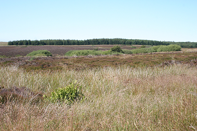
Snub Point is a prominent headland located on the coast of Banffshire, a historic county in northeastern Scotland. Situated on the North Sea, this coastal feature is known for its rugged and dramatic beauty, attracting both locals and tourists alike.

The point juts out into the sea, forming a distinct shape that resembles a snub-nose, hence its name. It is composed of ancient rocks, primarily consisting of sandstone and granite, which have been eroded over time by the powerful waves of the North Sea. This erosion has created steep cliffs that drop into the sea, offering breathtaking views of the surrounding coastline.

Snub Point is home to a diverse range of flora and fauna, including seabirds, such as gulls and fulmars, which nest on the cliffs. The surrounding waters are also teeming with marine life, making it a popular spot for fishing and birdwatching.

The headland offers various recreational opportunities for visitors. Hiking and walking trails traverse the area, providing access to the stunning coastal views and the chance to spot seals, dolphins, and even whales in the distance. The rugged terrain also appeals to rock climbers, who can challenge themselves on the cliffs.

Access to Snub Point is relatively easy, with a parking area nearby and a well-maintained path leading to the headland. However, caution is advised when exploring the area, as the cliffs can be hazardous, especially during stormy weather.

Overall, Snub Point is a captivating coastal feature in Banffshire, offering visitors a chance to experience the untamed beauty of the North Sea and its surrounding landscapes.

If you have any feedback on the listing, please let us know in the comments section below.

Snub Point Images

Images are sourced within 2km of 57.639185/-2.2915399 or Grid Reference NJ8261. Thanks to Geograph Open Source API. All images are credited.

Minor road near Hill of Troup
Minor road near Netherbrae
Derelict farm near Netherbrae
Law Cairn To be precise, the slopes that eventually culminate at Law Cairn. The slope is so gentle that it is not easy to pinpoint a summit.
Law Cairn
To be precise, the slopes that eventually culminate at Law Cairn. The slope is so gentle that it is not easy to pinpoint a summit.
Track to Moss of Kinbeam Peat was widely extracted from the moors here, and consequently there is a network of old tracks which make for excellent walking.
Track to Moss of Kinbeam
Peat was widely extracted from the moors here, and consequently there is a network of old tracks which make for excellent walking.
Long Glen The track to the Moss of Kinbeam runs parallel to the Long Glen, but you don't really see the glen from the track. There is what looks like a gentle dip in the middle distance here, and Long Glen is incised into that dip.
Long Glen
The track to the Moss of Kinbeam runs parallel to the Long Glen, but you don't really see the glen from the track. There is what looks like a gentle dip in the middle distance here, and Long Glen is incised into that dip.
Track from Moss of Kinbeam After the long dry spell we have just enjoyed, it was surprising to find water lying in the track, and quite deep too. Fortunately there was no difficulty in working my way round it, even in sandals that I did not want to get wet.
Track from Moss of Kinbeam
After the long dry spell we have just enjoyed, it was surprising to find water lying in the track, and quite deep too. Fortunately there was no difficulty in working my way round it, even in sandals that I did not want to get wet.
Long Glen It's just about possible to see the break in slope that defines Long Glen, although you can't see right down into the glen. A return visit, with boots and gaiters, on a clear winter day when there are no insects and no ticks, would be the time to take a good look into the glen.
Long Glen
It's just about possible to see the break in slope that defines Long Glen, although you can't see right down into the glen. A return visit, with boots and gaiters, on a clear winter day when there are no insects and no ticks, would be the time to take a good look into the glen.
Derelict cottage to the east of Backhill Croft
Burn through the Den of Muck
Looking sou'west from the Den of Muck
Upland to the nor'west of the Den of Muck
Lane and copse north of the Den of Muck
Eastbound lane on the slopes of Hill of Troup
NATS aerial array on Troup Hill NATS stands for National Air Traffic Services. The aerials range in use from airway reporting beacons to direction finding aids.
NATS aerial array on Troup Hill
NATS stands for National Air Traffic Services. The aerials range in use from airway reporting beacons to direction finding aids.
Copses on the Hill of Troup
National Air Traffic facility on Hill of Troup
Comyn's Den Named on the 1:25,000 map but not on the 1:50,000, this steepening glen is a tributary of the Den of Muck, which in turn is a tributary of the Tore of Troup.
Comyn's Den
Named on the 1:25,000 map but not on the 1:50,000, this steepening glen is a tributary of the Den of Muck, which in turn is a tributary of the Tore of Troup.
Show me another place!

Snub Point is located at Grid Ref: NJ8261 (Lat: 57.639185, Lng: -2.2915399)

Unitary Authority: Aberdeenshire

Police Authority: North East

What 3 Words

///differ.reclined.speaker. Near New Pitsligo, Aberdeenshire

Related Wikis

Netherbrae

Netherbrae is an area of farmland and small crofts in Aberdeenshire, Scotland. It is approximately 8 miles (13 km) north of Turriff and 9 miles (14 km...

Dubford

Dubford is a small village in northern coastal Aberdeenshire, Scotland. Dubford is situated along the B9031 road approximately 6 kilometres (3.7 mi) east...

Gardenstown

Gardenstown (Scots: Gamrie) is a small coastal village, 8.7 miles (14.0 km) by road east of Banff in Aberdeenshire, northeastern Scotland. The village...

Auchmeddan Castle

Auchmeddan Castle was a castle, most likely dating from the 16th century, now demolished, located 9 miles (14 km) west of Fraserburgh, at Mains of Auchmeddan...

Nearby Amenities

Located within 500m of 57.639185,-2.2915399
The data included in this document is from www.openstreetmap.org. The data is made available under ODbL.

Have you been to Snub Point?

Leave your review of Snub Point below (or comments, questions and feedback).