Point of Inganoust

Coastal Feature, Headland, Point in Orkney

Scotland

Point of Inganoust

Coastline, Holland Bay, Stronsay, Orkney Looking along the bay towards Holland Farm.
Coastline, Holland Bay, Stronsay, Orkney Credit: Claire Pegrum

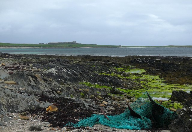
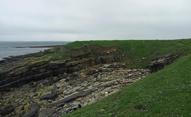
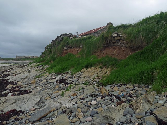
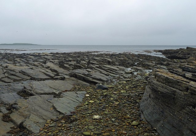
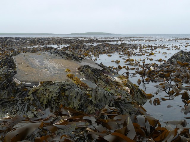
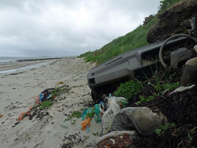
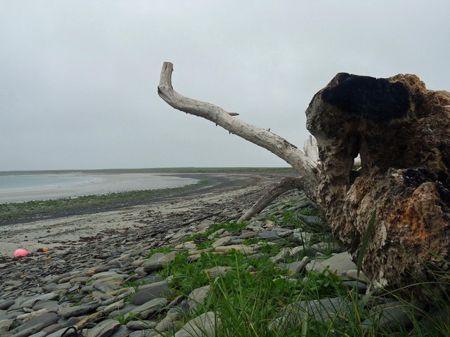
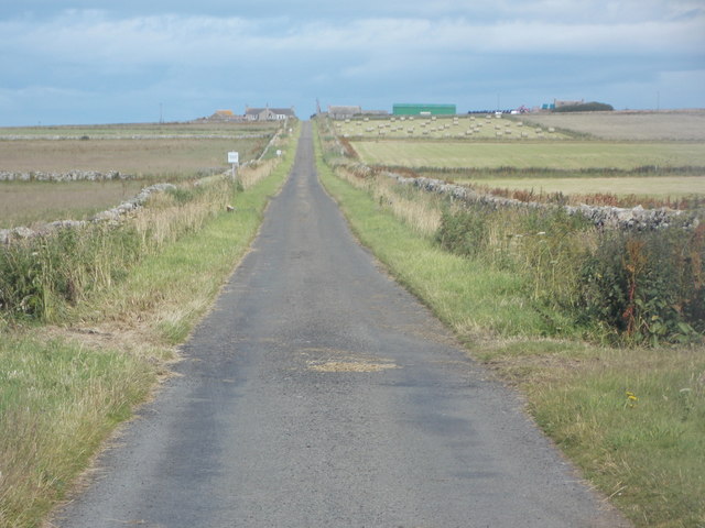
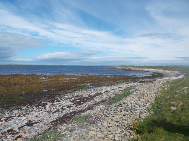
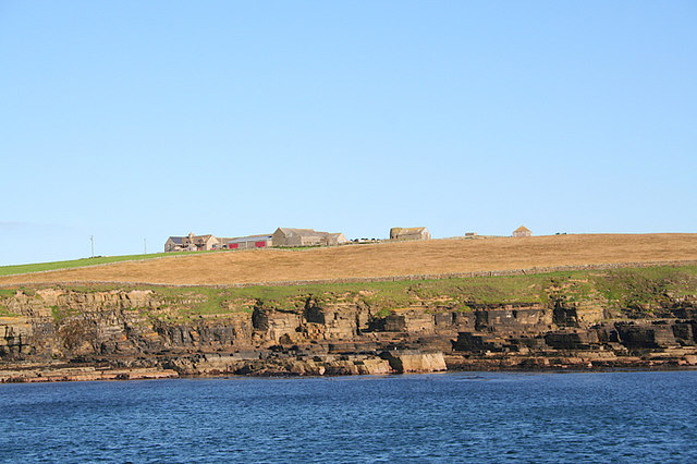
Point of Inganoust is a prominent coastal feature located on the island of Orkney, Scotland. Situated on the northeastern coast of the island, it is a headland that extends out into the North Sea. The point is characterized by steep cliffs that rise dramatically from the sea, offering breathtaking views of the surrounding landscape.

The headland is composed of rugged sandstone, shaped by years of erosion from the relentless waves. Its exposed position makes it susceptible to the strong winds and rough seas that are common in this region. The constant battering of the waves has created caves and sea stacks along the base of the cliffs, adding to the area's natural beauty.

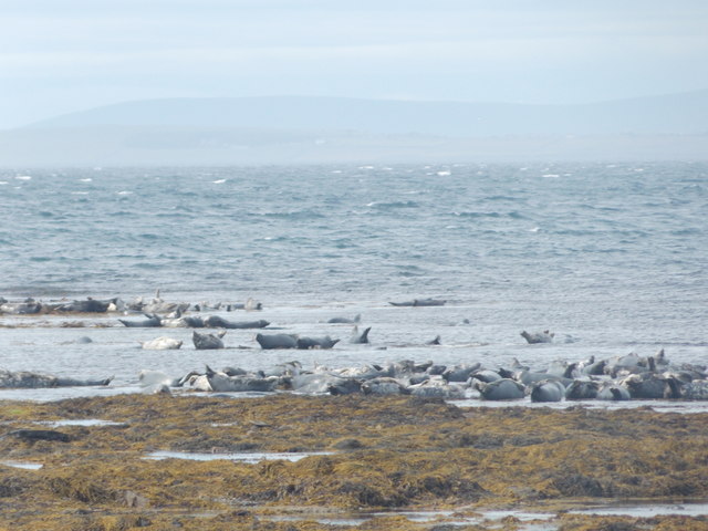
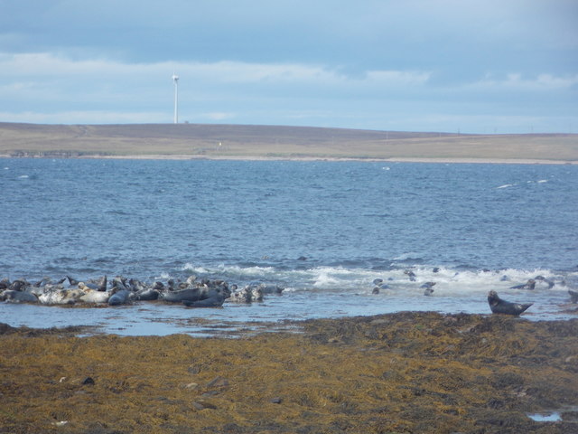
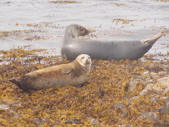
The Point of Inganoust is known for its rich biodiversity. The cliffs provide nesting sites for a variety of seabirds, including puffins, guillemots, and razorbills. Additionally, the surrounding waters are home to a diverse range of marine life, making it a popular spot for diving and wildlife enthusiasts.

Visitors to the area can enjoy scenic walks along the cliff tops, taking in the panoramic views of the North Sea and the surrounding coastline. The Point of Inganoust is also a popular spot for birdwatching, with numerous species to be spotted throughout the year.

Overall, the Point of Inganoust is a captivating coastal feature that showcases the natural beauty and abundant wildlife of Orkney. Its rugged cliffs, stunning views, and diverse ecosystem make it a must-visit destination for nature lovers and outdoor enthusiasts.

If you have any feedback on the listing, please let us know in the comments section below.

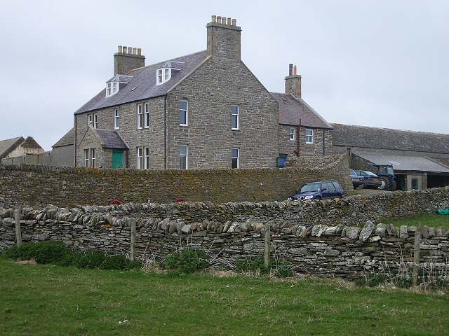
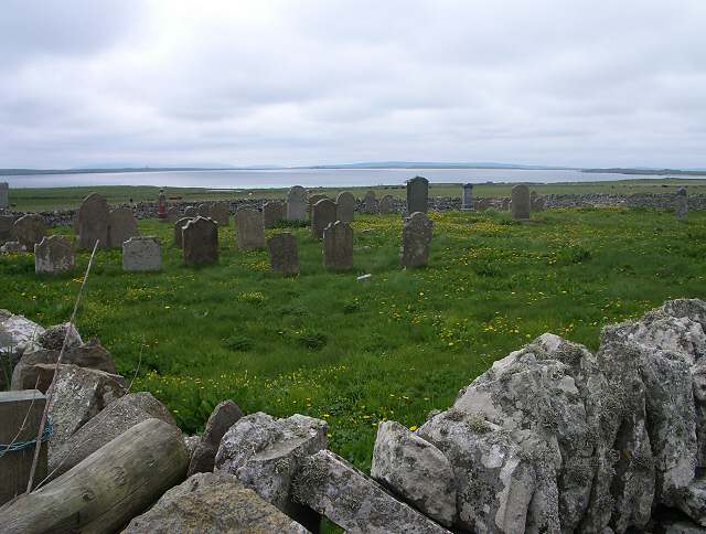
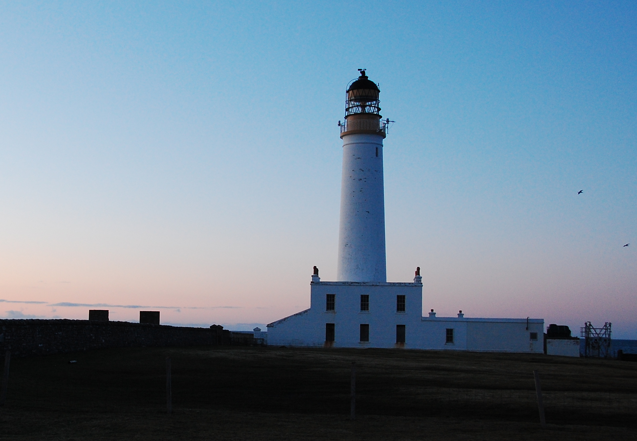
Point of Inganoust Images

Images are sourced within 2km of 59.086095/-2.6016887 or Grid Reference HY6522. Thanks to Geograph Open Source API. All images are credited.

Coastline, Holland Bay, Stronsay, Orkney Looking along the bay towards Holland Farm.
Coastline, Holland Bay, Stronsay, Orkney
Looking along the bay towards Holland Farm.
Grochlie Geo, Stronsay, Orkney Looking towards the Point of Freyageo.
Grochlie Geo, Stronsay, Orkney
Looking towards the Point of Freyageo.
Settlement mound, Lower Dishes, Stronsay, Orkney The drystone masonry exposed by coastal erosion below Lower Dishes farm is considered to be medieval to post-medieval (<span class="nowrap"><a title="http://canmore.rcahms.gov.uk/en/site/3358/details/stronsay+lower+dishes/" rel="nofollow ugc noopener" href="http://canmore.rcahms.gov.uk/en/site/3358/details/stronsay+lower+dishes/">Link</a><img style="margin-left:2px;" alt="External link" title="External link - shift click to open in new window" src="https://s1.geograph.org.uk/img/external.png" width="10" height="10"/></span> ).
Settlement mound, Lower Dishes, Stronsay, Orkney
The drystone masonry exposed by coastal erosion below Lower Dishes farm is considered to be medieval to post-medieval (LinkExternal link ).
Langa Mae, Stronsay, Orkney Looking towards Lamb Head.
Langa Mae, Stronsay, Orkney
Looking towards Lamb Head.
Kelp forest, Langa Mae, Stronsay, Orkney Looking towards Lamb Head.
Kelp forest, Langa Mae, Stronsay, Orkney
Looking towards Lamb Head.
Abandoned car on the beach, Bay of Holland, Stronsay, Orkney Anyone need parts for an Austin Maestro?
Abandoned car on the beach, Bay of Holland, Stronsay, Orkney
Anyone need parts for an Austin Maestro?
Sand of the Crook and ayre, Stronsay, Orkney Behind the ayre (shingle bank) is <a href="https://www.geograph.org.uk/photo/1086440">HY6621 : Lea Shun</a> loch.
Sand of the Crook and ayre, Stronsay, Orkney
Behind the ayre (shingle bank) is HY6621 : Lea Shun loch.
Stronsay: postbox № KW17 50, South School A Victorian postbox set into one of the pillars at the gateway of the old South School, now a private house.
Stronsay: postbox № KW17 50, South School
A Victorian postbox set into one of the pillars at the gateway of the old South School, now a private house.
Stronsay: the road to Holland Actually the road FROM Holland in this view.
Stronsay: the road to Holland
Actually the road FROM Holland in this view.
Stronsay: seals at the Bight of Scarma A particularly large number of seals are to be seen along this part of the Stronsay coast - certainly a couple of hundred as we walked along here this afternoon.
Stronsay: seals at the Bight of Scarma
A particularly large number of seals are to be seen along this part of the Stronsay coast - certainly a couple of hundred as we walked along here this afternoon.
Stronsay: seals making a splash Unsettled by our appearance, a large group of seals is roughly halved in size as the other half scarper underwater.
Stronsay: seals making a splash
Unsettled by our appearance, a large group of seals is roughly halved in size as the other half scarper underwater.
Stronsay: two seals As well as some very large groups of seals (see <a href="https://www.geograph.org.uk/photo/4713951">HY6521 : Stronsay: seals at the Bight of Scarma</a>), there were a few scattered all along the shore here. They were curious enough to turn their heads as I and another walked past, but on the whole didn't feel so threatened as to disappear.
Stronsay: two seals
As well as some very large groups of seals (see HY6521 : Stronsay: seals at the Bight of Scarma), there were a few scattered all along the shore here. They were curious enough to turn their heads as I and another walked past, but on the whole didn't feel so threatened as to disappear.
Stronsay: Bight of Scarma A small bay on the east side of Bay of Holland, seen at a low tide with lots of visible rocks. These are awash with seals - see for example <a href="https://www.geograph.org.uk/photo/4713951">HY6521 : Stronsay: seals at the Bight of Scarma</a>.
Stronsay: Bight of Scarma
A small bay on the east side of Bay of Holland, seen at a low tide with lots of visible rocks. These are awash with seals - see for example HY6521 : Stronsay: seals at the Bight of Scarma.
Stronsay: cemetery at Holland A quite large, square, walled cemetery opposite Holland Farm, with a few sheep grazing within.
Stronsay: cemetery at Holland
A quite large, square, walled cemetery opposite Holland Farm, with a few sheep grazing within.
On Stronsay - Mid House & Scoulters
On Stronsay - View towards Meikle Water from near Eastbank
Holland Farm, Stronsay A substantial stone farm in the south of Stronsay with much of its land managed for wildlife.
Holland Farm, Stronsay
A substantial stone farm in the south of Stronsay with much of its land managed for wildlife.
Cemetery at Holland Farm Looking across the cemetery over the Bay of Holland
Cemetery at Holland Farm
Looking across the cemetery over the Bay of Holland
Show me another place!

Point of Inganoust is located at Grid Ref: HY6522 (Lat: 59.086095, Lng: -2.6016887)

Unitary Authority: Orkney Islands

Police Authority: Highlands and Islands

What 3 Words

///starring.multiply.respected. Near Whitehall, Orkney Islands

Related Wikis

Stronsay

Stronsay () is an island in Orkney, Scotland. It is known as Orkney's 'Island of Bays', owing to an irregular shape with miles of coastline, with three...

Odness

Odness is a peninsula and headland on the island of Stronsay, in Orkney, Scotland. The Odness peninsula contains the farm of Odiness. Odness is also within...

Whitehall, Orkney

Whitehall is the village on the island of Stronsay, in the Orkney Islands of Scotland. It is a small village with about 50 houses. It also has a shop...

Auskerry

Auskerry (Scots: Soond; Old Norse: Austrsker, east skerry) is a small island in eastern Orkney, Scotland. It lies in the North Sea south of Stronsay and...

Linga Holm

Linga Holm, commonly known as Linga, Midgarth and the Holm of Midgarth is an uninhabited Scottish island extending to approximately 57 hectares (0.22...

Linga Sound, Orkney

Linga Sound is the strait between the islands of Linga Holm and Stronsay in the Orkney islands of Scotland. It leads into St. Catherines Bay from the north...

Papa Stronsay

Papa Stronsay (Scots: Papa Stronsee; Old Norse: Papey Minni) is a small island in Orkney, Scotland, lying north east of Stronsay. It is 74 hectares (183...

Sons of the Most Holy Redeemer

The Congregation of the Sons of the Most Holy Redeemer (Latin: Filii Sanctissimi Redemptoris; FSSR), commonly known as the Transalpine Redemptorists or...

Nearby Amenities

Located within 500m of 59.086095,-2.6016887
Entrance: yes
Lat/Long: 59.0852711/-2.5940282
Inganoust aka Inner Noust
Natural: bay
Lat/Long: 59.0876696/-2.6023861
The data included in this document is from www.openstreetmap.org. The data is made available under ODbL.

Have you been to Point of Inganoust?

Leave your review of Point of Inganoust below (or comments, questions and feedback).