Outer Knowe Head

Landscape Feature in Roxburghshire

Scotland

Outer Knowe Head

Forest track to the south-west of Brown Knowe Looking north-eastward.
Forest track to the south-west of Brown Knowe Credit: Peter Wood

Outer Knowe Head is a prominent landscape feature located in Roxburghshire, Scotland. Situated near the village of Ancrum, it is part of the beautiful and diverse countryside of the Scottish Borders region.

This natural landmark is characterized by its distinctive shape and elevation, rising to an impressive height of approximately 320 meters above sea level. Outer Knowe Head is primarily composed of rugged terrain and is known for its steep slopes and rocky outcrops. The landscape is covered with heather, grasses, and scattered shrubs, providing a picturesque view throughout the year.

Visitors to Outer Knowe Head can enjoy breathtaking panoramic views of the surrounding countryside, including the rolling hills, valleys, and meandering rivers. On clear days, it is possible to see as far as the Cheviot Hills and the Eildon Hills. The beauty of the landscape is further enhanced by the presence of ancient stone walls and remnants of old settlements, adding an element of historical significance.

Outdoor enthusiasts are drawn to Outer Knowe Head for its excellent walking and hiking opportunities. There are several well-maintained trails that lead to the summit, offering a challenging yet rewarding experience for those willing to explore. The area is also popular for birdwatching, as it is home to a variety of bird species, including red grouse, skylarks, and peregrine falcons.

Overall, Outer Knowe Head is a striking landscape feature that showcases the natural beauty and rich history of Roxburghshire. Whether for its stunning views, invigorating hikes, or wildlife observation, it is a destination that captivates visitors and provides a memorable experience.

If you have any feedback on the listing, please let us know in the comments section below.

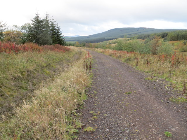
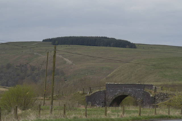
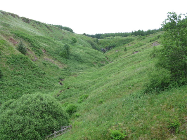
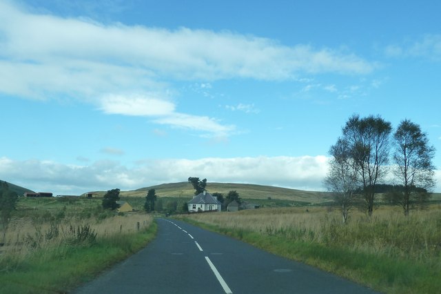
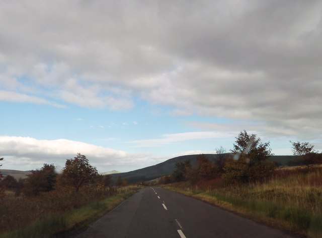
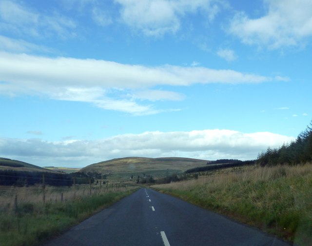
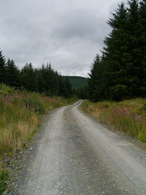
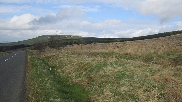
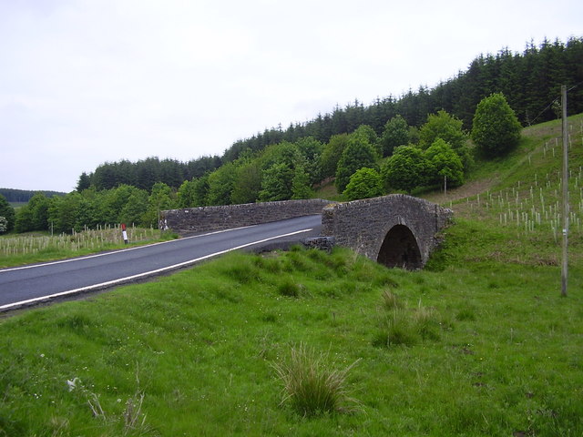
Outer Knowe Head Images

Images are sourced within 2km of 55.315218/-2.7124164 or Grid Reference NT5402. Thanks to Geograph Open Source API. All images are credited.

Forest track to the south-west of Brown Knowe Looking north-eastward.
Forest track to the south-west of Brown Knowe
Looking north-eastward.
A small stone bridge over the B6399 The bridge is on a very tight turn on the B6399.
A small stone bridge over the B6399
The bridge is on a very tight turn on the B6399.
Kiln Sike A small waterfall on the burn can be seen in the distance.
Kiln Sike
A small waterfall on the burn can be seen in the distance.
Wyndburgh Cottage Another lonely dwelling by the B6399.
Wyndburgh Cottage
Another lonely dwelling by the B6399.
B6399 just north of Whitrope Hass
B6399 just north of Roberts Linn
Forestry Access Track A track leading from the nearby B6399 and the trackbed of the former Waverley Route.
Forestry Access Track
A track leading from the nearby B6399 and the trackbed of the former Waverley Route.
Whitrope Hass Near the 363m summit of the pass between Hawick and Newcastleton. The pass is crossed by the narrow B6399 and once had a mainline railway which was inexplicably closed in 1969.
Whitrope Hass
Near the 363m summit of the pass between Hawick and Newcastleton. The pass is crossed by the narrow B6399 and once had a mainline railway which was inexplicably closed in 1969.
Kiln Knowe Replanted conifer forest above Whitrope Hass.
Kiln Knowe
Replanted conifer forest above Whitrope Hass.
Replanted woodland, Whitrope Hass Four years after: <a href="https://www.geograph.org.uk/photo/1252218">NT5301 : Timber harvesting at Whitrope Hass</a>
Note the Tuley tubes - they have gone in for some amenity screening.
Replanted woodland, Whitrope Hass
Four years after: NT5301 : Timber harvesting at Whitrope Hass Note the Tuley tubes - they have gone in for some amenity screening.
Young plantations A second generation of conifers and a view towards Maiden Paps from the road over Whitrope Hass.
Young plantations
A second generation of conifers and a view towards Maiden Paps from the road over Whitrope Hass.
Vast coniferous plantations A view towards Shankend Hill and the trackbed of the Waverley Line. This would have been sheep country for much of the lifetime of the railway.
Vast coniferous plantations
A view towards Shankend Hill and the trackbed of the Waverley Line. This would have been sheep country for much of the lifetime of the railway.
Kiln Sike A round stell, a remnant of the sheep farming days here is visible amongst young trees. This broadleaf woodland has been planted on land left behind when the conifers went in.
Kiln Sike
A round stell, a remnant of the sheep farming days here is visible amongst young trees. This broadleaf woodland has been planted on land left behind when the conifers went in.
Flosh Burn Some fields had survived the initial forest plantings. Now they have been planted with broadleaved trees.
Flosh Burn
Some fields had survived the initial forest plantings. Now they have been planted with broadleaved trees.
Road to Hawick
Road to Hawick
New Plantation at Kiln Knowe
New Plantation at Whitrope Hass
Road to Hawick
Road to Hawick
Show me another place!

Outer Knowe Head is located at Grid Ref: NT5402 (Lat: 55.315218, Lng: -2.7124164)

Unitary Authority: The Scottish Borders

Police Authority: The Lothians and Scottish Borders

What 3 Words

///elaborate.advising.handsets. Near Hawick, Scottish Borders

Related Wikis

Whitrope

Whitrope is a densely forested, but sparsely populated area, high in the Southern Upland hills in the south central Scottish Borders in the former county...
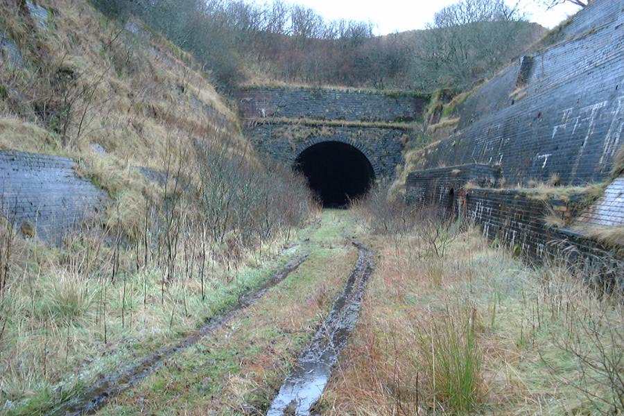
Whitrope Tunnel

The Whitrope Tunnel is a disused railway tunnel in the Scottish Borders, situated 12 miles (19 km) south of Hawick on the Waverley Route, close to Whitrope...

Waverley Route Heritage Association

Waverley Route Heritage Association is a heritage railway group involved with the history, heritage and preservation of the Waverley Route, based/centred...

Whitrope Siding

Whitrope Siding was a trailing short siding or spur off the "up" (southbound) line, an associated trailing cross-over between up and down lines, a pair...

Have you been to Outer Knowe Head?

Leave your review of Outer Knowe Head below (or comments, questions and feedback).