Scale Head

Landscape Feature in Lancashire South Lakeland

England

Scale Head

Path on Latterbarrow This is the path from Claife Heights, leading up the south ridge towards the summit of Latterbarrow.
Path on Latterbarrow Credit: Adrian Taylor

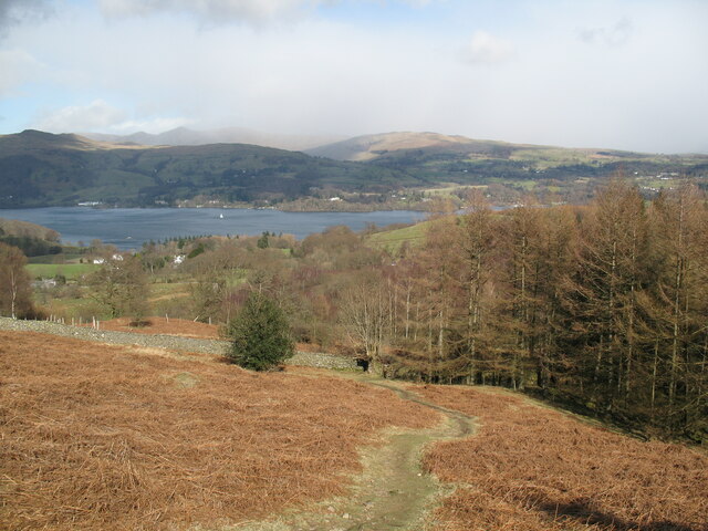
Scale Head is a prominent landscape feature located in the county of Lancashire, England. This geological formation is situated on the eastern side of the Forest of Bowland, a designated Area of Outstanding Natural Beauty. It is positioned approximately 5 miles north of the town of Clitheroe.

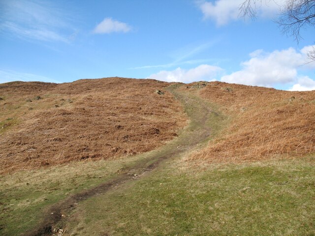
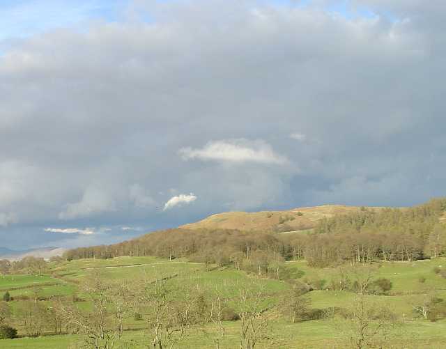
Rising to an elevation of 380 meters (1,250 feet), Scale Head is a notable hill that forms part of the Bowland Fells, a range of hills known for their picturesque beauty and diverse wildlife. The hill is characterized by its steep slopes, which are covered with heather and grass, creating a stunning mosaic of colors during the summer months.

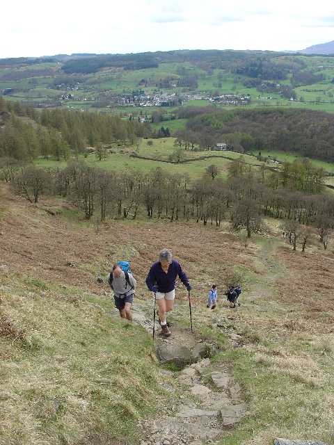
At the summit of Scale Head, visitors can enjoy breathtaking panoramic views of the surrounding countryside, including the Forest of Bowland, the Ribble Valley, and the Yorkshire Dales in the distance. On clear days, it is even possible to catch a glimpse of the iconic Pendle Hill to the south.

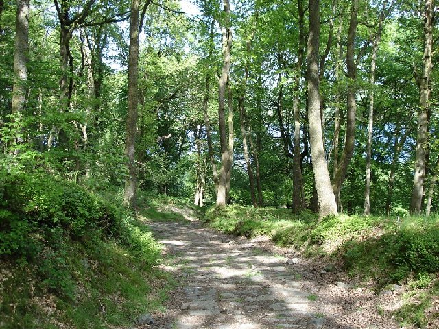
Scale Head is a popular destination for outdoor enthusiasts, offering opportunities for walking, hiking, and photography. The hill is traversed by various footpaths, providing access to its summit and allowing visitors to explore its natural beauty up close. The area is also home to a variety of wildlife, including birds of prey such as kestrels and peregrine falcons, as well as sheep and deer.

Overall, Scale Head is a stunning landscape feature that attracts nature lovers and adventurers alike, providing them with a chance to immerse themselves in the beauty of Lancashire's countryside.

If you have any feedback on the listing, please let us know in the comments section below.

Scale Head Images

Images are sourced within 2km of 54.371641/-2.9624345 or Grid Reference SD3797. Thanks to Geograph Open Source API. All images are credited.

Path on Latterbarrow This is the path from Claife Heights, leading up the south ridge towards the summit of Latterbarrow.
Path on Latterbarrow
This is the path from Claife Heights, leading up the south ridge towards the summit of Latterbarrow.
The Track up to Moss Eccles Tarn A lot of the trees in this area have blown over in, I presume, last year's gales.  Whether this timber is a result of that or has been deliberately 'harvested' from the local woodland, I don't know.
The Track up to Moss Eccles Tarn
A lot of the trees in this area have blown over in, I presume, last year's gales. Whether this timber is a result of that or has been deliberately 'harvested' from the local woodland, I don't know.
Moss Eccles Tarn from the Air Taken from the north from about 100m above ground. A small part of Esthwaite Water can be seen in the top right hand side of the photo.
Moss Eccles Tarn from the Air
Taken from the north from about 100m above ground. A small part of Esthwaite Water can be seen in the top right hand side of the photo.
Wise Een Tarn from the South Taken from about 120m above the ground, this is the view northwards from nearly above Moss Eccles Tarn
Wise Een Tarn from the South
Taken from about 120m above the ground, this is the view northwards from nearly above Moss Eccles Tarn
Path above Waterson Intake The path is the public footpath from Latterbarrow to High Wray.
Windermere is in the middle distance and there is a snow shower over the Kentmere Fells.
Path above Waterson Intake
The path is the public footpath from Latterbarrow to High Wray. Windermere is in the middle distance and there is a snow shower over the Kentmere Fells.
Esthwaite Water Fields alongside Esthwaite Water.
Esthwaite Water
Fields alongside Esthwaite Water.
Esthwaite Water Barn alongside Esthwaite Water.
Esthwaite Water
Barn alongside Esthwaite Water.
Esthwaite Water
Esthwaite Water
Lake Windermere This is a view of Lake Windermere looking in a NE direction. The two islands in the centre of the image are known as the 'Lilies of the Valley'. The island to the right is Belle Island. This image was taken about half way up SD3896 on the edge of the lake.
Lake Windermere
This is a view of Lake Windermere looking in a NE direction. The two islands in the centre of the image are known as the 'Lilies of the Valley'. The island to the right is Belle Island. This image was taken about half way up SD3896 on the edge of the lake.
Claife Heights The trig point on the top of Claife Heights (270m or 886ft above sea level). This is the top of the high ground between Windermere and Hawkshead.
Claife Heights
The trig point on the top of Claife Heights (270m or 886ft above sea level). This is the top of the high ground between Windermere and Hawkshead.
Western Slopes of Latterbarrow, Near Hawkshead, Cumbria This grid square is dominated by the small hill of Latterbarrow. The photo shows a group of walkers ascending Latterbarrow from the west.
In the background, the small town of Hawkshead can be seen.
Western Slopes of Latterbarrow, Near Hawkshead, Cumbria
This grid square is dominated by the small hill of Latterbarrow. The photo shows a group of walkers ascending Latterbarrow from the west. In the background, the small town of Hawkshead can be seen.
Latterbarrow. View from Hawkshead Latterbarrow is a local viewpoint for the village of Hawkshead. Accessible by foot after a short walk, the views from the top are excellent in almost 360 degrees. On a good day the Howgills can be seen.
Latterbarrow. View from Hawkshead
Latterbarrow is a local viewpoint for the village of Hawkshead. Accessible by foot after a short walk, the views from the top are excellent in almost 360 degrees. On a good day the Howgills can be seen.
View over Windermere from Red Nab This photograph was taken from the car-park at the end of the unclassified road that leads down to the west shore of Windermere from High Wray.
View over Windermere from Red Nab
This photograph was taken from the car-park at the end of the unclassified road that leads down to the west shore of Windermere from High Wray.
Woodland to the west of Belle Grange
Moss Eccles Tarn According to a National Trust guide at Hill Top, Beatrix Potter's home in Near Sawrey, this peaceful tarn was one of the author's favourite fishing spots.
Moss Eccles Tarn
According to a National Trust guide at Hill Top, Beatrix Potter's home in Near Sawrey, this peaceful tarn was one of the author's favourite fishing spots.
Wise Een Tarn Wise Een Tarn is on Claife Heights, and from here in clear weather you can see a wonderful panorama from Coniston to the Langdale Fells.
Wise Een Tarn
Wise Een Tarn is on Claife Heights, and from here in clear weather you can see a wonderful panorama from Coniston to the Langdale Fells.
Cruising on Windermere Between Thompson's Holme (L) and the Northern tip of Belle Isle (R)
Cruising on Windermere
Between Thompson's Holme (L) and the Northern tip of Belle Isle (R)
Storm damage
Storm damage
Show me another place!

Scale Head is located at Grid Ref: SD3797 (Lat: 54.371641, Lng: -2.9624345)

Administrative County: Cumbria

District: South Lakeland

Police Authority: Cumbria

What 3 Words

///shoppers.coping.skippers. Near Windermere, Cumbria

Related Wikis

Claife

Claife is a civil parish in the South Lakeland district of Cumbria, England. It is situated west of Windermere, and east of Esthwaite Water and the village...

Claife Heights

Claife Heights is an upland area in the Lake District, near to Windermere in Cumbria, England. It has a topographic prominence of 177 metres (581 ft) so...

Moss Eccles Tarn

Moss Eccles Tarn is a tarn on Claife Heights, near Near Sawrey in the Lake District, Cumbria. It is currently owned by the National Trust and known as...

Latterbarrow

Latterbarrow is a hill in the English Lake District, east of Hawkshead, Cumbria. It is the subject of a chapter of Wainwright's book The Outlying Fells...

Nearby Amenities

Located within 500m of 54.371641,-2.9624345
Three Dubs Crags
Is In Country Code: GB
Is In County: Cumbria
Is In National Park: Lake District National Park
Place: locality
Source: npe
Lat/Long: 54.3698379/-2.959001
Scale Head
Ele: 253
Natural: peak
Lat/Long: 54.3714124/-2.9621195
Seavy Mire Hill
Ele: 220
Natural: peak
Lat/Long: 54.3672501/-2.9616384
Ustick Moss Intake
Place: locality
Lat/Long: 54.3688394/-2.961548
Highs
Place: locality
Lat/Long: 54.3737905/-2.9669261
The data included in this document is from www.openstreetmap.org. The data is made available under ODbL.

Have you been to Scale Head?

Leave your review of Scale Head below (or comments, questions and feedback).