Hopeward Point

Coastal Feature, Headland, Point in Fife

Scotland

Hopeward Point

Footpath to Forth Reach The footpath from the main road, Harbour Drive, to Forth Reach.
Footpath to Forth Reach Credit: Sandy Gemmill

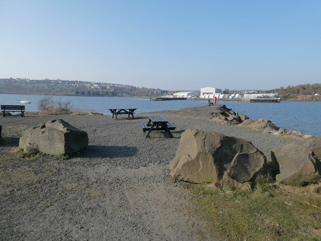
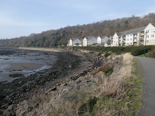
Hopeward Point is a prominent coastal feature located in Fife, Scotland. It is classified as a headland, also referred to as a point, due to its protrusion into the North Sea. The point sits at the easternmost end of the popular coastal town of Anstruther, offering breathtaking views of the surrounding landscape.

The headland is characterized by its rugged cliffs and rocky shoreline, which have been formed by years of coastal erosion. These cliffs provide a nesting site for various seabirds, including kittiwakes and fulmars, making it a haven for birdwatchers and nature enthusiasts. The crashing waves against the cliffs add a dramatic touch to the already picturesque scenery.

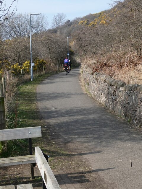
Visitors to Hopeward Point can enjoy a leisurely stroll along the coastal path that follows the edge of the headland. The path offers panoramic vistas of the North Sea, with views extending towards the Isle of May and the Bass Rock. On clear days, it is even possible to catch a glimpse of the East Lothian coastline across the water.

The headland is also home to a small beach known as Hopeward Sands, which is a popular spot for picnics and sunbathing during the summer months. However, caution is advised when swimming due to strong currents and a lack of lifeguard supervision.

Overall, Hopeward Point is a natural gem in Fife, offering a blend of rugged beauty, stunning views, and a diverse range of wildlife. Whether it's for a scenic walk, birdwatching, or simply appreciating the splendor of Scotland's coastline, Hopeward Point is a must-visit destination for nature enthusiasts and tourists alike.

If you have any feedback on the listing, please let us know in the comments section below.

Hopeward Point Images

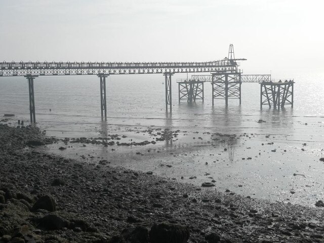
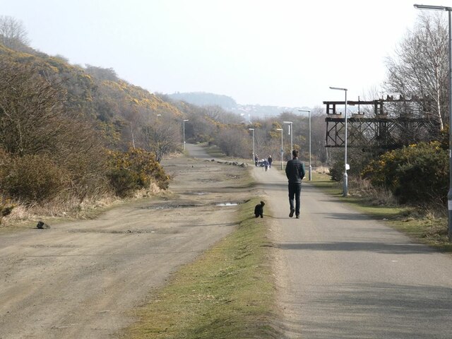
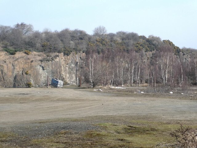
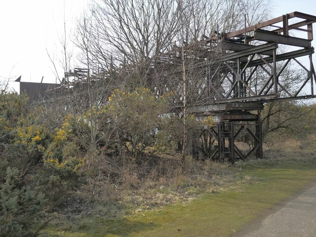
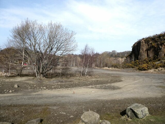
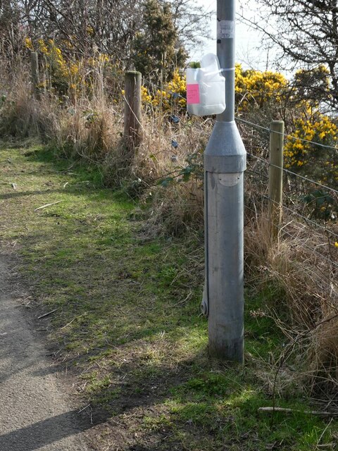
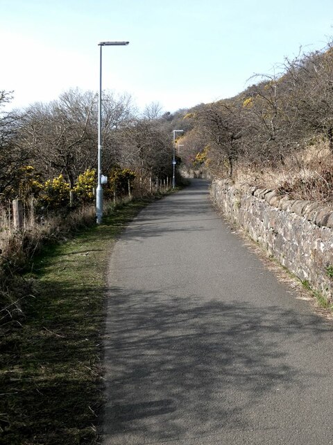
Images are sourced within 2km of 56.026291/-3.3633748 or Grid Reference NT1582. Thanks to Geograph Open Source API. All images are credited.

Footpath to Forth Reach The footpath from the main road, Harbour Drive, to Forth Reach.
Footpath to Forth Reach
The footpath from the main road, Harbour Drive, to Forth Reach.
Spinnaker Way and The Moorings junction The view of the junction with Spinnaker Way as seen from the Moorings.
Spinnaker Way and The Moorings junction
The view of the junction with Spinnaker Way as seen from the Moorings.
Junction between Link Road and Forth Reach The view of the junction with Link Road as seen from Forth Reach.
Junction between Link Road and Forth Reach
The view of the junction with Link Road as seen from Forth Reach.
A921 east of Inverkeithing
Concrete blocks in waiting It is not clear whether these are part of the business of the now-closed Cruicks Quarry nearby.
Concrete blocks in waiting
It is not clear whether these are part of the business of the now-closed Cruicks Quarry nearby.
Picnic  site at West Ness On the far side of the bay is the yard of Forth Bridge Stevedoring <a href="https://www.geograph.org.uk/gridref/NT1382">NT1382</a>.
Picnic site at West Ness
On the far side of the bay is the yard of Forth Bridge Stevedoring NT1382.
The Keithing Burn Looking upstream
The Keithing Burn
Looking upstream
Wall by the Prestonhill Quarry Beside the Fife Coastal Path.
Wall by the Prestonhill Quarry
Beside the Fife Coastal Path.
Derelict pier on Inner Inverkeithing Bay
Fife Coastal Path near Inverkeithing The old Prestonhill Quarry to the left, part of a derelict pier to the right (see <a href="https://www.geograph.org.uk/photo/7126350">NT1382 : Derelict pier on Inner Inverkeithing Bay</a>).
Fife Coastal Path near Inverkeithing
The old Prestonhill Quarry to the left, part of a derelict pier to the right (see NT1382 : Derelict pier on Inner Inverkeithing Bay).
Prestonhill Quarry The Prestonhill Quarry extracted dolerite over the period 1890 to 1980 (approximately) before being abandoned. The derelict site includes a large lake. There are proposals to redevelop the site with the construction of 180 houses, a cafe, a park and community facilities.
Prestonhill Quarry
The Prestonhill Quarry extracted dolerite over the period 1890 to 1980 (approximately) before being abandoned. The derelict site includes a large lake. There are proposals to redevelop the site with the construction of 180 houses, a cafe, a park and community facilities.
Derelict pier on Inner Inverkeithing Bay The landward end of the pier seen in <a href="https://www.geograph.org.uk/photo/7126350">NT1382 : Derelict pier on Inner Inverkeithing Bay</a>.
Derelict pier on Inner Inverkeithing Bay
The landward end of the pier seen in NT1382 : Derelict pier on Inner Inverkeithing Bay.
Prestonhill Quarry The Prestonhill Quarry extracted dolerite over the period 1890 to 1980 (approximately) before being abandoned. The derelict site includes a large lake. There are proposals to redevelop the site with the construction of 180 houses, a cafe, a park and community facilities.
Prestonhill Quarry
The Prestonhill Quarry extracted dolerite over the period 1890 to 1980 (approximately) before being abandoned. The derelict site includes a large lake. There are proposals to redevelop the site with the construction of 180 houses, a cafe, a park and community facilities.
Improvised dog waste bin Some public-spirited soul has installed a number of these in the neighbourhood, fashioned out of old plastic bottles.
Improvised dog waste bin
Some public-spirited soul has installed a number of these in the neighbourhood, fashioned out of old plastic bottles.
Fife Coastal Path near Preston Hill At this point, the Fife Coastal Path doubles up as part of National Cycle Network route 76.
Fife Coastal Path near Preston Hill
At this point, the Fife Coastal Path doubles up as part of National Cycle Network route 76.
Cyclists on the Fife Coastal Path Over this section just west of St David's Bay, the Fife Coastal Path doubles up as part of National Cycle Network, route 76. Note the dog waste bin strapped to the near lamppost (see <a href="https://www.geograph.org.uk/photo/7126370">NT1382 : Improvised dog waste bin</a>).
Cyclists on the Fife Coastal Path
Over this section just west of St David's Bay, the Fife Coastal Path doubles up as part of National Cycle Network, route 76. Note the dog waste bin strapped to the near lamppost (see NT1382 : Improvised dog waste bin).
Waterfront apartment blocks at St David's Harbour By the Fife Coastal Path (and National Cycle Network route 76).
Waterfront apartment blocks at St David's Harbour
By the Fife Coastal Path (and National Cycle Network route 76).
The Moorings, St David's Harbour Central green area by St David's Harbour ringed by apartment blocks. By the Fife Coastal Path (and National Cycle Network route 76)
The Moorings, St David's Harbour
Central green area by St David's Harbour ringed by apartment blocks. By the Fife Coastal Path (and National Cycle Network route 76)
Show me another place!

Hopeward Point is located at Grid Ref: NT1582 (Lat: 56.026291, Lng: -3.3633748)

Unitary Authority: Fife

Police Authority: Fife

What 3 Words

///gearing.panic.racetrack. Near Dalgety Bay, Fife

Related Wikis

Donibristle

Donibristle (Scots: also Dunibirsle) was a house and estate in Fife, Scotland, on the coast of the Firth of Forth. Only the wings of the house remain,...

Hillend, Fife

Hillend is a small village in Fife, Scotland. It is located roughly to the north-west of Dalgety Bay. It is the location of Heil's manufacturing facilities...

Inverkeithing High School

Inverkeithing High School is a secondary school located in Inverkeithing, a historic town on Fife's southern coast 3.5 miles away from Dunfermline's city...

Dalgety Bay railway station

Dalgety Bay railway station serves the town of Dalgety Bay in Fife, Scotland. Lying on the Fife Circle and EdinburghーDundee lines, it is managed by ScotRail...

Nearby Amenities

Located within 500m of 56.026291,-3.3633748
Bus Stop
Rosebery View
Bench: no
Bin: yes
Bus: yes
Lit: yes
Naptan AtcoCode: 6500D0730
Naptan Bearing: S
Naptan CommonName: Rosebery View
Naptan Indicator: opp
Naptan Landmark: Rosebery View
Naptan NaptanCode: 34323293
Naptan Street: Moray Way
Public Transport: platform
Ref: 34323293
Shelter: no
Source: naptan;bing
Tactile Paving: no
Lat/Long: 56.030378/-3.3644582
Bus Stop
The Bridges
Bench: no
Bin: yes
Bus: yes
Lit: yes
Naptan AtcoCode: 6500D0174
Naptan Bearing: E
Naptan CommonName: The Bridges
Naptan Indicator: opp
Naptan Landmark: The Bridges
Naptan NaptanCode: 34323262
Naptan Street: Moray Way
Public Transport: platform
Ref: 34323262
Shelter: no
Source: naptan;bing
Tactile Paving: no
Lat/Long: 56.0287/-3.3614555
Bus Stop
The Bridges
Bench: no
Bin: no
Bus: yes
Lit: yes
Naptan AtcoCode: 6500D0929
Naptan Bearing: W
Naptan CommonName: The Bridges
Naptan Indicator: adj
Naptan Landmark: The Bridges
Naptan NaptanCode: 34323263
Naptan Street: Moray Way
Public Transport: platform
Ref: 34323263
Shelter: yes
Source: naptan;bing
Tactile Paving: no
Lat/Long: 56.0286269/-3.3615588
Crossing
Crossing: unmarked
Crossing Island: no
Tactile Paving: no
Lat/Long: 56.0289092/-3.3605367
Crossing: informal
Lat/Long: 56.0303709/-3.3645397
Created By: Merkaartor 0.10
Lat/Long: 56.029342/-3.3611251
Created By: Merkaartor 0.10
Lat/Long: 56.0293967/-3.3610934
Created By: Merkaartor 0.10
Lat/Long: 56.0294358/-3.3610243
Created By: Merkaartor 0.10
Lat/Long: 56.0294369/-3.3609446
Created By: Merkaartor 0.10
Lat/Long: 56.029424/-3.3608524
Created By: Merkaartor 0.10
Lat/Long: 56.029453/-3.3607708
Crossing: informal
Lat/Long: 56.0303519/-3.3606517
Created By: Merkaartor 0.10
Lat/Long: 56.0294352/-3.3608536
Created By: Merkaartor 0.10
Lat/Long: 56.0294508/-3.3609719
Created By: Merkaartor 0.10
Lat/Long: 56.029475/-3.3609675
Created By: Merkaartor 0.10
Lat/Long: 56.0294968/-3.360941
Created By: Merkaartor 0.10
Lat/Long: 56.0295288/-3.36093
Created By: Merkaartor 0.10
Lat/Long: 56.0295567/-3.3608991
Created By: Merkaartor 0.10
Lat/Long: 56.0295797/-3.3608595
Created By: Merkaartor 0.10
Lat/Long: 56.0296039/-3.3608
Created By: Merkaartor 0.10
Lat/Long: 56.0295612/-3.3607022
Created By: Merkaartor 0.10
Lat/Long: 56.0295267/-3.3607191
Created By: Merkaartor 0.10
Lat/Long: 56.0294992/-3.3607434
Created By: Merkaartor 0.10
Lat/Long: 56.0294742/-3.360775
Created By: Merkaartor 0.10
Lat/Long: 56.0294508/-3.3608095
Crossing: informal
Lat/Long: 56.0295369/-3.3657066
Created By: Merkaartor 0.10
Lat/Long: 56.0283703/-3.3670843
Created By: Merkaartor 0.10
Lat/Long: 56.0284597/-3.3670984
Created By: Merkaartor 0.10
Lat/Long: 56.0286189/-3.3671206
Created By: Merkaartor 0.10
Lat/Long: 56.0287325/-3.3672303
Created By: Merkaartor 0.10
Lat/Long: 56.028895/-3.3674086
Created By: Merkaartor 0.10
Lat/Long: 56.0290187/-3.3675213
Created By: Merkaartor 0.10
Lat/Long: 56.0291458/-3.3676683
Created By: Merkaartor 0.10
Lat/Long: 56.0292291/-3.3677714
Created By: Merkaartor 0.10
Lat/Long: 56.0293325/-3.3678881
Created By: Merkaartor 0.10
Lat/Long: 56.02941/-3.3679334
Created By: Merkaartor 0.10
Lat/Long: 56.0294995/-3.3679991
Created By: Merkaartor 0.10
Lat/Long: 56.0295672/-3.3680149
Created By: Merkaartor 0.10
Lat/Long: 56.0296605/-3.368024
Created By: Merkaartor 0.10
Lat/Long: 56.0297444/-3.3680251
Created By: Merkaartor 0.10
Lat/Long: 56.0298367/-3.3680302
Crossing
Crossing: unmarked
Crossing Island: no
Tactile Paving: no
Lat/Long: 56.0275593/-3.3652316
Created By: Merkaartor 0.10
Lat/Long: 56.0294689/-3.3675279
Created By: Merkaartor 0.10
Lat/Long: 56.0294527/-3.3677133
Crossing: informal
Lat/Long: 56.0286266/-3.3632649
Crossing: informal
Lat/Long: 56.0288233/-3.3645238
Crossing
Crossing: unmarked
Crossing Island: no
Crossing Markings: no
Tactile Paving: no
Traffic Calming: hump
Lat/Long: 56.0267761/-3.3639128
Crossing: informal
Lat/Long: 56.0291677/-3.3641591
Barrier: cycle_barrier
Cycle Barrier: double
Cycle Barrier Installation: fixed
Lat/Long: 56.0287267/-3.3660986
Crossing
Crossing: unmarked
Crossing Island: no
Tactile Paving: no
Lat/Long: 56.0271218/-3.3596594
Crossing: informal
Lat/Long: 56.0279611/-3.3589788
Crossing
Crossing: unmarked
Crossing Island: no
Tactile Paving: no
Lat/Long: 56.0280797/-3.3595514
Crossing
Crossing: unmarked
Crossing Island: no
Crossing Markings: no
Tactile Paving: no
Lat/Long: 56.0277167/-3.3683439
Crossing
Crossing: unmarked
Crossing Island: no
Crossing Markings: no
Tactile Paving: no
Lat/Long: 56.0291379/-3.3693648
Hopeward Point
Place: locality
Lat/Long: 56.0257637/-3.3632022
Check Date: 2023-06-08
Information: map
Map Type: hiking
Operator: Fife Coast and Countryside Trust
Tourism: information
Lat/Long: 56.0277939/-3.3670235
Bench
Backrest: yes
Material: wood
Lat/Long: 56.026738/-3.3580784
Board Type: sight
Check Date: 2022-10-26
Information: board
Tourism: information
Lat/Long: 56.0267949/-3.3579249
Direction: 210-255
Tourism: viewpoint
Lat/Long: 56.0267032/-3.3581163
Addr Housenumber: 22
Addr Street: The Bridges
Lat/Long: 56.0291287/-3.3638675
Addr Housenumber: 10
Addr Street: Ross Avenue
Lat/Long: 56.028564/-3.3577419
Barrier: cycle_barrier
Bicycle: yes
Colour: green
Cycle Barrier: double
Cycle Barrier Installation: fixed
Foot: yes
Lat/Long: 56.0269891/-3.3594546
Crossing
Crossing: unmarked
Crossing Island: no
Tactile Paving: no
Lat/Long: 56.0289302/-3.35718
Crossing
Crossing: unmarked
Crossing Island: no
Tactile Paving: no
Lat/Long: 56.0287003/-3.3619852
Crossing
Crossing: unmarked
Crossing Island: no
Tactile Paving: no
Lat/Long: 56.0292783/-3.3631287
Crossing
Crossing: unmarked
Crossing Island: no
Tactile Paving: no
Lat/Long: 56.0286325/-3.3588064
Crossing
Crossing: unmarked
Crossing Island: no
Crossing Markings: no
Tactile Paving: no
Lat/Long: 56.0306708/-3.3648129
Artwork Type: sculpture
Tourism: artwork
Lat/Long: 56.0281993/-3.3697737
Board Type: nature
Information: board
Tourism: information
Lat/Long: 56.027336/-3.3591371
Crossing
Crossing: unmarked
Crossing Island: no
Tactile Paving: no
Lat/Long: 56.0269826/-3.3639217
Crossing
Crossing: unmarked
Crossing Island: no
Tactile Paving: no
Lat/Long: 56.0278805/-3.3689756
Crossing
Crossing: unmarked
Crossing Island: no
Tactile Paving: no
Traffic Calming: table
Lat/Long: 56.0292896/-3.3688891
Barrier: kerb
Kerb: lowered
Tactile Paving: no
Lat/Long: 56.0290638/-3.3692823
Barrier: kerb
Kerb: lowered
Tactile Paving: no
Lat/Long: 56.0290638/-3.3691704
Barrier: kerb
Kerb: lowered
Tactile Paving: no
Lat/Long: 56.0291705/-3.3691147
Barrier: kerb
Kerb: lowered
Tactile Paving: no
Lat/Long: 56.0291878/-3.3692166
Crossing
Crossing: unmarked
Crossing Island: no
Crossing Markings: no
Tactile Paving: no
Lat/Long: 56.0291794/-3.3691668
Crossing
Crossing: unmarked
Crossing Island: no
Crossing Markings: no
Tactile Paving: no
Lat/Long: 56.0290638/-3.3692255
Barrier: kerb
Kerb: flush
Tactile Paving: no
Lat/Long: 56.0278795/-3.3681861
Barrier: kerb
Kerb: flush
Tactile Paving: no
Lat/Long: 56.0279227/-3.3682124
Crossing
Crossing: unmarked
Crossing Island: no
Crossing Markings: no
Tactile Paving: no
Lat/Long: 56.0278994/-3.3681982
Barrier: kerb
Kerb: lowered
Tactile Paving: no
Lat/Long: 56.0286589/-3.3688431
Barrier: kerb
Kerb: lowered
Tactile Paving: no
Lat/Long: 56.0287487/-3.368933
Crossing
Crossing: unmarked
Crossing Island: no
Crossing Markings: no
Tactile Paving: no
Lat/Long: 56.0287066/-3.3688909
Barrier: kerb
Kerb: lowered
Tactile Paving: no
Lat/Long: 56.0291585/-3.3693537
Barrier: kerb
Kerb: lowered
Tactile Paving: no
Lat/Long: 56.0291147/-3.3693774
Barrier: kerb
Kerb: raised
Tactile Paving: no
Lat/Long: 56.0307811/-3.3635458
Barrier: kerb
Kerb: raised
Tactile Paving: no
Lat/Long: 56.0307415/-3.363749
Barrier: kerb
Kerb: raised
Tactile Paving: no
Lat/Long: 56.0307598/-3.3638297
Crossing
Crossing: unmarked
Crossing Island: no
Crossing Markings: no
Tactile Paving: no
Lat/Long: 56.0307499/-3.363786
Barrier: kerb
Kerb: raised
Tactile Paving: no
Lat/Long: 56.0304375/-3.3664463
Crossing
Crossing: unmarked
Crossing Island: no
Crossing Markings: no
Tactile Paving: no
Lat/Long: 56.0304318/-3.3665121
Barrier: kerb
Kerb: lowered
Tactile Paving: no
Lat/Long: 56.0305258/-3.3660889
Barrier: kerb
Kerb: raised
Tactile Paving: no
Lat/Long: 56.0300542/-3.3662826
Barrier: kerb
Kerb: raised
Tactile Paving: no
Lat/Long: 56.0300488/-3.3663688
Crossing
Crossing: unmarked
Crossing Island: no
Crossing Markings: no
Tactile Paving: no
Lat/Long: 56.0300508/-3.3663368
Barrier: kerb
Kerb: lowered
Tactile Paving: no
Lat/Long: 56.0306346/-3.3647996
Barrier: kerb
Kerb: lowered
Tactile Paving: no
Lat/Long: 56.0298901/-3.3671394
Barrier: kerb
Kerb: lowered
Tactile Paving: no
Lat/Long: 56.0298725/-3.3672103
Crossing
Crossing: unmarked
Crossing Island: no
Crossing Markings: no
Tactile Paving: no
Lat/Long: 56.0298813/-3.367175
Crossing
Crossing: unmarked
Crossing Island: no
Crossing Markings: no
Tactile Paving: no
Lat/Long: 56.0301038/-3.3673046
Barrier: kerb
Kerb: lowered
Tactile Paving: no
Lat/Long: 56.0301101/-3.3672618
Barrier: kerb
Kerb: raised
Tactile Paving: no
Lat/Long: 56.0300981/-3.367344
Waste Basket
Waste: trash
Lat/Long: 56.0277794/-3.3669816
Waste Basket
Waste: dog_excrement
Lat/Long: 56.0277981/-3.3667697
Barrier: kerb
Kerb: raised
Tactile Paving: no
Lat/Long: 56.0295724/-3.3669139
Barrier: kerb
Kerb: lowered
Tactile Paving: no
Lat/Long: 56.0298442/-3.3660831
Barrier: kerb
Kerb: raised
Tactile Paving: no
Lat/Long: 56.0282479/-3.3643499
Barrier: kerb
Kerb: lowered
Tactile Paving: no
Lat/Long: 56.028881/-3.3639813
Barrier: kerb
Kerb: raised
Tactile Paving: no
Lat/Long: 56.028892/-3.3641613
Barrier: kerb
Kerb: lowered
Tactile Paving: no
Lat/Long: 56.0292469/-3.3630572
Barrier: kerb
Kerb: lowered
Tactile Paving: no
Lat/Long: 56.0293185/-3.3631992
Barrier: kerb
Kerb: raised
Tactile Paving: no
Lat/Long: 56.0275559/-3.365175
Barrier: kerb
Kerb: flush
Tactile Paving: no
Lat/Long: 56.0275627/-3.3652912
Crossing
Crossing: unmarked
Crossing Island: no
Tactile Paving: no
Lat/Long: 56.0268998/-3.3640529
Barrier: kerb
Kerb: raised
Tactile Paving: no
Lat/Long: 56.0268521/-3.3639683
Barrier: kerb
Kerb: raised
Tactile Paving: no
Lat/Long: 56.0269561/-3.3641527
Barrier: kerb
Kerb: raised
Tactile Paving: no
Lat/Long: 56.0267561/-3.3639394
Barrier: kerb
Kerb: lowered
Tactile Paving: no
Lat/Long: 56.0267963/-3.3638862
Barrier: kerb
Kerb: lowered
Tactile Paving: no
Lat/Long: 56.0269645/-3.3638906
Barrier: kerb
Kerb: lowered
Tactile Paving: no
Lat/Long: 56.0270022/-3.3639554
Barrier: kerb
Kerb: raised
Tactile Paving: no
Lat/Long: 56.0287609/-3.3646765
Barrier: kerb
Kerb: lowered
Tactile Paving: no
Lat/Long: 56.0286904/-3.3649066
Crossing
Crossing: unmarked
Crossing Island: no
Tactile Paving: no
Lat/Long: 56.0287256/-3.3647917
Barrier: kerb
Kerb: raised
Tactile Paving: no
Lat/Long: 56.028458/-3.3654482
Barrier: kerb
Kerb: raised
Tactile Paving: no
Lat/Long: 56.0283573/-3.3655178
Barrier: kerb
Kerb: raised
Tactile Paving: no
Lat/Long: 56.0287192/-3.3661299
Barrier: kerb
Kerb: raised
Tactile Paving: no
Lat/Long: 56.0286976/-3.3662214
Barrier: kerb
Kerb: raised
Tactile Paving: no
Lat/Long: 56.0295279/-3.3656597
Barrier: kerb
Kerb: lowered
Tactile Paving: no
Lat/Long: 56.0295443/-3.3657457
Barrier: kerb
Kerb: raised
Tactile Paving: no
Lat/Long: 56.0291851/-3.3641238
Barrier: kerb
Kerb: lowered
Tactile Paving: no
Lat/Long: 56.0291515/-3.3641937
Barrier: kerb
Kerb: lowered
Tactile Paving: no
Lat/Long: 56.0288006/-3.3645165
Barrier: kerb
Kerb: raised
Tactile Paving: no
Lat/Long: 56.0288496/-3.3645326
Barrier: kerb
Kerb: raised
Tactile Paving: no
Lat/Long: 56.0286511/-3.3632348
Barrier: kerb
Kerb: raised
Tactile Paving: no
Lat/Long: 56.0286055/-3.3632909
Barrier: kerb
Kerb: lowered
Tactile Paving: no
Lat/Long: 56.028682/-3.361913
Barrier: kerb
Kerb: lowered
Tactile Paving: no
Lat/Long: 56.0287258/-3.3620796
Crossing
Crossing: unmarked
Crossing Island: no
Tactile Paving: no
Lat/Long: 56.0284049/-3.3654849
Crossing
Crossing: unmarked
Crossing Island: no
Tactile Paving: no
Lat/Long: 56.0287076/-3.3661791
Crossing
Crossing: unmarked
Crossing Island: no
Tactile Paving: no
Lat/Long: 56.0288871/-3.3640712
Barrier: kerb
Kerb: lowered
Tactile Paving: no
Lat/Long: 56.0286449/-3.358724
Barrier: kerb
Kerb: lowered
Tactile Paving: no
Lat/Long: 56.0286233/-3.3588946
Barrier: kerb
Kerb: lowered
Tactile Paving: no
Lat/Long: 56.0289683/-3.3570946
Barrier: kerb
Kerb: lowered
Tactile Paving: no
Lat/Long: 56.0289067/-3.3572384
Crossing
Crossing: unmarked
Crossing Island: no
Tactile Paving: no
Lat/Long: 56.0287218/-3.3566984
Barrier: kerb
Kerb: raised
Tactile Paving: no
Lat/Long: 56.0276834/-3.3557484
Crossing
Crossing: unmarked
Crossing Island: no
Crossing Markings: no
Tactile Paving: no
Traffic Calming: hump
Lat/Long: 56.0271606/-3.3610195
Crossing
Crossing: unmarked
Crossing Island: no
Tactile Paving: no
Lat/Long: 56.0273047/-3.3608247
Barrier: kerb
Kerb: lowered
Tactile Paving: no
Lat/Long: 56.0273052/-3.3607931
Barrier: kerb
Kerb: lowered
Tactile Paving: no
Lat/Long: 56.0273041/-3.3608629
Barrier: kerb
Kerb: raised
Tactile Paving: no
Lat/Long: 56.0271409/-3.3610132
Barrier: kerb
Kerb: lowered
Tactile Paving: no
Lat/Long: 56.0271832/-3.3610268
Barrier: kerb
Kerb: lowered
Tactile Paving: no
Lat/Long: 56.0271472/-3.3596811
Barrier: kerb
Kerb: lowered
Tactile Paving: no
Lat/Long: 56.0271009/-3.3596406
Barrier: kerb
Kerb: lowered
Tactile Paving: no
Lat/Long: 56.0281746/-3.3591786
Barrier: kerb
Kerb: raised
Tactile Paving: no
Lat/Long: 56.02799/-3.3589632
Barrier: kerb
Kerb: raised
Tactile Paving: no
Lat/Long: 56.0279374/-3.3589908
Barrier: kerb
Kerb: raised
Tactile Paving: no
Lat/Long: 56.0281055/-3.3595482
Barrier: kerb
Kerb: lowered
Tactile Paving: no
Lat/Long: 56.0280568/-3.3595542
Crossing
Crossing: unmarked
Crossing Island: no
Tactile Paving: no
Lat/Long: 56.0279423/-3.3585057
Crossing
Crossing: unmarked
Crossing Island: no
Tactile Paving: no
Lat/Long: 56.0280824/-3.3574198
Barrier: kerb
Kerb: lowered
Tactile Paving: no
Lat/Long: 56.0280946/-3.3573801
Barrier: kerb
Kerb: lowered
Tactile Paving: no
Lat/Long: 56.0280702/-3.3574595
Barrier: kerb
Kerb: raised
Tactile Paving: no
Lat/Long: 56.0283767/-3.3563319
Barrier: kerb
Kerb: raised
Tactile Paving: no
Lat/Long: 56.0284557/-3.3564722
Crossing
Crossing: unmarked
Crossing Island: no
Tactile Paving: no
Lat/Long: 56.0284053/-3.3563828
Addr Housenumber: 19
Addr Street: Harbour Place
Entrance: yes
Lat/Long: 56.0294769/-3.3685308
Addr Housenumber: 1-11
Addr Interpolation: odd
Addr Street: Harbour Place
Entrance: yes
Lat/Long: 56.0295402/-3.3687884
Addr Housenumber: 27
Addr Street: Harbour Place
Entrance: yes
Lat/Long: 56.0293311/-3.3686451
Addr Housenumber: 13-17,21-23
Addr Interpolation: odd
Addr Street: Harbour Place
Entrance: yes
Lat/Long: 56.0295263/-3.3685455
Addr Housenumber: 25
Addr Street: Harbour Place
Entrance: yes
Lat/Long: 56.0293914/-3.3686313
Addr Housenumber: 50-58
Addr Interpolation: even
Addr Street: Harbour Place
Entrance: yes
Lat/Long: 56.0289808/-3.3694184
Addr Housenumber: 31-53
Addr Interpolation: odd
Addr Street: Harbour Place
Entrance: yes
Lat/Long: 56.0291127/-3.3686606
Addr Housenumber: 29
Addr Street: Harbour Place
Entrance: yes
Lat/Long: 56.0292876/-3.368629
Barrier: kerb
Kerb: raised
Tactile Paving: no
Lat/Long: 56.0293818/-3.3598741
Barrier: kerb
Kerb: raised
Tactile Paving: no
Lat/Long: 56.0291473/-3.3589223
Barrier: kerb
Kerb: lowered
Tactile Paving: no
Lat/Long: 56.0301594/-3.35944
Barrier: kerb
Kerb: raised
Tactile Paving: no
Lat/Long: 56.0302964/-3.3600587
Barrier: kerb
Kerb: lowered
Tactile Paving: no
Lat/Long: 56.0303161/-3.3615024
Barrier: kerb
Kerb: raised
Tactile Paving: no
Lat/Long: 56.0300633/-3.3621587
Barrier: kerb
Kerb: lowered
Tactile Paving: no
Lat/Long: 56.0290767/-3.3616163
Barrier: kerb
Kerb: lowered
Tactile Paving: no
Lat/Long: 56.0292493/-3.3620347
Barrier: kerb
Kerb: raised
Tactile Paving: no
Lat/Long: 56.0303919/-3.3614548
Barrier: kerb
Kerb: raised
Tactile Paving: no
Lat/Long: 56.0303431/-3.3616572
Crossing
Crossing: unmarked
Crossing Island: no
Tactile Paving: no
Lat/Long: 56.0303704/-3.3615439
Barrier: kerb
Kerb: lowered
Tactile Paving: no
Lat/Long: 56.0302405/-3.3595279
Crossing
Crossing: unmarked
Crossing Island: no
Tactile Paving: no
Lat/Long: 56.0291474/-3.358813
Barrier: kerb
Kerb: raised
Tactile Paving: no
Lat/Long: 56.0292092/-3.3588134
Barrier: kerb
Kerb: raised
Tactile Paving: no
Lat/Long: 56.0290777/-3.3588125
Barrier: kerb
Kerb: lowered
Tactile Paving: no
Lat/Long: 56.0288778/-3.3599322
Barrier: kerb
Kerb: lowered
Tactile Paving: no
Lat/Long: 56.0289312/-3.3605396
Barrier: kerb
Kerb: raised
Tactile Paving: no
Lat/Long: 56.0288867/-3.3605338
Crossing
Crossing: unmarked
Crossing Island: no
Tactile Paving: no
Lat/Long: 56.0293957/-3.3599982
Barrier: kerb
Kerb: raised
Tactile Paving: no
Lat/Long: 56.0303767/-3.3606261
Barrier: kerb
Kerb: raised
Tactile Paving: no
Lat/Long: 56.0303322/-3.3606721
Barrier: kerb
Kerb: raised
Tactile Paving: no
Lat/Long: 56.0302183/-3.3599459
Barrier: kerb
Kerb: raised
Tactile Paving: no
Lat/Long: 56.0302523/-3.3602063
Crossing
Crossing: unmarked
Crossing Island: no
Tactile Paving: no
Lat/Long: 56.0302355/-3.3600781
Crossing
Crossing: unmarked
Crossing Island: no
Tactile Paving: no
Lat/Long: 56.0300314/-3.362061
Barrier: kerb
Kerb: raised
Tactile Paving: no
Lat/Long: 56.0301031/-3.361976
Barrier: kerb
Kerb: raised
Tactile Paving: no
Lat/Long: 56.0299749/-3.3621281
Barrier: kerb
Kerb: raised
Tactile Paving: no
Lat/Long: 56.0293475/-3.359998
Barrier: kerb
Kerb: raised
Tactile Paving: no
Lat/Long: 56.0294928/-3.3599985
Barrier: kerb
Kerb: raised
Tactile Paving: no
Lat/Long: 56.0295998/-3.3613276
Barrier: kerb
Kerb: raised
Tactile Paving: no
Lat/Long: 56.0295597/-3.3613698
Addr Housenumber: 133
Addr Street: Harbour Place
Entrance: yes
Lat/Long: 56.0282658/-3.3677058
Addr Housenumber: 85-89,93-95
Addr Interpolation: odd
Addr Street: Harbour Place
Entrance: yes
Lat/Long: 56.0285779/-3.3685865
Addr Housenumber: 79
Addr Street: Harbour Place
Entrance: yes
Lat/Long: 56.02872/-3.3681403
Addr Housenumber: 67
Addr Street: Harbour Place
Entrance: yes
Lat/Long: 56.028876/-3.3681201
Addr Housenumber: 139
Addr Street: Harbour Place
Entrance: yes
Lat/Long: 56.0282154/-3.3679536
Addr Housenumber: 219-229
Addr Interpolation: odd
Addr Street: Harbour Place
Entrance: yes
Lat/Long: 56.0278965/-3.3673554
Addr Housenumber: 159-169
Addr Interpolation: odd
Addr Street: Harbour Place
Entrance: yes
Lat/Long: 56.0279421/-3.3683507
Addr Housenumber: 59
Addr Street: Harbour Place
Entrance: yes
Lat/Long: 56.0288459/-3.3684516
Addr Housenumber: 75
Addr Street: Harbour Place
Entrance: yes
Lat/Long: 56.0287512/-3.3680305
Addr Housenumber: 55
Addr Street: Harbour Place
Entrance: yes
Lat/Long: 56.0288433/-3.3688098
Addr Housenumber: 77
Addr Street: Harbour Place
Entrance: yes
Lat/Long: 56.0287321/-3.3680517
Addr Housenumber: 81
Addr Street: Harbour Place
Entrance: yes
Lat/Long: 56.0287032/-3.3682146
Addr Housenumber: 57
Addr Street: Harbour Place
Entrance: yes
Lat/Long: 56.0288404/-3.3686839
Addr Housenumber: 63
Addr Street: Harbour Place
Entrance: yes
Lat/Long: 56.02886/-3.3683129
Addr Housenumber: 69
Addr Street: Harbour Place
Entrance: yes
Lat/Long: 56.0288316/-3.3681146
Addr Housenumber: 71
Addr Street: Harbour Place
Entrance: yes
Lat/Long: 56.0288029/-3.368094
Addr Housenumber: 207-217
Addr Interpolation: odd
Addr Street: Harbour Place
Entrance: yes
Lat/Long: 56.0278874/-3.3675822
Addr Housenumber: 127
Addr Street: Harbour Place
Entrance: yes
Lat/Long: 56.0283325/-3.3677462
Addr Housenumber: 137
Addr Street: Harbour Place
Entrance: yes
Lat/Long: 56.0282364/-3.3678554
Addr Housenumber: 119
Addr Street: Harbour Place
Entrance: yes
Lat/Long: 56.0283924/-3.3679689
Addr Housenumber: 125
Addr Street: Harbour Place
Entrance: yes
Lat/Long: 56.0283656/-3.3677687
Addr Housenumber: 171-193
Addr Interpolation: odd
Addr Street: Harbour Place
Entrance: yes
Lat/Long: 56.0278382/-3.3680933
Addr Housenumber: 73
Addr Street: Harbour Place
Entrance: yes
Lat/Long: 56.0287712/-3.3680712
Addr Housenumber: 140-150
Addr Street: Harbour Place
Entrance: yes
Lat/Long: 56.027744/-3.3687364
Addr Housenumber: 61
Addr Street: Harbour Place
Entrance: yes
Lat/Long: 56.0288533/-3.3683791
Addr Housenumber: 121
Addr Street: Harbour Place
Entrance: yes
Lat/Long: 56.0284135/-3.3678444
Addr Housenumber: 123
Addr Street: Harbour Place
Entrance: yes
Lat/Long: 56.0284153/-3.3677605
Addr Housenumber: 164-174
Addr Street: Harbour Place
Entrance: yes
Lat/Long: 56.0274338/-3.3691293
Addr Housenumber: 83
Addr Street: Harbour Place
Entrance: yes
Lat/Long: 56.0286866/-3.3682883
Addr Housenumber: 117
Addr Street: Harbour Place
Entrance: yes
Lat/Long: 56.0283865/-3.3680309
Addr Housenumber: 135
Addr Street: Harbour Place
Entrance: yes
Lat/Long: 56.0282488/-3.3677973
Addr Housenumber: 141-157
Addr Interpolation: odd
Addr Street: Harbour Place
Entrance: yes
Lat/Long: 56.0281239/-3.3683096
Addr Housenumber: 129
Addr Street: Harbour Place
Entrance: yes
Lat/Long: 56.0282985/-3.367723
Addr Housenumber: 97-113
Addr Interpolation: odd
Addr Street: Harbour Place
Entrance: yes
Lat/Long: 56.028393/-3.3684079
Addr Housenumber: 91
Addr Street: Harbour Place
Entrance: yes
Lat/Long: 56.0285179/-3.368599
Addr Housenumber: 115
Addr Street: Harbour Place
Entrance: yes
Lat/Long: 56.0283792/-3.368108
Addr Housenumber: 152-162
Addr Street: Harbour Place
Entrance: yes
Lat/Long: 56.027496/-3.3684975
Addr Housenumber: 178-188
Addr Street: Harbour Place
Entrance: yes
Lat/Long: 56.0277368/-3.3690861
Addr Housenumber: 131
Addr Street: Harbour Place
Entrance: yes
Lat/Long: 56.0282796/-3.3676878
Addr Housenumber: 195-205
Addr Interpolation: odd
Addr Street: Harbour Place
Entrance: yes
Lat/Long: 56.0278461/-3.3678228
Addr Housenumber: 87
Addr Street: The Bridges
Entrance: yes
Lat/Long: 56.0270239/-3.3623672
Barrier: kerb
Kerb: raised
Tactile Paving: no
Lat/Long: 56.0284255/-3.3642424
Noexit: yes
Lat/Long: 56.027139/-3.3623734
Noexit: yes
Lat/Long: 56.0271527/-3.3622406
Bench
Backrest: yes
Material: wood
Lat/Long: 56.0289334/-3.3658156
Barrier: kerb
Kerb: raised
Tactile Paving: no
Lat/Long: 56.0285189/-3.3612977
Life Ring
Emergency: life_ring
Lat/Long: 56.0273867/-3.3695861
Addr Housenumber: 2
Addr Street: Etive Place
Entrance: yes
Lat/Long: 56.0288633/-3.3581402
Addr Housenumber: 8
Addr Street: Etive Place
Entrance: yes
Lat/Long: 56.0291199/-3.3573697
Addr Housenumber: 4
Addr Street: Etive Place
Entrance: yes
Lat/Long: 56.0289435/-3.3578401
Addr Housenumber: 5
Addr Street: Etive Place
Entrance: yes
Lat/Long: 56.0295215/-3.3579106
Addr Housenumber: 1
Addr Street: Etive Place
Entrance: yes
Lat/Long: 56.0292533/-3.3580482
Addr Housenumber: 3
Addr Street: Etive Place
Entrance: yes
Lat/Long: 56.0293945/-3.3578728
Addr Housenumber: 6
Addr Street: Etive Place
Entrance: yes
Lat/Long: 56.0290197/-3.3576046
Addr Housenumber: 42
Addr Street: Morlich Grove
Entrance: yes
Lat/Long: 56.0291188/-3.360996
Addr Housenumber: 40
Addr Street: Morlich Grove
Entrance: yes
Lat/Long: 56.0291018/-3.3610031
Addr Housenumber: 38
Addr Street: Morlich Grove
Entrance: yes
Lat/Long: 56.0291762/-3.3609719
Addr Housenumber: 36
Addr Street: Morlich Grove
Entrance: yes
Lat/Long: 56.0291926/-3.360965
Barrier: kerb
Kerb: lowered
Tactile Paving: no
Lat/Long: 56.0270756/-3.3614622
Barrier: kerb
Kerb: raised
Tactile Paving: no
Lat/Long: 56.0303821/-3.3644851
Barrier: kerb
Kerb: raised
Tactile Paving: no
Lat/Long: 56.0303602/-3.3645974
Colour: grey
Man Made: street_cabinet
Operator: Virgin
Street Cabinet: telecom
Lat/Long: 56.0303529/-3.3644309
Colour: grey
Man Made: street_cabinet
Lat/Long: 56.0295078/-3.3688626
Colour: grey
Man Made: street_cabinet
Lat/Long: 56.0293639/-3.368931
Colour: grey
Man Made: street_cabinet
Lat/Long: 56.029268/-3.3691965
Colour: grey
Man Made: street_cabinet
Operator: Virgin
Street Cabinet: telecom
Lat/Long: 56.0290589/-3.3691375
Colour: black
Man Made: street_cabinet
Ref: CP55
Street Cabinet: traffic_monitoring
Lat/Long: 56.0289392/-3.3692756
Colour: grey
Man Made: street_cabinet
Lat/Long: 56.0289525/-3.3691328
Colour: grey
Man Made: street_cabinet
Lat/Long: 56.0287813/-3.3687727
Colour: grey
Man Made: street_cabinet
Operator: Virgin
Street Cabinet: telecom
Lat/Long: 56.0286871/-3.368771
Colour: green
Man Made: street_cabinet
Lat/Long: 56.0285516/-3.3687576
Colour: grey
Man Made: street_cabinet
Lat/Long: 56.0285237/-3.3687617
Colour: grey
Man Made: street_cabinet
Operator: Virgin
Street Cabinet: telecom
Lat/Long: 56.0278528/-3.3682209
Colour: black
Man Made: street_cabinet
Ref: CP56
Street Cabinet: traffic_monitoring
Lat/Long: 56.0279349/-3.3685296
Waste Basket
Colour: yellow
Lat/Long: 56.027873/-3.3689008
Waste Basket
Colour: black
Material: plastic
Lat/Long: 56.0280109/-3.3692629
Waste Basket
Colour: black
Material: plastic
Lat/Long: 56.0281631/-3.3703847
Colour: green
Man Made: street_cabinet
Operator: BT
Street Cabinet: telecom
Lat/Long: 56.0292751/-3.3634894
Colour: green
Man Made: street_cabinet
Operator: BT
Street Cabinet: telecom
Lat/Long: 56.0293104/-3.3635484
Colour: grey
Man Made: street_cabinet
Manufacturer: Lucy
Street Cabinet: power
Lat/Long: 56.0294179/-3.3637208
Colour: grey
Man Made: street_cabinet
Operator: Virgin
Street Cabinet: telecom
Lat/Long: 56.0288002/-3.3623066
Grit Bin
Colour: yellow
Lat/Long: 56.0286119/-3.3619968
Colour: grey
Man Made: street_cabinet
Lat/Long: 56.0285662/-3.3594447
Grit Bin
Colour: yellow
Lat/Long: 56.0289557/-3.3570763
Board Type: notice
Description: Board with personalised plaques for contributions to the Dalgety Bay Community Woodlands Group.
Information: board
Tourism: information
Lat/Long: 56.0268025/-3.3578977
Bench
Backrest: no
Material: wood
Lat/Long: 56.0267032/-3.3580761
Bench
Backrest: no
Material: wood
Lat/Long: 56.0266897/-3.3580888
Bench
Backrest: no
Material: wood
Lat/Long: 56.026683/-3.3581123
Bench
Backrest: no
Material: wood
Lat/Long: 56.0267261/-3.3581183
Bench
Backrest: no
Material: wood
Lat/Long: 56.0267167/-3.3581418
Bench
Backrest: no
Material: wood
Lat/Long: 56.0267042/-3.3581549
Bench
Backrest: no
Material: wood
Lat/Long: 56.0266871/-3.3581425
Waste Basket
Colour: black
Lat/Long: 56.0272143/-3.359391
Colour: grey
Man Made: street_cabinet
Operator: Virgin
Street Cabinet: telecom
Lat/Long: 56.0271911/-3.3595124
Waste Basket
Colour: black
Lat/Long: 56.0267203/-3.3627729
Colour: grey
Man Made: street_cabinet
Street Cabinet: power
Lat/Long: 56.02673/-3.3627776
Colour: grey
Man Made: street_cabinet
Lat/Long: 56.0267265/-3.362784
Colour: grey
Man Made: street_cabinet
Operator: Virgin
Ref: AH0205
Street Cabinet: telecom
Lat/Long: 56.0268138/-3.3641137
Colour: grey
Man Made: street_cabinet
Manufacturer: ABB Power T&D Limited
Street Cabinet: power
Lat/Long: 56.0277376/-3.3669981
Colour: grey
Man Made: street_cabinet
Lat/Long: 56.0281653/-3.3682835
Colour: grey
Man Made: street_cabinet
Lat/Long: 56.0288227/-3.3683409
Colour: grey
Man Made: street_cabinet
Lat/Long: 56.029232/-3.3688069
Barrier: kerb
Kerb: lowered
Tactile Paving: no
Lat/Long: 56.0293151/-3.3664744
Barrier: kerb
Kerb: lowered
Tactile Paving: no
Lat/Long: 56.0293311/-3.3667386
Barrier: kerb
Kerb: lowered
Tactile Paving: no
Lat/Long: 56.0291828/-3.3653266
Barrier: kerb
Kerb: lowered
Tactile Paving: no
Lat/Long: 56.0291071/-3.3656193
Colour: grey
Man Made: street_cabinet
Operator: Virgin
Ref: AH0203
Street Cabinet: telecom
Lat/Long: 56.0283817/-3.3655836
Noexit: yes
Lat/Long: 56.027794/-3.3644798
Waste Basket
Waste: dog_excrement
Lat/Long: 56.0282732/-3.3623522
Colour: grey
Man Made: street_cabinet
Lat/Long: 56.0288703/-3.3644825
Colour: grey
Man Made: street_cabinet
Operator: Virgin
Ref: AH0204
Street Cabinet: telecom
Lat/Long: 56.0290533/-3.3641295
Waste Basket
Lat/Long: 56.0288986/-3.3657492
Baby: yes
Playground: swing
Lat/Long: 56.0289038/-3.3656681
Colour: grey
Man Made: street_cabinet
Operator: Virgin
Ref: AH0202
Street Cabinet: telecom
Lat/Long: 56.0302635/-3.3665488
Grit Bin
Colour: yellow
Lat/Long: 56.0303394/-3.3665592
The data included in this document is from www.openstreetmap.org. The data is made available under ODbL.

Have you been to Hopeward Point?

Leave your review of Hopeward Point below (or comments, questions and feedback).