Sròn na Ceàrdaich

Landscape Feature in Perthshire

Scotland

Sròn na Ceàrdaich

Ardtalnaig A small settlement on the south Loch Tay road. Pipes on the left are for construction of a hydroelectric scheme on the Ardtalnaig Burn.
Ardtalnaig Credit: Jim Barton

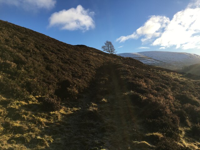
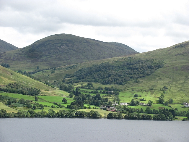
Sròn na Ceàrdaich, located in Perthshire, Scotland, is a prominent landscape feature that boasts breathtaking views and natural beauty. This stunning geographical formation is a prominent hill, rising to an elevation of approximately 450 meters (1,480 feet) above sea level.

The name Sròn na Ceàrdaich translates to "Nose of the Sheiling" in English, alluding to its distinctive shape that resembles the nose of a hill. This unique feature adds to its charm and allure, attracting nature enthusiasts, hikers, and photographers alike.

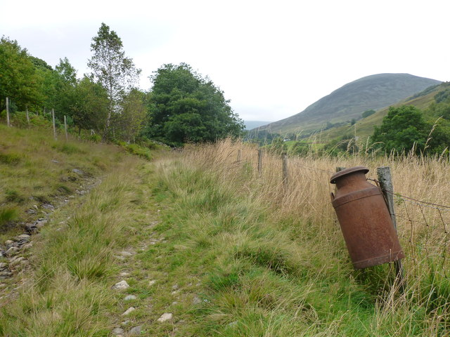
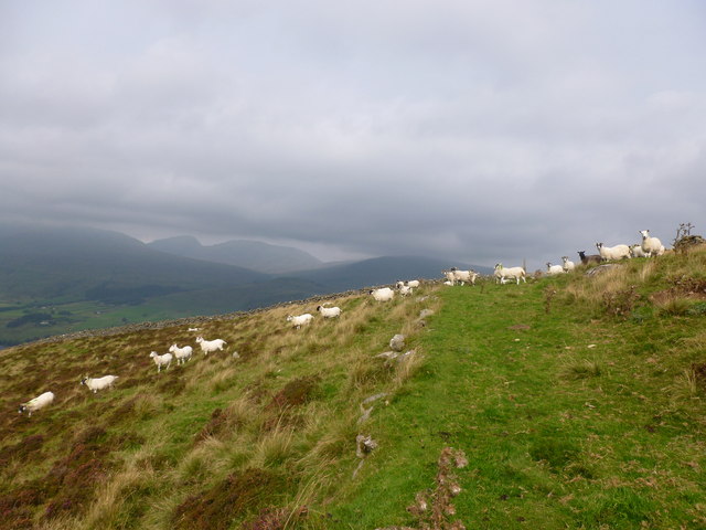
The hill is predominantly covered in heather, providing a picturesque purple hue during summer months. Additionally, the surrounding landscape is adorned with scattered trees, adding to the overall appeal of the area. The diverse flora and fauna found here make it an attractive habitat for wildlife, including various bird species and small mammals.

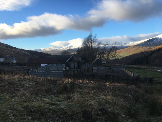
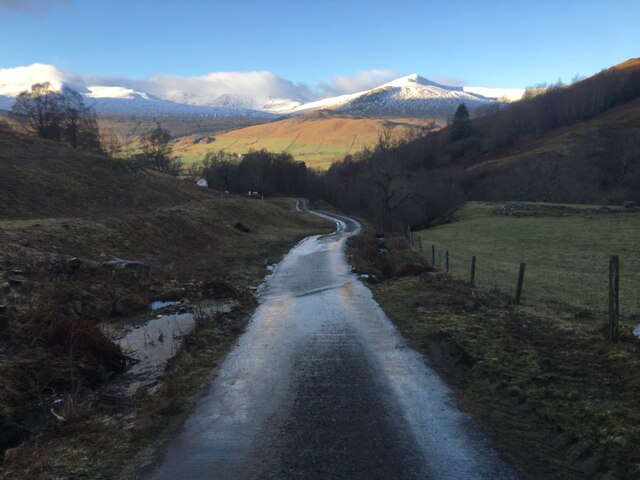
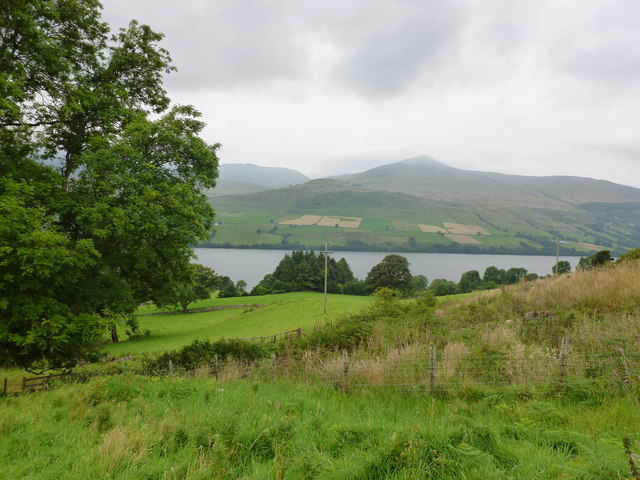
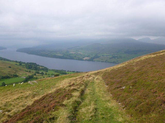
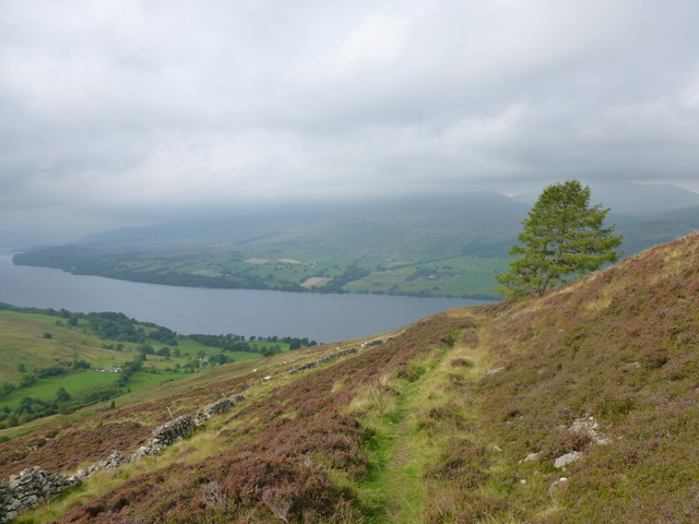
From the summit, visitors are rewarded with spectacular panoramic views of the surrounding Perthshire countryside. On a clear day, one can admire the rolling hills, shimmering lochs, and distant mountains that make up this stunning landscape.

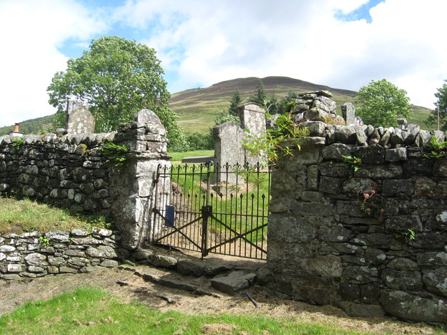
The area surrounding Sròn na Ceàrdaich is also rich in history and heritage. It is believed to have been a site of ancient settlements and has archaeological significance, with remnants of prehistoric stone structures and burial cairns found in the vicinity.

Overall, Sròn na Ceàrdaich offers a captivating blend of natural beauty, tranquility, and historical significance, making it a must-visit destination for those seeking to immerse themselves in the splendor of Perthshire's landscape.

If you have any feedback on the listing, please let us know in the comments section below.

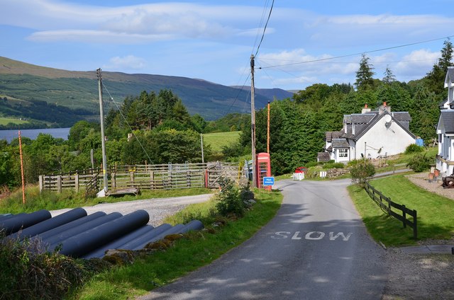
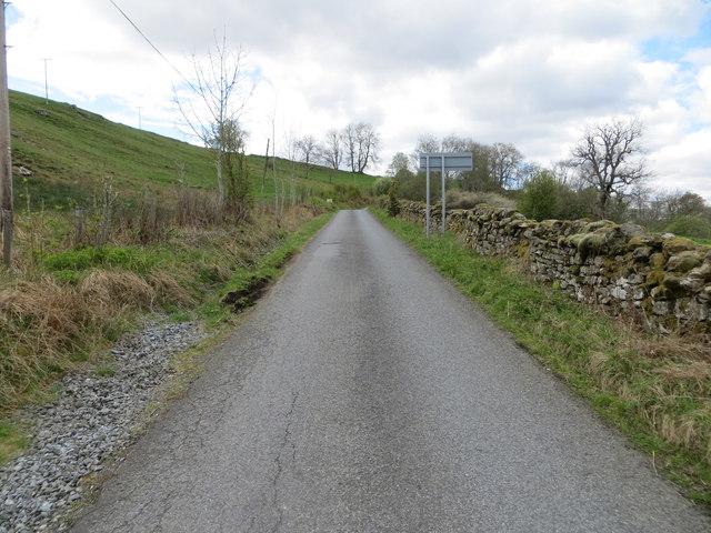
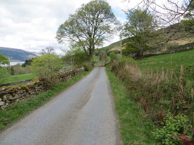
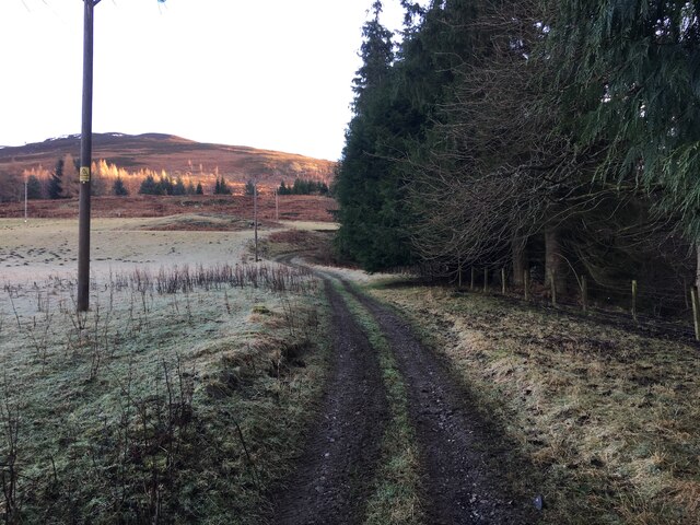
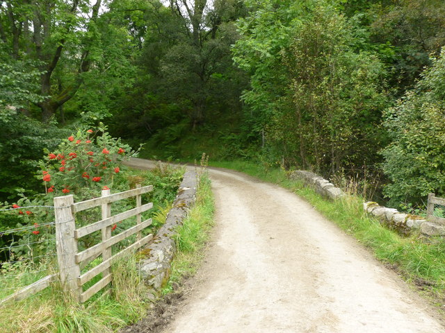
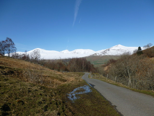
Sròn na Ceàrdaich Images

Images are sourced within 2km of 56.518143/-4.1075011 or Grid Reference NN7038. Thanks to Geograph Open Source API. All images are credited.

Ardtalnaig A small settlement on the south Loch Tay road. Pipes on the left are for construction of a hydroelectric scheme on the Ardtalnaig Burn.
Ardtalnaig
A small settlement on the south Loch Tay road. Pipes on the left are for construction of a hydroelectric scheme on the Ardtalnaig Burn.
Road near to Kendrochit Farm Looking south-westward.
Road near to Kendrochit Farm
Looking south-westward.
Road near to Kindrochit Farm Looking north-eastward.
Road near to Kindrochit Farm
Looking north-eastward.
Farm track at Ardtalnaig
Hill track near Ardtalnaig
Farm buildings at Claggan
Road towards Ardtalnaig
Telephone box, Ardtalnaig A scenic spot with a view of Loch Tay and Ben More.
Telephone box, Ardtalnaig
A scenic spot with a view of Loch Tay and Ben More.
Ardtalnaig Ardtalnaig is situated on the south side of Loch Tay, under the Shee of Ardtalnaig. The glen behind the village is an old drove route to Glen Almond and on to Crieff.
Ardtalnaig
Ardtalnaig is situated on the south side of Loch Tay, under the Shee of Ardtalnaig. The glen behind the village is an old drove route to Glen Almond and on to Crieff.
Entrance to the old graveyard at Ardtalnaig On the south shore of Loch Tay.
Entrance to the old graveyard at Ardtalnaig
On the south shore of Loch Tay.
Ardtalnaig Atmospheric hamlet on the south banks of Loch Tay.
Ardtalnaig
Atmospheric hamlet on the south banks of Loch Tay.
Farmland on the north side of Allt a' Chilleine Looking across Loch Tay towards Ben Lawers.
Farmland on the north side of Allt a' Chilleine
Looking across Loch Tay towards Ben Lawers.
Old metal milk can on a fence, Milton of Ardtalnaig By the track on the north side of Allt a' Chilleine.  The hill in the background is Shee of Ardtalnaig.
Old metal milk can on a fence, Milton of Ardtalnaig
By the track on the north side of Allt a' Chilleine. The hill in the background is Shee of Ardtalnaig.
Track across the flanks of Meall nan Oighreag Looking back across Loch Tay, with the cloud level just above the distinctive small peak of An Stuc (part of the Ben Lawers group of hills).
Track across the flanks of Meall nan Oighreag
Looking back across Loch Tay, with the cloud level just above the distinctive small peak of An Stuc (part of the Ben Lawers group of hills).
Sheep crossing the grassy track, Meall nan Oighreag The cloud level just clears the summits of An Stuc and Meall Garbh, part of the Ben Lawers group
Sheep crossing the grassy track, Meall nan Oighreag
The cloud level just clears the summits of An Stuc and Meall Garbh, part of the Ben Lawers group
Lone tree on the flanks of Meall nan Oighreag On heather moorland above Loch Tay.
Lone tree on the flanks of Meall nan Oighreag
On heather moorland above Loch Tay.
Bridge over Allt a' Chloidh Carrying the road on the south side of Ardtalnaig Glen. 

The berries are out on the many rowan trees in this glen.
Bridge over Allt a' Chloidh
Carrying the road on the south side of Ardtalnaig Glen. The berries are out on the many rowan trees in this glen.
Road between Ardtalnaig and Claggan The tarmac road ends up by the farm at Claggan but a walking route can be followed all the way through to Glen Lednock to Comrie.

The snow-covered Ben Lawers range forms the backdrop.
Road between Ardtalnaig and Claggan
The tarmac road ends up by the farm at Claggan but a walking route can be followed all the way through to Glen Lednock to Comrie. The snow-covered Ben Lawers range forms the backdrop.
Show me another place!

Sròn na Ceàrdaich is located at Grid Ref: NN7038 (Lat: 56.518143, Lng: -4.1075011)

Unitary Authority: Perth and Kinross

Police Authority: Tayside

What 3 Words

///notifying.club.dirt. Near Comrie, Perth & Kinross

Related Wikis

Ardtalnaig

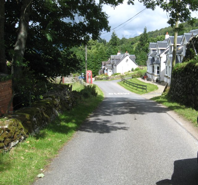
Ardtalnaig (; Àird Talanaig) is a hamlet on the south shore of Loch Tay in Perth and Kinross in Scotland. It is approximately 6 miles (10 km) from Kenmore...

Tomnadashan

Tomnadashan was a hamlet southwest of Ardtalnaig in Scotland. John Campbell, 2nd Marquess of Breadalbane tried to mine copper, gold, and sulphur there...
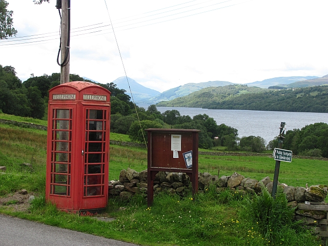
Loch Tay

Loch Tay (Scottish Gaelic: Loch Tatha) is a freshwater loch in the central highlands of Scotland, in the Perth and Kinross and Stirling council areas....

Lawers

Lawers is a village situated in rural Perthshire, Scotland. It lies on the banks of Loch Tay and at the foot of Ben Lawers. It was once part of a vibrant...

Nearby Amenities

Located within 500m of 56.518143,-4.1075011
The data included in this document is from www.openstreetmap.org. The data is made available under ODbL.

Have you been to Sròn na Ceàrdaich?

Leave your review of Sròn na Ceàrdaich below (or comments, questions and feedback).