Salthouse Point

Coastal Feature, Headland, Point in Glamorgan

Wales

Salthouse Point

Causeway crossing Llanrhidian Marsh Causeway crossing the eastern edge of Llanrhidian Marsh. The debris in the foreground suggests a recent high tide. Pwll is visible across the Loughor (Llwchwr) estuary.
Causeway crossing Llanrhidian Marsh Credit: Steve Rigg

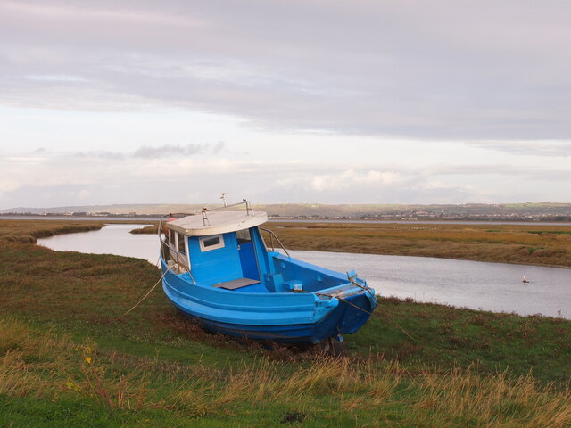
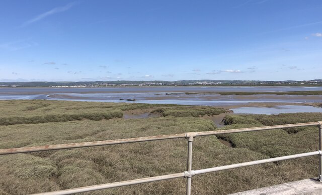
Salthouse Point is a prominent headland located in Glamorgan, a county in South Wales, United Kingdom. Situated on the southern coast of the country, it is a significant coastal feature known for its natural beauty and historical significance.

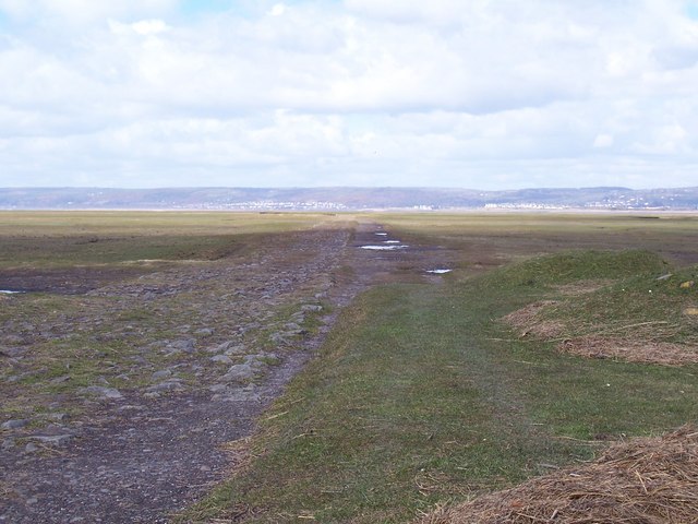
The headland is characterized by its rugged cliffs, which rise dramatically from the sea, providing breathtaking views of the surrounding landscape. These cliffs are composed of sedimentary rocks, including sandstone and limestone, which have been shaped by centuries of erosion from the powerful waves of the Bristol Channel.

Salthouse Point is a popular destination for both locals and tourists due to its rich history. The area has been inhabited for thousands of years, with evidence of prehistoric settlements discovered in nearby caves. It is also believed that the Vikings used the headland as a lookout point during their raids in the 11th century.

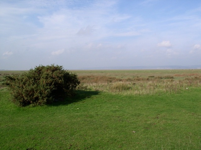
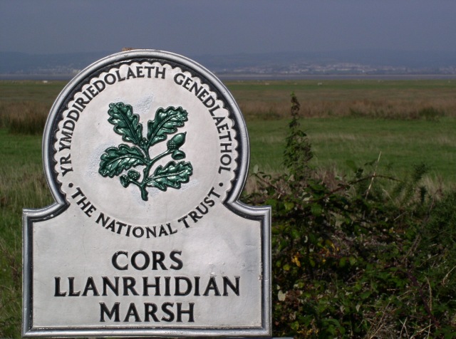
In addition to its historical significance, Salthouse Point is home to a diverse range of flora and fauna. The headland provides a vital habitat for various coastal plants, including sea thrift and sea campion. It is also a nesting site for seabirds such as puffins, gannets, and cormorants.

Visitors to Salthouse Point can enjoy a range of activities, including hiking along the coastal path that runs along the cliffs, birdwatching, and exploring the nearby caves. The headland is easily accessible and offers ample parking facilities. It is a must-visit destination for nature lovers and history enthusiasts seeking to explore the scenic beauty and cultural heritage of Glamorgan's coastal region.

If you have any feedback on the listing, please let us know in the comments section below.

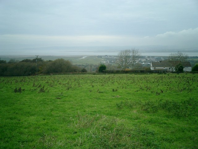
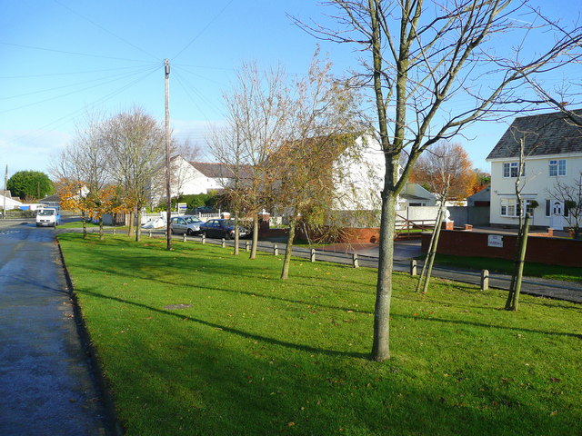
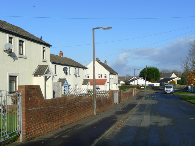
Salthouse Point Images

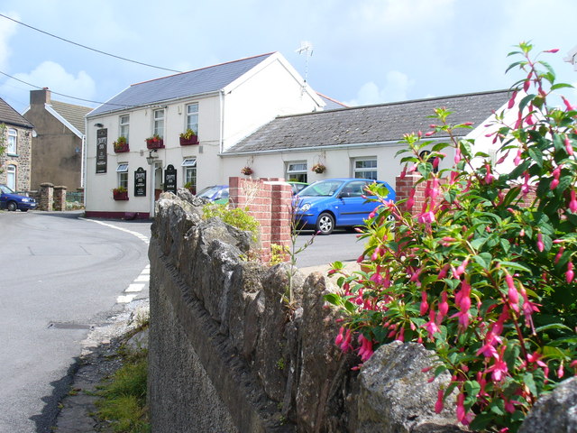
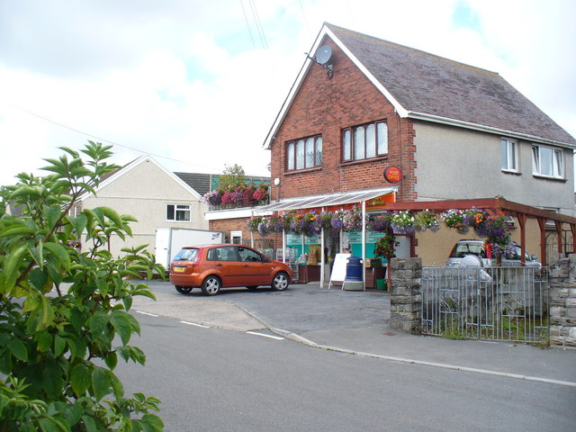
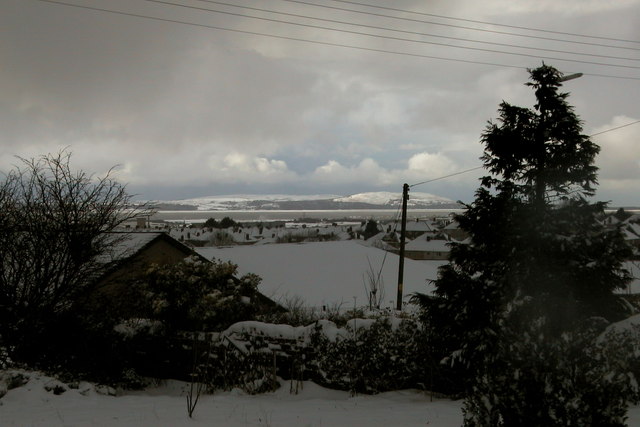
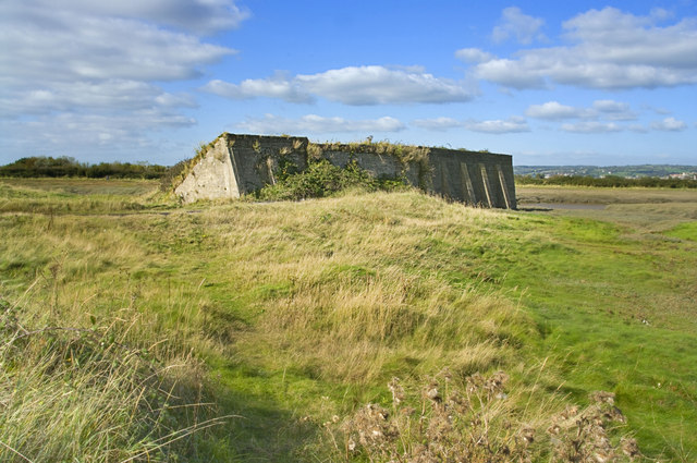
Images are sourced within 2km of 51.638468/-4.1388225 or Grid Reference SS5295. Thanks to Geograph Open Source API. All images are credited.

Causeway crossing Llanrhidian Marsh Causeway crossing the eastern edge of Llanrhidian Marsh. The debris in the foreground suggests a recent high tide. Pwll is visible across the Loughor (Llwchwr) estuary.
Causeway crossing Llanrhidian Marsh
Causeway crossing the eastern edge of Llanrhidian Marsh. The debris in the foreground suggests a recent high tide. Pwll is visible across the Loughor (Llwchwr) estuary.
Llanrhidian Marsh
Llanrhidian Marsh
St David's Church, Gwernffrwd The Ordnance Survey map shows this place as 'Wernffrwd', but the noticeboard outside the church shows 'Gwernffrwd'.
St David's Church, Gwernffrwd
The Ordnance Survey map shows this place as 'Wernffrwd', but the noticeboard outside the church shows 'Gwernffrwd'.
Llanrhidian Marsh
Llanrhidian Marsh
Ruined Chapel A ruined chapel on the hill above Crofty
Ruined Chapel
A ruined chapel on the hill above Crofty
Viewing Area This area is marked on the map as a disused rifle range.  Like the entire area, this has been cleaned up and converted into a viewing area.  Nearby, an area once full of heavy industry has over the past few years been converted into a golf course.
Viewing Area
This area is marked on the map as a disused rifle range. Like the entire area, this has been cleaned up and converted into a viewing area. Nearby, an area once full of heavy industry has over the past few years been converted into a golf course.
Salthouse Point Rainbow over Salthouse Point
Salthouse Point
Rainbow over Salthouse Point
Disused railway track now a cycle path The railway was opened in 1884 to take coal from local coal mines. It was closed for passengers in 1931 and for freight in 1957 and the track was lifted in 1959/1960.
Disused railway track now a cycle path
The railway was opened in 1884 to take coal from local coal mines. It was closed for passengers in 1931 and for freight in 1957 and the track was lifted in 1959/1960.
Evidence of historic industrial activity The station and railway are long gone but this is still the road name in Llanmorlais.
Evidence of historic industrial activity
The station and railway are long gone but this is still the road name in Llanmorlais.
View across Loughor estuary towards Llanelli
Crofty village street This was once a small port for local coal mining on the south side of the Loughor estuary.
Crofty village street
This was once a small port for local coal mining on the south side of the Loughor estuary.
Main Street, Crofty A village and small port on the north Gower coast.
Main Street, Crofty
A village and small port on the north Gower coast.
Crofty Inn Village pub in Crofty, on the edge of the Llanrhidian salt marshes on the Loughor Estuary.
Crofty Inn
Village pub in Crofty, on the edge of the Llanrhidian salt marshes on the Loughor Estuary.
Crofty Post Office Modern brick building with post office and shop in a village which is mainly of local stone houses in its central area.
Crofty Post Office
Modern brick building with post office and shop in a village which is mainly of local stone houses in its central area.
Gower View View of Crofty on the Gower Peninsula across the Loughor Estuary from The Bryn near Llanelli.
Gower View
View of Crofty on the Gower Peninsula across the Loughor Estuary from The Bryn near Llanelli.
Disused Rifle Range Disused concrete bunkers
Disused Rifle Range
Disused concrete bunkers
Inlet, Pen-clawdd
Inlet, Pen-clawdd
Salt Marsh on the southern side of the River Loughor Over the other side of the estuary is Llanelli
Salt Marsh on the southern side of the River Loughor
Over the other side of the estuary is Llanelli
Show me another place!

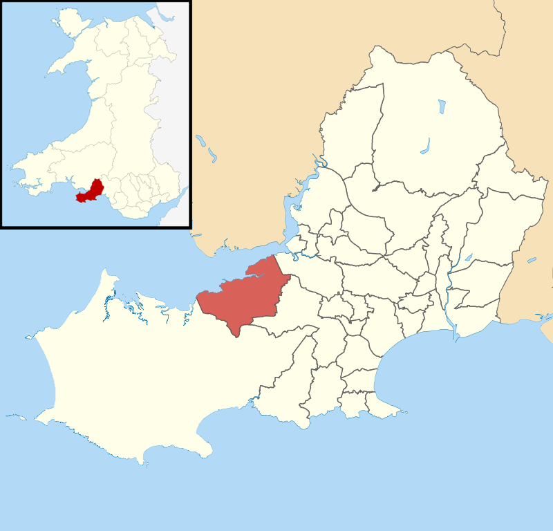
Salthouse Point is located at Grid Ref: SS5295 (Lat: 51.638468, Lng: -4.1388225)

Unitary Authority: Swansea

Police Authority: South Wales

What 3 Words

///approach.fairly.undertook. Near Crofty, Swansea

Related Wikis

Llanmorlais railway station

Llanmorlais railway station served the village of Llanmorlais, in the historical county of West Glamorgan, Wales, from 1884 to 1957 on the Llanmorlais...

Wernffrwd

Wernffrwd (Gwernffrwd) is a village in the south of Wales. It is located approximately 8.5 miles (13.7 km) from Swansea, and is within the Community of...

Pen-clawdd (electoral ward)

Pen-clawdd (formerly Penclawdd) is an electoral ward in the City and County of Swansea, Wales, UK. It is named after the village of Penclawdd, which falls...

Lordship of Gower

Gower was an ancient marcher lordship of Deheubarth in South Wales. == Creation of Lordship == Prior to the Norman invasion, the district was the commote...

Nearby Amenities

Located within 500m of 51.638468,-4.1388225
Turning Circle
Lat/Long: 51.6370248/-4.1348932
Turning Circle
Lat/Long: 51.6365254/-4.1325757
Turning Circle
Lat/Long: 51.6367828/-4.1336969
Salthouse Point
Place: locality
Lat/Long: 51.639146/-4.1362359
Direction: 185
Generator Method: photovoltaic
Generator Output Electricity: yes
Generator Solar Modules: 16
Generator Source: solar
Generator Type: solar_photovoltaic_panel
Location: roof
Power: generator
Lat/Long: 51.6370629/-4.1352186
Direction: S
Generator Method: photovoltaic
Generator Output Electricity: yes
Generator Solar Modules: 14
Generator Source: solar
Generator Type: solar_photovoltaic_panel
Location: roof
Power: generator
Lat/Long: 51.6365706/-4.1328784
Direction: 175
Generator Method: photovoltaic
Generator Output Electricity: yes
Generator Solar Modules: 16
Generator Source: solar
Generator Type: solar_photovoltaic_panel
Location: roof
Power: generator
Lat/Long: 51.6368082/-4.1324909
Direction: 185
Generator Method: photovoltaic
Generator Output Electricity: yes
Generator Solar Modules: 14
Generator Source: solar
Generator Type: solar_photovoltaic_panel
Location: roof
Power: generator
Lat/Long: 51.6379964/-4.1354942
Direction: 265
Generator Method: photovoltaic
Generator Output Electricity: yes
Generator Solar Modules: 9
Generator Source: solar
Generator Type: solar_photovoltaic_panel
Location: roof
Power: generator
Lat/Long: 51.6372906/-4.1323239
Direction: 85
Generator Method: photovoltaic
Generator Output Electricity: yes
Generator Solar Modules: 9
Generator Source: solar
Generator Type: solar_photovoltaic_panel
Location: roof
Power: generator
Lat/Long: 51.6372918/-4.1322783
Direction: SE
Generator Method: photovoltaic
Generator Output Electricity: yes
Generator Solar Modules: 16
Generator Source: solar
Generator Type: solar_photovoltaic_panel
Location: roof
Power: generator
Lat/Long: 51.6374787/-4.1360568
Direction: 185
Generator Method: photovoltaic
Generator Output Electricity: yes
Generator Solar Modules: 16
Generator Source: solar
Generator Type: solar_photovoltaic_panel
Location: roof
Power: generator
Lat/Long: 51.6373234/-4.1350919
The data included in this document is from www.openstreetmap.org. The data is made available under ODbL.

Have you been to Salthouse Point?

Leave your review of Salthouse Point below (or comments, questions and feedback).