Àird na Bà

Landscape Feature in Ross-shire

Scotland

Àird na Bà

Bridge on the Hebridean Way Geocaching is a type of global treasure hunt of people looking for caches, or hidden stashes of objects. Geocaching may also be described as a series of hide-and-seek games, where hiders provide online clues for seekers. Seekers use global positioning system (GPS) devices to find hidden caches
Bridge on the Hebridean Way Credit: Ralph Greig

Àird na Bà is a striking landscape feature located in Ross-shire, in the Highlands of Scotland. Translated from Gaelic as "the Point of the Cattle," Àird na Bà is a rugged headland that juts out into the Atlantic Ocean, offering breathtaking views and a unique geological makeup.

At approximately 400 feet high, Àird na Bà boasts steep cliffs that provide a dramatic backdrop against the crashing waves below. These cliffs are composed of Torridonian sandstone, a rock formation known for its distinctive red coloration and horizontal layers. Over millions of years, erosion from wind and water has carved out impressive caves and natural arches within the cliffs, adding to the allure of the landscape.

Located near the village of Applecross, Àird na Bà is accessible by a narrow road known as the Bealach na Bà, which winds its way through the rugged terrain. The road, often considered one of the most challenging in Scotland, offers incredible views of the surrounding mountains and sea as it ascends to a summit of 2,054 feet.

The headland itself is a popular destination for hikers and nature enthusiasts, who can explore the area on foot and take in the panoramic vistas. The diverse flora and fauna found at Àird na Bà include seabirds such as fulmars and kittiwakes, as well as heather, gorse, and other coastal plants.

With its dramatic cliffs, stunning views, and unique geological formations, Àird na Bà is a captivating landscape feature that showcases the natural beauty of the Scottish Highlands.

If you have any feedback on the listing, please let us know in the comments section below.
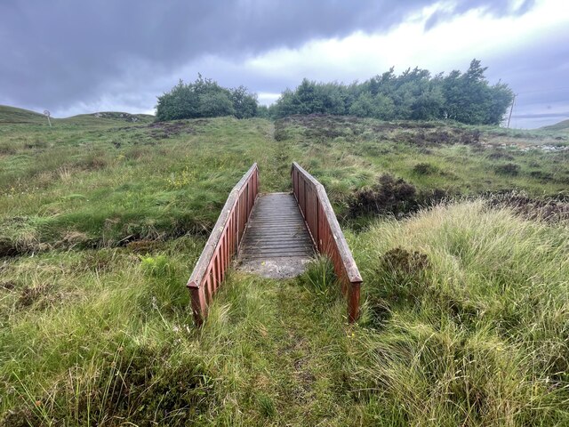
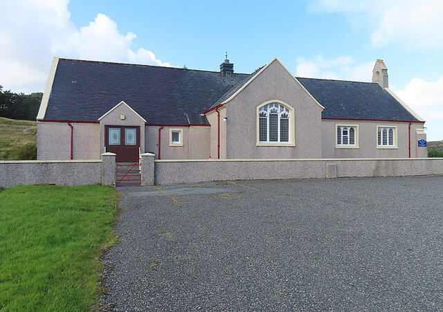
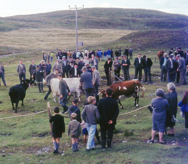
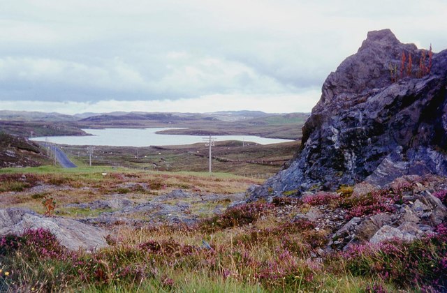
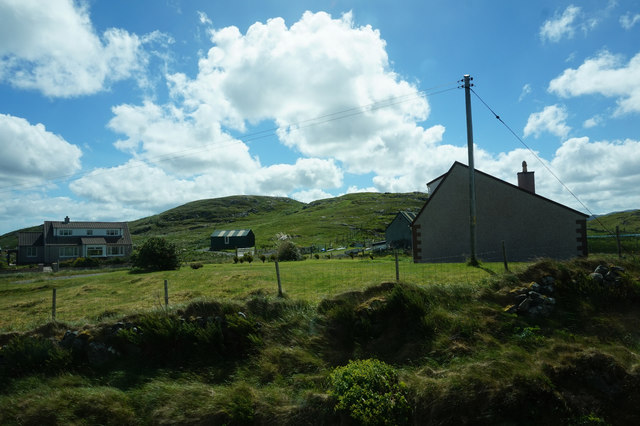
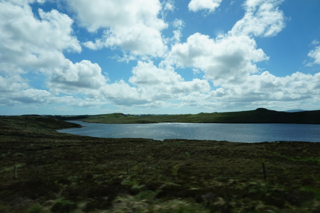
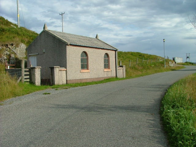
Àird na Bà Images

Images are sourced within 2km of 58.100536/-6.5595867 or Grid Reference NB3121. Thanks to Geograph Open Source API. All images are credited.

Bridge on the Hebridean Way Geocaching is a type of global treasure hunt of people looking for caches, or hidden stashes of objects. Geocaching may also be described as a series of hide-and-seek games, where hiders provide online clues for seekers. Seekers use global positioning system (GPS) devices to find hidden caches
Bridge on the Hebridean Way
Geocaching is a type of global treasure hunt of people looking for caches, or hidden stashes of objects. Geocaching may also be described as a series of hide-and-seek games, where hiders provide online clues for seekers. Seekers use global positioning system (GPS) devices to find hidden caches
Kinloch Parish Kirk Belonging to the Church of Scotland.
Kinloch Parish Kirk
Belonging to the Church of Scotland.
Kinloch Church (Free Church of Scotland) An active church.
Kinloch Church (Free Church of Scotland)
An active church.
Track, Druim nan Uan, Isle of Lewis The track extends further than currently shown on the OS 1:25,000 map (as viewed on OS maps 27/12/16).
Track, Druim nan Uan, Isle of Lewis
The track extends further than currently shown on the OS 1:25,000 map (as viewed on OS maps 27/12/16).
Balallan/Laxay Agricultural Show
A859 skirting Loch Bhaltois
Houses near Mircill Glas, Baile Ailein
Loch Bhaltois, taken from the A859
Fence line at Balallan I was going to walk further in but the weather was so miserable, typically Lewis, that the fence was as far as I got before the rain was on my lens!
Fence line at Balallan
I was going to walk further in but the weather was so miserable, typically Lewis, that the fence was as far as I got before the rain was on my lens!
Baile Ailean (Balallan) and Loch na Deasport The loch marks the eastern extremity of the crofting township of Baile Ailean. On older maps it is named Loch nan Deaspoirt. In the background are some of the hills north of Loch Shiphoirt (Loch Seaforth).
Baile Ailean (Balallan) and Loch na Deasport
The loch marks the eastern extremity of the crofting township of Baile Ailean. On older maps it is named Loch nan Deaspoirt. In the background are some of the hills north of Loch Shiphoirt (Loch Seaforth).
Lousewort (Pedicularis sylvatica) A common plant of wet, boggy places, Lousewort thrives in the acid peat of Leòdhas.
Lousewort (Pedicularis sylvatica)
A common plant of wet, boggy places, Lousewort thrives in the acid peat of Leòdhas.
Cnoc a' Ghille Ruaidh Bhig The name applies to the rocky outcrop and means 'rock of the small red boy'. The puddles on the road are evidence of recent heavy showers, and there were many more to come.
Cnoc a' Ghille Ruaidh Bhig
The name applies to the rocky outcrop and means 'rock of the small red boy'. The puddles on the road are evidence of recent heavy showers, and there were many more to come.
Wrecked Car This one hasn't been here for long enough to become rusted through, so in spite of the good work of the local authority in removing hundreds of eyesores all over the islands, it still seems to be the thing to abandon old cars and then use them for target practice. The slight elevation on the left is Cnoc na Buaile, meaning 'rock of the cattle fold', and the matching one to the left is Druim Bioraig, whose meaning I don't know.
Wrecked Car
This one hasn't been here for long enough to become rusted through, so in spite of the good work of the local authority in removing hundreds of eyesores all over the islands, it still seems to be the thing to abandon old cars and then use them for target practice. The slight elevation on the left is Cnoc na Buaile, meaning 'rock of the cattle fold', and the matching one to the left is Druim Bioraig, whose meaning I don't know.
A Bend in the Track Marked by another puddle, the track curves round the foot of Cnoc a' Ghille Ruaidh Bhig, just above an expanse of peat bog. The distant hill is Ròineabhal, just visible between Druim Biorag to its left and Cnoc Dubh Druim Biorag to its right.
A Bend in the Track
Marked by another puddle, the track curves round the foot of Cnoc a' Ghille Ruaidh Bhig, just above an expanse of peat bog. The distant hill is Ròineabhal, just visible between Druim Biorag to its left and Cnoc Dubh Druim Biorag to its right.
Track across the Moor All over the Hebrides there are rough roads and tracks which give access to areas where peat is cut. The peat banks show up as dark lines across the bog, where bare peat has been exposed by cutting. The low ridge is unnamed on the maps, but the outcrop of rock to its right is Creag Latharbaidh, round which a meander of the Abhainn Lacasaidh (Laxay River) 'salmon river' flows. The very distant highest point, crowned with masts, is Èitseal (223 metres) above Acha Mòr (Achmore) in <a href="https://www.geograph.org.uk/gridref/NB3030">NB3030</a>.
Track across the Moor
All over the Hebrides there are rough roads and tracks which give access to areas where peat is cut. The peat banks show up as dark lines across the bog, where bare peat has been exposed by cutting. The low ridge is unnamed on the maps, but the outcrop of rock to its right is Creag Latharbaidh, round which a meander of the Abhainn Lacasaidh (Laxay River) 'salmon river' flows. The very distant highest point, crowned with masts, is Èitseal (223 metres) above Acha Mòr (Achmore) in NB3030.
Looking towards Ròineabhal Ròineabhal (269 metres) appears in the gap between Cnoc na Buaile on the left and Druim Biorag on the right. In the bog in the foreground are the faces of peat banks laid bare when peat was last cut here, and not yet overgrown again. It would be interesting to know why the top of Druim Biorag is so green by comparison with the surrounding brown bog. It certainly seems to be the preferred grazing place for the sheep!
Looking towards Ròineabhal
Ròineabhal (269 metres) appears in the gap between Cnoc na Buaile on the left and Druim Biorag on the right. In the bog in the foreground are the faces of peat banks laid bare when peat was last cut here, and not yet overgrown again. It would be interesting to know why the top of Druim Biorag is so green by comparison with the surrounding brown bog. It certainly seems to be the preferred grazing place for the sheep!
Peat Bog near Baile Ailean In the bog in the foreground are the faces of peat banks laid bare when peat was last cut here, and not yet overgrown again.Notre how green the top of Druim Biorag by comparison with the surrounding brown bog. The grass there is obviously attractive to the sheep. The distant mountain is Ròineabhal, its appearance beying its modest 269 metres above sea level.
Peat Bog near Baile Ailean
In the bog in the foreground are the faces of peat banks laid bare when peat was last cut here, and not yet overgrown again.Notre how green the top of Druim Biorag by comparison with the surrounding brown bog. The grass there is obviously attractive to the sheep. The distant mountain is Ròineabhal, its appearance beying its modest 269 metres above sea level.
Baile Ailein (Balallan) A foreshortened view of Baile Ailein from the top of Cnoc a' Ghille Ruaidh Bhig seems to crowd the village at the foot of the hills. I can't quite make up my mind whether the most prominent hill is Dùn Chonaill in <a href="https://www.geograph.org.uk/gridref/NB2616">NB2616</a> or Cadha Cleit in <a href="https://www.geograph.org.uk/gridref/NB2615">NB2615</a>, but it's probably the latter.
Baile Ailein (Balallan)
A foreshortened view of Baile Ailein from the top of Cnoc a' Ghille Ruaidh Bhig seems to crowd the village at the foot of the hills. I can't quite make up my mind whether the most prominent hill is Dùn Chonaill in NB2616 or Cadha Cleit in NB2615, but it's probably the latter.
Show me another place!

Àird na Bà is located at Grid Ref: NB3121 (Lat: 58.100536, Lng: -6.5595867)

Unitary Authority: Na h-Eileanan an Iar

Police Authority: Highlands and Islands

What 3 Words

///hoped.skinny.firepower. Near Leurbost, Na h-Eileanan Siar

Related Wikis

Balallan

Balallan (Scottish Gaelic: Baile Ailein, Bail' Ailein), meaning "Allan's Town", is a crofting township on the Isle of Lewis, in the Outer Hebrides, Scotland...

Loch Erisort

Loch Erisort (Scottish Gaelic: Èireasort) is an 8-mile-long narrow sea inlet on the east coast of the Isle of Lewis in the Outer Hebrides off the west...

Keose

Keose is a settlement in the Kinloch community council area of the Western Isles, Scotland, in the civil parish of Lochs. It lies on the north shore of...

Cabharstadh

Cabharstadh or Caversta (Scottish Gaelic: Cabharstaigh) is a village on the Isle of Lewis in the Outer Hebrides, Scotland. Caversta is situated in the...

Nearby Amenities

Located within 500m of 58.100536,-6.5595867
Barrier: cattle_grid
Source: survey
Lat/Long: 58.1038435/-6.5563604
Power: pole
Lat/Long: 58.1043542/-6.5628407
Power: pole
Lat/Long: 58.1039925/-6.5644069
Power: pole
Lat/Long: 58.1046667/-6.5614671
Power: pole
Lat/Long: 58.10072/-6.5676168
Power: pole
Lat/Long: 58.1009283/-6.5662944
Power: pole
Lat/Long: 58.1005329/-6.5678984
Power: pole
Lat/Long: 58.1007668/-6.5663078
Power: pole
Lat/Long: 58.1010006/-6.5648916
Power: pole
Lat/Long: 58.1012302/-6.5633762
Power: pole
Lat/Long: 58.1015123/-6.5624911
Power: pole
Lat/Long: 58.1018453/-6.5615147
Power: pole
Lat/Long: 58.1023414/-6.5606967
Power: pole
Lat/Long: 58.1028148/-6.5599322
Power: pole
Lat/Long: 58.103478/-6.5588204
Power: pole
Lat/Long: 58.1039826/-6.5572661
Power: pole
Lat/Long: 58.1011253/-6.5649426
Power: pole
Lat/Long: 58.1018921/-6.561842
Power: pole
Lat/Long: 58.1022975/-6.5611553
Power: pole
Lat/Long: 58.1027297/-6.5604794
Power: pole
Lat/Long: 58.1035957/-6.5590256
Power: pole
Lat/Long: 58.1039486/-6.5578696
Power: pole
Lat/Long: 58.1042929/-6.5567699
The data included in this document is from www.openstreetmap.org. The data is made available under ODbL.

Have you been to Àird na Bà?

Leave your review of Àird na Bà below (or comments, questions and feedback).