Rubha Loisgt na Buaile

Landscape Feature in Ross-shire

Scotland

Rubha Loisgt na Buaile
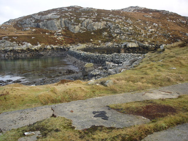
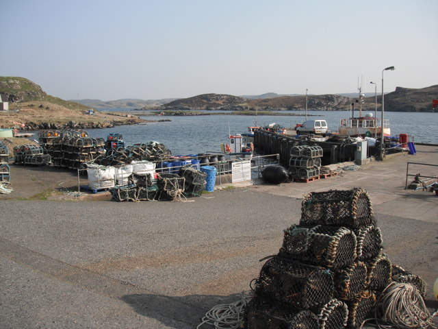
Old hardstandings at Tob Blar Meadha Abandoned lobster loading hardstandings at the lobster pond.
Old hardstandings at Tob Blar Meadha Credit: Gus Macdonald

Rubha Loisgt na Buaile is a stunning landscape feature located in Ross-shire, Scotland. Situated on the rugged west coast, this promontory juts out into the North Atlantic Ocean, offering breathtaking views and a dramatic setting.

The name Rubha Loisgt na Buaile translates to "burnt headland of the fold" in English, reflecting the area's history and natural features. The headland is characterized by its steep cliffs, which rise dramatically from the sea below. These cliffs are composed of ancient rock formations, displaying layers of sedimentary rock that have been shaped by centuries of erosion.

The headland is also known for its picturesque beaches, which are scattered along its coastline. These sandy shores provide a stark contrast to the rugged cliffs, and offer visitors the opportunity to relax and enjoy the tranquility of the area. The crystal-clear waters that lap against the shore are perfect for swimming or simply admiring the beauty of the surroundings.

In addition to its natural beauty, Rubha Loisgt na Buaile is home to a diverse range of wildlife. The cliffs provide nesting sites for seabirds such as gannets and puffins, while the surrounding waters are frequented by seals and dolphins. Birdwatchers and nature enthusiasts flock to the area to observe these fascinating creatures in their natural habitat.

Overall, Rubha Loisgt na Buaile is a captivating landscape feature that showcases the rugged beauty of the Scottish coastline. Its dramatic cliffs, stunning beaches, and diverse wildlife make it a must-visit destination for anyone seeking to immerse themselves in the natural wonders of Ross-shire.

If you have any feedback on the listing, please let us know in the comments section below.

Rubha Loisgt na Buaile Images

Images are sourced within 2km of 58.225399/-6.8302659 or Grid Reference NB1636. Thanks to Geograph Open Source API. All images are credited.
Old hardstandings at Tob Blar Meadha Abandoned lobster loading hardstandings at the lobster pond.
Old hardstandings at Tob Blar Meadha
Abandoned lobster loading hardstandings at the lobster pond.
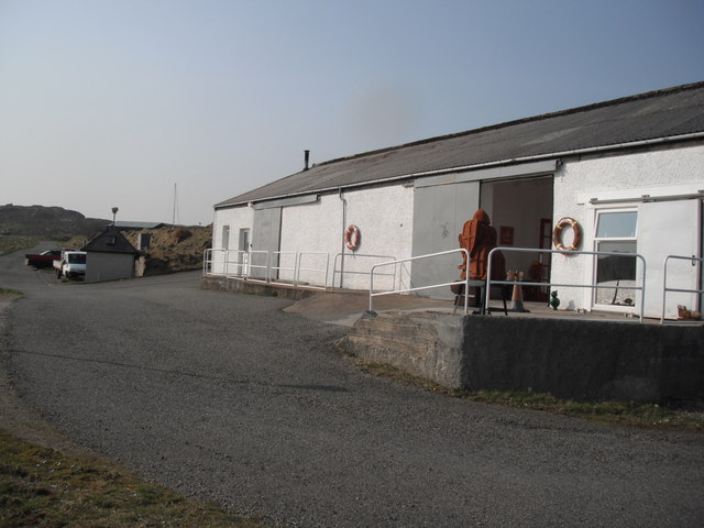
Craft workshop in Kirkibost One of the old shellfish processing factories at Kirkibost (Circeabost) is now reborn as a craftshop.
Craft workshop in Kirkibost
One of the old shellfish processing factories at Kirkibost (Circeabost) is now reborn as a craftshop.
Cleibh ghiomaich aig cidhe Chirceabost Lobster creels at Kirkibost harbour
Cleibh ghiomaich aig cidhe Chirceabost
Lobster creels at Kirkibost harbour
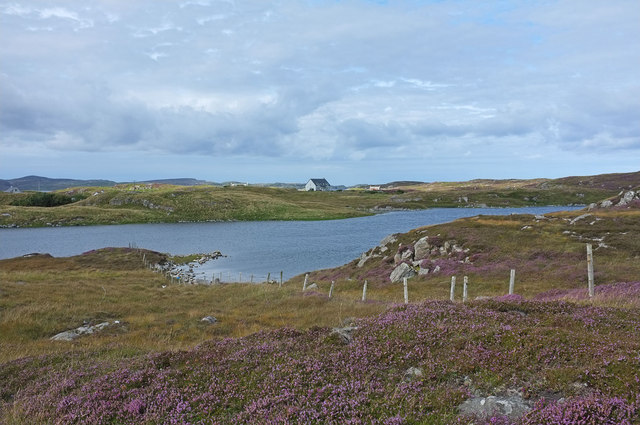
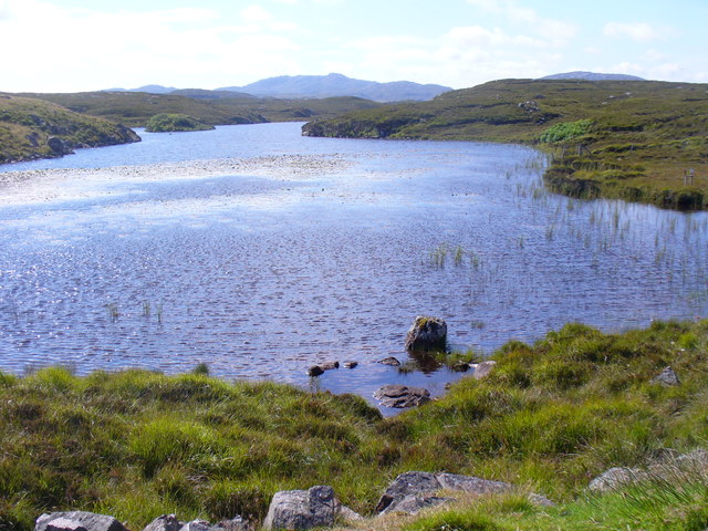
Moorland and loch on Great Bernera The loch is unnamed on the map, but the Allt Loch an Fheoir flows into it, so this must be Loch an Fheoir.

The houses in the distance are on the road south of Bhalasaigh.
Moorland and loch on Great Bernera
The loch is unnamed on the map, but the Allt Loch an Fheoir flows into it, so this must be Loch an Fheoir. The houses in the distance are on the road south of Bhalasaigh.
Bridge at Bhalasaigh Looking back to the road end on the main island of Great Bernera.
Bridge at Bhalasaigh
Looking back to the road end on the main island of Great Bernera.
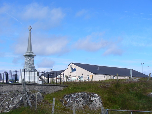
War Memorial, Breacleit The memorial stands on a mound at the crossroads in the centre of Breacleit / Breaclete, the capital of Great Bernera / Bearnaraigh. On the skyline is the Bernera Community Centre.
<span class="nowrap"><a title="http://www.uigandbernera.com/" rel="nofollow ugc noopener" href="http://www.uigandbernera.com/">Link</a><img style="margin-left:2px;" alt="External link" title="External link - shift click to open in new window" src="https://s1.geograph.org.uk/img/external.png" width="10" height="10"/></span>
War Memorial, Breacleit
The memorial stands on a mound at the crossroads in the centre of Breacleit / Breaclete, the capital of Great Bernera / Bearnaraigh. On the skyline is the Bernera Community Centre. LinkExternal link
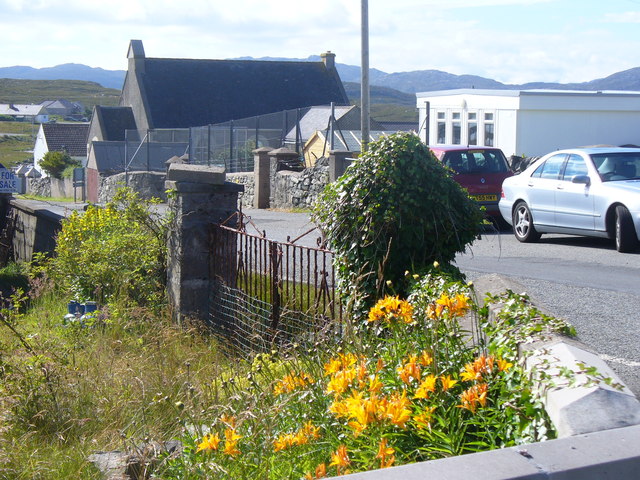
Breacleit, Bernera Summer flowers, church and school in the village centre.
<span class="nowrap"><a title="http://www.uigandbernera.com/" rel="nofollow ugc noopener" href="http://www.uigandbernera.com/">Link</a><img style="margin-left:2px;" alt="External link" title="External link - shift click to open in new window" src="https://s1.geograph.org.uk/img/external.png" width="10" height="10"/></span>
Breacleit, Bernera
Summer flowers, church and school in the village centre. LinkExternal link
Loch Ionail Freshwater loch on the island of Great Bernera / Bearnaraigh.
<span class="nowrap"><a title="http://www.uigandbernera.com/" rel="nofollow ugc noopener" href="http://www.uigandbernera.com/">Link</a><img style="margin-left:2px;" alt="External link" title="External link - shift click to open in new window" src="https://s1.geograph.org.uk/img/external.png" width="10" height="10"/></span>
Loch Ionail
Freshwater loch on the island of Great Bernera / Bearnaraigh. LinkExternal link
Tob Bhalasaigh Tidal lagoon with a mix of rare seaweeds on Great Bernera / Bearnaraigh.
<span class="nowrap"><a title="http://www.uigandbernera.com/" rel="nofollow ugc noopener" href="http://www.uigandbernera.com/">Link</a><img style="margin-left:2px;" alt="External link" title="External link - shift click to open in new window" src="https://s1.geograph.org.uk/img/external.png" width="10" height="10"/></span>
Tob Bhalasaigh
Tidal lagoon with a mix of rare seaweeds on Great Bernera / Bearnaraigh. LinkExternal link
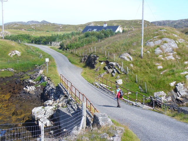
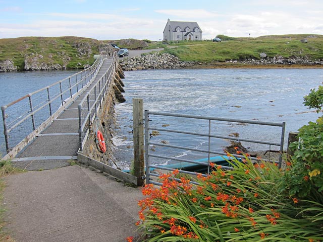
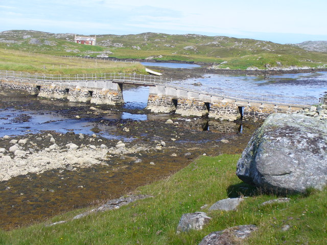
Valasay Bridge Carrying the single track road across an outlet of the tidal lagoon, Tob Bhalasaigh on Great Bernera / Bearnaraigh.
<span class="nowrap"><a title="http://www.uigandbernera.com/" rel="nofollow ugc noopener" href="http://www.uigandbernera.com/">Link</a><img style="margin-left:2px;" alt="External link" title="External link - shift click to open in new window" src="https://s1.geograph.org.uk/img/external.png" width="10" height="10"/></span>
Valasay Bridge
Carrying the single track road across an outlet of the tidal lagoon, Tob Bhalasaigh on Great Bernera / Bearnaraigh. LinkExternal link
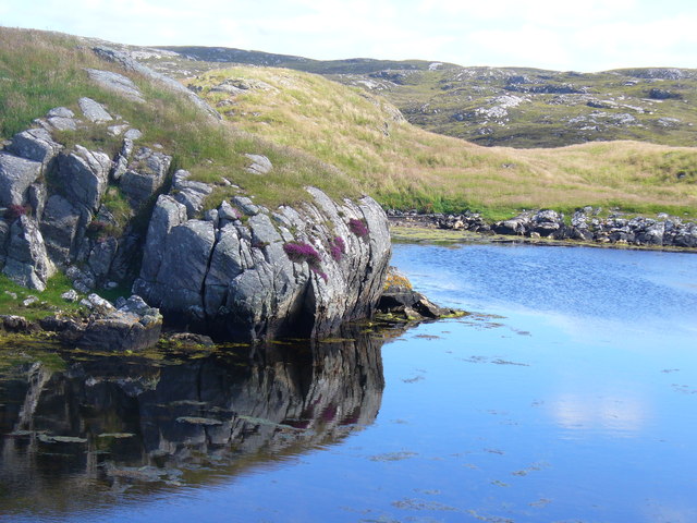
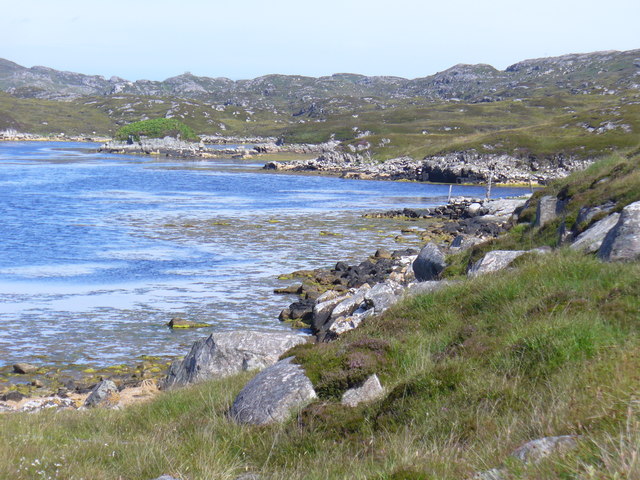
Shoreline at Tob Bhalasaigh Rocks and heather at the edge of the tidal lagoon in Valasay.
<span class="nowrap"><a title="http://www.uigandbernera.com/" rel="nofollow ugc noopener" href="http://www.uigandbernera.com/">Link</a><img style="margin-left:2px;" alt="External link" title="External link - shift click to open in new window" src="https://s1.geograph.org.uk/img/external.png" width="10" height="10"/></span>
Shoreline at Tob Bhalasaigh
Rocks and heather at the edge of the tidal lagoon in Valasay. LinkExternal link
Valasay Footbridge The bridge across the tidal Tob Bhalasaigh was built in 1898.
<span class="nowrap"><a title="http://www.uigandbernera.com/" rel="nofollow ugc noopener" href="http://www.uigandbernera.com/">Link</a><img style="margin-left:2px;" alt="External link" title="External link - shift click to open in new window" src="https://s1.geograph.org.uk/img/external.png" width="10" height="10"/></span>
Valasay Footbridge
The bridge across the tidal Tob Bhalasaigh was built in 1898. LinkExternal link
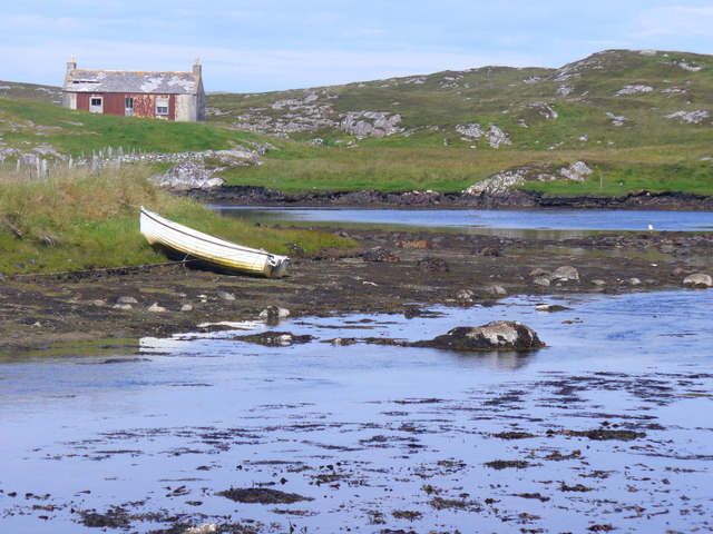
Tidal Lagoon, Valasay Tob Bhalasaigh, on the island of Great Bernera / Bearnaraigh.
<span class="nowrap"><a title="http://www.uigandbernera.com/" rel="nofollow ugc noopener" href="http://www.uigandbernera.com/">Link</a><img style="margin-left:2px;" alt="External link" title="External link - shift click to open in new window" src="https://s1.geograph.org.uk/img/external.png" width="10" height="10"/></span>
Tidal Lagoon, Valasay
Tob Bhalasaigh, on the island of Great Bernera / Bearnaraigh. LinkExternal link
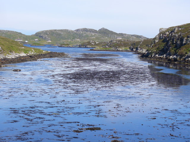
Tob Bhalasaigh from the Footbridge View northwards, along the narrow tidal lagoon, to Tobson 2 kilometres away in the distance.
Tob Bhalasaigh from the Footbridge
View northwards, along the narrow tidal lagoon, to Tobson 2 kilometres away in the distance.
Loch Ruig Sanndabhat Small and reedy freshwater loch below the slopes of Beinn Breacleit, Great Bernera / Bearnaraigh.
<span class="nowrap"><a title="http://www.uigandbernera.com/" rel="nofollow ugc noopener" href="http://www.uigandbernera.com/">Link</a><img style="margin-left:2px;" alt="External link" title="External link - shift click to open in new window" src="https://s1.geograph.org.uk/img/external.png" width="10" height="10"/></span>
Loch Ruig Sanndabhat
Small and reedy freshwater loch below the slopes of Beinn Breacleit, Great Bernera / Bearnaraigh. LinkExternal link
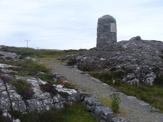
Crofters' Memorial Cairn, Great Bernera Erected in memory of April 1874 when local crofters marched to Lews Castle in Stornoway. They were protesting to Sir James Matheson that they had received eviction notices after using the moorland for centuries. The gentry wanted to use it for leisure / sport.
<span class="nowrap"><a title="http://www.uigandbernera.com/" rel="nofollow ugc noopener" href="http://www.uigandbernera.com/">Link</a><img style="margin-left:2px;" alt="External link" title="External link - shift click to open in new window" src="https://s1.geograph.org.uk/img/external.png" width="10" height="10"/></span>
Crofters' Memorial Cairn, Great Bernera
Erected in memory of April 1874 when local crofters marched to Lews Castle in Stornoway. They were protesting to Sir James Matheson that they had received eviction notices after using the moorland for centuries. The gentry wanted to use it for leisure / sport. LinkExternal link
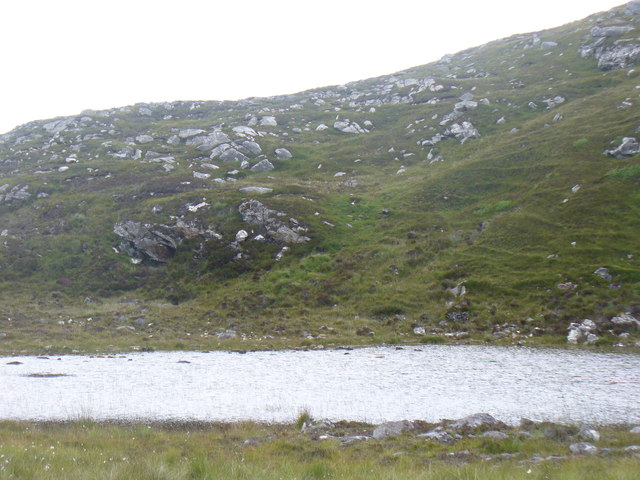
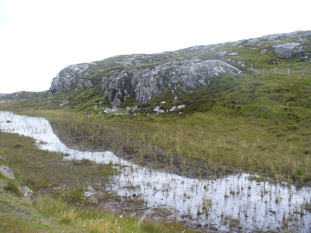
Lochan Below Beinn Breacleit Reedy lochan with rocky hillside, south-east of the Crofters' Memorial on Great Bernera / Bearnaraigh.
<span class="nowrap"><a title="http://www.uigandbernera.com/" rel="nofollow ugc noopener" href="http://www.uigandbernera.com/">Link</a><img style="margin-left:2px;" alt="External link" title="External link - shift click to open in new window" src="https://s1.geograph.org.uk/img/external.png" width="10" height="10"/></span>
Lochan Below Beinn Breacleit
Reedy lochan with rocky hillside, south-east of the Crofters' Memorial on Great Bernera / Bearnaraigh. LinkExternal link
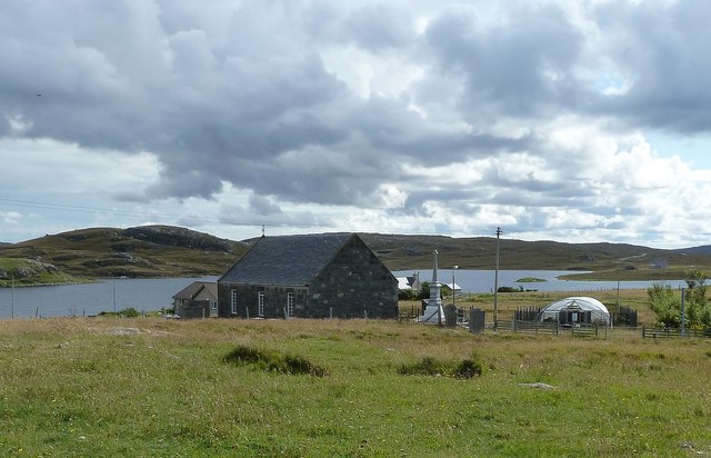
Breacleit church and war memorial Breacleit (or Breaclete) is the largest settlement on Great Bernera, an island off the west coast of Lewis attached to that larger island by a bridge. The little church seen here looks to date from the late C19th or early C20th. To its right can be seen the Bernera War Memorial <span class="nowrap"><a title="http://warmemscot.s4.bizhat.com/viewtopic.php?t=323" rel="nofollow ugc noopener" href="http://warmemscot.s4.bizhat.com/viewtopic.php?t=323">Link</a><img style="margin-left:2px;" alt="External link" title="External link - shift click to open in new window" src="https://s1.geograph.org.uk/img/external.png" width="10" height="10"/></span> 
Behind the church can be seen a little of Loch Breacleit.
Breacleit church and war memorial
Breacleit (or Breaclete) is the largest settlement on Great Bernera, an island off the west coast of Lewis attached to that larger island by a bridge. The little church seen here looks to date from the late C19th or early C20th. To its right can be seen the Bernera War Memorial LinkExternal link Behind the church can be seen a little of Loch Breacleit.
Show me another place!

Rubha Loisgt na Buaile is located at Grid Ref: NB1636 (Lat: 58.225399, Lng: -6.8302659)

Unitary Authority: Na h-Eileanan an Iar

Police Authority: Highlands and Islands

What 3 Words

///stove.vague.laugh. Near Carloway, Na h-Eileanan Siar

Related Wikis

Breaclete

Breacleit (or Roulanish; Scottish Gaelic: Breacleit; Old Norse: Breiðiklettr) is the central village on Great Bernera in the Outer Hebrides, Scotland....

Great Bernera

Great Bernera (; Scottish Gaelic: Beàrnaraigh Mòr), often known just as Bernera (Scottish Gaelic: Beàrnaraigh), is an island and community in the Outer...

Dun Bharabhat, Great Bernera

Dun Bharabhat (or Dun Baravat) is an Iron Age galleried dun or "semi-broch" situated on the island of Great Bernera near Lewis in Scotland (grid reference...

Callanish VIII

The Callanish VIII stone setting is one of many megalithic structures around the better-known (and larger) Calanais I on the west coast of the Isle of...

Nearby Amenities

Located within 500m of 58.225399,-6.8302659
Passing Place
Lat/Long: 58.2225958/-6.8332659
Passing Place
Lat/Long: 58.2234771/-6.8373699
Passing Place
Lat/Long: 58.2215011/-6.8288224
Passing Place
Lat/Long: 58.2244069/-6.8385418
Passing Place
Lat/Long: 58.2222864/-6.8311109
Passing Place
Lat/Long: 58.223295/-6.8360368
Power: pole
Lat/Long: 58.2238809/-6.837703
Power: pole
Lat/Long: 58.2238458/-6.8369057
The data included in this document is from www.openstreetmap.org. The data is made available under ODbL.

Have you been to Rubha Loisgt na Buaile?

Leave your review of Rubha Loisgt na Buaile below (or comments, questions and feedback).