Bragmere Pits

Lake, Pool, Pond, Freshwater Marsh in Norfolk Breckland

England

Bragmere Pits

Green Forest Track Forest track through forest that is marked on the map as Hills And Holes near to Great Hockham, Norfolk.
Green Forest Track Credit: Keith Evans

Bragmere Pits is a picturesque freshwater marsh located in Norfolk, England. It is an expansive area encompassing a combination of lakes, pools, ponds, and marshland, making it a diverse and ecologically significant site.

The main feature of Bragmere Pits is a large lake that stretches over several acres, providing a serene and tranquil setting. The lake is surrounded by lush vegetation, including reeds, rushes, and lily pads, which provide a habitat for a variety of wildlife. The calm waters of the lake are perfect for boating and fishing enthusiasts, attracting visitors from far and wide.

Adjacent to the lake, there are several smaller pools and ponds, each with its own distinct character. These smaller water bodies are home to an array of aquatic plants and animals, including frogs, newts, and water insects. The diverse range of habitats within Bragmere Pits supports a rich and diverse ecosystem, making it a haven for birdlife.

The marshland at Bragmere Pits is a unique feature that adds to the natural beauty of the area. The marsh is a wetland characterized by its saturated soil and waterlogged conditions. It is dominated by tall grasses, sedges, and other wetland plants, providing a habitat for an abundance of bird species, including reed warblers, marsh harriers, and bitterns.

Overall, Bragmere Pits is a haven for nature lovers and outdoor enthusiasts. Its combination of lakes, pools, ponds, and marshland offers a diverse range of habitats and a wealth of wildlife. Whether it is birdwatching, fishing, or simply enjoying the tranquility of the surroundings, Bragmere Pits has something to offer for everyone.

If you have any feedback on the listing, please let us know in the comments section below.

Bragmere Pits Images

Images are sourced within 2km of 52.489474/0.84771482 or Grid Reference TL9391. Thanks to Geograph Open Source API. All images are credited.

Green Forest Track Forest track through forest that is marked on the map as Hills And Holes near to Great Hockham, Norfolk.
Green Forest Track
Forest track through forest that is marked on the map as Hills And Holes near to Great Hockham, Norfolk.
Footpath Junction Footpath junction and five bar gate at Illington, Norfolk.
Footpath Junction
Footpath junction and five bar gate at Illington, Norfolk.
Footpath Looking West Footpath looking west near to Illington, Norfolk.
Footpath Looking West
Footpath looking west near to Illington, Norfolk.
Gas Line Marker Gas pipeline marker near to Illington, Norfolk.
Gas Line Marker
Gas pipeline marker near to Illington, Norfolk.
Track Junction Track and footpath junction near to Illington, Norfolk.
Track Junction
Track and footpath junction near to Illington, Norfolk.
Bambridge Lane Marked on the map as Bambridge Lane seen here north of Illington, Norfolk.
Bambridge Lane
Marked on the map as Bambridge Lane seen here north of Illington, Norfolk.
Bend In Track Track leading to Little Hockham near to Illington, Norfolk.
Bend In Track
Track leading to Little Hockham near to Illington, Norfolk.
Little Hockham Footpath sign and Little London near to Illington, Norfolk.
Little Hockham
Footpath sign and Little London near to Illington, Norfolk.
Country Lane Country leading to Little Hockham, Norfolk.
Country Lane
Country leading to Little Hockham, Norfolk.
Holy Trinity; the parish church of Great Hockham This church stands quite alone to the southwest of the village.  It lost its tower in the 19th century and was replaced by the present bell-tower in 1854.
Holy Trinity; the parish church of Great Hockham
This church stands quite alone to the southwest of the village. It lost its tower in the 19th century and was replaced by the present bell-tower in 1854.
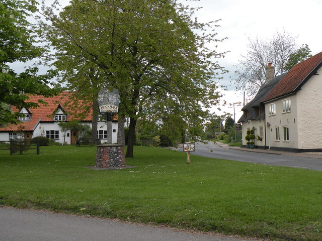
The village sign at Great Hockham
Forest Track Forest track near to Stonebridge, Norfolk.
Forest Track
Forest track near to Stonebridge, Norfolk.
Green Road Country Road near to Stonebridge, Norfolk.
Green Road
Country Road near to Stonebridge, Norfolk.
Country Lane Country lane and forest track entrance near to Stonebridge, Norfolk.
Country Lane
Country lane and forest track entrance near to Stonebridge, Norfolk.
Poor's Allotment This open land is marked on the map as Poor's Allotment near to Breckles, Norfolk.
Poor's Allotment
This open land is marked on the map as Poor's Allotment near to Breckles, Norfolk.
Green Track Green forest track near to Breckles, Norfolk.
Green Track
Green forest track near to Breckles, Norfolk.
Forest Track Forest track looking north towards Frost's Common near to Breckles, Norfolk.
Forest Track
Forest track looking north towards Frost's Common near to Breckles, Norfolk.
Country lane in the woods near to Great Hockham Early morning sun beams through the trees in the woods near Great Hockham, close to part of the Peddars Way.
Country lane in the woods near to Great Hockham
Early morning sun beams through the trees in the woods near Great Hockham, close to part of the Peddars Way.
Show me another place!

Bragmere Pits is located at Grid Ref: TL9391 (Lat: 52.489474, Lng: 0.84771482)

Administrative County: Norfolk

District: Breckland

Police Authority: Norfolk

What 3 Words

///exclusive.allows.powering. Near Griston, Norfolk

Related Wikis

Nearby Amenities

Located within 500m of 52.489474,0.84771482
Barrier: bar
Bicycle: yes
Vehicle: no
Lat/Long: 52.4911819/0.8515582
Bragmere Pits
Place: locality
Lat/Long: 52.4895861/0.8475233
Barrier: bar
Foot: yes
Vehicle: no
Lat/Long: 52.4892678/0.8489567
Board Type: nature
Description: Forestry Commission visitor information
Information: board
Tourism: information
Lat/Long: 52.4910921/0.8524409
Waste Basket
Waste: dog_excrement
Lat/Long: 52.4911083/0.8524402
The data included in this document is from www.openstreetmap.org. The data is made available under ODbL.

Have you been to Bragmere Pits?

Leave your review of Bragmere Pits below (or comments, questions and feedback).