Cheshunt Reservoir (North)

Lake, Pool, Pond, Freshwater Marsh in Hertfordshire Broxbourne

England

Cheshunt Reservoir (North)

Shops on High Street, Cheshunt
Shops on High Street, Cheshunt Credit: David Howard

Cheshunt Reservoir (North) is a freshwater body located in Hertfordshire, England. It is a man-made reservoir that serves as an important water supply source for the local community. The reservoir is situated in the town of Cheshunt, within close proximity to the Lea Valley Regional Park.

Covering an area of approximately 55 acres, Cheshunt Reservoir (North) is a significant body of water in the region. It is primarily used for water storage and management purposes, ensuring a reliable water supply for nearby towns and villages. The reservoir receives water from various sources, including rainfall and nearby rivers.

Surrounded by lush greenery, the reservoir offers a picturesque landscape to visitors. The area around the reservoir is well-maintained and provides a tranquil environment for nature enthusiasts. The reservoir is a popular spot for fishing, with a variety of fish species inhabiting its depths, including carp, pike, and roach.

The reservoir also supports a diverse range of wildlife, making it an attractive location for birdwatchers. Several bird species can be spotted in the area, including ducks, swans, and herons. Additionally, the reservoir is home to various flora and fauna, contributing to the overall biodiversity of the region.

Cheshunt Reservoir (North) plays an essential role in water management and conservation efforts in Hertfordshire. Its scenic beauty and recreational opportunities make it a cherished natural asset for both locals and visitors alike.

If you have any feedback on the listing, please let us know in the comments section below.

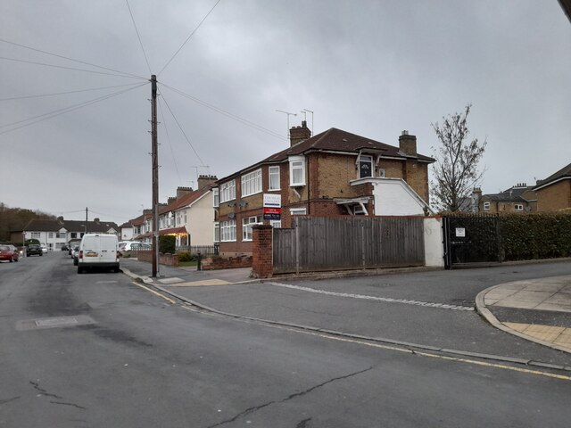
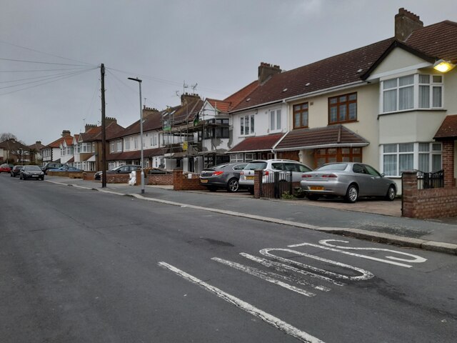
Cheshunt Reservoir (North) Images

Images are sourced within 2km of 51.714842/-0.043777248 or Grid Reference TL3503. Thanks to Geograph Open Source API. All images are credited.

Shops on High Street, Cheshunt
Mill Lane at the junction of High Street, Cheshunt
Brookfield Lane West, Turnford The road is split in two by the A10
Brookfield Lane West, Turnford
The road is split in two by the A10
Field by Brookfield Lane West, Turnford
Brookfield Lane West, Turnford
Houses on Brookfield Lane West, Turnford
Southbrook Drive, Turnford
Brookfield Lane West, Turnford
Modern house on Brookfield Road West, Flamstead End This style was popular in the 70s, I had a flat like it once. <a title="https://www.geograph.org.uk/photo/4839443" href="https://www.geograph.org.uk/photo/4839443">Link</a>
Modern house on Brookfield Road West, Flamstead End
This style was popular in the 70s, I had a flat like it once. Link
Houses on Brookfield Road West, Flamstead End
Houses on Perrysfield Road, Turnford The birch tree has suffered a recent accident, it was perfect a few years earlier.
Houses on Perrysfield Road, Turnford
The birch tree has suffered a recent accident, it was perfect a few years earlier.
Perrysfield Road, Turnford
Cheshunt Wash at the corner of Perrysfield Road
High Road, Turnford
High Road, Turnford
Great Cambridge Road, Turnford I didn't realise the Great Cambridge Road split in Cheshunt, as this is the name of it from Tottenham onwards, but no longer follows the newer section of the A10 but remained with the original part.
Great Cambridge Road, Turnford
I didn't realise the Great Cambridge Road split in Cheshunt, as this is the name of it from Tottenham onwards, but no longer follows the newer section of the A10 but remained with the original part.
Roundabout on High Street, Cheshunt
Clarendon Road, Cheshunt
Show me another place!

Cheshunt Reservoir (North) is located at Grid Ref: TL3503 (Lat: 51.714842, Lng: -0.043777248)

Administrative County: Hertfordshire

District: Broxbourne

Police Authority: Hertfordshire

What 3 Words

///custom.trout.gears. Near Cheshunt, Hertfordshire

Nearby Locations

Cheshunt Reservoir (North)

Related Wikis

Cheshunt Park

Cheshunt Park is a 40 hectare public park and Local Nature Reserve in Cheshunt in Hertfordshire. It is owned and managed by Broxbourne Borough Council...
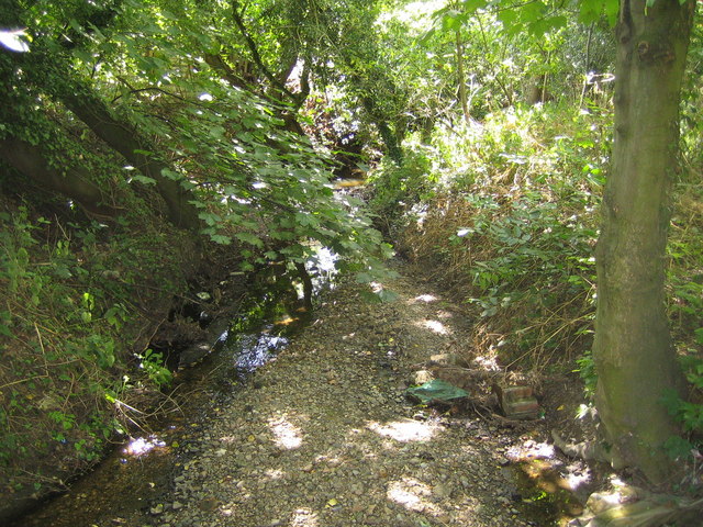
Rags Brook

Rags Brook is a tributary of the Small River Lea, which is a tributary of the River Lea. Rags Brook rises in the hills between Goffs Oak Cuffley in Hertfordshire...

Bishops' College, Cheshunt

Bishops' College, Cheshunt was an Anglican theological College set up to train clergy to serve in the Church of England. It was housed in buildings formerly...

Goffs Academy

Goffs Academy is a selective secondary school and sixth form with academy status located in Cheshunt, Hertfordshire, England with around 1,300 students...

Haileybury Turnford

Haileybury Turnford (formerly Turnford School) is a coeducational secondary school and sixth form located in Turnford, Hertfordshire, England. Previously...

Turnford, Hertfordshire

Turnford is a village in the Borough of Broxbourne, in Hertfordshire, England, in an area generally known as the Lee Valley. It is bounded by Wormley to...

F.C. Broxbourne Borough

Football Club Broxbourne Borough was a football club based in Broxbourne, Hertfordshire, England. They played at Goffs Lane in Cheshunt. == History... ==

Goffs-Churchgate Academy

Goffs-Churchgate Academy is a secondary school with academy status located in Cheshunt, Hertfordshire, England with around 600 students. == History... ==

Nearby Amenities

Located within 500m of 51.714842,-0.043777248
Created By: YahooApplet 1.0
Lat/Long: 51.7158797/-0.041566
Created By: YahooApplet 1.0
Lat/Long: 51.717937/-0.0391003
Created By: YahooApplet 1.0
Lat/Long: 51.7156172/-0.0422331
Created By: YahooApplet 1.0
Lat/Long: 51.7165678/-0.0394436
Created By: YahooApplet 1.0
Lat/Long: 51.7156638/-0.0419649
Created By: YahooApplet 1.0
Lat/Long: 51.7154976/-0.0422331
Created By: YahooApplet 1.0
Lat/Long: 51.7152317/-0.0422653
Created By: YahooApplet 1.0
Lat/Long: 51.7150389/-0.0421902
Created By: YahooApplet 1.0
Lat/Long: 51.7148794/-0.0419863
Created By: YahooApplet 1.0
Lat/Long: 51.7151054/-0.0426515
Created By: YahooApplet 1.0
Lat/Long: 51.7142811/-0.0403126
Created By: YahooApplet 1.0
Lat/Long: 51.713736/-0.0402375
Created By: YahooApplet 1.0
Lat/Long: 51.7145411/-0.0453766
Created By: YahooApplet 1.0
Lat/Long: 51.7148867/-0.0445613
Created By: YahooApplet 1.0
Lat/Long: 51.7155648/-0.0439497
Created By: YahooApplet 1.0
Lat/Long: 51.7158838/-0.0436278
Created By: YahooApplet 1.0
Lat/Long: 51.7159304/-0.0424584
Created By: YahooApplet 1.0
Lat/Long: 51.7155847/-0.0428125
Created By: YahooApplet 1.0
Lat/Long: 51.715033/-0.0430163
Created By: YahooApplet 1.0
Lat/Long: 51.714694/-0.043027
Leisure: fishing
Lat/Long: 51.7142328/-0.0440918
Leisure: fishing
Lat/Long: 51.7140154/-0.0450091
Created By: YahooApplet 1.0
Lat/Long: 51.7138099/-0.0461384
Created By: YahooApplet 1.0
Lat/Long: 51.7179321/-0.0393025
Created By: YahooApplet 1.0
Lat/Long: 51.7169055/-0.0393796
Created By: YahooApplet 1.0
Lat/Long: 51.7166268/-0.0396681
Created By: YahooApplet 1.0
Lat/Long: 51.7163407/-0.0402713
Created By: YahooApplet 1.0
Lat/Long: 51.7161098/-0.0409818
Created By: YahooApplet 1.0
Lat/Long: 51.7159227/-0.0416168
Created By: YahooApplet 1.0
Lat/Long: 51.7160015/-0.0425561
Created By: YahooApplet 1.0
Lat/Long: 51.7160621/-0.0431228
Created By: YahooApplet 1.0
Lat/Long: 51.7160217/-0.0437252
Created By: YahooApplet 1.0
Lat/Long: 51.7159104/-0.0449904
Created By: YahooApplet 1.0
Lat/Long: 51.7157243/-0.0463208
Created By: YahooApplet 1.0
Lat/Long: 51.7155648/-0.0479516
Created By: YahooApplet 1.0
Lat/Long: 51.7166549/-0.0503548
Created By: YahooApplet 1.0
Lat/Long: 51.7154941/-0.0424445
Created By: YahooApplet 1.0
Lat/Long: 51.714949/-0.0426805
Created By: YahooApplet 1.0
Lat/Long: 51.7143574/-0.0403953
Created By: YahooApplet 1.0
Lat/Long: 51.7148892/-0.0429809
Noexit: yes
Lat/Long: 51.7108728/-0.046885
Parking
Created By: Potlatch 0.9c
Lat/Long: 51.7123596/-0.0458552
Post Box
Operator: Royal Mail
Ref: EN7 23
Lat/Long: 51.7141068/-0.0433343
Noexit: yes
Lat/Long: 51.71406/-0.0493786
Noexit: yes
Lat/Long: 51.7139823/-0.0477645
Marks & Spencer
Brand: Marks & Spencer
Brand Wikidata: Q714491
Contact Website: https://www.marksandspencer.com/stores/cheshunt-97
Shop: supermarket
Wheelchair: yes
Lat/Long: 51.7167869/-0.0375755
Community Centre
Local Ref: NR
Naptan AtcoCode: 210021703023
Naptan Bearing: W
Naptan BusStopType: CUS
Naptan CommonName: Community Centre
Naptan Crossing: The Green
Naptan Indicator: nr
Naptan Landmark: The Green
Naptan NaptanCode: hrtajwpw
Naptan PlusbusZoneRef: CHESHNT
Naptan ShortCommonName: NA
Naptan Street: Whitefields Road
Naptan Verified: no
Source: naptan_import
Lat/Long: 51.7106272/-0.043749
Mayo Close
Naptan AtcoCode: 210021703025
Naptan Bearing: N
Naptan BusStopType: CUS
Naptan CommonName: Mayo Close
Naptan Crossing: Albemarle Avenue
Naptan Indicator: adj
Naptan Landmark: Albemarle Avenue
Naptan NaptanCode: hrtajwta
Naptan PlusbusZoneRef: CHESHNT
Naptan ShortCommonName: NA
Naptan Street: Whitefields Road
Naptan Verified: no
Source: naptan_import
Lat/Long: 51.7122431/-0.0446636
Mayo Close
Naptan AtcoCode: 210021703035
Naptan Bearing: S
Naptan BusStopType: CUS
Naptan CommonName: Mayo Close
Naptan Crossing: opp Albemarle Avenue
Naptan Indicator: opp
Naptan Landmark: opp Albemarle Avenue
Naptan NaptanCode: hrtajwtg
Naptan PlusbusZoneRef: CHESHNT
Naptan ShortCommonName: NA
Naptan Street: Whitefields Road
Naptan Verified: no
Source: naptan_import
Lat/Long: 51.7122405/-0.0445045
Community Centre
Naptan AtcoCode: 210021703037
Naptan Bearing: E
Naptan BusStopType: CUS
Naptan CommonName: Community Centre
Naptan Crossing: opp The Green
Naptan Indicator: opp
Naptan Landmark: opp The Green
Naptan NaptanCode: hrtajwtj
Naptan PlusbusZoneRef: CHESHNT
Naptan ShortCommonName: NA
Naptan Street: Whitefields Road
Naptan Verified: no
Source: naptan_import
Lat/Long: 51.7106766/-0.0434718
Noexit: yes
Lat/Long: 51.7142176/-0.0405062
Crossing
Lat/Long: 51.7154996/-0.0372669
Leisure: fishing
Lat/Long: 51.715149/-0.0442344
Leisure: fishing
Lat/Long: 51.7148705/-0.0445995
Bench
Source: gps+mapnoter
Lat/Long: 51.7146653/-0.0456055
Leisure: fishing
Lat/Long: 51.715922/-0.0434058
Bench
Source: gps+mapnoter
Lat/Long: 51.7146209/-0.0453964
Leisure: fishing
Lat/Long: 51.7154407/-0.0440204
Bench
Source: gps+mapnoter
Lat/Long: 51.7146924/-0.0453964
Leisure: fishing
Lat/Long: 51.7153292/-0.0440839
Leisure: fishing
Lat/Long: 51.7156029/-0.0439113
Leisure: fishing
Lat/Long: 51.7155037/-0.0439845
Leisure: fishing
Lat/Long: 51.7147699/-0.044857
Fixme: end fence
Source: gps+mapnoter
Lat/Long: 51.7160534/-0.0430951
Leisure: fishing
Source: gps+mapnoter
Lat/Long: 51.715977/-0.0429766
Leisure: fishing
Lat/Long: 51.7159582/-0.0431953
Leisure: fishing
Lat/Long: 51.7144082/-0.0436141
Leisure: fishing
Lat/Long: 51.7139046/-0.045601
Leisure: fishing
Lat/Long: 51.7139606/-0.0452827
Leisure: fishing
Lat/Long: 51.7141411/-0.0444453
Leisure: fishing
Lat/Long: 51.714455/-0.0434868
Leisure: fishing
Lat/Long: 51.7140647/-0.0448217
Waste Basket
Source: gps+mapnoter
Waste: dog
Lat/Long: 51.7135091/-0.0471318
Fixme: pitch here?
Lat/Long: 51.7153565/-0.0501263
Fixme: recheck paths here
Lat/Long: 51.7136282/-0.0468192
Fixme: paths from here?
Lat/Long: 51.7172061/-0.0484528
Fixme: entrance here?
Lat/Long: 51.7159166/-0.0505528
Waterway: weir
Lat/Long: 51.7159257/-0.0414094
Barrier: kissing_gate
Lat/Long: 51.7149449/-0.04207
Atm
Lat/Long: 51.7128538/-0.0501939
Noexit: yes
Lat/Long: 51.7114119/-0.0470382
Noexit: yes
Lat/Long: 51.7123139/-0.0432787
Noexit: yes
Lat/Long: 51.7112518/-0.0411987
Noexit: yes
Lat/Long: 51.7122078/-0.0411237
Barrier: yes
Foot: yes
Lat/Long: 51.7135773/-0.0405553
Noexit: yes
Lat/Long: 51.7138517/-0.04218
Noexit: yes
Lat/Long: 51.7122262/-0.0412192
Noexit: yes
Lat/Long: 51.7127314/-0.0420089
Noexit: yes
Lat/Long: 51.7128074/-0.0417695
Mini Roundabout
Lat/Long: 51.7117308/-0.0413444
Noexit: yes
Lat/Long: 51.7107496/-0.0420713
Noexit: yes
Lat/Long: 51.7108079/-0.0419317
Tesco Express
Addr Housenumber: 68
Addr Postcode: EN8 0HX
Addr Street: Flamstead End Road
Brand: Tesco Express
Brand Wikidata: Q98456772
Contact Website: https://www.tesco.com/store-locator/cheshunt/68-flamstead-end-road
Fhrs Id: 743466
Shop: convenience
Lat/Long: 51.7128809/-0.0500152
Barrier: yes
Foot: yes
Lat/Long: 51.7123651/-0.0406486
Barrier: bollard
Bollard: octagonal
Colour: grey
Lat/Long: 51.7142591/-0.0432378
Barrier: bollard
Bollard: octagonal
Colour: grey
Lat/Long: 51.714577/-0.0414693
Marker: yes
Material: concrete
Utility: yes
Lat/Long: 51.7145656/-0.0414763
Marker: yes
Material: concrete
Utility: yes
Lat/Long: 51.7145727/-0.041441
The data included in this document is from www.openstreetmap.org. The data is made available under ODbL.

Have you been to Cheshunt Reservoir (North)?

Leave your review of Cheshunt Reservoir (North) below (or comments, questions and feedback).