New Pond

Lake, Pool, Pond, Freshwater Marsh in Sussex Mid Sussex

England

New Pond

Balcombe Water Tower Situated on the extreme southern edge of the gridsquare, now as with most water towers in the UK also used as a mobile telephone mast.
Balcombe Water Tower Credit: Darren Hill

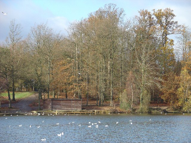
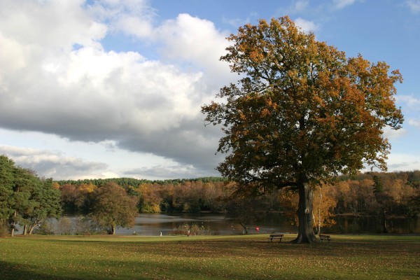
New Pond, located in Sussex, is a picturesque freshwater body that encompasses various ecosystems, including a lake, pool, pond, and freshwater marsh. Spanning a substantial area, this diverse landscape offers a haven for numerous species of flora and fauna.

The lake within New Pond is an expansive body of water, characterized by its deep and clear blue waters. It serves as a recreational hub for fishing enthusiasts, who are attracted by the abundance of fish species, such as trout and perch. Additionally, the lake provides an idyllic setting for boating and sailing activities.

Adjacent to the lake is a smaller pool, characterized by its shallower waters and tranquil ambiance. This pool serves as a sanctuary for numerous aquatic plants and invertebrates, creating a thriving ecosystem. Visitors often enjoy observing the vibrant underwater life or simply basking in the serenity of the surroundings.

Further into New Pond lies a smaller, yet equally enchanting, pond. Surrounded by lush vegetation, this pond is a hotspot for birdwatching, attracting a wide array of avian species throughout the year. Bird enthusiasts often flock to this area to catch a glimpse of rare and migratory birds, adding to the region's allure.

Lastly, New Pond is also home to a freshwater marsh. This marshland teems with various wetland plants, such as cattails and water lilies, providing a habitat for numerous amphibians and reptiles. It is a great spot for nature enthusiasts to observe and learn about the diverse wetland ecosystems.

In conclusion, New Pond in Sussex offers a remarkable blend of natural landscapes, including a lake, pool, pond, and freshwater marsh. With its diverse ecosystems and abundant wildlife, it provides a captivating experience for visitors of all interests.

If you have any feedback on the listing, please let us know in the comments section below.
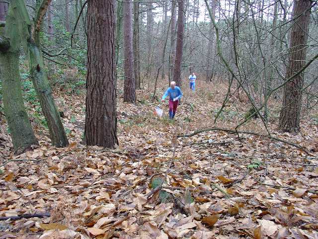
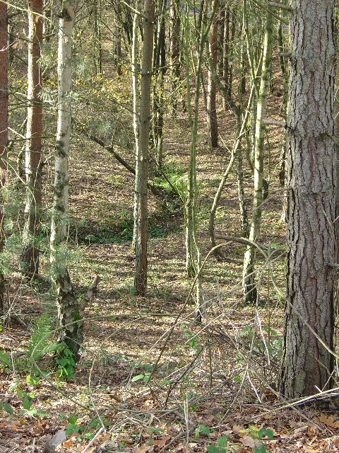
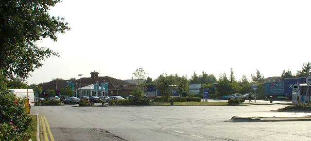
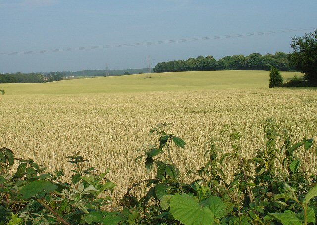
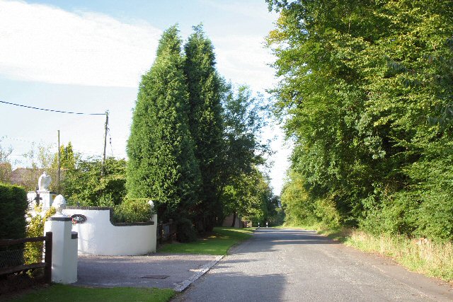
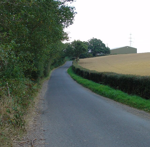
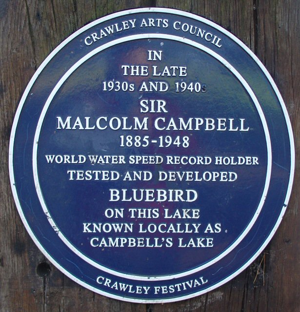
New Pond Images

Images are sourced within 2km of 51.082647/-0.18173264 or Grid Reference TQ2733. Thanks to Geograph Open Source API. All images are credited.

Balcombe Water Tower Situated on the extreme southern edge of the gridsquare, now as with most water towers in the UK also used as a mobile telephone mast.
Balcombe Water Tower
Situated on the extreme southern edge of the gridsquare, now as with most water towers in the UK also used as a mobile telephone mast.
Tilgate Lake, Tilgate Park, Crawley Tilgate Park is the largest public park in Crawley. Before the development of the Crawley New Town, it was the home of the Campbell family. Malcolm Campbell developed and tested his designs of the "Bluebird" world water speed record holding boats on this lake in the 1930s and 40s.
Tilgate Lake, Tilgate Park, Crawley
Tilgate Park is the largest public park in Crawley. Before the development of the Crawley New Town, it was the home of the Campbell family. Malcolm Campbell developed and tested his designs of the "Bluebird" world water speed record holding boats on this lake in the 1930s and 40s.
Tilgate Golf Course, Crawley Grid square TQ2834 is dominated by most of an 18 hole golf course. This fine course is popular and the view here shows three ladies enjoying a round on a Friday afternoon.
Tilgate Golf Course, Crawley
Grid square TQ2834 is dominated by most of an 18 hole golf course. This fine course is popular and the view here shows three ladies enjoying a round on a Friday afternoon.
Tilgate Forest: natural and un-natural trees Tilgate Forest dominates this square. The proximity to the M23 and high vantage point have led a mobile phone company to locate a mast here. It's supposed to blend in with the other flora, but I've never seen another tree like this round here!
Tilgate Forest: natural and un-natural trees
Tilgate Forest dominates this square. The proximity to the M23 and high vantage point have led a mobile phone company to locate a mast here. It's supposed to blend in with the other flora, but I've never seen another tree like this round here!
M23 Motorway looking NE from footbridge between Tilgate Golf Course and Tilgate Forest The M23 cuts across the S of grid square TQ2834. The motorway acts as a boundary between Tilgate Golf Course (to the N) and Tilgate Forest (to the S). The view here is that from a footbridge that crosses over the motorway. In the distance, the edge of the Maidenbower neighbourhood of Crawley can be seen (centre of photo, to left of motorway).
M23 Motorway looking NE from footbridge between Tilgate Golf Course and Tilgate Forest
The M23 cuts across the S of grid square TQ2834. The motorway acts as a boundary between Tilgate Golf Course (to the N) and Tilgate Forest (to the S). The view here is that from a footbridge that crosses over the motorway. In the distance, the edge of the Maidenbower neighbourhood of Crawley can be seen (centre of photo, to left of motorway).
Orienteering in Tilgate Forest, Nr Crawley, West Sussex This Square is dominated by Tilgate Forest, a public access forest managed by the Forestry Commission. The photo shows the mature mixed woodland that makes up most of the forest area. This part is predominantly broadleaved deciduous trees, with the odd coniferous example and a light scattering of rhododendron thickets. The high canopy is quite dense and doesn't let much heavy vegetation take hold. One of several popular woodland areas in the vicinity for orienteering. The event here was a Christmas Score event staged by Southdowns Orienteers.
Orienteering in Tilgate Forest, Nr Crawley, West Sussex
This Square is dominated by Tilgate Forest, a public access forest managed by the Forestry Commission. The photo shows the mature mixed woodland that makes up most of the forest area. This part is predominantly broadleaved deciduous trees, with the odd coniferous example and a light scattering of rhododendron thickets. The high canopy is quite dense and doesn't let much heavy vegetation take hold. One of several popular woodland areas in the vicinity for orienteering. The event here was a Christmas Score event staged by Southdowns Orienteers.
Ditch Bend in a Shallow Re-Entrant in a Coniferous Wooded Part of Tilgate Forest, Nr Crawley, West Sussex This view shows typical vegetation in much of this part of Tilgate Forest: pine trees (with the odd invading birch) with a fairly clean forest floor. The trees tend to form quite a dense canopy, preventing much from growing beneath them. The ditch is part of the drainage network.
Ditch Bend in a Shallow Re-Entrant in a Coniferous Wooded Part of Tilgate Forest, Nr Crawley, West Sussex
This view shows typical vegetation in much of this part of Tilgate Forest: pine trees (with the odd invading birch) with a fairly clean forest floor. The trees tend to form quite a dense canopy, preventing much from growing beneath them. The ditch is part of the drainage network.
Pease Pottage Services At the (current) end of the M23, Junction 11. Operated by Moto.
Pease Pottage Services
At the (current) end of the M23, Junction 11. Operated by Moto.
Corn Fields, Pease Pottage A very summery rural site. Ripening corn in this large field, which covers the N side of this grid square. Much of the rural sussex terrain is patches of trees interspersed by fields of various crops. Tilgate Forest can be seen in the far distance and Bensonshill Wood is on the right. High voltage electricity transmission cross the field (the pylons are just visible). View taken from the old A23 road between Pease Pottage and Handcross, looking E.
Corn Fields, Pease Pottage
A very summery rural site. Ripening corn in this large field, which covers the N side of this grid square. Much of the rural sussex terrain is patches of trees interspersed by fields of various crops. Tilgate Forest can be seen in the far distance and Bensonshill Wood is on the right. High voltage electricity transmission cross the field (the pylons are just visible). View taken from the old A23 road between Pease Pottage and Handcross, looking E.
The old Brighton Road at Pease Pottage Now replaced by the M23, this section of the old A23 is a cul-de-sac.
The old Brighton Road at Pease Pottage
Now replaced by the M23, this section of the old A23 is a cul-de-sac.
Parish Lane, near New Buildings Farm, Pease Pottage, Crawley, West Sussex A quiet "no through" road on the south side of Tilgate forest and the N edge of this grid square.  The route itself continues (in unmetalled form) as a bridleway once it's crossed the London-Brighton Railway. The barn on the skyline is part of New Buildings Farm on the S side of the road. View taken looking E.
Parish Lane, near New Buildings Farm, Pease Pottage, Crawley, West Sussex
A quiet "no through" road on the south side of Tilgate forest and the N edge of this grid square. The route itself continues (in unmetalled form) as a bridleway once it's crossed the London-Brighton Railway. The barn on the skyline is part of New Buildings Farm on the S side of the road. View taken looking E.
Tilgate lake, Tilgate park, Crawley Photo taken facing roughly south east showing what used to be called (maybe it still is?) Campbells lake after the former world water speed record holder Sir Donald Campbell, who used to keep his boat here.
Tilgate lake, Tilgate park, Crawley
Photo taken facing roughly south east showing what used to be called (maybe it still is?) Campbells lake after the former world water speed record holder Sir Donald Campbell, who used to keep his boat here.
Plaque Commemorating Malcolm Campbell, Tilgate Lake (Campbell's Lake), Tilgate Park, Crawley The Campbells used to live in the large house (now gone) of the then private estate. The large lake was used as a testing ground for some of Sir Malcolm Campbell's water borne speed vehicles.
Plaque Commemorating Malcolm Campbell, Tilgate Lake (Campbell's Lake), Tilgate Park, Crawley
The Campbells used to live in the large house (now gone) of the then private estate. The large lake was used as a testing ground for some of Sir Malcolm Campbell's water borne speed vehicles.
Mount Pleasant farm, Pease Pottage A view east of the back of Mount Pleasant farm, taken from behind the adjacent stables.
Mount Pleasant farm, Pease Pottage
A view east of the back of Mount Pleasant farm, taken from behind the adjacent stables.
K2 Leisure Centre, Crawley, West Sussex - View from SW Opened to the public on 14th November 2005, and due to have its official opening early in 2006. This new municipal facility replaces the 40 year old Crawley Leisure Centre situated more centrally in the town and scheduled to be redeveloped as housing. K2 boasts a 50m length swimming pool, large gymnasium, and a climbing wall (visible behind the glass structure to the left of "K2"). View taken from near the main vehicular entrance looking NE.
K2 Leisure Centre, Crawley, West Sussex - View from SW
Opened to the public on 14th November 2005, and due to have its official opening early in 2006. This new municipal facility replaces the 40 year old Crawley Leisure Centre situated more centrally in the town and scheduled to be redeveloped as housing. K2 boasts a 50m length swimming pool, large gymnasium, and a climbing wall (visible behind the glass structure to the left of "K2"). View taken from near the main vehicular entrance looking NE.
K2 Leisure Centre, Crawley, West Sussex - View from NW Another view of the front entrance of the Leisure Centre. K2 was built as part of a larger project to rebuild the adjacent Thomas Bennett Community College, which is designated to specialise in sport.
K2 Leisure Centre, Crawley, West Sussex - View from NW
Another view of the front entrance of the Leisure Centre. K2 was built as part of a larger project to rebuild the adjacent Thomas Bennett Community College, which is designated to specialise in sport.
Tilgate Lake, Tilgate Park, Crawley The fishing rights to this lake are owned by a local fishing club.  The members were holding a fishing competition the day we were there.  Guess the lake must be good for fish - none of the competitors seemed to have been able to persuade any of them to leave it.
Tilgate Lake, Tilgate Park, Crawley
The fishing rights to this lake are owned by a local fishing club. The members were holding a fishing competition the day we were there. Guess the lake must be good for fish - none of the competitors seemed to have been able to persuade any of them to leave it.
Tilgate Park a new viewing platform at the duck pond in the animal park.
Tilgate Park
a new viewing platform at the duck pond in the animal park.
Show me another place!

New Pond is located at Grid Ref: TQ2733 (Lat: 51.082647, Lng: -0.18173264)

Administrative County: West Sussex

District: Mid Sussex

Police Authority: Sussex

What 3 Words

///code.runways.magnitude. Near Broadfield, West Sussex

Related Wikis

Tilgate Nature Centre

Tilgate Nature Centre is a small BIAZA-accredited zoo located within Tilgate Park in Tilgate Forest, South-East Crawley, West Sussex, England. The nature...

Pease Pottage MSA

Pease Pottage services is a motorway service station at Junction 11 of the M23 motorway near Crawley. It is owned by Moto. == Facilities == Facilities...

Tilgate Park

Tilgate Park is a large recreational park situated south of Tilgate, South-East Crawley. Originally a 2,185-acre (8.84 km2) part of the ancient Worth...

Pease Pottage

Pease Pottage is a village in the Mid Sussex District of West Sussex, England. It lies on the southern edge of the Crawley built-up area, in the civil...

Nearby Amenities

Located within 500m of 51.082647,-0.18173264
Power: tower
Lat/Long: 51.079595/-0.1772568
Power: tower
Lat/Long: 51.0796627/-0.1808333
Barrier: kissing_gate
Lat/Long: 51.0812599/-0.1788375
Power: tower
Lat/Long: 51.0797374/-0.1847778
Starvemouse Farm
Place: farm
Lat/Long: 51.0808622/-0.1767149
New Buildings Farm
Place: farm
Lat/Long: 51.0801186/-0.184962
The data included in this document is from www.openstreetmap.org. The data is made available under ODbL.

Have you been to New Pond?

Leave your review of New Pond below (or comments, questions and feedback).