Hunters Close Pond

Lake, Pool, Pond, Freshwater Marsh in Hertfordshire Stevenage

England

Hunters Close Pond

Fairlands Valley Park This large lake is used by sailors and fishermen.  This photo is taken facing south.  To the rear there are two smaller lakes.  The park is very popular in the summer.
Fairlands Valley Park Credit: Robin Hall

Hunters Close Pond, located in Hertfordshire, is a serene and picturesque freshwater feature that serves as a natural oasis for both wildlife and visitors alike. Spanning over a relatively small area, the pond is considered a hidden gem within the region, offering a peaceful retreat from the hustle and bustle of daily life.

Surrounded by lush greenery, the pond boasts crystal-clear waters that reflect the beauty of its surroundings. It is primarily fed by local rainwater runoff, ensuring a constant flow of fresh water. The pond's depth varies throughout the year, with the water level highest during the rainy seasons and lower during drier periods, but it generally maintains a tranquil and inviting atmosphere.

The ecosystem of Hunters Close Pond supports a diverse range of plant and animal life. The water is adorned with lily pads and other aquatic vegetation, providing essential habitats for various species. Ducks, geese, and swans are often spotted gracefully gliding across the water, while dragonflies and other insects dance above its surface. The pond's surrounding vegetation attracts a multitude of bird species, making it a haven for birdwatching enthusiasts.

Visitors to Hunters Close Pond can enjoy leisurely walks along its banks, taking in the serene ambiance and immersing themselves in nature's beauty. The tranquil atmosphere provides an ideal setting for relaxation, picnics, and photography. The pond is easily accessible, with nearby parking and well-maintained footpaths for visitors to explore the area.

Overall, Hunters Close Pond is a charming freshwater feature in Hertfordshire that offers a peaceful retreat and a chance to connect with nature. Its tranquil waters, diverse flora and fauna, and stunning surroundings make it a beloved destination for locals and visitors alike.

If you have any feedback on the listing, please let us know in the comments section below.

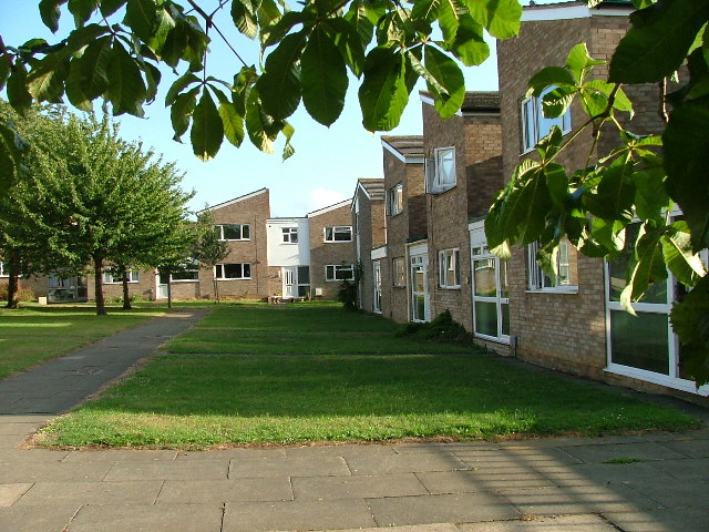
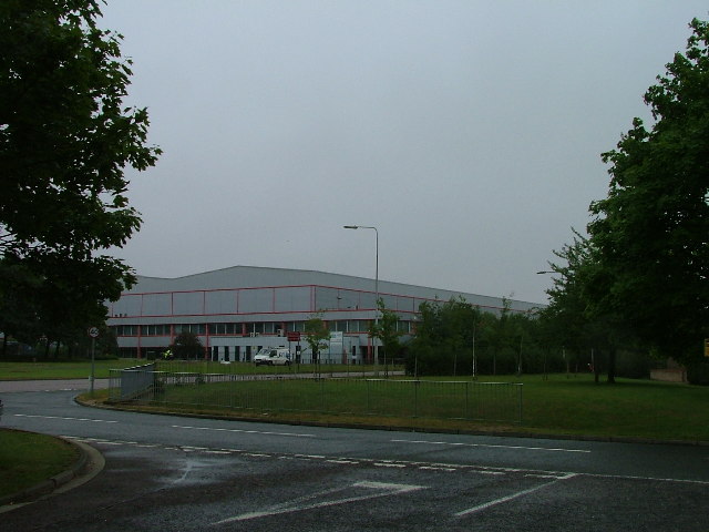
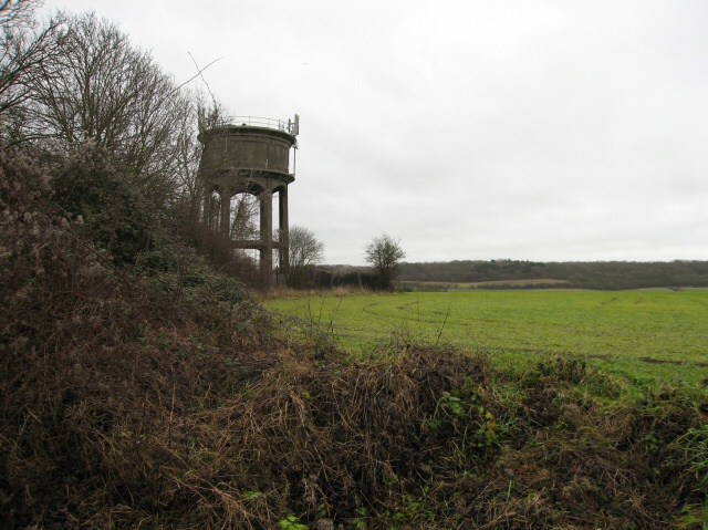
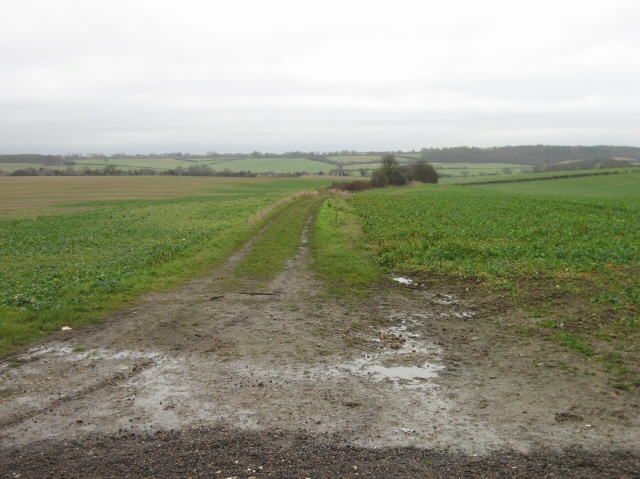
Hunters Close Pond Images

Images are sourced within 2km of 51.911102/-0.1594389 or Grid Reference TL2625. Thanks to Geograph Open Source API. All images are credited.

Fairlands Valley Park This large lake is used by sailors and fishermen.  This photo is taken facing south.  To the rear there are two smaller lakes.  The park is very popular in the summer.
Fairlands Valley Park
This large lake is used by sailors and fishermen. This photo is taken facing south. To the rear there are two smaller lakes. The park is very popular in the summer.
Parishes Mead. Parishes mead is a newer development on the east side of Stevenage.  There is a mixture of private and social housing here.
Parishes Mead.
Parishes mead is a newer development on the east side of Stevenage. There is a mixture of private and social housing here.
Mildmay Road. These houses were built in a variety of styles.  These are not untypical but some of the architectural styles bring their own maintenance problems.
Mildmay Road.
These houses were built in a variety of styles. These are not untypical but some of the architectural styles bring their own maintenance problems.
Fortuna Close One of the more modern parts of Stevenage and with some more imaginative building - three storeys!
Fortuna Close
One of the more modern parts of Stevenage and with some more imaginative building - three storeys!
Mastercare warehousing Although this photograph is actually taken (just) from neighbouring TL2526, this warehouse is typical of this industrial estate.  Not all are grey and red.  Some are grey and another colour!
Mastercare warehousing
Although this photograph is actually taken (just) from neighbouring TL2526, this warehouse is typical of this industrial estate. Not all are grey and red. Some are grey and another colour!
Ferrier Rd This could be any road in this area.  Plans seem to have been bought as a job lot.
Ferrier Rd
This could be any road in this area. Plans seem to have been bought as a job lot.
Telford Avenue. On the edge of TL2525..  I wasn't going any further into this estate.  I always get lost even though it's not that big by local standards.  This estate, in common with others in the area suffers from the increase in car ownership.  Parking is awkward, the roads not wide and the layout is twisting.
Telford Avenue.
On the edge of TL2525.. I wasn't going any further into this estate. I always get lost even though it's not that big by local standards. This estate, in common with others in the area suffers from the increase in car ownership. Parking is awkward, the roads not wide and the layout is twisting.
War memorial - Walkern. Stuck out in rather an odd place.  It sits in the grass triangle at a junction just outside of Walkern.  There are no houses or other buildings in the immediate vicinity.
War memorial - Walkern.
Stuck out in rather an odd place. It sits in the grass triangle at a junction just outside of Walkern. There are no houses or other buildings in the immediate vicinity.
Aston Water Tower The Water Tower and surrounding countryside from the lane to Aston End
Aston Water Tower
The Water Tower and surrounding countryside from the lane to Aston End
The Crown, Aston End
Just Outside Stevenage On the Stevenage boundary, looking across TL2725 from Stevenage Road and you are in open country.
Just Outside Stevenage
On the Stevenage boundary, looking across TL2725 from Stevenage Road and you are in open country.
Trig point at Lonsdale School I swear that tree was not there when I took the photo.

This Trig point is in the playing field of a special needs school caring for 75 children between the ages of 2 and 19 from London, Bedfordshire and Hertfordshire.
Trig point at Lonsdale School
I swear that tree was not there when I took the photo. This Trig point is in the playing field of a special needs school caring for 75 children between the ages of 2 and 19 from London, Bedfordshire and Hertfordshire.
St Vincent De Paul Roman Catholic Primary School Does what it says on the tin.
St Vincent De Paul Roman Catholic Primary School
Does what it says on the tin.
St Joseph's Church and Presbytery A modern church set in its own grounds.
St Joseph's Church and Presbytery
A modern church set in its own grounds.
Bedwell JMI School. Another of Stevenage's schools set in a cluster with others.
Bedwell JMI School.
Another of Stevenage's schools set in a cluster with others.
Moss Bury Primary School and Nursery Taken from a bridge over a part of Stevenage's excellent network of cycleways.  All of the tarmac between the school and the photographer is cycleway.  Road is over on the top left of this photo.
Moss Bury Primary School and Nursery
Taken from a bridge over a part of Stevenage's excellent network of cycleways. All of the tarmac between the school and the photographer is cycleway. Road is over on the top left of this photo.
Stevenage: Fairlands Valley Park The upstreammost of the artificial lakes in the park, viewed looking from the footbridge, with the top of the cascade to the next lower lake just visible in the bottom of the photograph.
Stevenage: Fairlands Valley Park
The upstreammost of the artificial lakes in the park, viewed looking from the footbridge, with the top of the cascade to the next lower lake just visible in the bottom of the photograph.
Stevenage: Fairlands Valley Park The second lake, going downstream, of the four in the park, this is the reverse view from <a href="https://www.geograph.org.uk/photo/175166">TL2524 : Stevenage: Fairlands Valley Park</a>
Stevenage: Fairlands Valley Park
The second lake, going downstream, of the four in the park, this is the reverse view from TL2524 : Stevenage: Fairlands Valley Park
Show me another place!

Hunters Close Pond is located at Grid Ref: TL2625 (Lat: 51.911102, Lng: -0.1594389)

Administrative County: Hertfordshire

District: Stevenage

Police Authority: Hertfordshire

What 3 Words

///poetic.canines.daffodils. Near Walkern, Hertfordshire

Related Wikis

The Nobel School

The Nobel School is a co-educational secondary school and sixth form located in Stevenage in the English county of Hertfordshire. == History == The Nobel...

Pryor's Wood

Pryor's Wood is an 8.7-hectare (21-acre) nature reserve in Great Ashby, near Stevenage in Hertfordshire. It was formerly managed by the Herts and Middlesex...

Marriotts School

Marriotts School is a secondary school in Stevenage, Hertfordshire, England. The school was rebuilt along with Lonsdale School (for special needs children...

Aston End

Aston End is a hamlet in Hertfordshire, England. It is in the civil parish of Aston. It features a pub and a butchers, as well as a few houses. == References... ==

Great Ashby

Great Ashby is a civil parish in Stevenage in the North Hertfordshire district, in the county of Hertfordshire, England. The name Great Ashby was coined...

Walkern

Walkern is a village and civil parish in East Hertfordshire, England. It is about two miles (3 km) from Stevenage. The village has several shops, including...

Benington High Wood

Benington High Wood is a 20.7-hectare (51-acre) biological Site of Special Scientific Interest in Benington, Hertfordshire. The planning authority is East...

Barnwell School

Barnwell School is a coeducational secondary school and sixth form that was established in 1959 and is situated in the south of Stevenage, Hertfordshire...

Nearby Amenities

Located within 500m of 51.911102,-0.1594389
Barrier: cycle_barrier
Cycle Barrier: double
Cycle Barrier Installation: fixed
Foot: yes
Lat/Long: 51.9101538/-0.1616294
Kerb: raised
Lat/Long: 51.9091435/-0.1595031
Created By: osmeditor2
Lat/Long: 51.9068317/-0.157321
Created By: osmeditor2
Lat/Long: 51.907985/-0.1567526
Created By: osmeditor2
Lat/Long: 51.908635/-0.1565776
Created By: osmeditor2
Lat/Long: 51.9124002/-0.156488
Note: Road markings are set up for traffic lights (including solid stop lines) but there are no traffic lights
Lat/Long: 51.9133685/-0.1564569
Created By: osmeditor2
Lat/Long: 51.9119328/-0.1586792
Created By: osmeditor2
Lat/Long: 51.9115945/-0.1586843
Chells Manor House
Building: yes
Wikidata: Q17555497
Lat/Long: 51.9118539/-0.1598482
Bus Stop
The White Way
Bench: yes
Bin: no
Bus: yes
Lit: yes
Naptan AtcoCode: 210021203070
Naptan Bearing: S
Naptan CommonName: The White Way
Naptan Crossing: The White Way
Naptan Indicator: S-bound
Naptan Landmark: The White Way
Naptan NaptanCode: hrtdwmdp
Naptan PlusbusZoneRef: STEVNGE
Naptan ShortCommonName: NA
Naptan Street: Gresley Way
Naptan Verified: no
Network: SB1
Public Transport: platform
Shelter: yes
Source: naptan_import
Tactile Paving: no
Lat/Long: 51.9090221/-0.1564219
Bus Stop
The White Way
Bench: yes
Bin: yes
Lit: yes
Local Ref: NR
Naptan AtcoCode: 210021204500
Naptan Bearing: N
Naptan CommonName: The White Way
Naptan Crossing: Chalkdown
Naptan Indicator: nr
Naptan Landmark: Chalkdown
Naptan NaptanCode: hrtdwgwm
Naptan PlusbusZoneRef: STEVNGE
Naptan ShortCommonName: NA
Naptan Street: Gresley Way
Naptan Verified: no
Shelter: yes
Source: naptan_import
Tactile Paving: no
Lat/Long: 51.9102483/-0.1566334
Bus Stop
Downlands
Bench: yes
Bin: yes
Bus: yes
Check Date Shelter: 2021-01-02
Lit: yes
Local Ref: NR
Naptan AtcoCode: 210021204501
Naptan Bearing: NW
Naptan CommonName: Downlands
Naptan Crossing: Beane Avenue
Naptan Indicator: nr
Naptan Landmark: Beane Avenue
Naptan NaptanCode: hrtdwgwp
Naptan PlusbusZoneRef: STEVNGE
Naptan ShortCommonName: NA
Naptan Street: The White Way
Naptan Verified: no
Network: SB1
Operator: Arriva
Public Transport: platform
Shelter: yes
Source: naptan_import
Tactile Paving: yes
Lat/Long: 51.9096252/-0.1581855
Bus Stop
Harvest Lane
Bench: no
Bin: no
Bus: yes
Lit: yes
Naptan AtcoCode: 210021204502
Naptan Bearing: NW
Naptan CommonName: Harvest Lane
Naptan Crossing: Conifer Walk
Naptan Indicator: opp
Naptan Landmark: Conifer Walk
Naptan NaptanCode: hrtdwgwt
Naptan PlusbusZoneRef: STEVNGE
Naptan ShortCommonName: NA
Naptan Street: The White Way
Naptan Verified: no
Public Transport: platform
Shelter: no
Source: naptan_import
Tactile Paving: yes
Lat/Long: 51.9107458/-0.1613124
Bus Stop
Wheatlands
Bench: no
Bin: no
Bus: yes
Lit: yes
Naptan AtcoCode: 210021204505
Naptan Bearing: N
Naptan CommonName: Wheatlands
Naptan Crossing: Wheatlands
Naptan Indicator: adj
Naptan Landmark: Wheatlands
Naptan NaptanCode: hrtdwjad
Naptan PlusbusZoneRef: STEVNGE
Naptan ShortCommonName: NA
Naptan Street: The White Way
Naptan Verified: no
Public Transport: platform
Shelter: no
Source: naptan_import
Tactile Paving: yes
Lat/Long: 51.9119338/-0.1640644
Bus Stop
Sweynes Mead
Bench: yes
Bin: yes
Bus: yes
Lit: yes
Naptan AtcoCode: 210021204507
Naptan Bearing: NE
Naptan CommonName: Sweynes Mead
Naptan Crossing: The Hedgerows
Naptan Indicator: adj
Naptan Landmark: The Hedgerows
Naptan NaptanCode: hrtdwjag
Naptan PlusbusZoneRef: STEVNGE
Naptan ShortCommonName: NA
Naptan Street: The White Way
Naptan Verified: no
Network: SB1
Operator: Arriva
Public Transport: platform
Shelter: yes
Source: naptan_import
Tactile Paving: yes
Lat/Long: 51.9132724/-0.1624015
Bus Stop
The Pastures
Bench: yes
Bin: no
Bus: yes
Check Date Shelter: 2021-01-02
Lit: yes
Naptan AtcoCode: 210021204510
Naptan Bearing: N
Naptan CommonName: The Pastures
Naptan Crossing: Fairlands Avenue
Naptan Indicator: adj
Naptan Landmark: Fairlands Avenue
Naptan NaptanCode: hrtdwjaj
Naptan PlusbusZoneRef: STEVNGE
Naptan ShortCommonName: NA
Naptan Street: The White Way
Naptan Verified: no
Network: SB1
Operator: Arriva
Public Transport: platform
Shelter: yes
Source: naptan_import
Tactile Paving: yes
Lat/Long: 51.9155264/-0.1597551
Bus Stop
Harvest Lane
Bench: no
Bin: no
Bus: yes
Lit: yes
Local Ref: NR
Naptan AtcoCode: 210021204570
Naptan Bearing: SE
Naptan CommonName: Harvest Lane
Naptan Crossing: Chells Lane
Naptan Indicator: nr
Naptan Landmark: Chells Lane
Naptan NaptanCode: hrtdwgtg
Naptan PlusbusZoneRef: STEVNGE
Naptan ShortCommonName: NA
Naptan Street: The White Way
Naptan Verified: no
Network: SB1
Operator: Arriva
Public Transport: platform
Shelter: no
Source: naptan_import
Tactile Paving: yes
Lat/Long: 51.9110361/-0.1621552
Bus Stop
Sweynes Mead
Bench: no
Bin: no
Bus: yes
Lit: yes
Naptan AtcoCode: 210021204580
Naptan Bearing: SW
Naptan CommonName: Sweynes Mead
Naptan Crossing: Hayfield
Naptan Indicator: opp
Naptan Landmark: Hayfield
Naptan NaptanCode: hrtdwgtj
Naptan PlusbusZoneRef: STEVNGE
Naptan ShortCommonName: NA
Naptan Street: The White Way
Naptan Verified: no
Public Transport: platform
Shelter: no
Source: naptan_import
Tactile Paving: yes
Lat/Long: 51.9129232/-0.1632268
Bus Stop
Downlands
Bench: no
Bin: no
Bus: yes
Lit: yes
Naptan AtcoCode: 210021204600
Naptan Bearing: SE
Naptan CommonName: Downlands
Naptan Crossing: Chells Lane
Naptan Indicator: opp
Naptan Landmark: Chells Lane
Naptan NaptanCode: hrtdwgtm
Naptan PlusbusZoneRef: STEVNGE
Naptan ShortCommonName: NA
Naptan Street: The White Way
Naptan Verified: no
Public Transport: platform
Shelter: no
Source: naptan_import
Tactile Paving: yes
Lat/Long: 51.9104265/-0.1594031
Post Box
Check Date: 2021-01-23
Collection Times: Mo-Fr 17:00; Sa 11:30
Post Box Type: pillar
Ref: SG2 416
Royal Cypher: EIIR
Royal Cypher Wikidata: Q33102113
Lat/Long: 51.909393/-0.157041
Post Box
Check Date: 2021-01-28
Collection Times: Mo-Fr 09:00, Sa 07:00
Ref: SG2 343
Royal Cypher: EIIR
Royal Cypher Wikidata: Q33102113
Lat/Long: 51.908619/-0.164969
Material: wood
Power: pole
Lat/Long: 51.9095256/-0.1545044
Material: wood
Power: pole
Lat/Long: 51.9099724/-0.1562827
Addr City: Stevenage
Addr Housenumber: 77
Addr Postcode: SG2 7BJ
Addr Street: Downlands
Building: house
Lat/Long: 51.9096783/-0.1614316
Barrier: cycle_barrier
Cycle Barrier: double
Cycle Barrier Installation: fixed
Lat/Long: 51.909573/-0.1623831
Grit Bin
Lat/Long: 51.9101036/-0.1592441
Waste Basket
Lat/Long: 51.9096126/-0.1581544
Waste Basket
Lat/Long: 51.9107129/-0.1607595
Waste Basket
Lat/Long: 51.912835/-0.1637971
Grit Bin
Lat/Long: 51.9121479/-0.1642424
Waste Basket
Lat/Long: 51.9082504/-0.1568194
Waste Basket
Lat/Long: 51.9101938/-0.1565637
Waste Basket
Lat/Long: 51.9128668/-0.1566095
Waste Basket
Lat/Long: 51.9149631/-0.1566236
Crossing
Crossing: unmarked
Crossing Island: no
Tactile Paving: yes
Lat/Long: 51.909475/-0.1566114
Barrier: cycle_barrier
Cycle Barrier: double
Cycle Barrier Installation: fixed
Lat/Long: 51.9119037/-0.160855
Barrier: cycle_barrier
Bicycle: yes
Cycle Barrier: double
Cycle Barrier Installation: fixed
Lat/Long: 51.9128155/-0.1637935
Waste Basket
Lat/Long: 51.9154726/-0.158708
Bench
Backrest: yes
Lat/Long: 51.9153266/-0.1587467
Grit Bin
Lat/Long: 51.913441/-0.1571808
Barrier: cycle_barrier
Cycle Barrier: double
Cycle Barrier Installation: fixed
Foot: yes
Lat/Long: 51.9122165/-0.1580141
Crossing
Crossing: unmarked
Crossing Island: no
Kerb: lowered
Tactile Paving: no
Lat/Long: 51.9147939/-0.1589901
Waste Basket
Lat/Long: 51.9102054/-0.1614891
Barrier: cycle_barrier
Cycle Barrier: double
Cycle Barrier Installation: fixed
Foot: yes
Lat/Long: 51.9103043/-0.1591316
Waste Basket
Lat/Long: 51.9111605/-0.158001
Waste Basket
Lat/Long: 51.9067177/-0.1596344
Bench
Backrest: yes
Lat/Long: 51.9067375/-0.1596424
Grit Bin
Lat/Long: 51.9093501/-0.157452
Waste Basket
Waste: dog_excrement
Lat/Long: 51.9080806/-0.1612289
Waste Basket
Waste: dog_excrement
Lat/Long: 51.9071829/-0.1623714
Barrier: cycle_barrier
Cycle Barrier: double
Cycle Barrier Installation: fixed
Lat/Long: 51.9097582/-0.1618545
Bus Stop
Uplands
Bench: no
Bin: no
Bus: yes
Lit: yes
Public Transport: platform
Shelter: no
Tactile Paving: no
Lat/Long: 51.9128416/-0.1563674
Defibrillator
Defibrillator Location: on post at roadside
Emergency: defibrillator
Indoor: no
Lat/Long: 51.9128932/-0.1565766
Bench
Backrest: yes
Lat/Long: 51.9074505/-0.1615024
Waste Basket
Lat/Long: 51.9083636/-0.1590861
Waste Basket
Lat/Long: 51.909767/-0.1618387
Crossing
Crossing: unmarked
Crossing Island: no
Kerb: lowered
Tactile Paving: yes
Lat/Long: 51.9094398/-0.1565202
Crossing
Crossing: unmarked
Crossing Island: no
Tactile Paving: yes
Lat/Long: 51.9133681/-0.1565418
Crossing
Crossing: unmarked
Crossing Island: no
Tactile Paving: yes
Lat/Long: 51.9112495/-0.1565659
Crossing
Crossing: unmarked
Crossing Island: no
Note: crossing is set up for traffic signals but they are not in use at the moment
Tactile Paving: yes
Lat/Long: 51.9132533/-0.1564629
Crossing
Crossing: unmarked
Crossing Island: no
Kerb: lowered
Tactile Paving: yes
Lat/Long: 51.9094747/-0.1562857
Crossing
Crossing: unmarked
Crossing Island: no
Note: crossing is set up for traffic signals but they are not in use at the moment
Tactile Paving: yes
Lat/Long: 51.9133682/-0.1561579
The data included in this document is from www.openstreetmap.org. The data is made available under ODbL.

Have you been to Hunters Close Pond?

Leave your review of Hunters Close Pond below (or comments, questions and feedback).