Chells Manor

Settlement in Hertfordshire Stevenage

England

Chells Manor

Fairlands Valley Park This large lake is used by sailors and fishermen.  This photo is taken facing south.  To the rear there are two smaller lakes.  The park is very popular in the summer.
Fairlands Valley Park Credit: Robin Hall

Chells Manor is a residential area located in the town of Stevenage, in the county of Hertfordshire, England. It is situated towards the eastern side of the town, just off the A602 road. Chells Manor is part of the larger Chells district, which is known for its family-friendly environment and proximity to amenities.

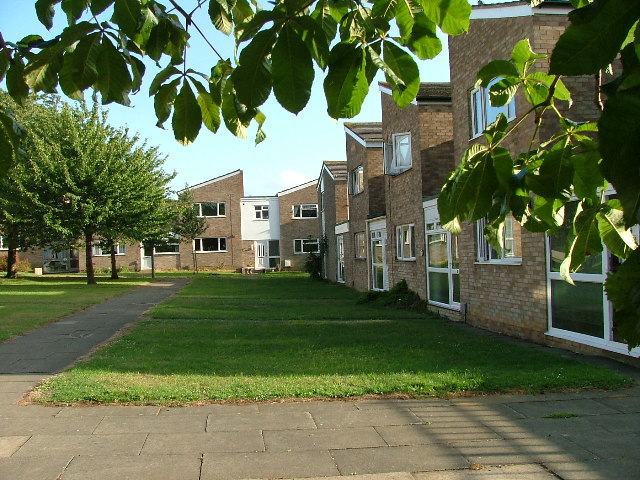
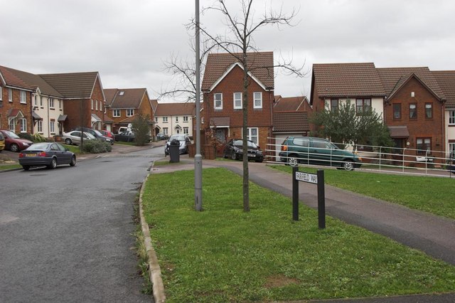
The residential area of Chells Manor mainly consists of houses, ranging from detached and semi-detached properties to terraced houses. The architecture is predominantly from the latter half of the 20th century, with many homes built in the 1970s and 1980s. The area offers a mix of private and council-owned properties, providing a diverse range of housing options.

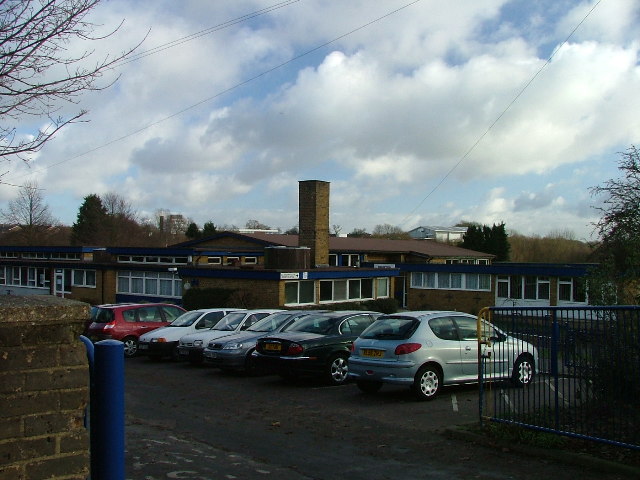
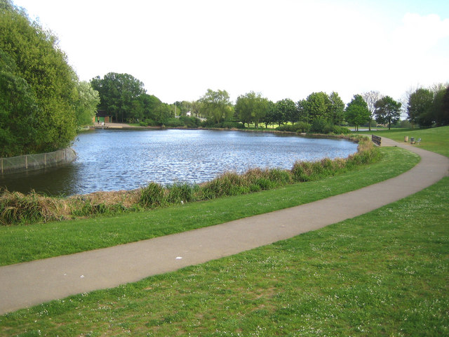
Chells Manor benefits from its convenient location, with easy access to various amenities. The nearby Chells Park offers open green spaces, a children's play area, and recreational facilities, making it a popular spot for families and outdoor enthusiasts. There are also several schools within the vicinity, including Chells Manor Primary School, which caters to the educational needs of the local community.

Transport links are well-established, with bus services connecting Chells Manor to Stevenage town center and the surrounding areas. The A602 road provides direct access to major routes, including the A1(M) motorway, facilitating convenient commuting by car.

Overall, Chells Manor in Hertfordshire offers a pleasant residential environment with a range of housing options, access to amenities, and excellent transport links, making it an attractive place to live.

If you have any feedback on the listing, please let us know in the comments section below.
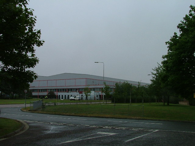
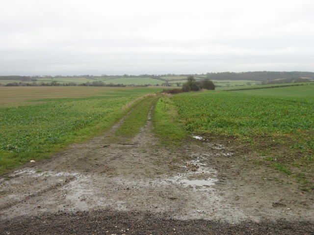
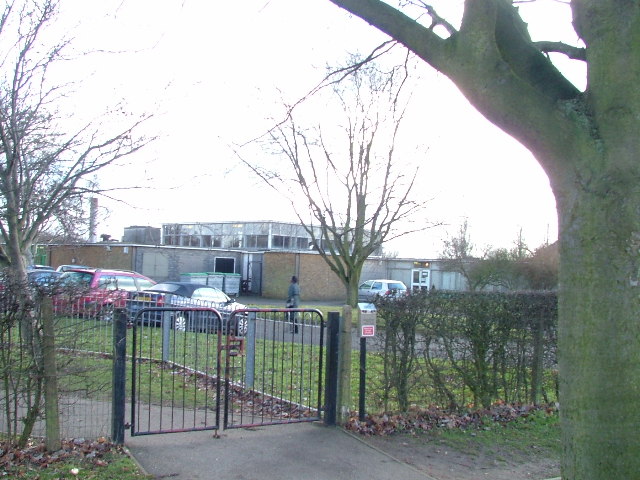
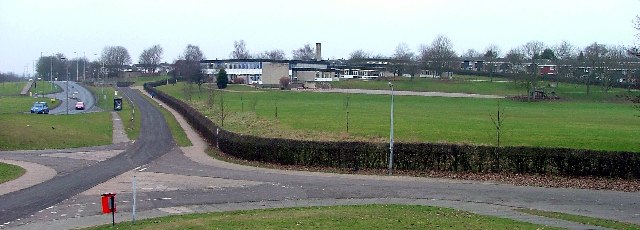
Chells Manor Images

Images are sourced within 2km of 51.915537/-0.16187483 or Grid Reference TL2625. Thanks to Geograph Open Source API. All images are credited.

Fairlands Valley Park This large lake is used by sailors and fishermen.  This photo is taken facing south.  To the rear there are two smaller lakes.  The park is very popular in the summer.
Fairlands Valley Park
This large lake is used by sailors and fishermen. This photo is taken facing south. To the rear there are two smaller lakes. The park is very popular in the summer.
Mildmay Road. These houses were built in a variety of styles.  These are not untypical but some of the architectural styles bring their own maintenance problems.
Mildmay Road.
These houses were built in a variety of styles. These are not untypical but some of the architectural styles bring their own maintenance problems.
Fortuna Close One of the more modern parts of Stevenage and with some more imaginative building - three storeys!
Fortuna Close
One of the more modern parts of Stevenage and with some more imaginative building - three storeys!
Mastercare warehousing Although this photograph is actually taken (just) from neighbouring TL2526, this warehouse is typical of this industrial estate.  Not all are grey and red.  Some are grey and another colour!
Mastercare warehousing
Although this photograph is actually taken (just) from neighbouring TL2526, this warehouse is typical of this industrial estate. Not all are grey and red. Some are grey and another colour!
Ferrier Rd This could be any road in this area.  Plans seem to have been bought as a job lot.
Ferrier Rd
This could be any road in this area. Plans seem to have been bought as a job lot.
Telford Avenue. On the edge of TL2525..  I wasn't going any further into this estate.  I always get lost even though it's not that big by local standards.  This estate, in common with others in the area suffers from the increase in car ownership.  Parking is awkward, the roads not wide and the layout is twisting.
Telford Avenue.
On the edge of TL2525.. I wasn't going any further into this estate. I always get lost even though it's not that big by local standards. This estate, in common with others in the area suffers from the increase in car ownership. Parking is awkward, the roads not wide and the layout is twisting.
The Crown, Aston End
Just Outside Stevenage On the Stevenage boundary, looking across TL2725 from Stevenage Road and you are in open country.
Just Outside Stevenage
On the Stevenage boundary, looking across TL2725 from Stevenage Road and you are in open country.
Trig point at Lonsdale School I swear that tree was not there when I took the photo.

This Trig point is in the playing field of a special needs school caring for 75 children between the ages of 2 and 19 from London, Bedfordshire and Hertfordshire.
Trig point at Lonsdale School
I swear that tree was not there when I took the photo. This Trig point is in the playing field of a special needs school caring for 75 children between the ages of 2 and 19 from London, Bedfordshire and Hertfordshire.
St Vincent De Paul Roman Catholic Primary School Does what it says on the tin.
St Vincent De Paul Roman Catholic Primary School
Does what it says on the tin.
St Joseph's Church and Presbytery A modern church set in its own grounds.
St Joseph's Church and Presbytery
A modern church set in its own grounds.
Bedwell JMI School. Another of Stevenage's schools set in a cluster with others.
Bedwell JMI School.
Another of Stevenage's schools set in a cluster with others.
Moss Bury Primary School and Nursery Taken from a bridge over a part of Stevenage's excellent network of cycleways.  All of the tarmac between the school and the photographer is cycleway.  Road is over on the top left of this photo.
Moss Bury Primary School and Nursery
Taken from a bridge over a part of Stevenage's excellent network of cycleways. All of the tarmac between the school and the photographer is cycleway. Road is over on the top left of this photo.
Stevenage: Fairlands Valley Park The upstreammost of the artificial lakes in the park, viewed looking from the footbridge, with the top of the cascade to the next lower lake just visible in the bottom of the photograph.
Stevenage: Fairlands Valley Park
The upstreammost of the artificial lakes in the park, viewed looking from the footbridge, with the top of the cascade to the next lower lake just visible in the bottom of the photograph.
Stevenage: Fairlands Valley Park The second lake, going downstream, of the four in the park, this is the reverse view from <a href="https://www.geograph.org.uk/photo/175166">TL2524 : Stevenage: Fairlands Valley Park</a>
Stevenage: Fairlands Valley Park
The second lake, going downstream, of the four in the park, this is the reverse view from TL2524 : Stevenage: Fairlands Valley Park
Stevenage: Fairlands Valley Park The second lake going downstream viewed from the weir to the third lake.
Stevenage: Fairlands Valley Park
The second lake going downstream viewed from the weir to the third lake.
Stevenage: Fairlands Valley Park The third of the four lakes going downstream. Fairlands was the name of the hamlet in the area before the post-war urban sprawl of Stevenage swallowed it up.
Stevenage: Fairlands Valley Park
The third of the four lakes going downstream. Fairlands was the name of the hamlet in the area before the post-war urban sprawl of Stevenage swallowed it up.
Boxbury Farm Looking across the fields to Boxbury Farm on bright New Years day.
Boxbury Farm
Looking across the fields to Boxbury Farm on bright New Years day.
Show me another place!

Chells Manor is located at Grid Ref: TL2625 (Lat: 51.915537, Lng: -0.16187483)

Administrative County: Hertfordshire

District: Stevenage

Police Authority: Hertfordshire

What 3 Words

///dose.bystander.butchers. Near Walkern, Hertfordshire

Related Wikis

The Nobel School

The Nobel School is a co-educational secondary school and sixth form located in Stevenage in the English county of Hertfordshire. == History == The Nobel...

Pryor's Wood

Pryor's Wood is an 8.7-hectare (21-acre) nature reserve in Great Ashby, near Stevenage in Hertfordshire. It was formerly managed by the Herts and Middlesex...

Marriotts School

Marriotts School is a secondary school in Stevenage, Hertfordshire, England. The school was rebuilt along with Lonsdale School (for special needs children...

Great Ashby

Great Ashby is a civil parish in Stevenage in the North Hertfordshire district, in the county of Hertfordshire, England. The name Great Ashby was coined...

Aston End

Aston End is a hamlet in Hertfordshire, England. It is in the civil parish of Aston. It features a pub and a butchers, as well as a few houses. == References... ==

Walkern

Walkern is a village and civil parish in East Hertfordshire, England. It is about two miles (3 km) from Stevenage. The village has several shops, including...

Rooks Nest House

Rooks Nest House is a house on Weston Road, Stevenage, Hertfordshire. It was the childhood home of the author E. M. Forster (1879–1970) who described it...

St Nicholas' Church, Stevenage

St Nicholas' Church is an Anglican parish church in Stevenage, a town in Hertfordshire, England. It occupies a hilltop site above Old Stevenage. It is...

Nearby Amenities

Located within 500m of 51.915537,-0.16187483
Note: Road markings are set up for traffic lights (including solid stop lines) but there are no traffic lights
Lat/Long: 51.9133685/-0.1564569
Created By: osmeditor2
Lat/Long: 51.9157183/-0.1566926
Created By: osmeditor2
Lat/Long: 51.9119328/-0.1586792
Created By: osmeditor2
Lat/Long: 51.9115945/-0.1586843
Crossing
Button Operated: yes
Crossing: traffic_signals
Crossing Island: no
Kerb: flush
Tactile Paving: yes
Traffic Signals Sound: yes
Traffic Signals Vibration: yes
Lat/Long: 51.9157796/-0.1612211
Crossing
Button Operated: yes
Crossing: traffic_signals
Crossing Island: no
Tactile Paving: yes
Traffic Signals Sound: yes
Traffic Signals Vibration: yes
Lat/Long: 51.9149715/-0.1657982
Crossing
Crossing: unmarked
Crossing Island: no
Kerb: flush
Tactile Paving: no
Lat/Long: 51.9157129/-0.1678176
Crossing
Crossing: unmarked
Crossing Island: no
Kerb: flush
Tactile Paving: no
Lat/Long: 51.9151839/-0.1661446
Post Office
Chells Manor Post Office
Addr City: Stevenage
Addr Housename: Costcutter
Addr Housenumber: 6
Addr Postcode: SG2 7QX
Addr Street: Emperors Gate
Brand: Post Office
Brand Wikidata: Q1783168
Opening Hours Signed: no
Operator: Costcutter
Ref Pol Id: 23693
Source Addr: FHRS Open Data
Website: https://www.postoffice.co.uk/branch-finder/102129x/chells-manor
Lat/Long: 51.9160975/-0.1611216
Pub
Emperor's Head
Lat/Long: 51.9158956/-0.1613953
Fast Food
Golden Fry Fish Bar
Opening Hours: Mo,Tu 17:00-21:30; We-Sa 12:00-14:00,17:00-21:30
Lat/Long: 51.9162198/-0.161044
Crossing
Crossing: unmarked
Crossing Island: no
Kerb: lowered
Tactile Paving: no
Lat/Long: 51.9157364/-0.158577
Chells Manor House
Building: yes
Wikidata: Q17555497
Lat/Long: 51.9118539/-0.1598482
Crossing
Crossing: marked
Crossing Island: no
Kerb: flush
Tactile Paving: no
Lat/Long: 51.9157098/-0.161995
Crossing
Crossing: unmarked
Crossing Island: no
Kerb: lowered
Tactile Paving: no
Lat/Long: 51.9177517/-0.1581196
Crossing
Crossing: unmarked
Crossing Island: no
Kerb: lowered
Tactile Paving: no
Lat/Long: 51.9196822/-0.1611608
Barrier: bollard
Bollard: removable
Lat/Long: 51.9172218/-0.1674029
Barrier: bollard
Bollard: removable
Lat/Long: 51.9174126/-0.1676288
Noexit: yes
Lat/Long: 51.9164649/-0.1633974
Noexit: yes
Lat/Long: 51.9164311/-0.1632921
Bus Stop
Chepstow Close
Bench: yes
Bin: yes
Bus: yes
Lit: yes
Local Ref: NR
Naptan AtcoCode: 210021202242
Naptan Bearing: E
Naptan CommonName: Chepstow Close
Naptan Crossing: Doncaster Close
Naptan Indicator: nr
Naptan Landmark: Doncaster Close
Naptan NaptanCode: hrtdwtaj
Naptan PlusbusZoneRef: STEVNGE
Naptan ShortCommonName: NA
Naptan Street: Fairlands Way
Naptan Verified: no
Network: SB1
Operator: Arriva
Public Transport: platform
Shelter: yes
Source: naptan_import
Tactile Paving: yes
Lat/Long: 51.9157122/-0.1690893
Trajan Gate
Naptan AtcoCode: 210021202250
Naptan Bearing: SW
Naptan BusStopType: CUS
Naptan CommonName: Trajan Gate
Naptan Crossing: Gresley Way
Naptan Indicator: adj
Naptan Landmark: Gresley Way
Naptan NaptanCode: hrtdwtam
Naptan PlusbusZoneRef: STEVNGE
Naptan ShortCommonName: NA
Naptan Street: Valerian Way
Naptan Verified: no
Source: naptan_import
Lat/Long: 51.9192377/-0.1616312
Bus Stop
Valerian Way
Bench: no
Bin: no
Lit: yes
Naptan AtcoCode: 210021202255
Naptan Bearing: SE
Naptan CommonName: Valerian Way
Naptan Crossing: Box Wood
Naptan Indicator: opp
Naptan Landmark: Box Wood
Naptan NaptanCode: hrtdwtap
Naptan PlusbusZoneRef: STEVNGE
Naptan ShortCommonName: NA
Naptan Street: Gresley Way
Naptan Verified: no
Shelter: no
Source: naptan_import
Tactile Paving: no
Lat/Long: 51.9195132/-0.1602675
Bus Stop
Fortuna Close
Bench: no
Bin: no
Bus: yes
Lit: yes
Naptan AtcoCode: 210021202505
Naptan Bearing: NE
Naptan CommonName: Fortuna Close
Naptan Crossing: Aintree Way
Naptan Indicator: opp
Naptan Landmark: Aintree Way
Naptan NaptanCode: hrtdwpgm
Naptan PlusbusZoneRef: STEVNGE
Naptan ShortCommonName: NA
Naptan Street: Pacatian Way
Naptan Verified: no
Public Transport: platform
Shelter: no
Source: naptan_import
Tactile Paving: yes
Lat/Long: 51.916191/-0.165769
Bus Stop
Emperors Gate
Bench: no
Bin: no
Bus: yes
Lit: yes
Local Ref: NR
Naptan AtcoCode: 210021202510
Naptan Bearing: S
Naptan CommonName: Emperors Gate
Naptan Crossing: Fairlands Way
Naptan Indicator: nr
Naptan Landmark: Fairlands Way
Naptan NaptanCode: hrtdwpgp
Naptan PlusbusZoneRef: STEVNGE
Naptan ShortCommonName: NA
Naptan Street: Pacatian Way
Naptan Verified: no
Public Transport: platform
Shelter: no
Source: naptan_import
Tactile Paving: yes
Lat/Long: 51.9164096/-0.1624883
Bus Stop
Fortuna Close
Bench: yes
Bin: no
Bus: yes
Lit: yes
Local Ref: NR
Naptan AtcoCode: 210021202525
Naptan Bearing: SW
Naptan CommonName: Fortuna Close
Naptan Crossing: opp Ayr Close
Naptan Indicator: nr
Naptan Landmark: opp Ayr Close
Naptan NaptanCode: hrtdwpgw
Naptan PlusbusZoneRef: STEVNGE
Naptan ShortCommonName: NA
Naptan Street: Pacatian Way
Naptan Verified: no
Network: SB1
Operator: Arriva
Public Transport: platform
Shelter: yes
Source: naptan_import
Tactile Paving: yes
Lat/Long: 51.9163626/-0.1652385
Bus Stop
Emperors Gate
Bench: yes
Bin: yes
Bus: yes
Lit: yes
Naptan AtcoCode: 210021202530
Naptan Bearing: N
Naptan CommonName: Emperors Gate
Naptan Crossing: Alexander Gate
Naptan Indicator: opp
Naptan Landmark: Alexander Gate
Naptan NaptanCode: hrtdwpja
Naptan PlusbusZoneRef: STEVNGE
Naptan ShortCommonName: NA
Naptan Street: Pacatian Way
Naptan Verified: no
Network: SB1
Operator: Arriva
Public Transport: platform
Shelter: yes
Source: naptan_import
Tactile Paving: yes
Lat/Long: 51.9161306/-0.1624706
Bus Stop
Wheatlands
Bench: no
Bin: no
Bus: yes
Lit: yes
Naptan AtcoCode: 210021204505
Naptan Bearing: N
Naptan CommonName: Wheatlands
Naptan Crossing: Wheatlands
Naptan Indicator: adj
Naptan Landmark: Wheatlands
Naptan NaptanCode: hrtdwjad
Naptan PlusbusZoneRef: STEVNGE
Naptan ShortCommonName: NA
Naptan Street: The White Way
Naptan Verified: no
Public Transport: platform
Shelter: no
Source: naptan_import
Tactile Paving: yes
Lat/Long: 51.9119338/-0.1640644
Bus Stop
Sweynes Mead
Bench: yes
Bin: yes
Bus: yes
Lit: yes
Naptan AtcoCode: 210021204507
Naptan Bearing: NE
Naptan CommonName: Sweynes Mead
Naptan Crossing: The Hedgerows
Naptan Indicator: adj
Naptan Landmark: The Hedgerows
Naptan NaptanCode: hrtdwjag
Naptan PlusbusZoneRef: STEVNGE
Naptan ShortCommonName: NA
Naptan Street: The White Way
Naptan Verified: no
Network: SB1
Operator: Arriva
Public Transport: platform
Shelter: yes
Source: naptan_import
Tactile Paving: yes
Lat/Long: 51.9132724/-0.1624015
Bus Stop
The Pastures
Bench: yes
Bin: no
Bus: yes
Check Date Shelter: 2021-01-02
Lit: yes
Naptan AtcoCode: 210021204510
Naptan Bearing: N
Naptan CommonName: The Pastures
Naptan Crossing: Fairlands Avenue
Naptan Indicator: adj
Naptan Landmark: Fairlands Avenue
Naptan NaptanCode: hrtdwjaj
Naptan PlusbusZoneRef: STEVNGE
Naptan ShortCommonName: NA
Naptan Street: The White Way
Naptan Verified: no
Network: SB1
Operator: Arriva
Public Transport: platform
Shelter: yes
Source: naptan_import
Tactile Paving: yes
Lat/Long: 51.9155264/-0.1597551
Trajan Gate
Naptan AtcoCode: 210021204525
Naptan Bearing: NE
Naptan BusStopType: CUS
Naptan CommonName: Trajan Gate
Naptan Crossing: Gordian Way
Naptan Indicator: opp
Naptan Landmark: Gordian Way
Naptan NaptanCode: hrtdwgpw
Naptan PlusbusZoneRef: STEVNGE
Naptan ShortCommonName: NA
Naptan Street: Valerian Way
Naptan Verified: no
Source: naptan_import
Lat/Long: 51.919196/-0.1618365
Bus Stop
The Pastures
Bench: no
Bin: no
Bus: yes
Covered: no
Lit: yes
Naptan AtcoCode: 210021204540
Naptan Bearing: S
Naptan CommonName: The Pastures
Naptan Crossing: Fairlands Way
Naptan Indicator: opp
Naptan Landmark: Fairlands Way
Naptan NaptanCode: hrtdwgta
Naptan PlusbusZoneRef: STEVNGE
Naptan ShortCommonName: NA
Naptan Street: The White Way
Naptan Verified: no
Network: SB1
Operator: Arriva
Public Transport: platform
Shelter: no
Source: naptan_import
Tactile Paving: yes
Lat/Long: 51.9156575/-0.1596826
Bus Stop
Valerian Way
Bench: yes
Bin: yes
Lit: yes
Local Ref: NR
Naptan AtcoCode: 210021204550
Naptan Bearing: NW
Naptan CommonName: Valerian Way
Naptan Crossing: Valerian Way
Naptan Indicator: nr
Naptan Landmark: Valerian Way
Naptan NaptanCode: hrtdwgtd
Naptan PlusbusZoneRef: STEVNGE
Naptan ShortCommonName: NA
Naptan Street: Gresley Way
Naptan Verified: no
Shelter: yes
Source: naptan_import
Tactile Paving: no
Lat/Long: 51.9191642/-0.1598019
Bus Stop
Sweynes Mead
Bench: no
Bin: no
Bus: yes
Lit: yes
Naptan AtcoCode: 210021204580
Naptan Bearing: SW
Naptan CommonName: Sweynes Mead
Naptan Crossing: Hayfield
Naptan Indicator: opp
Naptan Landmark: Hayfield
Naptan NaptanCode: hrtdwgtj
Naptan PlusbusZoneRef: STEVNGE
Naptan ShortCommonName: NA
Naptan Street: The White Way
Naptan Verified: no
Public Transport: platform
Shelter: no
Source: naptan_import
Tactile Paving: yes
Lat/Long: 51.9129232/-0.1632268
Bus Stop
Emperor's Head PH
Bench: yes
Bin: yes
Lit: yes
Naptan AtcoCode: 210021206103
Naptan Bearing: SW
Naptan CommonName: Emperor's Head PH
Naptan Crossing: Doctors Surgery
Naptan Indicator: opp
Naptan Landmark: Doctors Surgery
Naptan NaptanCode: hrtdwgjw
Naptan PlusbusZoneRef: STEVNGE
Naptan ShortCommonName: NA
Naptan Street: Fairlands Way
Naptan Verified: no
Shelter: yes
Source: naptan_import
Tactile Paving: no
Lat/Long: 51.9158547/-0.160926
Bus Stop
Emperor's Head PH
Bench: no
Bin: no
Lit: yes
Local Ref: NR
Naptan AtcoCode: 210021209698
Naptan Bearing: NE
Naptan CommonName: Emperor's Head PH
Naptan Crossing: Community Centre
Naptan Indicator: nr
Naptan Landmark: Community Centre
Naptan NaptanCode: hrtdwgma
Naptan PlusbusZoneRef: STEVNGE
Naptan ShortCommonName: NA
Naptan Street: Fairlands Way
Naptan Verified: no
Shelter: no
Source: naptan_import
Tactile Paving: no
Lat/Long: 51.9160123/-0.1606578
Post Box
Check Date: 2021-01-17
Collection Times: Mo-Fr 17:15, Sa 12:15
Post Box Type: pillar
Ref: SG1 11
Royal Cypher: EIIR
Royal Cypher Wikidata: Q33102113
Lat/Long: 51.915993/-0.1608709
Crossing
Crossing: unmarked
Crossing Island: yes
Tactile Paving: no
Lat/Long: 51.9155133/-0.1675089
Doctors
Manor House Surgery
Addr City: Stevenage
Addr Postcode: SG2 7QX
Addr Street: Emperors Gate
Check Date Opening Hours: 2024-01-14
Description: Local Surgery - No emergency service
Opening Hours: Mo,Tu,Th,Fr 08:00-17:00; We 08:00-12:30,13:30-17:00
Lat/Long: 51.9163861/-0.1609321
Community Centre
Chells Manor Community Centre
Addr City: Stevenage
Addr Housenumber: 12
Addr Postcode: SG2 7QX
Addr Street: Emperors Gate
Check Date Opening Hours: 2024-01-14
Email: chellsmanorcommunitycentre@gmail.com
Opening Hours Signed: no
Phone: +44 1438 748792
Website: https://www.chellsmanorcommunitycentre.org/
Wheelchair: yes
Lat/Long: 51.9161081/-0.1608493
Crossing
Crossing: unmarked
Crossing Island: yes
Tactile Paving: no
Lat/Long: 51.9160361/-0.1602505
Crossing
Crossing: unmarked
Crossing Island: yes
Kerb: lowered
Tactile Paving: no
Lat/Long: 51.9148322/-0.1650581
Man Made: tower
Lat/Long: 51.916438/-0.1564586
Man Made: tower
Lat/Long: 51.9163553/-0.1565149
Man Made: tower
Lat/Long: 51.9162428/-0.1566222
Crossing
Crossing: unmarked
Crossing Island: yes
Tactile Paving: no
Lat/Long: 51.9154408/-0.1621228
Waste Basket
Lat/Long: 51.912835/-0.1637971
Grit Bin
Lat/Long: 51.9121479/-0.1642424
Waste Basket
Lat/Long: 51.9158689/-0.1606992
Barrier: cycle_barrier
Cycle Barrier: double
Cycle Barrier Installation: fixed
Lat/Long: 51.915473/-0.1617895
Waste Basket
Lat/Long: 51.9161096/-0.1624721
Waste Basket
Lat/Long: 51.9164694/-0.1625365
Waste Basket
Lat/Long: 51.9164537/-0.1627122
Waste Basket
Lat/Long: 51.9165215/-0.1650631
Waste Basket
Lat/Long: 51.9128668/-0.1566095
Waste Basket
Lat/Long: 51.9149631/-0.1566236
Waste Basket
Lat/Long: 51.917826/-0.1582664
Waste Basket
Lat/Long: 51.9191487/-0.1597644
Waste Basket
Lat/Long: 51.9196168/-0.1611263
Barrier: cycle_barrier
Cycle Barrier: double
Cycle Barrier Installation: fixed
Lat/Long: 51.9119037/-0.160855
Barrier: cycle_barrier
Bicycle: yes
Cycle Barrier: double
Cycle Barrier Installation: fixed
Lat/Long: 51.9128155/-0.1637935
Barrier: cycle_barrier
Foot: yes
Lat/Long: 51.9183928/-0.1593056
Barrier: cycle_barrier
Cycle Barrier: double
Cycle Barrier Installation: fixed
Foot: yes
Lat/Long: 51.916312/-0.1590758
Waste Basket
Lat/Long: 51.9154726/-0.158708
Bench
Backrest: yes
Lat/Long: 51.9153266/-0.1587467
Grit Bin
Lat/Long: 51.913441/-0.1571808
Barrier: cycle_barrier
Cycle Barrier: double
Cycle Barrier Installation: fixed
Foot: yes
Lat/Long: 51.9122165/-0.1580141
Crossing
Crossing: unmarked
Crossing Island: no
Kerb: lowered
Tactile Paving: no
Lat/Long: 51.9147939/-0.1589901
Information: map
Tourism: information
Lat/Long: 51.9155975/-0.16844
Description: Welcome to Stevenage
Information: board
Tourism: information
Lat/Long: 51.9161257/-0.1578748
Ask Wines
Opening Hours: Mo-Sa 12:30-22:00; Su 12:30-21:00
Shop: wine
Lat/Long: 51.9160421/-0.1612899
Pharmacy
Stevenage Pharmacy
Dispensing: yes
Opening Hours: Mo-Fr 09:00-18:00; Sa 09:00-13:00
Lat/Long: 51.9161051/-0.1605466
Bus Stop
Uplands
Bench: no
Bin: no
Bus: yes
Lit: yes
Public Transport: platform
Shelter: no
Tactile Paving: no
Lat/Long: 51.9128416/-0.1563674
Barrier: cycle_barrier
Cycle Barrier: double
Cycle Barrier Installation: fixed
Lat/Long: 51.9144552/-0.165052
Costcutter
Addr City: Stevenage
Addr Housenumber: 6
Addr Postcode: SG2 7QX
Addr Street: Emperors Gate
Brand: Costcutter
Brand Wikidata: Q5175072
Check Date Opening Hours: 2024-01-14
Fhrs Id: 349405
Opening Hours: Mo-Sa 06:30-19:00; Su 08:00-16:00
Shop: convenience
Source Addr: FHRS Open Data
Lat/Long: 51.9160823/-0.1611619
Defibrillator
Defibrillator Location: on post at roadside
Emergency: defibrillator
Indoor: no
Lat/Long: 51.9128932/-0.1565766
Waste Basket
Lat/Long: 51.9124411/-0.1669843
Crossing
Crossing: unmarked
Crossing Island: no
Tactile Paving: yes
Lat/Long: 51.9133681/-0.1565418
Crossing
Crossing: unmarked
Crossing Island: no
Note: crossing is set up for traffic signals but they are not in use at the moment
Tactile Paving: yes
Lat/Long: 51.9132533/-0.1564629
Crossing
Crossing: unmarked
Crossing Island: no
Note: crossing is set up for traffic signals but they are not in use at the moment
Tactile Paving: yes
Lat/Long: 51.9133682/-0.1561579
The data included in this document is from www.openstreetmap.org. The data is made available under ODbL.

Have you been to Chells Manor?

Leave your review of Chells Manor below (or comments, questions and feedback).