Hartford Lake

Lake, Pool, Pond, Freshwater Marsh in Huntingdonshire Huntingdonshire

England

Hartford Lake

Houghton at Christmas The village shop, owned and run by the community, is well lit up for the festivities.
Houghton at Christmas Credit: Gordon Brown

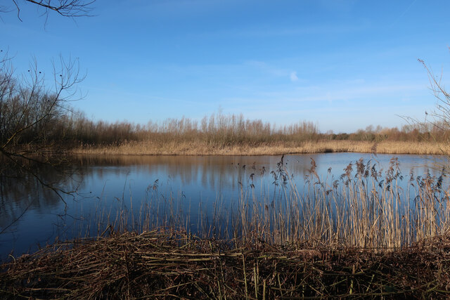
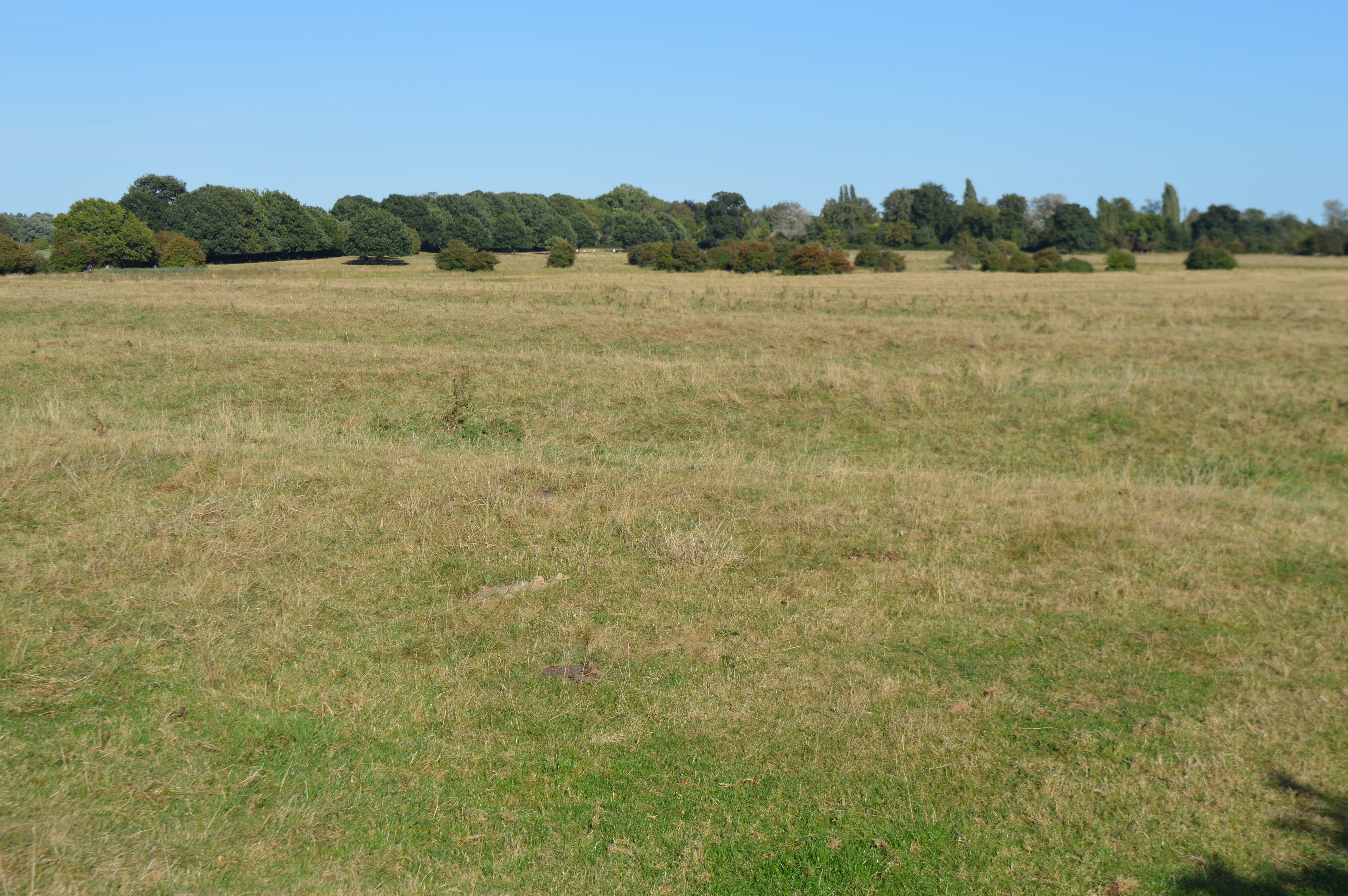
Hartford Lake, located in Huntingdonshire, is a picturesque freshwater body encompassing an area of approximately 20 acres. This natural water feature is commonly referred to as a lake, although its size might also classify it as a large pond or small pool. Situated within the scenic landscape of Huntingdonshire, this tranquil oasis is a popular destination for nature enthusiasts and wildlife observers.

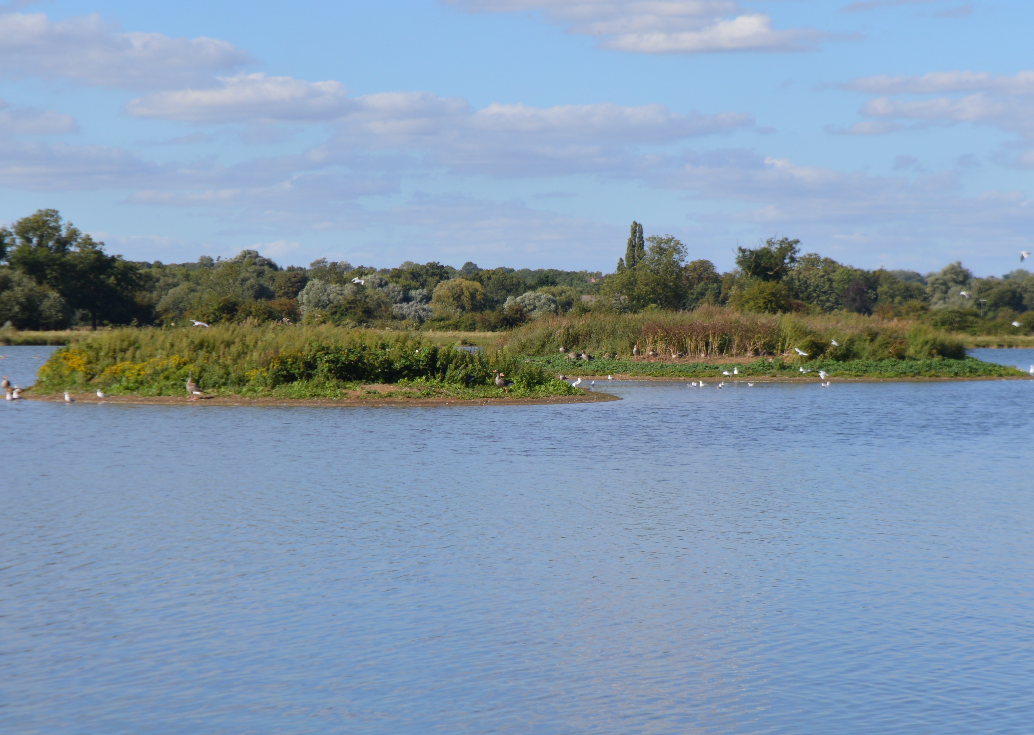
Hartford Lake is surrounded by dense vegetation, consisting of tall reeds and vibrant water lilies that adorn the water's surface. This flourishing ecosystem provides a habitat for various species of birds, including mallards, swans, and herons, which can often be spotted gracefully gliding across the lake. The abundance of fish, such as carp and perch, makes it a favored spot for anglers seeking a peaceful day of fishing.

The lake is also home to a diverse range of freshwater marsh plants, further enhancing its ecological significance. These plants, including cattails and bulrushes, create a lush and vibrant environment, providing shelter and sustenance for numerous aquatic creatures.

Visitors to Hartford Lake can enjoy a multitude of recreational activities. The calm waters make it an ideal location for boating and kayaking, allowing visitors to explore its serene surroundings at their leisure. The lake's tranquil atmosphere also attracts picnickers and nature enthusiasts seeking a peaceful escape from the bustling city life.

Overall, Hartford Lake is a captivating freshwater ecosystem, teeming with diverse wildlife and offering a range of recreational opportunities. Its natural beauty and tranquil ambiance make it a cherished destination for locals and visitors alike.

If you have any feedback on the listing, please let us know in the comments section below.

Hartford Lake Images

Images are sourced within 2km of 52.339127/-0.14484345 or Grid Reference TL2672. Thanks to Geograph Open Source API. All images are credited.

Houghton at Christmas The village shop, owned and run by the community, is well lit up for the festivities.
Houghton at Christmas
The village shop, owned and run by the community, is well lit up for the festivities.
Island Lake, Godmanchester Nature Reserve One of many sets of gravel pits along the Ouse valley.
Island Lake, Godmanchester Nature Reserve
One of many sets of gravel pits along the Ouse valley.
Island Lake, Godmanchester Nature Reserve Wildlife Trust nature reserve.
Island Lake, Godmanchester Nature Reserve
Wildlife Trust nature reserve.
Cook's Stream, Godmanchester Nature Reserve
Ouse Valley Way
Ouse Valley Way
Roman Lake, Godmanchester Nature Reserve
Wigeon Pond, Godmanchester Nature Reserve
Huntingdon Sewage Treatment Works entrance On Cow Lane.
Huntingdon Sewage Treatment Works entrance
On Cow Lane.
Cow Lane to Godmanchester Nature Reserve
Bridleway to Hemingford Abbots Across Godmanchester Eastside Common.
Bridleway to Hemingford Abbots
Across Godmanchester Eastside Common.
Sheep on Hemingford Meadow
Hartford, All Saints
Wild flowers blooming at Hemingford Meadow Boats on the River Great Ouse just visible in the distance.
Wild flowers blooming at Hemingford Meadow
Boats on the River Great Ouse just visible in the distance.
Hurst Hill Road, Wyton
Layby on the A141, Hartford Here was my previous visit. <a title="https://www.geograph.org.uk/photo/6876875" href="https://www.geograph.org.uk/photo/6876875">Link</a>
Layby on the A141, Hartford
Here was my previous visit. Link
Layby on the A141, Hartford Here is my previous visit. <a title="https://www.geograph.org.uk/photo/6876873" href="https://www.geograph.org.uk/photo/6876873">Link</a>
Layby on the A141, Hartford
Here is my previous visit. Link
Show me another place!

Hartford Lake is located at Grid Ref: TL2672 (Lat: 52.339127, Lng: -0.14484345)

Administrative County: Cambridgeshire

District: Huntingdonshire

Police Authority: Cambridgeshire

What 3 Words

///picked.committee.bowhead. Near Houghton, Cambridgeshire

Nearby Locations

Hartford Lake

Related Wikis

Hartford, Cambridgeshire

Hartford is a suburb of Huntingdon and former civil parish, now in the parish of Huntingdon, in Cambridgeshire, England. Historically part of Huntingdonshire...

Godmanchester Nature Reserve

Godmanchester Nature Reserve is a 59-hectare nature reserve in Godmanchester in Cambridgeshire, England. It is managed by the Wildlife Trust for Bedfordshire...

Wyton, Cambridgeshire

Wyton is a village and former civil parish, now in the parish of Houghton and Wyton, in Cambridgeshire, England. It lies approximately 2 miles (3 km) east...

Godmanchester Eastside Common

Godmanchester Eastside Common is a 29.7-hectare (73-acre) biological Site of Special Scientific Interest east of Godmanchester in Cambridgeshire. The site...

Nearby Amenities

Located within 500m of 52.339127,-0.14484345
Direction: both
Surface: asphalt
Traffic Calming: bump
Lat/Long: 52.3375697/-0.1437014
Barrier: bollard
Bicycle: yes
Bollard: rising
Bus: permit
Foot: yes
Horse: yes
Motor Vehicle: private
Lat/Long: 52.3377232/-0.147044
Surface: asphalt
Traffic Calming: bump
Lat/Long: 52.3376114/-0.1421644
Mini Roundabout
Direction: clockwise
Lat/Long: 52.3375443/-0.1439782
Surface: asphalt
Traffic Calming: bump
Lat/Long: 52.3375832/-0.1414815
Surface: asphalt
Traffic Calming: bump
Lat/Long: 52.337593/-0.1432296
Power: pole
Lat/Long: 52.3413616/-0.1413897
Power: pole
Lat/Long: 52.3410974/-0.1394744
Power: pole
Lat/Long: 52.341812/-0.1467248
Power: pole
Lat/Long: 52.3415124/-0.1431841
Power: pole
Lat/Long: 52.3416748/-0.1449733
Power: pole
Lat/Long: 52.3419696/-0.1484922
Power: pole
Lat/Long: 52.3420728/-0.1496509
Post Box
Brand: Royal Mail
Brand Wikidata: Q638098
Collection Times: Mo-Fr 17:15; Sa 12:00
Operator: Royal Mail
Operator Wikidata: Q638098
Lat/Long: 52.3377128/-0.1441871
Generator Method: photovoltaic
Generator Output Electricity: yes
Generator Source: solar
Generator Type: solar_photovoltaic_panel
Location: roof
Power: generator
Lat/Long: 52.3391355/-0.1518291
Generator Method: photovoltaic
Generator Output Electricity: yes
Generator Source: solar
Generator Type: solar_photovoltaic_panel
Location: roof
Power: generator
Lat/Long: 52.3393051/-0.151455
Generator Method: photovoltaic
Generator Output Electricity: yes
Generator Source: solar
Generator Type: solar_photovoltaic_panel
Location: roof
Power: generator
Lat/Long: 52.3391052/-0.1513812
Generator Method: photovoltaic
Generator Output Electricity: yes
Generator Source: solar
Generator Type: solar_photovoltaic_panel
Location: roof
Power: generator
Lat/Long: 52.3385496/-0.151294
Generator Method: photovoltaic
Generator Output Electricity: yes
Generator Source: solar
Generator Type: solar_photovoltaic_panel
Location: roof
Power: generator
Lat/Long: 52.338584/-0.1513101
Generator Method: photovoltaic
Generator Output Electricity: yes
Generator Source: solar
Generator Type: solar_photovoltaic_panel
Location: roof
Power: generator
Lat/Long: 52.3386103/-0.1513302
Generator Method: photovoltaic
Generator Output Electricity: yes
Generator Source: solar
Generator Type: solar_photovoltaic_panel
Location: roof
Power: generator
Lat/Long: 52.3386455/-0.1513463
Generator Method: photovoltaic
Generator Output Electricity: yes
Generator Source: solar
Generator Type: solar_photovoltaic_panel
Location: roof
Power: generator
Lat/Long: 52.3386897/-0.1513745
Generator Method: photovoltaic
Generator Output Electricity: yes
Generator Source: solar
Generator Type: solar_photovoltaic_panel
Location: roof
Power: generator
Lat/Long: 52.338734/-0.1513986
Generator Method: photovoltaic
Generator Output Electricity: yes
Generator Source: solar
Generator Type: solar_photovoltaic_panel
Location: roof
Power: generator
Lat/Long: 52.338775/-0.1514308
Generator Method: photovoltaic
Generator Output Electricity: yes
Generator Source: solar
Generator Type: solar_photovoltaic_panel
Location: roof
Power: generator
Lat/Long: 52.3388102/-0.1514429
Banks End
Place: neighbourhood
Lat/Long: 52.3379347/-0.1421375
Fuel
Seamark Small Craft Facility Category: fuel_station
Seamark Type: small_craft_facility
Waterway: fuel
Lat/Long: 52.3372535/-0.1439836
Visitor Holding Birth
Leisure: marina
Seamark Harbour Category: marina
Seamark Type: minor_berth
Lat/Long: 52.3351709/-0.143032
Seamark Small Craft Facility Category: pump-out
Seamark Type: small_craft_facility
Waterway: sanitary_dump_station
Lat/Long: 52.3372395/-0.1437615
Waterway: sluice_gate
Lat/Long: 52.3374941/-0.1466083
Boat Rental
Goodboats Day Hire
Contact Email: hire@goodboats.co.uk
Motorboat Rental: yes
Operator: Good Little Boat Hire Company
Operator Type: private
Phone: +44 7411 805067
Lat/Long: 52.3374538/-0.1435307
Surface: asphalt
Traffic Calming: bump
Lat/Long: 52.3374116/-0.1405245
Boat Rental
Go-paddle
Canoe Rental: yes
Contact Email: Gopaddlewyton@gmail.com
Standup Paddleboard Rental: yes
Website: https://www.gopaddlehuntingdon.com/
Lat/Long: 52.3372447/-0.1442739
Ladybird Trust
Amenity 1: boat_rental
Attraction: boat_ride
Contact Email: enquiries@ladybirdboat.org.uk
Disabled: designated
Group Only: yes
Operator: Ladybird Boat Trust
Operator Type: charitable
Wheelchair: yes
Lat/Long: 52.3372808/-0.1441742
Shop: ship_chandler
Lat/Long: 52.3374669/-0.1437054
Defibrillator
Access: yes
Defibrillator Location: Hartford Marina (Tingdene) Showroom. 150 meters West of Hartford Mill, Banks End. Huntingdon Road Wyton.
Emergency: defibrillator
Indoor: no
Lat/Long: 52.3374848/-0.1434071
Man Made: charge_point
Lat/Long: 52.3417452/-0.1507065
Man Made: charge_point
Lat/Long: 52.3417928/-0.1507051
Man Made: charge_point
Lat/Long: 52.3417786/-0.1507055
Man Made: charge_point
Lat/Long: 52.3417611/-0.150706
The data included in this document is from www.openstreetmap.org. The data is made available under ODbL.

Have you been to Hartford Lake?

Leave your review of Hartford Lake below (or comments, questions and feedback).