Bentley Heath Pond

Lake, Pool, Pond, Freshwater Marsh in Middlesex Hertsmere

England

Bentley Heath Pond

Closed shop on High Street, Potters Bar
Closed shop on High Street, Potters Bar Credit: David Howard

Bentley Heath Pond, located in Middlesex, is a picturesque freshwater body that serves as a prominent natural attraction in the area. Covering an area of approximately 4 acres, the pond offers a serene and tranquil environment for visitors to enjoy.

Surrounded by lush greenery and tall trees, Bentley Heath Pond provides a beautiful setting for nature enthusiasts and wildlife lovers alike. The pond is home to a diverse range of plant and animal species, making it an important ecosystem within the region. The presence of various aquatic plants, such as water lilies and reeds, adds to the aesthetic appeal of the pond.

Visitors can indulge in various recreational activities at Bentley Heath Pond. Fishing is a popular pastime, with the pond being well-stocked with a variety of fish species, including carp, roach, and perch. Anglers can cast their lines and enjoy a peaceful day of fishing amidst the natural beauty of the surroundings.

Additionally, Bentley Heath Pond offers opportunities for birdwatching, as it attracts a wide array of avian species throughout the year. Ducks, swans, and herons are commonly spotted in and around the pond, making it a haven for bird enthusiasts.

The pond is easily accessible, with well-maintained pathways and seating areas for visitors. It also features a small picnic area, where families and friends can gather for a leisurely outdoor meal while embracing the tranquil ambiance of the surroundings.

Overall, Bentley Heath Pond in Middlesex is a captivating natural haven, offering a delightful escape from the hustle and bustle of everyday life.

If you have any feedback on the listing, please let us know in the comments section below.

Bentley Heath Pond Images

Images are sourced within 2km of 51.680813/-0.19471375 or Grid Reference TQ2499. Thanks to Geograph Open Source API. All images are credited.

Closed shop on High Street, Potters Bar
About to join the M25 from the A111
Wash Lane bridge Spanning Bentley Heath Brook at the rear of South Mimms Motorway services.
Wash Lane bridge
Spanning Bentley Heath Brook at the rear of South Mimms Motorway services.
Potty's car park on Barnet Road, Potters Bar Potty's is on the corner of the road and is a pancake house.
Potty's car park on Barnet Road, Potters Bar
Potty's is on the corner of the road and is a pancake house.
Area around Potters Bar station
Mimshall Brook at Wash Lane Common Looking like a normal muddy stream here, the Mimshall Brook is actually quite an unusual river. About 4kms north of here in all but high flow conditions it will sink below the surface through swallow holes to continue its journey underground.
Mimshall Brook at Wash Lane Common
Looking like a normal muddy stream here, the Mimshall Brook is actually quite an unusual river. About 4kms north of here in all but high flow conditions it will sink below the surface through swallow holes to continue its journey underground.
Footbridge over the Mimshall Brook Taking a footpath over a small river on the Wash Lane Common nature reserve.
Footbridge over the Mimshall Brook
Taking a footpath over a small river on the Wash Lane Common nature reserve.
Wash Lane Common Nature Reserve Not many motorway service areas can offer a small nature reserve out at the back  as a place to stretch your legs during a journey. At South Mimms Services on the M25  a short path takes you into this park where you can have quite a long walk if you're not in a hurry.
Wash Lane Common Nature Reserve
Not many motorway service areas can offer a small nature reserve out at the back as a place to stretch your legs during a journey. At South Mimms Services on the M25 a short path takes you into this park where you can have quite a long walk if you're not in a hurry.
The entrance to Potters Bar FC
The Walks, Potters Bar
Parkfield Medical Centre, Potters Bar
Pizza Express, Welcome Break South Mimms <span class="nowrap"><a title="https://en.wikipedia.org/wiki/South_Mimms_services" rel="nofollow ugc noopener" href="https://en.wikipedia.org/wiki/South_Mimms_services">Link</a><img style="margin-left:2px;" alt="External link" title="External link - shift click to open in new window" src="https://s1.geograph.org.uk/img/external.png" width="10" height="10"/></span>
Pizza Express, Welcome Break South Mimms
Houses on Strafford Gate
M25 near to Potters Bar Officially named the London Orbital and frequently derided as nothing more than a very big car park, the M25 is a 117-mile orbital motorway that encircles London; one of the world's biggest ring roads (Europe's second longest orbital road after the Berliner Ring, which is 122 miles). It is not, however, a continuous loop of motorway as the Dartford Crossing section (comprising the Dartford Tunnels and the Queen Elizabeth II Bridge) over the Thames and its approach roads are designated as the A282. 

Constructed between 1975 and 1986, the M25 is reputedly the most expensive motorway Britain ever built, costing a total of £909m or roughly £7.5m per mile, but at the time of its planning, the demand for the road was considerably underestimated so that when it was finally completed in 1986, it was already out of date. Demand outstripped capacity within a few years and ever since then it's been very heavily congested. 

The M25 is one of the UK’s busiest motorways, carrying up to 200,000 vehicles and 10,000 HGVs per day (AADT - Annual Average Daily Traffic flow) on the section near to Heathrow Airport. Since its opening in the 1980s, the southern, western and eastern sections have been widened to largely dual four lane (D4M) standard, but much of the motorway retains its dual three lane road (D3M) cross-section as originally built. 

The M25 was home to England's first Variable Speed Limits on motorways between the A3 and M4 in the early 1990s.

<span class="nowrap"><a title="http://www.cbrd.co.uk/motorway/m25/" rel="nofollow ugc noopener" href="http://www.cbrd.co.uk/motorway/m25/">Link</a><img style="margin-left:2px;" alt="External link" title="External link - shift click to open in new window" src="https://s1.geograph.org.uk/img/external.png" width="10" height="10"/></span>  cbrd
<span class="nowrap"><a title="http://www.sabre-roads.org.uk/wiki/index.php?title=M25" rel="nofollow ugc noopener" href="http://www.sabre-roads.org.uk/wiki/index.php?title=M25">Link</a><img style="margin-left:2px;" alt="External link" title="External link - shift click to open in new window" src="https://s1.geograph.org.uk/img/external.png" width="10" height="10"/></span>  SABRE
M25 near to Potters Bar
Officially named the London Orbital and frequently derided as nothing more than a very big car park, the M25 is a 117-mile orbital motorway that encircles London; one of the world's biggest ring roads (Europe's second longest orbital road after the Berliner Ring, which is 122 miles). It is not, however, a continuous loop of motorway as the Dartford Crossing section (comprising the Dartford Tunnels and the Queen Elizabeth II Bridge) over the Thames and its approach roads are designated as the A282. Constructed between 1975 and 1986, the M25 is reputedly the most expensive motorway Britain ever built, costing a total of £909m or roughly £7.5m per mile, but at the time of its planning, the demand for the road was considerably underestimated so that when it was finally completed in 1986, it was already out of date. Demand outstripped capacity within a few years and ever since then it's been very heavily congested. The M25 is one of the UK’s busiest motorways, carrying up to 200,000 vehicles and 10,000 HGVs per day (AADT - Annual Average Daily Traffic flow) on the section near to Heathrow Airport. Since its opening in the 1980s, the southern, western and eastern sections have been widened to largely dual four lane (D4M) standard, but much of the motorway retains its dual three lane road (D3M) cross-section as originally built. The M25 was home to England's first Variable Speed Limits on motorways between the A3 and M4 in the early 1990s. LinkExternal link cbrd LinkExternal link SABRE
M25 at Junction 24 (Potters Bar) Officially named the London Orbital and frequently derided as nothing more than a very big car park, the M25 is a 117-mile orbital motorway that encircles London; one of the world's biggest ring roads (Europe's second longest orbital road after the Berliner Ring, which is 122 miles). It is not, however, a continuous loop of motorway as the Dartford Crossing section (comprising the Dartford Tunnels and the Queen Elizabeth II Bridge) over the Thames and its approach roads are designated as the A282. 

Constructed between 1975 and 1986, the M25 is reputedly the most expensive motorway Britain ever built, costing a total of £909m or roughly £7.5m per mile, but at the time of its planning, the demand for the road was considerably underestimated so that when it was finally completed in 1986, it was already out of date. Demand outstripped capacity within a few years and ever since then it's been very heavily congested. 

The M25 is one of the UK’s busiest motorways, carrying up to 200,000 vehicles and 10,000 HGVs per day (AADT - Annual Average Daily Traffic flow) on the section near to Heathrow Airport. Since its opening in the 1980s, the southern, western and eastern sections have been widened to largely dual four lane (D4M) standard, but much of the motorway retains its dual three lane road (D3M) cross-section as originally built. 

The M25 was home to England's first Variable Speed Limits on motorways between the A3 and M4 in the early 1990s.

<span class="nowrap"><a title="http://www.cbrd.co.uk/motorway/m25/" rel="nofollow ugc noopener" href="http://www.cbrd.co.uk/motorway/m25/">Link</a><img style="margin-left:2px;" alt="External link" title="External link - shift click to open in new window" src="https://s1.geograph.org.uk/img/external.png" width="10" height="10"/></span>  cbrd
<span class="nowrap"><a title="http://www.sabre-roads.org.uk/wiki/index.php?title=M25" rel="nofollow ugc noopener" href="http://www.sabre-roads.org.uk/wiki/index.php?title=M25">Link</a><img style="margin-left:2px;" alt="External link" title="External link - shift click to open in new window" src="https://s1.geograph.org.uk/img/external.png" width="10" height="10"/></span>  SABRE
M25 at Junction 24 (Potters Bar)
Officially named the London Orbital and frequently derided as nothing more than a very big car park, the M25 is a 117-mile orbital motorway that encircles London; one of the world's biggest ring roads (Europe's second longest orbital road after the Berliner Ring, which is 122 miles). It is not, however, a continuous loop of motorway as the Dartford Crossing section (comprising the Dartford Tunnels and the Queen Elizabeth II Bridge) over the Thames and its approach roads are designated as the A282. Constructed between 1975 and 1986, the M25 is reputedly the most expensive motorway Britain ever built, costing a total of £909m or roughly £7.5m per mile, but at the time of its planning, the demand for the road was considerably underestimated so that when it was finally completed in 1986, it was already out of date. Demand outstripped capacity within a few years and ever since then it's been very heavily congested. The M25 is one of the UK’s busiest motorways, carrying up to 200,000 vehicles and 10,000 HGVs per day (AADT - Annual Average Daily Traffic flow) on the section near to Heathrow Airport. Since its opening in the 1980s, the southern, western and eastern sections have been widened to largely dual four lane (D4M) standard, but much of the motorway retains its dual three lane road (D3M) cross-section as originally built. The M25 was home to England's first Variable Speed Limits on motorways between the A3 and M4 in the early 1990s. LinkExternal link cbrd LinkExternal link SABRE
Leighton House, Potters Bar Although the station at Potters Bar opened in 1850 the area around it did not become built up until well into the 20th century. Much of the town's development came after the Second World War and Leighton House on Darkes Lane was built opposite the station in the 1950s. Today it houses retail units and a dental practice on the ground floor with apartments above. See <a href="https://www.geograph.org.uk/photo/3213875">TL2501 : Leighton House</a> taken in 2012 from roughly the same spot which shows a branch of Barclays Bank where Specsavers is now.
Leighton House, Potters Bar
Although the station at Potters Bar opened in 1850 the area around it did not become built up until well into the 20th century. Much of the town's development came after the Second World War and Leighton House on Darkes Lane was built opposite the station in the 1950s. Today it houses retail units and a dental practice on the ground floor with apartments above. See TL2501 : Leighton House taken in 2012 from roughly the same spot which shows a branch of Barclays Bank where Specsavers is now.
Darkes Lane Bridge, Potters Bar This bridge at the south end of Potters Bar station carries the East Coast Main Line over Darkes Lane. When the railway was built a low girder design was adopted to lessen the gradient heading north through Barnet and Hadley Wood; as a consequence the roadway has had to be lowered to accommodate modern traffic. In May 2002 a serious derailment occurred on a set of points on the approach to the bridge causing a Kings Cross to Kings Lynn train to crash into the station platforms. One of the carriages struck the bridge parapet causing masonry to fall onto the road below. In addition to six passengers in the train, an elderly woman was killed while walking under the bridge. A replacement bridge had to be provided which was installed in November 2002, painted blue at the request of Hertsmere Council.
Darkes Lane Bridge, Potters Bar
This bridge at the south end of Potters Bar station carries the East Coast Main Line over Darkes Lane. When the railway was built a low girder design was adopted to lessen the gradient heading north through Barnet and Hadley Wood; as a consequence the roadway has had to be lowered to accommodate modern traffic. In May 2002 a serious derailment occurred on a set of points on the approach to the bridge causing a Kings Cross to Kings Lynn train to crash into the station platforms. One of the carriages struck the bridge parapet causing masonry to fall onto the road below. In addition to six passengers in the train, an elderly woman was killed while walking under the bridge. A replacement bridge had to be provided which was installed in November 2002, painted blue at the request of Hertsmere Council.
Show me another place!

Bentley Heath Pond is located at Grid Ref: TQ2499 (Lat: 51.680813, Lng: -0.19471375)

Administrative County: Hertfordshire

District: Hertsmere

Police Authority: Hertfordshire

What 3 Words

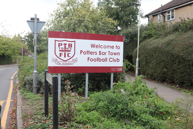
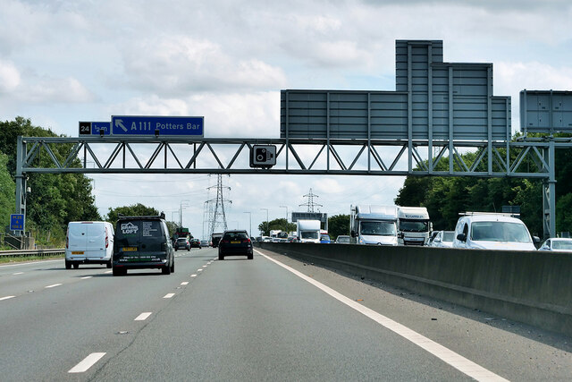
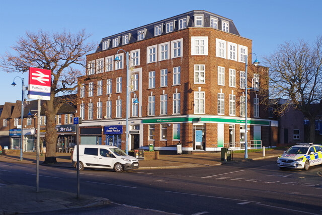
///closer.things.wide. Near Potters Bar, Hertfordshire

Related Wikis

Bentley Heath, Hertfordshire

Bentley Heath is a hamlet in Hertfordshire, England, between Chipping Barnet and Potters Bar. It is on the north edge of the Wrotham Park estate with which...

Wrotham Park

Wrotham Park (pronounced , ROO-təm) is a neo-Palladian English country house in the parish of South Mimms, Hertfordshire. It lies south of the town of...

Potters Bar Urban District

Potters Bar Urban District was a local government district in England from 1894 to 1974, covering the town of Potters Bar and the village of South Mimms...

Ganwick House

Ganwick House is a late-18th-century house in Wagon Road, Ganwick Corner (Gannic Corner), near Chipping Barnet, England. As of 2018, it was in use as a...
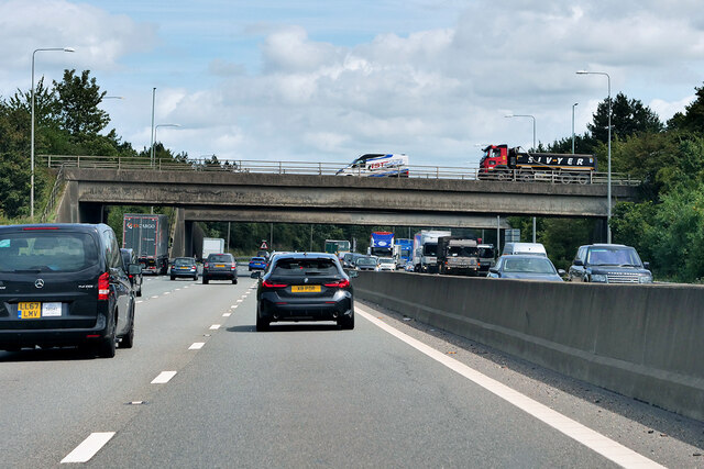
M16 motorway

The M16 motorway was the designation planned in the late 1960s and early 1970s for use on Ringway 3, a new motorway planned as part of the London Ringways...

Dame Alice Owen's School

Dame Alice Owen's School (DAOS, or simply Dame Alice Owen's or Owen's) is an 11–18 mixed, partially selective secondary school and sixth form with academy...

Dancers Hill House

Dancers Hill House is a Grade II listed house in Dancers Hill, Hertfordshire, England. The current house dates from c. 1750–1760, with later additions...
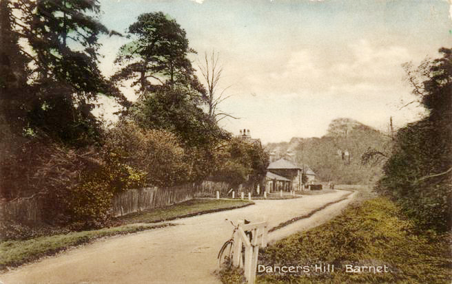
Dancers Hill

Dancers Hill is located in Hertfordshire, England, immediately south of the route of the M25 motorway. It was formerly in the historic county of Middlesex...

Related Videos

Walking Alone | Heart and Soul Rock | Melody | Heart Chakra | Binaural Beats

Please enjoy this relaxing Rock music melody with Binaural beats frequency 639 Hz Theta for your Heart Chakra. The track ...

Nearby Amenities

Located within 500m of 51.680813,-0.19471375
Street Lamp
Lat/Long: 51.6815315/-0.1889893
Power: tower
Lat/Long: 51.6845567/-0.1921137
Give Way
Direction: forward
Lat/Long: 51.6814345/-0.1889412
Traffic Calming: bump
Lat/Long: 51.6814379/-0.1879609
Phone
Emergency: phone
Lat/Long: 51.6848367/-0.1917659
Bentley Heath
Place: hamlet
Lat/Long: 51.6805778/-0.1943623
The data included in this document is from www.openstreetmap.org. The data is made available under ODbL.

Have you been to Bentley Heath Pond?

Leave your review of Bentley Heath Pond below (or comments, questions and feedback).