King's Mere

Lake, Pool, Pond, Freshwater Marsh in Surrey

England

King's Mere

Scio Pond Had I arrived a couple of minutes previously, I might have photographed a kingfisher sitting on this sign. At least I managed a distant photograph, a few minutes later.
Scio Pond Credit: Peter Trimming

King's Mere is a picturesque freshwater body located in Surrey, England. Situated amidst the stunning natural beauty of the Surrey Hills Area of Outstanding Natural Beauty, this lake has become a popular destination for locals and tourists alike.

Covering an area of approximately 10 acres, King's Mere is known for its crystal-clear waters and tranquil surroundings. It is surrounded by lush greenery, including dense woodlands and rolling hills, creating a serene and idyllic atmosphere. The lake itself is characterized by its calm and reflective surface, making it a haven for wildlife and a paradise for nature enthusiasts.

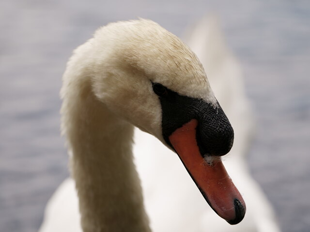
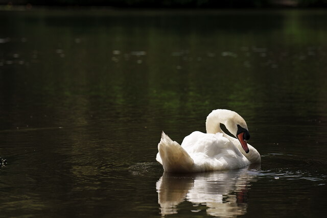
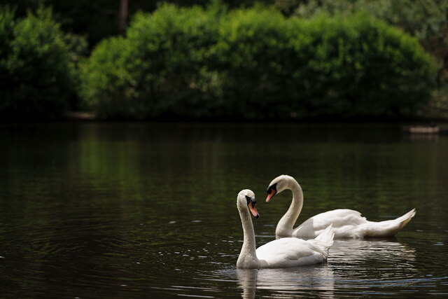
The lake serves as a habitat for a variety of aquatic life, including fish, frogs, and waterfowl. It is also home to an array of plant species, such as water lilies and reeds, which add to the area's natural charm. The peaceful ambiance of King's Mere makes it an ideal spot for birdwatching, with numerous bird species frequently seen nesting or stopping by during migration.

Surrounding the lake, visitors can find well-maintained footpaths and viewing platforms, allowing for leisurely walks and ample opportunities to enjoy the beautiful scenery. Additionally, the area offers picnic spots and benches where visitors can relax and take in the peaceful surroundings.

King's Mere is easily accessible, with parking facilities available nearby. Whether one seeks a tranquil escape, a day of wildlife spotting, or a peaceful picnic spot, King's Mere promises to be an enchanting destination for all nature lovers visiting Surrey.

If you have any feedback on the listing, please let us know in the comments section below.
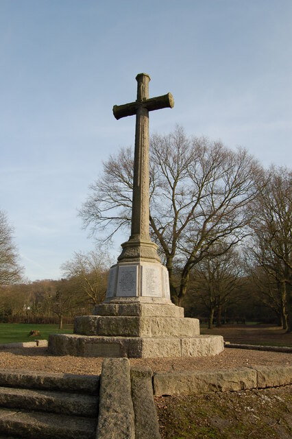
King's Mere Images

Images are sourced within 2km of 51.445105/-0.22890583 or Grid Reference TQ2373. Thanks to Geograph Open Source API. All images are credited.

Scio Pond Had I arrived a couple of minutes previously, I might have photographed a kingfisher sitting on this sign. At least I managed a distant photograph, a few minutes later.
Scio Pond
Had I arrived a couple of minutes previously, I might have photographed a kingfisher sitting on this sign. At least I managed a distant photograph, a few minutes later.
Scio Pond A kingfisher, at the western edge of the pond.
Scio Pond
A kingfisher, at the western edge of the pond.
Wimbledon Common During my walk, there were numerous robins flitting about and hunting for food. This was the only one which agreed to pose.
Wimbledon Common
During my walk, there were numerous robins flitting about and hunting for food. This was the only one which agreed to pose.
View over Putney Vale Cemetery Putney Vale Cemetery viewed from the edge of Wimbledon Common.
View over Putney Vale Cemetery
Putney Vale Cemetery viewed from the edge of Wimbledon Common.
Whitelands College A natural view into the Richmond Park from University of Roehampton, Whitelands College.
Whitelands College
A natural view into the Richmond Park from University of Roehampton, Whitelands College.
Tree on crutches
Tree on crutches
St Joseph's Catholic Church, by the T Junction
Roehampton village Teddy bear treasure hunt
Roehampton village
Teddy bear treasure hunt
War Memorial on Wimbledon Common
The Windmill on Wimbledon Common This windmill is a Grade II* listed building.  It was built in 1816 by Charles March, a Roehampton carpenter.  These days it houses a museum of windmills and a cafe.
The Windmill on Wimbledon Common
This windmill is a Grade II* listed building. It was built in 1816 by Charles March, a Roehampton carpenter. These days it houses a museum of windmills and a cafe.
Wimbledon Common Swans on Queen's Mere. Having packed away my camera, I realised that I have been spotted and that the swans were coming to see me.

The swans bred in 2022, but only produced two cygnets. One was reportedly taken by a pike but the fate of the second was unknown.
Wimbledon Common
Swans on Queen's Mere. Having packed away my camera, I realised that I have been spotted and that the swans were coming to see me. The swans bred in 2022, but only produced two cygnets. One was reportedly taken by a pike but the fate of the second was unknown.
Wimbledon Common One of the swans on Queen's Mere.
Wimbledon Common
One of the swans on Queen's Mere.
Wimbledon Common One of the swans on Queen's Mere.
Wimbledon Common
One of the swans on Queen's Mere.
Wimbledon Common One of the swans on Queen's Mere.
Wimbledon Common
One of the swans on Queen's Mere.
Wimbledon Common Swans on Queen's Mere.
Wimbledon Common
Swans on Queen's Mere.
Wimbledon Common Swans on Queen's Mere.
Wimbledon Common
Swans on Queen's Mere.
Wimbledon Common Swans on Queen's Mere.
Wimbledon Common
Swans on Queen's Mere.
Wimbledon Common Swans on Queen's Mere.
Wimbledon Common
Swans on Queen's Mere.
Show me another place!

King's Mere is located at Grid Ref: TQ2373 (Lat: 51.445105, Lng: -0.22890583)

Unitary Authority: Wandsworth

Police Authority: Metropolitan

What 3 Words

///dates.remind.tracks. Near Wandsworth, London

Related Wikis

Scio House Hospital

Scio House Hospital for Officers was a hospital catering for military officers in Putney, London. == History == Scio House was the last villa on Portsmouth...

Wildcroft Manor

Wildcroft Manor is a historic site in Putney in the London Borough of Wandsworth, with private housing and a Grade II Listed iron gateway. == Location... ==

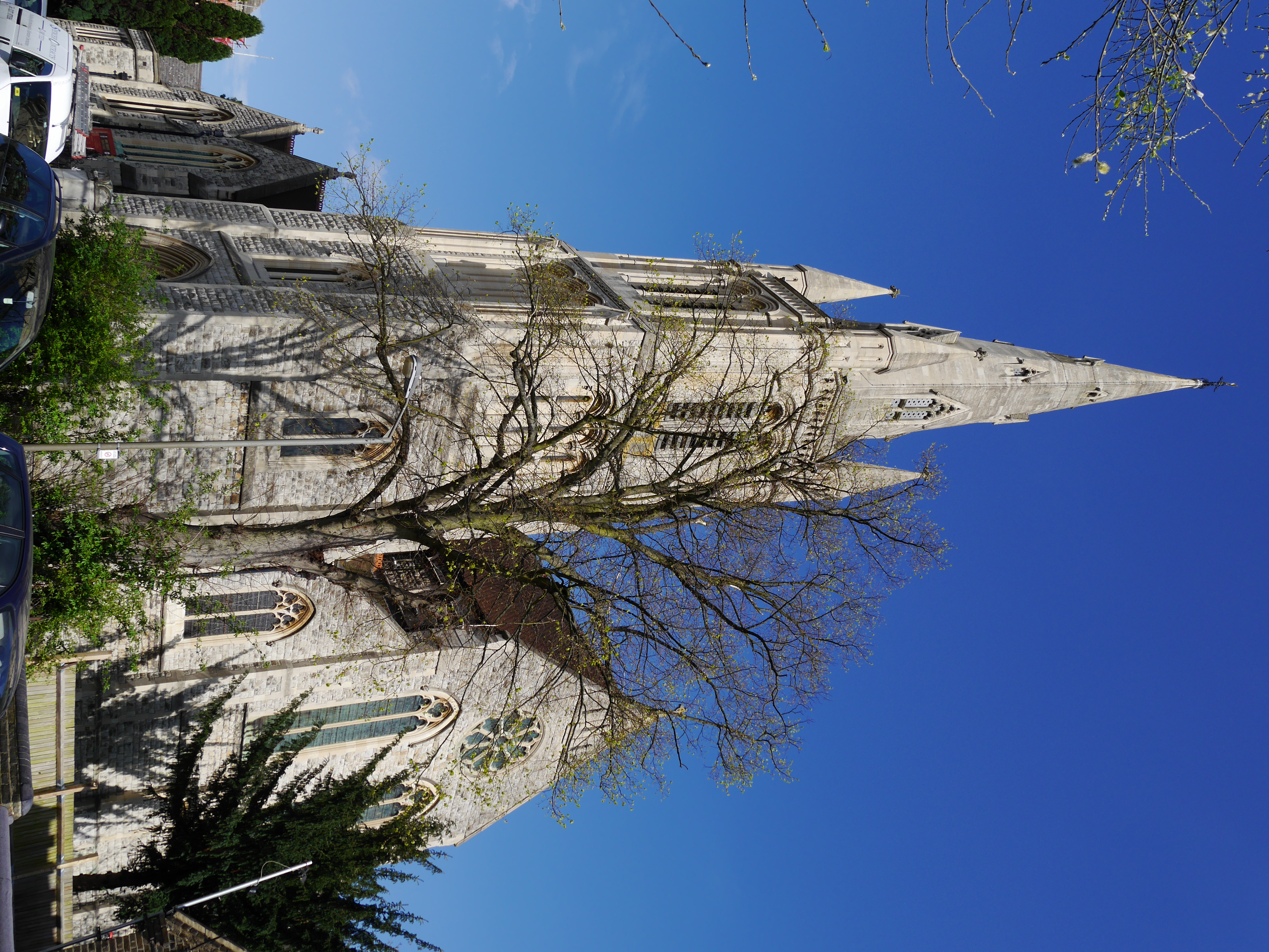
Holy Trinity, Roehampton

Holy Trinity is the Church of England parish church for Roehampton, located in Ponsonby Road, SW15. The building is Grade II* listed. Its spire, which...

The Wimbledon Synagogue

The Wimbledon Synagogue (formally, Wimbledon and District Synagogue), a member of the Movement for Reform Judaism, is a synagogue in the London Borough...

Wimbledon Windmill

Wimbledon Windmill is a Grade II* listed windmill situated on Wimbledon Common in the London Borough of Merton (originally in Surrey), in the west of South...

Ernest Alexander

Major-General Ernest Wright Alexander, (2 October 1870 – 25 August 1934) was a British Army officer and an English recipient of the Victoria Cross, the...

Drinking Fountain, Roehampton

The Drinking Fountain is a Grade II-listed monument at Roehampton Lane, Roehampton, London SW15. It was built in 1882, and designed by J. C. Radford....

St Joseph Church, Roehampton

St Joseph's Church is a Roman Catholic Parish church in Roehampton in the London Borough of Wandsworth. It was founded by the Jesuits in 1869 and designed...

Nearby Amenities

Located within 500m of 51.445105,-0.22890583
Motorway Junction
Tibbet's Corner
Lat/Long: 51.4467807/-0.2268358
Five Ways
Junction: yes
Lat/Long: 51.4427437/-0.2325677
Tangier Memorial
Historic: memorial
Memorial: war_memorial
Lat/Long: 51.4422778/-0.2344444
Post Box
Operator: Royal Mail
Operator Wikidata: Q638098
Ref: SW19 20
Lat/Long: 51.4451341/-0.222412
Bus Stop
Albemarle
Bench: yes
Bin: yes
Bus: yes
Local Ref: PX
Naptan AtcoCode: 490003146N
Naptan Bearing: N
Naptan CommonName: Albemarle
Naptan Indicator: Stop PX
Public Transport: platform
Ref: 54726
Shelter: yes
Source Ref: naptan
Tactile Paving: no
Lat/Long: 51.4427393/-0.2234058
Bus Stop
Inner Park Road
Bus: yes
Local Ref: PE
Naptan AtcoCode: 490008489S
Naptan Bearing: S
Naptan CommonName: Inner Park Road
Naptan Indicator: Stop PE
Public Transport: platform
Ref: 75766
Source Ref: naptan
Lat/Long: 51.4445936/-0.2226884
Bus Stop
Telegraph Road
Bench: yes
Bus: yes
Local Ref: PI
Naptan AtcoCode: 490013567N
Naptan Bearing: W
Naptan CommonName: Telegraph Road
Naptan Indicator: Stop PI
Naptan Street: TELEGRAPH ROAD
Public Transport: platform
Ref: 74117
Shelter: yes
Source Ref: naptan
Lat/Long: 51.449012/-0.227812
Bus Stop
Telegraph Road
Bench: no
Bin: no
Bus: yes
Lit: yes
Local Ref: PH
Naptan AtcoCode: 490013567N1
Naptan Bearing: N
Naptan CommonName: Telegraph Road
Naptan Indicator: Stop PH
Public Transport: platform
Ref: 48229
Shelter: no
Source Ref: naptan
Tactile Paving: no
Lat/Long: 51.4492521/-0.2272702
Bus Stop
Tibbet's Corner
Bench: yes
Bin: yes
Bus: yes
Local Ref: PK
Naptan AtcoCode: 490013662N1
Naptan Bearing: N
Naptan CommonName: Tibbet's Corner
Naptan Indicator: Stop PK
Public Transport: platform
Ref: 74688
Shelter: yes
Source Ref: naptan
Tactile Paving: no
Wheelchair: yes
Lat/Long: 51.4459592/-0.2224632
Bus Stop
Tibbet's Corner
Bench: yes
Bin: no
Bus: yes
Local Ref: PD
Naptan AtcoCode: 490013662S1
Naptan Bearing: S
Naptan CommonName: Tibbet's Corner
Naptan Indicator: Stop PD
Naptan Street: WIMBLEDON PARKSIDE
Public Transport: platform
Ref: 73167
Shelter: yes
Source Ref: naptan
Tactile Paving: no
Wheelchair: yes
Lat/Long: 51.4461154/-0.222237
Bus Stop
Wanborough Drive
Bench: yes
Bin: yes
Bus: yes
Lit: yes
Local Ref: RS
Naptan AtcoCode: 490014181S
Naptan Bearing: S
Naptan CommonName: Wanborough Drive
Naptan Indicator: Stop RS
Naptan Street: ROEHAMPTON LANE
Naptan Verified: no
Public Transport: platform
Ref: 57200
Shelter: yes
Source Ref: naptan
Tactile Paving: no
Lat/Long: 51.4457865/-0.2349027
Traffic Calming: bump
Lat/Long: 51.4485645/-0.2281875
Traffic Calming: bump
Lat/Long: 51.4479903/-0.2301589
Little Alp
Natural: peak
Note: Local informal name, see note 1567146 and changeset 7268593
Lat/Long: 51.4435169/-0.2336861
Recycling
Lat/Long: 51.4486183/-0.2252682
Crossing
Crossing: traffic_signals
Lat/Long: 51.4445799/-0.234273
Traffic Signals
Traffic Signals Direction: forward
Lat/Long: 51.4444694/-0.2346869
Crossing
Crossing: traffic_signals
Lat/Long: 51.4445141/-0.2346428
Crossing
Crossing: traffic_signals
Lat/Long: 51.4445339/-0.2343632
Hartley's Obelisk
Historic: memorial
Wikidata: Q26318606
Lat/Long: 51.4476931/-0.2252126
Traffic Calming: bump
Lat/Long: 51.4476848/-0.2293675
Bicycle Parking
Lat/Long: 51.4488643/-0.2262532
Crossing
Crossing: traffic_signals
Lat/Long: 51.4454404/-0.2225226
Ford: yes
Lat/Long: 51.4455425/-0.2315903
Turning Circle
Lat/Long: 51.4473753/-0.2287679
Give Way
Direction: forward
Lat/Long: 51.4491486/-0.2281962
Stop
Lat/Long: 51.4482655/-0.2303764
Give Way
Direction: forward
Lat/Long: 51.449011/-0.2273838
Edwin Saunders
Historic: memorial
Inscription: Sir Edwin Saunders (1814-1901) Dentist to Queen Victoria lived and died here
Memorial: blue_plaque
Openplaques Id: 228
Subject Wikidata: Q17479471
Lat/Long: 51.4463967/-0.2221523
Jerry's Hill
Natural: peak
Lat/Long: 51.44286/-0.2351618
Crossing
Crossing: traffic_signals
Lat/Long: 51.444515/-0.2344834
Cycleway: asl
Direction: forward
Lat/Long: 51.4445715/-0.2343805
Traffic Signals
Traffic Signals Direction: forward
Lat/Long: 51.4446223/-0.2344099
Traffic Signals
Traffic Signals Direction: forward
Lat/Long: 51.444604/-0.2343241
Traffic Signals
Traffic Signals Direction: forward
Lat/Long: 51.4444191/-0.2345512
Traffic Signals
Traffic Signals Direction: forward
Lat/Long: 51.4443814/-0.234109
Give Way
Direction: forward
Lat/Long: 51.448387/-0.23057
Stop
Direction: backward
Lat/Long: 51.4480667/-0.2302103
Give Way
Direction: forward
Lat/Long: 51.4479063/-0.2320868
Traffic Calming: bump
Lat/Long: 51.4471555/-0.2289336
Traffic Calming: bump
Lat/Long: 51.4471925/-0.2285185
Traffic Calming: bump
Lat/Long: 51.4474464/-0.2284057
Traffic Calming: bump
Lat/Long: 51.4479522/-0.2284102
Barrier: bollard
Bollard: fixed
Lat/Long: 51.4489639/-0.228761
Traffic Calming: bump
Lat/Long: 51.4487992/-0.2271628
Charging Station
21 Portsmouth Road
Access: yes
Brand: ubitricity
Brand Wikidata: Q113699692
Capacity: 1
Charge: 0.24 pr KwH
Fee: yes
Operator: ubitricity
Operator Wikidata: Q113699692
Socket Type2: 1
Socket Type2 Output: 5kW
Lat/Long: 51.4484431/-0.230363
Charging Station
89 Portsmouth Road
Access: yes
Brand: ubitricity
Brand Wikidata: Q113699692
Capacity: 1
Charge: 0.24 pr KwH
Fee: yes
Operator: ubitricity
Operator Wikidata: Q113699692
Socket Type2: 1
Socket Type2 Output: 5kW
Lat/Long: 51.4484995/-0.2300231
Charging Station
36 Portsmouth Road
Access: yes
Brand: ubitricity
Brand Wikidata: Q113699692
Capacity: 1
Charge: 0.24 pr KwH
Fee: yes
Operator: ubitricity
Operator Wikidata: Q113699692
Socket Type2: 1
Socket Type2 Output: 5kW
Lat/Long: 51.4488681/-0.2290934
Fire Hydrant
Emergency: fire_hydrant
Fire Hydrant Diameter: 100
Fire Hydrant Position: sidewalk
Fire Hydrant Type: underground
Lat/Long: 51.4489473/-0.2288153
Fire Hydrant
Emergency: fire_hydrant
Fire Hydrant Diameter: 100
Fire Hydrant Position: sidewalk
Fire Hydrant Type: underground
Lat/Long: 51.4490432/-0.227206
Fire Hydrant
Emergency: fire_hydrant
Fire Hydrant Diameter: 100
Fire Hydrant Position: sidewalk
Fire Hydrant Type: underground
Lat/Long: 51.4485671/-0.2301056
Fire Hydrant
Emergency: fire_hydrant
Fire Hydrant Diameter: 100
Fire Hydrant Position: sidewalk
Fire Hydrant Type: underground
Lat/Long: 51.4480908/-0.2315409
The data included in this document is from www.openstreetmap.org. The data is made available under ODbL.

Have you been to King's Mere?

Leave your review of King's Mere below (or comments, questions and feedback).