Western Lake

Lake, Pool, Pond, Freshwater Marsh in Hertfordshire North Hertfordshire

England

Western Lake

London Road, Baldock Taken from TL246325 looking north, this shows London Road as it heads into the town of Baldock. While ordinary looking now, it was once a major Roman road and part of the medieval Great North Road, which ultimately became the A1, which now runs 600m west of this position.
London Road, Baldock Credit: Paul Dixon

Western Lake is a picturesque freshwater body located in Hertfordshire, England. Spanning an area of approximately 20 acres, it is considered one of the largest lakes in the region. The lake is nestled within a serene natural setting, surrounded by lush greenery and diverse wildlife.

The lake's crystal-clear water is fed by various springs and small streams, ensuring a constant supply of freshwater. It boasts a maximum depth of around 10 meters, providing a suitable habitat for a wide range of aquatic flora and fauna.

Surrounding the lake is a combination of wetlands, pools, and ponds, creating a diverse ecosystem that supports a variety of plant and animal species. The freshwater marsh at the western end of the lake is particularly notable, providing a haven for numerous bird species, including herons, water rails, and reed warblers.

The lake offers recreational opportunities for visitors, including fishing and boating. It is home to a healthy population of fish, including carp, pike, and perch, making it a popular spot for anglers. Additionally, the lake's tranquil atmosphere and scenic beauty make it an ideal location for leisurely walks and picnics.

Western Lake is also of historical significance, with evidence of human activity dating back to the Roman period. Archaeological finds in the area suggest that the lake may have been used for fishing and as a water source during ancient times.

Overall, Western Lake in Hertfordshire is a natural gem, offering a unique blend of ecological diversity, recreational opportunities, and historical significance.

If you have any feedback on the listing, please let us know in the comments section below.
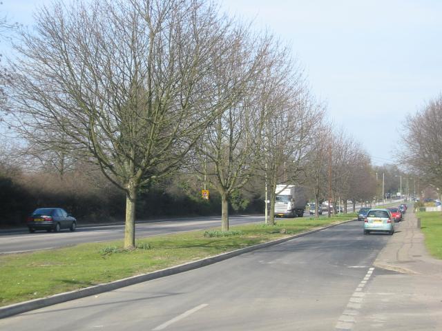
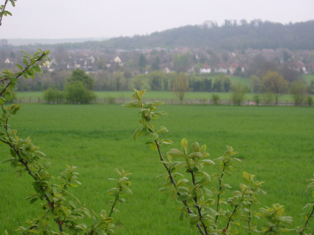
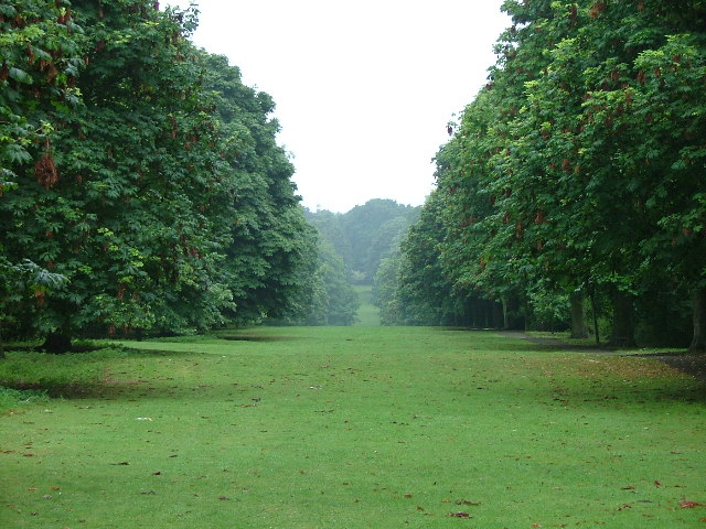
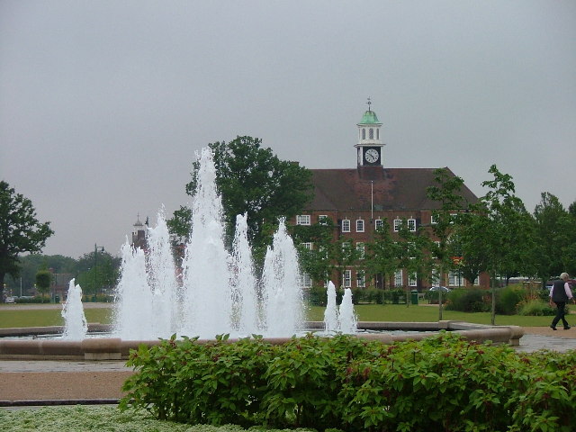
Western Lake Images

Images are sourced within 2km of 51.982241/-0.20808849 or Grid Reference TL2333. Thanks to Geograph Open Source API. All images are credited.

London Road, Baldock Taken from TL246325 looking north, this shows London Road as it heads into the town of Baldock. While ordinary looking now, it was once a major Roman road and part of the medieval Great North Road, which ultimately became the A1, which now runs 600m west of this position.
London Road, Baldock
Taken from TL246325 looking north, this shows London Road as it heads into the town of Baldock. While ordinary looking now, it was once a major Roman road and part of the medieval Great North Road, which ultimately became the A1, which now runs 600m west of this position.
From Willan to Baldock Taken from a bridleway from Baldock to Willan at TL 237 323 this is a view east across the A1 to Baldock
From Willan to Baldock
Taken from a bridleway from Baldock to Willan at TL 237 323 this is a view east across the A1 to Baldock
Norton Common In the middle of Letchworth is a large common.  Most people drive past without even noticing it.  There are black squirrels here.  Some people think that they are pigment mutations of greys but they seem to be much smaller than greys to me.
Norton Common
In the middle of Letchworth is a large common. Most people drive past without even noticing it. There are black squirrels here. Some people think that they are pigment mutations of greys but they seem to be much smaller than greys to me.
Broadway Gardens To the left the new fountain to the right and rear the Town Hall.  These gardens are becoming a popular sunny day haunt for all ages.
Broadway Gardens
To the left the new fountain to the right and rear the Town Hall. These gardens are becoming a popular sunny day haunt for all ages.
Letchworth power station. No longer operational, these chimneys could be seen for miles around.  They were demolished in 2006.
Letchworth power station.
No longer operational, these chimneys could be seen for miles around. They were demolished in 2006.
Baldock High Street Taken at 4:30 p.m. the traffic is beginning to build. By 6 p.m. this will be a nightmare.  This is a lovely old town with an old coaching inn where you can bang your head on the ceiling.
Baldock High Street
Taken at 4:30 p.m. the traffic is beginning to build. By 6 p.m. this will be a nightmare. This is a lovely old town with an old coaching inn where you can bang your head on the ceiling.
Maycroft. On the Grange estate.  This photograph was taken at about 5 p.m. on July 27th on the day that London recorded its coldest July day since records began.  Note the oncoming car with its lights on.
Maycroft.
On the Grange estate. This photograph was taken at about 5 p.m. on July 27th on the day that London recorded its coldest July day since records began. Note the oncoming car with its lights on.
Broughton Hill Howard Cottages are a housing association that have been around the town since the start of the town (Letchworth Garden City was founded in 1903).  All Howard Cottage houses are painted cream and green.
Broughton Hill
Howard Cottages are a housing association that have been around the town since the start of the town (Letchworth Garden City was founded in 1903). All Howard Cottage houses are painted cream and green.
Spring Road Spring Road disappears under the railway line.  Don't try to drive through  - here be bollards.
Spring Road
Spring Road disappears under the railway line. Don't try to drive through - here be bollards.
Converted Barns at Norton. Yet another barn conversion.  These have been converted into a number of homes that face away from the road into a common courtyard.
Converted Barns at Norton.
Yet another barn conversion. These have been converted into a number of homes that face away from the road into a common courtyard.
Corner of Works Rd and Green Lane. In this square this I could have submitted photographs of Renault, Citroen or Peugeot dealerships (the French quarter).  Slightly further afield I could have offered Ford, Mitsubishi, Seat, MG / Rover, Volvo, Honda or Mazda.  You may get some idea of what goes on around here.
Corner of Works Rd and Green Lane.
In this square this I could have submitted photographs of Renault, Citroen or Peugeot dealerships (the French quarter). Slightly further afield I could have offered Ford, Mitsubishi, Seat, MG / Rover, Volvo, Honda or Mazda. You may get some idea of what goes on around here.
The garage on the "Longabout" Commonly known locally as the longabout because it is a long stretched out roundabout.  Simple as that.
The garage on the "Longabout"
Commonly known locally as the longabout because it is a long stretched out roundabout. Simple as that.
Waysbrook Just off the longabout.  Slightly upmarket in the general scheme of things.
Waysbrook
Just off the longabout. Slightly upmarket in the general scheme of things.
Maddles Some of the streets hereabouts seem to have nonsense names.  This is one of them. Built 1969.
Maddles
Some of the streets hereabouts seem to have nonsense names. This is one of them. Built 1969.
Baldock Railway Station Tucked away in the corner of Baldock.  Trains go North to Cambridge and South to London.
Baldock Railway Station
Tucked away in the corner of Baldock. Trains go North to Cambridge and South to London.
St George's Church, Letchworth. Against a blue sky the otherwise dull concrete spire is quite impressive.
St George's Church, Letchworth.
Against a blue sky the otherwise dull concrete spire is quite impressive.
Easter Island Head in the snow. Some gardens in this square are tastefully (if somewhat inappropriately) appointed.
Easter Island Head in the snow.
Some gardens in this square are tastefully (if somewhat inappropriately) appointed.
Norton Post Office. This post office on the corner of Green Lane and Norton Road also serves as corner shop and newsagent, (in fact the place where I often buy my Sunday paper).
Norton Post Office.
This post office on the corner of Green Lane and Norton Road also serves as corner shop and newsagent, (in fact the place where I often buy my Sunday paper).
Show me another place!

Western Lake is located at Grid Ref: TL2333 (Lat: 51.982241, Lng: -0.20808849)

Administrative County: Hertfordshire

District: North Hertfordshire

Police Authority: Hertfordshire

What 3 Words

///idea.hatch.lobby. Near Letchworth Garden City, Hertfordshire

Nearby Locations

Western Lake

Related Wikis

Letchworth Garden City Eagles F.C.

Letchworth Garden City Eagles Football Club is a football club based in Letchworth, England. They are currently members of the Spartan South Midlands League...

Church of St Paul, Letchworth

The Church of St Paul in Letchworth in Hertfordshire is the Anglican parish church for the Letchworth Gate area of the town at the top of Pixmore Way....

Church of St George, Letchworth

St George's Church is an Anglican church of modern design in the Parish of Norton in Letchworth Garden City in Hertfordshire. Opening in 1964 and arrow...

Norton School

Norton School was a secondary school in Letchworth, Hertfordshire that was founded in 1905 and which closed in 2002 following a period of being in special...

Howard Park and Gardens

Howard Park and Gardens is a public recreation ground in Letchworth, in Hertfordshire, England, laid out when the garden city of Letchworth was created...

Knebworth Park and Winter Green Railway

The Knebworth and Winter Green Railway was a 1 ft 11+1⁄2 in (597 mm) narrow gauge railway built in the grounds of Knebworth House in 1972 as a tourist...
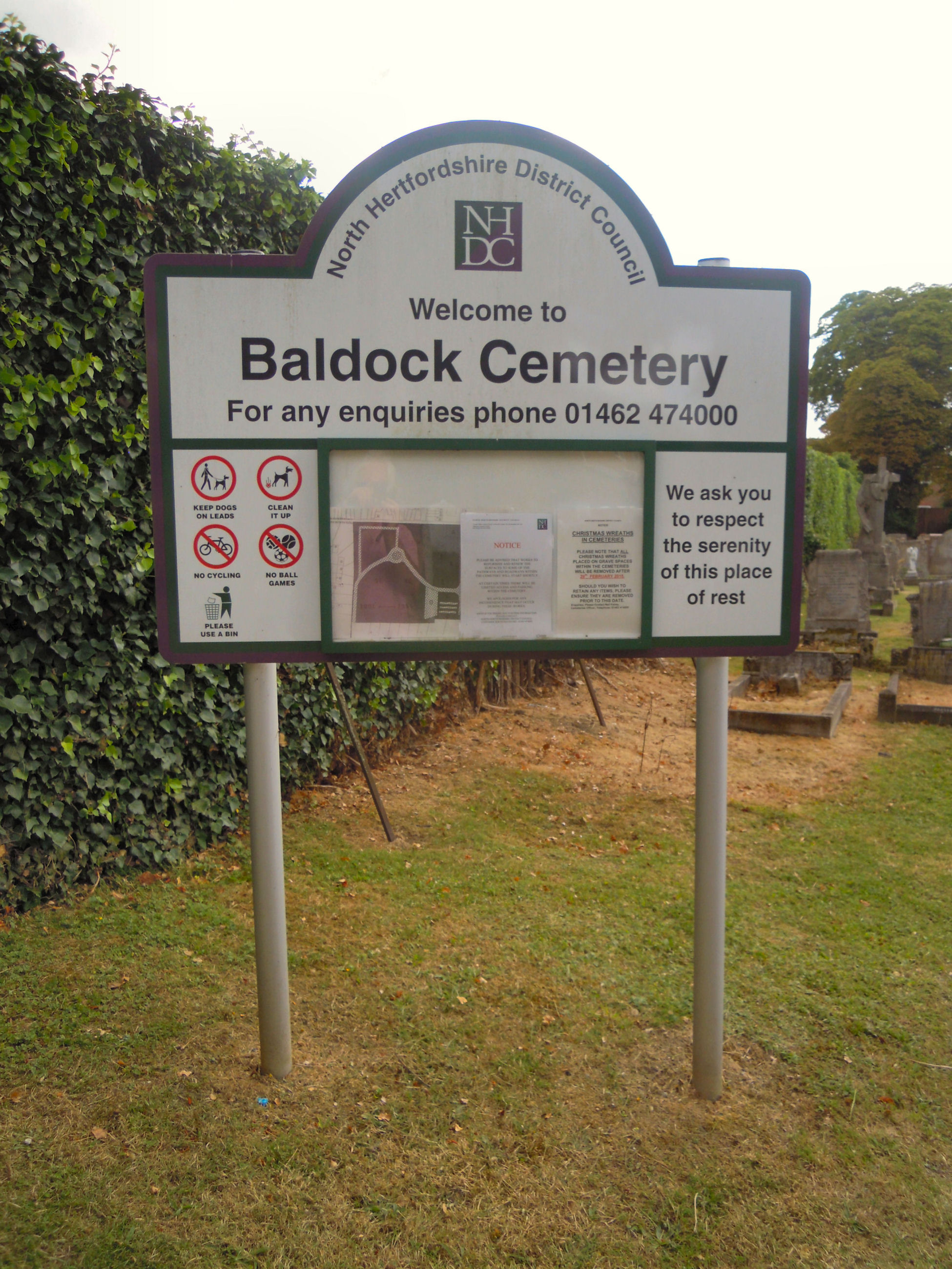
Baldock Cemetery

Baldock Cemetery is the burial ground for the market town of Baldock in North Hertfordshire and the surrounding area. It is maintained by North Hertfordshire...

Norton, Hertfordshire

Norton is a small village and former civil parish in Hertfordshire, England, one of the three original villages which were absorbed into Letchworth Garden...

Nearby Amenities

Located within 500m of 51.982241,-0.20808849
Mini Roundabout
Direction: clockwise
Lat/Long: 51.9846603/-0.2073738
Mini Roundabout
Direction: clockwise
Lat/Long: 51.9839365/-0.209568
Mini Roundabout
Direction: clockwise
Lat/Long: 51.9810627/-0.2046102
Crossing
Crossing: zebra
Lat/Long: 51.9817556/-0.2045633
Fuel
Sainsbury's Letchworth PFS
Brand: Sainsbury's
Brand Wikidata: Q152096
Compressed Air: yes
Fuel Diesel: yes
Fuel Octane 95: yes
Fuel Octane 98: yes
Opening Hours: Mo-We,Sa 07:00-21:30; Th,Fr 07:00-22:30; Su 08:00-16:30
Operator: Sainsbury's
Website: https://stores.sainsburys.co.uk/0235/letchworth-petrol-station
Lat/Long: 51.9820268/-0.2048985
Retail and Business Park
Place: locality
Lat/Long: 51.9836633/-0.2076837
Mini Roundabout
Direction: clockwise
Lat/Long: 51.9857509/-0.2038295
Bus Stop
Sixth Avenue
Bench: no
Bin: no
Bus: yes
Lit: yes
Local Ref: NR
Naptan AtcoCode: 210021112750
Naptan Bearing: N
Naptan CommonName: Sixth Avenue
Naptan Crossing: Basilica
Naptan Indicator: nr
Naptan Landmark: Basilica
Naptan NaptanCode: hrtdwgmd
Naptan PlusbusZoneRef: LTCE
Naptan ShortCommonName: NA
Naptan Street: Avenue One
Naptan Verified: no
Public Transport: platform
Shelter: no
Source: naptan_import
Tactile Paving: yes
Lat/Long: 51.9788907/-0.207053
Bus Stop
Leisure Centre
Bus: yes
Naptan AtcoCode: 210021112780
Naptan Bearing: NE
Naptan CommonName: Leisure Centre
Naptan Indicator: opp
Naptan Landmark: Unknown
Naptan NaptanCode: hrtgdmgm
Naptan PlusbusZoneRef: LTCE
Naptan ShortCommonName: NA
Naptan Street: Baldock Road
Naptan Verified: no
Public Transport: platform
Source: naptan_import
Lat/Long: 51.9785273/-0.206223
Bus Stop
Fourth Avenue
Bus: yes
Local Ref: NR
Naptan AtcoCode: 210021112785
Naptan Bearing: NE
Naptan CommonName: Fourth Avenue
Naptan Indicator: nr
Naptan Landmark: Unknown
Naptan NaptanCode: hrtjadaw
Naptan ShortCommonName: NA
Naptan Street: Avenue One
Naptan Verified: no
Public Transport: platform
Source: naptan_import
Lat/Long: 51.9836256/-0.2091648
Bus Stop
Third Avenue
Bus: yes
Local Ref: NR
Naptan AtcoCode: 210021112787
Naptan Bearing: NE
Naptan CommonName: Third Avenue
Naptan Indicator: nr
Naptan Landmark: Unknown
Naptan NaptanCode: hrtjadgj
Naptan ShortCommonName: NA
Naptan Street: Fourth Avenue
Naptan Verified: no
Public Transport: platform
Source: naptan_import
Lat/Long: 51.9828558/-0.2076228
Bus Stop
Sainsbury's
Bench: yes
Bin: yes
Bus: yes
Lit: yes
Naptan AtcoCode: 210021112790
Naptan Bearing: N
Naptan CommonName: Sainsbury's
Naptan Crossing: Sainsburys
Naptan Indicator: o/s
Naptan Landmark: Sainsburys
Naptan NaptanCode: hrtgdmgp
Naptan PlusbusZoneRef: LTCE
Naptan ShortCommonName: NA
Naptan Street: Third Avenue
Naptan Verified: no
Public Transport: platform
Shelter: yes
Source: naptan_import
Tactile Paving: no
Lat/Long: 51.9816097/-0.2049203
Bus Stop
Fourth Avenue
Bus: yes
Naptan AtcoCode: 210021112795
Naptan Bearing: N
Naptan CommonName: Fourth Avenue
Naptan Crossing: Works Road
Naptan Indicator: opp
Naptan Landmark: Works Road
Naptan NaptanCode: hrtjadga
Naptan ShortCommonName: NA
Naptan Street: Avenue One
Naptan Verified: no
Public Transport: platform
Source: naptan_import
Lat/Long: 51.9831022/-0.2090401
Bus Stop
Dunhams Lane
Bench: no
Bin: no
Lit: yes
Naptan AtcoCode: 210021112885
Naptan Bearing: NE
Naptan CommonName: Dunhams Lane
Naptan Indicator: opp
Naptan Landmark: Unknown
Naptan NaptanCode: hrtgdmat
Naptan PlusbusZoneRef: LTCE
Naptan ShortCommonName: NA
Naptan Street: Works Road
Naptan Verified: no
Shelter: no
Source: naptan_import
Tactile Paving: no
Lat/Long: 51.9835927/-0.2117292
Bus Stop
Avenue One
Bus: yes
Naptan AtcoCode: 210021112900
Naptan Bearing: NE
Naptan CommonName: Avenue One
Naptan Crossing: Gas Holders
Naptan Indicator: opp
Naptan Landmark: Gas Holders
Naptan NaptanCode: hrtgdmaw
Naptan PlusbusZoneRef: LTCE
Naptan ShortCommonName: NA
Naptan Street: Works Road
Naptan Verified: no
Public Transport: platform
Source: naptan_import
Lat/Long: 51.9843033/-0.2087883
Bus Stop
Neville's Court
Naptan AtcoCode: 210021113160
Naptan Bearing: W
Naptan CommonName: Neville's Court
Naptan Indicator: opp
Naptan Landmark: Unknown
Naptan NaptanCode: hrtgdjgj
Naptan PlusbusZoneRef: LTCE
Naptan ShortCommonName: NA
Naptan Street: Icknield Way
Naptan Verified: no
Source: naptan_import
Lat/Long: 51.9858003/-0.2102577
Bus Stop
Blackhorse Road
Local Ref: NR
Naptan AtcoCode: 210021115640
Naptan Bearing: SE
Naptan CommonName: Blackhorse Road
Naptan Crossing: opp Icknield Way
Naptan Indicator: nr
Naptan Landmark: opp Icknield Way
Naptan NaptanCode: hrtgdapj
Naptan PlusbusZoneRef: LTCE
Naptan ShortCommonName: NA
Naptan Street: Green Lane
Naptan Verified: no
Source: naptan_import
Lat/Long: 51.9866527/-0.2083596
Bus Stop
Avenue One
Bus: yes
Local Ref: NR
Naptan AtcoCode: 210021115745
Naptan Bearing: SW
Naptan CommonName: Avenue One
Naptan Crossing: opp Gas Holders
Naptan Indicator: nr
Naptan Landmark: opp Gas Holders
Naptan NaptanCode: hrtgdajt
Naptan PlusbusZoneRef: LTCE
Naptan ShortCommonName: NA
Naptan Street: Works Road
Naptan Verified: no
Public Transport: platform
Source: naptan_import
Lat/Long: 51.98426/-0.2083094
Bus Stop
Dunhams Lane
Bench: yes
Bin: yes
Lit: yes
Local Ref: NR
Naptan AtcoCode: 210021115750
Naptan Bearing: SW
Naptan CommonName: Dunhams Lane
Naptan Indicator: nr
Naptan Landmark: Unknown
Naptan NaptanCode: hrtgdajw
Naptan PlusbusZoneRef: LTCE
Naptan ShortCommonName: NA
Naptan Street: Works Road
Naptan Verified: no
Shelter: yes
Source: naptan_import
Tactile Paving: yes
Lat/Long: 51.983292/-0.2120616
Bus Stop
Jubilee Road
Naptan AtcoCode: 210021115860
Naptan Bearing: SW
Naptan CommonName: Jubilee Road
Naptan Indicator: opp
Naptan Landmark: Unknown
Naptan NaptanCode: hrtgdadw
Naptan PlusbusZoneRef: LTCE
Naptan ShortCommonName: NA
Naptan Street: Baldock Road
Naptan Verified: no
Source: naptan_import
Lat/Long: 51.9826636/-0.2009171
Bus Stop
Leisure Centre
Bench: yes
Bin: yes
Bus: yes
Lit: yes
Local Ref: NR
Naptan AtcoCode: 210021115885
Naptan Bearing: SW
Naptan CommonName: Leisure Centre
Naptan Indicator: nr
Naptan Landmark: Unknown
Naptan NaptanCode: hrtgdagj
Naptan PlusbusZoneRef: LTCE
Naptan ShortCommonName: NA
Naptan Street: Baldock Road
Naptan Verified: no
Public Transport: platform
Shelter: yes
Source: naptan_import
Tactile Paving: yes
Lat/Long: 51.9779021/-0.2070925
Post Box
Collection Times: Mo-Fr 18:30; Sa 12:00
Post Box Type: pillar
Ref: SG6 174
Royal Cypher: EIIR
Royal Cypher Wikidata: Q33102113
Lat/Long: 51.983429/-0.201524
Post Box
Collection Times: Mo-Fr 18:30; Sa 12:00
Note: Now a parcel box
Post Box Type: meter
Ref: SG6 4P
Lat/Long: 51.98344/-0.201539
Post Box
Collection Times: Mo-Fr 18:30; Sa 12:00
Post Box Type: pillar
Ref: SG6 1
Royal Cypher: EIIR
Royal Cypher Wikidata: Q33102113
Lat/Long: 51.981827/-0.209116
Post Box
Collection Times: Mo-Fr 18:30
Opening Hours: Mo-Fr 12:00-18:30
Post Box Type: meter
Ref: SG6 3
Lat/Long: 51.9816435/-0.2117781
Mini Roundabout
Direction: clockwise
Lat/Long: 51.9835913/-0.2023618
Crossing: uncontrolled
Footway: crossing
Lat/Long: 51.9830118/-0.2016176
Railway: switch
Lat/Long: 51.9846984/-0.2129114
Railway: switch
Lat/Long: 51.9858268/-0.2085373
Give Way
Lat/Long: 51.9819699/-0.2082815
Traffic Signals
Lat/Long: 51.9829409/-0.2008928
Give Way
Lat/Long: 51.9831098/-0.2058181
TJ Autocentre
Building: garage
Lat/Long: 51.9832768/-0.2142723
Phoenix Park Estate
Place: neighbourhood
Source: local knowledge
Lat/Long: 51.9794989/-0.2134772
Building: residential
Lat/Long: 51.9797086/-0.2140855
Building: residential
Lat/Long: 51.979708/-0.2140859
Building: residential
Lat/Long: 51.9797077/-0.2140849
Railway: switch
Lat/Long: 51.9859891/-0.2078732
Railway: switch
Lat/Long: 51.9859317/-0.2081734
A&M Motorcycles
Addr City: Letchworth Garden City
Addr Postcode: SG6 1LW
Addr Street: Works Road
Shop: motorcycle
Website: https://www.am-motorcycles.co.uk/
Lat/Long: 51.9852384/-0.2043376
Bicycle Parking
Bicycle Parking: stands
Capacity: 6
Covered: yes
Lat/Long: 51.9814622/-0.2037969
Bicycle Parking
Bicycle Parking: stands
Capacity: 3
Covered: yes
Lat/Long: 51.9826583/-0.202197
Bicycle Parking
Bicycle Parking: wall_loops
Capacity: 3
Covered: no
Lat/Long: 51.9827764/-0.2021366
Crossing
Crossing: uncontrolled
Crossing Ref: zebra
Tactile Paving: no
Lat/Long: 51.9790694/-0.2071657
Crossing
Crossing: uncontrolled
Crossing Ref: zebra
Tactile Paving: yes
Lat/Long: 51.9789495/-0.2081466
Crossing
Crossing: uncontrolled
Crossing Ref: zebra
Lat/Long: 51.9789152/-0.2085728
Crossing
Crossing: uncontrolled
Crossing Ref: zebra
Lat/Long: 51.9789578/-0.2083123
Crossing
Crossing: uncontrolled
Crossing Ref: zebra
Tactile Paving: yes
Lat/Long: 51.9788623/-0.2073795
Crossing
Crossing: uncontrolled
Crossing Ref: zebra
Lat/Long: 51.9790097/-0.207435
Power: transformer
Lat/Long: 51.9839526/-0.2061921
Power: transformer
Lat/Long: 51.9839468/-0.2064027
Post Box
Collection Times: Mo-Fr 18:30; Sa 12:00
Note: Now a parcel box
Post Box Type: meter
Ref: SG6 3P
Royal Cypher: no
Lat/Long: 51.9830102/-0.2142039
Bench
Backrest: yes
Material: wood
Lat/Long: 51.9793104/-0.2134086
Leisure: picnic_table
Material: wood
Lat/Long: 51.9793984/-0.213471
Carpetright
Brand: Carpetright
Brand Wikidata: Q5045782
Shop: carpet
Source: mapillary
Survey Date: 2017-12-23
Website: https://www.carpetright.co.uk/store/letchworth
Lat/Long: 51.9805399/-0.2047537
Topps Tiles
Brand: Topps Tiles
Brand Wikidata: Q17026595
Shop: tiles
Source: mapillary
Survey Date: 2017-12-23
Lat/Long: 51.980476/-0.2046084
B&M Home Store
Brand: B&M Home Store
Brand Wikidata: Q4836931
Shop: variety_store
Source: mapillary
Survey Date: 2017-12-23
Lat/Long: 51.980265/-0.2042478
Entrance: main
Lat/Long: 51.9785273/-0.2070397
Historic: memorial
Inscription: This lime tree was planted on 3rd March 1989 by Councillor A.A. Evens chairman of the North Hertfordshire District Council and Sidney Melman chairman of Letchworth Garden City Corporation
Memorial: plaque
Start Date: 1989-03-03
Support: pole
Lat/Long: 51.9799159/-0.2074045
The data included in this document is from www.openstreetmap.org. The data is made available under ODbL.

Have you been to Western Lake?

Leave your review of Western Lake below (or comments, questions and feedback).