Meadow Lake

Lake, Pool, Pond, Freshwater Marsh in Lincolnshire East Lindsey

England

Meadow Lake

Lodge Road towards Tattershall A disused railway line crosses in the distance, but is hardly noticeable.
Lodge Road towards Tattershall Credit: Julian P Guffogg

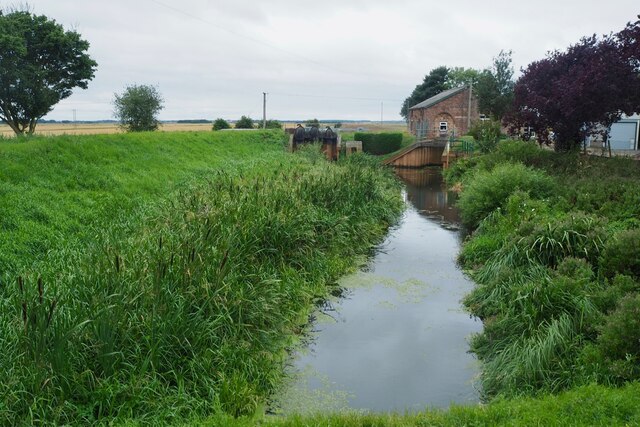
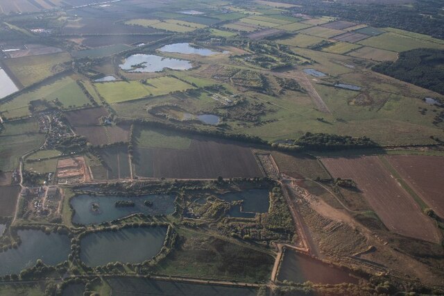
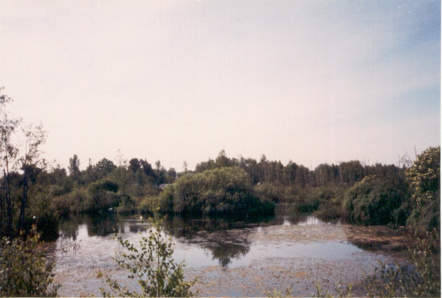
Meadow Lake is a picturesque body of water located in Lincolnshire, England. This stunning lake is surrounded by lush green meadows, making it a charming attraction for visitors and locals alike. With a total area of approximately 10 acres, Meadow Lake offers a tranquil environment for those seeking relaxation or outdoor activities.

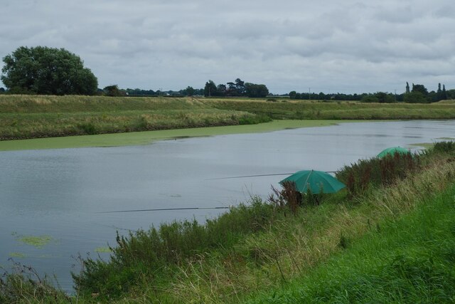
The crystal-clear waters of Meadow Lake provide an ideal habitat for a variety of aquatic life. It is home to numerous fish species, including carp, roach, and perch, making it a popular destination for fishing enthusiasts. Fishing permits are readily available, allowing visitors to enjoy a day of angling in this serene setting.

The lake also offers opportunities for boating and canoeing, allowing visitors to explore its calm waters and admire the surrounding natural beauty. Additionally, there are designated swimming areas for those looking to cool off during the summer months.

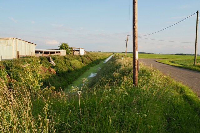
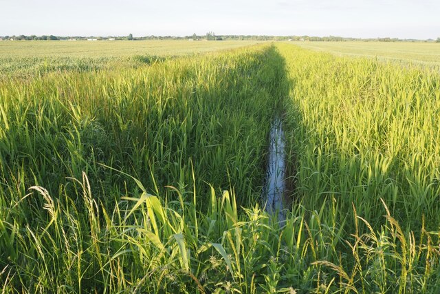
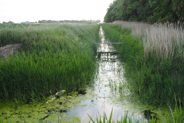
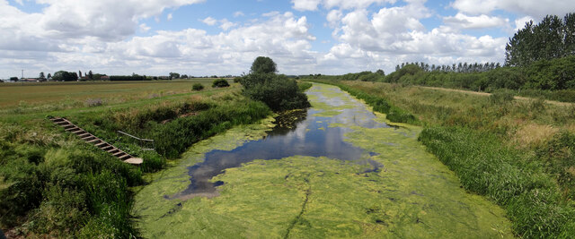
Meadow Lake is not only a lake but also features a small pool and pond, enhancing the diversity of its aquatic ecosystem. The freshwater marshes surrounding the lake are teeming with an array of plant and animal species, including reeds, rushes, and waterfowl. This makes it an excellent spot for birdwatching and nature photography.

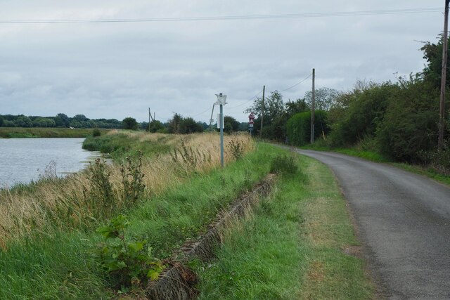
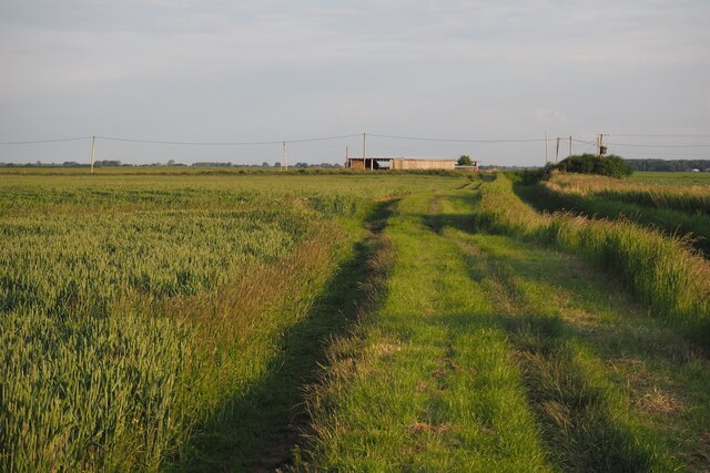
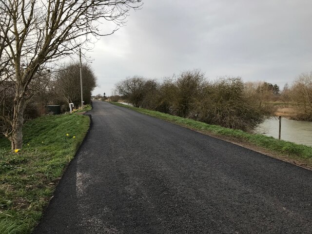
The lake is well-maintained, with picnic areas and walking trails that provide a pleasant experience for families and nature enthusiasts. Meadow Lake truly offers a serene escape from the bustling city life, allowing visitors to immerse themselves in the tranquility of nature.

If you have any feedback on the listing, please let us know in the comments section below.
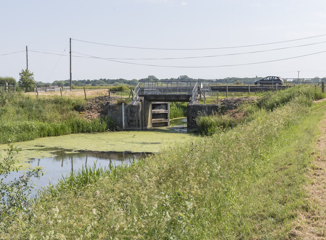
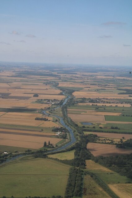
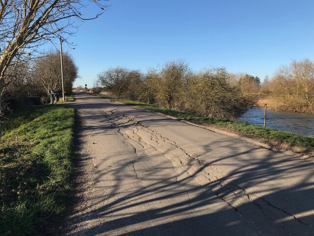
Meadow Lake Images

Images are sourced within 2km of 53.109788/-0.22274444 or Grid Reference TF1958. Thanks to Geograph Open Source API. All images are credited.

Lodge Road towards Tattershall A disused railway line crosses in the distance, but is hardly noticeable.
Lodge Road towards Tattershall
A disused railway line crosses in the distance, but is hardly noticeable.
Fishers on The River Witham
Witham Bank A narrow road running along the right bank of the river between Kirkstone and Tattashall bridges.

It forms part of the Water Rail Way - National Cycle Network Route 1.
Witham Bank
A narrow road running along the right bank of the river between Kirkstone and Tattashall bridges. It forms part of the Water Rail Way - National Cycle Network Route 1.
Brick sorting I think these are the same buildings as <a href="https://www.geograph.org.uk/photo/3565223">TF1958 : Old farm buildings near Bank Farm</a>.
Brick sorting
I think these are the same buildings as TF1958 : Old farm buildings near Bank Farm.
Pumping Station on Engine Drain
Signpost at Thorpe Tilney Dales
Thorpe Tilney Drove
Thorpe Tilney Drove
Drain at Decoy Bridge
Field drain on Tonge Farm Looking towards the line of building, including Tonge Farm, on the River Witham bank.
Field drain on Tonge Farm
Looking towards the line of building, including Tonge Farm, on the River Witham bank.
Restricted byway near Decoy Bridge
Field drain with small bridge
Gravel pits near Tattershall Thorpe with view to disused RAF Woodhall Spa: aerial 2022 Disused airfield in <a href="https://www.geograph.org.uk/gridref/TF2161">TF2161</a>.
Gravel pits near Tattershall Thorpe with view to disused RAF Woodhall Spa: aerial 2022
Disused airfield in TF2161.
Billinghay Skirth Pointing Doors Otherwise known as Tidal Doors.
Gates tend to remain in the position to which they were last pushed by the flow, and may remain open after water levels have equalised.
The gates will shut when the tide flows in.
Billinghay Skirth Pointing Doors
Otherwise known as Tidal Doors. Gates tend to remain in the position to which they were last pushed by the flow, and may remain open after water levels have equalised. The gates will shut when the tide flows in.
Billinghay Skirth choked View from the walkway above the pointing doors.  It's not just small drains that get weeded over, the main waterway 'behind', namely the River Witham, can also get choked <a href="https://www.geograph.org.uk/photo/6968649">TF1956 : Choked</a>.
Billinghay Skirth choked
View from the walkway above the pointing doors. It's not just small drains that get weeded over, the main waterway 'behind', namely the River Witham, can also get choked TF1956 : Choked.
River Witham and dismantled railway NW of Tattershall: aerial 2021 Kirkstead ahead.
River Witham and dismantled railway NW of Tattershall: aerial 2021
Kirkstead ahead.
Cracked tarmac The Witham Bank road is in poor repair.  Due for relaying in a few week's time.
Cracked tarmac
The Witham Bank road is in poor repair. Due for relaying in a few week's time.
New tarmac Compare with <a href="https://www.geograph.org.uk/photo/7191754">TF1860 : Cracked tarmac</a>
New tarmac
Pond, Willow Holt, 1989 The ponds are by the campsite at Willow Holt and are presumably flooded pits.
Pond, Willow Holt, 1989
The ponds are by the campsite at Willow Holt and are presumably flooded pits.
Show me another place!

Meadow Lake is located at Grid Ref: TF1958 (Lat: 53.109788, Lng: -0.22274444)

Administrative County: Lincolnshire

District: East Lindsey

Police Authority: Lincolnshire

What 3 Words

///gazes.tinted.scoping. Near Coningsby, Lincolnshire
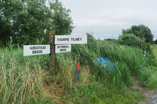
Related Wikis

Lincolnshire

Lincolnshire (abbreviated Lincs.) is a ceremonial county in the East Midlands and Yorkshire and the Humber regions of England. It is bordered by the East...

Tattershall railway station

Tattershall railway station was a station in Tattershall, Lincolnshire. It was closed in 1963. It is now an art gallery. == References == == External... ==

Tattershall Castle, Lincolnshire

Tattershall Castle is a castle in Tattershall, Lincolnshire, England, Since 1925 it has been in the care of the National Trust. == History == Tattershall...

Tattershall

Tattershall is a village and civil parish in the East Lindsey district of Lincolnshire, England. It is situated on the A153 Horncastle to Sleaford road...

Tattershall College

Tattershall College was a grammar school in Tattershall, Lincolnshire. The college was established in 1439 and the building that still stands today was...

Barnes Wallis Academy

Barnes Wallis Academy (formerly Gartree Community School) is a coeducational secondary school located in the village of Tattershall in Lincolnshire, England...

Thorpe Camp

Thorpe Camp, officially known as the Thorpe Camp Visitor Centre, is the former Royal Air Force barracks for RAF Woodhall Spa. It is 2.5 miles (4.0 km)...

St Leonard's Without

The church of St Leonard's Without is a small chapel built between 1230 and 1240 in the parish of Kirkstead, Lincolnshire, close to Woodhall Spa. The chapel...

Nearby Amenities

Located within 500m of 53.109788,-0.22274444
Source: OS_OpenData _StreetView
Lat/Long: 53.1055679/-0.2201794
Source: OS_OpenData _StreetView
Lat/Long: 53.1062432/-0.2215676
Source: OS_OpenData _StreetView
Lat/Long: 53.1069235/-0.2225908
Source: OS_OpenData _StreetView
Lat/Long: 53.107715/-0.2235305
Source: OS_OpenData _StreetView
Lat/Long: 53.109674/-0.2251442
Source: OS_OpenData _StreetView
Lat/Long: 53.110719/-0.2252591
Source: OS_OpenData _StreetView
Lat/Long: 53.1116848/-0.2252074
Source: OS_OpenData _StreetView
Lat/Long: 53.112366/-0.2244064
Source: OS_OpenData _StreetView
Lat/Long: 53.1128448/-0.2235967
Source: OS_OpenData _StreetView
Lat/Long: 53.1090411/-0.2249852
Source: OS_OpenData _StreetView
Lat/Long: 53.1119411/-0.2250523
Source: OS_OpenData _StreetView
Lat/Long: 53.1132812/-0.2235319
Source: OS_OpenData _StreetView
Lat/Long: 53.1139399/-0.2237666
Source: OS_OpenData _StreetView
Lat/Long: 53.1126761/-0.2234233
Source: OS_OpenData _StreetView
Lat/Long: 53.1064285/-0.2219152
Source: OS_OpenData _StreetView
Lat/Long: 53.1121362/-0.2248291
Source: OS_OpenData _StreetView
Lat/Long: 53.1141682/-0.2238792
Source: OS_OpenData _StreetView
Lat/Long: 53.1095099/-0.2246547
Source: OS_OpenData _StreetView
Lat/Long: 53.1140114/-0.2232574
Source: OS_OpenData _StreetView
Lat/Long: 53.1077438/-0.2229754
Source: OS_OpenData _StreetView
Lat/Long: 53.1127071/-0.2230715
Source: OS_OpenData _StreetView
Lat/Long: 53.1123109/-0.2235843
Source: OS_OpenData _StreetView
Lat/Long: 53.1089135/-0.2243534
Source: OS_OpenData _StreetView
Lat/Long: 53.1113606/-0.2248021
Source: OS_OpenData _StreetView
Lat/Long: 53.1068127/-0.2219178
Source: OS_OpenData _StreetView
Lat/Long: 53.111853/-0.2244432
Source: OS_OpenData _StreetView
Lat/Long: 53.1131534/-0.2230202
Source: OS_OpenData _StreetView
Lat/Long: 53.1105141/-0.22477
Source: OS_OpenData _StreetView
Lat/Long: 53.1101901/-0.2243981
Source: OS_OpenData _StreetView
Lat/Long: 53.1137116/-0.223493
Source: OS_OpenData _StreetView
Lat/Long: 53.106387/-0.2216416
Source: OS_OpenData _StreetView
Lat/Long: 53.1140756/-0.2236355
Source: OS_OpenData _StreetView
Lat/Long: 53.112374/-0.2238534
Source: OS_OpenData _StreetView
Lat/Long: 53.1116178/-0.2242815
Source: OS_OpenData _StreetView
Lat/Long: 53.1062206/-0.2202769
Source: OS_OpenData _StreetView
Lat/Long: 53.111682/-0.2249953
Source: OS_OpenData _StreetView
Lat/Long: 53.1123724/-0.2230446
Source: OS_OpenData _StreetView
Lat/Long: 53.1119578/-0.2246921
Source: OS_OpenData _StreetView
Lat/Long: 53.1084412/-0.2234583
Source: OS_OpenData _StreetView
Lat/Long: 53.1072891/-0.222058
Source: OS_OpenData _StreetView
Lat/Long: 53.113708/-0.2228353
Source: OS_OpenData _StreetView
Lat/Long: 53.1107389/-0.225124
Source: OS_OpenData _StreetView
Lat/Long: 53.1131418/-0.2226949
Source: OS_OpenData _StreetView
Lat/Long: 53.1093018/-0.2242184
Source: OS_OpenData _StreetView
Lat/Long: 53.1076308/-0.2232679
Source: OS_OpenData _StreetView
Lat/Long: 53.111461/-0.224401
Source: OS_OpenData _StreetView
Lat/Long: 53.1129413/-0.2233229
Source: OS_OpenData _StreetView
Lat/Long: 53.1058467/-0.2195546
Source: OS_OpenData _StreetView
Lat/Long: 53.1133063/-0.2233828
Source: OS_OpenData _StreetView
Lat/Long: 53.1121187/-0.2234942
Source: OS_OpenData _StreetView
Lat/Long: 53.1120764/-0.2245038
Source: OS_OpenData _StreetView
Lat/Long: 53.1118644/-0.2239805
Source: OS_OpenData _StreetView
Lat/Long: 53.1069219/-0.2216015
Source: OS_OpenData _StreetView
Lat/Long: 53.1114476/-0.225101
Source: OS_OpenData _StreetView
Lat/Long: 53.1126557/-0.2227703
Source: OS_OpenData _StreetView
Lat/Long: 53.1090225/-0.2240148
Power: pole
Source: Bing
Lat/Long: 53.1107622/-0.2297367
Power: pole
Source: Bing
Lat/Long: 53.1091264/-0.2296857
Power: pole
Source: Bing
Lat/Long: 53.1064092/-0.2227722
Power: pole
Source: Bing
Lat/Long: 53.107005/-0.2209188
Power: pole
Source: Bing
Lat/Long: 53.1062908/-0.2237472
Power: pole
Source: Bing
Lat/Long: 53.1069864/-0.2245398
Power: pole
Source: Bing
Lat/Long: 53.1054511/-0.2229935
Bank Farm
Place: farm
Source: Bing
Lat/Long: 53.1071257/-0.2205246
Power: pole
Source: Bing
Lat/Long: 53.1124439/-0.2274648
Power: pole
Source: Bing
Lat/Long: 53.1115696/-0.2272824
Power: pole
Source: Bing
Lat/Long: 53.1105666/-0.2270651
Power: pole
Source: Bing
Lat/Long: 53.1095128/-0.2268277
Power: pole
Source: Bing
Lat/Long: 53.1086787/-0.2265877
Power: pole
Source: Bing
Lat/Long: 53.1077659/-0.2254816
Bank Farm
Place: farm
Source: Bing
Lat/Long: 53.1059585/-0.2220446
Power: pole
Source: Bing
Lat/Long: 53.1088717/-0.2266893
Note: Name?
Place: farm
Source: Bing
Lat/Long: 53.1069/-0.2233555
Witham First District I.D.B. Excavator Depot
Landuse: depot
Operator: Witham First District Internal Drainage Board
Source: Bing
Lat/Long: 53.1093279/-0.2260779
Note: Name?
Place: farm
Source: Bing
Lat/Long: 53.1139707/-0.2248815
Inscription: M/CO OIL PIPELINE L-8" CP 1145
Marker: plate
Utility: oil
Lat/Long: 53.1085308/-0.2244623
Inscription: M/CO OIL PIPELINE L-8" CP 3858
Marker: plate
Operator: exolum
Utility: oil
Lat/Long: 53.1085336/-0.2244528
The data included in this document is from www.openstreetmap.org. The data is made available under ODbL.

Have you been to Meadow Lake?

Leave your review of Meadow Lake below (or comments, questions and feedback).