Oldwood Pond

Lake, Pool, Pond, Freshwater Marsh in Surrey Woking

England

Oldwood Pond

Lock No. 5, Basingstoke Canal
Lock No. 5, Basingstoke Canal Credit: David Martin

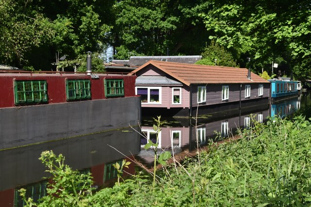
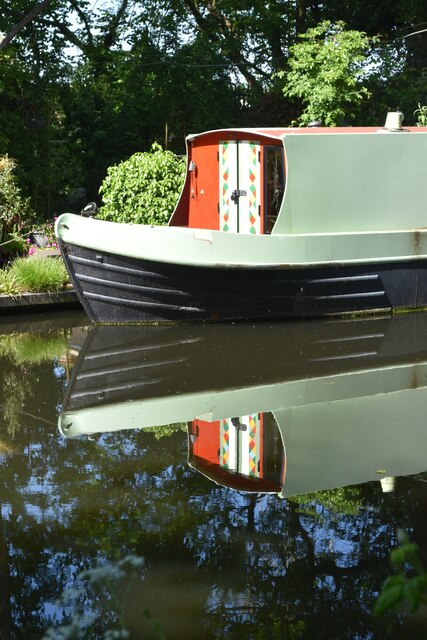
Oldwood Pond is a picturesque freshwater pond located in Surrey, England. Situated amidst lush greenery and rolling hills, it is a popular destination for nature enthusiasts and locals seeking tranquility. The pond covers an area of approximately 2 acres, making it a relatively small water body.

The water in Oldwood Pond is sourced from natural springs and rainfall, ensuring a constant supply of freshwater. The clarity of the water is exceptional, allowing visitors to observe the diverse flora and fauna thriving within it. The pond is home to a variety of aquatic plants, including water lilies, reeds, and cattails, which provide shelter and food for various species of birds, insects, and small mammals.

Oldwood Pond also serves as a habitat for a range of freshwater fish, such as carp, pike, and roach. Fishing enthusiasts can often be seen casting their lines in search of a prized catch. Additionally, the pond attracts a multitude of bird species, including ducks, swans, and herons, making it a haven for birdwatching enthusiasts.

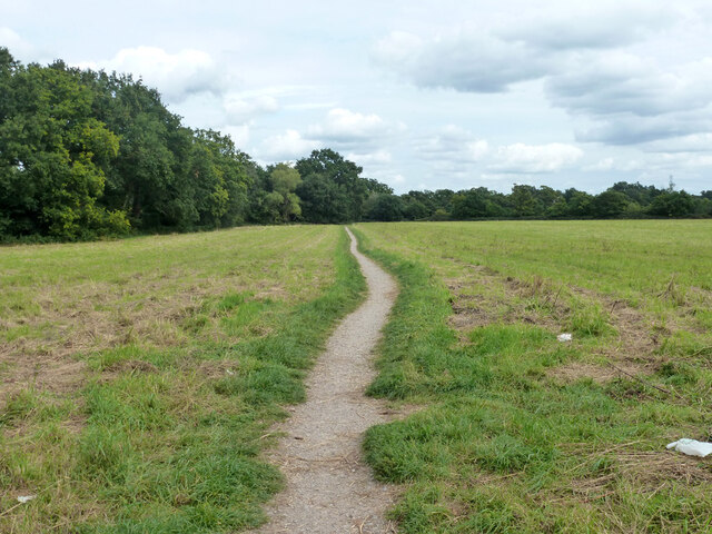
Surrounding the pond is a lush green meadow, where visitors can relax and enjoy a picnic or take a leisurely stroll along the designated walking paths. The serene atmosphere and scenic beauty of Oldwood Pond make it an ideal location for nature photography and wildlife observation.

Overall, Oldwood Pond is a charming freshwater ecosystem that offers a peaceful retreat for both wildlife and visitors alike. Its natural beauty and diverse wildlife make it a cherished natural asset in the Surrey countryside.

If you have any feedback on the listing, please let us know in the comments section below.
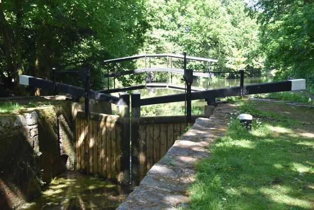
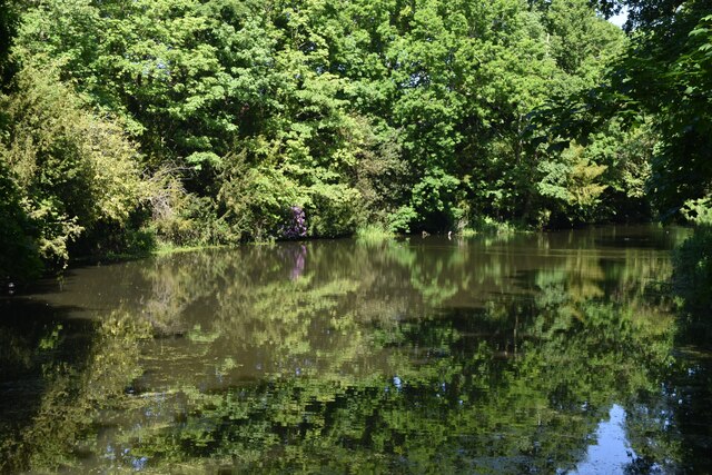
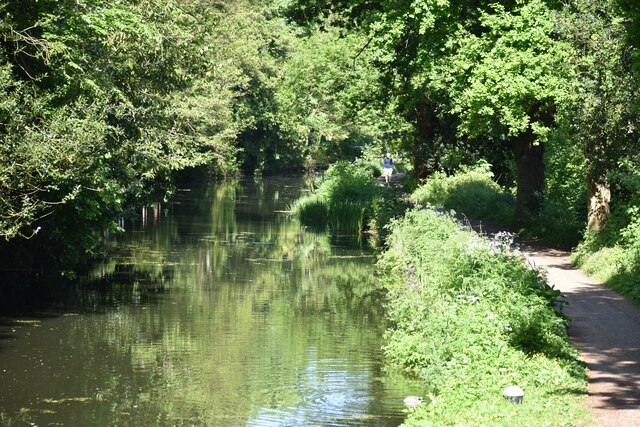
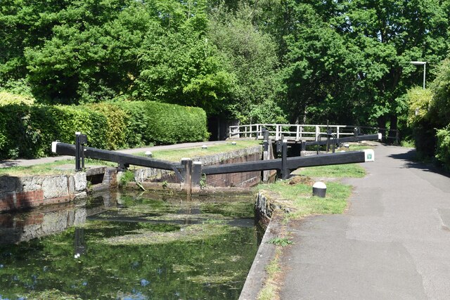
Oldwood Pond Images

Images are sourced within 2km of 51.338906/-0.4870185 or Grid Reference TQ0561. Thanks to Geograph Open Source API. All images are credited.

Lock No. 5, Basingstoke Canal
Below Lock No. 5, Basingstoke Canal
Below Lock No. 4, Basingstoke Canal
Woodham Lock, No. 3 on the Basingstoke Canal
Houseboats, Basingstoke Canal
Moored narrowboat, Basingstoke Canal
The Station public house, West Byfleet
West Byfleet railway station
One day it will look like this Modern apartments and builder's hoarding, West Byfleet
One day it will look like this
Modern apartments and builder's hoarding, West Byfleet
Imaginary countryside Modern apartments and builder's hoarding, West Byfleet
Imaginary countryside
Modern apartments and builder's hoarding, West Byfleet
Cheniston Close, West Byfleet
South West main line to London, looking towards West Byfleet The station footbridge is visible in the distance.
South West main line to London, looking towards West Byfleet
The station footbridge is visible in the distance.
New Haw - River Wey Navigation A line of pleasure boats moored south of New Haw Lock.
New Haw - River Wey Navigation
A line of pleasure boats moored south of New Haw Lock.
New Haw - River Wey Navigation Narrowboat "Wey Otter" heading sedately south from New Haw Lock.
New Haw - River Wey Navigation
Narrowboat "Wey Otter" heading sedately south from New Haw Lock.
Bridleway 92, Woking Running from the end of suburban Dodd's Lane to and including the old Dodd's Lane. Older maps suggest this part was once a track.
Bridleway 92, Woking
Running from the end of suburban Dodd's Lane to and including the old Dodd's Lane. Older maps suggest this part was once a track.
Dodd's Lane Bridleway 92, Woking, towards the River Wey Navigation.
Dodd's Lane
Bridleway 92, Woking, towards the River Wey Navigation.
Dodd's Lane Bridleway 92, Woking, towards the River Wey Navigation.
Dodd's Lane
Bridleway 92, Woking, towards the River Wey Navigation.
River Wey Navigation north of Dodd's Bridge The Navigation and the natural river are separate for several km here, and are a good way apart, the river being well to the east - over 1 km at this spot.
River Wey Navigation north of Dodd's Bridge
The Navigation and the natural river are separate for several km here, and are a good way apart, the river being well to the east - over 1 km at this spot.
Show me another place!

Oldwood Pond is located at Grid Ref: TQ0561 (Lat: 51.338906, Lng: -0.4870185)

Administrative County: Surrey

District: Woking

Police Authority: Surrey

What 3 Words

///firms.thick.weedy. Near West Byfleet, Surrey

Nearby Locations

Old Wood Oldwood Pond

Related Wikis

British Aerospace Company Ground

British Aerospace Company Ground was a cricket ground in Byfleet, Surrey. The ground was built as a works venue for the nearby Vickers-Armstrongs factory...

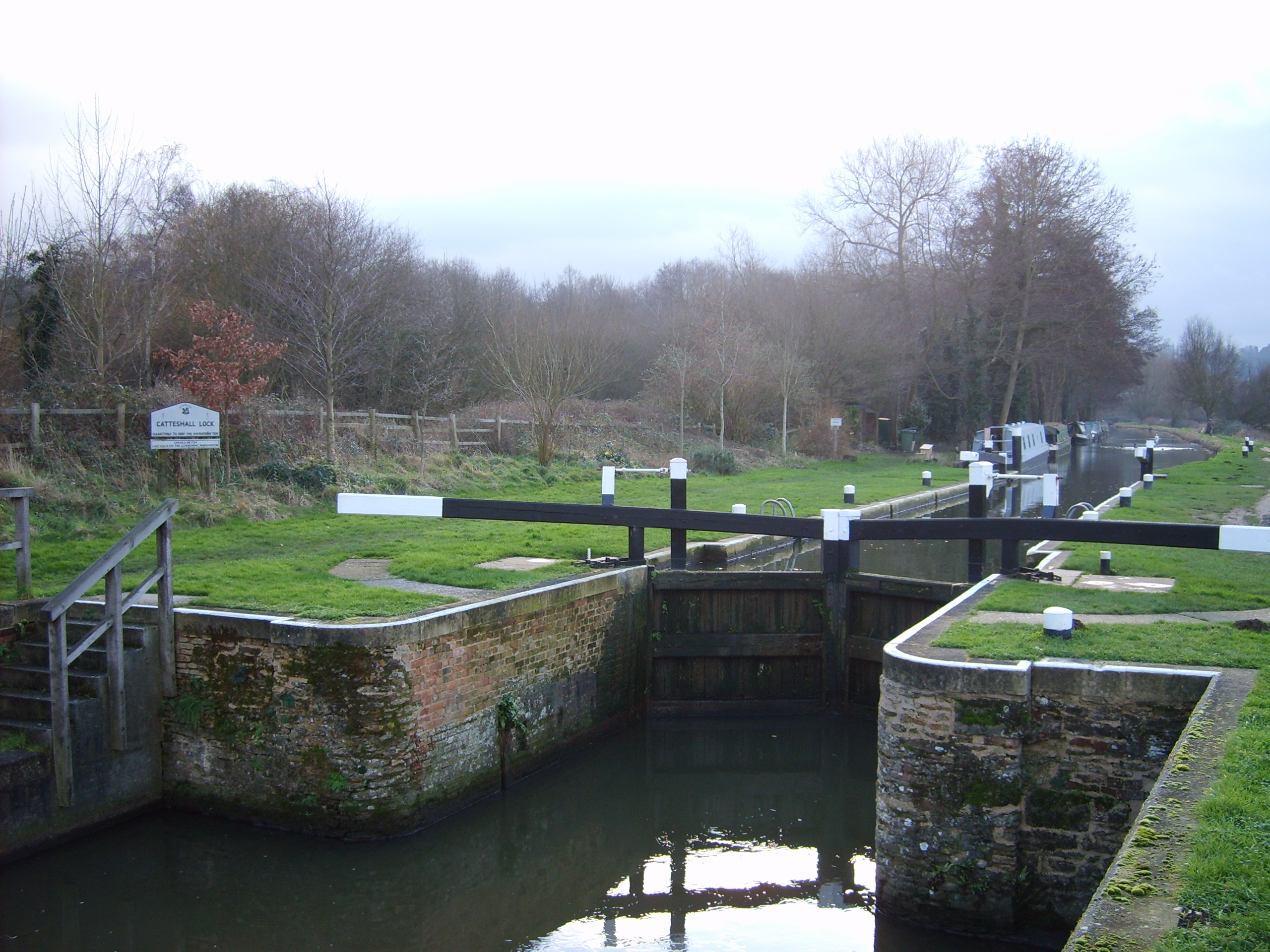
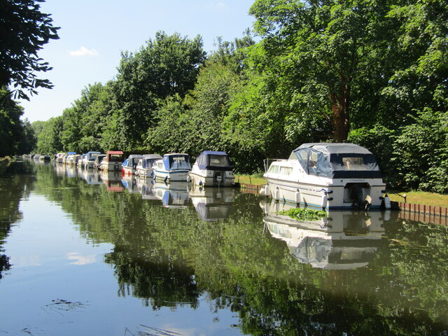
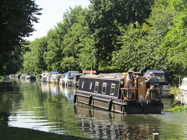
Wey and Godalming Navigations

The River Wey Navigation and Godalming Navigation together provide a 20-mile (32 km) continuous navigable route from the River Thames near Weybridge via...
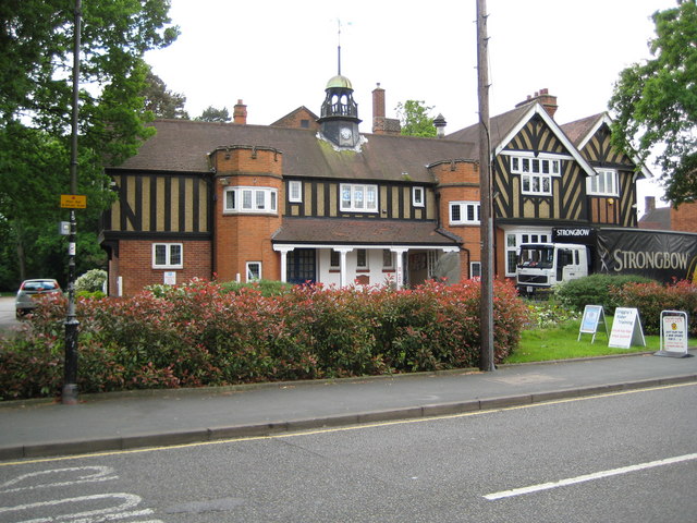
West Byfleet

West Byfleet is a village in Surrey which grew up around its relatively minor stop on the London & South Western Railway: the station, originally Byfleet...

Byfleet

Byfleet is a village in Surrey, England. It is located in the far east of the borough of Woking, around 1.5 miles (2.4 km) east of West Byfleet, from which...

Nearby Amenities

Located within 500m of 51.338906,-0.4870185
Power: tower
Lat/Long: 51.3379316/-0.4834567
Power: tower
Lat/Long: 51.3419282/-0.484137
Power: tower
Lat/Long: 51.3353907/-0.4833458
Location Transition: yes
Power: tower
Lat/Long: 51.335017/-0.4844707
Post Box
Collection Times: Mo-Fr 09:00; Sa 07:00
Operator: Royal Mail
Post Box Type: wall
Ref: KT14 28D
Royal Cypher: GR
Royal Cypher Wikidata: Q33102273
Lat/Long: 51.3399464/-0.488233
Phone
Emergency: phone
Operator: National Highways
Operator Wikidata: Q5760006
Lat/Long: 51.337377/-0.484952
Phone
Emergency: phone
Operator: National Highways
Operator Wikidata: Q5760006
Lat/Long: 51.3373712/-0.4843165
Bus Stop
Queens Head
Naptan AtcoCode: 40004404011A
Naptan Bearing: W
Naptan CommonName: Queens Head
Naptan Indicator: O/s
Naptan Landmark: Queens Head
Naptan NaptanCode: surgdawm
Naptan PlusbusZoneRef: WOKING
Naptan Street: Parvis Road
Naptan Verified: no
Public Transport: platform
Source: naptan_import
Lat/Long: 51.3399204/-0.481569
Bus Stop
Queens Head
Naptan AtcoCode: 40004404011B
Naptan Bearing: NE
Naptan CommonName: Queens Head
Naptan Indicator: Opp
Naptan Landmark: Queens Head
Naptan NaptanCode: surgdawp
Naptan PlusbusZoneRef: WOKING
Naptan Street: Parvis Road
Naptan Verified: no
Public Transport: platform
Source: naptan_import
Lat/Long: 51.3400605/-0.4809688
Bus Stop
Dartnell Park Road
Layby: yes
Naptan AtcoCode: 40004404012A
Naptan Bearing: W
Naptan CommonName: Dartnell Park Road
Naptan Indicator: Opp
Naptan Landmark: Dartnell Park Road
Naptan NaptanCode: surgdawt
Naptan PlusbusZoneRef: WOKING
Naptan Street: Parvis Road
Naptan Verified: no
Public Transport: platform
Source: naptan_import
Lat/Long: 51.3395021/-0.489148
Bus Stop
Dartnell Park Road
Layby: yes
Naptan AtcoCode: 40004404012B
Naptan Bearing: E
Naptan CommonName: Dartnell Park Road
Naptan Indicator: adj
Naptan Landmark: Dartnell Park Road
Naptan NaptanCode: surgdgad
Naptan PlusbusZoneRef: WOKING
Naptan Street: Parvis Road
Naptan Verified: no
Public Transport: platform
Source: naptan_import
Lat/Long: 51.339787/-0.4872316
Bus Stop
Blackwood Close
Bench: no
Bin: no
Naptan AtcoCode: 40004404013A
Naptan Bearing: W
Naptan CommonName: Blackwood Close
Naptan Indicator: Just after
Naptan Landmark: Blackwood Close
Naptan NaptanCode: surgdgag
Naptan PlusbusZoneRef: WOKING
Naptan Street: Parvis Road
Naptan Verified: no
Public Transport: platform
Shelter: no
Source: naptan_import
Tactile Paving: no
Lat/Long: 51.3387897/-0.4941395
Bus Stop
Blackwood Close
Bench: no
Bin: no
Naptan AtcoCode: 40004404013B
Naptan Bearing: E
Naptan CommonName: Blackwood Close
Naptan Indicator: Just Before
Naptan Landmark: Blackwood Close
Naptan NaptanCode: surgdgaj
Naptan PlusbusZoneRef: WOKING
Naptan Street: Parvis Road
Naptan Verified: no
Public Transport: platform
Shelter: no
Source: naptan_import
Tactile Paving: no
Lat/Long: 51.3389182/-0.4939582
Unity Motor Spares
Addr Housenumber: 24
Addr Street: High Road
Opening Hours: Mo-Fr 08:00-18:00; Sa 08:30-17:00; Su 09:00-14:00
Phone: +44 1932 340100
Shop: car_parts
Lat/Long: 51.3397132/-0.4799903
Pub
The Queens Head
Addr City: West Byfleet
Addr Housenumber: 2
Addr Postcode: KT14 7QG
Addr Street: High Road
Beer Garden: yes
Contact Facebook: https://www.facebook.com/thequeensheadbyfleet/
Email: info@queensheadbyfleet.co.uk
Food: yes
Internet Access: wlan
Internet Access Fee: no
Last Check: 2018-08-28
Phone: +44 1932 345433
Tourism: hotel
Website: https://www.queensheadbyfleet.co.uk/
Lat/Long: 51.3398442/-0.4816322
Parking
Parking: surface
Lat/Long: 51.3396506/-0.4818611
Barrier: bollard
Source: Bing
Lat/Long: 51.3399164/-0.4814699
Turning Circle
Lat/Long: 51.3415622/-0.4824718
Crossing
Crossing: uncontrolled
Crossing Island: yes
Kerb: lowered
Lat/Long: 51.3396368/-0.4884282
Crossing
Bicycle: yes
Crossing: unmarked
Kerb: lowered
Lat/Long: 51.3400317/-0.4831743
Turning Circle
Lat/Long: 51.3403077/-0.485858
Power: tower
Lat/Long: 51.3400845/-0.4848555
Power: tower
Lat/Long: 51.3360529/-0.4820929
Power: tower
Lat/Long: 51.3418003/-0.4848522
Power: tower
Lat/Long: 51.3379331/-0.4839726
TLC
Waterway: boatyard
Lat/Long: 51.3401258/-0.4863113
Crossing
Bicycle: yes
Crossing: uncontrolled
Crossing Island: yes
Kerb: lowered
Lat/Long: 51.3397664/-0.4882192
Crossing
Bicycle: yes
Crossing: unmarked
Kerb: lowered
Lat/Long: 51.340025/-0.4822517
Crossing
Crossing: unmarked
Kerb: lowered
Sloped Curb: yes
Lat/Long: 51.339956/-0.4881138
Crossing
Bicycle: yes
Crossing: unmarked
Kerb: lowered
Sloped Curb: yes
Lat/Long: 51.3393556/-0.4909099
Crossing
Bicycle: yes
Crossing: unmarked
Kerb: lowered
Lat/Long: 51.3390279/-0.4933112
Clock
Display: digital
Faces: 1
Support: wall_mounted
Thermometer: yes
Lat/Long: 51.3397436/-0.4803677
Note: 비행기장인데 지도에는 없음
Note En: "It is an airplane but not on the map"
Tourism: attraction
Lat/Long: 51.3347893/-0.487445
Street Lamp
Lamp Model: Philips SGS204
Lamp Type: SON
Source: Mapillary (2019-02-15)
Lat/Long: 51.3352319/-0.4838356
Street Lamp
Lamp Model: Philips SGS204
Lamp Type: SON
Source: Mapillary (2019-02-15)
Lat/Long: 51.3355972/-0.4839885
Street Lamp
Lamp Model: Philips SGS204
Lamp Type: SON
Source: Mapillary (2019-02-15)
Lat/Long: 51.3359458/-0.4841334
Street Lamp
Lamp Model: Philips SGS204
Lamp Type: SON
Source: Mapillary (2019-02-15)
Lat/Long: 51.336301/-0.4842702
Street Lamp
Lamp Model: Philips SGS204
Lamp Type: SON
Source: Mapillary (2019-02-15)
Lat/Long: 51.3366663/-0.4843989
Street Lamp
Lamp Model: Philips SGS204
Lamp Type: SON
Source: Mapillary (2019-02-15)
Lat/Long: 51.3370249/-0.4845169
Street Lamp
Lamp Model: Philips SGS253
Lamp Type: SON
Source: Mapillary (2019-02-15)
Lat/Long: 51.3373768/-0.4846028
Street Lamp
Lamp Model: Philips SGS204
Lamp Type: SON
Source: Mapillary (2019-02-15)
Lat/Long: 51.3373718/-0.4846631
Street Lamp
Lamp Model: Philips SGS204
Lamp Type: SON
Source: Mapillary (2019-02-15)
Lat/Long: 51.3377371/-0.4847342
Street Lamp
Lamp Model: Philips SGS204
Lamp Type: SON
Source: Mapillary (2019-02-15)
Lat/Long: 51.3381107/-0.4848281
Street Lamp
Lamp Model: Philips SGS204
Lamp Type: SON
Source: Mapillary (2019-02-15)
Lat/Long: 51.3385112/-0.4849219
Street Lamp
Lamp Model: Philips SGS204
Lamp Type: SON
Source: Mapillary (2019-02-15)
Lat/Long: 51.3389/-0.4850078
Street Lamp
Lamp Model: Philips SGS204
Lamp Type: SON
Source: Mapillary (2019-02-15)
Lat/Long: 51.3392853/-0.4850802
Street Lamp
Lamp Model: Philips SGS204
Lamp Type: SON
Source: Mapillary (2019-02-15)
Lat/Long: 51.3396506/-0.4851472
Street Lamp
Lamp Model: Industria Arc 80
Lamp Type: SON
Source: Mapillary (2019-02-15)
Lat/Long: 51.3398852/-0.4854798
Street Lamp
Lamp Model: Industria Arc 80
Lamp Type: SON
Source: Mapillary (2019-02-15)
Lat/Long: 51.339917/-0.4849836
Street Lamp
Lamp Model: Philips SGS204
Lamp Type: SON
Source: Mapillary (2019-02-15)
Lat/Long: 51.3403963/-0.4852438
Street Lamp
Lamp Model: Philips SGS204
Lamp Type: SON
Source: Mapillary (2019-02-15)
Lat/Long: 51.3400293/-0.4852009
Street Lamp
Lamp Model: Philips SGS204
Lamp Type: SON
Source: Mapillary (2019-02-15)
Lat/Long: 51.3407766/-0.4852867
Street Lamp
Lamp Model: Philips SGS204
Lamp Type: SON
Source: Mapillary (2019-02-15)
Lat/Long: 51.3411603/-0.4853135
Street Lamp
Lamp Model: Philips SGS204
Lamp Type: SON
Source: Mapillary (2019-02-15)
Lat/Long: 51.341549/-0.4853377
Street Lamp
Lamp Model: Philips SGS204
Lamp Type: SON
Source: Mapillary (2019-02-15)
Lat/Long: 51.3419042/-0.4853484
Street Lamp
Lamp Model: Philips SGS204
Lamp Type: SON
Source: Mapillary (2019-02-15)
Lat/Long: 51.3422795/-0.4853538
Street Lamp
Lamp Model: Philips SGS204
Lamp Type: SON
Source: Mapillary (2019-02-15)
Lat/Long: 51.3426515/-0.4853511
Street Lamp
Lamp Model: Philips SGS204
Lamp Type: SON
Source: Mapillary (2019-02-15)
Lat/Long: 51.3430285/-0.485343
Camera Mount: pole
Camera Type: panning
Height: 8
Man Made: surveillance
Operator: National Highways
Operator Wikidata: Q5760006
Surveillance: outdoor
Surveillance Type: camera
Surveillance Zone: traffic
Lat/Long: 51.3379014/-0.485103
Traffic Sign: variable_message
Variable Message Model: MS2
Lat/Long: 51.3379671/-0.4844813
Barrier: cycle_barrier
Lat/Long: 51.3403871/-0.4863826
Parking
Access: private
Capacity: 10
Operator: Busy Bees Nursery
Operator Type: private
Parking: surface
Surface: asphalt
Lat/Long: 51.3354446/-0.4878188
Crossing
Crossing: uncontrolled
Crossing Island: yes
Kerb: lowered
Lat/Long: 51.3390296/-0.4928246
Traffic Sign: variable_message
Variable Message Model: AMI
Lat/Long: 51.3379572/-0.4845756
Traffic Sign: variable_message
Variable Message Model: AMI
Lat/Long: 51.3379512/-0.4846317
Traffic Sign: variable_message
Variable Message Model: AMI
Lat/Long: 51.3379457/-0.4846839
Traffic Sign: variable_message
Variable Message Model: AMI
Lat/Long: 51.3379397/-0.4847406
Traffic Sign: variable_message
Variable Message Model: AMI
Lat/Long: 51.3379285/-0.4848469
Traffic Sign: variable_message
Variable Message Model: AMI
Lat/Long: 51.337924/-0.4848892
Traffic Sign: variable_message
Variable Message Model: AMI
Lat/Long: 51.3379178/-0.484948
Traffic Sign: variable_message
Variable Message Model: AMI
Lat/Long: 51.3379123/-0.4850005
Traffic Sign: variable_message
Variable Message Model: MS2
Lat/Long: 51.3379054/-0.4850653
Grit Bin
Colour: yellow
Source: survey
Survey Date: 2022-11-20
Lat/Long: 51.3398591/-0.4845778
The data included in this document is from www.openstreetmap.org. The data is made available under ODbL.

Have you been to Oldwood Pond?

Leave your review of Oldwood Pond below (or comments, questions and feedback).