Stig's Dip

Lake, Pool, Pond, Freshwater Marsh in Lincolnshire South Kesteven

England

Stig's Dip

Bridge and ford on B1176
Bridge and ford on B1176 Credit: Tim Heaton

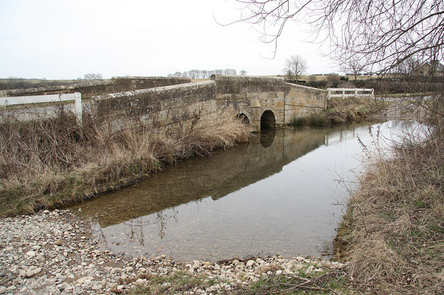
Stig's Dip is a picturesque freshwater marsh located in Lincolnshire, England. It is a small body of water that serves as a lake, pool, and pond, making it a unique natural feature in the region. The dip is surrounded by lush greenery and is a popular spot for nature enthusiasts and birdwatchers.

The freshwater marsh is home to a diverse range of flora and fauna. It hosts a variety of water plants such as reeds, cattails, and lilies, which provide habitat and food for numerous species of birds, insects, and amphibians. The shallow water of the dip is an ideal breeding ground for many aquatic creatures.

Bird lovers flock to Stig's Dip to observe the resident and migratory bird species. The dense vegetation and calm waters attract a wide range of waterfowl, including ducks, geese, and herons. Visitors may also spot rare species such as bitterns and marsh harriers, which are known to frequent the area.

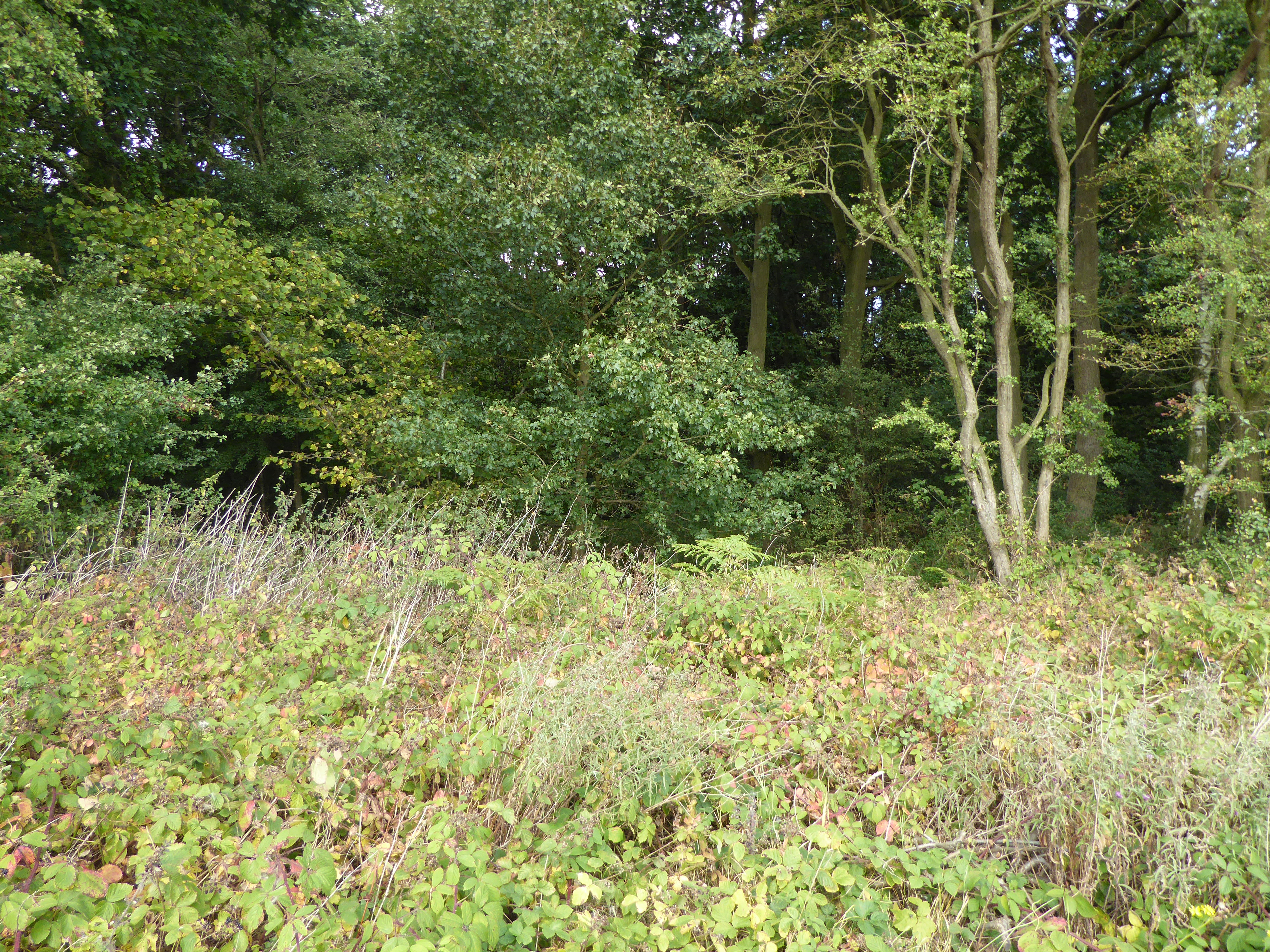
The tranquil surroundings of Stig's Dip make it a peaceful retreat for those seeking a break from the hustle and bustle of everyday life. The marsh offers a serene atmosphere, with the calming sound of water and the gentle rustling of leaves.

Stig's Dip is easily accessible, with designated walking paths and observation points for visitors to enjoy the beauty of the marsh while minimizing disturbance to the wildlife. It is a haven for nature lovers and provides a valuable habitat for a variety of plants and animals.

If you have any feedback on the listing, please let us know in the comments section below.

Stig's Dip Images

Images are sourced within 2km of 52.720523/-0.48682855 or Grid Reference TF0214. Thanks to Geograph Open Source API. All images are credited.

Bridge and ford on B1176
Church of St Stephen, Careby
'East Coast' rail line near Carlby
Stream Valley near Carlby
Railway bridge
Railway bridge
Footpath to Aunby This footpath links Holywell Hall with Aunby.
Footpath to Aunby
This footpath links Holywell Hall with Aunby.
Careby The road from Stamford (right) runs over the East Coast main railway line (bridge) towards Little Bytham
Careby
The road from Stamford (right) runs over the East Coast main railway line (bridge) towards Little Bytham
Road running east to Careby
View across wheat field to corner of Docksight Wood From the bridleway running SE to Aunby. Docksight Wood was classified as 'Ancient Woodland' in the English Nature 2005 Survey <span class="nowrap"><a title="http://www.english-nature.org.uk/pubs/publication/PDF/653Appendices.pdf" rel="nofollow ugc noopener" href="http://www.english-nature.org.uk/pubs/publication/PDF/653Appendices.pdf">Link</a><img style="margin-left:2px;" alt="External link" title="External link - shift click to open in new window" src="https://s1.geograph.org.uk/img/external.png" width="10" height="10"/></span>
View across wheat field to corner of Docksight Wood
From the bridleway running SE to Aunby. Docksight Wood was classified as 'Ancient Woodland' in the English Nature 2005 Survey LinkExternal link
Bridleway running SE towards Aunby Wheat and corner of The Heath woodland on right. Very desiccated oilseed rape to left.
Bridleway running SE towards Aunby
Wheat and corner of The Heath woodland on right. Very desiccated oilseed rape to left.
Farm buildings on track running N towards Careby Wood
View west from edge of Monk's Wood
Fire tower, Careby Wood Much of the original coniferous woodland has been felled and replaced by mixed deciduous shrub.
Fire tower, Careby Wood
Much of the original coniferous woodland has been felled and replaced by mixed deciduous shrub.
Entrance to Careby Wood The tag on the gatepost identifies this as 'Forest Enterprise' property. I've never understood the difference between this and the Forestry Commission.
Entrance to Careby Wood
The tag on the gatepost identifies this as 'Forest Enterprise' property. I've never understood the difference between this and the Forestry Commission.
Lane near Newell Wood in the Summer The woodland on the right is called Castle Dyke Wood, part of the Newell Wood complex which almost covers this square. This is in Lincolnshire while <a href="https://www.geograph.org.uk/photo/127556">TF0014 : Country lane by Newell Wood</a> is in Rutland.
Lane near Newell Wood in the Summer
The woodland on the right is called Castle Dyke Wood, part of the Newell Wood complex which almost covers this square. This is in Lincolnshire while TF0014 : Country lane by Newell Wood is in Rutland.
Farmland near Castledyke Wood The woodland on the horizon is The Heath in <a href="https://www.geograph.org.uk/gridref/TF0114">TF0114</a>
Farmland near Castledyke Wood
The woodland on the horizon is The Heath in TF0114
Tree-lined lane near Aunby Between The Heath and Little Warren, both part of the woodland that stretches from here along the Lincolnshire/Rutland border to Morkery Wood in <a href="https://www.geograph.org.uk/gridref/SK9418">SK9418</a>.
Tree-lined lane near Aunby
Between The Heath and Little Warren, both part of the woodland that stretches from here along the Lincolnshire/Rutland border to Morkery Wood in SK9418.
Show me another place!

Stig's Dip is located at Grid Ref: TF0214 (Lat: 52.720523, Lng: -0.48682855)

Administrative County: Lincolnshire

District: South Kesteven

Police Authority: Lincolnshire

What 3 Words

///identify.forehand.boils. Near Essendine, Rutland

Nearby Locations

Stig's Dip Aunby Mill Pond

Related Wikis

Aunby

Aunby is a village in the parish of Careby Aunby and Holywell, in the South Kesteven district of Lincolnshire, England. It is situated north from Stamford...

Ryhall Pasture and Little Warren Verges

Ryhall Pasture and Little Warren Verges is a 6.2-hectare (15-acre) biological Site of Special Scientific Interest north of the village of Ryhall. Little...

Careby Aunby and Holywell

Careby Aunby and Holywell is a civil parish in the district of South Kesteven, south-west Lincolnshire, in England. It stretches from the county border...

Careby

Careby is the principal village in the a civil parish of Careby Aunby and Holywell [in which the population is included] in the South Kesteven district...

Newell Wood

Newell Wood is a 33.3-hectare (82-acre) biological Site of Special Scientific Interest east of Pickworth in Rutland, adjacent to Lincolnshire Gate. This...

Holywell, Lincolnshire

Holywell is a tiny settlement in the civil parish of Careby Aunby and Holywell, in the South Kesteven district of Lincolnshire, England. It lies 5.5 miles...

Lincolnshire Gate

Lincolnshire Gate is the name given to a corner in the road between Holywell, Lincolnshire and Pickworth, Rutland to the south-west of Castle Bytham, in...

Little Bytham railway station

Little Bytham railway station was a station in Little Bytham, Lincolnshire on the Great Northern Railway main line. It closed in 1959. The Midland and...

Nearby Amenities

Located within 500m of 52.720523,-0.48682855
Aunby
Is In: Lincolnshire, England, UK
Place: locality
Lat/Long: 52.7198416/-0.4892216
Design: barrel
Line Attachment: suspension
Material: steel
Power: tower
Structure: lattice
Lat/Long: 52.7227865/-0.4867699
Design: barrel
Line Attachment: anchor
Material: steel
Power: tower
Structure: lattice
Lat/Long: 52.7199336/-0.4835479
Addr Housename: Aunby Lodge Farm
Alt Name: Lodge Farm
Source: Bing
Lat/Long: 52.7161356/-0.4866062
Addr Housename: Aunby Manor
Lat/Long: 52.7199802/-0.4887848
Addr Housename: Mill View
Source Addr: OS OpenData StreetView
Lat/Long: 52.7193107/-0.4897986
Ford: yes
Source: Bing
Lat/Long: 52.7209222/-0.4815857
Addr Housename: Manor Farm Cottage
Source Addr: OS OpenData StreetView
Lat/Long: 52.7203276/-0.488479
Building: yes
Lat/Long: 52.719592/-0.4811935
Manor Farm
Place: farm
Lat/Long: 52.7189045/-0.48666
Glen Cottage
Place: isolated_dwelling
Lat/Long: 52.7194829/-0.4813385
Lodge Farm
Place: farm
Lat/Long: 52.71611/-0.4865957
The data included in this document is from www.openstreetmap.org. The data is made available under ODbL.

Have you been to Stig's Dip?

Leave your review of Stig's Dip below (or comments, questions and feedback).