Walsingham, Great

Settlement in Norfolk North Norfolk

England

Walsingham, Great

Permissive path from Great Walsingham Barns
Permissive path from Great Walsingham Barns Credit: Hugh Venables

Walsingham is a small village located in the county of Norfolk, England. Situated in the northern part of the county, it lies approximately 30 miles northwest of Norwich. Walsingham is known for its religious significance and its historical charm.

The village is famous for being a major pilgrimage site for Christians. It is home to the Shrine of Our Lady of Walsingham, a place of worship dedicated to the Virgin Mary. The shrine attracts visitors from around the world who come to pay their respects and seek spiritual solace. The religious history of Walsingham dates back to the 11th century when a noblewoman claimed to have experienced visions of the Virgin Mary.

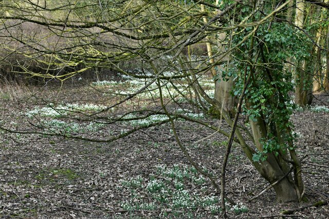
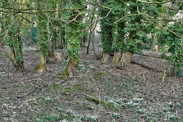
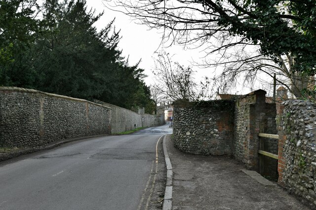
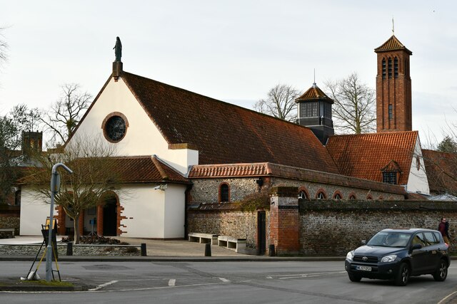
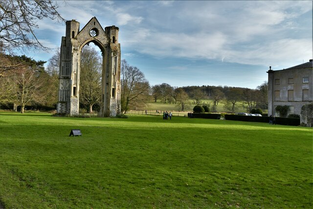
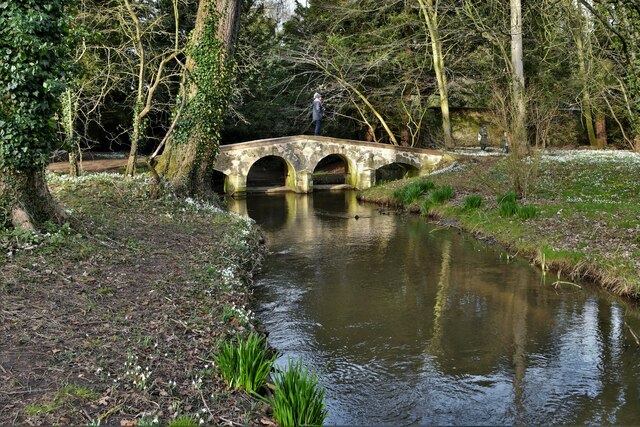
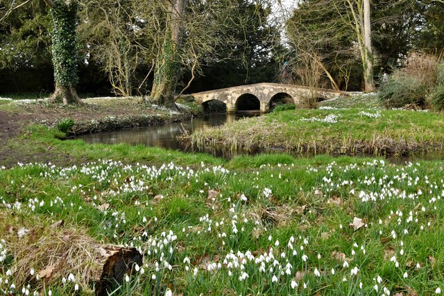
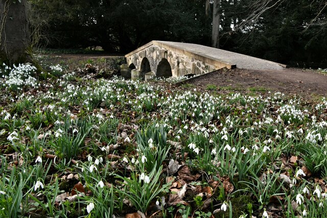
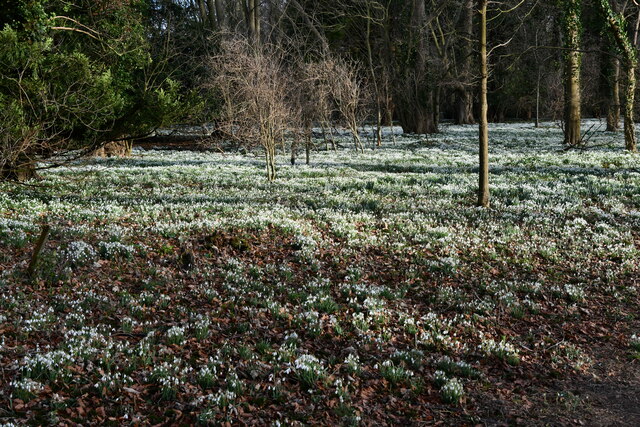
Aside from its religious importance, Walsingham is also known for its picturesque setting and well-preserved medieval architecture. The village is filled with timber-framed houses, charming cottages, and narrow streets, creating an atmosphere of old-world charm. The medieval ruins of the priory, which was once one of the most important religious sites in England, further add to the village's historical appeal.

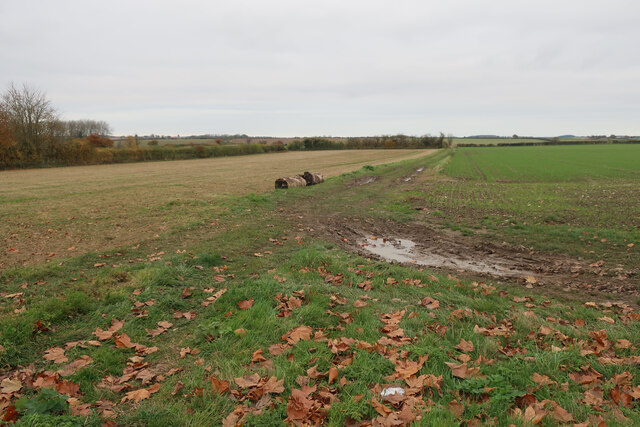
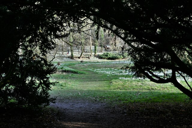
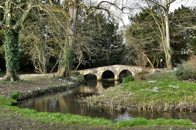
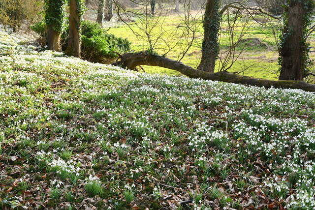
Walsingham offers a variety of amenities for visitors, including small shops, tea rooms, and traditional pubs. The surrounding countryside is also a popular destination for nature lovers, with scenic walking trails and beautiful landscapes. Additionally, the village hosts several events throughout the year, such as religious processions and medieval reenactments, which attract both locals and tourists.

Overall, Walsingham is a place where history, religion, and natural beauty converge, making it a unique and captivating destination for visitors seeking a glimpse into England's past.

If you have any feedback on the listing, please let us know in the comments section below.

Walsingham, Great Images

Images are sourced within 2km of 52.899065/0.879916 or Grid Reference TF9337. Thanks to Geograph Open Source API. All images are credited.

Permissive path from Great Walsingham Barns
Little Walsingham: Wooded area carpeted in snowdrops 1
Little Walsingham: Wooded area carpeted in snowdrops 2
Little Walsingham: Holt Road approaching the bridge over the river
Little Walsingham: The Shrine of Our Lady of Walsingham
Walsingham Abbey, the remains of the Augustinian priory
Walsingham Abbey Snowdrop Trail 1
Walsingham Abbey Snowdrop Trail 2: The recently restored Packhorse Bridge
Walsingham Abbey Snowdrop Trail 3: The recently restored Packhorse Bridge
Walsingham Abbey Snowdrop Trail 4: The recently restored Packhorse Bridge
Walsingham Abbey Snowdrop Trail 5: The recently restored Packhorse Bridge
Walsingham Abbey Snowdrop Trail 7
Walsingham Abbey Snowdrop Trail 6: The recently restored Packhorse Bridge
Walsingham Abbey Snowdrop Trail 8
Walsingham Abbey Snowdrop Trail 9
Walsingham Abbey Snowdrop Trail 10
Show me another place!

Walsingham, Great is located at Grid Ref: TF9337 (Lat: 52.899065, Lng: 0.879916)

Administrative County: Norfolk

District: North Norfolk

Police Authority: Norfolk

What 3 Words

///cheering.inform.interviewer. Near Wells-next-the-Sea, Norfolk

Related Wikis

Anglican Shrine of Our Lady of Walsingham

The Anglican Shrine of Our Lady of Walsingham is a Church of England shrine church built in 1938 in Walsingham, Norfolk, England. Walsingham is the site...

Walsingham (W&WLR) railway station

Walsingham railway station is located in Walsingham, Norfolk, on the narrow gauge Wells and Walsingham Light Railway. It was opened in 1982. It is located...
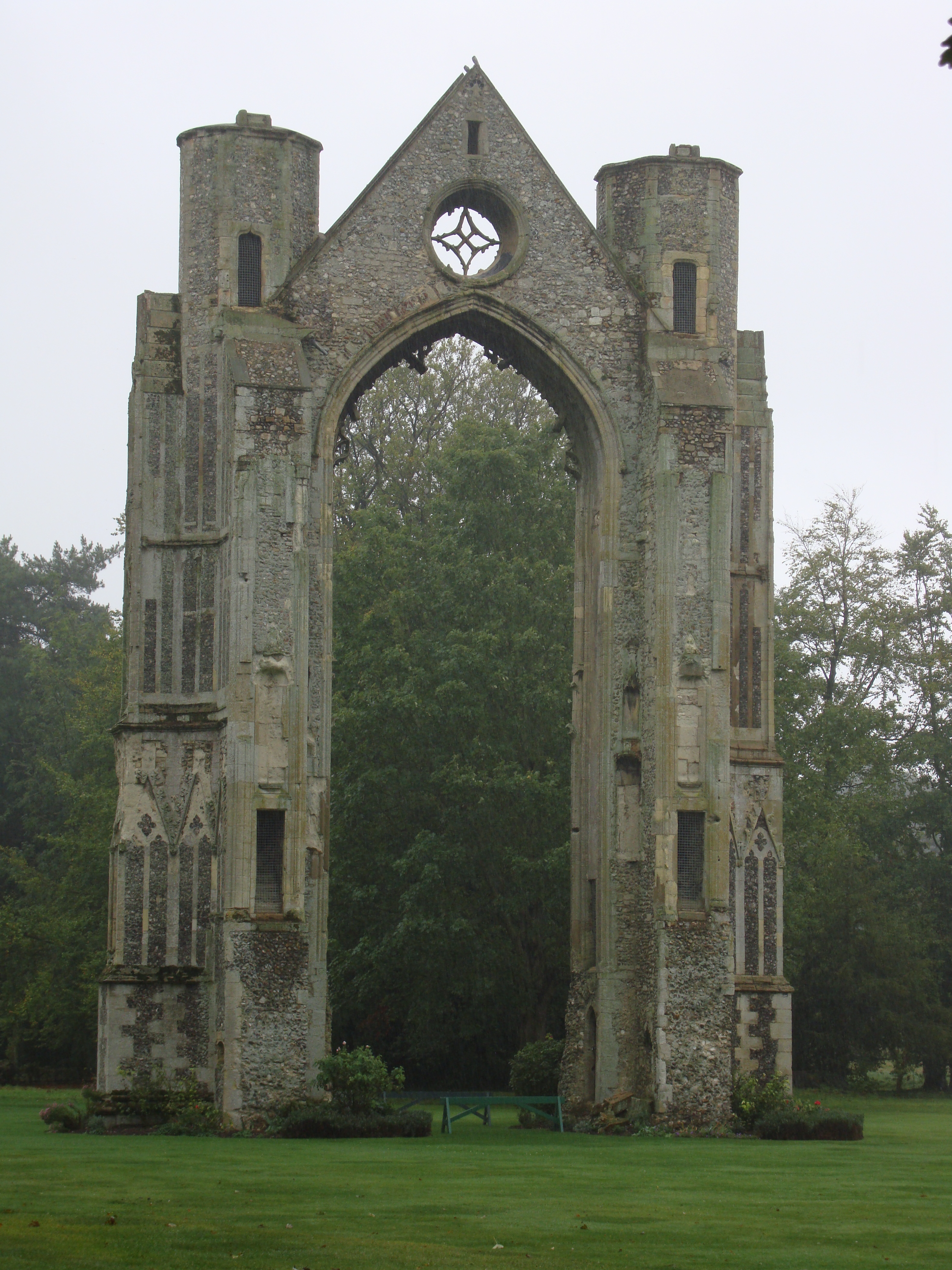
Walsingham Priory

Walsingham Priory was a monastery of Augustinian Canons regular in Walsingham, Norfolk, England seized by the crown at the Dissolution of the Monasteries...

Walsingham

Walsingham () is a civil parish in North Norfolk, England, famous for its religious shrines in honour of Mary, mother of Jesus. It also contains the ruins...

Walsingham railway station

Walsingham was a railway station on the Wells and Fakenham Railway, later part of the Great Eastern Railway. It opened on 1 December 1857, and served the...

St Mary and All Saints, Little Walsingham

St Mary and All Saints Church is the parish church of Little Walsingham in the English county of Norfolk. It is dedicated to the Virgin Mary and All Saints...

Walsingham Friary

Walsingham Friary was a Franciscan friary at Walsingham, Norfolk, England. It was founded in 1347 and suppressed in the 16th century in the Dissolution...

Wighton Halt railway station

Wighton Halt is a railway station serving the small village of Wighton, Norfolk. It is a public railway station, originally part of the standard gauge...

Nearby Amenities

Located within 500m of 52.899065,0.879916
Great Walsingham
Old Name: Old Walsingham
Place: village
Source: npe
Lat/Long: 52.900852/0.886245
Bus Stop
school, adj
Departures Board: timetable
Naptan AtcoCode: 2900W052
Naptan Bearing: S
Naptan CommonName: school
Naptan Indicator: adj
Naptan Landmark: Primary School
Naptan Locality: Little Walsingham
Naptan NaptanCode: nfogdatm
Naptan Street: Wells Road
Naptan Verified: no
Shelter: yes
Source: naptan_import
Lat/Long: 52.897937/0.8759191
Bus Stop
school, opp
Departures Board: timetable
Naptan AtcoCode: 2900W058
Naptan Bearing: N
Naptan BusStopType: CUS
Naptan CommonName: school
Naptan Indicator: opp
Naptan Landmark: Primary School
Naptan Locality: Little Walsingham
Naptan NaptanCode: nfogdawd
Naptan Street: Wells Road
Naptan Verified: no
Shelter: yes
Source: naptan_import
Timetable: yes
Lat/Long: 52.8980139/0.875716
Post Box
Operator: Royal Mail
Operator Wikidata: Q638098
Post Box Type: wall
Ref: NR22 2204
Royal Cypher: VR
Royal Cypher Wikidata: Q33102356
Lat/Long: 52.8956173/0.8756009
Ford: yes
Lat/Long: 52.9012402/0.8858236
Power: pole
Lat/Long: 52.8958889/0.8831874
Power: pole
Lat/Long: 52.8956957/0.8837525
Bench
Backrest: yes
Bench: yes
Colour: green
Lat/Long: 52.8959009/0.8753282
Give Way
Lat/Long: 52.9033375/0.8777989
Give Way
Lat/Long: 52.9033618/0.8781012
Bench
Backrest: yes
Lat/Long: 52.8980198/0.8756575
Historic: memorial
Memorial: war_memorial
Lat/Long: 52.8958696/0.8753482
Grit Bin
Lat/Long: 52.8984269/0.8761961
Power: pole
Lat/Long: 52.8965355/0.8811052
Power: pole
Lat/Long: 52.8971889/0.8789243
Power: pole
Lat/Long: 52.8985504/0.8789487
Power: pole
Lat/Long: 52.8992156/0.8789318
Power: pole
Lat/Long: 52.900914/0.8788507
Power: pole
Lat/Long: 52.901465/0.8801287
Power: pole
Lat/Long: 52.902458/0.8823201
Power: pole
Lat/Long: 52.9026979/0.8821949
Power: pole
Lat/Long: 52.9030511/0.8824122
Cafe
Norton's Cafe Bar
Addr City: Walsingham
Addr Postcode: NR22 6DA
Addr Street: Knight Street
Website: https://www.walsinghamanglican.org.uk/visit/nortons-cafe-bar/
Lat/Long: 52.895493/0.8753959
Parking
Lat/Long: 52.8978258/0.8760979
Entrance: yes
Lat/Long: 52.9005909/0.8805476
Historic: memorial
Memorial: war_memorial
Lat/Long: 52.9006095/0.8815281
Bench
Backrest: no
Material: wood
Lat/Long: 52.9005221/0.8816153
Entrance: main
Lat/Long: 52.9003676/0.8805472
Give Way
Direction: forward
Lat/Long: 52.8958104/0.8751345
Give Way
Direction: backward
Lat/Long: 52.8957268/0.8755381
Give Way
Direction: forward
Lat/Long: 52.8960289/0.8753878
Post Office
Walsingham Mobile Post Office Service
Addr City: Walsingham
Addr Postcode: NR22 6BU
Addr Street: Guild Street
Brand: Post Office
Brand Wikidata: Q1783168
Contact Website: https://www.postoffice.co.uk/branch-finder/7171366/walsingham-mobile-service
Opening Hours: Tu 11:00-12:00
Operator: Guist PO
Ref Pol Id: 134972
Source: pol_branch_list_2018-01
Lat/Long: 52.8957342/0.8749545
Historic: ruins
Historic Civilization: medieval
Lat/Long: 52.9005461/0.8862225
Historic: monument
Religion: christian
Lat/Long: 52.9013761/0.883266
Historic: ruins
Historic Civilization: medieval
Lat/Long: 52.9013405/0.8830273
Leisure: pitch
Sport: skateboard
Lat/Long: 52.897823/0.8763459
Parish church of All Saints and St Mary
Access: private
Historic: ruins
Historic Civilization: medieval
Wikidata: Q26291163
Lat/Long: 52.902776/0.8820237
Barrier: kissing_gate
Lat/Long: 52.8997375/0.8799411
Fast Food
Cuisine: fish_and_chips
Takeaway: yes
Lat/Long: 52.8960266/0.8755975
Parking
Access: private
Note: Residents parking
Parking: surface
Surface: grass
Lat/Long: 52.8965237/0.8755948
Flag Type: national
Man Made: flagpole
Lat/Long: 52.8958307/0.8752424
The data included in this document is from www.openstreetmap.org. The data is made available under ODbL.

Have you been to Walsingham, Great?

Leave your review of Walsingham, Great below (or comments, questions and feedback).