Great Waltham

Settlement in Essex Chelmsford

England

Great Waltham

Hatchfields, Great Waltham
Hatchfields, Great Waltham Credit: David Howard

Great Waltham is a charming village located in the county of Essex, England. Situated approximately seven miles northwest of the city of Chelmsford, it is nestled amidst picturesque countryside, offering residents and visitors a peaceful and idyllic setting.

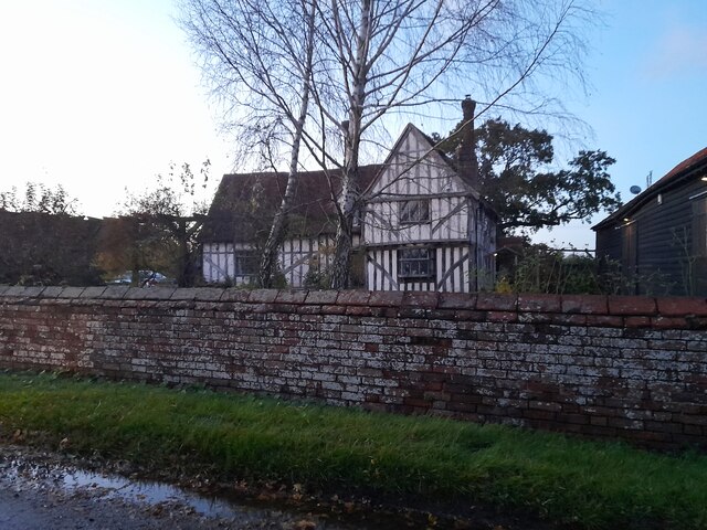
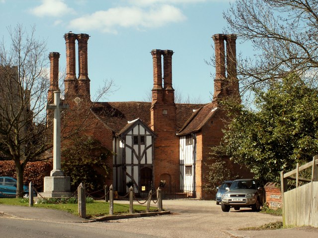
The village is steeped in history, with evidence of human habitation dating back to the Roman period. Its historic charm is visible through the presence of several well-preserved medieval buildings, including the beautiful All Saints' Church, which dates back to the 13th century. The church's stunning stained glass windows and intricate stonework are a testament to the village's rich heritage.

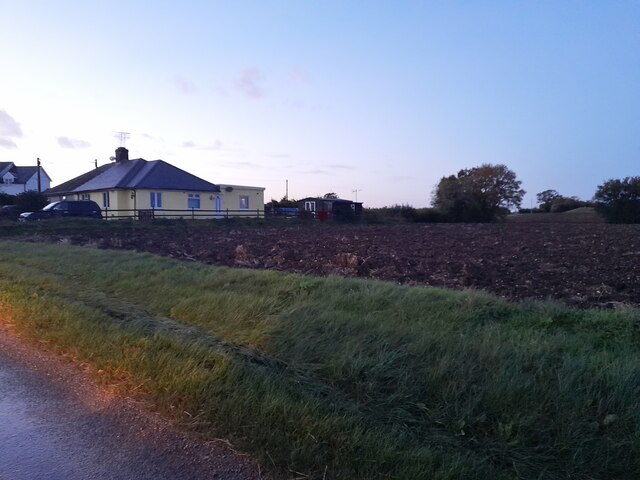
Great Waltham boasts a close-knit community, with a population of around 1,500 people. The village is home to a primary school, providing education for local children, and a village hall that serves as a hub for various community activities and events.

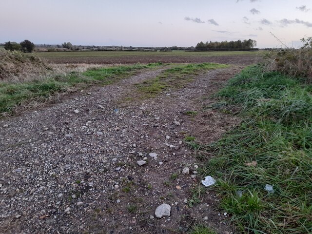
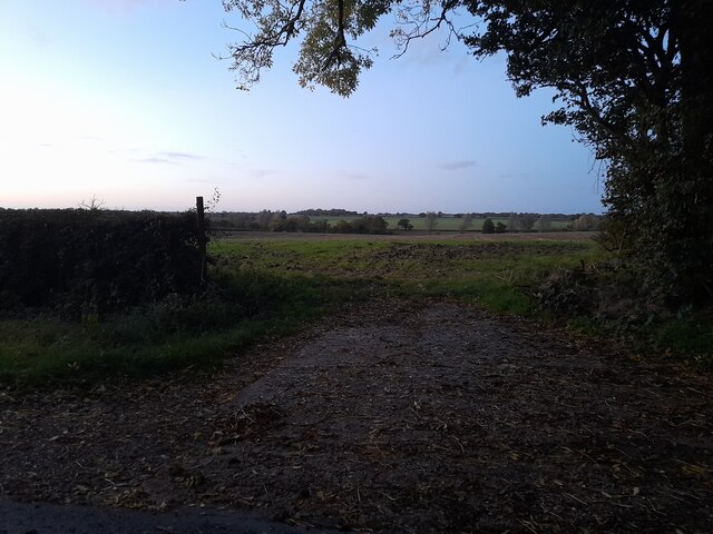
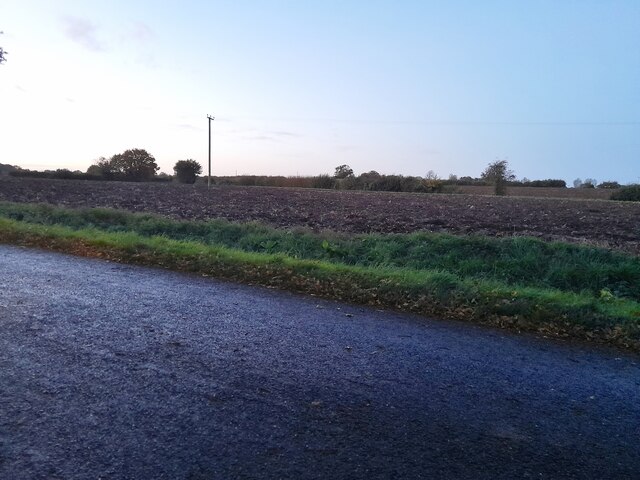
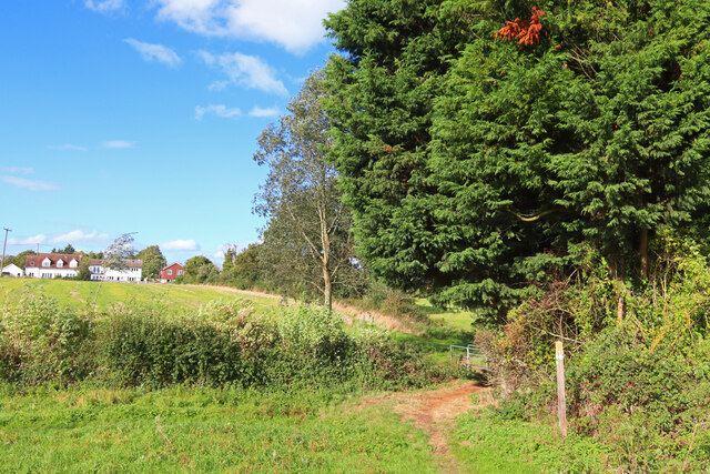
Nature enthusiasts will find plenty to explore in Great Waltham, as the village is surrounded by picturesque countryside and farmland. The nearby River Can provides opportunities for leisurely walks and peaceful picnics.

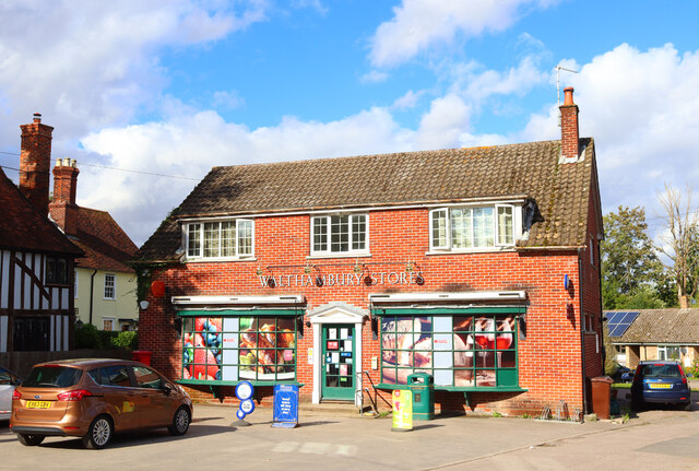
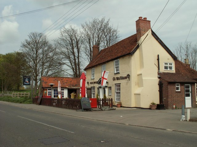
Although small in size, Great Waltham offers several amenities for its residents, including a local pub, a village shop, and a post office. For those seeking a wider range of amenities, the city of Chelmsford is easily accessible, offering a comprehensive range of shops, restaurants, and leisure facilities.

In conclusion, Great Waltham is a delightful village in Essex, known for its rich history, tranquil setting, and strong sense of community. It is a place where residents can enjoy the best of both worlds – the charm of rural living combined with easy access to nearby urban amenities.

If you have any feedback on the listing, please let us know in the comments section below.

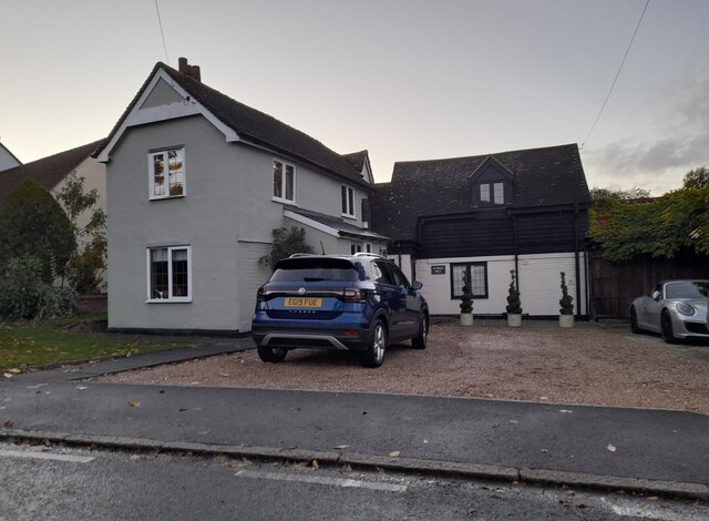
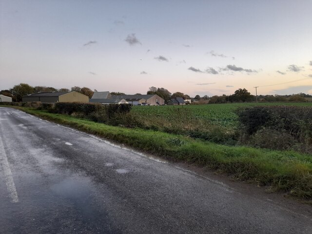
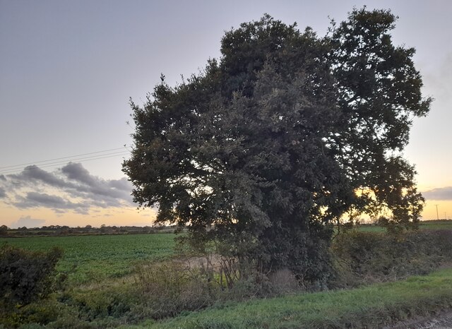
Great Waltham Images

Images are sourced within 2km of 51.794182/0.456609 or Grid Reference TL6913. Thanks to Geograph Open Source API. All images are credited.

Hatchfields, Great Waltham
Walthambury Farm, Great Waltham
Field entrance on Pleshey Road
Flat field in Great Waltham
Field in Great Waltham
Hedgerow by Pleshey Road, Great Waltham
Barrack Lane at the junction of Bury Lane
Fields by Mashbury Road, Great Waltham
Tudor farmhouse on Mashbury Road, Great Waltham This is Barnett's Farm
Tudor farmhouse on Mashbury Road, Great Waltham
This is Barnett's Farm
Fields by Mashbury Road near Pleshey
Houses and field by Mashbury Road near Pleshey
House on Main Road, Great Waltham It was white before this.
House on Main Road, Great Waltham
It was white before this.
Main Road, Great Waltham
Pleshey Road looking towards Walthambury Farm
Tree on Pleshey Road, Great Waltham
Great Waltham View towards Great Waltham from near Salt House Farm.
Great Waltham
View towards Great Waltham from near Salt House Farm.
Great Waltham Post Office Walthambury Stores in Great Waltham.
Great Waltham Post Office
Walthambury Stores in Great Waltham.
Show me another place!

Great Waltham is located at Grid Ref: TL6913 (Lat: 51.794182, Lng: 0.456609)

Administrative County: Essex

District: Chelmsford

Police Authority: Essex

What 3 Words

///pancakes.united.situation. Near Great Leighs, Essex

Related Wikis

Great Waltham

Great Waltham, also known as Church End, is a village and civil parish in the Chelmsford district, in the county of Essex, England. == Description == The...

Breeds, Essex

Breeds is a hamlet in the Great Waltham civil parish of the Chelmsford district of Essex, England. It is situated on South Street of the village of Great...

Minnow End

Minnow End is a hamlet in the parish of Great Waltham in Chelmsford district, in the English county of Essex. Nearby settlements include the town of Chelmsford...

Broad's Green

Broads Green is a hamlet in the civil parish of Great Waltham and the Chelmsford district, of Essex, England. Nearby settlements include the town of Chelmsford...

Nearby Amenities

Located within 500m of 51.794182,0.456609
Crossing
Crossing: unmarked
Lat/Long: 51.7979122/0.4569179
Great Waltham
Place: village
Source: npe
Lat/Long: 51.7937081/0.4567737
Kerb: raised
Lat/Long: 51.7956063/0.4571046
Bus Stop
Crowbush House
Bench: no
Bin: no
Bus: yes
Lit: yes
Naptan AtcoCode: 15002007004
Naptan Bearing: S
Naptan CommonName: Crowbush House
Naptan Indicator: o/s
Naptan Landmark: Crowbush House
Naptan NaptanCode: esxgwmdm
Naptan Street: Village The
Naptan Verified: no
Public Transport: platform
Shelter: no
Source: naptan_import
Tactile Paving: no
Lat/Long: 51.7953401/0.4570935
Bus Stop
Crowbush House
Bench: no
Bin: no
Bus: yes
Lit: no
Naptan AtcoCode: 150020070Y4
Naptan Bearing: N
Naptan CommonName: Crowbush House
Naptan Indicator: Opp
Naptan Landmark: Crowbush House
Naptan NaptanCode: esxgwmdp
Naptan Street: Village The
Naptan Verified: no
Public Transport: platform
Shelter: no
Source: naptan_import
Tactile Paving: no
Lat/Long: 51.7957102/0.4570266
Bus Stop
Memorial
Bench: yes
Bin: yes
Bus: yes
Lit: yes
Naptan AtcoCode: 1500ADD3000
Naptan Bearing: W
Naptan CommonName: Memorial
Naptan Crossing: Banbury Square
Naptan Indicator: W-bound
Naptan Landmark: Memorial
Naptan NaptanCode: esxgmwap
Naptan Street: Village The
Naptan Verified: no
Public Transport: platform
Shelter: no
Source: naptan_import
Tactile Paving: no
Lat/Long: 51.7935979/0.4574049
Parking Entrance
Lat/Long: 51.793053/0.4564761
Parking Entrance
Lat/Long: 51.7928599/0.4564286
Barrier: kissing_gate
Lat/Long: 51.7975607/0.4585177
Barrier: kissing_gate
Lat/Long: 51.7967901/0.4581619
Barrier: kissing_gate
Lat/Long: 51.7968402/0.4582397
Barrier: kissing_gate
Lat/Long: 51.7975147/0.458498
Barrier: kissing_gate
Lat/Long: 51.7955851/0.4572083
Crossing
Lat/Long: 51.7972455/0.4596996
Bus Stop
Hatchfields
Bench: no
Bin: no
Bus: yes
Lit: no
Naptan AtcoCode: 1500IM6001
Naptan NaptanCode: esxjmdmj
Naptan Verified: no
Public Transport: platform
Shelter: no
Source: naptan
Tactile Paving: no
Lat/Long: 51.7936628/0.4601998
Material: wood
Power: pole
Lat/Long: 51.7904378/0.4593244
Material: wood
Power: pole
Lat/Long: 51.7905132/0.4577579
Material: wood
Power: pole
Lat/Long: 51.7905819/0.4564117
Great Waltham war memorial
Historic: memorial
Memorial: war_memorial
Lat/Long: 51.7938988/0.458324
Talking bench
Fee: no
Information: audioguide
Tourism: information
Lat/Long: 51.793973/0.458416
Great Waltham Info Point
Booth: K6
Covered: booth
Description: Phonebox
Information: map
Listed Status: Grade II
Man Made: telephone_box
Tourism: information
Lat/Long: 51.7938158/0.4585625
Building: residential
Lat/Long: 51.7933814/0.456703
Parking Entrance
Access: customers
Lat/Long: 51.7935638/0.4585942
Turning Circle
Lat/Long: 51.791883/0.4609295
Barrier: stile
Step Count: 1
Stile: stepover
Lat/Long: 51.7934389/0.4609921
Crossing
Crossing: unmarked
Crossing Island: no
Tactile Paving: yes
Lat/Long: 51.7935046/0.4610239
Barrier: cycle_barrier
Cycle Barrier: double
Cycle Barrier Installation: fixed
Lat/Long: 51.7937926/0.4595672
Crossing
Crossing: unmarked
Crossing Island: no
Kerb: lowered
Tactile Paving: no
Lat/Long: 51.7929403/0.4577749
Barrier: stile
Step Count: 1
Stile: stepover
Lat/Long: 51.7959516/0.4604633
Barrier: stile
Step Count: 1
Stile: stepover
Lat/Long: 51.7967523/0.4614704
Post Box
Brand: Royal Mail
Brand Wikidata: Q638098
Brand Wikipedia: en:Royal Mail
Collection Times: Mo-Fr 17:00; Sa 12:15
Drive Through: no
Operator: Royal Mail
Operator Wikidata: Q638098
Ref: CM3 464
Royal Cypher: EIIR
Royal Cypher Wikidata: Q33102113
Lat/Long: 51.7944625/0.4555617
Bench
Backrest: yes
Lat/Long: 51.7918935/0.4578618
Waste Basket
Lat/Long: 51.7918991/0.457891
Leisure: pitch
Sport: table_tennis
Lat/Long: 51.7911974/0.457289
Parking Entrance
Lat/Long: 51.7943162/0.4556097
Bicycle Parking
Bicycle Parking: wall_loops
Capacity: 3
Covered: no
Lat/Long: 51.7944543/0.4557134
Waste Basket
Lat/Long: 51.7944588/0.4556719
Entrance: main
Lat/Long: 51.792598/0.455734
Post Box
Collection Times: Mo-Fr 09:00; Sa 07:00
Post Box Type: lamp
Royal Cypher: EIIR
Royal Cypher Wikidata: Q33102113
Lat/Long: 51.7932172/0.4602949
Waste Basket
Waste: dog_excrement
Lat/Long: 51.7935645/0.4604837
Waste Basket
Waste: dog_excrement
Lat/Long: 51.7919867/0.4587128
Man Made: street_cabinet
Lat/Long: 51.7935176/0.4607111
Power: substation
Lat/Long: 51.792946/0.4581542
Fire Hydrant
Emergency: fire_hydrant
Fire Hydrant Diameter: 4"
Fire Hydrant Position: sidewalk
Fire Hydrant Type: underground
Lat/Long: 51.7934919/0.4606012
Man Made: street_cabinet
Lat/Long: 51.7935027/0.4606995
Recycling
Recycling Type: container
Lat/Long: 51.7926533/0.4563182
Waste Basket
Waste: dog_excrement
Lat/Long: 51.7926983/0.4563254
Waste Basket
Waste: dog_excrement
Lat/Long: 51.7909478/0.4544543
Waste Basket
Waste: dog_excrement
Lat/Long: 51.7945619/0.4540315
Waste Basket
Lat/Long: 51.7943886/0.4546165
Waste Basket
Lat/Long: 51.7943295/0.4555278
Entrance: yes
Lat/Long: 51.7938513/0.4571192
Entrance: yes
Lat/Long: 51.7940098/0.4570081
Bus Stop
Memorial
Bench: yes
Bin: yes
Bus: yes
Lit: yes
Naptan AtcoCode: 1500IM2416
Naptan Bearing: E
Naptan CommonName: Memorial
Naptan Crossing: Banbury Square
Naptan Indicator: E-bound
Naptan Landmark: Memorial
Naptan NaptanCode: esxadpma
Naptan Street: Chelmsford Road
Naptan Verified: no
Network: 42
Public Transport: platform
Shelter: yes
Source: naptan_import
Tactile Paving: no
Lat/Long: 51.7939284/0.4590103
The data included in this document is from www.openstreetmap.org. The data is made available under ODbL.

Have you been to Great Waltham?

Leave your review of Great Waltham below (or comments, questions and feedback).