Ash and Dust Settling Ponds

Lake, Pool, Pond, Freshwater Marsh in Yorkshire Selby

England

Ash and Dust Settling Ponds

Multi fuel Power stations Ferrybridge The two new power stations at Ferrybridge and the three remaining cooling towers from the demolished "C" station.
Multi fuel Power stations Ferrybridge Credit: derek dye

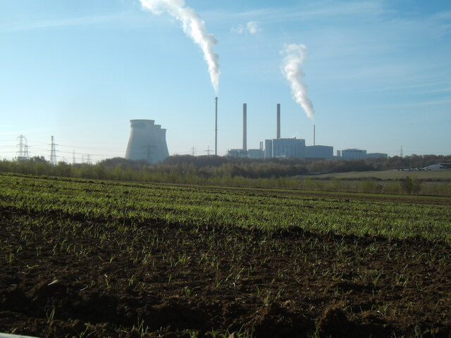
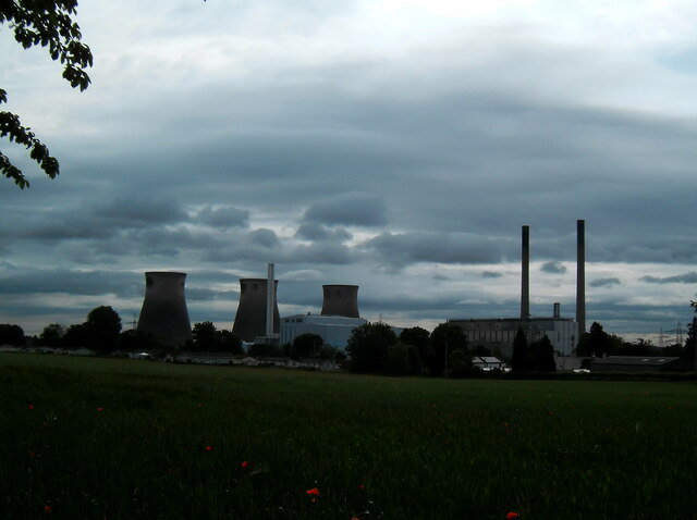
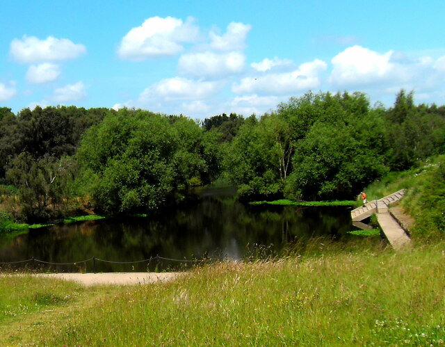
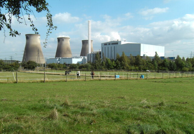
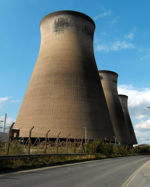
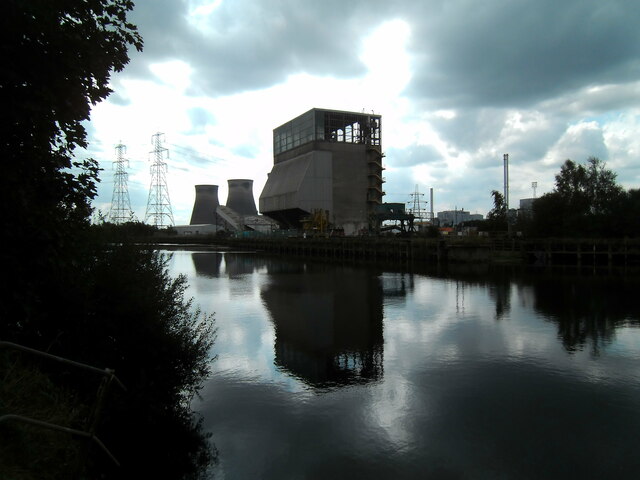
Ash and Dust Settling Ponds, located in Yorkshire, are a collection of man-made water bodies designed to contain and treat industrial waste materials. These settling ponds serve as a crucial part of the waste management system in the region, providing an effective means of separating ash and dust particles from industrial runoff before it is released into the environment.

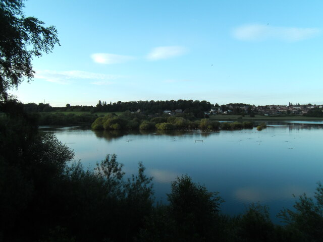
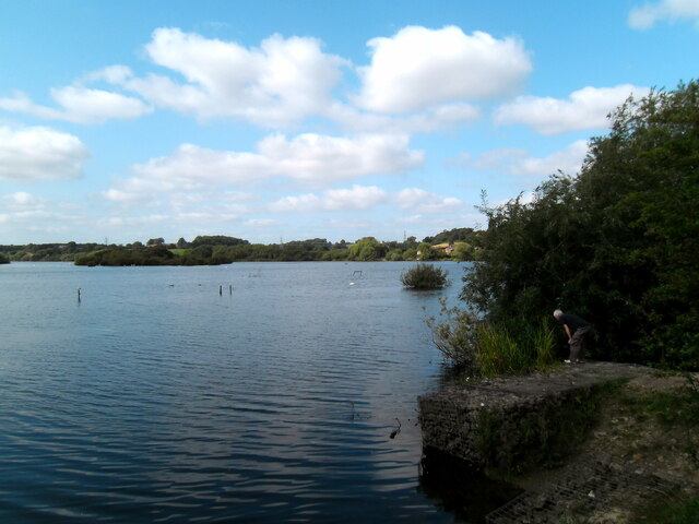
The ponds are typically characterized by their calm and still waters, resembling small lakes or pools. They are usually shallow and have a relatively large surface area, allowing for the settling of fine particles suspended in the water. The water in these ponds is predominantly freshwater, although it may contain varying levels of contaminants depending on the type and volume of waste being treated.

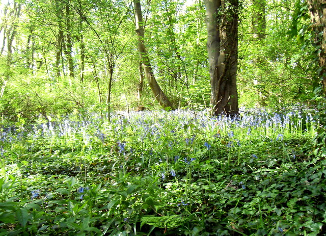
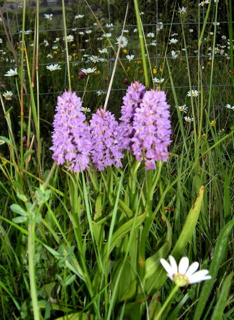
Surrounding the ponds, one can often find lush vegetation and reed beds, indicating the presence of a freshwater marsh ecosystem. These marshes play a vital role in filtering pollutants, absorbing excess nutrients, and providing habitat for a diverse range of plant and animal species. Consequently, they contribute to the overall ecological health and biodiversity of the area.

Ash and Dust Settling Ponds are essential for mitigating the environmental impact of industrial activities, as they prevent the release of potentially harmful substances into nearby rivers and streams. Regular monitoring and maintenance are carried out to ensure the effective functioning of these ponds and to minimize any potential risks to the surrounding environment.

If you have any feedback on the listing, please let us know in the comments section below.

Ash and Dust Settling Ponds Images

Images are sourced within 2km of 53.734597/-1.2797716 or Grid Reference SE4726. Thanks to Geograph Open Source API. All images are credited.

Multi fuel Power stations Ferrybridge The two new power stations at Ferrybridge and the three remaining cooling towers from the demolished "C" station.
Multi fuel Power stations Ferrybridge
The two new power stations at Ferrybridge and the three remaining cooling towers from the demolished "C" station.
Fryston wood bluebells
The green canopy Light filtering through the leaves and branches of an old horse chestnut tree in Fryston woods.
The green canopy
Light filtering through the leaves and branches of an old horse chestnut tree in Fryston woods.
Fryston Hall Farm
Fryston Hall Farm
Heading upstream under the "Three Bridges" at Faiburn.
Night falls on the power industry
Beetle mania
Beetle mania
Fairburn Ings
Fairburn Ings
Poppy power
Poppy power
Woodland wild flowers
Re generated canal basin Aire and Calder navigation Ex Fryston Colliery barge loading staithe / basin given a new lease of life.
Re generated canal basin Aire and Calder navigation
Ex Fryston Colliery barge loading staithe / basin given a new lease of life.
Pylonsand fields  on Wheldale Lane Castleford
Pylonsand fields on Wheldale Lane Castleford
Sunrise over Fryston woods Viewed from my bedroom window.
Sunrise over Fryston woods
Viewed from my bedroom window.
Fairburn Ings
Fairburn Ings
Ferrybridge Multi fuel power station The old remaining cooling towers of C station, form a background to the new fuel technology.
Ferrybridge Multi fuel power station
The old remaining cooling towers of C station, form a background to the new fuel technology.
Last men standing All that remains of the once mighty coal fired "C" station of Ferrybridge. These three remaining cooling towards have a stay of execution, just in case they may be needed in the future?
Last men standing
All that remains of the once mighty coal fired "C" station of Ferrybridge. These three remaining cooling towards have a stay of execution, just in case they may be needed in the future?
Demolition of 200 tonne barge lifter Coal that used to be transported by 200 tonne floating containers from nearby Kellingley colliery was physically lifted out of the water. It was then conveyed  and tippled onto the coal stockpile by this huge piece of engineering. Now in the process of being demolished.
Demolition of 200 tonne barge lifter
Coal that used to be transported by 200 tonne floating containers from nearby Kellingley colliery was physically lifted out of the water. It was then conveyed and tippled onto the coal stockpile by this huge piece of engineering. Now in the process of being demolished.
Fairburn churchyard
Fairburn churchyard
Show me another place!

Ash and Dust Settling Ponds is located at Grid Ref: SE4726 (Lat: 53.734597, Lng: -1.2797716)

Division: West Riding

Administrative County: North Yorkshire

District: Selby

Police Authority: North Yorkshire

What 3 Words

///bronzes.unto.sketching. Near Byram, North Yorkshire

Related Wikis

Fryston Hall

Fryston Hall was a country house at Water Fryston, West Yorkshire which stood in an estate between the town of Castleford and the River Aire near where...

Brotherton

Brotherton is a village and civil parish in the Selby District of North Yorkshire, England. The village is on a border with the City of Wakefield and West...

Fairburn, North Yorkshire

Fairburn is a small village and civil parish in North Yorkshire, England. Situated approximately 10 miles (16 km) east of Leeds, the village lies close...

Byram, North Yorkshire

Byram is a village in the Selby District in North Yorkshire, England. It lies 3 miles (4.8 km) east of Castleford, across the River Aire in West Yorkshire...

Nearby Amenities

Located within 500m of 53.734597,-1.2797716
Power: tower
Lat/Long: 53.7321405/-1.2744607
Power: pole
Lat/Long: 53.7319286/-1.2750423
Power: pole
Lat/Long: 53.7319604/-1.2739055
Power: pole
Lat/Long: 53.7333769/-1.2745865
Power: pole
Lat/Long: 53.7339606/-1.2752782
Power: pole
Lat/Long: 53.7343024/-1.2751229
Power: pole
Lat/Long: 53.7358243/-1.2753293
Power: pole
Lat/Long: 53.7372397/-1.2759662
Power: pole
Lat/Long: 53.7381639/-1.278687
Power: pole
Lat/Long: 53.7389955/-1.2796961
Man Made: tower
Lat/Long: 53.7306972/-1.2834129
Brotherton
Historic: boundary_stone
Lat/Long: 53.7329661/-1.2741174
The data included in this document is from www.openstreetmap.org. The data is made available under ODbL.

Have you been to Ash and Dust Settling Ponds?

Leave your review of Ash and Dust Settling Ponds below (or comments, questions and feedback).