Backwell Green

Settlement in Somerset

England

Backwell Green

Backwell: Teague’s Colliery The waste tip of an early 19th century coal mine on Backwell Common, now covered in trees. James Teague (1750-1818), its developer, was an ironmaster and owner of coal pits in the Forest of Dean. For further information see Ralph Anstis, The Industrial Teagues and the Forest of Dean, Allan Sutton, 1990. Seen from one of the numerous public footpaths in the parish
Backwell: Teague’s Colliery Credit: Martin Bodman

Backwell Green is a small village located in the county of Somerset, England. Situated about 7 miles southwest of Bristol, it falls within the North Somerset district. This picturesque village is nestled in the rolling countryside, providing its residents with a peaceful and scenic environment.

Backwell Green is known for its charming and traditional architecture, with many historic buildings and cottages lining the streets. The village is centered around a green, a common feature of English villages, which serves as a gathering place and a focal point for community events.

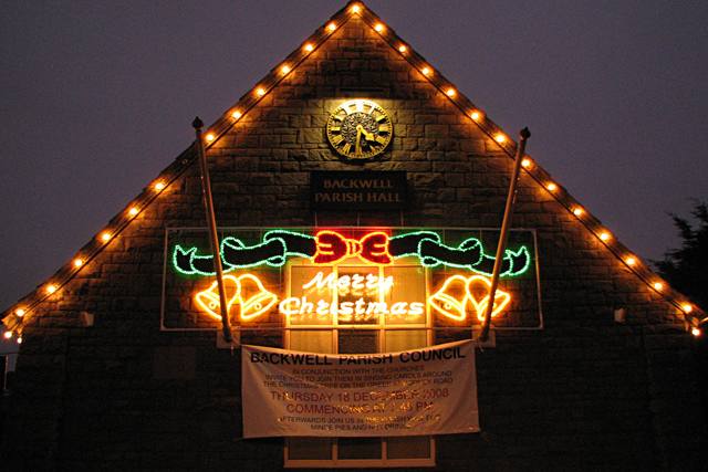
Despite its small size, Backwell Green boasts a range of amenities and facilities for its residents. These include a primary school, a village hall, and a local pub, which serves as a social hub for the community. The village also has a convenience store, providing basic necessities for its residents.

Nature lovers will appreciate the surrounding countryside, which offers ample opportunities for outdoor activities. The nearby Backwell Lake and surrounding woodlands provide a peaceful setting for walks and birdwatching. The rolling hills and fields surrounding the village are perfect for hiking and exploring the beautiful Somerset landscape.

Transport links are well-established in Backwell Green, with regular bus services connecting the village to nearby towns and cities. The village is also conveniently located near the M5 motorway, providing easy access to Bristol and other major cities in the region.

Overall, Backwell Green offers a tranquil and idyllic lifestyle for its residents, with its charming village atmosphere, natural beauty, and convenient amenities.

If you have any feedback on the listing, please let us know in the comments section below.

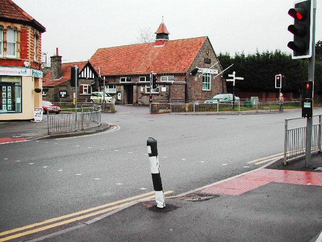
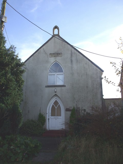
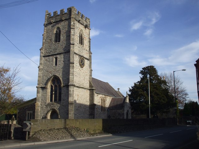
Backwell Green Images

Images are sourced within 2km of 51.422306/-2.726408 or Grid Reference ST4969. Thanks to Geograph Open Source API. All images are credited.

Backwell: Teague’s Colliery The waste tip of an early 19th century coal mine on Backwell Common, now covered in trees. James Teague (1750-1818), its developer, was an ironmaster and owner of coal pits in the Forest of Dean. For further information see Ralph Anstis, The Industrial Teagues and the Forest of Dean, Allan Sutton, 1990. Seen from one of the numerous public footpaths in the parish
Backwell: Teague’s Colliery
The waste tip of an early 19th century coal mine on Backwell Common, now covered in trees. James Teague (1750-1818), its developer, was an ironmaster and owner of coal pits in the Forest of Dean. For further information see Ralph Anstis, The Industrial Teagues and the Forest of Dean, Allan Sutton, 1990. Seen from one of the numerous public footpaths in the parish
Crossroads in centre of Backwell For further information see the Backwell Village website <span class="nowrap"><a title="http://atbackwell.co.uk/default.aspx" rel="nofollow ugc noopener" href="http://atbackwell.co.uk/default.aspx">Link</a><img style="margin-left:2px;" alt="External link" title="External link - shift click to open in new window" src="https://s1.geograph.org.uk/img/external.png" width="10" height="10"/></span>
Crossroads in centre of Backwell
For further information see the Backwell Village website LinkExternal link
The A370 runs through Backwell
St Andrew's church, Backwell This is the old part of Backwell, Church Lane was originally the main Bristol to Weston road before the A370 took over.
St Andrew's church, Backwell
This is the old part of Backwell, Church Lane was originally the main Bristol to Weston road before the A370 took over.
Backwell Church of England Primary School
Backwell Lake Designated as a nature reserve in the 1990's.
Backwell Lake
Designated as a nature reserve in the 1990's.
Farleigh Cottage
Farleigh Cottage
Farming Field in Backwell Looking North across fields, in the background you can see Wraxell, and to the left is Nailsea.
Farming Field in Backwell
Looking North across fields, in the background you can see Wraxell, and to the left is Nailsea.
The George Inn, Backwell Farleigh
Converted National School Inscription above window reads, National School
Converted National School
Inscription above window reads, National School
Nailsea & Backwell Station This photo shows the 17:00 Great Western train zooming off to Bristol Temple Meads without stopping.  Taken the day before the shortest day of the year which explains why 5pm looks like 10pm.
Nailsea & Backwell Station
This photo shows the 17:00 Great Western train zooming off to Bristol Temple Meads without stopping. Taken the day before the shortest day of the year which explains why 5pm looks like 10pm.
Backwell Parish Hall A festive message to be seen on the side of the village hall in Backwell, a village dating back to at least 1086.  See link below for a clearer idea of the Hall's location.

<a title="https://www.geograph.org.uk/photo/100452" href="https://www.geograph.org.uk/photo/100452">Link</a>
Backwell Parish Hall
A festive message to be seen on the side of the village hall in Backwell, a village dating back to at least 1086. See link below for a clearer idea of the Hall's location. Link
Nailsea & Backwell Station Train on platform one is waiting to take passengers South West towards Weston-Super-Mare.

<span class="nowrap"><a title="http://en.wikipedia.org/wiki/Nailsea_and_Backwell_railway_station" rel="nofollow ugc noopener" href="http://en.wikipedia.org/wiki/Nailsea_and_Backwell_railway_station">Link</a><img style="margin-left:2px;" alt="External link" title="External link - shift click to open in new window" src="https://s1.geograph.org.uk/img/external.png" width="10" height="10"/></span>
Nailsea & Backwell Station
Train on platform one is waiting to take passengers South West towards Weston-Super-Mare. LinkExternal link
Beef Supper One of a few fields along the Nailsea railway line often populated by the bovine population, making the footpath particularly muddy!
Beef Supper
One of a few fields along the Nailsea railway line often populated by the bovine population, making the footpath particularly muddy!
Field above Backwell A large L-shaped meadow on the slopes of Backwell Hill, seen from the bridleway above Cheston Combe.
Field above Backwell
A large L-shaped meadow on the slopes of Backwell Hill, seen from the bridleway above Cheston Combe.
View down Backwell Hill Like <a href="https://www.geograph.org.uk/photo/1886790">ST4968 : Field above Backwell</a>, a view across a field above Church Town, Backwell, from higher up the bridleway, with the Land Yeo valley in the background.
View down Backwell Hill
Like ST4968 : Field above Backwell, a view across a field above Church Town, Backwell, from higher up the bridleway, with the Land Yeo valley in the background.
Jubilee Stone In Jubilee Stone Wood. The granite obelisk was erected on 20th June 1897 to mark Queen Victoria's 60th year on the throne. Inscriptions have been added on successive royal jubilees and coronations.
Jubilee Stone
In Jubilee Stone Wood. The granite obelisk was erected on 20th June 1897 to mark Queen Victoria's 60th year on the throne. Inscriptions have been added on successive royal jubilees and coronations.
Jubilee Stone Another view of Backwell's <a href="https://www.geograph.org.uk/photo/1886851">ST4967 : Jubilee Stone</a>, at about 155 metres on Backwell Hill.
Jubilee Stone
Another view of Backwell's ST4967 : Jubilee Stone, at about 155 metres on Backwell Hill.
Show me another place!

Backwell Green is located at Grid Ref: ST4969 (Lat: 51.422306, Lng: -2.726408)

Unitary Authority: North Somerset

Police Authority: Avon and Somerset

What 3 Words

///cared.harsh.sake. Near Nailsea, Somerset

Nearby Locations

Backwell Green Farleigh

Related Wikis

Backwell House

Backwell House, in Backwell, Somerset, England is a house of historical significance and is listed on the English Heritage Register. The house and entrance...

Flax Bourton

Flax Bourton is a village and civil parish in Somerset, England. The parish, with a population of 715, is situated within the unitary authority of North...

Church of St Michael and All Angels, Flax Bourton

The Anglican Church of St. Michael and All Angels in Flax Bourton in the English county of Somerset was built in the 12th century. It has been designated...

Backwell School

Backwell School is a secondary academy school in Backwell, Bristol, Somerset, England. It was considered to be one of the best-performing state schools...

Nearby Amenities

Located within 500m of 51.422306,-2.726408
Pub
The George
Addr City: Bristol
Addr Housenumber: 125
Addr Place: Backwell
Addr Postcode: BS48 3PG
Addr Street: Farleigh Road
Fhrs Id: 186601
Source: npe
Source Addr: FHRS Open Data
Wikidata: Q111874208
Lat/Long: 51.4196092/-2.7244033
Place Of Worship
Backwell Baptist Church
Created By: POI Editor
Denomination: baptist
Religion: christian
Source: npe
Lat/Long: 51.4211424/-2.7247098
Barrier: stile
Lat/Long: 51.4256627/-2.7239713
Farleigh
Is In Country: United Kingdom
Is In County: North Somerset
Place: hamlet
Lat/Long: 51.4191899/-2.7231173
Bus Stop
The George
Naptan AtcoCode: 0190NSC30618
Naptan Bearing: E
Naptan CommonName: The George
Naptan Crossing: Backwell Hill Road
Naptan NaptanCode: wsmgwtd
Naptan Street: Farleigh Road
Naptan Verified: no
Source: naptan_import
Wheelchair: yes
Lat/Long: 51.4193708/-2.724946
Bus Stop
The George
Bus: yes
Naptan AtcoCode: 0190NSC30619
Naptan Bearing: W
Naptan CommonName: The George
Naptan Crossing: Backwell Hill Road
Naptan NaptanCode: wsmgwtm
Naptan Street: Farleigh Road
Naptan Verified: no
Public Transport: platform
Source: naptan_import
Lat/Long: 51.4198249/-2.7227528
Barrier: stile
Lat/Long: 51.4255476/-2.7255013
Barrier: stile
Lat/Long: 51.4254353/-2.725519
Power: pole
Source: Bing
Lat/Long: 51.4238321/-2.7274343
Power: pole
Source: Bing
Lat/Long: 51.4247501/-2.7273936
Power: pole
Source: Bing
Lat/Long: 51.4256682/-2.7273338
Power: pole
Source: Bing
Lat/Long: 51.4264899/-2.7273193
Barrier: stile
Lat/Long: 51.4253776/-2.7281815
Barrier: stile
Lat/Long: 51.4252444/-2.7282678
Barrier: bollard
Lat/Long: 51.4241554/-2.7277936
Post Box
Post Box Type: pillar
Royal Cypher: EIIR
Royal Cypher Wikidata: Q33102113
Lat/Long: 51.41927/-2.72526
Railway: signal
Railway Signal Main: GB-NR:main
Railway Signal Main Form: light
Ref: DM125
Lat/Long: 51.4237977/-2.7256761
Brand: National Grid
Brand Wikidata: Q1465461
Material: wood
Operator: National Grid Electricity Distribution
Operator Old: Western Power Distribution
Operator Wikidata: Q7988183
Owner: National Grid Electricity Distribution (South West) Plc
Owner Wikidata: Q114397866
Power: pole
Lat/Long: 51.4235592/-2.7256722
Brand: National Grid
Brand Wikidata: Q1465461
Material: wood
Operator: National Grid Electricity Distribution
Operator Old: Western Power Distribution
Operator Wikidata: Q7988183
Owner: National Grid Electricity Distribution (South West) Plc
Owner Wikidata: Q114397866
Power: pole
Lat/Long: 51.4234988/-2.7269799
Brand: National Grid
Brand Wikidata: Q1465461
Material: wood
Operator: National Grid Electricity Distribution
Operator Old: Western Power Distribution
Operator Wikidata: Q7988183
Owner: National Grid Electricity Distribution (South West) Plc
Owner Wikidata: Q114397866
Power: pole
Lat/Long: 51.4236171/-2.7243871
Brand: National Grid
Brand Wikidata: Q1465461
Material: wood
Operator: National Grid Electricity Distribution
Operator Old: Western Power Distribution
Operator Wikidata: Q7988183
Owner: National Grid Electricity Distribution (South West) Plc
Owner Wikidata: Q114397866
Power: pole
Lat/Long: 51.4236673/-2.7231289
Brand: National Grid
Brand Wikidata: Q1465461
Material: wood
Operator: National Grid Electricity Distribution
Operator Old: Western Power Distribution
Operator Wikidata: Q7988183
Owner: National Grid Electricity Distribution (South West) Plc
Owner Wikidata: Q114397866
Power: pole
Lat/Long: 51.4237432/-2.7217572
Brand: National Grid
Brand Wikidata: Q1465461
Material: wood
Operator: National Grid Electricity Distribution
Operator Old: Western Power Distribution
Operator Wikidata: Q7988183
Owner: National Grid Electricity Distribution (South West) Plc
Owner Wikidata: Q114397866
Power: pole
Lat/Long: 51.4237972/-2.7204474
Brand: National Grid
Brand Wikidata: Q1465461
Material: wood
Operator: National Grid Electricity Distribution
Operator Old: Western Power Distribution
Operator Wikidata: Q7988183
Owner: National Grid Electricity Distribution (South West) Plc
Owner Wikidata: Q114397866
Power: pole
Lat/Long: 51.4243677/-2.7262335
Brand: National Grid
Brand Wikidata: Q1465461
Material: wood
Operator: National Grid Electricity Distribution
Operator Old: Western Power Distribution
Operator Wikidata: Q7988183
Owner: National Grid Electricity Distribution (South West) Plc
Owner Wikidata: Q114397866
Power: pole
Lat/Long: 51.4242827/-2.7244704
Brand: National Grid
Brand Wikidata: Q1465461
Material: wood
Operator: National Grid Electricity Distribution
Operator Old: Western Power Distribution
Operator Wikidata: Q7988183
Owner: National Grid Electricity Distribution (South West) Plc
Owner Wikidata: Q114397866
Power: pole
Lat/Long: 51.4240147/-2.7224988
Brand: National Grid
Brand Wikidata: Q1465461
Material: wood
Operator: National Grid Electricity Distribution
Operator Old: Western Power Distribution
Operator Wikidata: Q7988183
Owner: National Grid Electricity Distribution (South West) Plc
Owner Wikidata: Q114397866
Power: pole
Lat/Long: 51.4241944/-2.722766
Brand: National Grid
Brand Wikidata: Q1465461
Material: wood
Operator: National Grid Electricity Distribution
Operator Old: Western Power Distribution
Operator Wikidata: Q7988183
Owner: National Grid Electricity Distribution (South West) Plc
Owner Wikidata: Q114397866
Power: pole
Lat/Long: 51.4233033/-2.7215058
Brand: National Grid
Brand Wikidata: Q1465461
Material: wood
Operator: National Grid Electricity Distribution Plc
Operator Old: Western Power Distribution
Operator Wikidata: Q7988183
Owner: National Grid Electricity Distribution (South West) Plc
Owner Wikidata: Q114397866
Power: pole
Lat/Long: 51.4226065/-2.7205292
Brand: National Grid
Brand Wikidata: Q1465461
Material: wood
Operator: National Grid Electricity Distribution Plc
Operator Old: Western Power Distribution
Operator Wikidata: Q7988183
Owner: National Grid Electricity Distribution (South West) Plc
Owner Wikidata: Q114397866
Power: pole
Lat/Long: 51.4217326/-2.719309
Brand: National Grid
Brand Wikidata: Q1465461
Material: wood
Operator: National Grid Electricity Distribution
Operator Old: Western Power Distribution
Operator Wikidata: Q7988183
Owner: National Grid Electricity Distribution (South West) Plc
Owner Wikidata: Q114397866
Power: pole
Lat/Long: 51.4245112/-2.7290526
Brand: National Grid
Brand Wikidata: Q1465461
Material: wood
Operator: National Grid Electricity Distribution
Operator Old: Western Power Distribution
Operator Wikidata: Q7988183
Owner: National Grid Electricity Distribution (South West) Plc
Owner Wikidata: Q114397866
Power: pole
Lat/Long: 51.4245653/-2.7301777
Brand: National Grid
Brand Wikidata: Q1465461
Material: wood
Operator: National Grid Electricity Distribution
Operator Old: Western Power Distribution
Operator Wikidata: Q7988183
Owner: National Grid Electricity Distribution (South West) Plc
Owner Wikidata: Q114397866
Power: pole
Lat/Long: 51.4246512/-2.7318593
Generator Method: photovoltaic
Generator Output Electricity: yes
Generator Source: solar
Generator Type: solar_photovoltaic_panel
Location: roof
Power: generator
Lat/Long: 51.4184332/-2.727301
Generator Method: photovoltaic
Generator Output Electricity: yes
Generator Source: solar
Generator Type: solar_photovoltaic_panel
Location: roof
Power: generator
Lat/Long: 51.4194076/-2.7254301
Generator Method: photovoltaic
Generator Output Electricity: yes
Generator Source: solar
Generator Type: solar_photovoltaic_panel
Location: roof
Power: generator
Lat/Long: 51.4194569/-2.7254771
Generator Method: photovoltaic
Generator Output Electricity: yes
Generator Source: solar
Generator Type: solar_photovoltaic_panel
Location: roof
Power: generator
Lat/Long: 51.4195874/-2.7256179
Generator Method: photovoltaic
Generator Output Electricity: yes
Generator Source: solar
Generator Type: solar_photovoltaic_panel
Location: roof
Power: generator
Lat/Long: 51.4195464/-2.7259599
Generator Method: photovoltaic
Generator Output Electricity: yes
Generator Source: solar
Generator Type: solar_photovoltaic_panel
Location: roof
Power: generator
Lat/Long: 51.419538/-2.7259102
Generator Method: photovoltaic
Generator Output Electricity: yes
Generator Source: solar
Generator Type: solar_photovoltaic_panel
Location: roof
Power: generator
Lat/Long: 51.4197187/-2.7257922
Generator Method: photovoltaic
Generator Output Electricity: yes
Generator Source: solar
Generator Type: solar_photovoltaic_panel
Location: roof
Power: generator
Lat/Long: 51.4198391/-2.72403
Generator Method: photovoltaic
Generator Output Electricity: yes
Generator Source: solar
Generator Type: solar_photovoltaic_panel
Location: roof
Power: generator
Lat/Long: 51.4211889/-2.7257171
The data included in this document is from www.openstreetmap.org. The data is made available under ODbL.

Have you been to Backwell Green?

Leave your review of Backwell Green below (or comments, questions and feedback).