Loch of Flatpunds

Lake, Pool, Pond, Freshwater Marsh in Shetland

Scotland

Loch of Flatpunds

Water mill site beside Upper Loch Brouster, Shetland This structure isn't shown on the OS map. There is, however, a structure near the burn at this location.
Water mill site beside Upper Loch Brouster, Shetland Credit: AlastairG

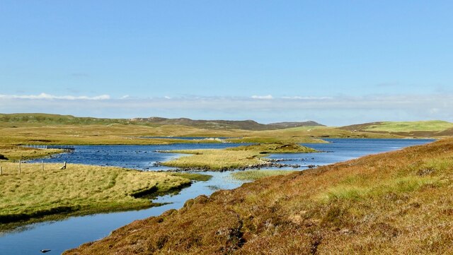
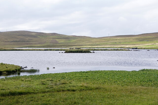
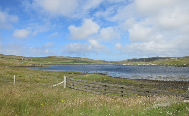
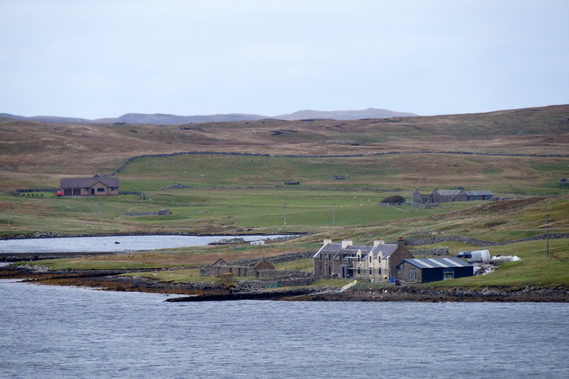
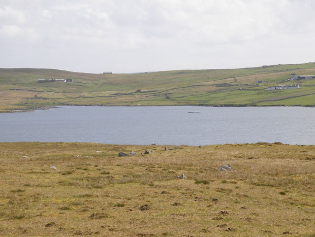
Loch of Flatpunds is a picturesque freshwater loch located in the Shetland Islands, Scotland. Nestled within a serene natural landscape, the loch covers an area of approximately 50 acres and is surrounded by rolling hills, heather moorland, and scattered birch trees.

The Loch of Flatpunds is renowned for its tranquil and untouched beauty. Its crystal-clear waters reflect the ever-changing colors of the sky, creating a mesmerizing sight for visitors. The loch is home to an abundance of freshwater vegetation, including water lilies and reeds, which provide a habitat for a variety of wildlife.

The loch is a haven for birdwatchers, attracting numerous species of waterfowl throughout the year. Visitors can spot graceful swans, elegant Greylag geese, and elusive ducks such as teal and wigeon. The surrounding marshy areas serve as nesting grounds for wading birds like lapwings and redshanks.

Fishing enthusiasts are drawn to Loch of Flatpunds for its excellent trout fishing opportunities. The loch is stocked with brown trout, offering anglers a chance to test their skills and patience. Fishing permits can be obtained locally, ensuring a sustainable and regulated fishing experience.

The Loch of Flatpunds is a popular destination for nature lovers, photographers, and those seeking solitude amidst the breathtaking Scottish countryside. It offers a tranquil retreat from the hustle and bustle of everyday life, providing a peaceful and idyllic setting for visitors to connect with nature and enjoy the beauty of the Shetland Islands.

If you have any feedback on the listing, please let us know in the comments section below.

Loch of Flatpunds Images

Images are sourced within 2km of 60.252058/-1.5558474 or Grid Reference HU2452. Thanks to Geograph Open Source API. All images are credited.

Water mill site beside Upper Loch Brouster, Shetland This structure isn't shown on the OS map. There is, however, a structure near the burn at this location.
Water mill site beside Upper Loch Brouster, Shetland
This structure isn't shown on the OS map. There is, however, a structure near the burn at this location.
Brace Burn leaving Loch of Voxterby, Shetland This burn connects Loch of Voxterby with Upper Loch of Brouster. Both contain trout but Loch of Voxterby is the more attractive of the two.
Brace Burn leaving Loch of Voxterby, Shetland
This burn connects Loch of Voxterby with Upper Loch of Brouster. Both contain trout but Loch of Voxterby is the more attractive of the two.
Lawby Knowe between Sandness and Walls
Footbridge across the Brace Burn by Upper Loch of Brouster This footbridce crosses the burn which feeds Upper Loch of Brouster. It seem to have survived well since the first submission <a href="https://www.geograph.org.uk/photo/2330293">HU2652 : Brace Burn Brig</a>
Footbridge across the Brace Burn by Upper Loch of Brouster
This footbridce crosses the burn which feeds Upper Loch of Brouster. It seem to have survived well since the first submission HU2652 : Brace Burn Brig
Brace Burn, Shetland Taken from the same spot as  <a href="https://www.geograph.org.uk/photo/7446337">HU2652 : Footbridge across the Brace Burn by Upper Loch of Brouster</a>  this upstream view shows the Brace Burn which drains the Loch of Voxterby near Walls.
Brace Burn, Shetland
Taken from the same spot as HU2652 : Footbridge across the Brace Burn by Upper Loch of Brouster this upstream view shows the Brace Burn which drains the Loch of Voxterby near Walls.
Stennestwatt, Walls
Stennestwatt, Walls
Loch of Bardister, Walls
Smaila Waters An area of bog and small pools beside the road north out of Walls.
The map names the higher ground in the distance as Hansie's Crooie.
Smaila Waters
An area of bog and small pools beside the road north out of Walls. The map names the higher ground in the distance as Hansie's Crooie.
Road North of Walls
Road North of Walls
Standing Stone and Cairn There is an antiquity marked here, a Long Cairn, which is presumably that heap of rocks.
The standing stone just gets ordinary script, so I guess it's some recent addition.
Standing Stone and Cairn
There is an antiquity marked here, a Long Cairn, which is presumably that heap of rocks. The standing stone just gets ordinary script, so I guess it's some recent addition.
Lunga Water
Lunga Water
View South from the Bridge of Walls Looking towards the Voe of Browland.
View South from the Bridge of Walls
Looking towards the Voe of Browland.
Voe of Browland
Voe of Browland
Stone by the Road This is the "Stone" marked on the map. There's a similar one a bit further back towards Walls.
I guess they're landmarks of some kind. They don't get Olde Script, so presumably they are recent.
Stone by the Road
This is the "Stone" marked on the map. There's a similar one a bit further back towards Walls. I guess they're landmarks of some kind. They don't get Olde Script, so presumably they are recent.
Loch of Brouster
Loch of Brouster
Houses by the shore at Bridge of Walls Taken from Browland.
Houses by the shore at Bridge of Walls
Taken from Browland.
The Bridge of Walls Bridge crossing an arm of the Voe of Browland; the area above the bridge is still tidal but is known as the Loch of Brouster.
The Bridge of Walls
Bridge crossing an arm of the Voe of Browland; the area above the bridge is still tidal but is known as the Loch of Brouster.
Lunga Water in west Mainland
Show me another place!

Loch of Flatpunds is located at Grid Ref: HU2452 (Lat: 60.252058, Lng: -1.5558474)

Unitary Authority: Shetland Islands

Police Authority: Highlands and Islands

What 3 Words

///frame.midfield.inhabited. Near Walls, Shetland Islands

Nearby Locations

Loch of Flatpunds

Related Wikis

Scord of Brouster

The Scord of Brouster is one of the earliest Neolithic farm sites in Shetland, Scotland. It has been dated to 2220 BC with a time window of 80 years on...
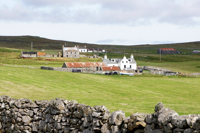
Walls, Shetland

Walls, known locally as Waas (Old Norse: Vagar = "Sheltered Bays" (voes) - the Ordnance Survey added the "ll" as they thought it was a corruption of "walls...

Browland

Browland is a village on Mainland in Shetland, Scotland situated about 1.9 miles (3 km) east north east of Walls. Browland is within the parish of Sandsting...

West Mainland

The West Mainland of the Shetland Islands is the part of the Shetland Mainland lying west of Aith (1° 23′ W). == Geography == Points of interest include...

Nearby Amenities

Located within 500m of 60.252058,-1.5558474
Cairn
Historic: archaeological_site
Lat/Long: 60.253185/-1.5623684
Power: pole
Lat/Long: 60.2476171/-1.5568401
Power: pole
Lat/Long: 60.2478342/-1.5578185
Power: pole
Lat/Long: 60.2480758/-1.5589074
Power: pole
Lat/Long: 60.2482588/-1.5597321
Power: pole
Lat/Long: 60.2486998/-1.5605914
Power: pole
Lat/Long: 60.2491974/-1.5615608
Power: pole
Lat/Long: 60.2494313/-1.5620165
Power: pole
Lat/Long: 60.2499361/-1.5630001
Power: pole
Lat/Long: 60.250446/-1.5639935
The data included in this document is from www.openstreetmap.org. The data is made available under ODbL.

Have you been to Loch of Flatpunds?

Leave your review of Loch of Flatpunds below (or comments, questions and feedback).