Longcross Pond

Lake, Pool, Pond, Freshwater Marsh in Hampshire New Forest

England

Longcross Pond

Road over Longcross Plain
Road over Longcross Plain Credit: Helen Steed

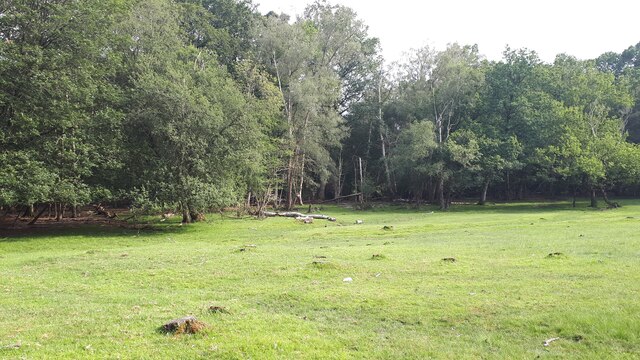
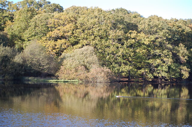
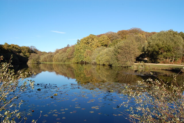
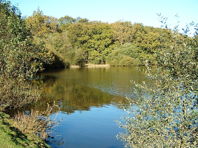
Longcross Pond is a picturesque freshwater pond located in Hampshire, England. Nestled within the Longcross Estate, it spans an area of approximately 2.5 acres and is surrounded by lush greenery, creating a peaceful and serene atmosphere.

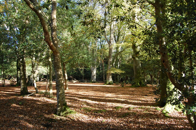
This natural water feature is home to a diverse range of flora and fauna, making it a popular spot for nature enthusiasts and birdwatchers. The pond is surrounded by reed beds and freshwater marshes, providing a habitat for various aquatic plants and animals. Visitors can often spot a variety of bird species, including herons, ducks, and swans, as well as dragonflies and butterflies.

The crystal-clear waters of Longcross Pond are fed by natural springs, ensuring a constant flow of freshwater throughout the year. The pond's depth varies, with some areas being relatively shallow, while others are deeper, creating different habitats for aquatic life.

A wooden boardwalk stretches along the edge of the pond, allowing visitors to explore and observe the wildlife at close proximity. The tranquil setting also makes it an ideal location for leisurely walks and picnics, with benches strategically placed for visitors to relax and enjoy the surrounding natural beauty.

Longcross Pond is well-maintained, with regular monitoring of water quality and conservation efforts to preserve its ecological balance. It is a designated Site of Importance for Nature Conservation (SINC) due to its significance in supporting the local biodiversity.

Whether it's birdwatching, photography, or simply seeking a peaceful escape in nature, Longcross Pond offers a delightful experience for all who visit.

If you have any feedback on the listing, please let us know in the comments section below.

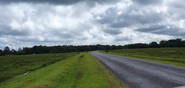
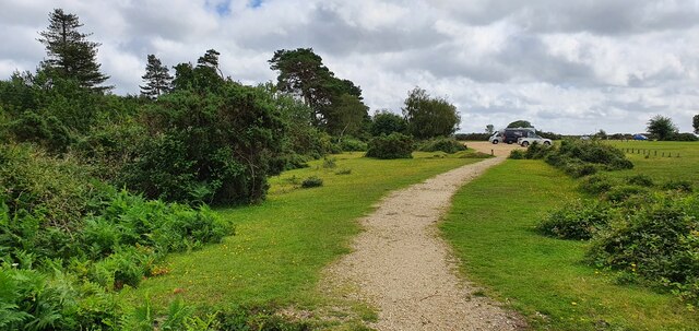
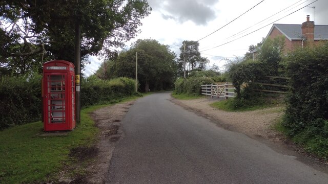
Longcross Pond Images

Images are sourced within 2km of 50.935866/-1.6498619 or Grid Reference SU2415. Thanks to Geograph Open Source API. All images are credited.

Road over Longcross Plain
Path to Janesmore Pond
View across clearing in Brook Wood
Phone Box Not Phone Box Not! Now an impromptu library.
Phone Box Not
Phone Box Not! Now an impromptu library.
Irons Well near Fritham in the New Forest
Ancient woodland near Irons Well
Irons Well
Irons Well
Bowl Barrow on Black Bush Plain (Scales 1m) <span class="nowrap"><a title="https://historicengland.org.uk/listing/the-list/list-entry/1012585?section=official-listing" rel="nofollow ugc noopener" href="https://historicengland.org.uk/listing/the-list/list-entry/1012585?section=official-listing">Link</a><img style="margin-left:2px;" alt="External link" title="External link - shift click to open in new window" src="https://s1.geograph.org.uk/img/external.png" width="10" height="10"/></span>
Bowl Barrow on Black Bush Plain
(Scales 1m) LinkExternal link
Bowl barrows on Black Bush Plain (Scales 1m) <span class="nowrap"><a title="https://historicengland.org.uk/listing/the-list/list-entry/1012585?section=official-listing" rel="nofollow ugc noopener" href="https://historicengland.org.uk/listing/the-list/list-entry/1012585?section=official-listing">Link</a><img style="margin-left:2px;" alt="External link" title="External link - shift click to open in new window" src="https://s1.geograph.org.uk/img/external.png" width="10" height="10"/></span>
Bowl barrows on Black Bush Plain
(Scales 1m) LinkExternal link
Bowl Barrow on Black Bush Plain (Scales 1m) <span class="nowrap"><a title="https://historicengland.org.uk/listing/the-list/list-entry/1012584?section=official-listing" rel="nofollow ugc noopener" href="https://historicengland.org.uk/listing/the-list/list-entry/1012584?section=official-listing">Link</a><img style="margin-left:2px;" alt="External link" title="External link - shift click to open in new window" src="https://s1.geograph.org.uk/img/external.png" width="10" height="10"/></span>
Bowl Barrow on Black Bush Plain
(Scales 1m) LinkExternal link
Bowl Barrow on Black Bush Plain (Scales 1m) <span class="nowrap"><a title="https://historicengland.org.uk/listing/the-list/list-entry/1012583?section=official-listing" rel="nofollow ugc noopener" href="https://historicengland.org.uk/listing/the-list/list-entry/1012583?section=official-listing">Link</a><img style="margin-left:2px;" alt="External link" title="External link - shift click to open in new window" src="https://s1.geograph.org.uk/img/external.png" width="10" height="10"/></span>
Bowl Barrow on Black Bush Plain
(Scales 1m) LinkExternal link
Long Cross Plain Looking towards Long Cross Pond.
Long Cross Plain
Looking towards Long Cross Pond.
Track in King's Garn Gutter Inclosure
Royal Oak Pub, Fritham
Black Pillar Box, Fritham
Cottages, Bramshaw On the small green at Butchers Corner.
Cottages, Bramshaw
On the small green at Butchers Corner.
Fritham, brook Looking upstream at a brook that rises in Bramshaw, and feeds Eyeworth Pond downstream. Seen on a fine, cold winter day.
Fritham, brook
Looking upstream at a brook that rises in Bramshaw, and feeds Eyeworth Pond downstream. Seen on a fine, cold winter day.
Road crossing Longcross Plain near to Bramshaw Triangulation Pillar Looking southward.
Road crossing Longcross Plain near to Bramshaw Triangulation Pillar
Looking southward.
Show me another place!

Longcross Pond is located at Grid Ref: SU2415 (Lat: 50.935866, Lng: -1.6498619)

Administrative County: Hampshire

District: New Forest

Police Authority: Hampshire

What 3 Words

///grin.apparatus.herb. Near Cadnam, Hampshire

Related Wikis

Fritham

Fritham is a small village in Hampshire, England. It lies in the north of the New Forest, near the Wiltshire border. It is in the civil parish of Bramshaw...

Eyeworth Pond

Eyeworth Pond is a pond located near Fritham in the New Forest, in Hampshire, England. The pond was created in 1871 by damming Latchmore Brook, with the...

RAF Stoney Cross

Royal Air Force Stoney Cross or more simply RAF Stoney Cross is a former Royal Air Force station in the New Forest, Hampshire, England. The airfield is...

Nomansland, Wiltshire

Nomansland is a small village in Wiltshire, England, close to the county border with Hampshire. It is part of the parish of Landford and lies about 3.5...

Bramshaw

Bramshaw is a small village and civil parish in Hampshire, England. It lies just inside the New Forest. The name Bramshaw means Bramble Wood. Until 1895...

Brook, New Forest

Brook is a hamlet in the civil parish of Bramshaw, in Hampshire, England. It lies just inside the New Forest. The hamlet contains a mix of 18th and 19th...

Landford Heath

Landford Heath (grid reference SU265178) is an 11.75 hectare biological Site of Special Scientific Interest near Landford in southeast Wiltshire, England...

Ocknell Plain

Ocknell Plain can be found in the New Forest near Southampton, England. The area was used in World War II for the Stoney Cross airfield and it is now very...

Nearby Amenities

Located within 500m of 50.935866,-1.6498619
Lcn Ref: 20
Lat/Long: 50.9332886/-1.6517661
Lcn Ref: 22
Lat/Long: 50.9320192/-1.6495929
Lcn Ref: 21
Lat/Long: 50.9324265/-1.6503273
Parking
Fixme: not sure this exists?
Lat/Long: 50.9327038/-1.6508089
Bus Stop
Bus: yes
Naptan AtcoCode: 1900HAA09430
Naptan Bearing: NE
Naptan BusStopType: CUS
Naptan CommonName: Long Cross
Naptan Crossing: Nomansland Road
Naptan NaptanCode: hamjdtjd
Naptan Street: B3080 Roger Penny Way
Naptan Verified: no
Source: naptan_import
Lat/Long: 50.9392309/-1.6528952
Bus Stop
Long Cross
Bus: yes
Naptan AtcoCode: 1900HAA09431
Naptan Bearing: SE
Naptan BusStopType: CUS
Naptan CommonName: Long Cross
Naptan Crossing: B3080 Roger Penny Way
Naptan NaptanCode: hamjdtjg
Naptan Street: Nomansland Road
Naptan Verified: no
Source: naptan_import
Lat/Long: 50.9390955/-1.6526827
Bus Stop
Long Cross
Bus: yes
Naptan AtcoCode: 1900HAA09432
Naptan Bearing: NW
Naptan BusStopType: CUS
Naptan CommonName: Long Cross
Naptan Crossing: Fritham Road
Naptan NaptanCode: hamjdtjm
Naptan Street: B3080 Roger Penny Way
Naptan Verified: no
Source: naptan_import
Lat/Long: 50.9389612/-1.6528973
Longcross Plain
Place: locality
Lat/Long: 50.9350042/-1.6568361
Longcross Plain
Ele: 125
Man Made: survey_point
Natural: peak
Ref: S2718
Source: Garmin eTrex 30 GPS
Lat/Long: 50.9350252/-1.6534121
Bramble Hill Walk
Place: locality
Lat/Long: 50.9395807/-1.6464922
Man Made: tower
Tower Type: communication
Lat/Long: 50.9333414/-1.6505443
The data included in this document is from www.openstreetmap.org. The data is made available under ODbL.

Have you been to Longcross Pond?

Leave your review of Longcross Pond below (or comments, questions and feedback).