Smalla Waters

Lake, Pool, Pond, Freshwater Marsh in Shetland

Scotland

Smalla Waters

Water mill site beside Upper Loch Brouster, Shetland This structure isn't shown on the OS map. There is, however, a structure near the burn at this location.
Water mill site beside Upper Loch Brouster, Shetland Credit: AlastairG

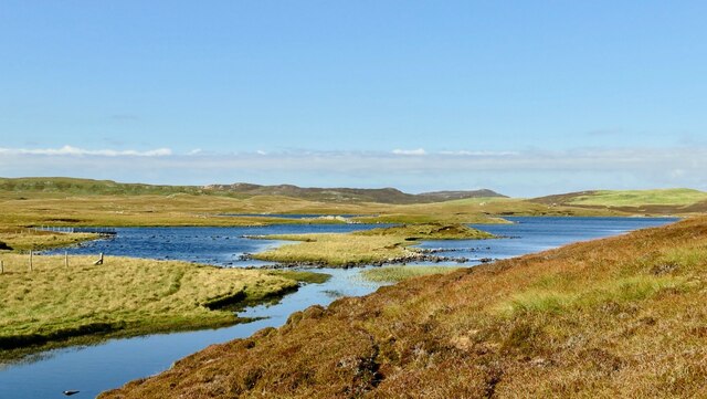
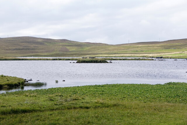
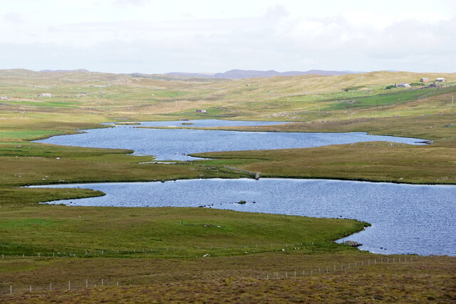
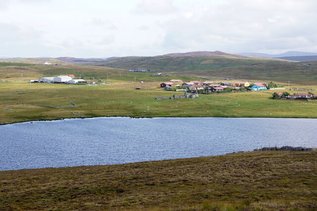
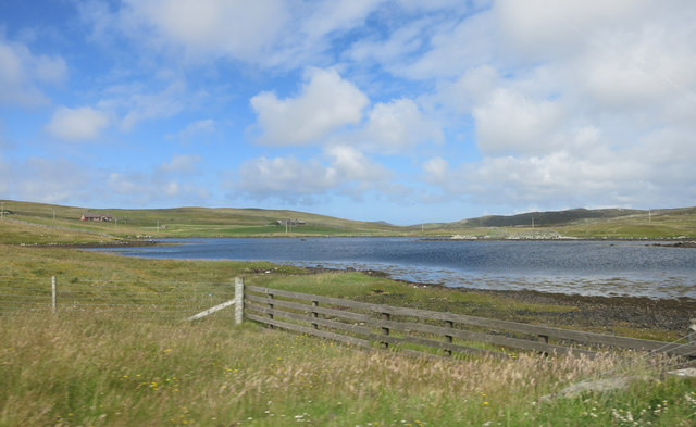
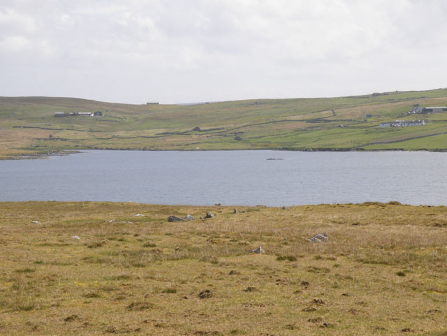
Smalla Waters is a picturesque freshwater marsh located in the heart of Shetland, an archipelago in Scotland. Spanning an area of approximately 2 hectares, this serene water body is a unique amalgamation of a lake, pool, pond, and freshwater marsh. Nestled amidst rolling hills and lush greenery, Smalla Waters exudes a sense of tranquility that attracts both locals and tourists alike.

The water in Smalla Waters is crystal clear and teeming with life. It supports a diverse range of aquatic plants such as water lilies, reeds, and bulrushes that create a vibrant and colorful ecosystem. These plants provide shelter and food for a variety of water-dwelling creatures, including frogs, newts, and dragonflies. The marshy areas around the water are inhabited by sedges and grasses, which further enhance the natural beauty of the site.

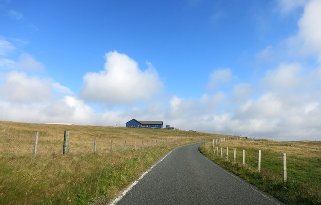
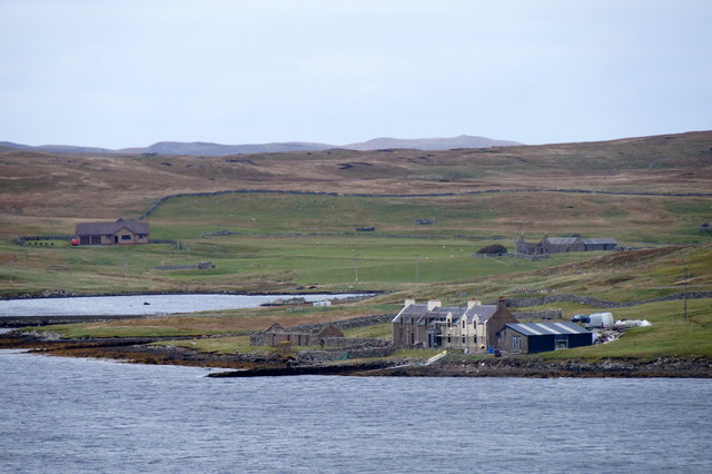
The surrounding landscape offers breathtaking views, with heather-covered moors and rocky outcrops adding to the charm of Smalla Waters. The area is a haven for birdwatchers, as numerous species of water birds can be spotted here throughout the year. Swans, ducks, and herons are a common sight, while rare visitors like ospreys and merlins occasionally grace the skies above.

Smalla Waters is a popular spot for nature lovers and photographers, who are drawn to its untouched beauty and peaceful ambiance. It provides an ideal setting for leisurely walks, picnics, and even fishing. The calm and serene atmosphere of Smalla Waters offers a welcome escape from the hustle and bustle of everyday life, allowing visitors to immerse themselves in the natural wonders that Shetland has to offer.

If you have any feedback on the listing, please let us know in the comments section below.

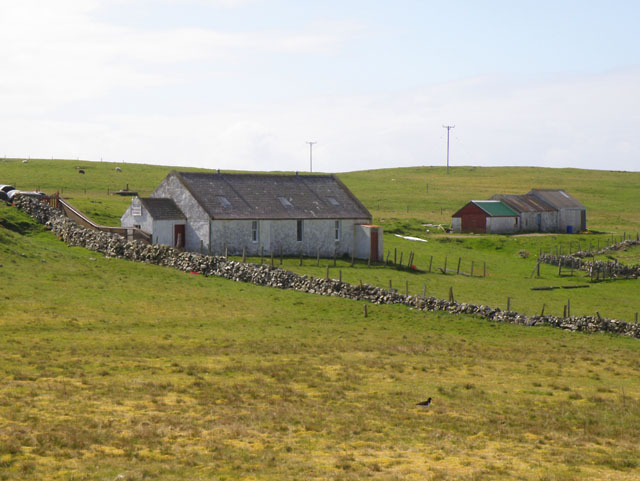
Smalla Waters Images

Images are sourced within 2km of 60.245406/-1.5561542 or Grid Reference HU2451. Thanks to Geograph Open Source API. All images are credited.

Water mill site beside Upper Loch Brouster, Shetland This structure isn't shown on the OS map. There is, however, a structure near the burn at this location.
Water mill site beside Upper Loch Brouster, Shetland
This structure isn't shown on the OS map. There is, however, a structure near the burn at this location.
Brace Burn leaving Loch of Voxterby, Shetland This burn connects Loch of Voxterby with Upper Loch of Brouster. Both contain trout but Loch of Voxterby is the more attractive of the two.
Brace Burn leaving Loch of Voxterby, Shetland
This burn connects Loch of Voxterby with Upper Loch of Brouster. Both contain trout but Loch of Voxterby is the more attractive of the two.
Footbridge across the Brace Burn by Upper Loch of Brouster This footbridce crosses the burn which feeds Upper Loch of Brouster. It seem to have survived well since the first submission <a href="https://www.geograph.org.uk/photo/2330293">HU2652 : Brace Burn Brig</a>
Footbridge across the Brace Burn by Upper Loch of Brouster
This footbridce crosses the burn which feeds Upper Loch of Brouster. It seem to have survived well since the first submission HU2652 : Brace Burn Brig
Brace Burn, Shetland Taken from the same spot as  <a href="https://www.geograph.org.uk/photo/7446337">HU2652 : Footbridge across the Brace Burn by Upper Loch of Brouster</a>  this upstream view shows the Brace Burn which drains the Loch of Voxterby near Walls.
Brace Burn, Shetland
Taken from the same spot as HU2652 : Footbridge across the Brace Burn by Upper Loch of Brouster this upstream view shows the Brace Burn which drains the Loch of Voxterby near Walls.
Stennestwatt, Walls
Stennestwatt, Walls
Loch of Bardister, Walls
Lochs of Kirkigarth and Bardister, Walls
Loch of Kirkigarth and Kirkidale, Walls
Smaila Waters An area of bog and small pools beside the road north out of Walls.
The map names the higher ground in the distance as Hansie's Crooie.
Smaila Waters
An area of bog and small pools beside the road north out of Walls. The map names the higher ground in the distance as Hansie's Crooie.
Road North of Walls
Road North of Walls
Standing Stone and Cairn There is an antiquity marked here, a Long Cairn, which is presumably that heap of rocks.
The standing stone just gets ordinary script, so I guess it's some recent addition.
Standing Stone and Cairn
There is an antiquity marked here, a Long Cairn, which is presumably that heap of rocks. The standing stone just gets ordinary script, so I guess it's some recent addition.
Lunga Water
Lunga Water
View South from the Bridge of Walls Looking towards the Voe of Browland.
View South from the Bridge of Walls
Looking towards the Voe of Browland.
Voe of Browland
Voe of Browland
Loch of Brouster
Loch of Brouster
Houses by the shore at Bridge of Walls Taken from Browland.
Houses by the shore at Bridge of Walls
Taken from Browland.
The Bridge of Walls Bridge crossing an arm of the Voe of Browland; the area above the bridge is still tidal but is known as the Loch of Brouster.
The Bridge of Walls
Bridge crossing an arm of the Voe of Browland; the area above the bridge is still tidal but is known as the Loch of Brouster.
The dam at Lunga Water in west Mainland
Show me another place!

Smalla Waters is located at Grid Ref: HU2451 (Lat: 60.245406, Lng: -1.5561542)

Unitary Authority: Shetland Islands

Police Authority: Highlands and Islands

What 3 Words

///probe.overjoyed.biked. Near Walls, Shetland Islands

Nearby Locations

Smalla Waters Long Cairn

Related Wikis

Scord of Brouster

The Scord of Brouster is one of the earliest Neolithic farm sites in Shetland, Scotland. It has been dated to 2220 BC with a time window of 80 years on...
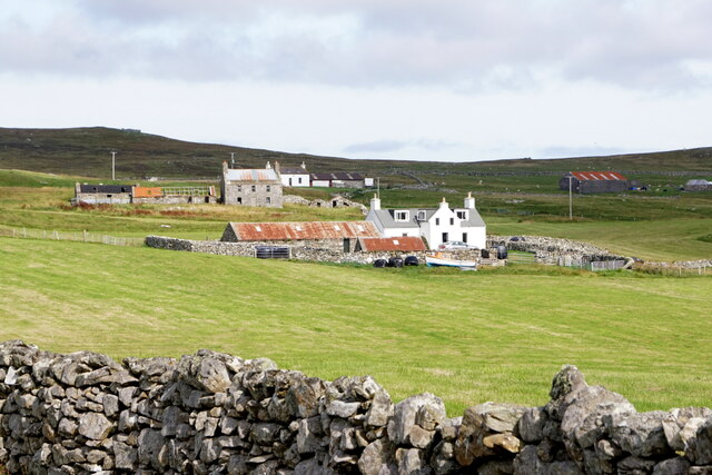
Walls, Shetland

Walls, known locally as Waas (Old Norse: Vagar = "Sheltered Bays" (voes) - the Ordnance Survey added the "ll" as they thought it was a corruption of "walls...

Browland

Browland is a village on Mainland in Shetland, Scotland situated about 1.9 miles (3 km) east north east of Walls. Browland is within the parish of Sandsting...

West Mainland

The West Mainland of the Shetland Islands is the part of the Shetland Mainland lying west of Aith (1° 23′ W). == Geography == Points of interest include...

Linga, Vaila Sound

Linga is one of the Shetland Islands, near Vaila and Walls on Mainland, Shetland. Its highest elevation is 28 metres (91 ft). In 2014 and 2018 it was...

Stanydale

Stanydale is a hamlet on the island of Mainland, Shetland, Scotland. The archaeological site of Stanydale Temple is less than 0.5 miles (0.80 km) to...

Stanydale Temple

Stanydale Temple is a Neolithic site on Mainland, Shetland, Scotland. It is located in a field to the south of the modern village of Stanydale, roughly...

Gruting

Gruting is a hamlet on the island of Mainland, Shetland in Scotland. It is about 1 kilometre (0.62 mi) southwest of the archaeological site of Stanydale...

Nearby Amenities

Located within 500m of 60.245406,-1.5561542
Power: pole
Lat/Long: 60.2414927/-1.5589673
Power: pole
Lat/Long: 60.2417451/-1.5575647
Power: pole
Lat/Long: 60.2454808/-1.5472119
Power: pole
Lat/Long: 60.2457172/-1.5482773
Power: pole
Lat/Long: 60.2459466/-1.5493112
Power: pole
Lat/Long: 60.246139/-1.5501783
Power: pole
Lat/Long: 60.2463247/-1.5510153
Power: pole
Lat/Long: 60.2465474/-1.5520189
Power: pole
Lat/Long: 60.2468204/-1.5532492
Power: pole
Lat/Long: 60.2470831/-1.5544333
Power: pole
Lat/Long: 60.2473148/-1.5554775
Power: pole
Lat/Long: 60.2476171/-1.5568401
Power: pole
Lat/Long: 60.2478342/-1.5578185
Power: pole
Lat/Long: 60.2480758/-1.5589074
Power: pole
Lat/Long: 60.2482588/-1.5597321
Power: pole
Lat/Long: 60.2486998/-1.5605914
The data included in this document is from www.openstreetmap.org. The data is made available under ODbL.

Have you been to Smalla Waters?

Leave your review of Smalla Waters below (or comments, questions and feedback).