Olton Reservoir

Lake, Pool, Pond, Freshwater Marsh in Warwickshire

England

Olton Reservoir

Seven Star Road, Solihull This is the A41 Solihull Bypass. Although it goes from the centre of London to Birkenhead, lack of trunking means there is hardly any left between Bicester and the West Midlands, and not only was it not replaced with a single alternative number, some is now also a B road, although those parts still cover the same route as before.
Seven Star Road, Solihull Credit: David Howard

Olton Reservoir is a freshwater lake located in Warwickshire, England. Spanning an area of approximately 8.5 hectares, it serves as a popular recreational spot for both locals and tourists alike. The reservoir is situated in the northeastern part of Solihull, near the town of Olton.

With its picturesque surroundings and tranquil atmosphere, Olton Reservoir offers visitors a peaceful retreat from the hustle and bustle of everyday life. The lake is surrounded by lush greenery, including trees and shrubs, creating a beautiful natural landscape. The calm waters of the reservoir reflect the surrounding scenery, adding to its serene ambiance.

The reservoir not only provides a scenic setting for leisure activities but also serves as a habitat for a variety of wildlife. Birdwatchers flock to Olton Reservoir to catch a glimpse of the numerous bird species that call it home. Common sightings include swans, ducks, herons, and geese. The diverse range of birdlife makes the reservoir a popular destination for ornithologists and nature enthusiasts.

For those interested in fishing, Olton Reservoir offers ample opportunities. The lake is stocked with a variety of fish species, including carp, bream, roach, and perch. Anglers can be seen casting their lines from the banks, hoping for a successful catch.

In addition to its recreational and ecological value, Olton Reservoir also serves as a water supply for the surrounding region. The reservoir is managed by the local water authority, ensuring the maintenance of its water quality and sustainability.

Overall, Olton Reservoir is a tranquil haven for nature lovers, offering a range of recreational activities and a diverse ecosystem.

If you have any feedback on the listing, please let us know in the comments section below.

Olton Reservoir Images

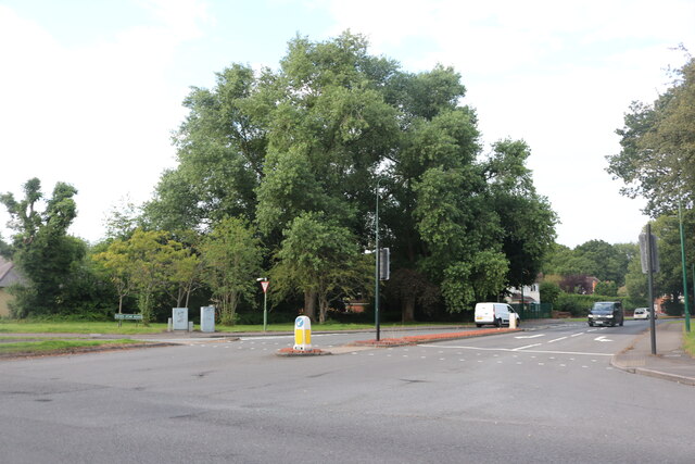
Images are sourced within 2km of 52.432144/-1.8037198 or Grid Reference SP1381. Thanks to Geograph Open Source API. All images are credited.

Seven Star Road, Solihull This is the A41 Solihull Bypass. Although it goes from the centre of London to Birkenhead, lack of trunking means there is hardly any left between Bicester and the West Midlands, and not only was it not replaced with a single alternative number, some is now also a B road, although those parts still cover the same route as before.
Seven Star Road, Solihull
This is the A41 Solihull Bypass. Although it goes from the centre of London to Birkenhead, lack of trunking means there is hardly any left between Bicester and the West Midlands, and not only was it not replaced with a single alternative number, some is now also a B road, although those parts still cover the same route as before.
Bunny garden on Seven Star Road The bunny has put on a mask to be up with covid rules.
Bunny garden on Seven Star Road
The bunny has put on a mask to be up with covid rules.
Seven Star Road, Solihull
The Spread Eagle A Wetherspoons public house on Warwick Road, Birmingham.
The Spread Eagle
A Wetherspoons public house on Warwick Road, Birmingham.
Warwick Road, Acock Green, Birmingham
Old Lode Lane at Lode Lane, Birmingham
Businesses on Warwick Road, Acock's Green The Warwick Road shopping area of Acock's Green always seems quite bustling. In this parade, service businesses predominate.
Businesses on Warwick Road, Acock's Green
The Warwick Road shopping area of Acock's Green always seems quite bustling. In this parade, service businesses predominate.
Businesses on Warwick Road, Acock's Green Picture taken at 9am on a weekday morning. Perhaps some of these businesses had not yet opened up for the day, or maybe not since the pandemic.
Businesses on Warwick Road, Acock's Green
Picture taken at 9am on a weekday morning. Perhaps some of these businesses had not yet opened up for the day, or maybe not since the pandemic.
Businesses on Warwick Road, Acock's Green The date stone in the archway gable reads 1929.
Businesses on Warwick Road, Acock's Green
The date stone in the archway gable reads 1929.
Businesses on Warwick Road, Acock's Green The date stone in the archway gable reads 1929.
Businesses on Warwick Road, Acock's Green
The date stone in the archway gable reads 1929.
Silhill Hall Road, Solihull Although it is an ancient Warwickshire market town and remains independently administered, Solihull is in effect a Birmingham suburb. This leafy street to the north of the town centre, with its large detached houses, is characteristic of the area. The road is named after Silhill Hall which stood nearby and was the oldest building in the borough until it was illegally demolished by its owner in 1966.
Silhill Hall Road, Solihull
Although it is an ancient Warwickshire market town and remains independently administered, Solihull is in effect a Birmingham suburb. This leafy street to the north of the town centre, with its large detached houses, is characteristic of the area. The road is named after Silhill Hall which stood nearby and was the oldest building in the borough until it was illegally demolished by its owner in 1966.
Silhill Hall Road, Solihull Looking towards the junction with Ashleigh Road in this leafy suburban part of the West Midlands conurbation.
Silhill Hall Road, Solihull
Looking towards the junction with Ashleigh Road in this leafy suburban part of the West Midlands conurbation.
Businesses in Dovehouse Parade, Olton This busy parade on the main Warwick Road appears to be generally thriving. It seemed that only one unit was vacant when I visited.
Businesses in Dovehouse Parade, Olton
This busy parade on the main Warwick Road appears to be generally thriving. It seemed that only one unit was vacant when I visited.
Bridge parapet, Lode Lane Bridge #81 carries Lode Lane over the Grand Union Canal on the north side of Solihull. A metal plaque, visible to the right of this photo, tells us that the bridge was reconstructed in 1957. Parapets in a modernist style were added at this time, with a pattern of squares cast in relief in the concrete. The bridge can be seen here <a href="https://www.geograph.org.uk/photo/6256875">SP1481 : Bridge #81  Lode Lane, Grand Union Canal</a>.
Bridge parapet, Lode Lane
Bridge #81 carries Lode Lane over the Grand Union Canal on the north side of Solihull. A metal plaque, visible to the right of this photo, tells us that the bridge was reconstructed in 1957. Parapets in a modernist style were added at this time, with a pattern of squares cast in relief in the concrete. The bridge can be seen here SP1481 : Bridge #81 Lode Lane, Grand Union Canal.
Public footpath, Lode Lane, Solihull The path runs from Lode Lane to Tanhouse Farm Road and Elmdon Park. It skirts the fenced-off northern side of the Jaguar Land Rover site, one entrance to which can be seen to the right of the fence post. Fenced-off suburban gardens hem the path in on the other side, too. The OS Six Inch 1888-1913 map shows a path running from Lode Lane to the school in Elmdon Park near Elmdon Hall <span class="nowrap"><a title="https://maps.nls.uk/geo/explore/side-by-side/#zoom=16&lat=52.44531&lon=-1.76364&layers=6&right=osm" rel="nofollow ugc noopener" href="https://maps.nls.uk/geo/explore/side-by-side/#zoom=16&lat=52.44531&lon=-1.76364&layers=6&right=osm">Link</a><img style="margin-left:2px;" alt="External link" title="External link - shift click to open in new window" src="https://s1.geograph.org.uk/img/external.png" width="10" height="10"/></span> . The first section of the modern path follows this one, but it then turns to the left and follows long-lost field boundaries.
Public footpath, Lode Lane, Solihull
The path runs from Lode Lane to Tanhouse Farm Road and Elmdon Park. It skirts the fenced-off northern side of the Jaguar Land Rover site, one entrance to which can be seen to the right of the fence post. Fenced-off suburban gardens hem the path in on the other side, too. The OS Six Inch 1888-1913 map shows a path running from Lode Lane to the school in Elmdon Park near Elmdon Hall LinkExternal link . The first section of the modern path follows this one, but it then turns to the left and follows long-lost field boundaries.
Show me another place!

Olton Reservoir is located at Grid Ref: SP1381 (Lat: 52.432144, Lng: -1.8037198)

Unitary Authority: Solihull

Police Authority: West Midlands

What 3 Words

///pass.output.such. Near Acocks Green, West Midlands

Related Wikis

Olton Reservoir

Olton Reservoir or Olton Mere (grid reference SP134815) is a canal feeder reservoir in the Olton district of Solihull, West Midlands, England. The reservoir...

Olton & West Warwickshire Hockey Club

Olton & West Warwickshire Hockey Club (Olton & West Warwick for short) is a field hockey club based at the West Warwickshire Sports Club in Grange Road...

Olton

Olton is an area/suburban village within the Metropolitan Borough of Solihull in the West Midlands, England. In the 13th century, the Lords of the Manor...

Langley School, Solihull

Langley School is a secondary school with academy status situated in the Metropolitan Borough of Solihull, West Midlands. It has specialist status in the...

Nearby Amenities

Located within 500m of 52.432144,-1.8037198
Check Date: 2022-05-25
Source: Warwicks CC Aerial Imagery 2013
Traffic Calming: bump
Lat/Long: 52.4307426/-1.8092232
Check Date: 2022-05-25
Source: survey
Traffic Calming: bump
Lat/Long: 52.4325627/-1.808813
Check Date: 2023-04-20
Source: bing
Traffic Calming: bump
Lat/Long: 52.4351864/-1.8075564
Turning Circle
Source: bing
Lat/Long: 52.4317809/-1.8109503
Give Way
Source: Warwicks CC Aerial Imagery 2013
Lat/Long: 52.4361542/-1.800693
Turning Circle
Source: bing
Lat/Long: 52.4299183/-1.7998341
Turning Circle
Source: bing
Lat/Long: 52.4314887/-1.8002104
Source: bing
Traffic Calming: bump
Lat/Long: 52.4354946/-1.8007673
Mini Roundabout
Source: bing
Lat/Long: 52.4341423/-1.7974499
Check Date: 2022-05-25
Source: bing
Traffic Calming: bump
Lat/Long: 52.4344682/-1.7983076
Source: Warwicks CC Aerial Imagery 2013
Traffic Calming: hump
Lat/Long: 52.4332745/-1.7981688
Check Date: 2022-05-25
Source: bing
Traffic Calming: bump
Lat/Long: 52.4317104/-1.797433
Crossing
Crossing: zebra
Crossing Island: no
Kerb: lowered
Tactile Paving: yes
Lat/Long: 52.4292909/-1.7988758
Maxheight: 4.8
Source: survey
Lat/Long: 52.4354126/-1.8026644
St Bernards Rd / Woodshires Rd
Naptan AtcoCode: 43000151701
Naptan Bearing: E
Naptan BusStopType: CUS
Naptan CommonName: Woodshires Rd
Naptan Indicator: after
Naptan NaptanCode: nwmptawm
Naptan PlusbusZoneRef: BHAMNWS
Naptan Status: ACT
Naptan StopType: BCT
Naptan Street: ST BERNARDS RD
Naptan Towards: Solihull
Naptan Verified: no
Source: WMCA
Lat/Long: 52.4307578/-1.8083093
St Bernards Rd / Woodshires Rd
Naptan AtcoCode: 43000151702
Naptan Bearing: N
Naptan BusStopType: CUS
Naptan CommonName: Woodshires Rd
Naptan Indicator: before
Naptan NaptanCode: nwmtajmt
Naptan PlusbusZoneRef: BHAMNWS
Naptan Status: ACT
Naptan StopType: BCT
Naptan Street: ST BERNARDS RD
Naptan Towards: Olton
Naptan Verified: no
Source: WMCA
Lat/Long: 52.4307812/-1.8091495
Bus Stop
Warwick Road / Reservoir Rd
NaPTANAreaCode: 43000152501
Asset Ref: 809208G
Bench: yes
Bin: yes
Bus: yes
Lit: yes
Naptan AtcoCode: 43000152501
Naptan Bearing: S
Naptan BusStopType: MKD
Naptan CommonName: Reservoir Rd
Naptan Indicator: adj
Naptan NaptanCode: nwmadpga
Naptan PlusbusZoneRef: BHAMNWS
Naptan Status: ACT
Naptan StopType: BCT
Naptan Street: WARWICK ROAD
Naptan Towards: Solihull
Public Transport: platform
Route Ref: 37
Shelter: yes
Shelter Ref: 809208
Source: WMCA
Tactile Paving: no
Towards: Solihull
Lat/Long: 52.4334562/-1.8003985
Bus Stop
Warwick Road / Reservoir Rd
NaPTANAreaCode: 43000152502
Asset Ref: 809209
Bench: yes
Bin: yes
Bus: yes
Lit: yes
Naptan AtcoCode: 43000152502
Naptan Bearing: N
Naptan BusStopType: MKD
Naptan CommonName: Reservoir Rd
Naptan Indicator: opp
Naptan NaptanCode: nwmadpgd
Naptan PlusbusZoneRef: BHAMNWS
Naptan Status: ACT
Naptan StopType: BCT
Naptan Street: WARWICK ROAD
Naptan Towards: Birmingham
Public Transport: platform
Route Ref: 37
Shelter: yes
Shelter Ref: 809209
Source: WMCA
Tactile Paving: no
Towards: Birmingham
Lat/Long: 52.4337948/-1.8009017
Bus Stop
Warwick Road / Grange Rd
NaPTANAreaCode: 43000153101
Asset Ref: 810801
Bench: yes
Bin: yes
Bus: yes
Lit: yes
Naptan AtcoCode: 43000153101
Naptan Bearing: N
Naptan BusStopType: MKD
Naptan CommonName: Grange Rd
Naptan Indicator: adj
Naptan NaptanCode: nwmadpgj
Naptan PlusbusZoneRef: BHAMNWS
Naptan Status: ACT
Naptan StopType: BCT
Naptan Street: WARWICK ROAD
Naptan Towards: Birmingham
Public Transport: platform
Route Ref: 37
Shelter: yes
Shelter Ref: 810801
Source: WMCA
Tactile Paving: yes
Lat/Long: 52.4301173/-1.7986954
Kineton Green
Is In: Solihull
Place: village
Source: OS_OpenData_StreetView
Lat/Long: 52.4326177/-1.8109544
Grit Bin
Source: survey
Lat/Long: 52.4278813/-1.8031513
Addr City: Solihull
Addr Housenumber: 39
Addr Postcode: B91 1BW
Addr Street: Grange Road
Source: survey
Lat/Long: 52.4280104/-1.8025617
Cafe
Number 1 Dovehouse
Outdoor Seating: yes
Source: survey
Lat/Long: 52.429791/-1.7980775
William H Painter Ltd
Opening Hours: Mo-Fr 09:00-17:00
Shop: funeral_directors
Source: survey
Lat/Long: 52.4297459/-1.7980585
Cornucopia
Shop: butcher, greengrocer, fishmonger, lorist
Source: survey
Lat/Long: 52.4294425/-1.797934
Telephone
Booth: InLink
Check Date: 2023-04-19
Operator: BT
Phone: +44 121 706 2562
Source: survey
Lat/Long: 52.4295604/-1.7981409
Wood Floor & Carpet Shop
Shop: carpet
Source: survey
Lat/Long: 52.4295717/-1.7979736
Fast Food
Dovehouse Fish Bar
Opening Hours: Tu-Sa 12:00-14:00,17:00-21:00
Source: survey
Lat/Long: 52.4293872/-1.7979395
Dentist
Dovehouse Dentistry
Healthcare: dentist
Source: survey
Lat/Long: 52.429733/-1.7979845
Post Box
Collection Times: Mo-Fr 17:00; Sa 12:00
Post Box Type: pillar
Ref: B91 323
Royal Cypher: EIIR
Royal Cypher Wikidata: Q33102113
Source: GPS Survey
Lat/Long: 52.4296415/-1.7981642
James Carl
Shop: hairdresser
Source: survey
Lat/Long: 52.4295376/-1.797964
Crossing
Button Operated: yes
Crossing: traffic_signals
Crossing Island: no
Crossing Ref: pelican
Source: survey
Source Type: BCC_CycleData
Tactile Paving: yes
Traffic Signals Sound: yes
Traffic Signals Vibration: yes
Lat/Long: 52.4296613/-1.7984619
Aesthetics Hair & Beauty
Female: yes
Shop: hairdresser
Source: survey
Lat/Long: 52.4296995/-1.7980268
Pharmacy
W M Brown Ltd
Healthcare: pharmacy
Opening Hours: Mo-Fr 08:00-20:00; Sa 09:00-17:30
Source: survey
Lat/Long: 52.4296145/-1.7979968
Atm
Check Date: 2023-04-19
Lat/Long: 52.4297162/-1.7980993
Solihull Convenience Store
Branch: Newsagents
Check Date: 2023-07-25
Shop: convenience
Source: survey
Lat/Long: 52.4296625/-1.7980145
Give Way
Source: Warwicks CC Aerial Imagery 2013
Lat/Long: 52.4306891/-1.7967527
Check Date: 2022-05-25
Source: bing
Traffic Calming: bump
Lat/Long: 52.4308077/-1.7968746
Check Date: 2022-05-25
Source: bing
Traffic Calming: bump
Lat/Long: 52.4352408/-1.8075256
Source: bing
Traffic Calming: bump
Lat/Long: 52.434974/-1.800936
Check Date: 2022-05-25
Source: bing
Traffic Calming: bump
Lat/Long: 52.4359743/-1.8007572
Check Date: 2022-06-07
Source: bing
Traffic Calming: bump
Lat/Long: 52.4314217/-1.7986016
Source: bing
Traffic Calming: bump
Lat/Long: 52.4325156/-1.7978333
Check Date: 2022-05-25
Source: bing
Traffic Calming: bump
Lat/Long: 52.4339347/-1.7976532
Check Date: 2022-05-25
Source: bing
Traffic Calming: bump
Lat/Long: 52.4340266/-1.797142
Source: bing
Traffic Calming: bump
Lat/Long: 52.4341956/-1.8007455
Traffic Calming: bump
Lat/Long: 52.4342684/-1.7977871
Source: bing
Traffic Calming: bump
Lat/Long: 52.4345528/-1.7997949
Parcel Locker
Addr City: Solihull
Addr Postcode: B92 7AW
Addr Street: Warwick Road
Brand: Locker InPost
Brand Wikidata: Q3182097
Collection Times: 24/7
Operator: InPost
Parcel Mail In: yes
Ref: UKSOL1106
Source: survey
Lat/Long: 52.4365028/-1.8039028
Post Box
Collection Times: Mo-Fr 17:00; Sa 10:30
Post Box Type: pillar
Ref: B92 81D
Royal Cypher: EIIR
Royal Cypher Wikidata: Q33102113
Source: survey
Lat/Long: 52.4328754/-1.808618
Post Box
Collection Times: Mo-Fr 09:00; Sa 07:00
Post Box Type: pillar
Ref: B92 452D
Royal Cypher: GR
Royal Cypher Wikidata: Q33102273
Source: survey
Lat/Long: 52.4341162/-1.7972542
Man Made: street_cabinet
Operator: Solihull MBC
Ref: G0514
Street Cabinet: traffic_signals
Lat/Long: 52.4297085/-1.7983644
Man Made: street_cabinet
Source: survey
Lat/Long: 52.4296916/-1.7983592
Give Way
Source: Warwickshire CC Aerial Imagery 2013
Lat/Long: 52.4299719/-1.7984712
Power: substation
Source: survey
Lat/Long: 52.4336608/-1.8105009
Man Made: street_cabinet
Source: survey
Street Cabinet: communications
Lat/Long: 52.4301905/-1.8091841
Grit Bin
Source: survey
Lat/Long: 52.4305089/-1.8079373
Grit Bin
Source: survey
Lat/Long: 52.4305756/-1.8057578
Power: substation
Source: survey
Lat/Long: 52.4306914/-1.8081174
Grit Bin
Source: survey
Lat/Long: 52.4326319/-1.8075628
Man Made: street_cabinet
Operator: BT
Source: survey
Street Cabinet: communications
Lat/Long: 52.4326453/-1.8077799
Man Made: street_cabinet
Operator: BT
Source: survey
Street Cabinet: communications
Lat/Long: 52.4326457/-1.8078249
Man Made: street_cabinet
Source: survey
Street Cabinet: communications
Lat/Long: 52.4328709/-1.8061288
Man Made: street_cabinet
Source: survey
Street Cabinet: communications
Lat/Long: 52.4330068/-1.8085635
Man Made: street_cabinet
Operator: Royal Mail
Source: survey
Street Cabinet: mail_cache
Lat/Long: 52.4330227/-1.8085586
Grit Bin
Source: survey
Lat/Long: 52.4348616/-1.8061156
Man Made: street_cabinet
Source: survey
Street Cabinet: communications
Lat/Long: 52.4348723/-1.8060876
Man Made: street_cabinet
Source: survey
Street Cabinet: communications
Lat/Long: 52.43488/-1.8060657
Man Made: street_cabinet
Source: survey
Street Cabinet: communications
Lat/Long: 52.4351292/-1.8072735
Bus Stop
Grange Rd / Warwick Rd
Bench: no
Bin: no
Bus: yes
Lit: no
Naptan AtcoCode: 43000151501
Naptan Bearing: SW
Naptan BusStopType: CUS
Naptan CommonName: Warwick Rd
Naptan Indicator: after
Naptan NaptanCode: nwmwdtmp
Naptan Status: ACT
Naptan StopType: BCT
Naptan Street: GRANGE RD
Naptan Towards: Solihull (via Bryanston Rd)
Naptan Refresh: query
Public Transport: platform
Route Ref: S11
Shelter: no
Source: WMCA
Tactile Paving: no
Lat/Long: 52.429165/-1.7992796
Man Made: street_cabinet
Source: survey
Street Cabinet: telecom
Lat/Long: 52.4349574/-1.8008459
Give Way
Source: survey
Lat/Long: 52.4346492/-1.8016264
Source: Warwicks CC Aerial Imagery 2013
Traffic Calming: hump
Lat/Long: 52.434744/-1.8014172
Power: substation
Source: survey
Lat/Long: 52.4350449/-1.8011034
Give Way
Source: survey
Lat/Long: 52.4340965/-1.8010135
Man Made: street_cabinet
Source: survey
Street Cabinet: telecom
Lat/Long: 52.434139/-1.8007466
Fire Hydrant
Emergency: fire_hydrant
Fire Hydrant Diameter: 4"
Fire Hydrant Position: sidewalk
Fire Hydrant Type: underground
Operator: WMFS
Source: survey
Lat/Long: 52.4342011/-1.8011221
Fire Hydrant
Emergency: fire_hydrant
Fire Hydrant Diameter: 4"
Fire Hydrant Position: sidewalk
Fire Hydrant Type: underground
Operator: WMFS
Source: survey
Lat/Long: 52.4346361/-1.7991266
Source: Warwicks CC Aerial Imagery 2013
Traffic Calming: hump
Lat/Long: 52.4336198/-1.7979705
Give Way
Source: Warwicks CC Aerial Imagery 2013
Lat/Long: 52.4313348/-1.7989448
Fire Hydrant
Emergency: fire_hydrant
Fire Hydrant Type: underground
Operator: WMFS
Source: survey
Lat/Long: 52.4304121/-1.7998508
Fire Hydrant
Emergency: fire_hydrant
Fire Hydrant Type: underground
Operator: WMFS
Source: survey
Lat/Long: 52.4315331/-1.8003067
Railway: signal
Source: survey
Lat/Long: 52.4362394/-1.8029313
Post Office
Dovehouse Lane Post Office
Addr City: Solihull
Addr Housenumber: 349
Addr Parentstreet: Warwick Road
Addr Postcode: B91 1BQ
Addr Street: Dovehouse Parade
Brand: Post Office
Brand Wikidata: Q1783168
Opening Hours: Mo-Su 06:00-23:00
Ref Pol Id: 11084
Source: pol_branch_list_2018-02
Website: https://www.postoffice.co.uk/branch-finder/2772469/dovehouse-lane
Lat/Long: 52.4296671/-1.7979365
Generator Method: photovoltaic
Generator Output Electricity: yes
Generator Source: solar
Generator Type: solar_photovoltaic_panel
Location: roof
Power: generator
Lat/Long: 52.4345274/-1.8090749
Generator Method: photovoltaic
Generator Output Electricity: yes
Generator Source: solar
Generator Type: solar_photovoltaic_panel
Location: roof
Power: generator
Lat/Long: 52.4332829/-1.8008861
Generator Method: photovoltaic
Generator Output Electricity: yes
Generator Source: solar
Generator Type: solar_photovoltaic_panel
Location: roof
Power: generator
Lat/Long: 52.4354595/-1.8010148
Generator Method: photovoltaic
Generator Output Electricity: yes
Generator Source: solar
Generator Type: solar_photovoltaic_panel
Location: roof
Power: generator
Lat/Long: 52.4357726/-1.7997046
Generator Method: photovoltaic
Generator Output Electricity: yes
Generator Source: solar
Generator Type: solar_photovoltaic_panel
Location: roof
Power: generator
Lat/Long: 52.4357742/-1.7997904
Bicycle Rental
Warwick Rd/Dovehouse
Bicycle Rental: docking_station
Capacity: 12
Email: support@beryl.cc
Fee: yes
Network: West Midlands Cycle Hire
Network Regional: Starley
Operator: Beryl
Operator Wikidata: Q106575369
Payment App: yes
Payment Cash: no
Payment Credit Cards: no
Payment Cryptocurrencies: no
Payment Debit Cards: no
Payment Electronic Purses: no
Phone: +44 20 3003 5044
Ref Gbfs: beryl_west_midlands:2840
Ref Wmch: 2840
Rental: city_bike;ebike
Source: tfwm/serco
Website: https://beryl.cc/scheme/west-midlands
Wmch Name: Warwick Rd/Dovehouse
Lat/Long: 52.429623/-1.7983278
Parcel Locker
Addr City: Solihull
Addr Postcode: B92 7AW
Addr Street: Warwick Road
Brand: Amazon Hub
Brand Wikidata: Q16974764
Collection Times: 24/7
Description: Amazon Hub Locker
Operator: Amazon
Parcel Mail In: yes
Source: survey
Lat/Long: 52.4364876/-1.8038291
The data included in this document is from www.openstreetmap.org. The data is made available under ODbL.

Have you been to Olton Reservoir?

Leave your review of Olton Reservoir below (or comments, questions and feedback).