Kineton Green

Settlement in Warwickshire

England

Kineton Green

Seven Star Road, Solihull This is the A41 Solihull Bypass. Although it goes from the centre of London to Birkenhead, lack of trunking means there is hardly any left between Bicester and the West Midlands, and not only was it not replaced with a single alternative number, some is now also a B road, although those parts still cover the same route as before.
Seven Star Road, Solihull Credit: David Howard

Kineton Green is a small village located in the county of Warwickshire, England. Situated approximately 3 miles southeast of the town of Solihull, it forms part of the Metropolitan Borough of Solihull. The village is nestled in a picturesque rural setting, surrounded by rolling countryside and farmland.

Historically, Kineton Green was primarily an agricultural community, with farming and livestock rearing being the mainstay of the local economy. Over the years, it has evolved into a residential area with a mix of traditional cottages and modern housing developments. The village retains its rural charm, with many of the older buildings displaying traditional architectural features.

Kineton Green benefits from its proximity to Solihull, which offers a wide range of amenities including schools, shopping centers, and leisure facilities. The village itself has a primary school, providing education for the local children. Additionally, there are several parks and green spaces nearby, offering opportunities for outdoor activities and recreational pursuits.

Transport links in Kineton Green are excellent, with easy access to major road networks such as the M42 and A41. This allows residents to commute to nearby towns and cities, including Birmingham and Coventry, which are both within a short driving distance.

Overall, Kineton Green offers a tranquil and idyllic lifestyle, combining the benefits of rural living with the convenience of nearby urban centers.

If you have any feedback on the listing, please let us know in the comments section below.

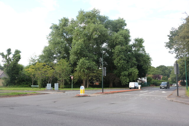
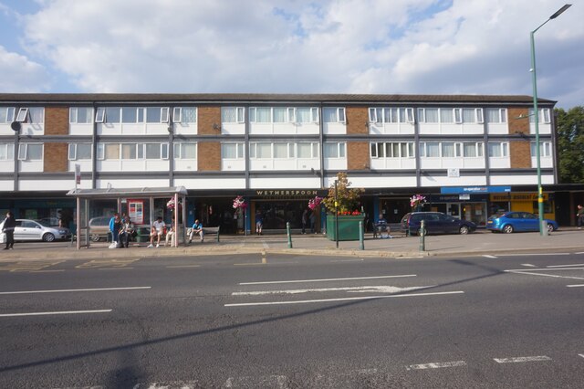
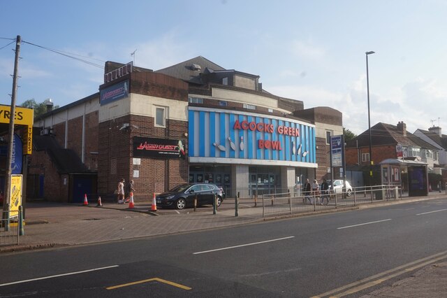
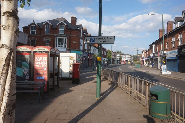
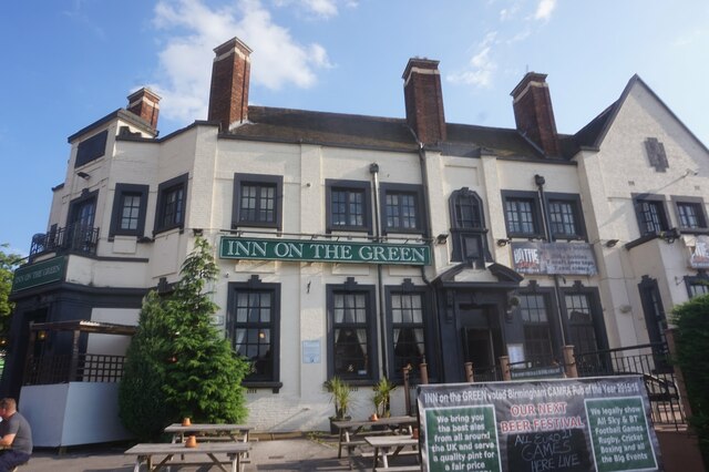
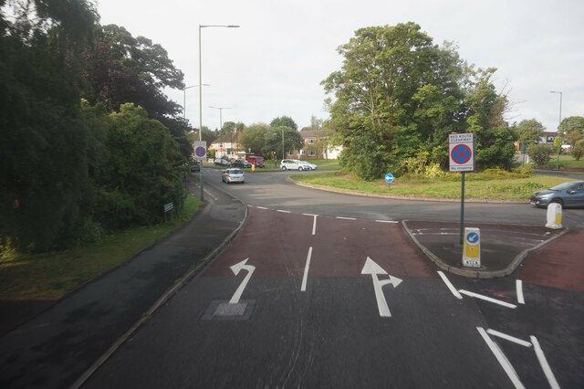
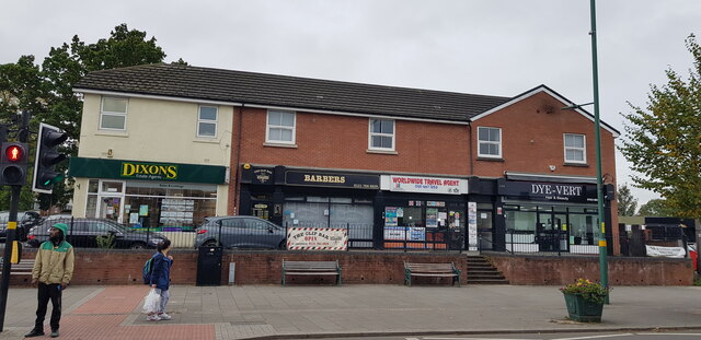
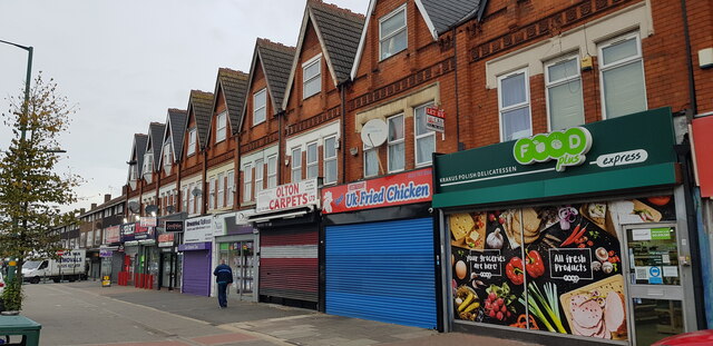
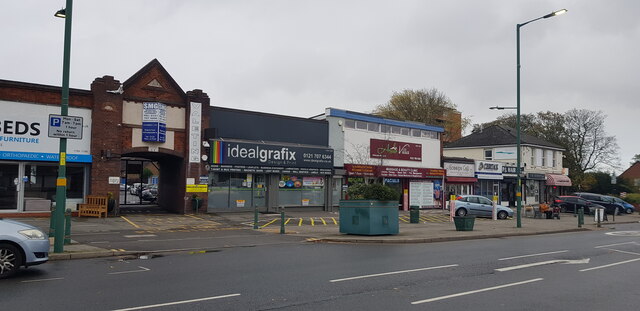
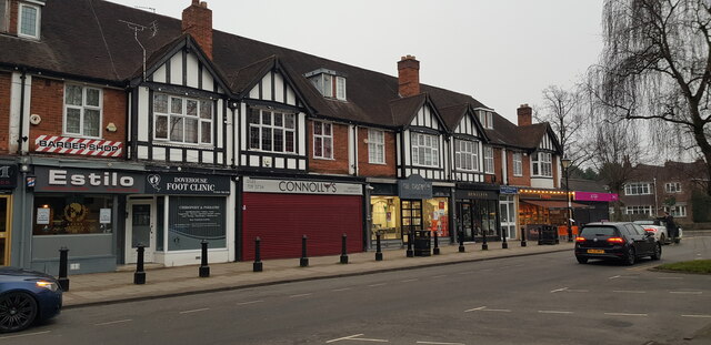
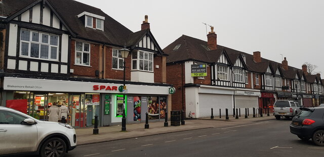
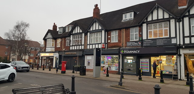
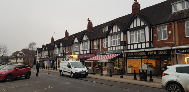
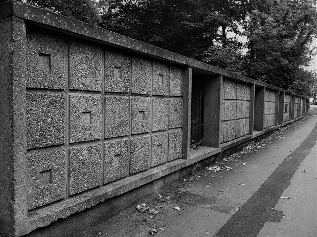
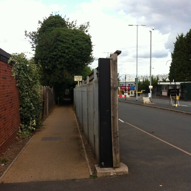
Kineton Green Images

Images are sourced within 2km of 52.433542/-1.808752 or Grid Reference SP1381. Thanks to Geograph Open Source API. All images are credited.

Seven Star Road, Solihull This is the A41 Solihull Bypass. Although it goes from the centre of London to Birkenhead, lack of trunking means there is hardly any left between Bicester and the West Midlands, and not only was it not replaced with a single alternative number, some is now also a B road, although those parts still cover the same route as before.
Seven Star Road, Solihull
This is the A41 Solihull Bypass. Although it goes from the centre of London to Birkenhead, lack of trunking means there is hardly any left between Bicester and the West Midlands, and not only was it not replaced with a single alternative number, some is now also a B road, although those parts still cover the same route as before.
The Spread Eagle A Wetherspoons public house on Warwick Road, Birmingham.
The Spread Eagle
A Wetherspoons public house on Warwick Road, Birmingham.
Acocks Green Bowl, Westley Road, Birmingham
Warwick Road, Acock Green, Birmingham
Inn on the Green, Acocks Green, Birmingham
Old Lode Lane at Lode Lane, Birmingham
Businesses on Warwick Road, Acock's Green The Warwick Road shopping area of Acock's Green always seems quite bustling. In this parade, service businesses predominate.
Businesses on Warwick Road, Acock's Green
The Warwick Road shopping area of Acock's Green always seems quite bustling. In this parade, service businesses predominate.
Businesses on Warwick Road, Acock's Green Picture taken at 9am on a weekday morning. Perhaps some of these businesses had not yet opened up for the day, or maybe not since the pandemic.
Businesses on Warwick Road, Acock's Green
Picture taken at 9am on a weekday morning. Perhaps some of these businesses had not yet opened up for the day, or maybe not since the pandemic.
Businesses on Warwick Road, Acock's Green The date stone in the archway gable reads 1929.
Businesses on Warwick Road, Acock's Green
The date stone in the archway gable reads 1929.
Businesses on Warwick Road, Acock's Green The date stone in the archway gable reads 1929.
Businesses on Warwick Road, Acock's Green
The date stone in the archway gable reads 1929.
Businesses in Dovehouse Parade, Olton This busy parade on the main Warwick Road appears to be generally thriving. It seemed that only one unit was vacant when I visited.
Businesses in Dovehouse Parade, Olton
This busy parade on the main Warwick Road appears to be generally thriving. It seemed that only one unit was vacant when I visited.
Bridge parapet, Lode Lane Bridge #81 carries Lode Lane over the Grand Union Canal on the north side of Solihull. A metal plaque, visible to the right of this photo, tells us that the bridge was reconstructed in 1957. Parapets in a modernist style were added at this time, with a pattern of squares cast in relief in the concrete. The bridge can be seen here <a href="https://www.geograph.org.uk/photo/6256875">SP1481 : Bridge #81  Lode Lane, Grand Union Canal</a>.
Bridge parapet, Lode Lane
Bridge #81 carries Lode Lane over the Grand Union Canal on the north side of Solihull. A metal plaque, visible to the right of this photo, tells us that the bridge was reconstructed in 1957. Parapets in a modernist style were added at this time, with a pattern of squares cast in relief in the concrete. The bridge can be seen here SP1481 : Bridge #81 Lode Lane, Grand Union Canal.
Public footpath, Lode Lane, Solihull The path runs from Lode Lane to Tanhouse Farm Road and Elmdon Park. It skirts the fenced-off northern side of the Jaguar Land Rover site, one entrance to which can be seen to the right of the fence post. Fenced-off suburban gardens hem the path in on the other side, too. The OS Six Inch 1888-1913 map shows a path running from Lode Lane to the school in Elmdon Park near Elmdon Hall <span class="nowrap"><a title="https://maps.nls.uk/geo/explore/side-by-side/#zoom=16&lat=52.44531&lon=-1.76364&layers=6&right=osm" rel="nofollow ugc noopener" href="https://maps.nls.uk/geo/explore/side-by-side/#zoom=16&lat=52.44531&lon=-1.76364&layers=6&right=osm">Link</a><img style="margin-left:2px;" alt="External link" title="External link - shift click to open in new window" src="https://s1.geograph.org.uk/img/external.png" width="10" height="10"/></span> . The first section of the modern path follows this one, but it then turns to the left and follows long-lost field boundaries.
Public footpath, Lode Lane, Solihull
The path runs from Lode Lane to Tanhouse Farm Road and Elmdon Park. It skirts the fenced-off northern side of the Jaguar Land Rover site, one entrance to which can be seen to the right of the fence post. Fenced-off suburban gardens hem the path in on the other side, too. The OS Six Inch 1888-1913 map shows a path running from Lode Lane to the school in Elmdon Park near Elmdon Hall LinkExternal link . The first section of the modern path follows this one, but it then turns to the left and follows long-lost field boundaries.
The Round Pool, Fox Hollies Park/Pool Farm Park Formerly associated with Pool Farm.  Pool drains via an overflow into the nearby Westley Brook, which lies lower.
The Round Pool, Fox Hollies Park/Pool Farm Park
Formerly associated with Pool Farm. Pool drains via an overflow into the nearby Westley Brook, which lies lower.
Pond at Palmers Rough This pond is situated within the Palmers Rough Local Nature Reserve. It is man-made and probably mid 20th century in origin. It has recently been the subject of a restoration project with the aim of removing silt and debris, restoring water quality and improving the quality of habitat. Access has been improved and there are a couple of good wood-carved artworks.
Pond at Palmers Rough
This pond is situated within the Palmers Rough Local Nature Reserve. It is man-made and probably mid 20th century in origin. It has recently been the subject of a restoration project with the aim of removing silt and debris, restoring water quality and improving the quality of habitat. Access has been improved and there are a couple of good wood-carved artworks.
Show me another place!

Kineton Green is located at Grid Ref: SP1381 (Lat: 52.433542, Lng: -1.808752)

Unitary Authority: Solihull

Police Authority: West Midlands

What 3 Words

///epic.aims.claps. Near Acocks Green, West Midlands

Related Wikis

Olton Reservoir

Olton Reservoir or Olton Mere (grid reference SP134815) is a canal feeder reservoir in the Olton district of Solihull, West Midlands, England. The reservoir...

Olton

Olton is an area/suburban village within the Metropolitan Borough of Solihull in the West Midlands, England. In the 13th century, the Lords of the Manor...

Olton & West Warwickshire Hockey Club

Olton & West Warwickshire Hockey Club (Olton & West Warwick for short) is a field hockey club based at the West Warwickshire Sports Club in Grange Road...

Langley School, Solihull

Langley School is a secondary school with academy status situated in the Metropolitan Borough of Solihull, West Midlands. It has specialist status in the...

Nearby Amenities

Located within 500m of 52.433542,-1.808752
Mini Roundabout
Direction: clockwise
Lat/Long: 52.4377272/-1.8074701
Check Date: 2022-05-25
Source: Warwicks CC Aerial Imagery 2013
Traffic Calming: bump
Lat/Long: 52.4307426/-1.8092232
Check Date: 2022-05-25
Source: survey
Traffic Calming: bump
Lat/Long: 52.4325627/-1.808813
Check Date: 2023-04-20
Source: bing
Traffic Calming: bump
Lat/Long: 52.4351864/-1.8075564
Man Made: monitoring_station
Monitoring Traffic: yes
Operator: Solihull MBC
Traffic Sensor: loop
Lat/Long: 52.4374193/-1.805729
Turning Circle
Source: bing
Lat/Long: 52.4317809/-1.8109503
Post Box
Collection Times: Mo-Fr 17:00; Sa 10:30
Post Box Type: pillar
Ref: B91 201
Royal Cypher: GR
Royal Cypher Wikidata: Q33102273
Source: survey
Lat/Long: 52.4320884/-1.8127968
Post Box
Collection Times: Mo-Fr 09:00; Sa 07:00
Post Box Type: pillar
Ref: B92 1058D
Royal Cypher: EIIR
Royal Cypher Wikidata: Q33102113
Source: survey
Lat/Long: 52.4371716/-1.8084426
Maxheight: 4.8
Source: survey
Lat/Long: 52.4354126/-1.8026644
Bus Stop
Kineton Green Rd / Gunns Way
Bench: no
Bin: no
Bus: yes
Lit: no
Naptan AtcoCode: 43000151201
Naptan Bearing: S
Naptan BusStopType: MKD
Naptan CommonName: Gunns Way
Naptan Indicator: opp
Naptan NaptanCode: nwmgdjtj
Naptan PlusbusZoneRef: BHAMNWS
Naptan Status: ACT
Naptan StopType: BCT
Naptan Street: KINETON GREEN RD
Naptan Towards: Solihull
Public Transport: platform
Route Ref: 30
Shelter: no
Source: WMCA
Tactile Paving: no
Towards: Solihull
Lat/Long: 52.4310252/-1.8124705
Bus Stop
Kineton Green Rd / Gunns Way
Bench: no
Bin: no
Bus: yes
Lit: no
Naptan AtcoCode: 43000151202
Naptan Bearing: N
Naptan BusStopType: MKD
Naptan CommonName: Gunns Way
Naptan Indicator: adj
Naptan NaptanCode: nwmgdjtm
Naptan PlusbusZoneRef: BHAMNWS
Naptan Status: ACT
Naptan StopType: BCT
Naptan Street: KINETON GREEN RD
Naptan Towards: Olton
Naptan Verified: no
Public Transport: platform
Route Ref: 30
Shelter: no
Source: WMCA
Tactile Paving: no
Towards: Olton
Lat/Long: 52.4313511/-1.8127707
Bus Stop
Kineton Green Rd / Allesley Rd
Bench: no
Bin: no
Bus: yes
Lit: no
Naptan AtcoCode: 43000151301
Naptan Bearing: S
Naptan BusStopType: MKD
Naptan CommonName: Allesley Rd
Naptan Indicator: opp
Naptan NaptanCode: nwmgdjtp
Naptan PlusbusZoneRef: BHAMNWS
Naptan Status: ACT
Naptan StopType: BCT
Naptan Street: KINETON GREEN RD
Naptan Towards: Solihull
Naptan Verified: no
Public Transport: platform
Route Ref: 30
Shelter: no
Source: WMCA
Tactile Paving: no
Lat/Long: 52.4335191/-1.8120716
Bus Stop
Kineton Green Rd / Allesley Rd
Bench: no
Bin: no
Bus: yes
Lit: no
Naptan AtcoCode: 43000151302
Naptan Bearing: N
Naptan BusStopType: MKD
Naptan CommonName: Allesley Rd
Naptan Indicator: adj
Naptan NaptanCode: nwmgdjtw
Naptan PlusbusZoneRef: BHAMNWS
Naptan Status: ACT
Naptan StopType: BCT
Naptan Street: KINETON GREEN RD
Naptan Towards: Olton
Naptan Verified: no
Public Transport: platform
Route Ref: 30
Shelter: no
Source: WMCA
Tactile Paving: no
Lat/Long: 52.4340511/-1.8120241
Bus Stop
Kineton Green Rd / Junior School
Bench: no
Bin: no
Bus: yes
Lit: no
Naptan AtcoCode: 43000151401
Naptan Bearing: SW
Naptan BusStopType: MKD
Naptan CommonName: Junior School
Naptan Indicator: opp
Naptan NaptanCode: nwmgdjwa
Naptan PlusbusZoneRef: BHAMNWS
Naptan Status: ACT
Naptan StopType: BCT
Naptan Street: KINETON GREEN RD
Naptan Towards: Solihull
Naptan Verified: no
Public Transport: platform
Route Ref: 30
Shelter: no
Source: WMCA
Tactile Paving: no
Lat/Long: 52.435517/-1.8104068
Bus Stop
Kineton Green Rd / Junior School
Bench: no
Bin: no
Bus: yes
Lit: no
Naptan AtcoCode: 43000151402
Naptan Bearing: NE
Naptan BusStopType: MKD
Naptan CommonName: Junior School
Naptan Indicator: adj
Naptan NaptanCode: nwmgdjwd
Naptan PlusbusZoneRef: BHAMNWS
Naptan Status: ACT
Naptan StopType: BCT
Naptan Street: KINETON GREEN RD
Naptan Towards: Olton
Naptan Verified: no
Public Transport: platform
Route Ref: 30
Shelter: no
Source: WMCA
Tactile Paving: no
Lat/Long: 52.4357148/-1.8103618
St Bernards Rd / Woodshires Rd
Naptan AtcoCode: 43000151701
Naptan Bearing: E
Naptan BusStopType: CUS
Naptan CommonName: Woodshires Rd
Naptan Indicator: after
Naptan NaptanCode: nwmptawm
Naptan PlusbusZoneRef: BHAMNWS
Naptan Status: ACT
Naptan StopType: BCT
Naptan Street: ST BERNARDS RD
Naptan Towards: Solihull
Naptan Verified: no
Source: WMCA
Lat/Long: 52.4307578/-1.8083093
St Bernards Rd / Woodshires Rd
Naptan AtcoCode: 43000151702
Naptan Bearing: N
Naptan BusStopType: CUS
Naptan CommonName: Woodshires Rd
Naptan Indicator: before
Naptan NaptanCode: nwmtajmt
Naptan PlusbusZoneRef: BHAMNWS
Naptan Status: ACT
Naptan StopType: BCT
Naptan Street: ST BERNARDS RD
Naptan Towards: Olton
Naptan Verified: no
Source: WMCA
Lat/Long: 52.4307812/-1.8091495
Bus Stop
Warwick Road / Ulverley Green Rd
NaPTANAreaCode: 43000152401
Asset Ref: 809207
Bench: no
Bin: yes
Bus: yes
Layby: yes
Lit: no
Naptan AtcoCode: 43000152401
Naptan Bearing: SE
Naptan BusStopType: MKD
Naptan CommonName: Ulverley Green Rd
Naptan Indicator: adj
Naptan NaptanCode: nwmadpdt
Naptan PlusbusZoneRef: BHAMNWS
Naptan Status: ACT
Naptan StopType: BCT
Naptan Street: WARWICK ROAD
Naptan Towards: Solihull
Public Transport: platform
Route Ref: 37
Shelter: yes
Shelter Ref: 809207
Source: WMCA
Tactile Paving: no
Towards: Solihull
Lat/Long: 52.4370273/-1.8046764
Bus Stop
Warwick Road / Ulverley Green Rd
NaPTANAreaCode: 43000152402
Asset Ref: 809206
Bench: yes
Bin: yes
Bus: yes
Layby: yes
Lit: yes
Naptan AtcoCode: 43000152402
Naptan Bearing: NW
Naptan BusStopType: MKD
Naptan CommonName: Ulverley Green Rd
Naptan Indicator: opp
Naptan NaptanCode: nwmadpdw
Naptan PlusbusZoneRef: BHAMNWS
Naptan Status: ACT
Naptan StopType: BCT
Naptan Street: WARWICK ROAD
Naptan Towards: Birmingham
Public Transport: platform
Route Ref: 37
Shelter: yes
Shelter Ref: 809206
Source: WMCA
Tactile Paving: no
Towards: Birmingham
Lat/Long: 52.4366788/-1.8045318
Man Made: tower
Source: visual survey;estimate
Tower Type: communication
Lat/Long: 52.4370717/-1.8044001
Brand: National Grid
Brand Wikidata: Q1465461
Operator: National Grid Electricity Distribution Plc
Operator Old: Western Power Distribution
Operator Wikidata: Q7988183
Owner: National Grid Electricity Distribution (West Midlands) Plc
Owner Wikidata: Q114397791
Power: substation
Ref: 5047
Source: survey
Lat/Long: 52.4329418/-1.8137275
Kineton Green
Is In: Solihull
Place: village
Source: OS_OpenData_StreetView
Lat/Long: 52.4326177/-1.8109544
Source: Warwicks Aerial Imagery OGLv2
Traffic Calming: bump
Lat/Long: 52.4352841/-1.8108176
Check Date: 2022-05-25
Source: bing
Traffic Calming: bump
Lat/Long: 52.4352408/-1.8075256
Crossing
Button Operated: yes
Crossing: traffic_signals
Kerb: lowered
Tactile Paving: yes
Traffic Signals Sound: no
Traffic Signals Vibration: yes
Lat/Long: 52.4373853/-1.8053874
Crossing
Button Operated: yes
Crossing: traffic_signals
Crossing Island: yes
Kerb: lowered
Tactile Paving: yes
Traffic Signals Sound: no
Traffic Signals Vibration: yes
Lat/Long: 52.4374624/-1.8056564
Source: visual survey; bing
Traffic Calming: bump
Lat/Long: 52.4323826/-1.8129916
Source: visual survey; bing
Traffic Calming: bump
Lat/Long: 52.4316083/-1.8126946
Crossing
Button Operated: yes
Check Date Crossing: 2023-04-20
Crossing: traffic_signals
Crossing Ref: pelican
Source: BING;BCC_CycleData
Tactile Paving: yes
Traffic Signals Sound: no
Traffic Signals Vibration: yes
Lat/Long: 52.4374339/-1.8052766
Crossing
Button Operated: yes
Check Date Crossing: 2023-04-20
Crossing: traffic_signals
Crossing Ref: pelican
Source: BING;BCC_CycleData
Tactile Paving: yes
Traffic Signals Sound: no
Traffic Signals Vibration: yes
Lat/Long: 52.4376284/-1.8057095
Source: bing
Traffic Calming: bump
Lat/Long: 52.4371517/-1.8087774
Source: bing
Traffic Calming: bump
Lat/Long: 52.4342744/-1.8118362
Crossing
Crossing: uncontrolled
Crossing Island: no
Tactile Paving: yes
Lat/Long: 52.4366629/-1.8089355
Parcel Locker
Addr City: Solihull
Addr Postcode: B92 7AW
Addr Street: Warwick Road
Brand: Locker InPost
Brand Wikidata: Q3182097
Collection Times: 24/7
Operator: InPost
Parcel Mail In: yes
Ref: UKSOL1106
Source: survey
Lat/Long: 52.4365028/-1.8039028
Post Box
Collection Times: Mo-Fr 17:00; Sa 10:30
Post Box Type: pillar
Ref: B92 81D
Royal Cypher: EIIR
Royal Cypher Wikidata: Q33102113
Source: survey
Lat/Long: 52.4328754/-1.808618
Traffic Signals
Button Operated: yes
Crossing: traffic_signals
Crossing Ref: pelican
Source: BING;BCC_CycleData
Tactile Paving: yes
Traffic Signals Sound: no
Traffic Signals Vibration: yes
Lat/Long: 52.4373413/-1.8053236
Traffic Signals
Button Operated: yes
Crossing: traffic_signals
Crossing Ref: pelican
Source: BING;BCC_CycleData
Tactile Paving: yes
Traffic Signals Sound: no
Traffic Signals Vibration: yes
Lat/Long: 52.4374433/-1.8056922
Man Made: street_cabinet
Source: survey
Street Cabinet: communications
Lat/Long: 52.4374775/-1.8058333
Man Made: street_cabinet
Source: survey
Street Cabinet: communications
Lat/Long: 52.4374891/-1.8058432
Man Made: street_cabinet
Operator: Solihull MBC
Source: survey
Street Cabinet: traffic_signals
Lat/Long: 52.4375311/-1.8058051
Man Made: street_cabinet
Operator: Solihull MBC
Source: survey
Street Cabinet: traffic_signals
Lat/Long: 52.4375397/-1.80582
Man Made: street_cabinet
Operator: Solihull MBC
Source: survey
Street Cabinet: traffic_signals
Lat/Long: 52.4375483/-1.8058051
Man Made: street_cabinet
Operator: BT
Source: survey
Street Cabinet: communications
Lat/Long: 52.4361566/-1.8137115
Man Made: street_cabinet
Operator: BT
Source: survey
Street Cabinet: communications
Lat/Long: 52.4362401/-1.8128922
Barrier: bollard
Source: survey
Lat/Long: 52.4355401/-1.8127573
Barrier: bollard
Source: survey
Lat/Long: 52.4359479/-1.8121388
Man Made: street_cabinet
Source: survey
Street Cabinet: communications
Lat/Long: 52.4339597/-1.8127895
Man Made: street_cabinet
Source: survey
Street Cabinet: communications
Lat/Long: 52.4339661/-1.8128171
Man Made: street_cabinet
Source: survey
Street Cabinet: communications
Lat/Long: 52.4339733/-1.8128446
Grit Bin
Source: survey
Lat/Long: 52.4342466/-1.8139892
Man Made: street_cabinet
Source: survey
Street Cabinet: communications
Lat/Long: 52.4345158/-1.8140112
Traffic Calming: bump
Lat/Long: 52.4325395/-1.8125093
Traffic Calming: bump
Lat/Long: 52.4337362/-1.8121024
Power: substation
Source: survey
Lat/Long: 52.4336608/-1.8105009
Man Made: street_cabinet
Operator: BT
Source: survey
Street Cabinet: communications
Lat/Long: 52.4370946/-1.8086749
Man Made: street_cabinet
Operator: BT
Source: survey
Street Cabinet: communications
Lat/Long: 52.4370981/-1.808692
Man Made: street_cabinet
Operator: BT
Source: survey
Street Cabinet: communications
Lat/Long: 52.4371928/-1.8084358
Man Made: street_cabinet
Operator: BT
Source: survey
Street Cabinet: communications
Lat/Long: 52.4371939/-1.8084175
Man Made: street_cabinet
Source: survey
Lat/Long: 52.437642/-1.8072943
Man Made: street_cabinet
Source: survey
Lat/Long: 52.437646/-1.8073179
Man Made: street_cabinet
Operator: Royal Mail
Source: survey
Street Cabinet: mail_cache
Lat/Long: 52.4376512/-1.8073443
Man Made: street_cabinet
Source: survey
Lat/Long: 52.4378526/-1.8072943
Man Made: street_cabinet
Source: survey
Street Cabinet: communications
Lat/Long: 52.4319867/-1.8125634
Man Made: street_cabinet
Source: survey
Street Cabinet: communications
Lat/Long: 52.4301905/-1.8091841
Grit Bin
Source: survey
Lat/Long: 52.4305089/-1.8079373
Grit Bin
Source: survey
Lat/Long: 52.4305756/-1.8057578
Power: substation
Source: survey
Lat/Long: 52.4306914/-1.8081174
Grit Bin
Source: survey
Lat/Long: 52.4326319/-1.8075628
Man Made: street_cabinet
Operator: BT
Source: survey
Street Cabinet: communications
Lat/Long: 52.4326453/-1.8077799
Man Made: street_cabinet
Operator: BT
Source: survey
Street Cabinet: communications
Lat/Long: 52.4326457/-1.8078249
Man Made: street_cabinet
Source: survey
Street Cabinet: communications
Lat/Long: 52.4328709/-1.8061288
Man Made: street_cabinet
Source: survey
Street Cabinet: communications
Lat/Long: 52.4330068/-1.8085635
Man Made: street_cabinet
Operator: Royal Mail
Source: survey
Street Cabinet: mail_cache
Lat/Long: 52.4330227/-1.8085586
Grit Bin
Source: survey
Lat/Long: 52.4348616/-1.8061156
Man Made: street_cabinet
Source: survey
Street Cabinet: communications
Lat/Long: 52.4348723/-1.8060876
Man Made: street_cabinet
Source: survey
Street Cabinet: communications
Lat/Long: 52.43488/-1.8060657
Man Made: street_cabinet
Source: survey
Street Cabinet: communications
Lat/Long: 52.4351292/-1.8072735
Man Made: monitoring_station
Monitoring Traffic: yes
Operator: Solihull MBC
Traffic Sensor: loop
Lat/Long: 52.4373028/-1.8052747
Man Made: street_cabinet
Source: survey
Street Cabinet: communications
Lat/Long: 52.4308938/-1.8133641
Man Made: street_cabinet
Source: survey
Street Cabinet: communications
Lat/Long: 52.4309468/-1.8130073
Man Made: street_cabinet
Source: survey
Lat/Long: 52.4307027/-1.8138778
Give Way
Source: survey
Lat/Long: 52.4346492/-1.8016264
Railway: signal
Source: survey
Lat/Long: 52.4362394/-1.8029313
Generator Method: photovoltaic
Generator Output Electricity: yes
Generator Source: solar
Generator Type: solar_photovoltaic_panel
Location: roof
Power: generator
Lat/Long: 52.4322821/-1.8147424
Generator Method: photovoltaic
Generator Output Electricity: yes
Generator Source: solar
Generator Type: solar_photovoltaic_panel
Location: roof
Power: generator
Lat/Long: 52.4322559/-1.8154612
Generator Method: photovoltaic
Generator Output Electricity: yes
Generator Source: solar
Generator Type: solar_photovoltaic_panel
Location: roof
Power: generator
Lat/Long: 52.4375885/-1.8116324
Generator Method: photovoltaic
Generator Output Electricity: yes
Generator Source: solar
Generator Type: solar_photovoltaic_panel
Location: roof
Power: generator
Lat/Long: 52.4345274/-1.8090749
Parcel Locker
Addr City: Solihull
Addr Postcode: B92 7AW
Addr Street: Warwick Road
Brand: Amazon Hub
Brand Wikidata: Q16974764
Collection Times: 24/7
Description: Amazon Hub Locker
Operator: Amazon
Parcel Mail In: yes
Source: survey
Lat/Long: 52.4364876/-1.8038291
Solihull Art Gallery
Fee: no
Opening Hours: Tu-Sa 11:00-17:30
Tourism: gallery
Lat/Long: 52.4369753/-1.8044266
The data included in this document is from www.openstreetmap.org. The data is made available under ODbL.

Have you been to Kineton Green?

Leave your review of Kineton Green below (or comments, questions and feedback).