Churn Pool

Lake, Pool, Pond, Freshwater Marsh in Gloucestershire Cotswold

England

Churn Pool

Danger Keep Out! Gate off the Ermine Way to parking area next to gravel pit pools.
Danger Keep Out! Credit: Jeff Gogarty

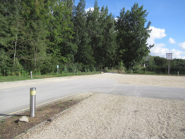
Churn Pool is a freshwater lake located in the county of Gloucestershire, England. Situated within the Cotswold Water Park, it is a popular attraction for both locals and tourists alike. The lake covers an area of approximately 20 hectares and is surrounded by beautiful natural scenery and wildlife.

The pool is formed from an old gravel extraction site and has been transformed into a tranquil and picturesque body of water. Its clear and calm waters make it an ideal spot for various water activities such as fishing, boating, and kayaking. Fishing enthusiasts can enjoy angling for a variety of species including carp, pike, perch, and bream.

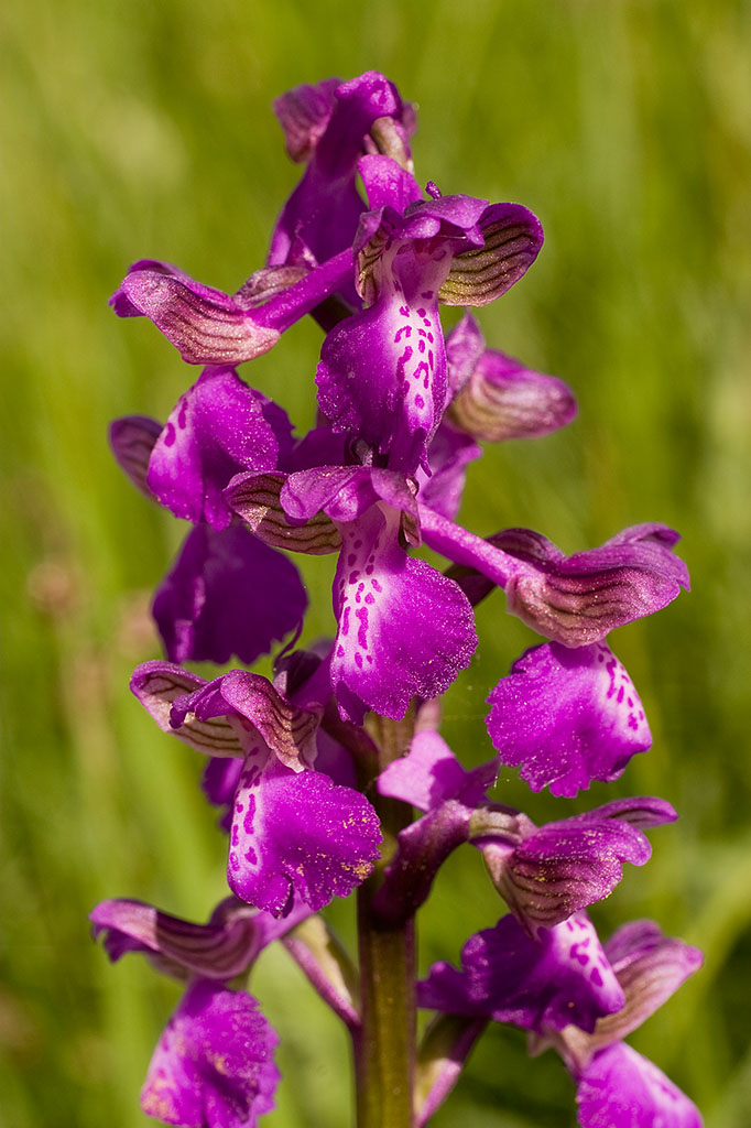
Churn Pool is also a haven for birdwatchers, as it attracts a wide range of bird species. The surrounding marshland provides a suitable habitat for many waterfowl, waders, and other wetland birds. Visitors can expect to see species such as swans, ducks, herons, and geese among others.

The lake is well-maintained with designated pathways and picnic areas, making it an excellent place for families to spend a day outdoors. It offers ample opportunities for relaxation and enjoying the peaceful natural surroundings. The nearby Cotswold Water Park Visitor Centre provides additional amenities such as parking, toilets, and a café.

Overall, Churn Pool in Gloucestershire offers a serene and scenic environment for various recreational activities and is a delightful destination for nature lovers and outdoor enthusiasts.

If you have any feedback on the listing, please let us know in the comments section below.

Churn Pool Images

Images are sourced within 2km of 51.66859/-1.8972893 or Grid Reference SU0796. Thanks to Geograph Open Source API. All images are credited.

Danger Keep Out! Gate off the Ermine Way to parking area next to gravel pit pools.
Danger Keep Out!
Gate off the Ermine Way to parking area next to gravel pit pools.
The Ermine Way towards Latton
Canal Milestone Thames and Severn Canal, on the towpath of the Cerney Wick Pound (canal between locks). Replica plate in the style of the originals. Cut Benchmark represented 278.1 ft ASL (in 1900).

Inscription Walbridge / 19 / Inglesham 9¾

Milestone Society ID: TSC-19
Canal Milestone
Thames and Severn Canal, on the towpath of the Cerney Wick Pound (canal between locks). Replica plate in the style of the originals. Cut Benchmark represented 278.1 ft ASL (in 1900). Inscription Walbridge / 19 / Inglesham 9¾ Milestone Society ID: TSC-19
Thames & Severn canal Milestone Modern plate placed there by volunteers of the Cotswold Canals Trust ( <span class="nowrap"><a title="https://cotswoldcanals.org/" rel="nofollow ugc noopener" href="https://cotswoldcanals.org/">Link</a><img style="margin-left:2px;" alt="External link" title="External link - shift click to open in new window" src="https://s1.geograph.org.uk/img/external.png" width="10" height="10"/></span> ). The plate is a respectful clone of the style of the original plates used on this canal. The modern bridge on the "Spine Road" is 200m to the left and can clearly be seen on an alternative view - <a href="https://www.geograph.org.uk/photo/6539254">SU0797 : Thames & Severn Path near South Cerney</a>. An earlier image shows the stone before it was pieced together, and set upright see <a href="https://www.geograph.org.uk/photo/1082683">SU0797 : Thames & Severn Canal milepost near Spine Road Bridge</a>

Inscription: Walbridge / 18½ / Inglesham / 10¼

Milestone Society National ID: TSC-18½
Thames & Severn canal Milestone
Modern plate placed there by volunteers of the Cotswold Canals Trust ( LinkExternal link ). The plate is a respectful clone of the style of the original plates used on this canal. The modern bridge on the "Spine Road" is 200m to the left and can clearly be seen on an alternative view - SU0797 : Thames & Severn Path near South Cerney. An earlier image shows the stone before it was pieced together, and set upright see SU0797 : Thames & Severn Canal milepost near Spine Road Bridge Inscription: Walbridge / 18½ / Inglesham / 10¼ Milestone Society National ID: TSC-18½
Milestone remnant Thames & Severn canal This stone has the same cross section as stones at <a title="https://www.geograph.org.uk/photo/7031573" href="https://www.geograph.org.uk/photo/7031573">Link</a> & <a title="https://www.geograph.org.uk/photo/6995454" href="https://www.geograph.org.uk/photo/6995454">Link</a> and is 1 mile from the former, to within 0.01 miles. Between what was Crane Bridge and the extant Little Lock. The towpath has been used as access to a large house, and the stone sits on the South side of the road almost in the ditch.

Inscription (would have been): WALBRIDGE / 17½ / INGLESHAM / 11¼


Milestone Society National ID: TSC-17½
Milestone remnant Thames & Severn canal
This stone has the same cross section as stones at Link & Link and is 1 mile from the former, to within 0.01 miles. Between what was Crane Bridge and the extant Little Lock. The towpath has been used as access to a large house, and the stone sits on the South side of the road almost in the ditch. Inscription (would have been): WALBRIDGE / 17½ / INGLESHAM / 11¼ Milestone Society National ID: TSC-17½
Roundhouse and Cerney Wick Lock A disused lock on the defunct Thames and Severn Canal.  The building on the right is a lockkeeper's house.  It is one of five on this canal; they are known as Roundhouses.
Roundhouse and Cerney Wick Lock
A disused lock on the defunct Thames and Severn Canal. The building on the right is a lockkeeper's house. It is one of five on this canal; they are known as Roundhouses.
The A419 passing Cerney Wick The A419 follows the route of Ermin Way, a Roman Road at this point.  The road was dualled some years ago, the old A449 runs on a parallel course nearby.
The A419 passing Cerney Wick
The A419 follows the route of Ermin Way, a Roman Road at this point. The road was dualled some years ago, the old A449 runs on a parallel course nearby.
Road junction at Latton Road junction at Latton near Malvern.
Road junction at Latton
Road junction at Latton near Malvern.
Lake at the Cotswold Water Park The Cotswold Water Park covers around 40 square miles on the borders of Gloucestershire and Wiltshire.  The park is made up of artificial lakes which have been developed in former gravel pits, to cater for leisure activities.

The Water Park has two parts, the larger around the villages of South Cerney and Ashton Keynes, while the other is further east around Fairford and Lechlade.
Lake at the Cotswold Water Park
The Cotswold Water Park covers around 40 square miles on the borders of Gloucestershire and Wiltshire. The park is made up of artificial lakes which have been developed in former gravel pits, to cater for leisure activities. The Water Park has two parts, the larger around the villages of South Cerney and Ashton Keynes, while the other is further east around Fairford and Lechlade.
Wildmoor Lane, South Cerney Dry land amongst the proliferating flooded gravel pits.
Wildmoor Lane, South Cerney
Dry land amongst the proliferating flooded gravel pits.
Station Road, South Cerney
Hotel carpark, Cotswold Water Park
Hotel, Cotswold Water Park
Stone Stile, Cerney Wick On Gloucestershire footpath BSC30 opposite Sunnyside.
Stone Stile, Cerney Wick
On Gloucestershire footpath BSC30 opposite Sunnyside.
Stone Stile, Cerney Wick On Gloucestershire footpath BSC26 alongside "Sunnyside". The stone slab is draped in ivy, forward and to the right of the steel kissing gate. Opposite is <a href="https://www.geograph.org.uk/photo/7296628">SU0795 : Stone Stile, Cerney Wick</a> and on the alternative view <a href="https://www.geograph.org.uk/photo/2865102">SU0795 : An old stile either side of the lane in Cerney Wick</a> this slab can be more clearly seen.
Stone Stile, Cerney Wick
On Gloucestershire footpath BSC26 alongside "Sunnyside". The stone slab is draped in ivy, forward and to the right of the steel kissing gate. Opposite is SU0795 : Stone Stile, Cerney Wick and on the alternative view SU0795 : An old stile either side of the lane in Cerney Wick this slab can be more clearly seen.
Stone Stile, Cerney Wick On Gloucestershire footpath BSC26 looking from the road. The view NE to the road and ex public house (Crown) is <a href="https://www.geograph.org.uk/photo/7296659">SU0795 : Stone Stile, Cerney Wick</a>.
Stone Stile, Cerney Wick
On Gloucestershire footpath BSC26 looking from the road. The view NE to the road and ex public house (Crown) is SU0795 : Stone Stile, Cerney Wick.
Stone Stile, Cerney Wick On Gloucestershire footpath BSC26 looking to the road and ex public house (Crown). The view SW from the road is <a href="https://www.geograph.org.uk/photo/7296658">SU0795 : Stone Stile, Cerney Wick</a>.
Stone Stile, Cerney Wick
On Gloucestershire footpath BSC26 looking to the road and ex public house (Crown). The view SW from the road is SU0795 : Stone Stile, Cerney Wick.
Stone Stile, South Cerney On Gloucestershire footpath BSC26, skirting the boating lake, looking SE with the lake behind left.
The view to the lake is <a href="https://www.geograph.org.uk/photo/7330040">SU0795 : Stone Stile, South Cerney</a>.
Stone Stile, South Cerney
On Gloucestershire footpath BSC26, skirting the boating lake, looking SE with the lake behind left. The view to the lake is SU0795 : Stone Stile, South Cerney.
Show me another place!

Churn Pool is located at Grid Ref: SU0796 (Lat: 51.66859, Lng: -1.8972893)

Administrative County: Gloucestershire

District: Cotswold

Police Authority: Gloucestershire

What 3 Words

///sitting.cabinets.wrist. Near South Cerney, Gloucestershire

Nearby Locations

Churn Pool Cerney Wick

Related Wikis

Wildmoorway Meadows

Wildmoorway Meadows (grid reference SU066973) is a 12.6-hectare (31-acre) biological Site of Special Scientific Interest in Gloucestershire, to the east...

South Cerney railway station

South Cerney railway station was on the Midland and South Western Junction Railway in Gloucestershire. The station opened on 18 December 1883 on the Swindon...

Elmlea Meadows

Elmlea Meadows (grid reference SU079948) is a 6.9-hectare (17-acre) biological Site of Special Scientific Interest in Gloucestershire, notified in 1989...

Latton, Wiltshire

Latton is a village and civil parish in Wiltshire, England, 1.5 miles (2.4 km) north of Cricklade, on the county border with Gloucestershire. The village...

Church of All Hallows, South Cerney

The Church of All Hallows is an Anglican parish church in the village of South Cerney, Gloucestershire. The church is of Norman origins, with medieval...

South Cerney

South Cerney is a village and civil parish in the Cotswold district of Gloucestershire, 3 miles south of Cirencester and close to the border with Wiltshire...

South Cerney Castle

South Cerney Castle was an adulterine castle of Motte and bailey construction built in South Cerney, Gloucestershire in the mid-12th century. Today only...

Upper Waterhay Meadow

Upper Waterhay Meadow (grid reference SU068937) is a 2.8 hectare biological Site of Special Scientific Interest in north Wiltshire, England, notified in...

Nearby Amenities

Located within 500m of 51.66859,-1.8972893
Bus Stop
Outdoor Education Centre
Bus: yes
Naptan AtcoCode: 1600GLC609
Naptan Bearing: NE
Naptan CommonName: Outdoor Education Centre
Naptan NaptanCode: glogawgt
Naptan Street: Spine Road East
Naptan Verified: no
Public Transport: platform
Source: naptan_import
Lat/Long: 51.6697156/-1.9038388
Bus Stop
Outdoor Education Centre
Bus: yes
Naptan AtcoCode: 1600GLC610
Naptan Bearing: SW
Naptan CommonName: Outdoor Education Centre
Naptan Indicator: Opp
Naptan NaptanCode: glogawja
Naptan Street: Spine Road East
Naptan Verified: no
Public Transport: platform
Source: naptan_import
Lat/Long: 51.6697962/-1.903506
Barrier: kissing_gate
Foot: yes
Lat/Long: 51.6680075/-1.8949267
Barrier: lift_gate
Lat/Long: 51.6709776/-1.9023458
Entrance: yes
Lat/Long: 51.6695158/-1.9001184
Mini Roundabout
Direction: clockwise
Lat/Long: 51.6712098/-1.8998254
Access: yes
Leisure: playground
Lat/Long: 51.66971/-1.9013937
Watersmeet
Entrance: yes
Wheelchair: yes
Lat/Long: 51.6697331/-1.9003901
Watersedge
Entrance: yes
Lat/Long: 51.6700884/-1.900571
Fountain
Lat/Long: 51.6706781/-1.8993599
Reception
Entrance: main
Lat/Long: 51.6706801/-1.8991417
Crossing
Crossing: uncontrolled
Crossing Ref: zebra
Lat/Long: 51.6709801/-1.8999647
Turning Circle
Lat/Long: 51.6676042/-1.9016116
Barrier: kissing_gate
Foot: yes
Lat/Long: 51.6679481/-1.8948307
Fixme: incomplete
Lat/Long: 51.6728296/-1.8980464
Bus Stop
Windrush Lakes
Bus: yes
Naptan AtcoCode: 160000644
Naptan Bearing: NE
Naptan CommonName: Windrush Lakes
Naptan Indicator: by
Naptan NaptanCode: glojagwd
Naptan Verified: no
Public Transport: platform
Lat/Long: 51.6709666/-1.901359
Barrier: stile
Stile: stepover
Lat/Long: 51.6697153/-1.9041853
Brand: Mer
Brand Wikidata: Q100821564
Capacity: 2
Man Made: charge_point
Ref: MER-UK-AD00791
Ref EU EVSE: GB*MER*E004557
Socket Type2: 2
Socket Type2 Output: 22 kW
Lat/Long: 51.672389/-1.8971425
Brand: Mer
Brand Wikidata: Q100821564
Capacity: 2
Man Made: charge_point
Note: Both EVSEs have the same reference numbers.
Ref: MER-UK-KM0073
Ref EU EVSE: GB*MER*E004556
Socket Type2 Combo: 2
Socket Type2 Combo Output: 75 kW
Lat/Long: 51.6724327/-1.8969946
Brand: Mer
Brand Wikidata: Q100821564
Capacity: 2
Man Made: charge_point
Note: Both EVSEs have the same reference numbers.
Ref: MER-UK-KM0073
Ref EU EVSE: GB*MER*E004556
Socket Type2 Combo: 2
Socket Type2 Combo Output: 75 kW
Lat/Long: 51.6724219/-1.8969066
Information: office
Tourism: information
Lat/Long: 51.6718083/-1.8975909
Bicycle Rental
Discover Bikes
Lat/Long: 51.6721245/-1.8973683
Bicycle Wash
Lat/Long: 51.6718022/-1.8977313
Charging Station
Capacity: 2
Note: Female sockets
Lat/Long: 51.6718684/-1.8977267
Entrance: main
Lat/Long: 51.6717018/-1.8979673
Bench: yes
Leisure: picnic_table
Lit: no
Lat/Long: 51.6714836/-1.898569
Conference Centre
Entrance: yes
Lat/Long: 51.6711324/-1.898886
Bench: yes
Leisure: picnic_table
Lit: no
Lat/Long: 51.6715909/-1.8984369
Bench: yes
Leisure: picnic_table
Lit: no
Lat/Long: 51.6715559/-1.8984876
Pipeline: substation
Substance: gas
Lat/Long: 51.6713458/-1.8988919
Parking Space
Capacity: 2
Parking Space: disabled
Lat/Long: 51.6716037/-1.8982877
Bench: yes
Leisure: picnic_table
Lit: no
Lat/Long: 51.6714461/-1.8986084
Leisure: outdoor_seating
Lat/Long: 51.6715652/-1.8977598
Fast Food
The Donut Stop
Cuisine: crepe;donut;waffle
Opening Hours: Mo-Su 10:00-20:00
Takeaway: yes
Lat/Long: 51.6723264/-1.897283
Information: map
Tourism: information
Lat/Long: 51.671839/-1.8975494
Entrance: yes
Lat/Long: 51.6718655/-1.8976153
Leisure: outdoor_seating
Lat/Long: 51.6718899/-1.8975157
Leisure: outdoor_seating
Lat/Long: 51.6708343/-1.8985082
Leisure: outdoor_seating
Lat/Long: 51.6721042/-1.8971684
Lake 6
Information: board
Tourism: information
Lat/Long: 51.6694287/-1.8984748
Building: service
Power: substation
Lat/Long: 51.6709107/-1.9007809
Information: guidepost
Tourism: information
Lat/Long: 51.671911/-1.8960644
Fast Food
Pizzeria 720°
Cuisine: pizza
Lat/Long: 51.6720532/-1.8970557
Bicycle Parking
Covered: no
Lat/Long: 51.6720803/-1.8967856
Entrance: yes
Lat/Long: 51.6705216/-1.9001433
Shop: travel_agency
Lat/Long: 51.67195/-1.8965915
Marker: yes
Lat/Long: 51.6687039/-1.8925172
Bicycle Parking
Lat/Long: 51.6708835/-1.9006675
Leisure: outdoor_seating
Lat/Long: 51.6722716/-1.8973058
Generator Method: photovoltaic
Generator Output Electricity: yes
Generator Source: solar
Generator Type: solar_photovoltaic_panel
Location: roof
Power: generator
Lat/Long: 51.6719409/-1.8969762
Generator Method: photovoltaic
Generator Output Electricity: yes
Generator Source: solar
Generator Type: solar_photovoltaic_panel
Location: roof
Power: generator
Lat/Long: 51.6719275/-1.8967151
Generator Method: photovoltaic
Generator Output Electricity: yes
Generator Source: solar
Generator Type: solar_photovoltaic_panel
Location: roof
Power: generator
Lat/Long: 51.6721133/-1.8967666
Crossing
Lat/Long: 51.67162/-1.8981575
Barrier: entrance
Lat/Long: 51.6718016/-1.8980681
Crossing
Crossing: uncontrolled
Crossing Markings: yes
Lat/Long: 51.6712582/-1.8994301
Access: customers
Leisure: fitness_centre
Lat/Long: 51.6710002/-1.8993468
Spa 6
Access: customers
Leisure: swimming_pool
Lit: yes
Location: indoor
Lat/Long: 51.6709148/-1.8993157
Restaurant
Access: customers
Lat/Long: 51.6708872/-1.8986413
Bar
Access: customers
Lat/Long: 51.6707669/-1.8989057
Conference Centre
Brand: Space
Operator: De Vere
Operator Type: private
Lat/Long: 51.6710595/-1.8986971
Description: Dog/boots wash
Drinking Water: no
Man Made: water_tap
Lat/Long: 51.6717924/-1.8977471
Description: Dog/boots wash
Drinking Water: no
Man Made: water_tap
Lat/Long: 51.6702019/-1.9005313
Description: Dog/boots wash
Drinking Water: no
Man Made: water_tap
Lat/Long: 51.6697705/-1.9006973
Parking
Parking: street_side
Lat/Long: 51.6695432/-1.9010241
Parking
Parking: street_side
Lat/Long: 51.6698709/-1.9007791
Parking
Capacity: 6
Parking: street_side
Lat/Long: 51.6701113/-1.9007032
Parking
Parking: street_side
Lat/Long: 51.6701609/-1.9008409
Assembly Point
Emergency: assembly_point
Lat/Long: 51.6710474/-1.8999887
Parking Space
Capacity: 8
Parking Space: disabled
Lat/Long: 51.6709008/-1.900521
Entrance: staircase
Lat/Long: 51.6698782/-1.9000202
Assembly Point
Emergency: assembly_point
Lat/Long: 51.6697029/-1.9009839
Bus Stop
Windrush Lakes
Bus: yes
Naptan AtcoCode: 160000645
Naptan Bearing: SW
Naptan CommonName: De Vere Hotel
Naptan Indicator: o/s
Naptan NaptanCode: glojagwg
Naptan Verified: no
Public Transport: platform
Lat/Long: 51.6711417/-1.9007736
Bug Hotel
Attraction: animal
Lat/Long: 51.6694119/-1.8989566
Life Ring
Emergency: life_ring
Lat/Long: 51.6695672/-1.8992618
Life Ring
Emergency: life_ring
Lat/Long: 51.6695906/-1.8995395
Life Ring
Emergency: life_ring
Lat/Long: 51.6701079/-1.8991444
Life Ring
Emergency: life_ring
Lat/Long: 51.6709271/-1.8983594
Waste Basket
Lat/Long: 51.6706289/-1.9004446
Waste Basket
Lat/Long: 51.6699951/-1.900697
Waste Basket
Lat/Long: 51.6700542/-1.9008734
Grit Bin
Lat/Long: 51.6697641/-1.9007564
Man Made: street_cabinet
Lat/Long: 51.6697194/-1.9006978
Man Made: mast
Lat/Long: 51.6694146/-1.9007947
Entrance: yes
Lat/Long: 51.6693338/-1.9003831
Parking Space
Parking Space: disabled
Lat/Long: 51.6723175/-1.8971489
Entrance: yes
Lat/Long: 51.6709277/-1.8985373
Information: guidepost
Tourism: information
Lat/Long: 51.6656794/-1.9019564
Information: guidepost
Tourism: information
Lat/Long: 51.6670573/-1.8990283
Information: guidepost
Tourism: information
Lat/Long: 51.6679601/-1.8948399
Information: guidepost
Tourism: information
Lat/Long: 51.6670548/-1.8989778
Information: guidepost
Tourism: information
Lat/Long: 51.6677427/-1.8958829
Barrier: lift_gate
Lat/Long: 51.6710492/-1.9022091
The data included in this document is from www.openstreetmap.org. The data is made available under ODbL.

Have you been to Churn Pool?

Leave your review of Churn Pool below (or comments, questions and feedback).