Da Loch o Ouvrafandal

Lake, Pool, Pond, Freshwater Marsh in Shetland

Scotland

Da Loch o Ouvrafandal

View from Da Kame to Da Sneug, Foula The highest hill on Foula and the second highest in Shetland. Taken from near da Kame. On the left are the Lochs o' da Fleck and the Loch o' Ouvrafandel is in the distance.
View from Da Kame to Da Sneug, Foula Credit: Mike Pennington

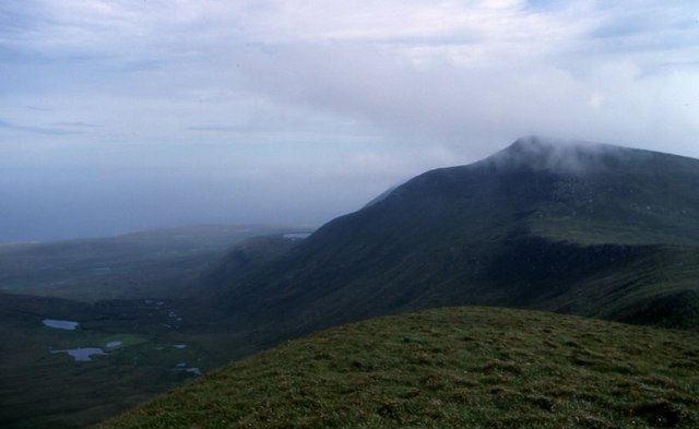
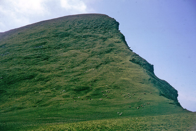
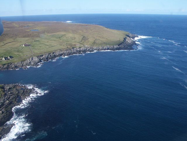
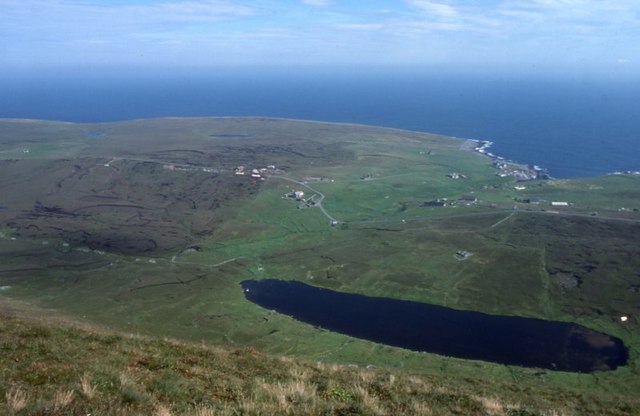
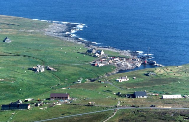
Da Loch o Ouvrafandal is a picturesque freshwater loch located in the remote and rugged landscape of Shetland, an archipelago in Scotland. Nestled amidst rolling hills and moorland, it covers an area of approximately 10 hectares, making it one of the larger bodies of water in the region. The loch sits at an elevation of about 100 meters above sea level and is surrounded by peat bogs and heather, adding to its untouched beauty.

The water in Da Loch o Ouvrafandal is crystal clear and reflects the vibrant colors of the surrounding landscape. It is fed by small streams and springs that flow from the nearby hills. The loch is known for its rich biodiversity, supporting a variety of aquatic plants and animal species. It is home to several species of fish, including brown trout and Arctic char, attracting anglers from near and far.

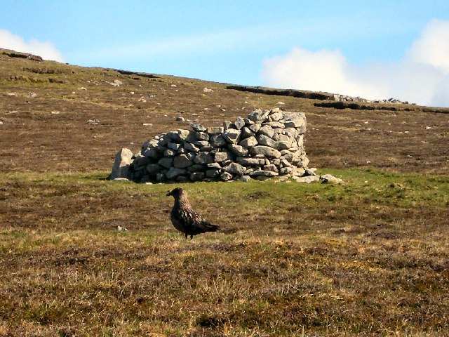
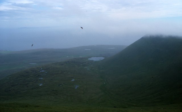
The area around Da Loch o Ouvrafandal is a haven for birdwatchers as well, with numerous species of waterfowl, waders, and raptors frequenting its shores. The loch also provides a vital habitat for a range of amphibians and invertebrates, contributing to the overall ecological balance of the region.

Visitors to Da Loch o Ouvrafandal can enjoy its tranquility and serenity, as well as indulge in activities such as fishing, birdwatching, and nature walks. It offers a unique opportunity to immerse oneself in the unspoiled beauty of Shetland's natural environment and experience the peacefulness of this remote loch.

If you have any feedback on the listing, please let us know in the comments section below.

Da Loch o Ouvrafandal Images

Images are sourced within 2km of 60.140384/-2.0734432 or Grid Reference HT9639. Thanks to Geograph Open Source API. All images are credited.

View from Da Kame to Da Sneug, Foula The highest hill on Foula and the second highest in Shetland. Taken from near da Kame. On the left are the Lochs o' da Fleck and the Loch o' Ouvrafandel is in the distance.
View from Da Kame to Da Sneug, Foula
The highest hill on Foula and the second highest in Shetland. Taken from near da Kame. On the left are the Lochs o' da Fleck and the Loch o' Ouvrafandel is in the distance.
Da Nort Bank On this slope the skuas attacked and the sheep tried to chase me over the cliff. It was the nesting season but both skuas and sheep meant business.
Da Nort Bank
On this slope the skuas attacked and the sheep tried to chase me over the cliff. It was the nesting season but both skuas and sheep meant business.
The cliffs of Foula The highest point, the Kame, is in the mist.
The cliffs of Foula
The highest point, the Kame, is in the mist.
The croft of Harrier 1964 The skuas did not attack if you were on the island road, but it was always useful to carry a long bonxie stick, and wave it in the air above your head when they sized you up.
The croft of Harrier 1964
The skuas did not attack if you were on the island road, but it was always useful to carry a long bonxie stick, and wave it in the air above your head when they sized you up.
Hiorawick and Strem Ness A storm prevented our leaving by boat or plane but created massive breakers in Hiorawick Bay
Hiorawick and Strem Ness
A storm prevented our leaving by boat or plane but created massive breakers in Hiorawick Bay
South Harrier Rough and improved grazings at South Harrier.  The hill at extreme left is The Kame, the second highest seacliffs in UK.
South Harrier
Rough and improved grazings at South Harrier. The hill at extreme left is The Kame, the second highest seacliffs in UK.
Cliffs NE coast of Foula Stunted, salt-sprayed clifftop vegetation meets cliffs
Cliffs NE coast of Foula
Stunted, salt-sprayed clifftop vegetation meets cliffs
Foula ferry The 'New Advance' ferry leaves Foula for the Shetland mainland
Foula ferry
The 'New Advance' ferry leaves Foula for the Shetland mainland
Plantiecrub on Foula Plantiecrubs were used by crofters to keep their kale and cabbage seedlings safe from grazing by livestock. The bird in the foreground is a bonxie (great skua).
Plantiecrub on Foula
Plantiecrubs were used by crofters to keep their kale and cabbage seedlings safe from grazing by livestock. The bird in the foreground is a bonxie (great skua).
Cliffs north-west of Da Smaalie, Foula These cliffs are on the west coast of Foula where the land rises steeply to the main ridge of hills that crosses the island.
Cliffs north-west of Da Smaalie, Foula
These cliffs are on the west coast of Foula where the land rises steeply to the main ridge of hills that crosses the island.
Da Head o da Taing Taking off northwards from the airstrip, this is the last view of Foula from the plane. The small loch is Rossie's Loch.
Da Head o da Taing
Taking off northwards from the airstrip, this is the last view of Foula from the plane. The small loch is Rossie's Loch.
Hamnafield, Foula Hamnafield from the Sneug.
Hamnafield, Foula
Hamnafield from the Sneug.
Mill Loch, Foula With Ham beyond.
Mill Loch, Foula
With Ham beyond.
Ham, Foula The main settlement on the island. The breakwater at Ham Voe is under construction.
Ham, Foula
The main settlement on the island. The breakwater at Ham Voe is under construction.
Sneck o' da Smaalie, Foula A crack in the rocks in the cliffs at the end of the valley of Da Smaalie. Slithering down and over the rocks down to the wave-cut beach at the bottom is a popular Sunday afternoon day out on Foula - or it was the day we descended.
Sneck o' da Smaalie, Foula
A crack in the rocks in the cliffs at the end of the valley of Da Smaalie. Slithering down and over the rocks down to the wave-cut beach at the bottom is a popular Sunday afternoon day out on Foula - or it was the day we descended.
Sneck  o' da Smaalie, Foula The view looking back up the crack in the cliffs after the descent. The upper and lower entrances to the Sneck are in different gridsquares.
Sneck o' da Smaalie, Foula
The view looking back up the crack in the cliffs after the descent. The upper and lower entrances to the Sneck are in different gridsquares.
Mucklebrik's Wick, Foula Taken after a descent of the Sneck o' da Smaalie, looking towards the headland of Wester Hoevda.
Mucklebrik's Wick, Foula
Taken after a descent of the Sneck o' da Smaalie, looking towards the headland of Wester Hoevda.
Foula Post Office in 1964 The deeply shadowed Hamnafjeld is the background to the Post Office.
The Post Office and telephone box in 2013 have been photographed for Geograph by Richard Webb, <a href="https://www.geograph.org.uk/photo/3553344">HT9638 : Former post office, Foula</a>.
Foula Post Office in 1964
The deeply shadowed Hamnafjeld is the background to the Post Office. The Post Office and telephone box in 2013 have been photographed for Geograph by Richard Webb, HT9638 : Former post office, Foula.
Show me another place!

Da Loch o Ouvrafandal is located at Grid Ref: HT9639 (Lat: 60.140384, Lng: -2.0734432)

Unitary Authority: Shetland Islands

Police Authority: Highlands and Islands

What 3 Words

///glimmers.late.laugh. Near Walls, Shetland Islands

Nearby Locations

Da Loch o Ouvrafandal

Related Wikis

Foula

Foula (), located in the Shetland archipelago of Scotland, is one of the United Kingdom's most remote permanently inhabited islands. Owned since the turn...

Foula Airfield

Foula Airfield (IATA: FOA) is an airfield located on the remote island of Foula, part of the Shetland Islands in the north of Scotland. == History == The...

RMS Oceanic (1899)

Oceanic was a transatlantic ocean liner built for the White Star Line. She sailed on her maiden voyage on 6 September 1899 and was the largest ship in...

Nearby Amenities

Located within 500m of 60.140384,-2.0734432
Hamnafield
Ele: 344
Natural: peak
Place: locality
Lat/Long: 60.1371051/-2.0751741
Ouvrafandal
Place: locality
Lat/Long: 60.1414625/-2.0810083
The data included in this document is from www.openstreetmap.org. The data is made available under ODbL.

Have you been to Da Loch o Ouvrafandal?

Leave your review of Da Loch o Ouvrafandal below (or comments, questions and feedback).